Take the Trail
Start at the corner of Bartels Road and East Terrace.
This Trail is on the traditional land of the Kaurna people. First Nations people are advised that this Trail Guide contains the name and an image of a person who has died.
The Trail is 1.7 km long. Allow 90 minutes.
1. Introduction and Naming
2. Rubbish dump
3. Alice statue
4, Botanic Creek and Kaurna use
5. The island: building the Park 1958-62
6. The kiosk
7. Diagonal tree-lined avenues
8. Rose gardens and timber pergola
9. Bowling club
10. Former tram line and embankment
11. Quentin Kenihan Inclusive Playspace
12. Events and festivals
13. Lake renewal
14. O-Bahn tunnel
15. Holm Oak and fountain
16. Place of Reflection

Start this trail at the corner of Bartels Road and East Terrace.
There are 16 stops on this Trail. It is 1.7 kilometres long, and it will take about 90 minutes to complete. Walking instructions are designated by bold type at the end of each of the 16 stop descriptions.
Optional: Download and print a tri-fold leaflet, a double-sided single A4 page, with a brief summary of this Trail Guide: (PDF, 2.2 Mb).

1. Introduction and Naming
Start this Trail at the corner of Bartels Road and East Terrace.
This is one of the better known parts of the Adelaide Park Lands. Few people know the names of all the various Adelaide Parks but most people know what this one is called, or at least they know the English name of this Park.
This Park lies in-between Bartels Road, and Rundle Road – and also in-between East Terrace and Dequetteville Terrace. It is about 14.5 hectares – which means it’s only about two percent of the area of the entire Adelaide Park Lands.
Like most other parts of the Adelaide Park Lands, this Park has three names. An English name, a Kaurna name, and a number. The number came first. This Park has been identified as Park 14 since the late 1880’s – when all the Parks were assigned numbers.
The name Rymill Park came much later - only in 1962. Sir Arthur Campbell Rymill was a lawyer, company director and politician. He was an alderman on the City Council in the 1930’s but left to join the Army in the second World War. After the War, he became Lord Mayor of Adelaide from 1950 to 1954, and stayed on the Council for another decade until 1964. He was both an alderman on the Council and a member of State Parliament’s Upper House at the same time.
Through this era he was working with his friend, the City Council Town Clerk (what we would call the CEO) William Veale to landscape several areas of the Park Lands. Their plan was not just to beautify this Park, but also (at about the same time) Veale Gardens and Bonython Park as well. All three of these areas were landscaped and turned into gardens in the early 1960’s.
For decades, Sir Arthur Rymill was a prominent figure within the “Liberal Country League” as the Liberal Party was then known. He died in 1989 at the age of 82.
This park got its third name, its Kaurna name, in the year 2002. Murlawirrapurka was a man – an important Kaurna elder at the time of European settlement (or as the Kaurna people call it, “the invasion”) from 1837. The colonists called him King John.

Wax portrait (right) byTheresa Walker, Kertamaroo, c.1840, Bequest of Sir Samuel Way 1916, Art Gallery of South Australia
Murlawirrapurka was one of the main informants of two Lutheran missionaries (Teichelmann and Schürmann) who were the only Europeans of the time who bothered to learn the Kaurna language.
From this point, walk north-west, along the sealed pathway directly into the Park, until you reach another sealed pathway turning off to the right.

2. Rubbish dump
.
In the early days of European settlement, the 1840’s and 1850’s, nearly all of the Park Lands were cleared of nearly all their trees. The early European settlers cut down thousands of trees for firewood and fencing posts. Many areas of the Park Lands were also used as quarries. Stone was excavated for building work.
However, there doesn’t appear to be any record of a quarry here in Park 14, because it was a waterlogged, boggy area.
Where you are now standing was part of the course of a creek: what we now call the Botanic Creek that empties into the Rymill Park lake and then goes on, downstream, to the Adelaide Botanic Garden.
However in the 1850’s it was just a quagmire. Because it was no use to anyone, the area was used as a rubbish dump. In 1856 a Letter to the Editor was published in The Observer newspaper. The letter said:
“Hundreds of cart-loads of every description of refuse have, for a long time past, been ruthlessly scattered about upon the surface. Vegetable matter lies at leisure to decay; broken glass and bottles, mingled with old mattresses and tin-kettles; rags, bones, and dead dogs vary the scene with heaps of chemical refuse”
You might wonder what the City Council did about this. Rather than clean it up or issue fines to people dumping rubbish, the Council decided to turn the site into a proper Council-run dump. In 1903 the Council decided to screen the dump from view, by planting hedges around it.
It was known as the “Bartels Rubbish Dump” named after Bartels Road.

Photo: City of Adelaide archives
It wasn’t until 1960 that the Bartels Rubbish Dump was removed to make way for the creation of Rymill Park.
So just remember that the western portion of this Park was a rubbish dump, for more than 100 years.
We often hear arguments from people – even as high as a former Premier - who say that some parts of the Park Lands aren’t worth protecting, because they are degraded or not landscaped.
Out response is to remind them that this part of Rymill Park was once a rubbish dump. Degraded parts of the Park Lands can be saved – but not if they have multi-million dollar buildings over them.

Looking westwards along Rundle Road, from Dequetteville Tce, c1872 Photo: City of Adelaide archives
From this point walk east along a dirt path towards a statue of a young girl.

3. Alice statue
This bronze statue was unveiled in 1962.
It’s by sculptor John Dowie who has a number of other notable statues still in place around Adelaide (including another one here in Rymill Park, near the playground, that you’ll see later).
His largest work is the “Three Rivers” fountain in Victoria Square. He also did the statue of the Greek god “Pan” which sits in a pool at Veale Gardens.
Alice stands on a stone pedestal, surrounded by a flower bed. The inscription on the pedestal acknowledges the donors who funded the sculpture: Josephine and Norman Lewis, who put up one thousand pounds.
The Lewises were inspired by a statue of Peter Pan in London’s Kensington Gardens. They had originally wanted a local version of Peter Pan, and they had wanted it to be on the island, in the centre of the lake.
However, after discussing it with the sculptor John Dowie, they agreed with his suggestion that it be a statue of Alice instead of Peter Pan.
The inscription reads “For the children” because in the early 1960’s it was hoped that the landscaping of this Park would create a space that would be popular with children.
A circular frieze around the base of the statue depicts figures from Lewis Carroll’s two “Alice” books including the White Rabbit, Tweedledum and Tweedledee and a Cheshire Cat, all tumbling over and crowding each other.
John Dowie created a plaster version of the statue which was sent to Italy to be cast into bronze.
The bronze sculpture was shipped back from Italy and it was unveiled in December 1962 by the then Lord-Mayor, Charles Glover.

Pictured at the unveiling of the Alice statue in 1962 are (from left) the sculptor John Dowie, Mr Norman Lewis, Lord Mayor Charles Glover and Mrs Josephine Lewis. In the background, at left, Town Clerk William Veale. The recent photo at right is by @ingridklees
From this point keep walking along the dirt pathway. Go past two sets of water pipes encased in two metal cages, and stop when you reach the lowest point on the path, beneath a light pole.

4. Botanic Creek and Kaurna use
It’s not obvious, but there is a Creek that runs through the middle of this Park – draining from south to north. It’s called Botanic Creek because it drains into the lake in the Adelaide Botanic Garden.
Before European settlement there was a water hole in what is now the Botanic Garden, and the water hole was used by the Kaurna people. That pre-existing water hole was eventually transformed into what we now call Botanic Lake.
Here in Rymill Park, this area was a bog in winter and a dust bowl in summer. However there was no lake or water hole here – just a bog and a rubbish dump - until this man-made lake was constructed in the early 1960s. You’ll learn about the lake a bit later on this trail.
If you look across Bartels Road to the south, you can see the place where the creek crosses underneath the road, as it comes from Park 15 into this Park. The creek goes underground beneath your feet here, and drains into the lake before going on further north, underneath Rundle Road, and into Park 13 just north of here. From there, it again goes underneath Botanic Road into the Adelaide Botanic Garden.

This creek was in use by the Kaurna people both before and after European settlement.
In the late 1800’s one of the well-known local aboriginal people – a so-called “fringe dweller” who called himself “Tommy Walker” often set up camp here, in what we now call Rymill Park.
Tommy Walker was something of a local celebrity. The press often reported on his activities, which included frequent arrests for being drunk and disorderly, using insulting language, or begging. His begging was often a form of street theatre. He would entertain onlookers by mimicking the latest magistrate who’d impose a fine. School children created a rhyme which Tommy himself often sang in public:
“Tommy Walker, walk up here
You are charged with drinking beer
Forty bob you'll have to pay
Or down below you'll have to stay
Ta-ra-ra-ra-boom-de-ay.”
Tommy died in 1901 after walking nearly 100 kilometres from Encounter Bay to Adelaide to see the Duke of Cornwall (the future King George V) who was visiting Adelaide at the time.
Tommy’s headstone was paid for by the Adelaide Stock Exchange. It was later discovered that his body had been removed before burial and sent to the University of Edinburgh for study. His remains were repatriated in the early 1990s.
From here, walk down the grassy slope to the sealed path around the lake. Turn left and follow the edge of the lake and go over the bridge. Stop on the paved area in the middle of the island.

5. The Island - building the Park 1958-62
In the late 1950’s there was only one part of the Park Lands that had been landscaped and irrigated with lawns. Elder Park on the Torrens Riverbank was crowded with people every weekend, because it was the only area that had been landscaped to make it appealing to Europeans.
The CEO of the City Council at that time was William Veale. In 1957 Mr Veale went on a six-month study tour to the USA, Canada, Britain and Europe, visiting parks and gardens. He came back enthusiastic about the possibilities for the Adelaide Park Lands.
It was William Veale’s drive and vision over the following five or six years that saw the creation of three beautiful new landscaped areas in the Adelaide Park Lands – places that we now call Bonython Park, Veale Gardens and Rymill Park. All three were turned from bare paddocks into gardens in the period from 1958 to 1962.
For this Park (Park 14) the first change, in 1958, was to relocate the Adelaide Bowling Club from Kintore Avenue to Dequetteville Terrace. You’ll visit that site later, on this trail. A few months later, in 1958, the rubbish dump on Bartels Road was removed. A year later, in 1959 this “boating lake” had been created with water piped from the River Torrens.

The Rymill Park lake in early 1961. Pic: Neil Christiansen.
As mentioned earlier, this had been a boggy area. The idea of a lake had been suggested about 100 years earlier, but not acted upon.

Rymill Park, 1962. Pic: City of Adelaide archives
Across Rundle Road, in nearby Park 13, a smaller children’s wading pool was created at the same time (in 1959) although that has since disappeared.
Here in this Park, the work in 1959 and 1960 included not just the lake but also a playground, reorganising the pathways to accommodate the lake, extensive re-contouring works, erection of a kiosk and toilet block (both made from Carey Gully sandstone) and the removal of all the weeping willow trees that had been growing along Botanic Creek.
The grand opening was in 1960 but it wasn’t until the following year that it was officially named Rymill Park, even though Arthur Rymill, by that time, was no longer the Lord Mayor.
At about the same time, the rose gardens were established, to the east of the lake, as well as the statue of Alice that you’ve already passed.
Now walk across the island, to the stone kiosk building.

6. The kiosk
The kiosk here – made of Carey Gully sandstone - was known for decades as “Arnie’s kiosk” after Arnie Rossis who took it over in 1998.
While it was operating as Arnie’s Kiosk you could not only buy refreshments here, but you could also hire paddle boats to use on the lake.
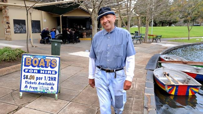
The late Arnie Rossis outside the kiosk. Pic: The Advertiser / Adelaide Now
Arnie Rossis stepped away from the business in 2013 due to ill-health. He died in 2016 at the age of 67.

There is a plaque in tribute to Arnie Rossis on this park bench just north of the kiosk.
Arnie’s family kept working the kiosk for a few years after his death, until 2018, then were forced to close, in part (they said) because of the disruption caused by construction of the O-Bahn tunnel.
A different operator took over in December 2018 – and called the kiosk “Lock and Quay” but they too gave it away after only about 12 months. In 2021 another different operator took over and called it “Colada Lakeside Kiosk”. However they lasted little more than a year and ceased trading in April 2022.
In July 2022, the City Council endorsed a plan to upgrade the area around the kiosk, and then look for new tenants.
In 2024, a new 21-year lease was entered with the "Creative Place Hospitality Group" the operators of several other Adelaide cafes.
The new lessees then began renovating and partially rebuilding the kiosk, while retaining the original 1960s Carey Gulley stone walls. When finished, they were intending to bring back paddle boats to the lake.
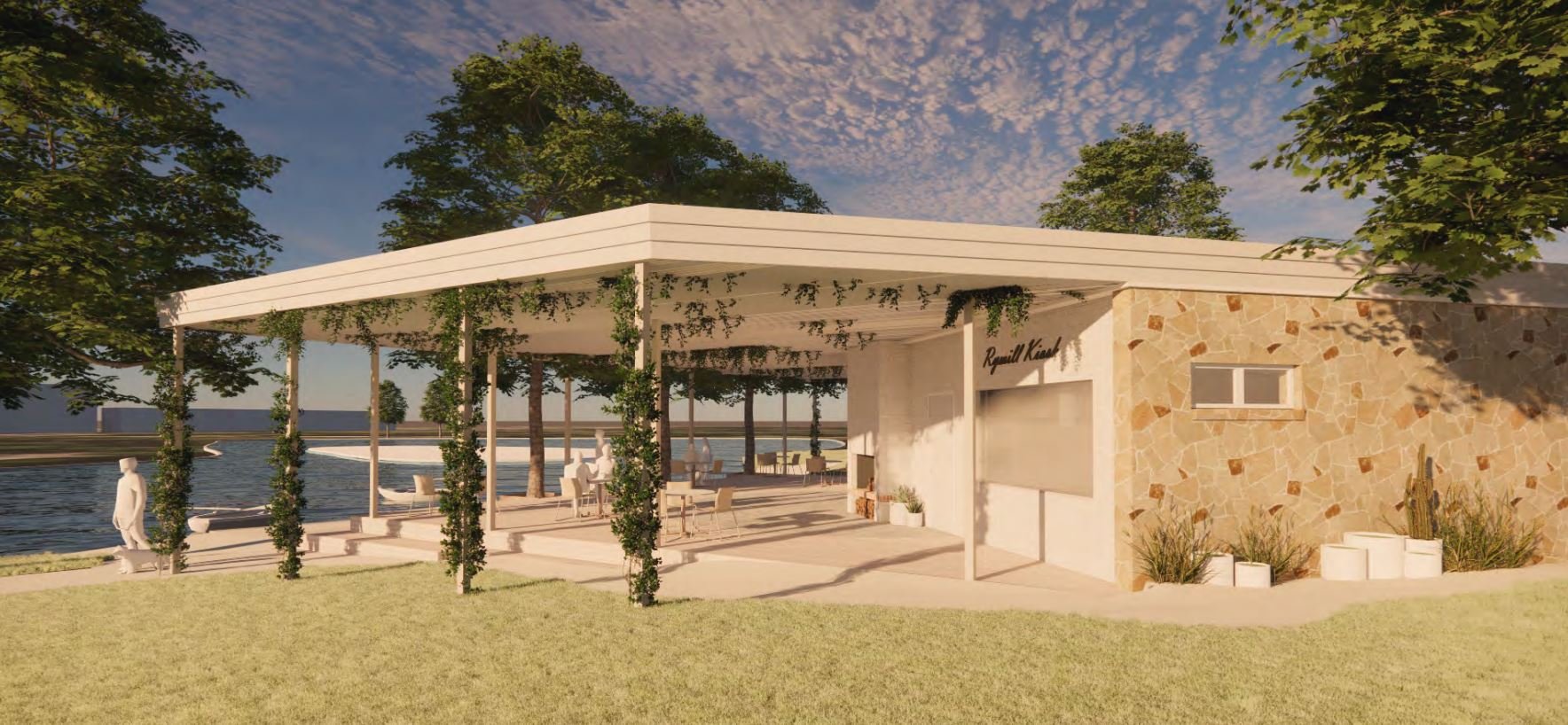
Artist’s impression of the renovations proposed for the kiosk. Source: Kadaltilla /Park Lands Authority agenda, 22 February 2024.
From this point, walk north-east, across the grass to a pathway lined with trees just near a red brick shed.

7. Diagonal tree-lined avenues
You are now standing on a tree-lined pathway. The path runs diagonally between the lake area in the centre of the Park, to the south-eastern corner of the Park near the corner of Bartels Road and Dequetteville Terrace.
The trees along both sides of this pathway are Oriental Plane trees. They are the same species as the trees on the island, in the middle of the lake.

Oriental Plane trees on either side of the diagonal avenue in the south-eastern part of the Park
On the other side of the lake, there is another diagonal pathway that leads from the top of the O‑Bahn tunnel entrance to the corner of East Terrace and Rundle Road. That pathway is lined with white cedar trees, many of them planted before 1880. Some of them remain, but many were cut down to build the O-Bahn trench or tunnel in 2017.
Likewise, an avenue of white cedar trees also used to run from the lake up to the north-western corner of the Park – near the corner of Dequetteville Terrace and Rundle Road. That avenue of trees was almost totally destroyed by the O-Bahn tunnel works.
So this avenue of trees where you are standing, is the only intact avenue, of the three that used to exist in this Park.

Keep walking south-west along this tree-lined avenue until you get to a wooden arbor or pergola, and the rose gardens.

8. Rose garden and timber pergola
The rose gardens on the north side of this pathway were established at the same time that all of the landscaping that was going on, to create the lake area, about 1959 to 1960.
The idea for a rose garden was put forward by the Rose Society of South Australia.
The Society wanted a garden that would be similar to the Queen Mary Gardens in Regent’s Park, London.

Their idea was to have the rose gardens focused around a large Moreton Bay Fig tree that was in this spot.
However that didn’t work because the shade from the fig tree and its roots interfered with the roses. So the ancient Moreton Bay Fig tree was removed in 1960, to make way for the roses.
This collection of rose beds was established in two different eras, decades apart.
On the north side of the pathway, there is a huge circular rose plantation. On either side of the circle, there are two smaller, semi-circular beds. All of these were established in or about 1960. At the time it opened, there were 64 separate rose beds, containing over three thousand plants with 1,200 of them were donated by the Rose Society.
There is also a memorial bronze sundial there, in the main rose garden in memory to H.L. Lipman who was one of the most prominent supporters of the Rose Garden proposal. Mr Lipman died in 1960 just before these rose gardens were opened.

Sundial (left) and memorial plaque (right) both in the northern section of the Rymill Park rose garden
On the south side of the pathway, this timber arbor, the paving, and two more rectangular rose garden beds came much later, in 1997. The project was carried out by secondary students under a Vocational Skill Training Program.

Aerial view of the rectangular (southern) section of the rose garden and the 1997 timber arbor or pergola
This area is just one of a number of Adelaide’s famous rose gardens. There are also mass rose plantings in Veale Gardens (Park 21), Brougham Gardens (Park 29), off King William Road in Park 12, and next to the tropical conservatory in the Botanic Garden just off Hackney Road, in Park 11.
Adelaide was the first Australian capital city to have a rose variety named after the City. The ‘City of Adelaide’ rose was bred in France in 1990 and named because of Adelaide’s reputation as one of the best places in the world to grow roses. The “City of Adelaide” rose variety is described as “having clusters of semi-double, rich salmon pink blooms with a slight fragrance.”
The World Rose Convention was held in Adelaide in October 2022.
From this point, walk north, across the circular rose garden, to Dequetteville Terrace and a car parking area.

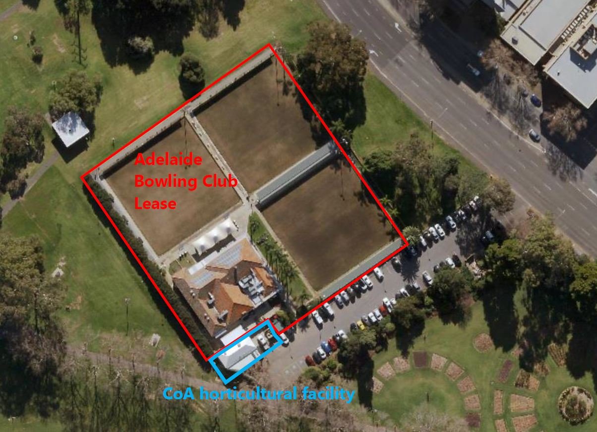
9. Bowling club
This is a public car park – but not all of the parking spaces are available to the public. Several of the parking spaces are reserved, 24 hours a day, for officials of the Adelaide Bowling Club.
Works to establish the Bowling Club grounds and facilities commenced in 1957 – before the rest of the landscaping works in Rymill Park. The clubhouse was opened by the then Premier, Sir Thomas Playford in July 1958.
Before that time, the Adelaide Bowling Club had been located on a different Park Lands site – just off Kintore Avenue near the Torrens Parade Grounds in Park 12. When the landscaping in the rest of Rymill Park was done in the next couple of years, (1959 to 1960) the area of the Bowling Club was the only part of Rymill Park that was off-limits to the general public, and that’s the way it has stayed for more than 60 years.
This site is one of many within your Park Lands that has been fenced off from the public, and reserved for paying members or customers.
The Bowling Club is not used solely for the sport of bowls. It is also advertised as a function venue, for hire. It specialises in corporate functions.
It is, in effect, a privatised part of your Park Lands. There are other such sites in other parts of your Park Lands, but this is the only one in Rymill Park.
The Bowling Club’s website says anyone is able to join. it says “Members can attend the club at any time, enjoy fantastic drink prices throughout the year and attend members-only events.”

You can download a membership form, which (in May 2024) was quoting a fee of $250 for full membership, although it also says: “Membership fees are subject to change – please check with club manager for current pricing“.
From this point, walk along the edge of Dequetteville Terrace, past the bowling club and stop at a very large stobie pole (electricity pylon) which is next to two large trees.

10. Former tram line and embankment
The two large trees here are Holm Oaks. There are three large Holm Oak trees in Rymill Park, on diagonally-opposite sides of the Park. These two are in the north-east corner. The other one is in the south-west corner, near the end of this Trail Guide.
Unlike traditional English Oaks, the evergreen Mediterranean Holm Oak thrives in Australia’s dry climate.
From this point, looking west, you can see what remains of an earthen embankment that ran in a curved line through the Park – to carry a tram line.
In the late 1800s and early 1900s Adelaide had a considerable network of tram services.
At first they were horse-drawn trams, but one by one (in the 20th century) the lines were all converted to electric trams.

The route of the former tram line through Rymill Park / Murlawirrapurka (Park 14)
The tram from the City to Norwood and Kensington ran right through the middle of this Park, close to the spot where you are now standing. It was electrified in the summer of 1907-08.

Laying electricity cables alongside East Terrace, 1907
A few years later, in 1913, the City Council decided to make the electric towers look more attractive.
They put in what was described as “rustic structures around the tramways cable towers” and planted various climbing plants around the structures.
The tram line came from Kensington, along Rundle Street in Kent Town, through Park 14 and then the trams ended up in Grenfell Street.
There was an embankment running through the Park, with the ground elevated so the tram line wouldn’t ever be flooded in the winter.

An electric tram on the embankment in Rymill Park shortly before the line’s closure in the 1950’s, Pic: The Tramway Museum
Electrifying the line required overhead wires, the removal of numerous trees and “three large wooden guard boxes that were built around the trunks of Plane Trees” which at the time were growing at the foot of the tramway embankment.
More than a hundred years later, something similar happened with dozens of trees cut down so that a huge trench could be dug along the route of the old tramway embankment,
The O-Bahn busway trench was then covered up to become a tunnel. It follows the same route. The buses go underground now, along almost the same route as the trams used to travel.
Most of Adelaide’s tram lines were ripped up in the 1950’s. The only tram line that was saved was the Glenelg tram. There is a tramways museum in St Kilda just north of Adelaide where you can see some of the old trams along with information about the old network.
When the tram-line was removed in the 1950s, the embankment was planted out with shrubbery. Most of that shrubbery disappeared when the O-Bahn tunnel was built in 2017.
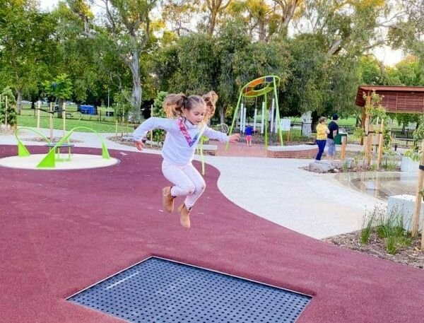
From this point, walk south-west towards the next large stobie pole (electricity pylon) near the children’s playground, then around the playground and stop where you see a large bright red squiggly pole .

11. Quentin Kenihan Inclusive playspace
.
The first playground in Rymill Park was established at the same time as the general landscaping works, in 1959. It was part of the plan put forward by the then Town Clerk, William Veale, who wanted Rymill Park to be appealing to children. The installation of the “Alice” statue was part of that plan.
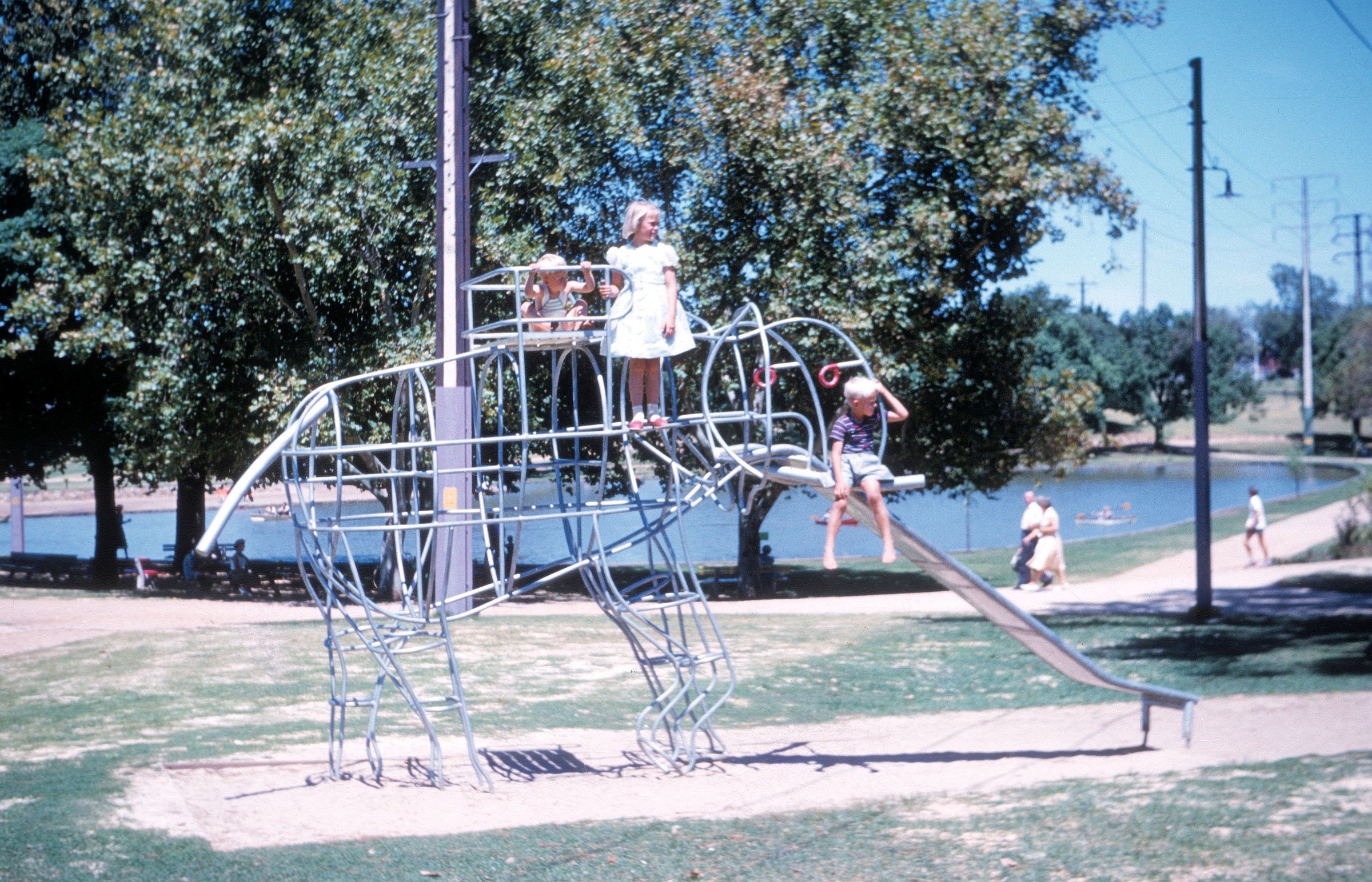
The first play equipment installed, in early 1961. Pic: Neil Christiansen.

Rymill Park playground in the 1960s
There is also another John Dowie sculpture on the southern side of the playground, called “Piccaninny”. It has a drinking fountain on top of the sculpture. You can see it near the red squiggly pole.
At the time, in 1959, the Adelaide Park Lands already had several playgrounds for children. Many of them had been established just after the first World War from 1918 to 1926.

Rymill Park playground in 2015
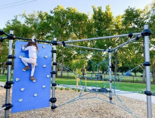
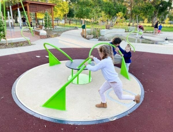
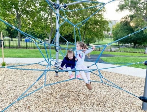
There are now ten playgrounds throughout the Park Lands, but this one is something special. After months of work in late 2020, the playground was re-opened in January 2021 with the new name Quentin Kenihan Inclusive Playspace.
Quentin Kenihan was an Adelaide writer, actor and disability advocate. The playground was designed to cater for children with a disability but soon after its opening there were media reports that it was NOT disability compliant and further work costing $500,000 would be required, including for disability toilets.
The City of Adelaide advises that those reports were incorrect: that the Playspace was “disability compliant” from its opening and remains so. The Council advises that completion of the toilets had merely been affected by shipping delays, and that the additional $500,000 of works approved in April 2021, four months after the official opening, was for additional works - various improvements and extensions.
Quentin Kenihan was born with a serious bone disease called osteogenesis imperfecta. He spent nearly all his life in a motorised wheelchair. He was less than one metre tall – 99 centimetres. He achieved fame as a child, after being interviewed on TV, aged seven, by current affairs host Mike Willessee. He had a brief TV career, with a show on Network Ten called “Quentin Crashes” and was also in the movie “Mad Max: Fury Road” playing the character Corpus Colossus.
Quentin Kenihan died in October 2018 at the age of 43. At the time of his death he was running for election to the City Council and his name stayed on the ballot papers in 2018 because the papers had already been printed.
Photos of the Quentin Kenihan Inclusive Playspace by Kids in Adelaide
The new City Council, elected in 2018 just after his death, decided to name this new playground in his honour. The play equipment here includes a wheelchair trampoline, sound and sensory garden, water play, swings and a carousel. Other features include barbecues, shelter and seats, and a fully fenced playspace.
This red pipe sculpture, just outside the playground fence is called “Squiggle”. It was created by Karl Meyer, who said his vision was to express Quentin’s passion, including his enthusiasm for superheroes such as Superman. The bold use of red is dynamic, represents power, is ‘superman-like’ and references his fondness of Christmas time. In a broader context, the form and its colour suggest a fiery nature, brightness and willpower.

“Squiggle” by Karl Meyer. Photo: James Elsby
From here, walk a few metres to the north around the lake, to the spot where the five pathways almost meet, or cross over each other.

12. Events and festivals
From June to October 2022, Rymill Park was fenced off, to allow underground services: water, sewerage, and electricity to be upgraded.
These works, costing around $3 million, were intended to reduce the need to import toilets and noisy diesel generators for short-term events in the Park.
Rymill Park is often been used as the scene for large, popular events – either IN this Park, or around the Park.
a) Moonlight Cinema
For one year only, in the summer of 2021-22 the popular Moonlight Cinema was set up in Rymill Park, near the playground. In the summer of 2022-23, Moonlight Cinema returned to its previous location in Botanic Park.
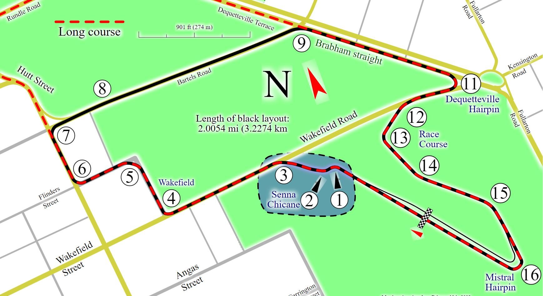
b) Motor racing
Going back to 1985, this Park was surrounded every October and November with motor racing crash barriers, and pedestrian overpasses, as the Formula One Grand Prix circuit came through Rundle Road and around East Terrace

The annual Adelaide 500 motor race also comes past this Park. It was held for 20 years – from 1999 to 2020, then cancelled in 2021 before being brought back and held again on the first week in December 2022.
The Adelaide 500 uses a slightly shorter course than the Formula One cars used. The Adelaide 500 circuit uses Bartels Road rather than Rundle Road. Many spectators base themselves here in Rymill Park though, for a view of the cars coming down Bartels Road.
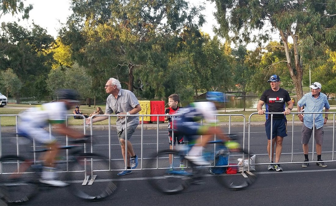
c) Cycling
The annual Tour Down Under professional cycling event is conducted mostly on country roads, but every year there is a what they call a “prologue” or a criterium race on a city circuit, to open the week-long cycling festival. In past years the prologue has featured laps of Rymill Park.
In 2021 and in 2022 the event was called off due to COVID. In 2023 the prologue was held in a different part of your Adelaide Park Lands - Parks 26, 12 and 10, between the City and North Adelaide, along the River Torrens / Karrawirra Pari.
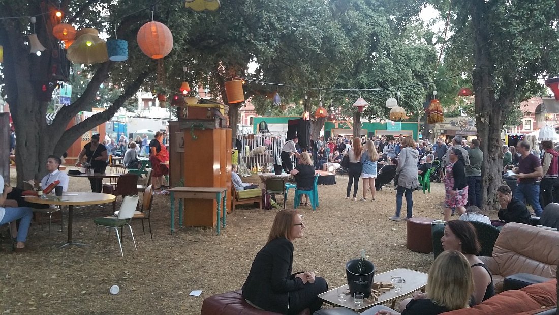
d) Fringe festival
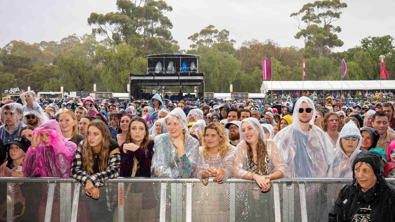
For several years Rymill Park has been one of the main venues for the annual Festival Fringe. It gets the name “Gluttony” for the duration of the event in February and March every year. There are tents, stalls, places to eat, lighting, music and car carnival attractions set up here for about a month.
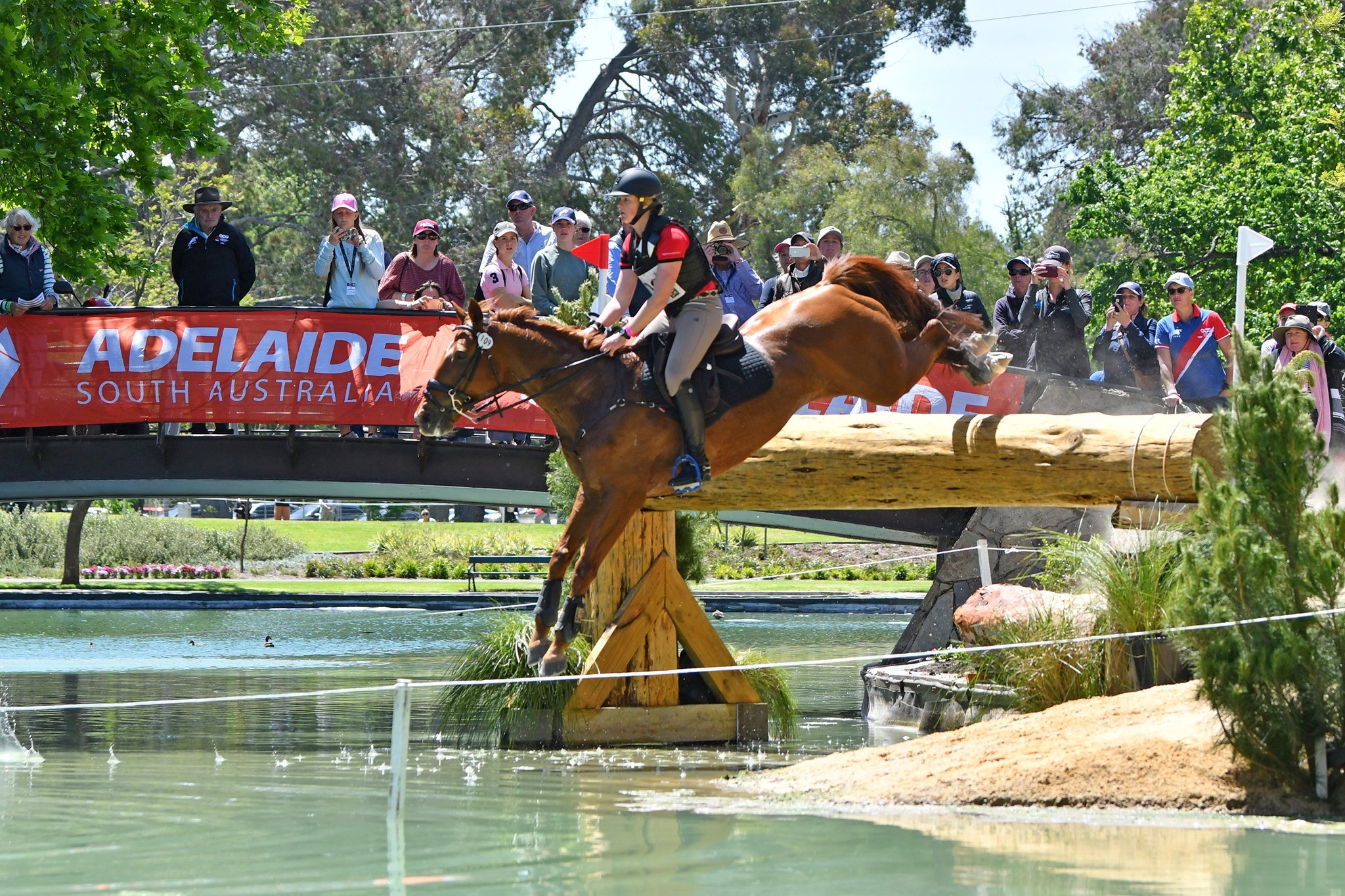
e) Equestrian
Rymill Park also has been part of the annual Adelaide Equestrian Festival (formerly known as the “International Three-Day Event”) for horses and their riders. The lake is used as part of the event, and the full cross-country course goes from here all the way south to Victoria Park. In 2020 and 2021, the event was cancelled due to COVID-19. It returned in April 2023, re-named as the Adelaide Equestrian Festival and was held again in April 2024, and May 2025.
f) Harvest Rock
In November 2022, a two-day music festival, Harvest Rock was staged across both this Park, and the Park immediately south of here, King Rodney Park. Although the first event was marred by heavy rain and mud, Harvest Rock returned in October 2023, but another edition that was planned for October 2024 was cancelled.
From this point walk along the path on the northern edge of the lake, towards a circular wooden structure. Stop to look at the terraced garden on your right.

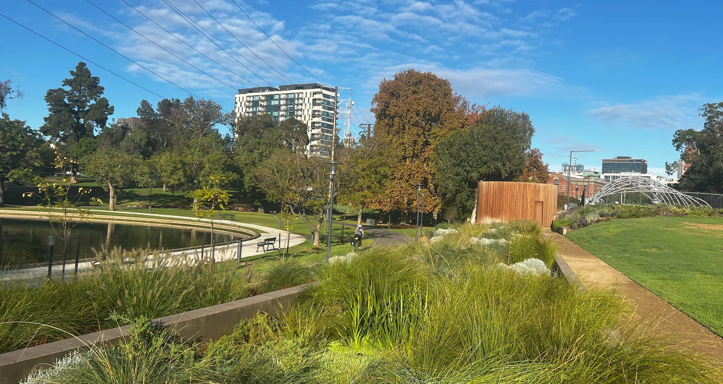
13. Lake Renewal
In the late 2010s, the City Council developed what it called a “Master Plan” for major works in this Park. Construction of the Quentin Kenihan Inclusive Playspace was the first step in became a large-scale makeover for the Park, to support the Park’s role as what the Council calls “a premium event venue”.
Consultation on the draft Plan took place in late 2019. After going through the Park Lands Authority in 2021, the final version of the Plan was approved by the City Council in July 2022.

One of the major questions during this process was the future of the lake within the Park. During consultation, two differing options were presented: maintain the lake as purely ornamental; or convert it into a vegetated wetland. Opinions were evenly divided so the final decision was a compromise. The Council decided to rebuild what it called a “sustainable” lake which meant keeping the lake primarily ornamental (with open water and attractive views, boating and equestrian events) but supplementing the poor water flow from Botanic Creek with an alternative, sustainable water source.
The State Government provided some funding ($75,000) for “renewal” of the lake’s concrete walls, base and structures. Bollard lights were installed around the lake perimeter.
This work took place over summer 2023-24. The lake water quality has been improved by upgrading Botanic Creek through Parks 15 and 16 to the south, widening Botanic Creek and installing reed beds, incorporating “water sensitive urban design.”
An innovative system was introduced used to keep the lake free from blue-green algae.
Beside the lake, you can see what looks like a circular wooden structure. This is actually just a large water tank behind a wooden shell, or screen.
The tank feeds what’s described as a “rain garden”. Despite its name, the rain garden doesn’t actually need rain to do its job. Its job is to clean the lake’s water 24 hours a day, to remove nutrients (predominantly duck poo) that would otherwise promote the growth of blue-green algae.


Robin Allison from “Design Flow” explains in a City of Adelaide video, that:
“We draw water from the lake and pump it to a tank behind the timber shell and every hour and a half or so the tank releases a pulse of water over the rain garden surface and then the water percolates down through the sandy media of the rain garden. The rain gardens act like the kidneys of the system. So we're trying to filter out the sediments and the nutrients that that are in the water to try and reduce the incidence of algae and other water quality issues.”
The OTHER changes, that were part of the 2022 Master Plan, included:
a new rose rotunda, for climbing roses;
a new avenue of trees along the edge of Rundle Road
under-grounding of power lines (completed in 2022); and
installing decks next to the kiosk and on the island for small, informal events such as weddings and photo opportunities.
From this point, walk uphill and over the top of the O-Bahn tunnel entrance.
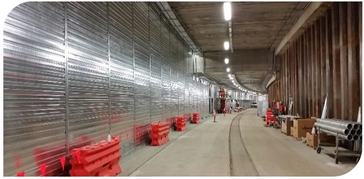
14. O-Bahn tunnel
In 2015 the State Government proposed cutting right through Rymill Park with a four-lane highway. Part of the proposed route was to be underground through Rundle Park and Rymill Park.
As part of the plan, the Government also proposed closing Rundle Road entirely and returning the full width of Rundle Road to Park Lands.
The proposal sparked a massive public reaction. There was opposition not just from Park Lands supporters but also from Rundle Street traders, who believed they would lose business due to the closure of car parking spaces in Rundle Road. Many residents of the east end were opposed to losing their view of Rymill Park, and having it replaced with a view of a new major road.
There was also opposition from residents of Hackney and College Park who believed the busway would make it harder to cross Hackney Road. There was a major event held on 31 May 2015 – a “Save Rymill Park Picnic Rally” right here.

Then Lord Mayor Martin Haese addresses the crowd at the Save Rymill Park Picnic Rally in May 2015.
A few days later, the State Government did a partial back down. It announced changes to the plans. Instead of a major road for all cars it would be a transit route only for buses. The length of the tunnel was extended another 100 metres underground, and Rundle Road would no longer be closed.
And that’s what happened. The result you can see here. The work commenced about April 2016 with dozens of mature trees being felled – some of them up to 100 years old. Smaller shrubs along the edge of the lake were also removed.
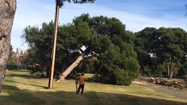
You can call it a tunnel. You could also call it a covered trench, because that’s how it was constructed, as a trench that was later covered. The benefit is supposedly a three-minute saving in commuting times on the O-Bahn route to and from the north-eastern suburbs. There were two marginal electorates in those suburbs.
From this point, walk down the slope to the bottom of the hill, and stop amongst the giant elm trees.

These giant elm trees were planted in the first decade of the 20th century, about 1907.
They are the few survivors of the tree massacre that took place for the O-Bahn tunnel project.
Many more trees of this size and this age were cut down on the eastern side of the Park, to allow the trench to be dug.
From this point walk up the slope back to East Terrace, and cross the O-Bahn busway at the traffic lights to reach the southern side. Stop at the fountain on the other side of the busway.

15. Holm Oak and fountain
The large tree here next to the fountain is another Holm Oak (at least 100 years old), like the two you saw earlier in the north-east corner of the Park next to the Bowling Club. On the south side of the tree there is bird nesting box installed.
The fountain that you see here was first installed not here, but across on the other side of East Terrace, back in 1966. It stayed there for 51 years before it was moved here, in 2017.
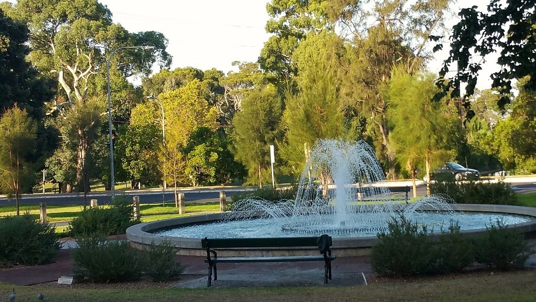
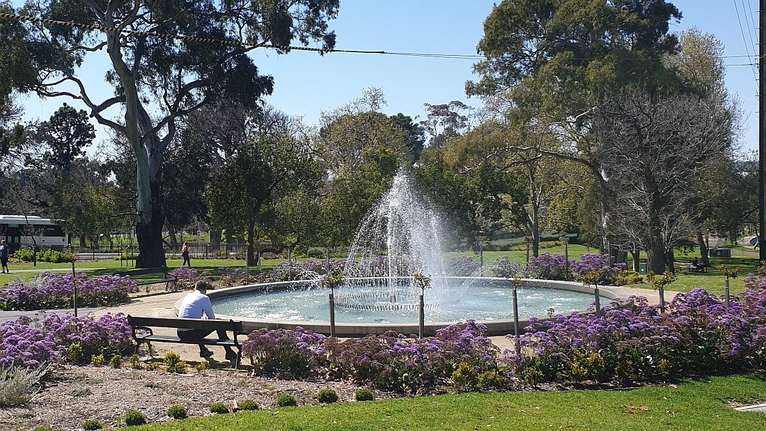
The Bridgland fountain in 2016 (left) on the western side of East Terrace, and then in 2020 (right) after being relocated to the eastern side of East Terrtace.
The fountain was officially opened in 1966 by the then-Lord Mayor, Walter Bridgland. It was known after that, as the Bridgland fountain. It was moved as part of the O-Bahn construction in 2017.
From here, walk across East Terrace to the small patch of grass to the west.

16. Place of Reflection
It’s not obvious but this very small Park is actually part of Rymill Park. Before the O-Bahn busway project in 2017 this patch was much larger. It’s sometimes referred to as a ‘Pocket Park’ but it has a significant bit of history attached to it.

East Terrace has been re-aligned twice: once in 1965 and once in 2017. Each time the pocket part on the west side of East Terrace has been reduced in size.
In the 1840’s, before there was any Catholic Church in Adelaide, it was the venue for the first Catholic services in the new colony of South Australia. There is a plaque here commemorating the first service on 13 June 1840.
This south-western space hosts the newest public artwork of your Adelaide Park Lands, called “Empty Arms”.
In September 2023, the Lord Mayor, Jane Lomax-Smith officially unveiled this statue. The Lord Mayor said that this “Place of Reflection” is now:
“…a dedicated space in the city for members of the Stolen Generation to reflect and connect … [This] high-profile piece of public art in the city … we hope will acknowledge the loss and help the healing process for members of the Stolen Generations, their families, friends and the wider community
“Importantly, it will give the community of people affected a dedicated and safe space to meet, reflect and support each other.
“The design is a powerful statement and I hope this memorial will start conversations to help educate future generations about the previous loss and ongoing pain of these practices.”
The “Place of Reflection” is intended to provide a link between this pocket park and the adjacent Tandanya National Aboriginal Cultural Institute.

From left: designer Karl Meyer, Lord Mayor Jane Lomax-Smith, Ngarrindjerri weaver Aunty Yvonne Koolmatrie, and Attorney-General Kyam Maher at the official opening on 14 September 2023. Pic: courtesy of Jane Lomax-Smith
The inscription below the statue reads: “She has no eyes, she has no ears, and she has no mouth. She had seen it all, she had heard it all, and what was the use of speaking. It had already happened.”
Optional: Download and print a tri-fold leaflet, a double-sided single A4 page, with a brief summary of this Trail Guide: (PDF, 2.2 Mb).
All of our Trail Guides and Guided Walks are on the traditional lands of the Kaurna people. The Adelaide Park Lands Association acknowledges and pays respect to the past, present and future traditional custodians and elders of these lands.