Take the Trail
Start at the corner of South Tce and Unley Rd
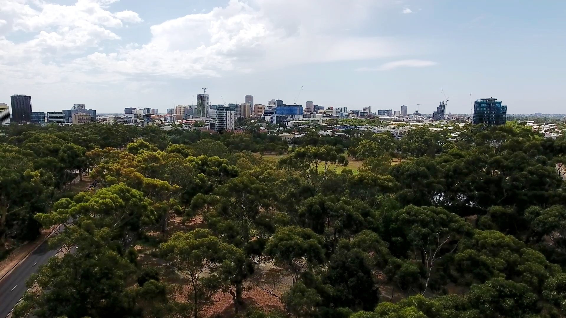
This Trail is on the traditional land of the Kaurna people. It’s just over 2 kilometres and it will take about 90 minutes to complete.

1. Introduction
2. Peppermint Park/Wita Wirra
3. Osmond Gardens and pergola
4. Himeji Garden
5. River red gums
6. Three sporting fields
7. Creek and open woodland
8. Privet hedge
9. Pelzer Park / Pityarilla
10. Marshmallow play space
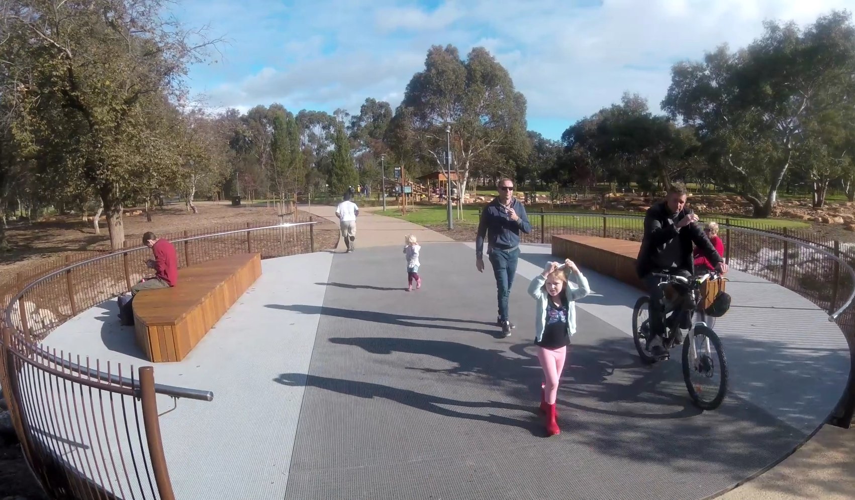
11. Adelaide’s first bicycle path
12. Colour wheel
13. Emu Net & yarning circle
14. Adelaide Comets junior soccer
15. Three pathways
16. Oxbow play space
17. Lookout
18. Dog Park
Start this trail at the corner of South Tce and Unley Road (location #1 on the map above).
There are 18 stops on this Trail. It’s just over 2 km and it will take 90 minutes, to two hours to complete. Walking instructions are designated by bold type at the end of each of the 18 stop descriptions.
Optional: download and print a tri-fold leaflet, i.e. a double-sided single A4 page, with a brief summary of this Trail Guide: (PDF, 1.7 Mb)

1. Introduction
Most of our Trail Guides cover only one Park at a time, but this Trail Guide covers two separate parks, that are on opposite sides of Glen Osmond Road. Because Glen Osmond Road is on a diagonal, these two Parks are triangular-shaped.
Your starting point here, is at the northern tip of Park 19, but you will cross almost straight away into Park 18, and walk around in Park 18 before crossing back into Park 19 and finishing up back here at your starting point.
The walk will take between 90 minutes and two hours. You will pass a public toilet – an ExcelLoo – at about the half-way mark of the Trail.
At this point, on the northern tip of Park 19, there is a grove of four carob trees, including one very old one tree, estimated to have been planted in 1865. Carob trees came from the eastern Mediterranean region, although they are now cultivated all around the world. Their pods are edible and are typically used as a chocolate substitute.

Historical carob trees near the starting point of this Trail Guide.
From this point, please walk over to Glen Osmond Road and cross over the road where there is a pedestrian shelter in the middle of the road. Go to the garden bed on the other side of Glen Osmond Road.

You are now in Peppermint Park, also known as Wita Wirra, or Park 18. This triangular shaped Park has had no boundary changes since 1886. That was when Hutt Street was opened up, south of South Terrace, as far as Glen Osmond Road.
Park 18 was then, and still is today, bounded by Glen Osmond Road, South Terrace and Hutt Road. That makes it unusual because most of Adelaide’s Parks have changed shape over the generations.


It has been known as Park 18 since the 1890s. Its two names are much more recent. In 2002, the City Council decided to give Kaurna language names to each of the Parks. This one is called Wita Wirra which means the place of Peppermint gums, or Peppermint Grove.
Peppermint gums are eucalyptus radiata. Their leaves have a peppermint smell and taste. However, using that as the name for this Park is strange because there are no peppermint gums in this Park.
In 2017 the City Council decided to give all Parks English names as well, so this one got called Peppermint Park. Therefore the Kaurna name and the English name mean the same thing, and the names are equally wrong.
Most people find it more convenient to use the Park numbers. Park 18 is in-between Park 17 and Park 19 and therefore is easy to remember.
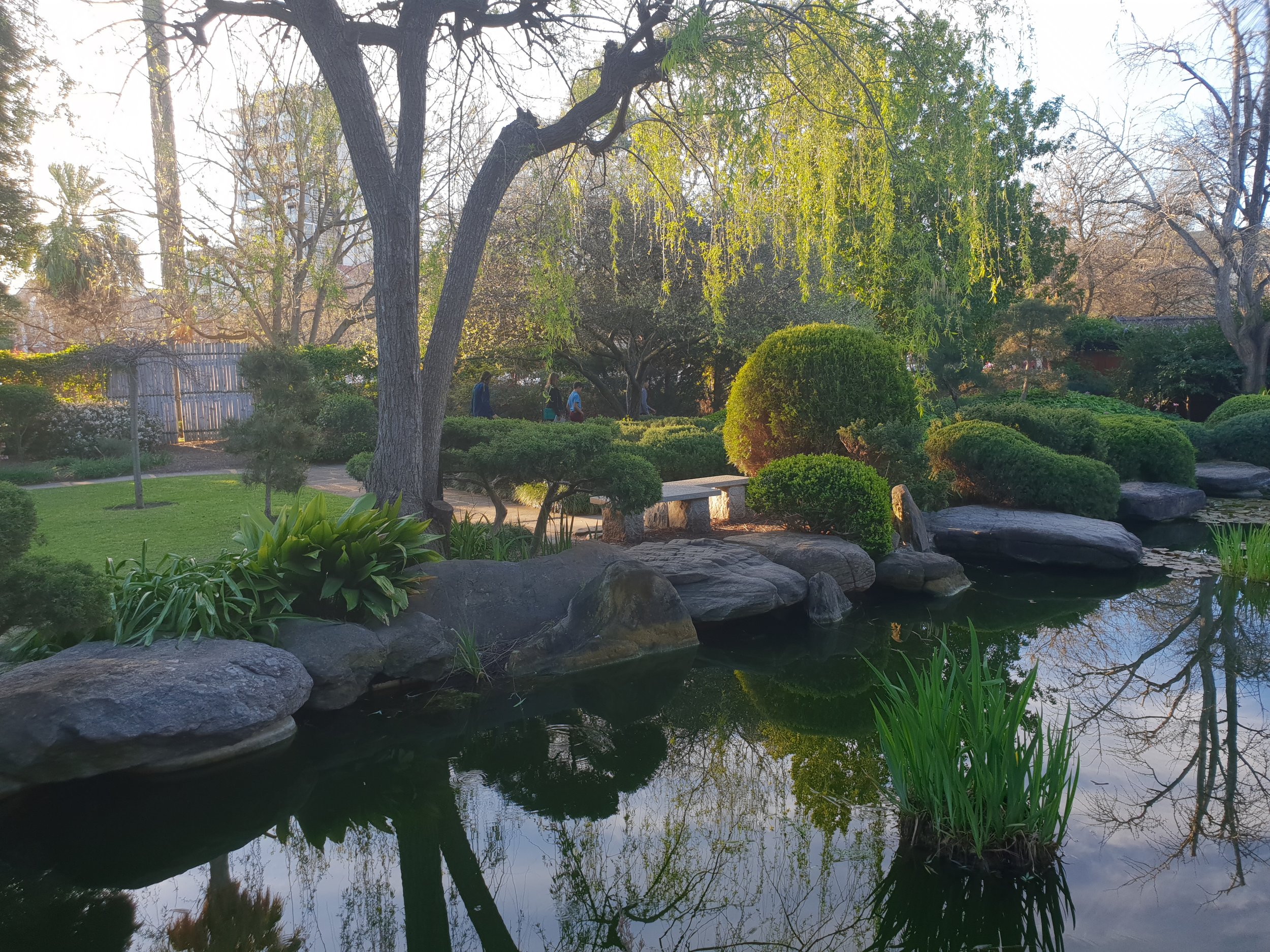
Walk east a short distance to the Osmond Gardens and a wooden pergola.

3. Osmond Gardens and pergola
.
This area between the pergola and Glen Osmond Road is called Osmond Gardens.
It’s named after the first Treasurer of South Australia, Osmond Gilles. Mr Gilles was very good at getting things named after him, perhaps because he was a member of the Street Naming Committee in the late 1830s when Adelaide was being established.
He has probably more things named after him, in Adelaide, than anyone else, including:
Glen Osmond Road
Glen Osmond, the suburb
Mount Osmond and Mount Osmond Road
Osmond Terrace at Norwood
Gilles Street in the City
Gilles Plains the suburb
Osmond Gardens; and
O.G. Road at Klemzig

Osmond Gillies, SA’s first colonial Treasurer
Osmond Gilles died in 1866, so he didn’t live to see these Osmond Gardens. They were designed, laid out and named after him in the first decade of the 20th century, between 1906 and 1908. At that time, these pathways were installed, as well as rockeries and rustic wooden bridges.
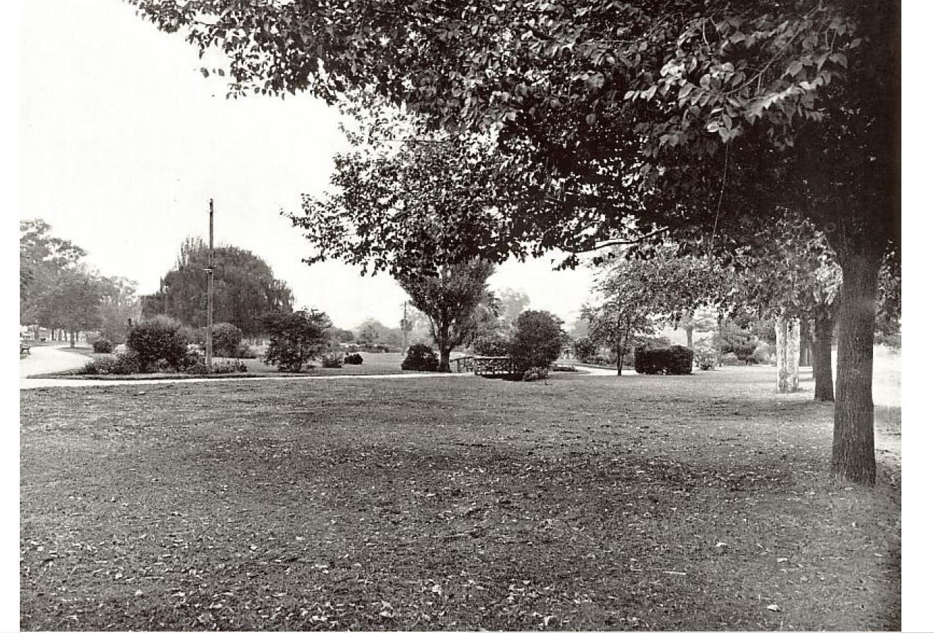
Osmond Gardens in 1928
At the time, Osmond Gardens covered 2.5 hectares (just over 6 acres). It’s much smaller now and you’ll soon find out why it’s smaller.

The succulent bed in Osmond Gardens
There are two garden beds remaining here. The smaller one closer to Glen Osmond road features quite a few succulents. The main oval-shaped bed here is planted with a variety of shrubs and bushes to ensure that something is in bloom and colourful at all times of the year.

The main oval-shaped garden bed in Osmond Gardens
That oval-shaped space was once occupied by a single gigantic Moreton Bay fig tree. We’re not sure when it was removed, but it was very noticeable in a 1936 photo, and missing from a photo taken in 1990.
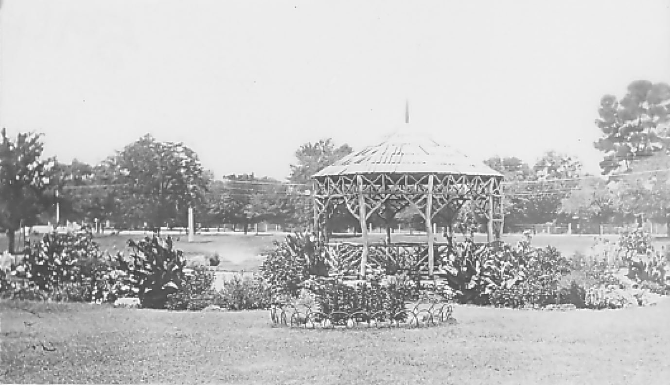
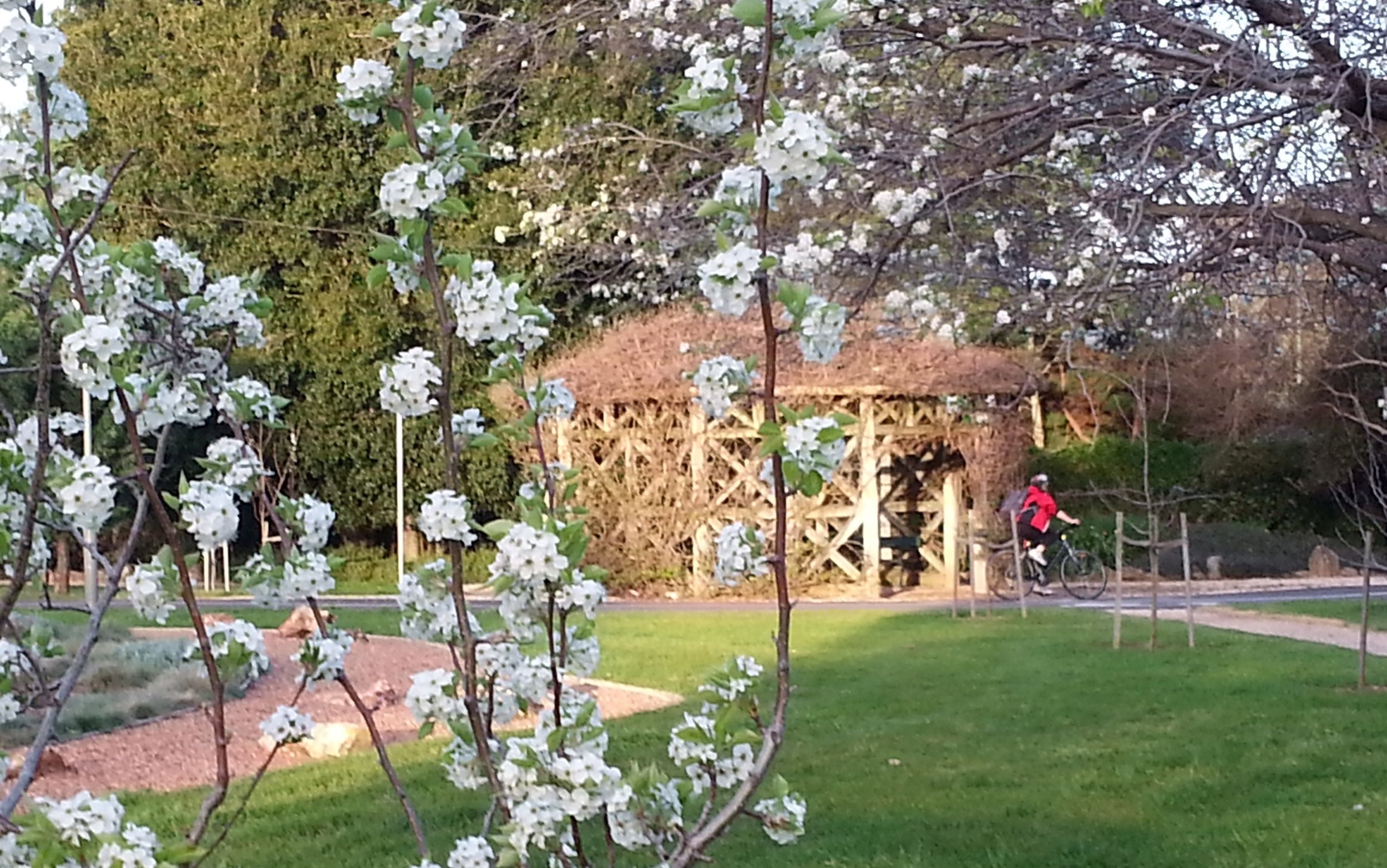
One of the other features here is this wooden pergola. It was built in 1912 and is still going strong. In summer the vines over the pergola are covered in leaves, while in winter the vines are bare.
From this point, step a little further to the west and enter the Himeji Japanese Garden.

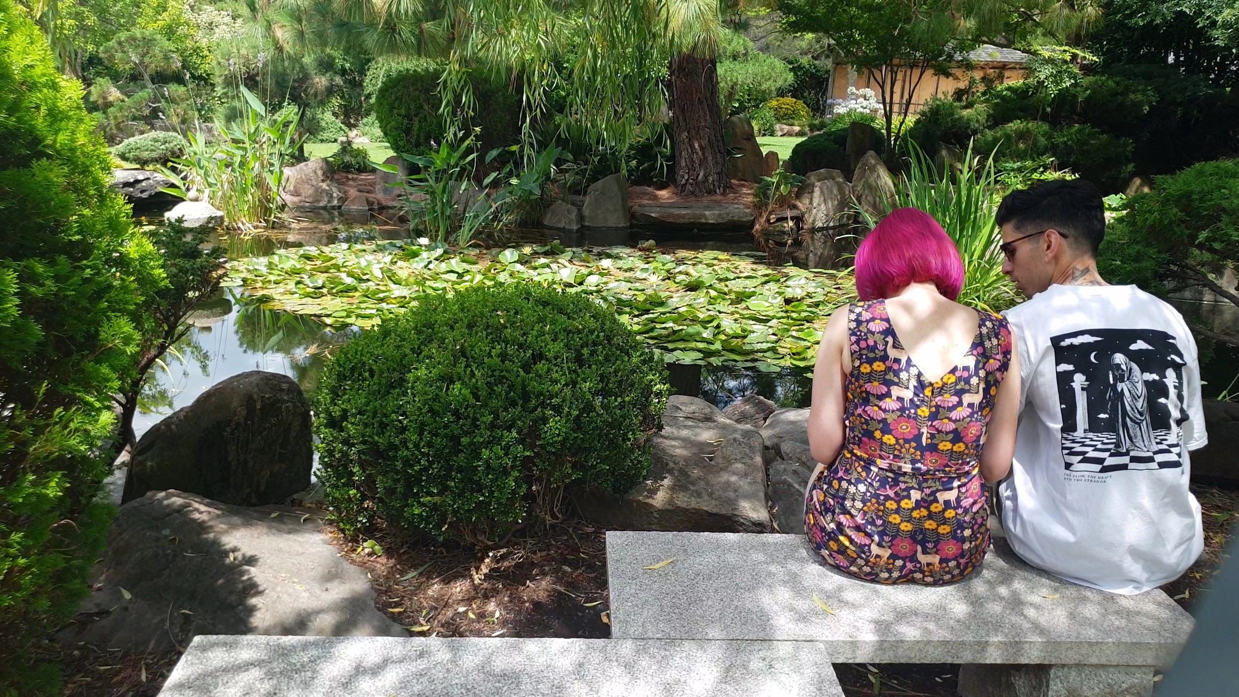
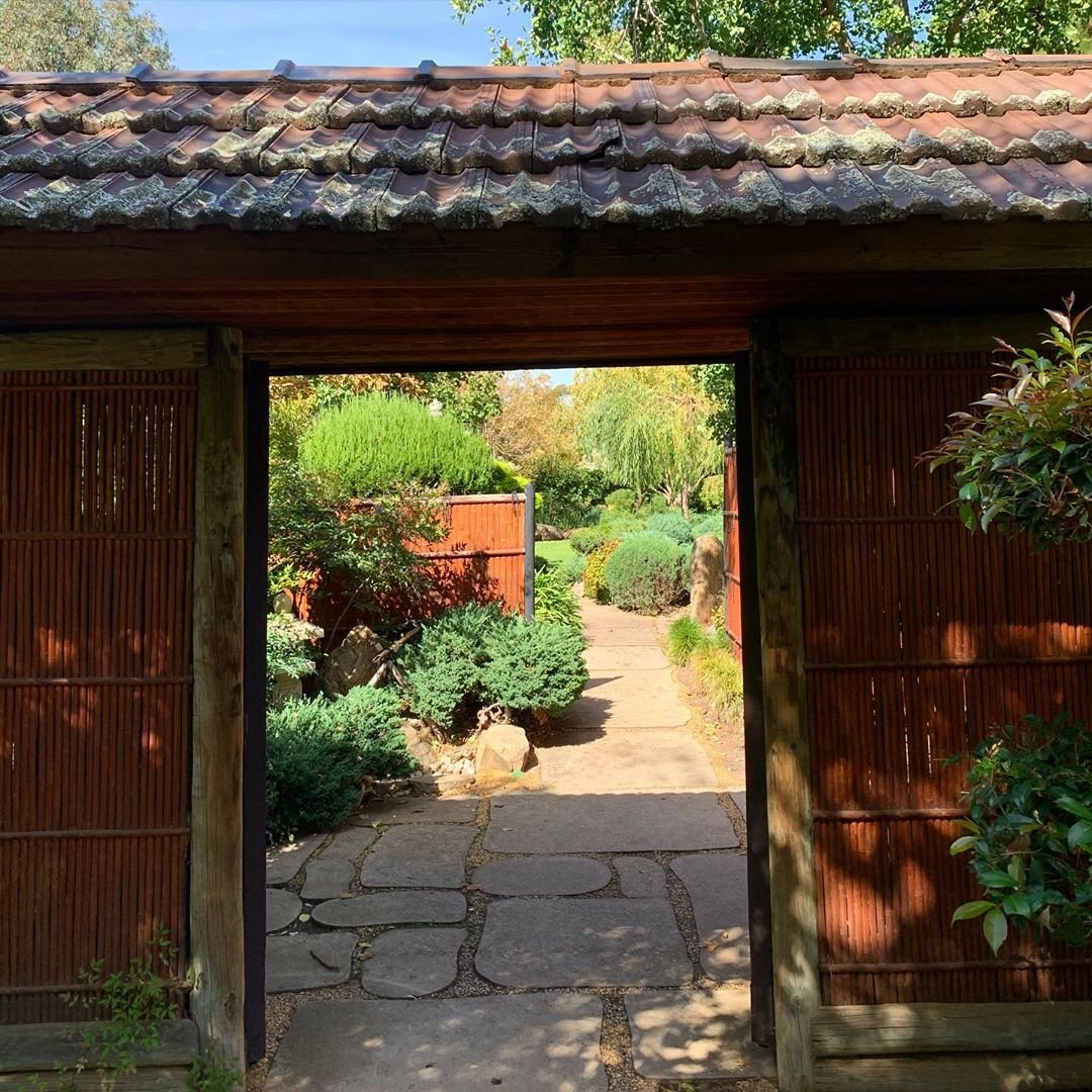
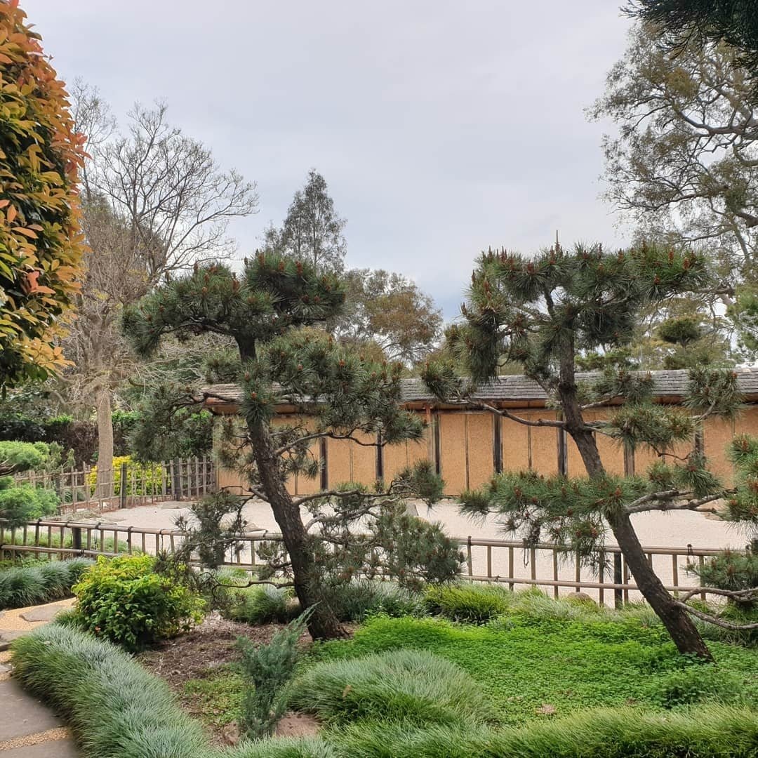
4. Himeji Garden
In 1982, the City of Adelaide entered a “sister city” relationship with the ancient Japanese city of Himeji. The City Council of the day decided to reduce the size of Osmond Gardens to insert the Japanese Garden.
It was opened in 1985 but it wasn’t actually finished until five years later, in 1990. The City Council’s landscaping department consulted with the local Japanese community but they got a few things wrong.
When it was first opened in 1985 it was a compromise between a real Japanese garden and something that local people thought Adelaide people would expect or enjoy. It had bare Cyclone wire fencing around it. Dozens of Japanese fish were donated by the Mayor of Himeji but they lasted only a few weeks. They were picked off by birds very soon.
Also, at that time, the Council did not devote sufficient resources to maintaining the garden. This garden is one of the most labour-intensive parts of the Adelaide Park Lands - it takes a lot of effort to keep it looking this good.
In 1986, a landscape designer from Himeji visited the garden and in co-operation with the Council started a four-year project to rehabilitate the garden. It’s largely thanks to him, Yoshitaka Kumada, that what he have now is an authentic Japanese garden.
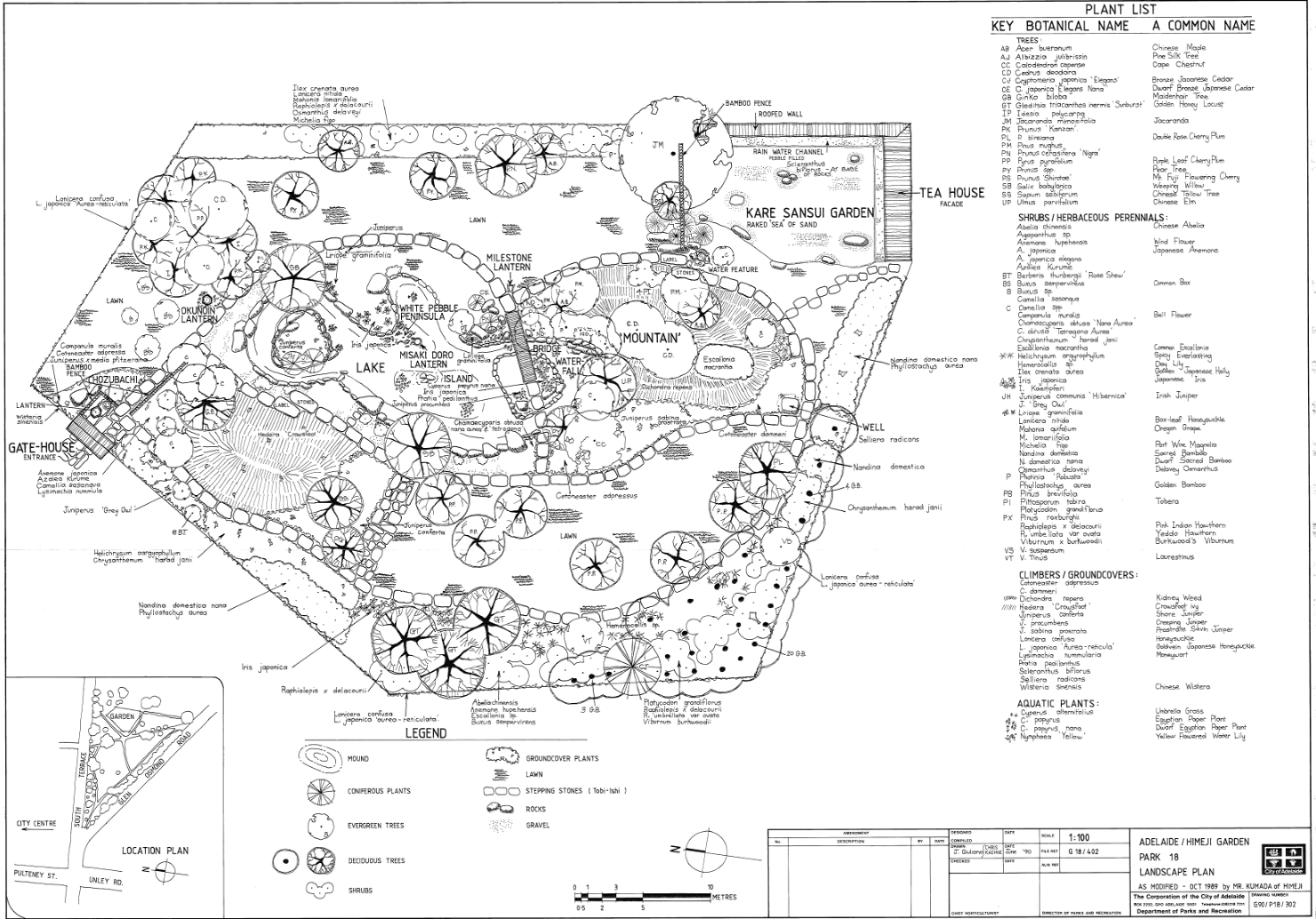
Original landscape plan for the Himeji Japanese garden
One of the best places to view the garden is at a “standing stone” near the entrance, which gives you a view right up to the waterfall along the lines of the garden.
Graphic above provided by ABM visual
The paving stones within the garden are deliberately placed close together to encourage you to take two short steps on each stone to avoid the gaps, it’s a psychological trick to slow you down and make you take your time.
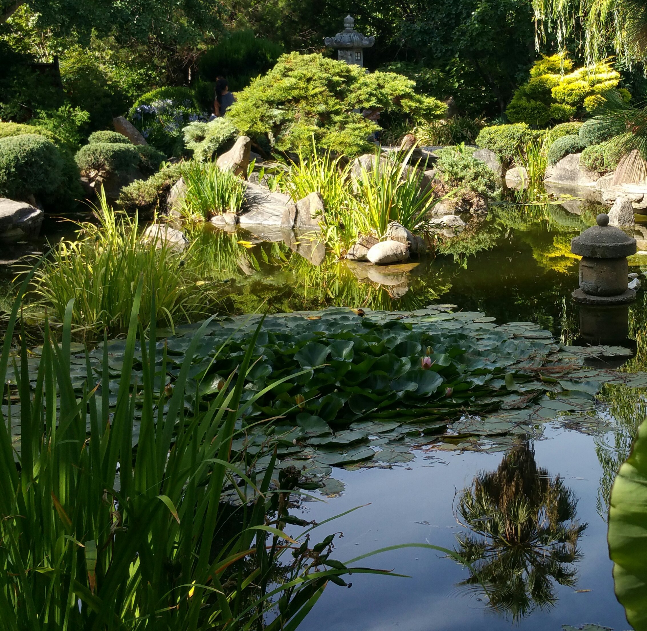
The Himeji Garden blends two classic styles. The first is the ‘senzui’ (lake and mount garden), where water and the imagination create images of vastness and grandeur. The second is the ‘kare senzui’ (dry garden), where rocks and sand evoke the presence of water, even the sea itself.
The City Council gardeners are still using techniques that were taught to them by Mr Kumada, including lessons on how to rake the sea of sand, to give the illusion of waves.
The Garden is open every day from 8am but is closed and locked after sunset.
From this point, we’ll leave the garden and head east, along the line of huge river red gums along South Terrace

5. River red gums
The early European settlers, in the 1840’s and 50’s stripped away almost every tree in the Adelaide Park Lands. They chopped them down for firewood and fencing.
Some re-planting occurred in the 1870’s but it was only in 1880 that the City Council employed a Scottish forestry expert to literally write the book on how to re-vegetate Adelaide’s Park Lands. John Ednie Brown was his name and his plan for re-vegetating was used for decades after he wrote the book. In this Park, and in many other parts of the Park Lands, the plan was to plant trees near the roadside, around the perimeter of each Park.

River red gums (Eucalyptus camaldulensis) in Park 18 near the corner of South Tce and Hutt Rd
The trees weren’t all planted at the same time. The largest trees in this Park, like these river red gums, would have been planted over a period of thirty or forty years, from the 1880’s to the 1920’s. But that means the oldest specimens here are more than 100 years old. These are mainly Sugar Gums, Aleppo Pines and River Red Gums.
There is one major river red gum right outside the Himeji Japanese garden and a collection of six of them near the corner of Hutt Road.
From this point walk southwards across the sporting field until you come to a two-storey shed.

6. Three sporting fields
This Park is a good example of three different types of Park Lands. All three types are Open, Green and Public. But they are all very different.
We have beautiful landscaped gardens, we have an open woodland, and we also have three sporting fields.

This two-storey shed is the home base of the Adelaide City Women’s Soccer Club. They have the use of three soccer pitches all next to each other in Park 18. Junior girls teams also play here.
This two-storey shed is the home base of the Adelaide City Women’s Soccer Club. They have the use of three soccer pitches all next to each other in Park 18. Junior girls teams also play here.
The City Council has LICENCED the use of the playing fields and LEASED the site of the building. The difference is that the sporting fields are available for public use whenever the Adelaide City Women’s Soccer Club is not using them. The building, of course, is NOT available to the public.
So the fields are OPEN GREEN AND PUBLIC. The building is NOT Open, NOT Green, and NOT public.
From this point, walk a little bit further south through the trees, until you come to a bitumen path and a bridge over a creek.

A solitary large sugar gum, in between the sporting fields on Park 18.

7. Creek and open woodland
This open woodland in the southern part of Park 18 has been re-vegetated in first two decades of the 21st century. An aerial photo taken in 1990 shows this area largely tree-less, with just a few small shrubs dotted about.
The woodland you can see here has been nurtured by the City Council’s biodiversity team, to try to recreate the type of environment that would have existed here before European settlement.
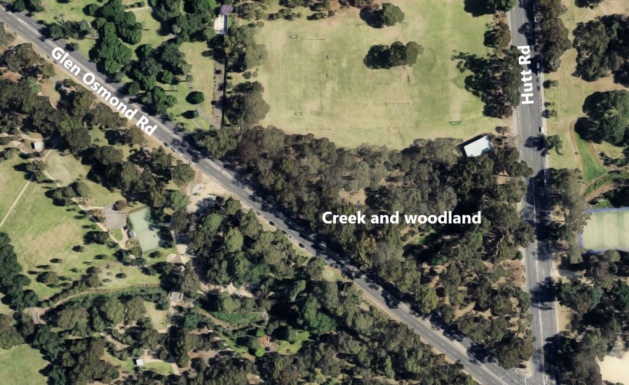
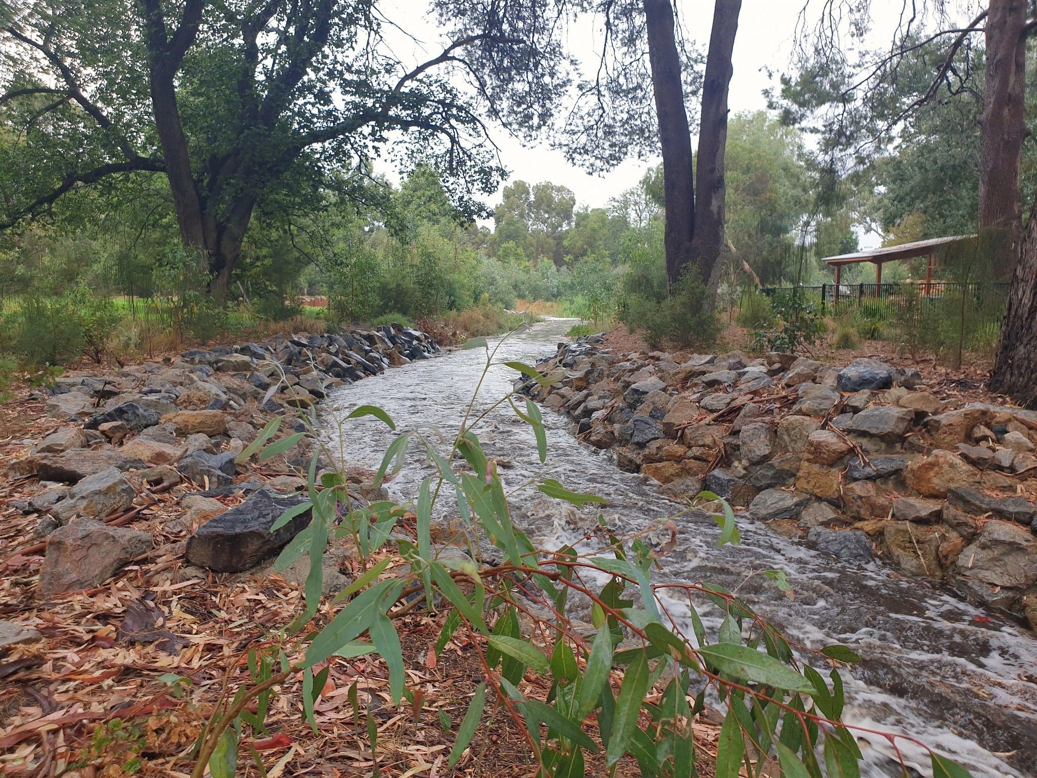
The Creek here is not a natural creek. It’s an artificial drainage channel which was originally constructed in 1917. It’s been known for most of its life as the South Park Lands Creek. It drains the southern Park Lands and eventually flows into the suburbs of Wayville, Goodwood and Unley, where, in the past, after heavy rain it caused flooding.

The South Park Lands Creek in Park 18. Pic: Chris Ayles
That’s the main reason why in 2021-22, a huge wetland was built in the southern section of nearby Victoria Park, as a stormwater detention basin.
This bridge was built and the Creek was widened in 2017. The work also included planting of reed beds to encourage more biodiversity – so the project was about more than just flood mitigation.

The reed beds pictured in 2018. Compare this to how they look today.
The “Park Lands Trail” pedestrian and cycling route passes through Park 18, linking the adjacent Parks 17 and 19.

The Park Lands Trail crosses over the South Park Lands Creek on this bridge that was rebuilt in 2017.
From here, follow the Park Lands Trail towards Glen Osmond Rd and walk towards the city until you come to the place where the woodland ends, and you enter an open grassy place.

8. Privet hedge
At this point you are close to another crossing over Glen Osmond Road.
To the north of this point, on your right is a low hedge. The hedge was planted in 1915, on the orders of the Adelaide head gardener at the time, August Pelzer. There’ll be more about Mr Pelzer later in this Trail Guide.
It’s known as a privet hedge. Its proper name is Ligustrum ovalifolium. The “oval” part of the name means that the leaves are oval in shape. It’s related to olive trees.
It’s sometimes called a California privet although it’s native to Japan.
The plants in the hedge now, are not the same plants from 1915.
They would have been replaced many years ago, but the hedge has existed here for more than 100 years. It marks the boundary between the sporting fields and Osmond Gardens further north.
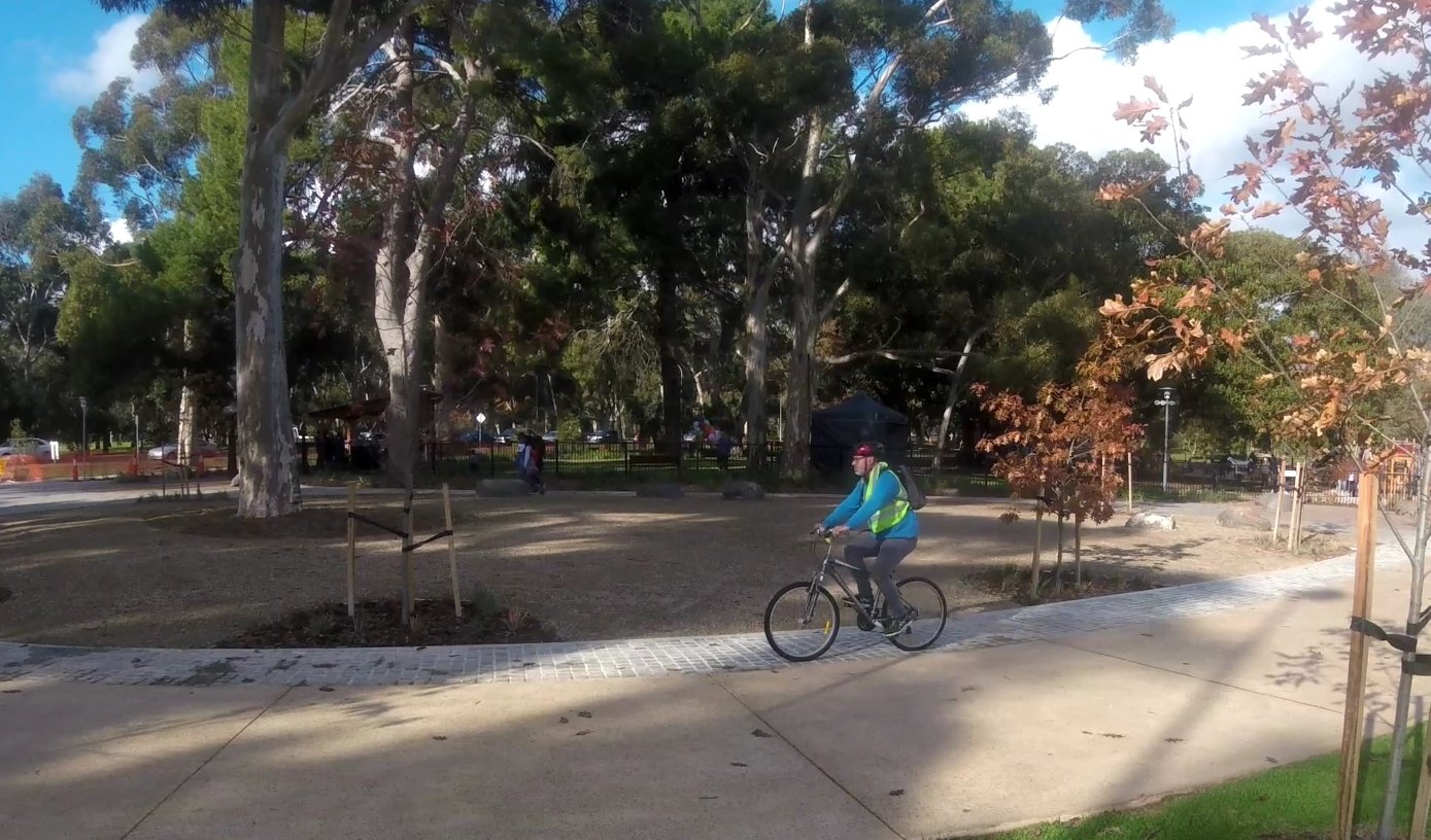
The bike path that heads northwards through Osmond Gardens is a popular commuting route.
It links a bikeway in Unley (Porter Street) with the Frome Street bikeway in the city.
From this point, cross over Glen Osmond Road again to Park 19, and stop outside the fenced tennis court.


9. Pelzer Park / Pityarilla
This is Park 19. It has been known as Park 19 since the 1890s. However, like most of the Parks within the Adelaide Park Lands, this Park also has been given two names.
The Kaurna name was assigned in 2002. “Pityarilla” means “marshmallow root place" referring to the native marshmallow or hollyhock that grew here – a food source for the Kaurna people.
The other, English name was assigned more recently, in 2017. It was named after August Pelzer who was Adelaide’s city gardener from 1899 to 1932.
Pelzer was born and trained in Germany, then moved to England, from where he was recruited for this Adelaide role.
Pelzer’s influence is evident in thousands of plantings not only in this Park, but throughout the Park Lands.
He was not a fan of eucalypts. His legacy includes many hundreds of European species throughout the Park Lands, including plane trees and ash trees. As you walk along the pathways in the Park Lands, you usually walk underneath a canopy of trees planted on either side of each path. That was Pelzer’s idea, and it has persisted for more than 100 years.
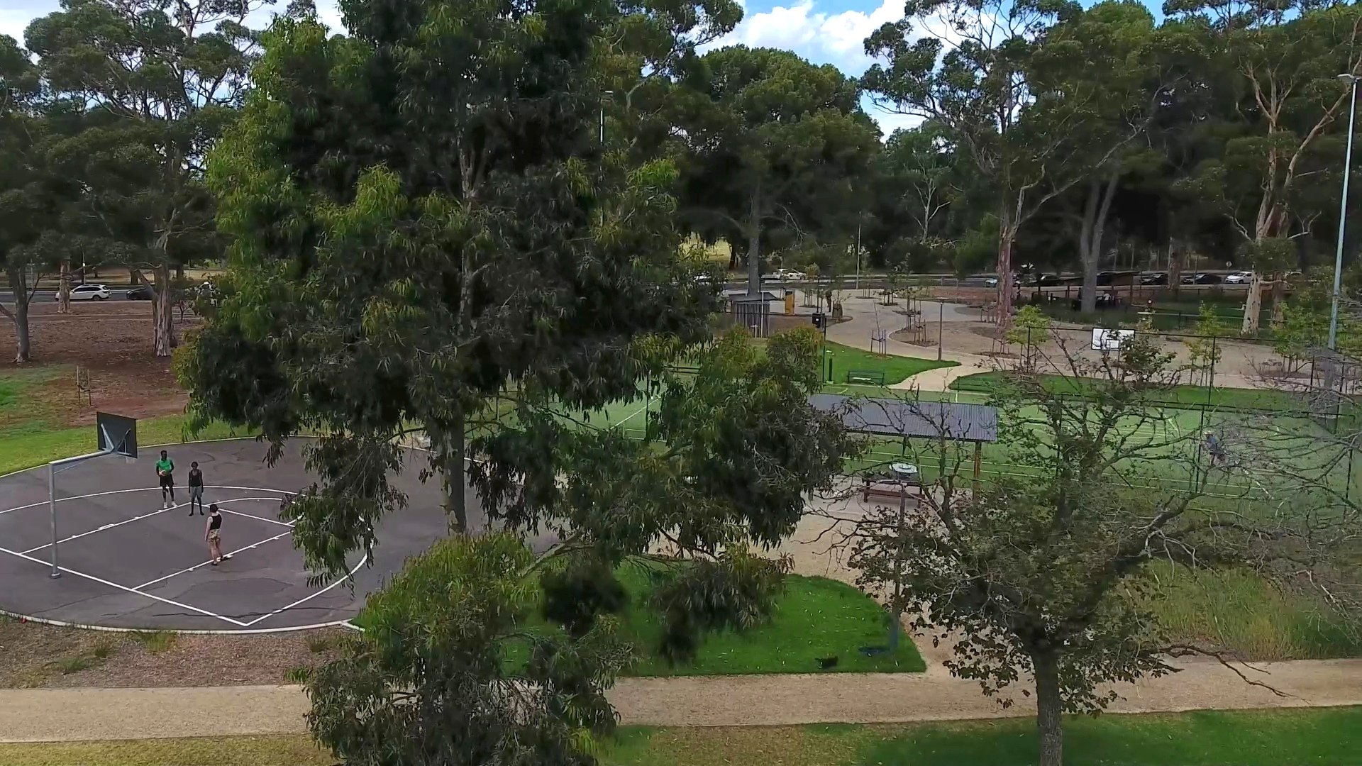
The basketball and tennis courts here were re-surfaced in 2017 - and push-button lighting was installed to have them usable at night - but that was only a small portion of the work that was done to create what the planners called a “community hub” or “activity hub.”
Several million dollars was set aside. The funding came from both the State Government and the City Council.
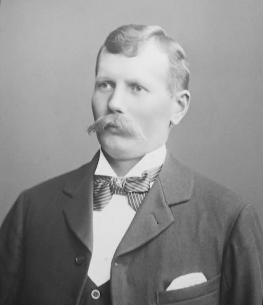
August Pelzer 1862-1934

They hired landscape architects to design what you can see here. But they didn’t start with a blank canvas – there were already basketball and tennis courts, and a playground had been here since the early 1960’s.
The rejuvenation works include an upgraded nature playspace, new promenade and plaza space, intended for open-air markets and events, a new toilet block, upgraded recreation courts, a dog park, and enhanced ‘formal’ park amenities.
The enhancements also provide for a ‘cultural stage’, and ‘wild play’ roaming areas. The design is a result of community, school and Kaurna group consultations, and weaves a narrative inspired equally by nature’s ecological systems and traditional Kaurna knowledge.
The Park has a focus on learning through play, celebrating diversity and interaction with others.
It has become a popular place for families to visit in the past few years.
From here, go through the gate into the Marshmallow Playspace.

10. Marshmallow play space
One of the most popular parts of Park 19 is this Marshmallow Playspace. The first playground on this site was established by the Apex club, in 1961. It was known then as the Apex playground.
It was upgraded in the 1990s and re-named the Marshmallow Playground. It was then was upgraded again in 2018.
Marshmallow playspace graphic above provided by ABM visual
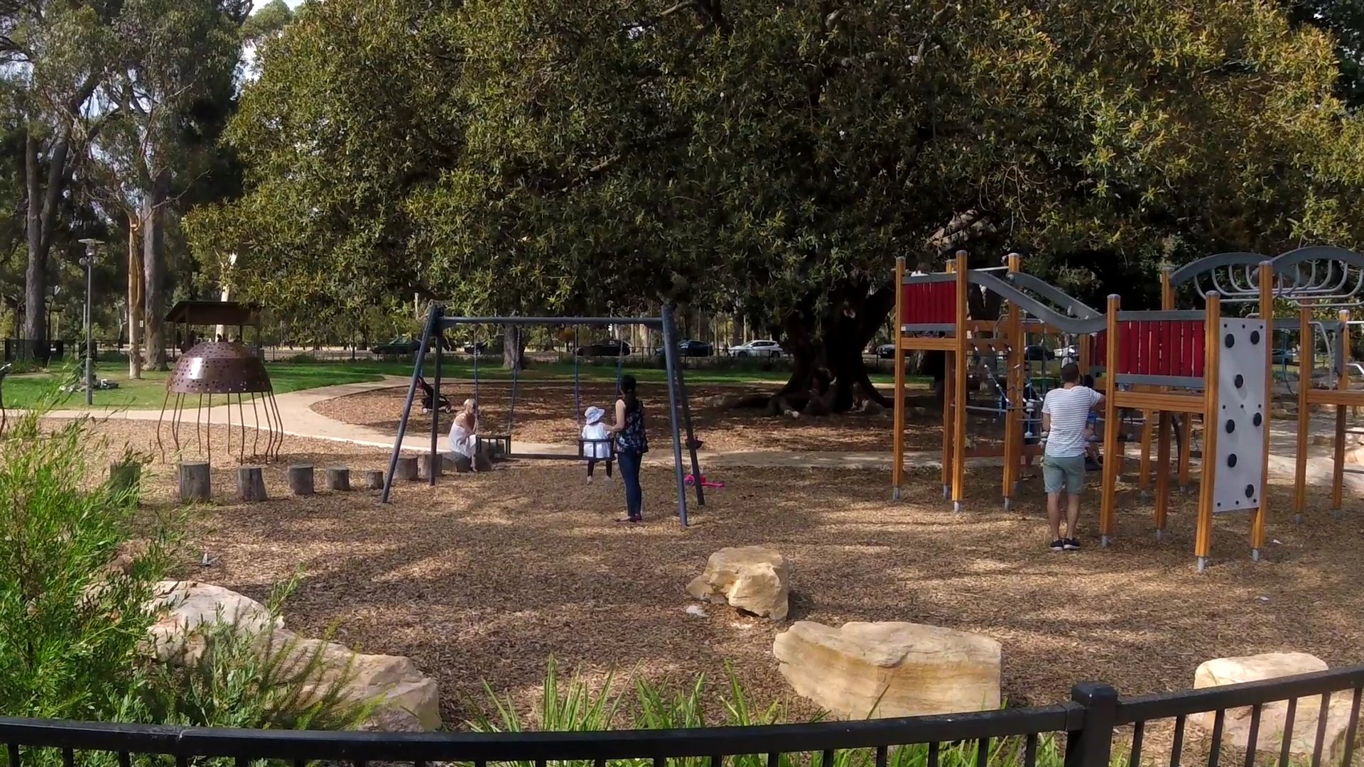
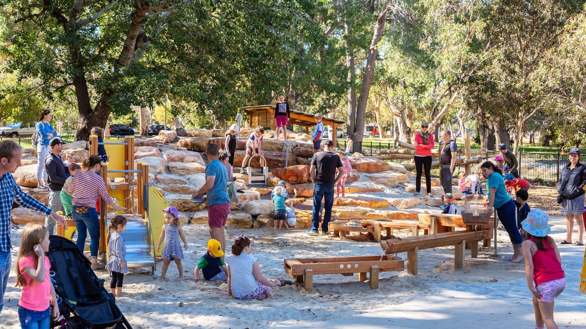
One of the major features of the playground is this huge Moreton Bay fig tree.

The new features that were added in 2018 include interactive water play elements, to encourage children to work together to weave a flow of water through rock and sand paths. Traditional play equipment - swings, slides and climbing frames - sits alongside cubby house structures inspired by Aboriginal Wurlies.
Some of the equipment is designed to be accessible from a wheelchair. There are also jellyfish and witchetty grub sculptures.
Now leave the playground at the southern end and walk out onto the bicycle path alongside Glen Osmond Rd.

11. Adelaide’s first bicycle path
.
This pathway was Adelaide’s first-ever bicycle path. It was constructed in 1901-02, long before motor vehicles were using Glen Osmond Road.
In fact, cycling was something of a craze during the 1890’s – not just in Adelaide but in cities around the world. Bicycles were being mass produced and were the cheapest most efficient means of transport at the time. People of all ages and both sexes were taking up cycling, some just for transport, others for sport. By the early 1900’s there were several women’s cycling clubs that had become popular in Adelaide.
When this path was built in 1901, it was named “Ponder Avenue” after a City Councillor who pushed for its establishment. Other bicycle paths soon followed, the next one being on the other side of this Park, off Unley Road.
You will notice along the side of the path a large drain. That was built at the same time as the bicycle path – 1901.
It’s lined with very large sugar gum trees, along with some pepper trees and Aleppo pines nearby. These were probably planted in the 1890s before August Pelzer became City Gardener. They also pre-date the bike path.
Fortunately in the early 20th century, Pelzer allowed the sugar gums to be retained, despite the fact that he mostly preferred European trees.

The bike path lined with sugar gums
The line of sugar gums goes all the way to Greenhill Road. When the trees were planted, Hutt Road stopped at a T-junction with Glen Osmond Road, (i.e. it did not extend to reach Greenhill Road) so in those days Park 19 was a complete triangle. Hutt Road was extended south to Greenhill Road in 1916, cutting through Park 19.
Now Park 19 stops at Hutt Rd. The last bit of the triangle, on the other side of Hutt Road, is now considered to be part of Park 17.
That small triangular section bounded by Hutt Rd, Glen Osmond Rd and Greenhill Rd is one of the very few parts of the Park Lands that have been retained as a passive park, with no facilities, as envisaged by August Pelzer.
From this point, walk through the trees into the Park, until you come to a dirt pathway, then turn right. Stop where you can see a circular shape laid out on the ground.

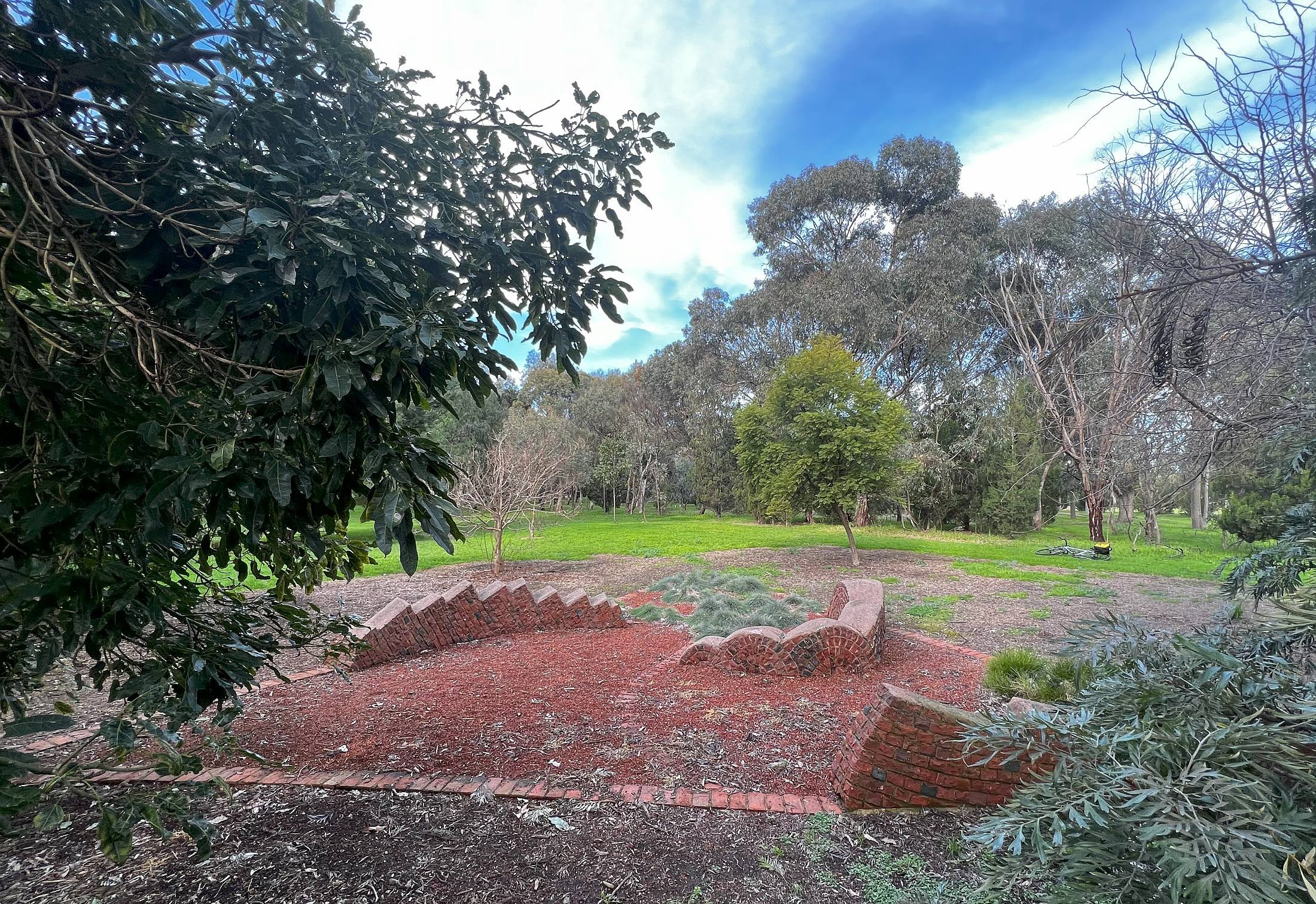
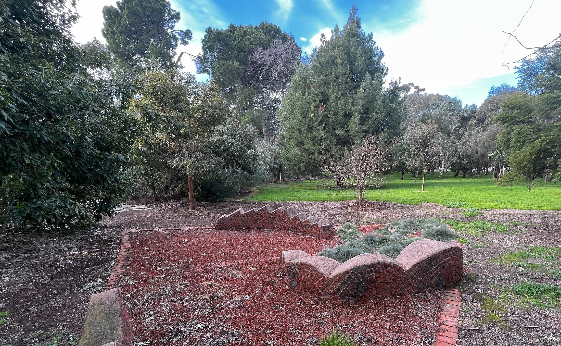
12. Colour Wheel
This is called the “Colour Wheel.” It was commissioned by the City Council in 2006 from artist Evette Sunset, who calls herself a freelance environmental sculptor. She calls it a “living sculpture” a meditation site, picnic area and children’s playspace.
After two years of research, she chose six different trees: three for the primary colours (red, yellow and blue) and three for the complementary colours (orange, yellow and green). Each of the three walls represents a primary colour and an element – a bronze-coloured “earth wall,” a red-coloured “fire wall” and a blue-coloured “water wall”.

The gesture of each wall suggests the character of each colour, and words sound its spirit. When the trees were planted Evette Sunset said that, “over time, the trees should be about the same height”. However a crepe myrtle died when watering was stopped and so a replacement has been trying to catch up.
From about November to January, the trees flower together profusely, leaving a palette of brightly coloured dried flowers on the ground.
At other times, three strap-leaved plants are intended to provide a ground-cover spread, echoing in softer tones, the three primary colours.
The yellow tree is Grevillea Robusta
The orange tree is the Illawarra Flame
The red tree is Corymbia Ficifolia – red flowering gum
The violet tree is a Crepe Myrtle Lagerstroemia "lipan"
The blue tree is a Jacaranda
The green tree is a Gleditsia
From this point, walk a bit further south to the edge of the soccer field.

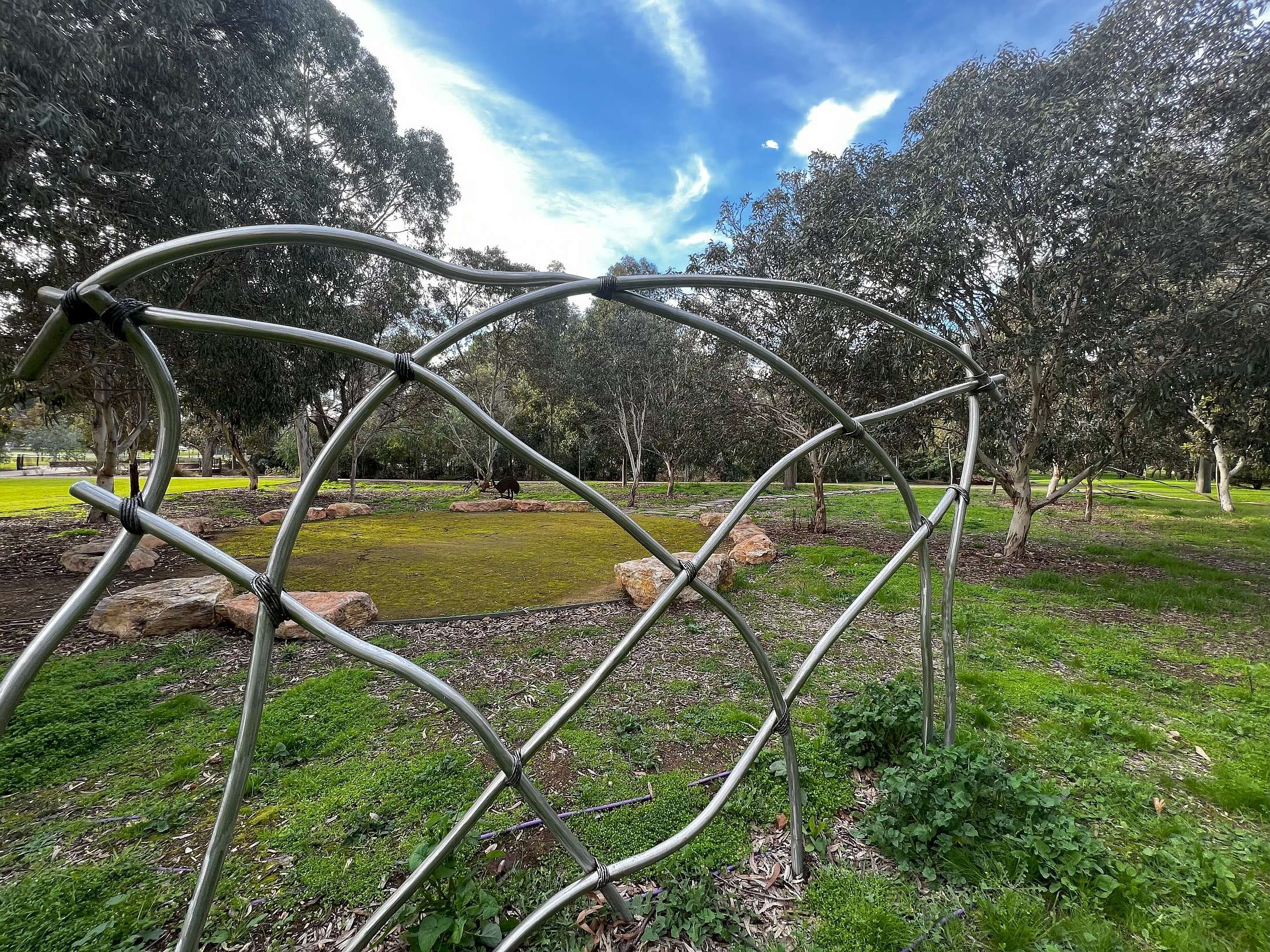
13. Emu Net and yarning circle
In this place you can see a “Kardi Munta” (emu net) and “Kardi” (emu) sculptures. They are Kaurna cultural markers that connect Kaurna culture to Kaurna Country. These cultural markers capture a moment in time back when Kaurna people would build strong nets to capture larger game, as opposed to the finer nets that were made from natural strings to capture smaller animals like ducks and fish.
The frame of these large-scale nets were made from long branches of Drooping She-oak. The branches were inter-woven to create a frame and then bound together with long strips of the inner bark of Red Gum trees. The nets were so strong, they were able to capture emu. A traditional emu net is stored within the South Australian Museum. This sculpture evokes the real net.
The emu is the second-largest living bird by height in the world. It can grow up to around two metres tall and can live between ten and twenty years in the wild. It is endemic to Australia, where it is the largest native bird. Up to the early 19th century, its relative, the Dwarf Emu lived on Kangaroo Island, South Australia.
The emu is significant to the Kaurna people. Its spirit is embedded in Kaurna creation stories, the landscape and the night sky, guiding and shaping the Kaurna way of life.
Its feathers are used for ceremonial purposes and its movements are replicated in dance. There are emus in the Adelaide Hills, including in the Belair National Park, but it has been a very long time since any emus have been sighted in your Adelaide Park Lands. They did live here, before European settlement; along the river, creeks and across the lightly wooded grassy plains.
A yarning and learning circle – such as the circle on display here, is another Kaurna “cultural marker”.
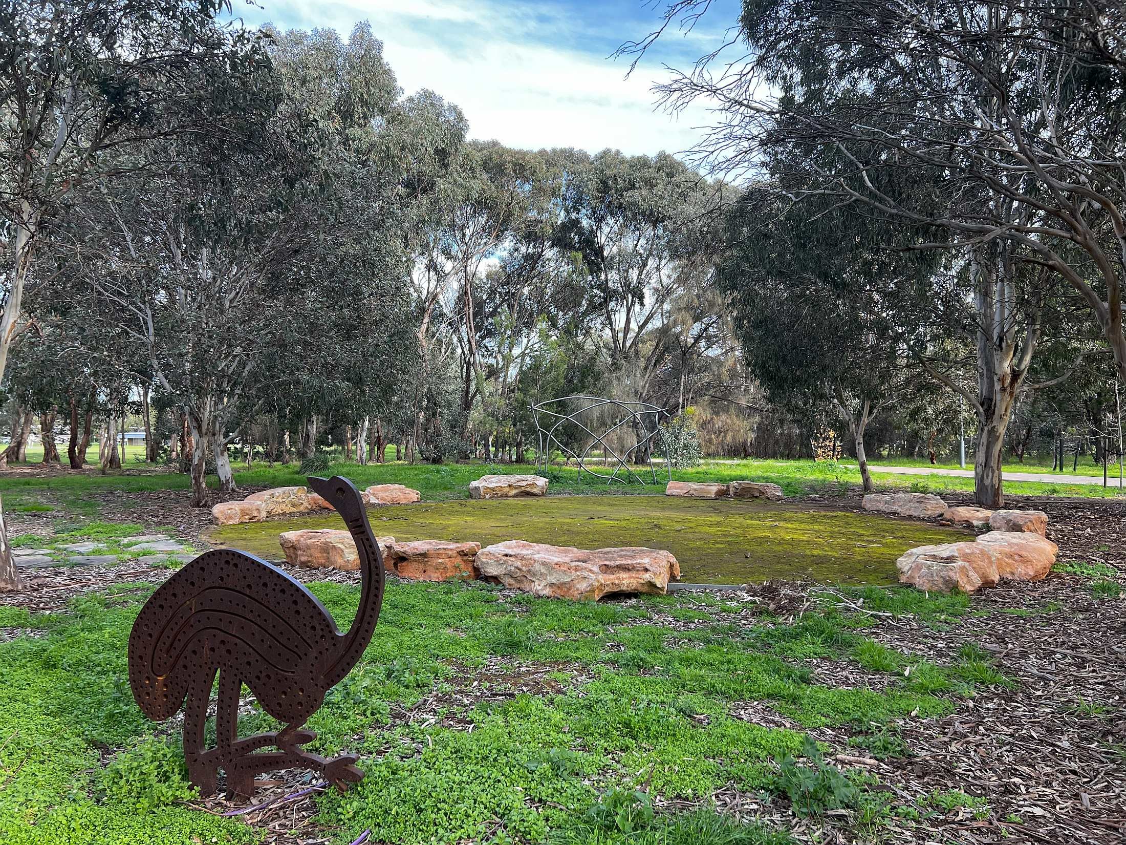
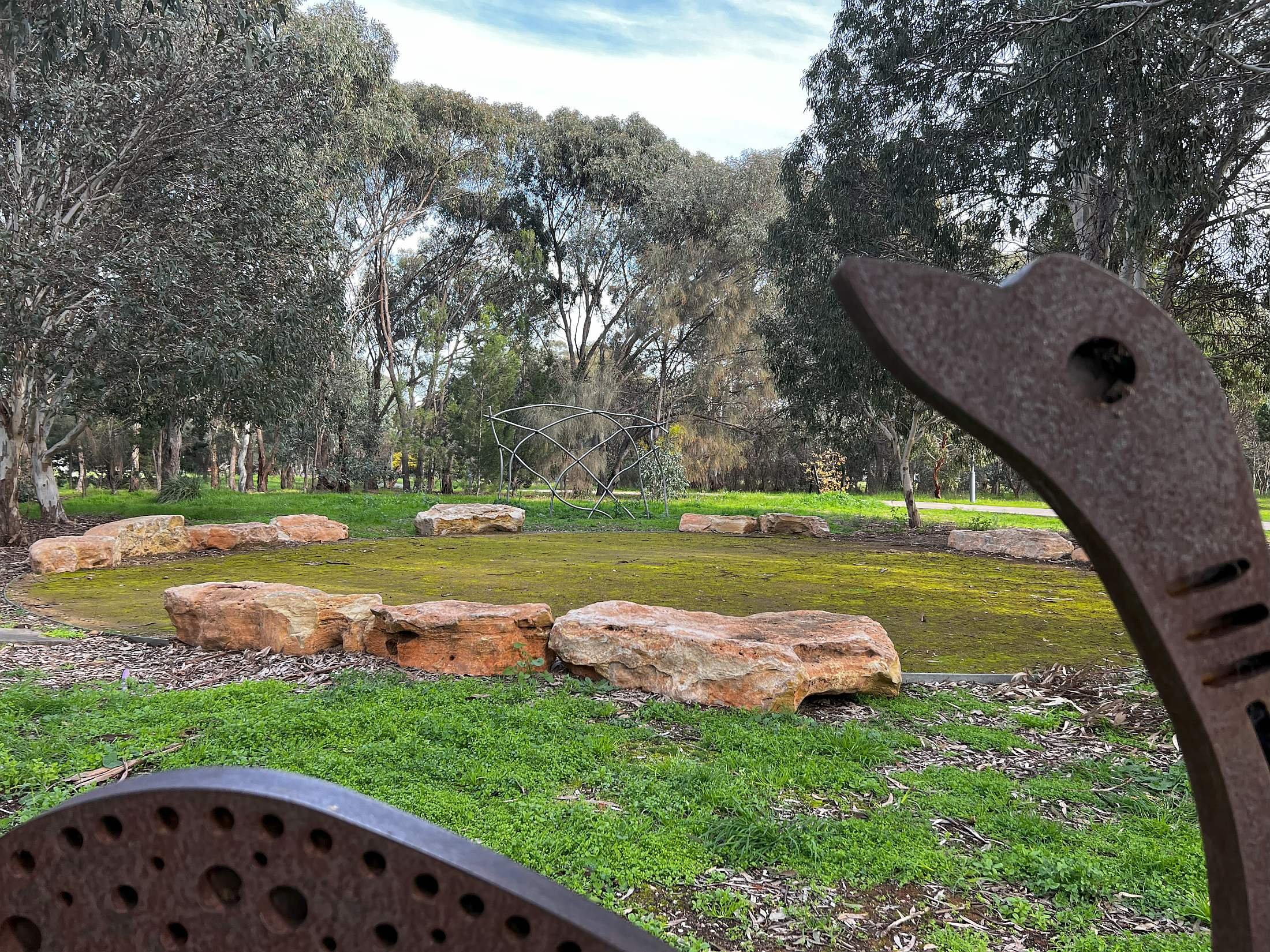
The yarning and learning circle provided opportunities for Kaurna Elders to celebrate the living Kaurna culture by sharing Kaurna knowledge through the generations.
The Kardi Munta (emu net) here was created by local Kaurna / Ngarrindjeri Landscape architect, and artist, Paul Mantirri. It’s made from a combination of stainless steel, mild steel and copper, the cultural markers bring to life a Kaurna story of this area, as told by Senior Kaurna Elder, Aunty Lynette Crocker (also known as ‘Lone Crow’).
Go to the soccer fields.

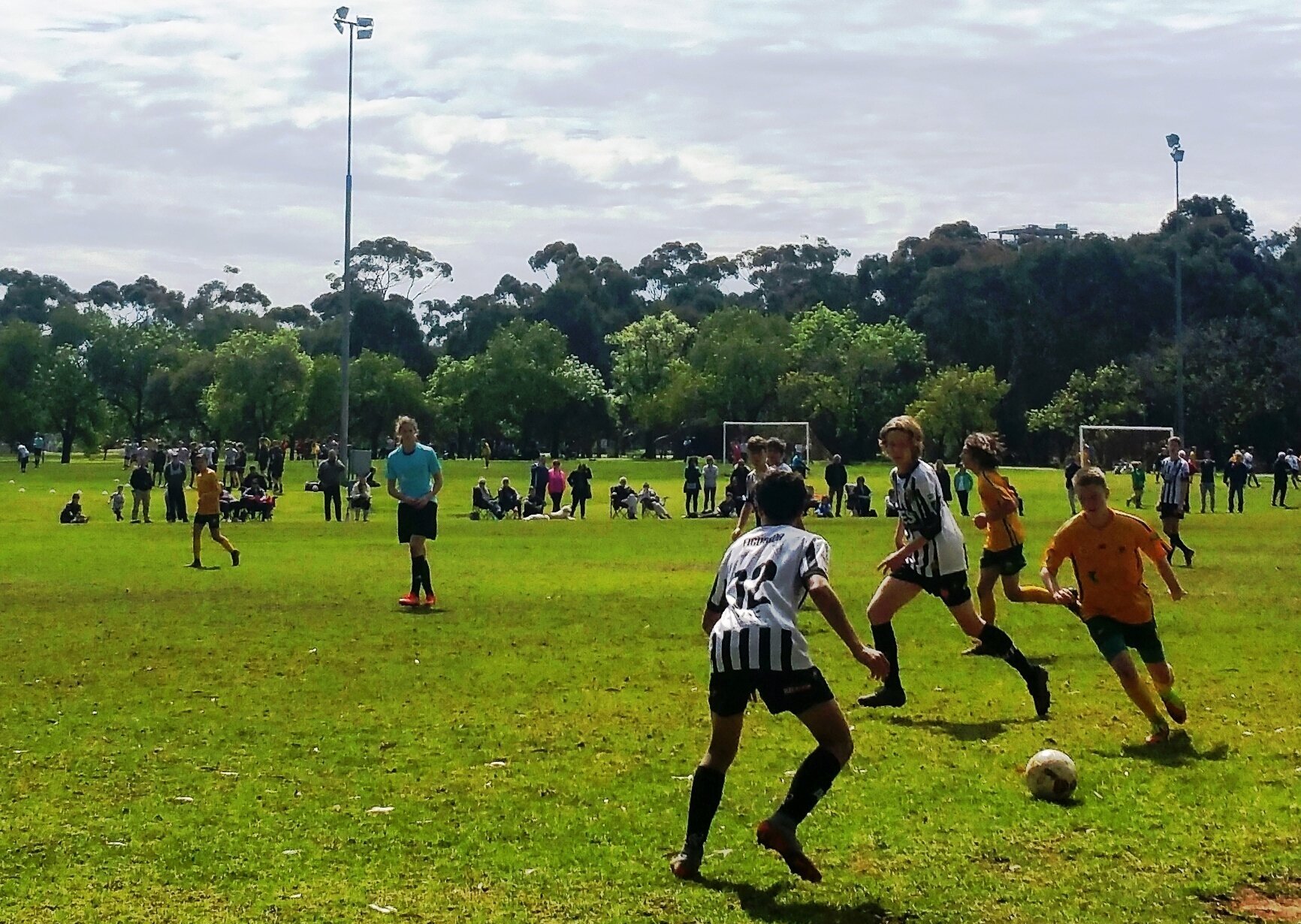
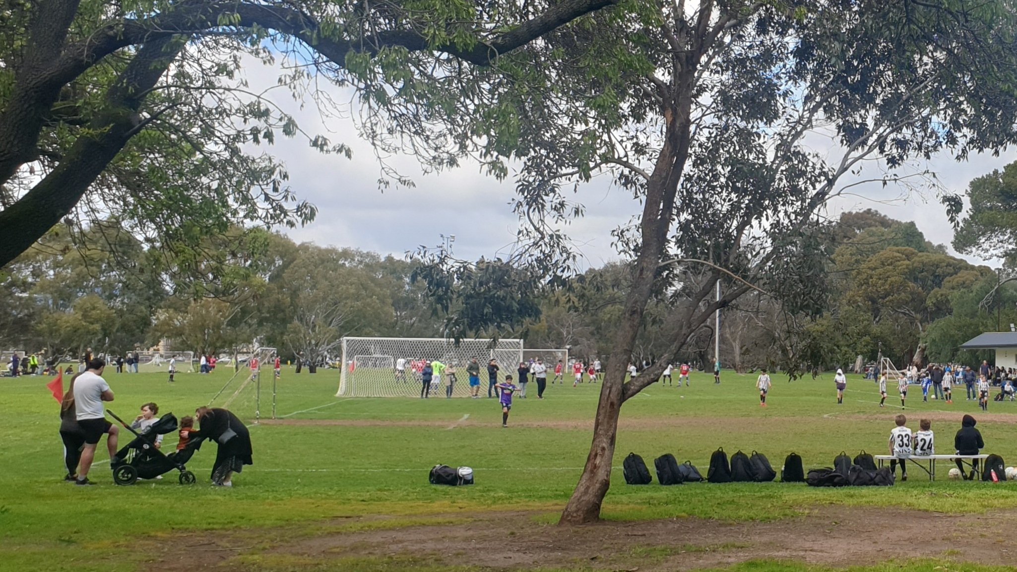
14. Adelaide Comets junior soccer ground
Park 19 is similar to Park 18 next door, in that it features several soccer fields – in fact four of them.
Three of them, alongside Unley Road are licenced to the Adelaide City Football Club and used mainly for the boys competition. They have a clubroom building and changing shed just off Unley Road.
This playing field is the exception. It’s licensed to the Adelaide Comets, and also used for their juniors. There are floodlights here for training at night. The Comets junior players have a shed just off Greenhill Road.
From this point, walk a little further to the west until you come to a bitumen pathway.

15. Three pathways
This is one of three north-south pathways through Park 19.
One of them starts at the corner of Hutt Road and Greeenhill Road. That path goes past the Colour Wheel, that you saw earlier.
It’s a dirt path, going from the south-east to the north-west diagonally across the Park. It was originally lined with English elm trees that were planted in 1919, perhaps as a tribute to World War One soldiers.

The dirt pathway looking towards the corner of Greenhill Road and Hutt Road, showing only a couple of the remaining English elm trees.
Originally there were 145 English elm trees planted on that path. Very few of them remain today, having been replaced over the years with native species.
The other two paths are both sealed and they both start on Greenhill Road, opposite Porter Street in Unley. Both of them are lined with desert ash trees – reflecting the vision of August Pelzer.

From Greenhill Road, looking north: the two sealed paths through Park 19 split off in slightly different northerly directions.
One heads almost directly north, and crosses over the dirt path before the community activity hub. It then crosses Glen Osmond Road near Osmond Gardens, and it links up with the Frome Street bikeway in the city.
The other path leaves Greenhill Road going in a more north-westerly direction, and meets South Terrace near the corner of Unley Road and Pulteney Street. Each of the two sealed pathways is very popular with pedestrians and cyclists commuting to and from the city.
The path to the west was planted first in the 1920’s. The more directly northerly path had to wait a few years afterwards to be lined with desert ash trees. A photo taken in 1936 shows this path, but no trees at all alongside it.

1936 aerial photo showing the central N-S pathway through Park 19, with no trees lining the path at that time. Image: City of Adelaide archives.
Now walk north along this path until it crosses the dirt path at the Oxbow Playspace.

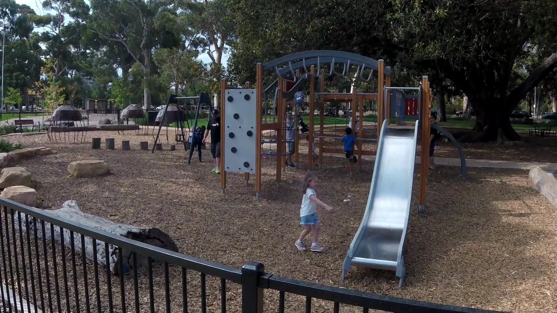
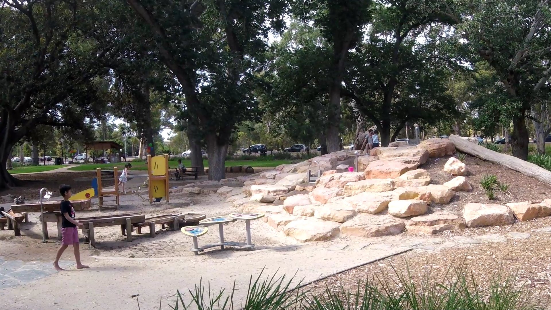
16. Oxbow play space
The word “oxbow” means a loop or a bend in a river. This is where the South Park Lands Creek takes a slight bend, and also where a new children’s playspace was built in 2018.
It’s also a great spot for picnics. You can just spread out a picnic blanket on the grass, or use one of the two free electric barbecues.
The playspace is designed for children slightly older than those who might use the Marshmallow playspace. Stepping stones, logs and climbing boulders surround the island where recycled logs are perched to form an enormous tepee.
Teepee graphic above provided by ABM visual
A large wooden climbing frame, complete with a rope net, provides a challenge for the bigger kids. There is a smaller sister frame in Marshmallow Playspace.

The Oxbow playspace in Pelzer Park / Pityarilla (Park 19)
The re-development of this part of Park 19 in 2018 also coincided with large earthworks to improve the condition of the South Park Lands Creek. As you saw earlier, in Park 18, the South Park Lands creek has been widened and planted with thousands of reeds and other shrubs to encourage insects and birds to visit. There is a mix of indigenous plant species here now, to increase biodiversity and prevent weeds and erosion.
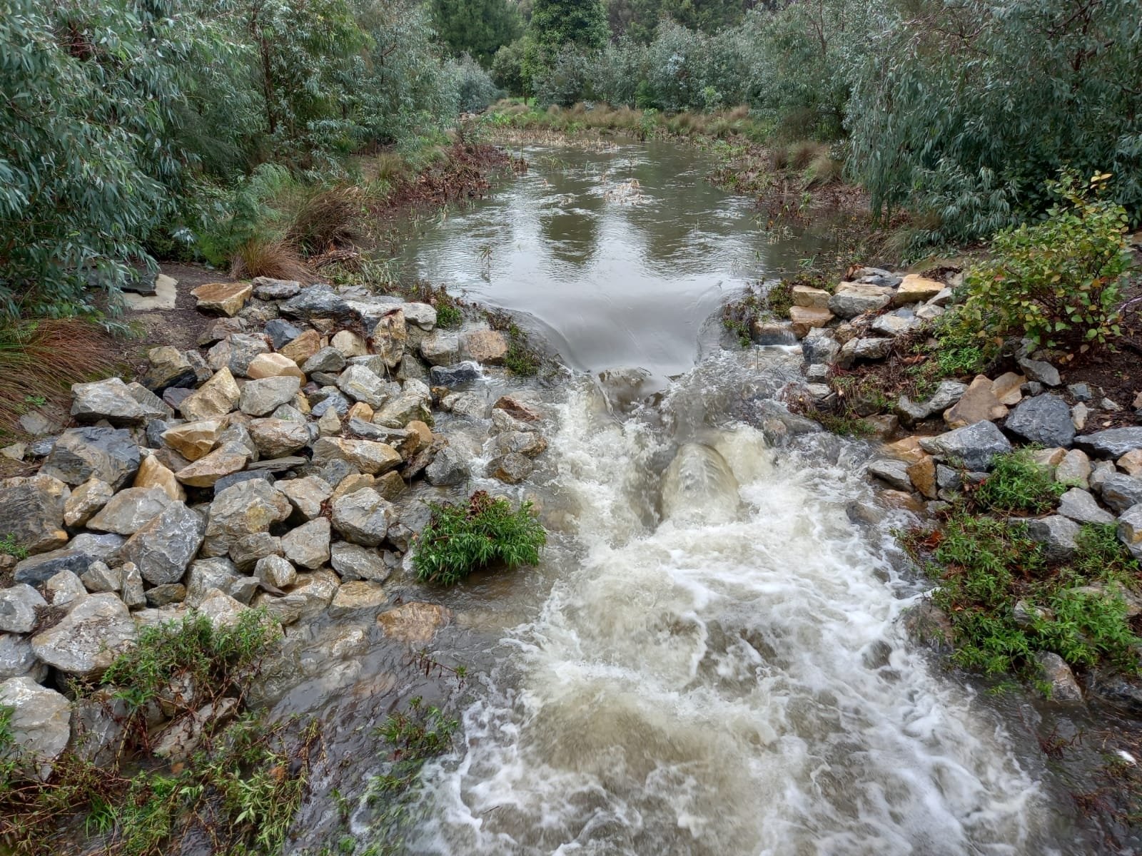
The creek is quite often dry, but after a heavy downpour it can have a very large and fast flow of rainwater.
Now, if you have the energy, try walking to the top of the nearby small hill, to get a good view of the Park.

17. Lookout
This lookout was created during development of the Park 19 community activity hub in 2018. It gives a good vantage point over the tennis and basketball courts, and the two play spaces.
It also allows you to see the three north-south pathways, and the east-west pathway as well.

If you are young enough to enjoy that sort of thing, it’s great fun rolling your body down the slope!
From this point, you can walk (or roll!) down the hill to the north and head towards the fenced dog park.

18. Dog park
This part of the Pityarilla activity hub was completed several months before the rest of it. The two fenced dog compounds were opened in 2017.
They are modelled on a similar dog park in Park 5, in North Adelaide, which was opened several years earlier and won an award as the best dog park in Australia.
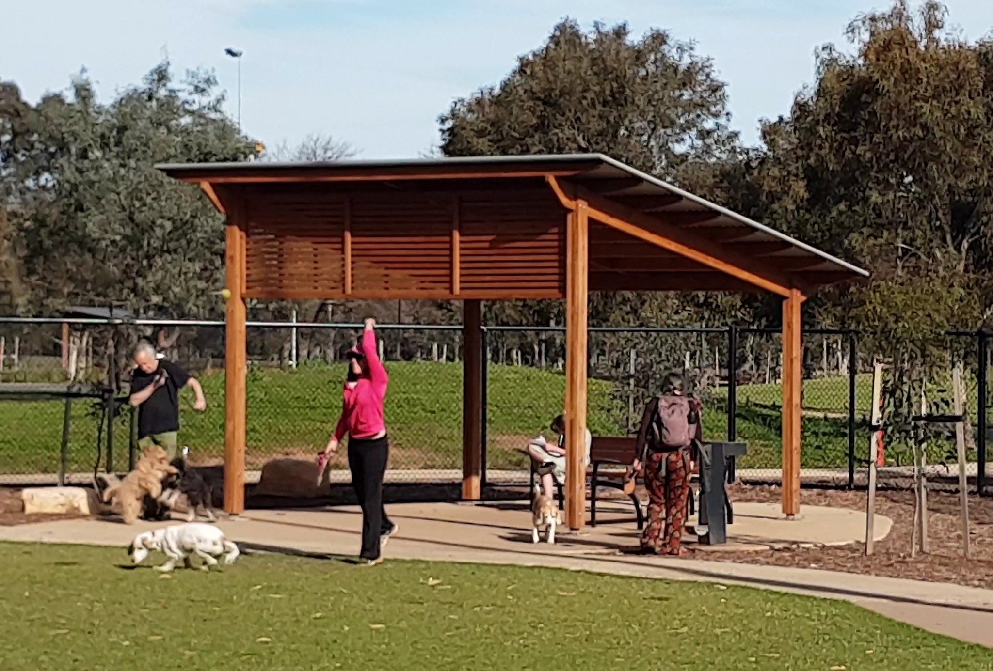
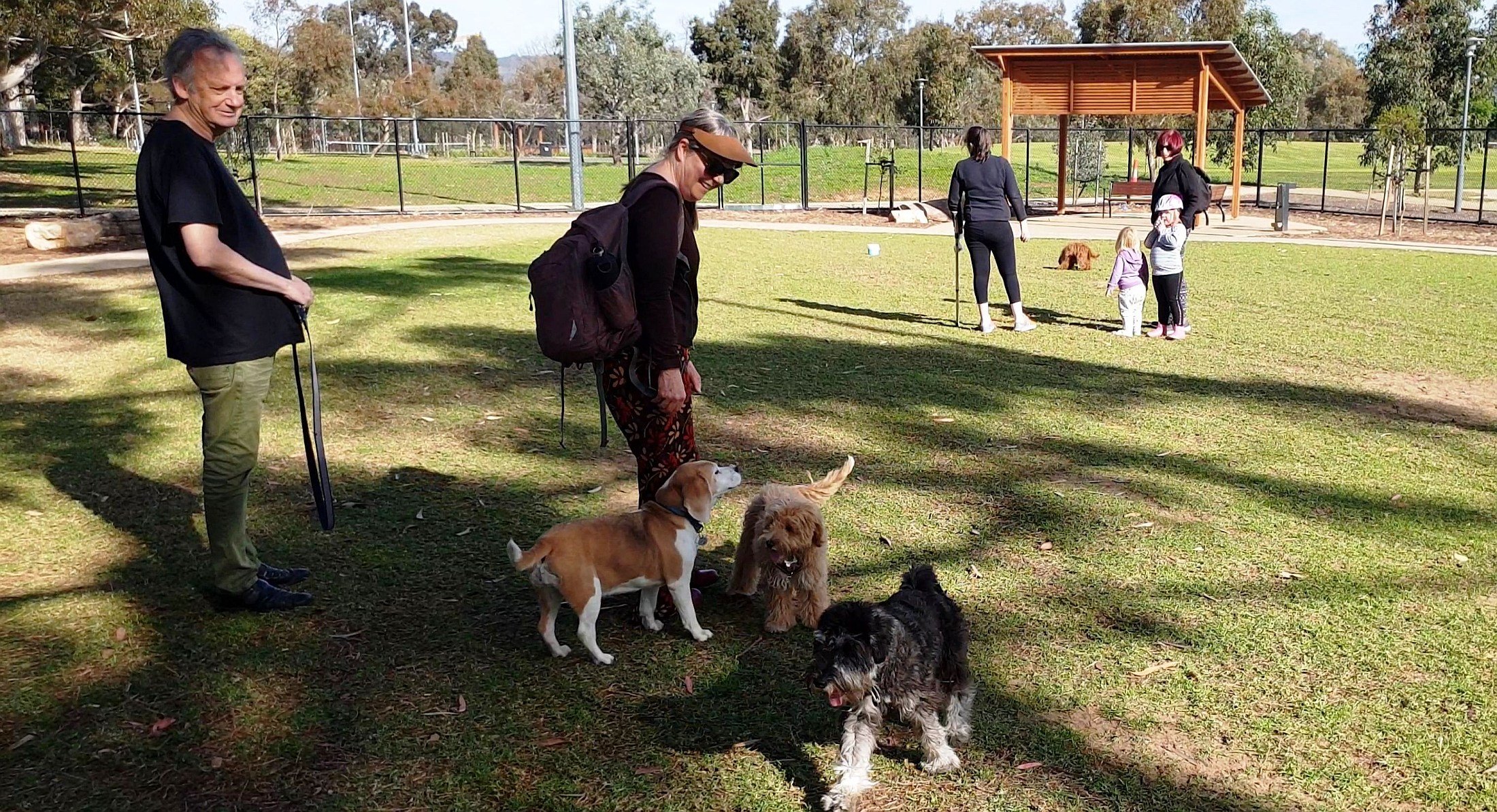
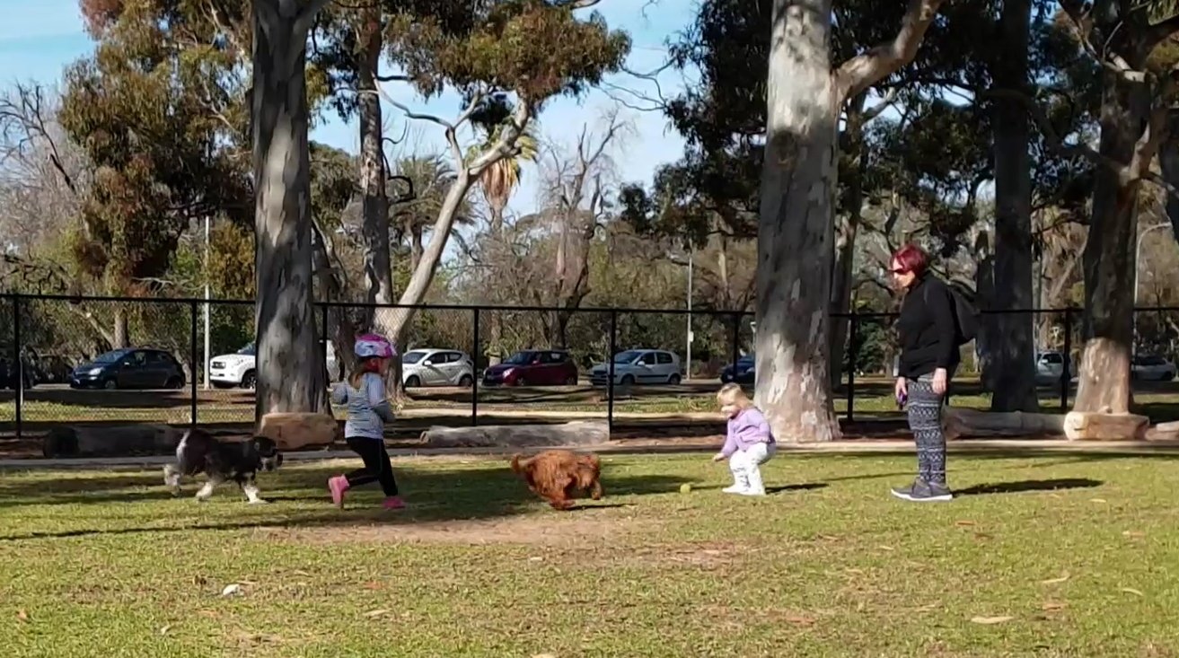
This one is perhaps better. It has a doggy water play feature. Dogs can step on a button that will shoot a water spout into the air.
Like the one in North Adelaide, this one too is separated into two sections – one for small dogs and one for all dogs.
For the humans there’s sheltered seating in both sections.
This is the conclusion of the tour - we hope you have enjoyed it!
Optional: download and print a tri-fold leaflet, i.e. a double-sided single A4 page, with a brief summary of this Trail Guide: (PDF, 1.7 Mb)
All of our Trail Guides and Guided Walks are on the traditional lands of the Kaurna people. The Adelaide Park Lands Association acknowledges and pays respect to the past, present and future traditional custodians and elders of these lands.