
Take the trail
Start at the University Boat shed on War Memorial Drive
This Trail is on the traditional land of the Kaurna people.
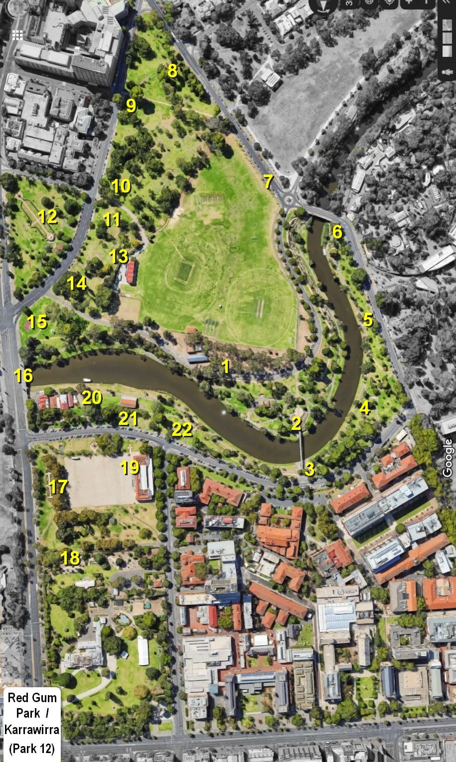
Start this trail at the University boat shed on War Memorial Drive (location #1 on the map above). There are 22 stops on this Trail and it will take about two hours to complete. Walking instructions are designated by bold type at the end of each of the 22 stop descriptions.
Optional: download and print a tri-fold leaflet, i.e. a double-sided single A4 page, with a brief summary of this Trail Guide: (PDF, 1.8 Mb)

1. Introduction & arboretum
This Park is called Red Gum Park / or Karrawirra or simply Park 12.
In Kaurna language Karrawirra means Red Gum Forest, and the River Torrens is identified as Karrawirra Pari which means Red Gum Forest River.
The Park’s English name and its Kaurna name mean the same thing: Red Gum Park.
To the east (on the other side of Frome Rd) is Park 11. To the west is Park 26 “Tarntanya Wama” which means “Adelaide Plain” and includes Adelaide Oval.
Before European settlement the river (Karrawirra Parri) was important for the Kaurna people, providing food and hunting resources and importance was in terms of its association with the Red Kangaroo Dreaming.
One of the early survey maps has a marking on the map at this site that says “Crayfish found here.”
This Trail Guide starts in roughly the middle of the Park, because Park 12 stretches from North Terrace – all the way to the Women’s and Children’s Hospital, north of here. The Park includes the entire University precinct which has, over time, taken over a large part of Park 12.
What you will see on this guided walk today is the part of Red Gum Park / Karrawirra that so far has been retained as Park Lands. It's very precious as part of the dwindling Park Lands buffer between the City and North Adelaide in the middle part of the Park Lands Figure 8 garland.
What remains today of Park 12 is 14 hectares in size. That seems like a large area of land. It is – it could be cut up into about 200 standard size house blocks. But in the context of the whole Adelaide Park Lands, Red Gum Park / Karrawirra is only small – just two percent of the total 700 ha.
McEwin Arboretum
These trees on the north side of War Memorial Drive are all that remain of what was the first arboretum in South Australia – established in the 1920's by the City Council and named after then-Councillor George McEwin.
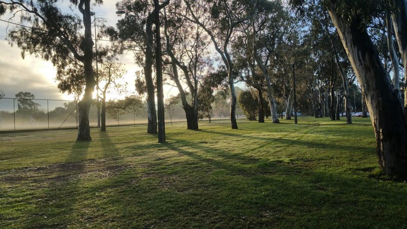
Part of the former McEwin arboretum
These trees pre-date the much more extensive Waite Arboretum at Urrbrae. Councillor McEwin in 1921 wanted to have trees of “economic value” (as he put it) planted here. It is not recognised or signposted as an arboretum any more.
Now walk along War Memorial Drive until you come to the University footbridge.
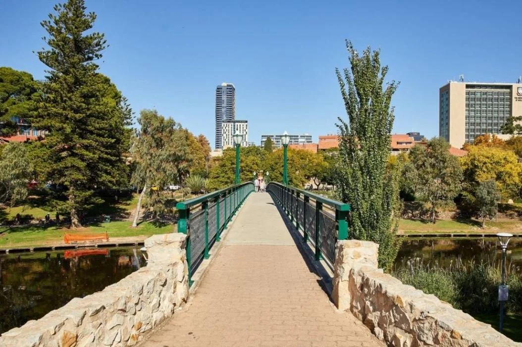
2. University footbridge
Described as a 'brave' design this bridge is reputed to be the first welded steel bridge in South Australia. In terms of bridges over the Torrens it was a relative latecomer – long after many other bridges were constructed.

University Footbridge in the 1940’s. Pic: City of Adelaide archives
There was a bridge close to this site that was built in 1842, but it didn’t last long. It was destroyed by flood in February 1855. It was later replaced by a ford and then another small footbridge, much more modest than this one.
This University footbridge was designed by the South Australian railways department in 1928, but construction was delayed by the depression until 1937.
The bridge was part-funded by the Misses Waite (the prominent South Australian family whose philanthropy led to the establishment of the Waite Agricultural Research Institute). Adelaide City Council funded the remainder of the bridge as part of its contribution to the centenary of South Australia in 1936.
In 2015-16 the bridge was in the news because of the number of “love locks” that had been fixed to the bridge. Someone suggested the bridge would be compromised because of the weight of thousands of locks – but the reality is there was only some minimal risk to cyclists and pedestrians accidentally hitting them as they go over. The Lord Mayor said in 2016 that more time had been spent in the Council chambers debating the future of the love locks than the council's strategic plan!
Way back in 1971 in a Prosh Day Prank, an FJ Holden was suspended from the bridge, with cables, so it's unlikely that the weight of the padlocks was a real issue for the integrity of the bridge.

In 1971, University of Adelaide engineering graduate David Gray and some fellow students suspended an FJ Holden under the University Footbridge. Pic: University of Adelaide Magazine “Lumen” Winter 2014
Now cross over the University footbridge until you reach the pedestrian traffic lights on Victoria Drive.
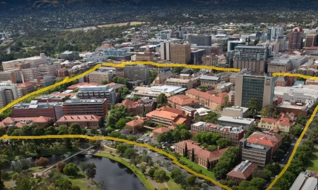
3. The University Precinct
The entire University precinct, from here to North Terrace, was taken away from Park 12, but it didn’t happen all at once. In 1875 the University sought permission to put just ONE building on Park Lands.
The University said we need only one building, so permission was granted for the sandstone Mitchell building on North Terrace. It took almost another 70 years for the University to gradually expand over the entire block, which was accomplished by the 1940s.
The University is still expanding over Park Lands, with buildings now on Park 11 and Park 27, further along North Terrace to the east and west.
Nevertheless, the University in recent years has recognised its Park Lands heritage. In 2018 it took down some of the former wrought iron fencing on Victoria Drive, and reinstated a small Park on the corner of Frome Rd and Victoria Drive.
In 2020, the University also established a public open area across the road here at its Victoria Drive entrance. The “Kaurna Learning Circle” includes a steel fire pit for ceremonial use, and a steel structure inscribed with a welcome to country. The inscription “Marni naa pudni tirka kurruru-ana” means “good you all come to learning circle”.
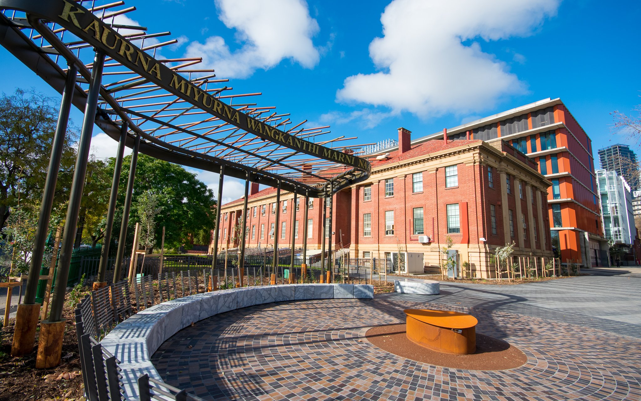
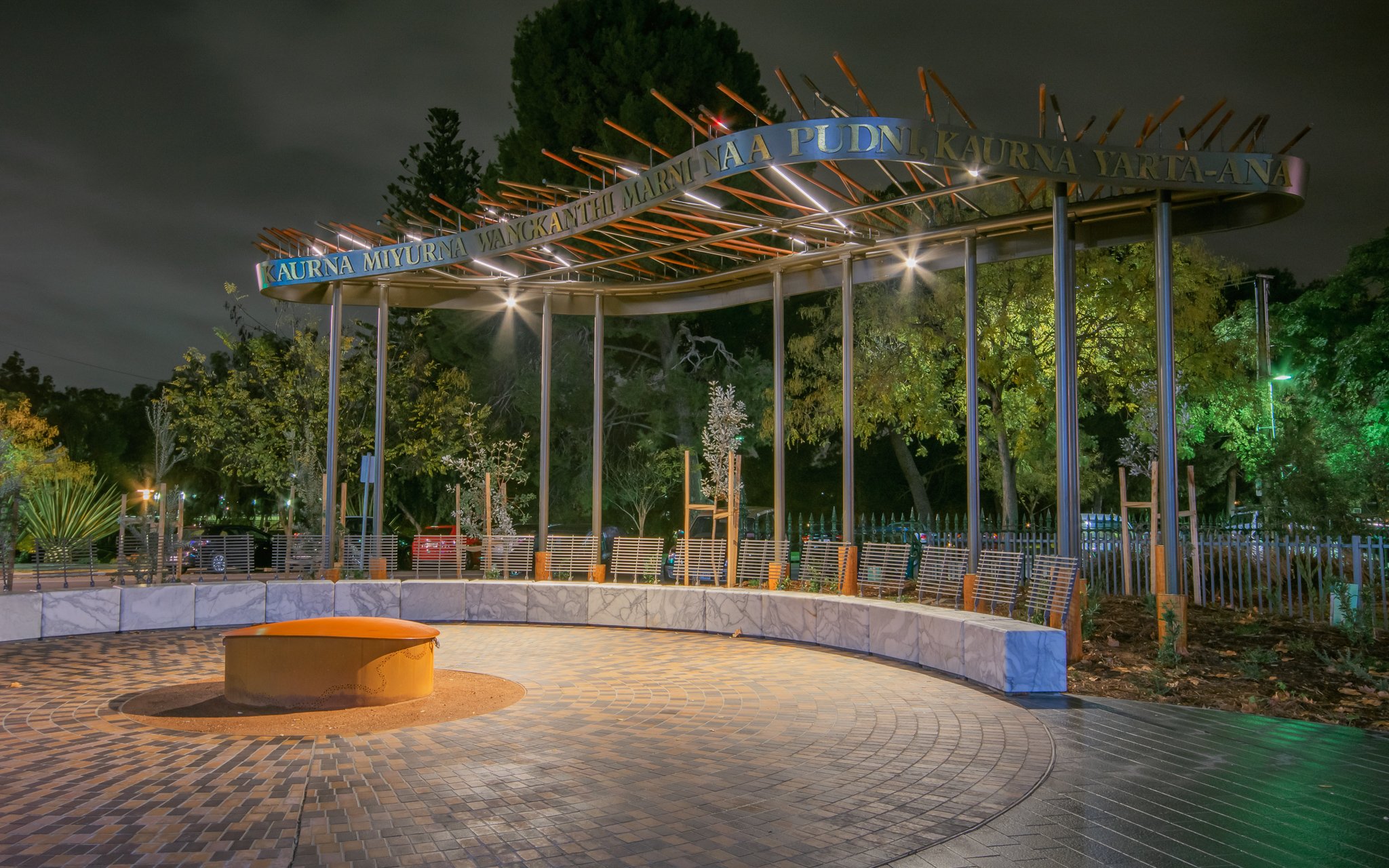
Kaurna Learning Circle. Photo credit - University of Adelaide
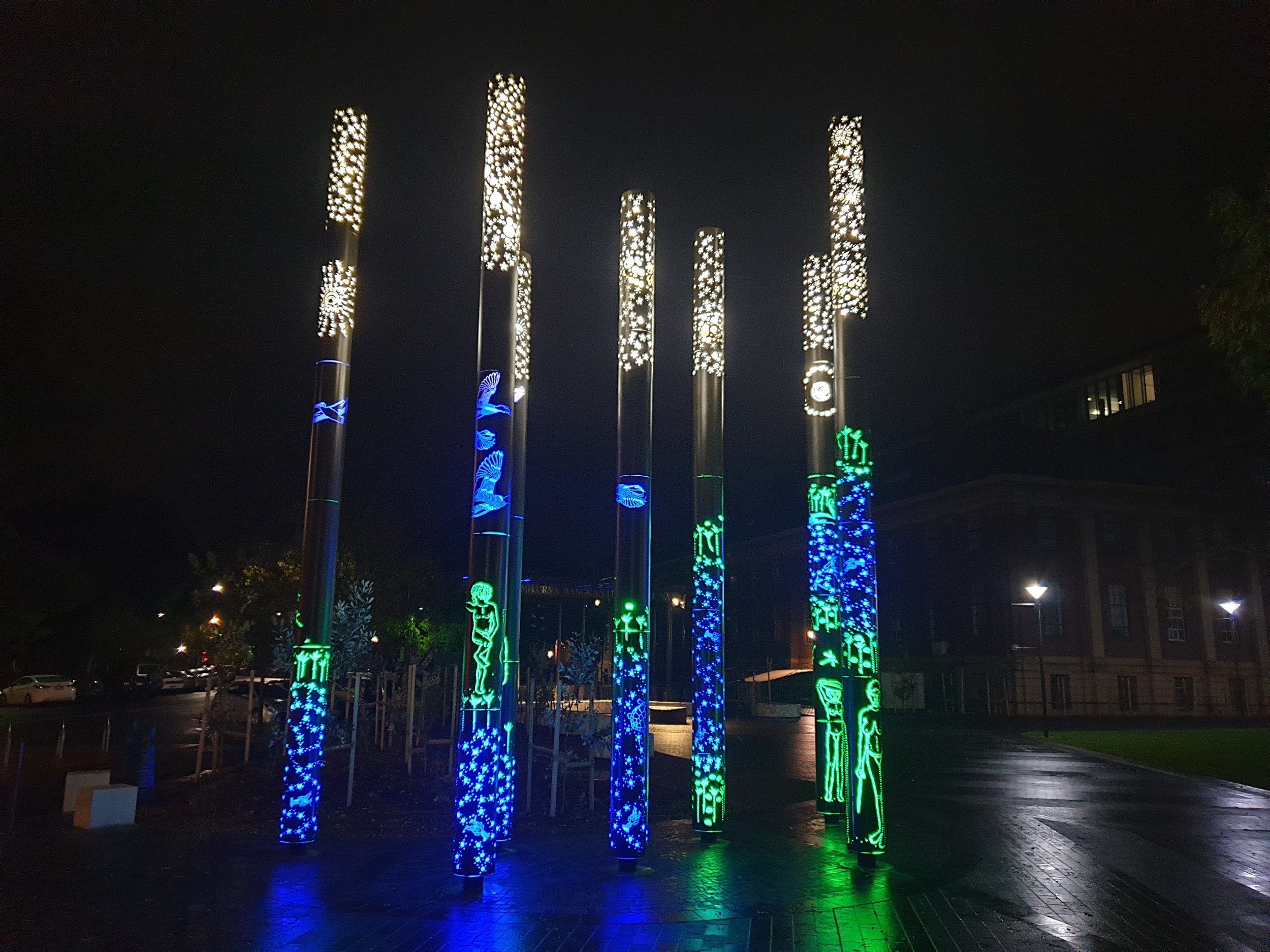
The area also features the “Wangu Poles”, striking illuminated artwork designed by Kaurna and Ngarrindjeri artist (and landscape architect) Paul Herzich. The seven poles contain references to Kaurna dreaming stories, ancient ceremonial practices, and traditional life along the nearby Karrawirra Pari (River Torrens).
Duncan Memorial
On the south side of the Uni footbridge there is a triangle-shaped monument to commemorate Dr George Duncan, who died near here in 1972 after being beaten and thrown into the River, where he drowned.
Dr Duncan had come to Adelaide only six weeks earlier to take up a position as a law lecturer. This monument was erected near the site of the murder on the 30th anniversary of his death.

Duncan memorial
Dr Duncan's murder never resulted in a conviction and it was very controversial due the fact that Dr Duncan was a homosexual and it was believed that members of the police force were implicated in the crime. He was one of a number of victims of what was called at the time “poofter bashing.”
More than 16 years after his murder, in 1988, two former members of the SA Police were put on trial for his murder but were acquitted.
His murder was significant because public outrage generated by the murder became the trigger for homosexual law reform that led to South Australia becoming the first Australian State to decriminalise homosexuality.
Now, walk along the south side of the river until you reach a big black stone boulder.

4. Two public art works
There are two major public art works on this side of the river.
You can see what looks like two square blocks of black stone, and a very large black boulder embedded in the ground. That’s not a natural formation.
It’s an artwork called "The Space Between" by artists Christine Cholewa and Deb Jones. It was installed in 2016 to acknowledge the pain of past forced adoption practices, or both relinquishing mothers and their children.

"The Space Between" - Christine Cholewa and Deb Jones, 2016
Further away, much closer to Frome Road is another sculpture that looks something like two or three huge rusty metal paper clips linked together. It’s called “Fugue”: by sculptor Greg Johns. It was done in 1998. Originally commissioned for a winery in the Adelaide Hills – Nepenthe. After the winery's founder Ed Tweddell died in 2005 his widow Sue donated the sculpture to the Art Gallery of SA and the Art Gallery with the permission of the City Council located it here, where it has been ever since.
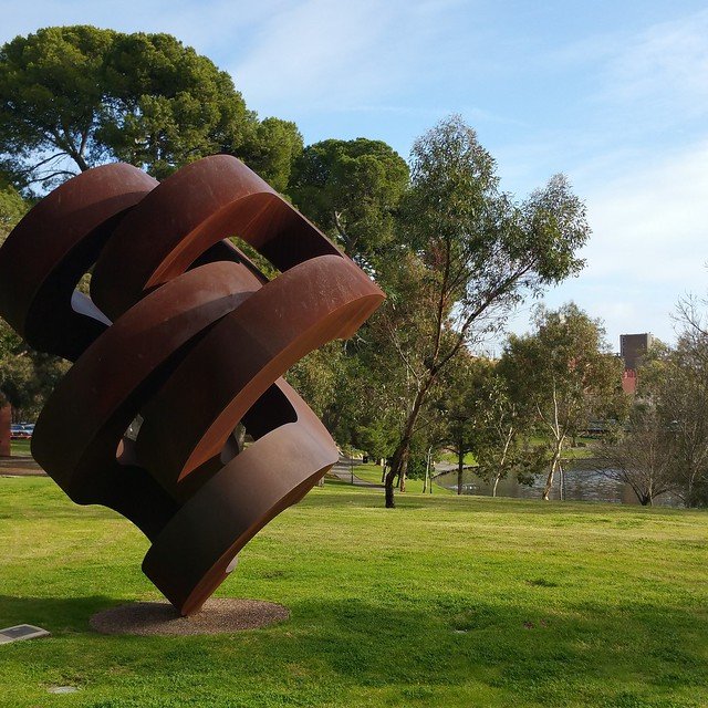
‘Fugue’ - Greg Johns, 1998
The agreement between the Art Gallery and the City Council allows the artwork to remain here until at least 2028. The are two other works by Greg Johns (quite similar to this, one) in the Mt Lofty Botanic Gardens.
Now walk along the riverbank and look at the stone retaining walls that feature on both sides of the river, and look for a trickle of water coming into the River from under the walls on your right-hand side.

5. Grundy Gardens
The entire stretch of riverbank between King William Road and Frome Road is called Grundy Gardens. Not “grungy” but ‘Grundy”.
The Gardens’ main feature is the dry stone walling which provides paths and takes advantage of the topography of the site along the edge of the River Torrens.
They were designed by Stanley Orchard, (the Council’s Curator of Parks and Gardens from 1933). and were completed in sections over a period of 30 years from the 1930s to the 1960s
Grundy Gardens was named in 1969 after Councillor and Alderman Tom Hadfield Grundy (1902-1966) in belated recognition of his 34 years of service to the Council. Tom Grundy didn’t live to see the Gardens named after him, as he died three years earlier in 1966.
Only a very small proportion of the Adelaide Park Lands contains remnant native vegetation or bush - just 6%. Another 24% of the Park Lands is classed as “open woodland”.
About 70% of the Park Lands have been “improved” - with landscaping, gardens, sports fields, roads, paths, buildings and so on.
Red Gum Park is a part of the Park Lands that is very formal, or landscaped. There is virtually no part of this Park 12 that contains any native vegetation, bushland or open woodland.

Part of Grundy Gardens
These river banks have been extensively graded and converted to gardens. There is very little of the indigenous river vegetation, instead an emphasis on exotics such as the white poplars. Notwithstanding, Karrawirra means red gum.
The entire park requires intensive regular gardening, especially the flower beds and clipped hedges, which is a big expense for the City Council.
You can see a trickle of water entering the River nearby. This is the end of a creek, called First Creek. There are five creeks that flow down the Adelaide Hills, and eventually join the River Torrens. They have the imaginative names: First Creek, Second Creek, Third Creek, Fourth Creek, and Fifth Creek!
First Creek flows down the Adelaide Hills from Cleland Wildlife Park near Mt Lofty, through Burnside, under Hackney Road, and into the Botanic Gardens where it feeds the beautiful First Creek wetlands. First Creek then goes into Botanic Park, and flows under Frome Road, and empties into the River Torrens, right here.
Now, walk further upstream to the heritage Albert Bridge.

6. Albert Bridge
This is a State Heritage Place. The bridge is named after Queen Victoria's husband Albert.
The original bridge close to this site was destroyed by flood, forcing all traffic over the Torrens to go across the City Bridge in King William Road. It didn't take long to recognise that a single bridge was inadequate so in 1871 this “new” crossing was planned just slightly upstream from where the old one had been flooded away. However even back then, it was a long time (eight years) between the concept and the reality.
Eventually, the construction of this substantial structure greatly improved communication and transportation of goods between northern and southern Adelaide.
This Albert Bridge was designed in part by John Grainger who was the father of the great composer Percy Grainger. (Do you know the song “Danny Boy”?)
John Grainger was born in London but lived in Adelaide (before Percy was born) where he practised as an architect and civil engineer. He later moved to Melbourne where he designed Melbourne’s Princes Bridge as well as notable buildings in Western Australia such as the Perth law Court, and the Houses of Parliament. He also designed the Ambassadors Hotel in King William Street here in Adelaide.
Opened in 1879, the bridge was constructed from iron brought over from the UK but constructed here . In 1879 construction cost £9,000. (about $1.4 million dollars in today's money, a bargain)

A traffic accident on the Albert Bridge in 1923. Image: State Library of South Australia PRG-280-41-173
The bridge has a span of 36 metres broken into three separate spans. Originally it had timber decking but in 1933 that was replaced with reinforced concrete which was again replaced in the 1980s.
In the year 2000 guard rails and improved lighting were added to improve safety while retaining the bridge's gracious features.
Now, walk across War Memorial Drive and head northwards along the edge of Frome Road until you reach an Adelaide Park Lands sign.

7. Park Lands sign
This sign marks a small victory for the Adelaide Park Lands Association.
In 2014 a businessman located in North Adelaide (Stephan Mavrakis) contacted us. Back then there was a different sign here. The old sign read: “University of Adelaide Sports Grounds – University Oval - Ground use by booking only.”
Mr Mavrakis sometimes had a group of his workmates, and friends play a friendly game of soccer here after work. However grounds staff employed by the University would eject them, at one stage threatening to call the police if he and his friends did not leave.
It took two years of working with the University and the City Council to admit that the University had no authority to evict people from the Park Lands. The University was required to change the sign to this one. As the sign now makes clear, the land is free for anyone to use – except on the occasions when the University itself has booked it.

Comparison of the signage, before and after
This land has been a sports ground for almost 150 years. There is an 1871 map on which this land is marked as “football ground”, pre-dating the founding of Adelaide University.
Now keep walking northwards along Frome Road and stop at the tall metal flowers.

8. Memorial to “forgotten Australians”
This triangular section of Park 12 used to be known (in the 1800's) as 'Roberts Place' or 'Roberts Reserve' named after Colonization Commissioner Josiah Roberts. The huge Moreton Bay fig was originally planted about the year 1900 right in the centre of what was then known as Roberts Reserve.
Outside the Women's and Children's Hospital is the Memorial to "the forgotten Australians and Wards of the State" The huge metal flowers are intended to be gazanias.

Memorial to “the forgotten Australians and Wards of the State”
Gazanias are flowers that are native to South Africa. They are found by the roadside all over South Australia and they are considered to be weeds, but they are beautiful weeds.
The artist was Craige Andrae and this was erected in 2010. The inscription reads:
“In honour of the children who suffered abuse in institutional and out-of-home care. We have grown through awareness and unity we celebrate our courage, strength and resilience. We are no longer forgotten. Dedicated to the future protection and nurturing of all children.
Now cross over Roberts Place to the road on the other side, next to the Women’s and Children’s Hospital.
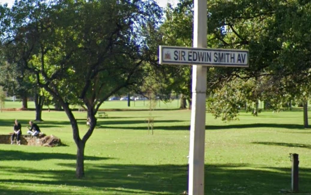
9. Sir Edwin Smith Avenue
This street, next to the Womens and Childrens Hospital, is called Sir Edwin Smith Avenue.

Sir Edwin Smith, c1872. Pic: State Library of SA, B-1288-6
Sir Edwin Thomas Smith was born in England in 1830 and migrated to Adelaide in 1853 as a young man. He made a great success of life in the new colony as a brewer, a businessman, councillor, mayor, politician and benefactor. He was Mayor of Adelaide 1886 to 1888. He was Knighted in 1887 during his term as Mayor.
At Adelaide Oval there is an Edwin Smith stand. The name survived the 2014 rebuild of the Oval. Sir Edwin Smith was also a great patron of the Norwood Football Club from its establishment in 1879 until his death in 1919.
Right on the footpath of Sir Edwin Smith Avenue, at the traffic lights opposite Kermode Street is a large redgum tree. If you look carefully at the trunk about four metres above the ground you can see a hollow where a branch once was. Rainbow lorikeets have been observed nesting in that hollow.
Our next stop is only a few metres further south along Sir Edwin Smith Avenue, just past the bus stop.

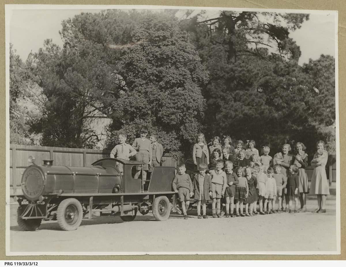
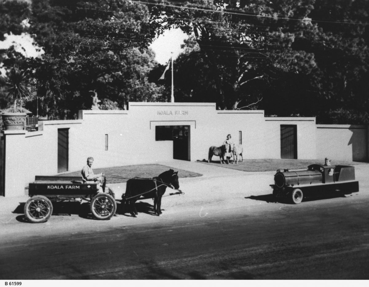
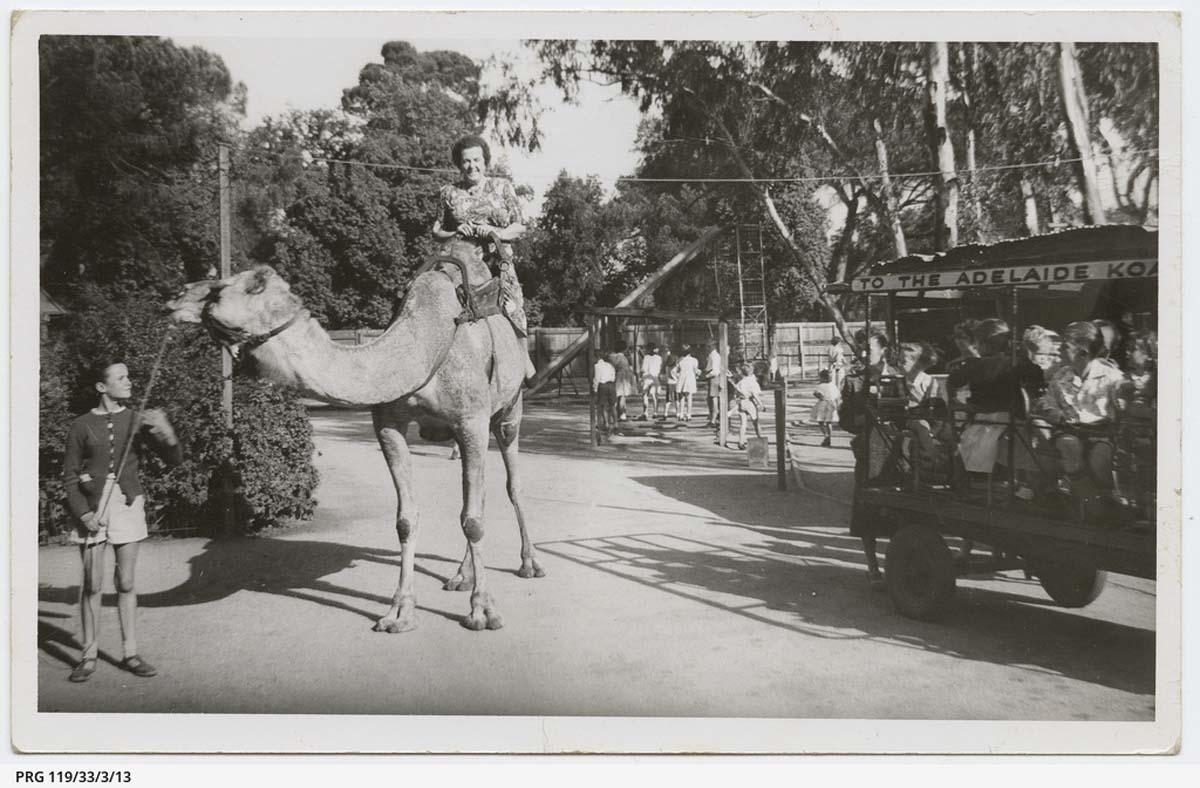
10. Koala Farm and Peace Park
In the open area on your left, on the eastern side of Sir Edwin Smith Avenue, there was once a commercial tourist attraction; a Snake Park and Koala Farm. This attraction was opened in 1927 initially on 1,400 square metres, just as a “snake park'. Its proprietor was Alfred Minchin who at the time was the Director of the Zoological Gardens.
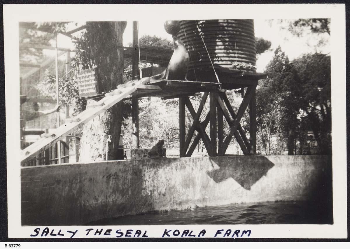
Images: State Library of South Australia
Koalas were added in the 1930's, and made available for visitors to hold. In the 1940's the lease area was extended to 4,000 square metres, and additional attractions, camels and seals were introduced. Eventually, in 1960 the Council decided not to renew the lease. The animals were dispersed (most going to the Zoo) and the land returned to Park Lands. There's nothing here now to indicate that the “Snake Park and Koala Farm” ever existed.

British entertainer Noel Coward at the ‘Snake Park and Koala Farm’ c. 1930
Decades later, in 1986 this area of Red Gum Park / Karrawirra (Park 12) was given the name 'Peace Park'. It hosts a number of commemorative features dedicated to, or with the theme of 'Peace'. If you walk around you can see signs and markers highlighting:
Sri Chinmoy Peace Mile, from 1986
A “Freedom and Democracy” memorial to the 1989 Tiananmen Square massacre in Beijing
A simple plaque on a rock marked “America Remembers” dated 1996
A white pole inscribed, in several languages, with the words “May Peace Prevail on Earth”. This is the motto of the 'International Day of Peace' which is marked annually on 21 September.

The Sri Chinmoy Peace Mile is a marked running circuit. Photo credit Flickr: Contemplari
It is perhaps fitting that we have a Peace Park here, because as you'll soon see, there's also a great many memorials in this vicinity to the memory of war and those who died in war. War Memorial Drive itself was opened in 1919 just a year after the end of the First World War, and you will see a few more explicit war memorials shortly.
Our next location is few metres further south again, just past a driveway on our left that leads to the University sporting fields. Stop where you can see a ship’s anchor.

11. SA Naval Memorial (1995)
The SA Naval Memorial is an anchor mounted on a granite slab. It is surrounded by thirty-two bronze plaques which commemorate ships and services in the Royal Australian Navy.
Further behind the anchor monument is a flag pole marking the tombstone of Phineas Philip Davies.
Surrounding the monuments are garden beds resembling the shape of an anchor.

SA Naval Memorial. Photo credit - Madeleine Ryan, History SA
The Death of Phineas Philip Davies
Before 1901 there was no nation of Australia. There were only the separate British colonies that we now call each of the States of Australia. So in the 1800’s there was no Australian navy, but there was a South Australian Navy.
Every year in Adelaide there is a ceremony on the 28th of December for “Proclamation Day” – the day the colony of South Australia was founded in 1836. There is a commemoration at the Old Gum Tree at Glenelg.
It was the same way back in 1885 – a ceremony at Glenelg, and the South Australian Navy took part with a royal salute – firing the guns on the navy ship – the SA Navy’s ONLY ship – HMS Protector.
However on that day there was what we might now call an industrial accident.
Seaman Phineas Philip Davies was killed when a blank cartridge was loaded into a gun breech which was burning inside.
Both Davies and another seaman were rushed to Sempahore Hospital. Davies never recovered consciousness and died. The other seaman was permanently “disfigured” and the loss of sight in one eye.
Davies was unmarried and had no family in South Australia. His shipmates raised funds for his burial at Cheltenham cemetery where his body stayed for more than a hundred years. Eventually in the 1980’s the lease on his grave plot expired.
Then the Naval Association (the Association for ex-navy personnel) became involved and decided to honour him properly more than 100 years later, with this memorial and the garden.
The Naval Association developed the anchor design and the Navy itself funded the project. ‘Courage’ roses were used to fill the garden beds.
A crowd of one thousand attended the unveiling on 8 April 1995. The garden and its monuments stand as a reminder of the sacrifices in the Australian Navy.
Now walk across Sir Edwin Smith Avenue towards a very tall stone cross.

12. Garden of Remembrance
This Park is called Pennington Gardens East, or more commonly, the Garden of Remembrance. This garden, dating from the early 1920's, is a tribute to the women of South Australia and their contributions during the First World War.
The “Garden of Remembrance” includes a Cross of Remembrance and Stone of Remembrance which is inscribed with words by Rudyard Kipling from Ecclesiasticus—“Their Name Liveth for Evermore.”

There is an interpretive sign to one side of the Garden.
At the crossing you will see, on one side, Ataturk’s Tribute to the World War One soldiers in both Turkish and English. On the other side of the crossing is 'the 'Eternal Flame' contributed by the City Council in 2006.
The Lord Mayor of the 1920's, Charles Glover, described this Garden as “an open air cathedral". The cost of the memorial was about £4,000, raised by voluntary contributions from South Australian women.
The Garden consists of a Cross of Sacrifice, more than 11 metres high, heading a rectangular garden aligned to the façade of St Peter’s Cathedral. In fact, the layout of this garden is a mirror image of St Peters.

Garden of Remembrance
The Cross and Stone were concepts derived from the Commonwealth War Graves Commission to unify graves in France with memorials proposed in Australia.
The project used Tea Tree Gully sandstone. Local builder Walter Torode undertook the works; and was paid only £100 for his labours.
A foundation stone was laid by Governor Sir Archibald Weigall in 1920. The Cross was unveiled on Anzac Day 1922 and the Remembrance Stone a year later.
Now cross back over Sir Edwin Smith Avenue to a heritage grandstand.
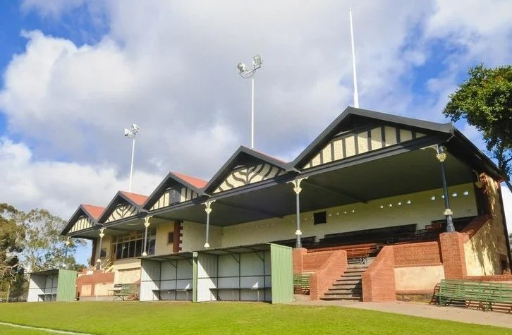
13. Adelaide University “Pavilion” (1910)
Adelaide University has been paying the City Council since 1908 for the use of a large part of this Park as sporting fields.
In 1910, the University built both this grandstand (described in 1910 as a “pavilion”) and also a boat shed next to what is now War Memorial Drive.
The grandstand or “pavilion,” is a two storey, Carey Gully sandstone structure, with red brick detailing, five gabled corrugated iron roof, cast iron posts, and metal strap seating, came from donations by some rich benefactors together with smaller donations to an overall cost of £1,200.

The pavilion as it looked after construction in 1910
Even before the pavilion was complete, the University sports ground had been “suitably fenced and planted.” The City Council (rather than the University) erected two tennis courts in 1913, and another three in the early 1920's.
Soon after that, the University started thinking about a bridge over the river to connect the campus to these sports facilities. But it was not until 1937 that a bridge was built.
From here, walk a little further along the side of Sir Edwin Smith Avenue to a statue of a man sitting on a horse.

14. Statue of King George V (1950)
Adelaide has many statues in Adelaide to past Kings and Queens. We have a statue of Queen Victoria in Victoria Square. In Park 12 we have statues of Queen Victoria's son, Edward VII (on North Terrace) and Queen Victoria's grandson King George V, right here on a horse.
George V's two sons were King Edward VIII who reigned for only a few months in 1936 and Edward's brother, George VI. Queen Elizabeth of course is the daughter of George VI and the grand-daughter of this chap, George V.
His full name was George Frederick Ernest Albert. He was born in 1865, became King in 1910 at the age of 45 after his father died and stayed on the throne until his death in 1936 at the age of 70. His full title was “King of the United Kingdom and the British Dominions, and Emperor of India”.

King George V statue
Surprisingly this statue was not put here until 14 years after King George died. This monument was funded by public subscription and the South Australian Government The unveiling of the statue (Anzac Day 1950) was delayed because of the Second World War.
His reign spanned the First World War. During this time he regularly visited the British and colonial troops in England and those serving on the Western Front. He had earlier represented his father King Edward VII at the opening of the Australian Parliament in May 1901 and had visited Adelaide as part of his visit to Australia.
From this point, cross over War Memorial Drive to a flower bed, and a statue of a man and a donkey.

15. Angas Gardens
This road, War Memorial Drive, did not exist before the First World War. It is a road built as a Memorial to those killed in the First World War.
At the entrance to War Memorial Drive is a plaque, with the date 1919. This was the year that the first section of War Memorial Drive was opened (that is, the section between Frome Road and Sir Edwin Smith Avenue).
It was built by returned soldiers. The costs of the new road construction were met partly by the City Council, partly by a donation from Lord Mayor Charles Glover and partly with funds from the Federal Government (to employ returned soldiers).
It was deemed a success and so the second stage of War Memorial Drive, from King William Rd to Montefiore Rd was commenced the very next year, 1920.

“Simpson and his donkey” statue by Robert Hannaford (2012)
The gardens here are called Angas Gardens. They feature a statue of “Simpson and his Donkey” by Robert Hannaford, erected in 2012 commemorating John Simpson Kirkpatrick, an unlikely figure who became a national hero.
Simpson deserted from the merchant navy in 1910.
He then tramped around Australia and worked in a variety of jobs. He enlisted in the Australian Infantry, expecting this would give him the chance to get back to England. It didn’t get him what he wanted, but it did make him famous in death. Private Simpson found himself at ANZAC Cove on 25 April 1915, and was killed less than four weeks later.
Famously, he used a small donkey to carry men down from the front line, often exposing himself to fire. The bravery of this "man with the donkey" soon became the most prominent symbol of Australian courage and tenacity on Gallipoli. This story is acknowledged in the interpretive sign on the statue.
The centrepiece of the Angas Gardens, featuring a white canopy and a black angel, is the Angas Memorial, a State Heritage Place - built in memory of pioneers and pastoralists George Fife Angas and his son John Harris Angas. The Angases have a substantial legacy around Adelaide and SA. Apart from these Angas Gardens, we have an Angas Street in the city, and the town of Angaston in the Barossa. They made an enormous contribution to the success of South Australia in the 1800's.

Angas memorial
The Angas memorial is by sculptor William Robert Colton who designed both the canopy and the bronzes. Erected originally in 1915 on North Terrace, it was relocated to Angas Gardens in 1930.
From this point, walk to King William Road to cross over the River on the Adelaide bridge.

16. Adelaide Bridge (1931)
This Adelaide Bridge was the third bridge on this site, replacing two earlier ones, and was the fifth bridge that linked the City and North Adelaide across the Torrens.
The first bridge on this site was erected in 1839 just after the founding of the colony. It lasted 38 years before its replacement was built in 1877. However, the 1877 bridge was considered out of date by 1920, as it was often congested, especially when trams were crossing the bridge.
The City Council decided to do away with the bottleneck, by providing a bridge of the same width as King William Road. The design was by the city engineer.

Adelaide Bridge, with Adelaide Oval in the background
There are two interpretive signs – one on each pylon (north and south) on the eastern side of the bridge, where we're walking. When built in 1931, it was considered enormously wide – over 40 metres. Lights were placed onto the pylons much more recently, in 2003.
From here, head south, walk across Victoria Drive at the traffic lights, to the rose garden in front of a large paved area known as the Torrens Parade Grounds.

17. Rose garden
You are headed towards a garden behind a low red brick wall, but before you reach that garden you will see an open rose gardens containing two bronze busts, by sculptor Ken Martin.
At one end of the rose garden is Lady Esther Lipman, who was the first female member of Adelaide City Council, for 22 years from 1956.

Lipman and Solomon busts - Rose Garden
At the other end of the rose garden is her father Vaiben Louis Solomon who was, at various times between 1890 and 1908 a Member of State Parliament, a member of Federal Parliament, and also served briefly as Premier of South Australia.
Walk a few metres further south, towards North Terrace, where you will see a formal garden behind a low brick wall.
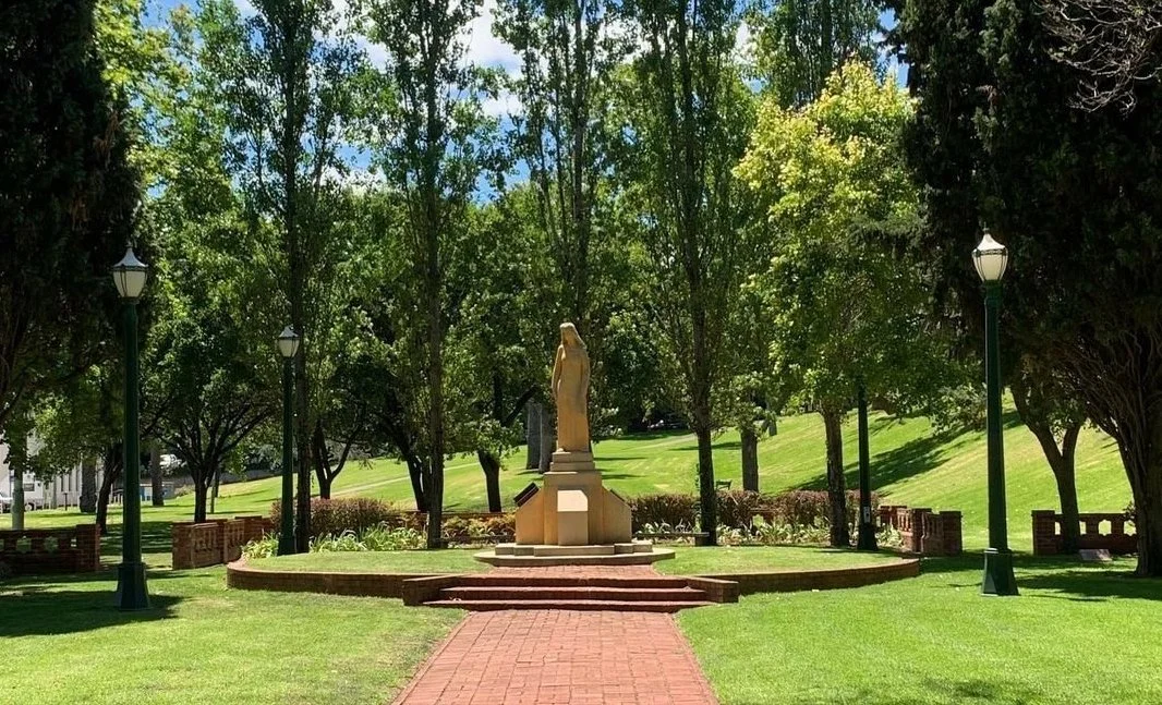
18. Pioneer Women’s Memorial Garden
This garden was established for South Australia's Centenary Year of 1936 by the women of South Australia as a tribute to the pioneer women of the state. There is an interpretive sign here, which includes some history.
The statue, by Ola Cohn was erected five years after the garden, in 1941, during the Second World War, but it's not a war memorial. It represents "the spirit of womanhood capable of giving birth to a nation".

Pioneer Women’s Memorial Garden
This garden is known by many people as the site of the annual “Writers’ Week” during the Adelaide Festival.
To the south of here, up the hill and behind the wall, is Government House, the residence of the State Governor. The grounds of Government House are opened to the public twice per year on a Sunday. On this walk, however, turn around and head back towards Victoria Drive across the large bitumen area.

19. Torrens Parade Ground and drill hall
This site has been taken away from the Park Lands twice! From 1839 to 1850 it was a "Government Quarry". Long after the quarry had stopped operating, in the 1890's it was partially returned to Park Lands, but then in 1936, the Commonwealth Government erected this building that now has heritage status.
The large white building, a former training depot, is no longer a military building, and is now the headquarters of several veterans organisations. There is an interpretive sign about this site just off Victoria Drive.

Torrens Parade Ground and former Training Depot
The Parade Ground is still recognised as part of the Park Lands despite being covered with bitumen. In 2021 the State Government was considering what might be changed about this area, and APA received some publicity in The Advertiser for recommending that the bitumen should be converted into something greener, like perhaps, a Park!
Immediately north of the Parade ground alongside Victoria Drive, is a collection of statues and memorials. The Aboriginal & Torres Strait Islander war memorial was designed by Tony Rosella, Lee-Ann Tjunypa Buckskin and Michelle Nikou. It was unveilled in 2013.
The Vietnam War Memorial was sculpted by James Martin (himself a Vietnam veteran).

Vietnam War Memorial - James Martin, 2006
It was unveiled and dedicated in October 2006.
From here, walk back across Victoria Drive again, and head down to the Riverbank.

20. Early 20th century boat houses
Between Victoria Drive and the river is a collection of four buildings that are all either former or current boat sheds.
Each of them has been here for at least a hundred years.
A photo of a Torrens rowing regatta, taken in 1918 shows the four boat sheds side by side in exactly the same positions – but some of them looked a little different in 1918.
A crowd on the banks of Torrens Lake watching a boat race. Phot credit - State Library of South Australia
The one closest to the Adelaide Bridge is Jolley’s Boathouse, but it's been many decades since this building last housed any boats. Although it's the second-oldest of these four buildings, it has been, for many years, a restaurant.
Next to Jolley’s is the red Torrens Rowing Club. The original one burned down 1936 and was replaced.
The next one along to the east is the boatshed of Adelaide High School. It too was burned down, in 1962, and then replaced.
The fourth in line is Lounders Boathouse – now a cafe.
Lounders Boatshed Cafe is among the oldest buildings on the Torrens Lake. It was built in 1913 and is the only one specifically built for the construction and repair of rowing boats.
Many thousands of men and women currently living in South Australia and elsewhere learned to row and competed in boats built in this former boatshed,
For much of this shed's existence, many of the Torrens recreational paddleboats as well as the ‘Popeye’ launches were managed and maintained here.
The first of the eight ‘Popeye' launches which have plied the lake since 1937 was designed and built here in Lounders boatshed. After its life as a boatshed was finished, it began a new life as a cafe in 2017.
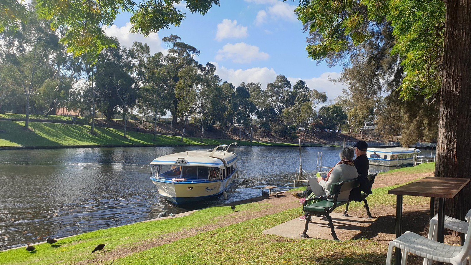
Popeye launches outside Lounders Boatshed Cafe
If you were coming back to Adelaide after a few years away you wouldn't recognise it because for most of its history it was painted green – just an unremarkable green shed.
Some of its remarkable history is acknowledged in an interpretive sign now incorporated into the building.
Your next stop is just a little further along the river-front, at a small white building.

21. Water Police station (1928)
Built in 1928, the Former Water Police Station is a prime example of the Spanish Mission style which was popular between 1915 and 1940. Other prominent buildings in the same Spanish Mission style include the Hartley Building just uphill a short way on Kintore Avenue.

Former Water Police Station
Built by the South Australian Public Buildings Department, the former water police station once housed two water police officers who monitored activities on the River and in the vicinity. The officer in charge was called “Inspector of Boats and Keeper of Swans”.
The Police role there ended in 1956. Their duties of licensing boats and looking after swans was eventually taken over by the City Council in the 1970s.
The building contains a small room, an exercise yard and a single cell. It now houses Adelaide City Council horticultural staff.
From here, walk a short distance eastwards, back towards your starting point, along the riverside path. Stop where you can see a black stone obelisk.

22. Vietnamese boat people memorial
This is one of the newest public art work in the Adelaide Park Lands. It was officially unveiled in February 2021.
In the 1970’s after the end of the Vietnam war, hundreds of thousands of South Vietnamese people fled persecution and the threat of death in their homeland. In those days Australia was more welcoming to refugees arriving by boat. In the following 10 years, more than 80,000 Vietnamese boat people settled in Australia.
However many more did not make it here or anywhere else. Hundreds of thousands died at sea in rickety boats.
The local Vietnamese community spent several years raising funds for this and lobbying for permission to erect it in the Park Lands. The City Council gave approval in late 2019.

Vietnamese Boat People Memorial
This memorial is a boat and a stylised beacon. Local sculptor Tim Thomson is responsible for the boat and the figures a mother and son.
From here, you can walk back along Victoria Drive and cross the University footbridge again to return to the starting point.
Before returning, we should acknowledge that there is one part of Park 12 that we have not visited on this walk.
On the northern side of the University precinct, along the edge of North Terrace, a little sliver of Park 12 remains. It's called Prince Henry Gardens.
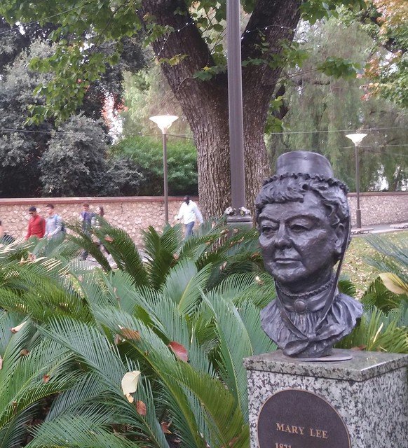
Mary Lee - a key figure in the women’s suffrage movement at the end of the 19th century, one of the first initiatives advancing gender equality. Prince Henry Gardens
It contains many statues and busts of famous South Australians. Dame Roma Mitchell, Howard Florey (inventor of penicillin) to name two. There's also the Cenotaph – the National War Memorial on the corner of Kintore Ave.

South Australian National War Memorial. Photo credit - Experience Adelaide
Optional: download and print a tri-fold leaflet, i.e. a double-sided single A4 page, with a brief summary of this Trail Guide: (PDF, 1.8 Mb)
All of our Trail Guides and Guided Walks are on the traditional lands of the Kaurna people. The Adelaide Park Lands Association acknowledges and pays respect to the past, present and future traditional custodians and elders of these lands.

