

Take the Trail
Start at the corner of Bartels Road and East Terrace.
This Trail is on the traditional land of the Kaurna people. First Nations people are advised that this Trail Guide contains the name and an image of a person who has died.

Start this trail at the corner of Bartels Road and East Terrace (location #1 on the map above). There are 13 stops on this Trail and it will take about 90 minutes to complete. Walking instructions are designated by bold type at the end of each of the 13 stop descriptions.
Optional: download and print a tri-fold leaflet, i.e. a double-sided single A4 page, with a brief summary of this Trail Guide: (PDF, 1.2 Mb).
1. Naming
Welcome to King Rodney Park, also known as Ityamai-itpina or simply Park 15. It is arguably the most under-appreciated and overlooked area of the eastern Adelaide Park Lands.
Thousands of people come through the park every day, commuting to or from the city. It is truly a family park, with almost 150,000 visits by families using the playspace and ovals here each year.
King Rodney Park consists of an almost-rectangular block of land bounded by East Terrace, Dequetteville Terrace, Wakefield Road and Bartels Road. No boundary changes have occurred since the park was first surveyed, so it has retained its original shape and form as devised by Colonial Light in 1837.
In its early days after European settlement, this park was commonly known as ‘Bartel’s Park’.
Bartel’s Park and Bartel’s Road were named after Councillor and Mayor Adolph Bartel who served from 1871 to 1873. Since the 1890’s this park has been known as Park 15. It didn’t get any official name until 2002.

Adolph Bartels (1819 – 1878). Mayor of Adelaide 1871–1873. Source: State Library of SA - B18071 ~ Date: c1870
Few people in Adelaide would recognise either the English name or the Kaurna name for this park. Even using the number “Park 15” usually raises eyebrows. To communicate effectively to people about this Park, you usually need to say that “it’s the Park in-between Rymill Park and Victoria Park – between Bartels Road and Wakefield Road.”
But how did it get its name? And who was King Rodney? Follow this trail to find out!
The walk covers about 1.6 - 2 km and takes around 60-90 minutes.

Westward view of King Rodney Park / Ityamai-itpina (Park 15)
Walk south, across the grass, to where East Terrace takes a right-hand bend.
The first stop on this trail is at a very tall tree on that corner.
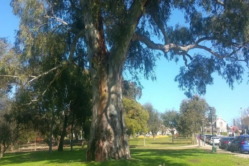
2. River Red Gum
To the north of the Playspace, where East Terrace curves to the right, is a very large river red gum.
The age of the tree is unknown. It was probably planted in the 1870s, or 80s. On an aerial photo of the Park, taken in 1936 it’s already clearly visible as a large tree.

1936 aerial photo of King Rodney Park / Ityamai-itpina (Park 15) showing location of a 19th century River red gum (Eucalyptus camaldulensis) off East Terrace. Source: City of Adelaide, 1936
At the base of the tree there was previously a plaque placed by the Australia-Japan Association - honouring the Friendship Anniversaries that were celebrated from 1995 to 1998. The plaque – installed in 1997 – said that the nearby trees were “dedicated as a living symbol of the bonds of friendship that Australia shares with Japan.” However in 2025 the plaque had been removed.
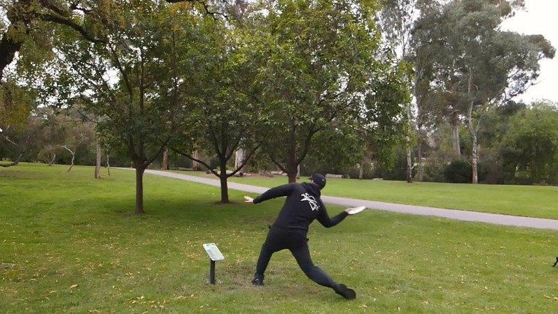
Next to the River Red Gum is a concrete slab, which marks the tee for the first basket of the disc golf course. The disc golf course is featured later in this Trail Guide.

Next to the giant River Red Gum, the first tee of the disc golf course. You can see the basket in the distance among the olive trees.
Now, walk towards the playground fence.

3. Glover East Playspace
To your right is the historic Glover East Playspace. This was the third of three playgrounds funded by and bearing the name of the Lord Mayor of the late 19-teens and early 1920s, Charles Glover.
The first Glover Playground was (and is) on South Terrace (Park 20) – having opened in December 1918.
The second Glover Playground was (and is) on Lefevre Terrace in North Adelaide (Park 6).

Glover East Playspace 1928
The playground was proposed by Mayor Glover in 1924, for the benefit of children in the east of the City, including those attending what was at the time the Flinders Street School.
Mayor Glover donated considerable personal funds to the establishment of all three of these playgrounds.
Work commenced on this playground in 1924, including the construction of a cream-coloured stuccoed gabled toilet block. The East Terrace Playground was opened by Australia’s Governor-General of the day, Lord Henry Forster in 1925.
It originally comprised swings, see-saws a joy-wheel, seats, shelter house, and “jungle gym”. The City Council also installed what was new technology at the time - a direct telephone line from the playgrounds to the Police Station.

Glover East Playspace 1928
This telephone line was described as of “great service to the supervisors in case of undesirables refusing to leave the playgrounds”.
This playground area was closed in early 2016 when contaminated soil was identified. The soil contamination was rectified, and the playground was redeveloped in 2017-18 after consultation with the community.
Old equipment was replaced with new activities including terraced nature play areas incorporating interactive stepping stones, large rock formations and existing established trees.
New sports areas such as small basketball and netball courts as well as handball areas were also installed. The area is very popular with students from the nearby Christian Brothers College primary campus.

Glover East Playspace 2019
The historic toilet block shelter still stands, and was refurbished in 2017. The original East Terrace Glover Playground sign is still located above the main entrance to the playspace on the corner of Wakefield Road and East Terrace.
Close the fence you can see a Brush Box tree. Within the playground area is a large Desert Ash tree, planted in 1924 at the time of original construction.
Now walk a few steps along the path and look to your left.

4. Historic olive grove
To your left is a large plantation of old olive trees. This grove, and other olive groves in other parts of your Park Lands, were a Victorian-era solution to a problem caused in the Victorian era - the degradation of the Park Lands in the first decades of the colony.
Within 20 years of European settlement, most of the Adelaide Park Lands had been stripped bare of trees. By the 1850s, the early settlers used almost all of the existing trees for firewood, fence posts, and to allow sheep, cattle and horses to graze.
As a result, most of the Park Lands had become bare dust-bowls in summer and quagmires in winter, especially here in King Rodney Park. This degradation led to an increased public demand for something to be done.
The olive tree, so the argument went in the 1850s, “would ‘add to salubrity and beauty for the city and provide outdoor employment for the young, the poor, the blind, the maimed, the aged and destitute”. One objector of the day, however, thought “the frondage of the olive to be the most gloomy possible, and…which could be likened to a horticultural cemetery”.

Olive Grove in King Rodney Park / Ityamai-itpina (Park 15)
At the time, olives were seen as an optimal solution, being both fast growing and potentially lucrative. However, attempts by contractors to create an industry by processing the oil were patchy at best and eventually proved unsuccessful.
The olive grove in King Rodney Park was planted in 1872, and completed an almost continuous belt of olive trees in the east Park Lands from the Adelaide Botanic Garden to South Terrace. This grove, and another one across Wakefield Road in Victoria Park, both remain much as they were originally set out.

The olive grove in Park 15, pictured from East Terrace, in 1880. Image: State Library of SA B-9420
You can obtain a free permit collect olives from the trees in Adelaide’s Park Lands for your domestic use via an online form from the City of Adelaide website.
The olive groves here are one of two separate “woodland” areas within Park 15. The other woodland area is a more significant (and certainly taller) semi-forest of Blue Gums, Sugar Gums, and River Red Gums near Dequetteville Terrace.
Walk further along this path. Turn left at the path intersection and head downhill towards the creek, but not across the bridge.

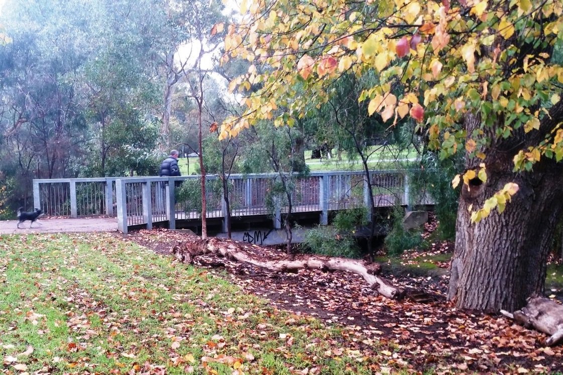
5. Botanic Creek
After following the path a short distance down the hill you can see a creek ahead. This is Botanic Creek, and is the central feature of King Rodney Park.
Botanic Creek is bordered by dense mature vegetation and provides lovely areas to rest or to enjoy a picnic.
The creek doesn’t run all year. It’s an “ephemeral” creek; meaning that it flows only after rainfall. It channels water from near Greenhill Road, north through all the eastern Park Lands, and eventually empties into the Botanic Garden lake about a kilometre north of here.
Before European settlement, this part-time watercourse would have been a camping area for the Kaurna people, with the watercourse providing a wealth of natural resources, mainly in the wetter months of the year.
The bridge that you can see here is the newest bridge within the Park. When the first bridge on this site was built in the early 1900’s it was a timber bridge, but it was re-done in 1999 in steel, so that it could carry council maintenance vehicles.
Botanic Creek is set for a major improvement over a three-year period to 2028. The project will restore Botanic Creek, developing biodiverse swales, creating new habitat and natural spaces.

Read more about the project here: https://www.adelaide-parklands.asn.au/blog/2023/8/14/creek-of-cultural-connection
In 2025, the City Council released imagery to suggest how this Park might look after the “renewal” of Botanic Creek.

Pic: Kadaltilla /Adelaide Park Lands Authority agenda, 22 May 2025
From here, don’t cross the bridge but turn right to follow the path towards Wakefield Road.
While walking towards Wakefield Road you will pass large sugar gums on your left, and two more Brush Box trees on your right, among others.
Stop when you reach a sign with a map of the disc golf course.

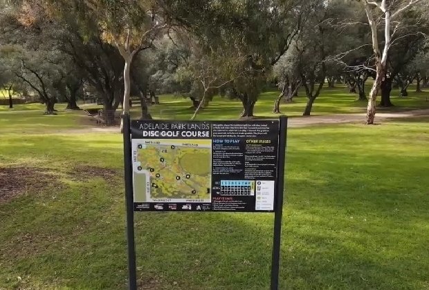
6. Disc golf
While on this walk, you would have seen signs about a “Disc Golf” course. You are now standing at Hole #7” on the Adelaide Park Lands disc golf course.
In recent years the sport has been growing rapidly in popularity but is still not widely known.
Players use the term “disc” although most people would know a flying disc as a “frisbee”. “Frisbee” is a trade mark, and just one brand of flying disc.
The idea of disc golf is very similar to the idea of standard golf. Golfers try to get the ball in a hole. Disc golfers try to get the disc into a basket, in a minimum number of throws.
The 9-hole ‘disc golf’ course in this Park was constructed in May 2020, and was subject to a five-year trial period. Despite occasional misunderstandings between players and others using the Park, the course has been mostly regarded as successful, and disc golf players are encouraged to always give other Park visitors right-of-way.

This course was not the first disc golf course in the Park Lands. There was an earlier one, in the 1980s, in Bonython Park, but it fell into disuse and was removed after a few years.
The cost of installing the baskets in this Park was shared 50/50 between the City Council and the Adelaide Disc Golf Club.
To avoid having the baskets regarded as “permanent infrastructure” the baskets have been installed in sleeves so that they can be removed for major events.
The course is a par 28. The Adelaide Disc Golf Club describes the course as “challenging” with “a surprising amount of elevation change that cleverly uses the creek lines and a 100 year old olive grove to create some tight fairways.”
Now walk a few metres further east towards the fenced basketball court area.

7. Basketball courts
Walking east alongside Wakefield Road, you can see a fenced area for basketball.
These facilities were previously used for tennis as well, but tennis was moved out to accommodate a skate park, that was built here in 2016, with the intention (at the time) that the skate facilities would be only temporary.
The skate facilities were built here as a stop-gap measure after a different skate park, on North Terrace, was closed early in the 2010’s to make way for expansion of the bio-medical precinct on North Terrace. At that time (2016) there was no funding available for a larger, permanent skate park.
The skate park was constructed within the area of the basketball and the former tennis courts. After construction of the skate facilities, basketball was restricted to two half-courts.
Built for both experienced and inexperienced skaters, the facility included quarter pipes, flat banks, ledges and rails.

Basketball court and the “temporary” skate park in King Rodney Park / Ityamai-itpina (Park 15)
Despite the opening of a much larger, new skatepark on the other side of the City in 2022, in Park 25, off West Terrace opposite Hindley Street, the skate facilities here were allowed to remain.
Close to the basketball courts, behind you on the edge of Wakefield Road, is a large sugar gum tree which features more than a dozen large “burls”.

Burls on a Sugar Gum tree (Eucalyptus cladocalyx) off Wakefield Road in King Rodney Park / Ityamai-itpina (Park 15)
These outgrowths on the trunk would have been produced by this Sugar gum over many years, probably in response to infestation by mould, bacteria, fungi or viruses, or damage from wounds. The effect of the tree’s response is that the trunk continues to grow at the same rate as the rest of the tree but in a drastically changed direction. Burl wood is prized by woodworkers because the grain features unique swirls, but cutting burls off a tree can kill the tree.
Now, keep walking east on the path next to Wakefield Road, towards the Britannia roundabout. Stop where the path is crossed by another bitumen path.

8. Park Lands Trail
The Park Lands Trail (on which you have been walking) is a series of connected walking and cycling trails which loop both the city of Adelaide and North Adelaide.
There are two bitumen paths that both traverse King Rodney Park from north-west to south-east. One crosses Botanic Creek and links up with Bartels Road and Rymill Park to the north. The other stays on this side of the creek and links up with East Terrace and Flinders Street.
At some times of the year there are signs along the trail warning you that olive fruit might be a slipping hazard on the trail.
The pathways are not new: they were laid out in the early 1900s by former city gardener August Pelzer – but more on him later.
This path, on the northern side of Wakefield Road, was first laid here in 1908. It is lined with majestic South Australian blue gums.
Keep following the trail eastwards down into the tall trees near the Britannia roundabout.

9. Eucalyptus woodland
The south-east corner of the park – bordered by Wakefield Road and Dequetteville Terrace - is notable for its dense and tall grove of eucalypts – particularly Red Gums and South Australian Blue Gums.
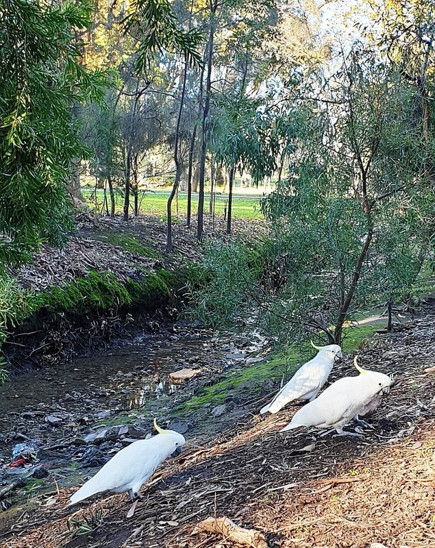
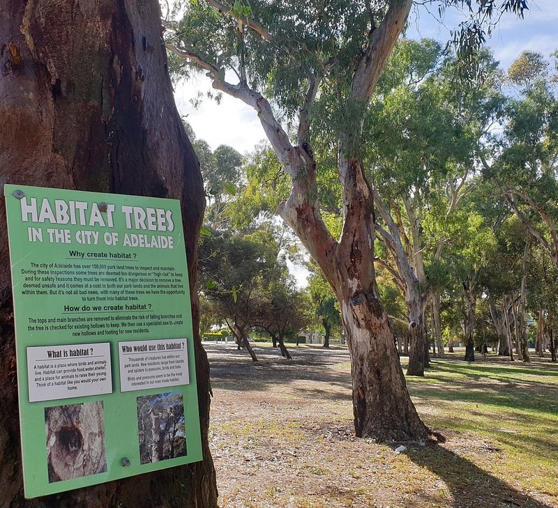
Despite the constant hum of passing traffic, this is another lovely area to walk around. Keep an eye out for a variety of birds and possums that may be living in tree hollows – so-called “habitat trees”.
The shared-use walking and cycling trail heads north from here, along the side of Dequetteville Terrace, up to the corner of Bartels Road.
From that point, walkers and cyclists can either cross Bartels Road at the traffic lights, or head westwards on the southern side of Bartels Road back towards the city, on the northern side of the Park 15 sporting fields.
In that north-eastern part of Park 15, there are two clubrooms and toilet blocks adjacent to Bartels Road that were built in the 1960’s.
However on this Trail, you can get off the bitumen now. You turn back here into the centre of the Park, to view one of its little-appreciated sights.
Turn around and walk directly across the playing fields to reach the metal fenced cricket practice nets.

10. Cricket nets and pepper tree avenue
Enclosed in metal wire fencing, these are practice cricket pitches and nets. They are open for public use, but are most often used by Christian Brothers College, to the west of here in Wakefield Street.

A few steps past the cricket nets, at the top of a gentle rise, a road rolls away downhill, towards the west. The road is lined with about a dozen mature pepper trees. For decades it was a dirt track but the track was sealed with bitumen in 2022, to assist with preparations for annual motor racing events that utilise Wakefield Road.

The pepper tree avenue before (top) and after (bottom) it was sealed, in 2022, to assist preparations for annual motor vehicle racing.
One of the lovely things about this Park is that it’s not flat. The gentle slopes give it more character than some other parts of the Park Lands. It’s said to be a reminder of the Adelaide landscape prior to European settlement in1836.
Like so many other parts of the Adelaide Park Lands, this Park was cleared of almost all trees in the first three decades of European settlement – from the late 1830s to the late 1860s. During that time it was used for gathering firewood and grazing cattle.
Attempts to turn it into a proper Park really commenced only with fencing and tree plantings in the late 1870s and 1880s.
This avenue of pepper trees is just one of the many notable achievements of City Gardener August Pelzer, who virtually ruled the Park Lands for 33 years from 1899. The pepper trees here were planted in 1905. There were more of them initially. Some have been lost over the years.
Before Pelzer’s time, a Scottish forestry expert, John Ednie Brown, had recommended creating a semi-formal Victorian Garden, and laid out a plan for it. Pelzer used elements of Brown’s plan, without fully committing to it.

More recently, King Rodney Park was one of 32 sites in the Park Lands for the “SA Urban Forests - Million Tree Program” which ran from 2003 to 2012. It aimed to recreate the original woodland environment where possible, and protect remnant grasses.
Most of the trees planted during that period were put in along the course of Botanic Creek.
Now, walk down the hill and stop at the edge of the main sporting oval.

11. Sports Fields and Major Events
There are three sporting fields in this Park. One is in the south-east corner, another one in the north-east closer to Bartels Road, and the largest of the three is near the centre, on the north side of the creek, also close to Bartels Road. This trail takes you on the southern side of this, the main oval.
The first sporting oval was set up by City Gardener August Pelzer in 1906. The other two, closer to Dequetteville Terrace, came much later, after the 1930s.
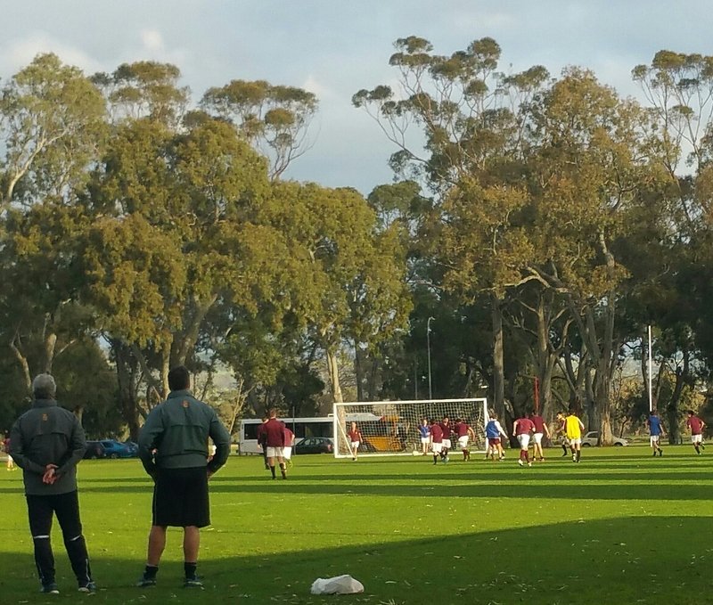
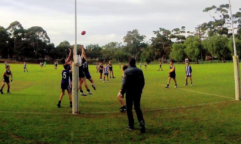
The sporting fields are used for cricket, football and athletics. They’re licenced for use by various community sports clubs and most notably the nearby Christian Brothers College (CBC). The College has licenced the use of sporting land in Park 15 since at least 1908.
On the far side of this oval there was an ugly concrete bunker that the City Council built for CBC in the 1970s. The bunker was removed in 2020 but replaced with the very similar storage building you can see there today. It’s one example of more than two hundred Park Lands alienations – land that is no longer open, green and public.

King Rodney Park is one of Adelaide’s most utilised Parks – if not the most utilised - Park for major events.
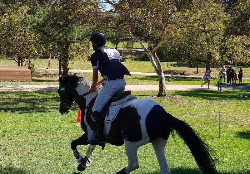
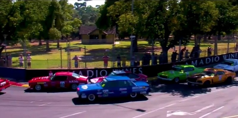
For many years it was a pivotal centerpiece in what were three massively popular annual sporting events - the Tour Down Under; the equestrian 3-day event and the V8 supercar festival known as the Adelaide 500.
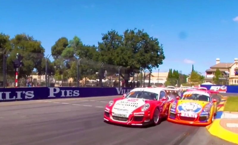
The large oval you see here, has been used to host a stage for popular music concerts that are held in the evenings after Adelaide 500 motor racing, which used to take place in early March each year. After being cancelled at the time of the COVID pandemic, the Adelaide 500 motor racing event resumed in late 2022 for another five years.
In 2024 the Motor Sport Board added another event, located entirely within this King Rodney Park. This oval was transformed into a dirt speedway track, for three nights of “sprintcar” racing. The event was scheduled to be repeated in November 2025.
The roads around this Park were also part of the circuit for the former Australian Formula One Grand Prix, from 1985 until it was moved to Melbourne in 1996.

Speedway track in King Rodney Park, November 2024. Image: SA Motor Sport Board.
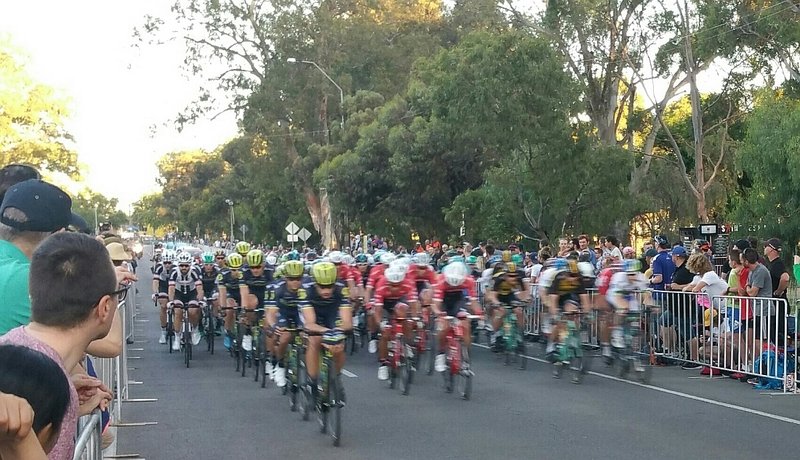
The first event held during the Tour Down Under cycling each year is a closed circuit street race or criterium, usually about 50 kilometres, in which the peleton does laps of a city circuit. In some years, the pack has raced around the outside of this Park 15. In other years the city circuit has been held at Glenelg, or just north of here around Rymill Park instead.
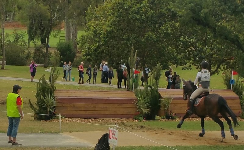
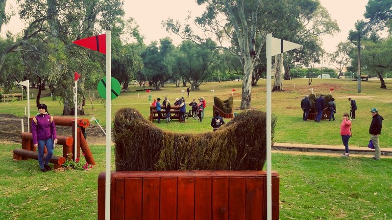
Starting in 1997, the cross-country track in Australia’s premier equestrian 3-day competition traversed King Rodney Park and neighbouring Victoria Park and Rymill Park each year. Following the COVID pandemic, the event was re-badged as the “Adelaide Equestrian Festival” and its schedule moved to April or May.
Tens of thousands of people have attended these events and enjoyed the surrounds of King Rodney Park at the same time.
Now follow the path along the edge of the oval, then turn left, get off the path and cross the grass to a wooden bridge across the creek.

12. Wooden bridges and water race
This bridge and the other similar wooden bridges nearby represent another one of the many achievements of former City Gardener August Pelzer.
The first decade of the 20th century was an economic boom time for South Australia, and the State was relatively wealthy.
Beginning in 1905, the City Council approved a series of recommendations from Mr Pelzer to improve this Park as well as other Parks nearby.
The avenue of pepper trees, and the sporting ovals were just the beginning. In 1906, Mr Pelzer also planted English elm trees along Dequetteville Terrace (although most of them are gone now).
At about the same time, the Council stopped issuing “agistment licences”. Horses and cattle were still kept for decades more, in other parts of the Park Lands – but not here in Park 15 after 1906. The eastern side of the City, and the eastern Park Lands were given better treatment, earlier, than the western Park Lands.

Water “race” in King Rodney Park / Ityamai-itpina (Park 15)
The first wooden footbridge was constructed in 1906 and the “water race” that you can see here was constructed the following year, 1907 to put the creek beneath the pathway.
From here, cross the wooden bridge and head northwards, on the grass alongside the creek. Stop just before you reach Bartels Road.

13. Aboriginal connection
Image above: “Adelaide, a tribe of natives on the banks of the River Torrens 1850”. Source: https://artsearch.nga.gov.au Creator: Alexander Schramm, 1850
Before European settlement in South Australia, this creek (Botanic Creek) was used as a meeting place for the Kaurna community and especially where the creek emptied into a waterhole that later became the lake in the Adelaide Botanic Garden.
To the Adelaide people of the late Victorian era, one of the few aboriginal people who was well-known was a so-called ‘fringe-dweller’, Tommy Walker. He frequented and camped in the eastern Park Lands in the second half of the 19th century.
Tommy, or to give him his correct name, Poltpalingada Booboorowie, was not a Kaurna man. He was a Ngarrindjeri man who was born on the shores of what we call Lake Albert near the Murray mouth. Many of his fellow Ngarrindjeri people took up living in the nearby Point MacLeay mission, or Raukkan, that was set up in 1959.
Poltpalingada didn’t appreciate the restrictive confines of the mission so he and his companion Mary came north to live in Adelaide in the 1880s – mostly in the Park Lands to pursue a life of more freedom. He was a renowned mimic with a “sharp wit and acid tongue”. Tommy Walker spoke fluent English and his popularity with the public was so great that the government gave him a pass for free travel on public transport.

Poltpalingada Booboorowie aka “Tommy Walker” (1830–1901) ~ Source: State Library of South Australia B14430 ~ Creator: Unknown ~ Date: c1860
His begging was popular with the public because it resembled street theatre in which he would recount his most recent arrest, and jokingly send up the latest magistrate who had sentenced him
Tommy Walker died in 1901 and his death was marked by a relatively long story in The Advertiser on page 4. But he was not King Rodney.
The actual “King Rodney” or Ityamai-itpina was a Kaurna elder who lived well before Tommy Walker, at the time European settlement began in the late 1830s. There are no known photos or even sketches of King Rodney.
King Rodney or Ityamai-itpina had a connection with the Adelaide Plains as a general area, not necessarily this Park area alone. He was a Kaurna elder with whom the colonists supposedly “negotiated” occupancy of the Adelaide plains. Little did he know what was going to happen to Kaurna land over the next few decades!
The name Ityamai-itpina is hyphenated. That is a a clue to its meaning. In the Kaurna language, “itpina” means “father” so Ityamai-itpina means Ityamai’s father. We’re not sure what he called himself before his son was born!
It was in the late 1990s that the City Council began deciding what Kaurna names to give to each of the Parks. The Council consulted a Kaurna language expert, Professor Rob Amery of the University of Adelaide who made a series of suggestions for Park names. The name Ityamai-itpina was assigned in 2002. Fifteen years later, in 2017, the Council gave it an English name as well – King Rodney Park, referring to the same Kaurna person, Ityamai-itpina.
From here – walk westwards, back along Bartels Road, to the starting point of this trail on the corner of East Terrace.
Optional: download and print a tri-fold leaflet, i.e. a double-sided single A4 page, with a brief summary of this Trail Guide: (PDF, 1.2 Mb).
All of our Trail Guides and Guided Walks are on the traditional lands of the Kaurna people. The Adelaide Park Lands Association acknowledges and pays respect to the past, present and future traditional custodians and elders of these lands.

