

Take the Trail
Start at the corner of Bundey’s Road and MacKinnon Pde.
This Trail is on the traditional land of the Kaurna people.

Start this trail at the corner of MacKinnon Pde and Bundeys Road. There are 11 stops on this Trail and it will take about 75 minutes to complete. Walking instructions are designated by bold type at the end of each of the 11 stop descriptions.
Optional: download and print a tri-fold leaflet, i.e. a double-sided single A4 page, with a brief summary of this Trail Guide: (PDF, 1.5 Mb)

1. Introduction and naming
This small wedge of Park Land is only 5.7 hectares which means it comprises less than one per cent of the total area of the Adelaide Park Lands.
Nevertheless it is a very popular area for local residents of North Adelaide and the suburbs immediately to the east, including Gilberton and Walkerville.
Tidlangga is a Kaurna language name, which means ‘tidla root place’, referring to a bulbous root eaten by the Indigenous people.

Due to its location close to the river and other known corroboree grounds, in pre-colonisation times this area may have been used as an encampment for the local Kaurna people.
Its other name, Bundey’s Paddock, has been used (informally) since the 1880’s in honour of a former mayor of Adelaide in the 1880’s, William Bundey.
The name was formally assigned to the Park (by the City Council) only as recently as September 2017.
Tidlangga is a Kaurna language name, which means ‘tidla root place’, referring to a bulbous root eaten by the Indigenous people.
Adelaide City Council is proud of this park because, they say, it demonstrates the way urban planning can both encourage and respond to community activity.
The big tree on the corner is a river red gum: possibly around 100 years old. It’s one of several river red gums in this Park.
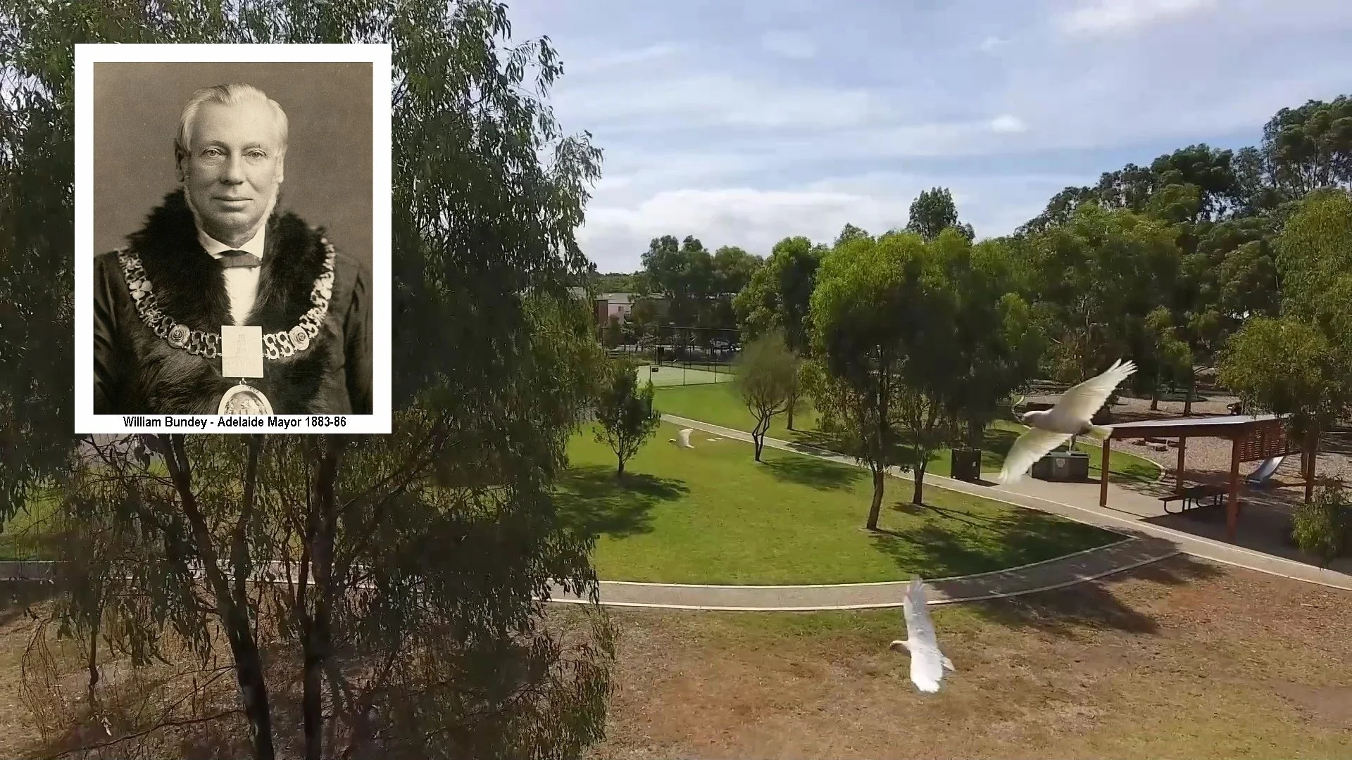
William Bundey and his family arrived in South Australia in 1848, when he was aged only 22.
He died in 1889, at the age of 63, just three years after ending his term as Mayor. He is buried in Walkerville Cemetery. He died of a heart attack minutes after having proposed a toast at a wedding reception being held in the North Adelaide Institute in Tynte Street. Mr Bundey was a stalwart of the Methodist Church on Melbourne Street (now the Elders Fine Art Gallery) and lived on Mackinnon Parade, although records don’t indicate in which house.
It’s assumed that he kept horses and/or cattle across the road in this Park, hence it became known in his lifetime as Bundey’s Paddock.

2. Park 9 history
.
This Park contains three distinct areas that sit easily alongside each other. There is a bushland trail, a “community hub”, and a well-used sporting oval.
However this part of the Park Lands has not always been as carefully tended. Following European settlement in 1837, the combined effects of grazing and unchecked clearing for timber and firewood turned parts of the Park Lands into a dustbowl in summer, and a quagmire in winter, and had rendered most parks devoid of native animal life.
By the 1850s, public opinion had concluded that something needed to be done about the barren and unappealing nature of this Park. The City Council of the day commenced by planting mainly British and Mediterranean tree species.
A report commissioned in 1880 recommended a systematic approach to the re-vegetation of the Park Lands. Accordingly, by 1899, new city gardener August Pelzer began removing failing trees and conducting a vigorous replanting of the parks which continued well into the early twentieth century. This walk will highlight some of the larger trees.
However, unlike other parts of the Park Lands there are no listed “significant trees” in this Park. Nor are there any places on the State Heritage Register.
If you’re walking here in open shoes or sandals, watch out for ants swarming around their underground nests, especially in warmer weather.
The ants won’t do lasting damage but you can be bitten repeatedly if you don’t watch your feet.
Walk about 30 metres along the footpath on the edge of Bundeys Rd until you come to a metal gate which prevents cars driving into the park.

Photo: Google Streetview
Turning left here, into the Park will bring you to the start of the bushland trail.

3. Bushland trail
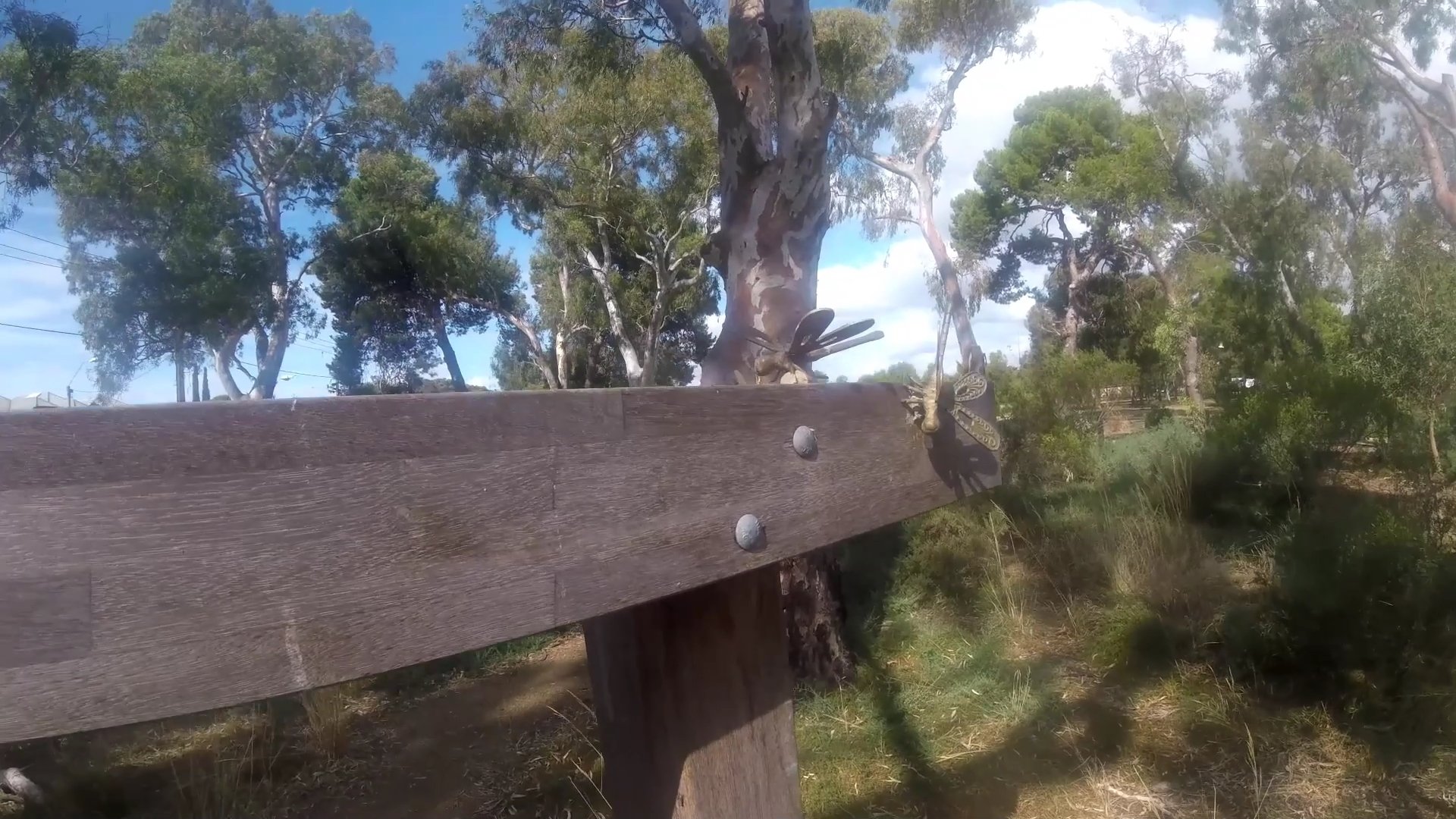
The entrance to the bushland trail is framed, quite literally with a wire-and-post fence and a wooden gate.
Several more of these wooden frames on the trail are adorned with metal dragonflies. How many can you count?
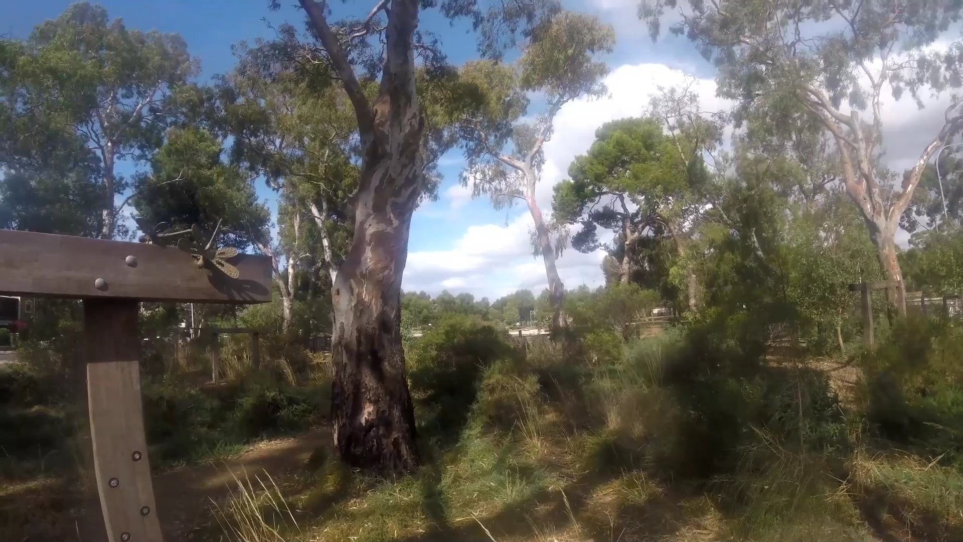
In contrast to the historical neglect of this Park, this area is now a flourishing native vegetation site, providing homes for native bird and animal life, especially possums, which are often seen around twilight.
The common bird species here include lorikeets, magpies, corellas, galahs, sulphur-crested cockatoos, ibis, banded lapwings and noisy miners.

Wind your way through the bushland trail until you emerge at the “community hub”
To your left, on the MacKinnon Parade footpath you can see two old metal fence posts that have been left in place as a reminder of a bygone era. They are more than 100 years old.
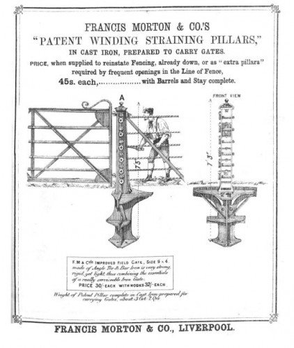
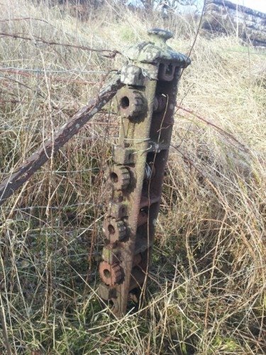
These are wrought iron gate “straining posts” and if you look carefully you can see they are embossed with the words “Francis Morton’s Patent No 1 Liverpool” on each post cap. These are rare surviving examples of the wrought iron fencing that was acquired by the City Council in the 1910s to fence Park Land blocks.
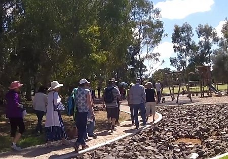
Now, walk up to the rocky ground in the playspace. Stop before you reach the tennis court.

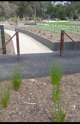
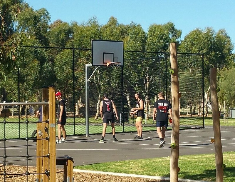
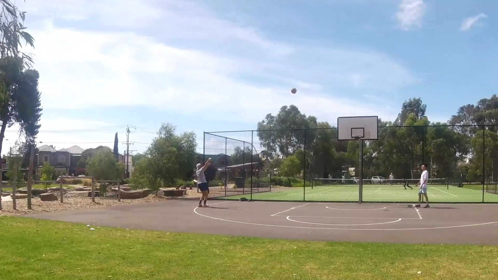
4. Playspace and Community Hub
This part of Bundey’s Paddock / Tidlangga includes a sandy petanque piste, tennis courts, playground, sandpit, barbecues and picnic tables.
It is frequently visited by families—in fact, there are over 3,000 visits to this park every year.
Personal trainers often bring their clients here for workouts, and you can often see ad hoc usage by small groups of young men (usually) at the basketball facilities.
The first children’s playground in the Adelaide Park Lands was established in 1918, off South Terrace in Park 20.
Today there are ten playgrounds in the Park Lands.
This “adventure” playground was installed in 2016, by a firm called “ProLudic” contracted by the City Council.
It replaced a former playground of the old fashioned swings and metal slippery dips type that had been further along Mackinnon Parade for many decades.
This one incorporates the principles of adventure and exploration that underpin planning of play areas in kindergartens and schools these days – and children love it.
The rock fields are intended to encourage children to practice their balance on an uneven surface.
The existence of the playground has made this spot a favourite site for children’s birthday parties!
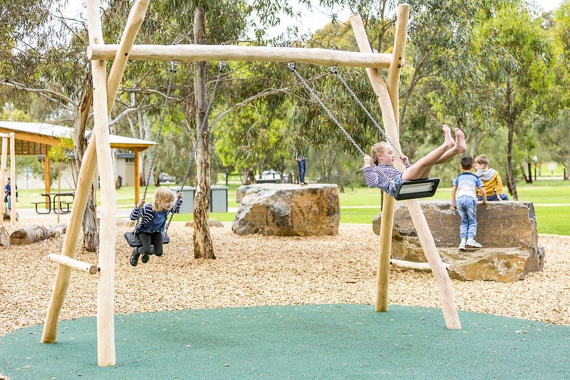
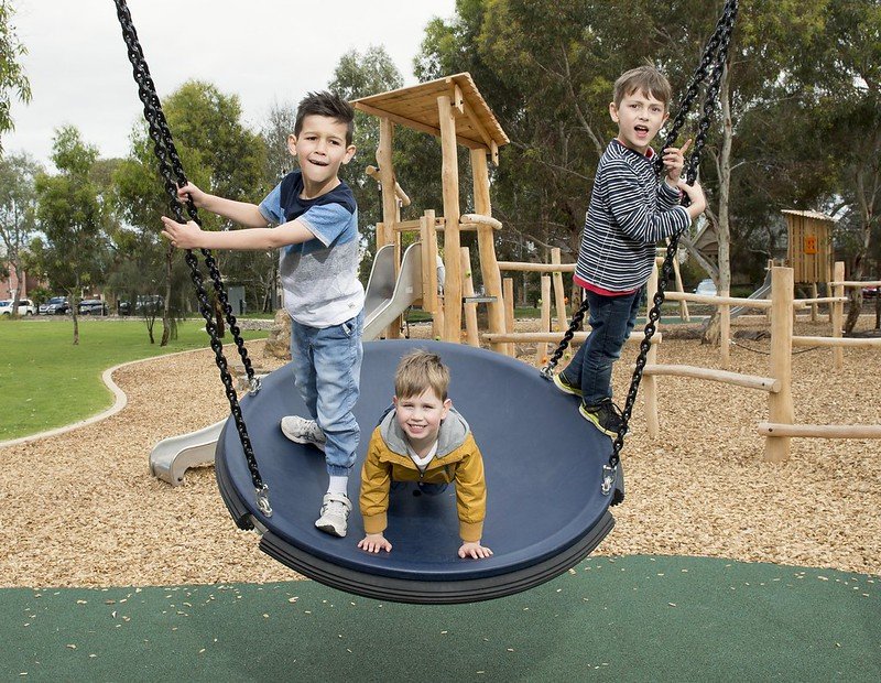
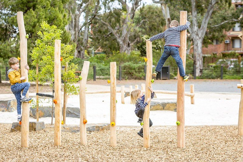
Photos: ProLudic
From here, walk back out to the street, to see the MacKinnon Parade streetscape.

5. MacKinnon Pde streetscape
MacKinnon Parade is named after William Mackinnon (1784-1870), one of the foundation SA Commissioners appointed during 1834 to help administer the new colony. He benefitted from the slavery trade (taking slaves from Antigua). Somewhat incongruously, he was a strong supporter of the RSPCA, and also a Fellow of the Royal Society.
Houses and apartments
50 Mackinnon Parade was originally called Keith House, after Frances Keith Sheridan, who lived there with her family, and ran a school there with her daughters.
Her elder daughter was Alice Frances Keith Sheridan (1844 to 1922). Alice Sheridan lived all her adult life in "Keith House", the last twenty years or so alone with her dogs, shunning human company. Despite owning considerable wealth, she did not employ any help apart from occasional visits from a gardener, and she spent little on herself. Alice Sheridan had a genius for languages, having a considerable knowledge of Greek, Hebrew, Latin, French, German, Spanish, Italian and Danish. It was through her knowledge of Danish that she was able to publish a book of Hans Christian Anderson stories which had not previously appeared in English.
When she died she left around £30,000 to the Adelaide University, fulfilling an agreement made with her sister Violet that whichever of them survived should enjoy the income from family property in the city ("Globe Chambers" on the corner of Grote Street and Victoria Square), then leave the land and buildings to the University, to be used for the "advancement of medical science, in memory of their parents." Among her papers was a request for the University to take care of the graves of herself and the members of her family in the West Terrace Cemetery.
"Keith House" was left to the North Adelaide Institute, and in 1925 it became the Keith Sheridan Institute.

50 Mackinnon Pde in 1925. Image: State Library of South Australia B2443
In 1963 the building became the Sheridan Theatre, home of the Adelaide Theatre Group. The Theatre closed in 1985 and the builidng has since been a private residence.
Alice Frances Keith Sheridan made another bequest. After she died in 1922 a further £2,000 from her estate was paid to the Royal Adelaide Hospital to build a kiosk, to be operated by the Adelaide Hospital Auxiliary. The building, an octagonal structure with a dome roof, was opened in 1925. It’s still there, known as the Sheridan cafe, off North Terrace in what the State Government calls “Lot Fourteen”.
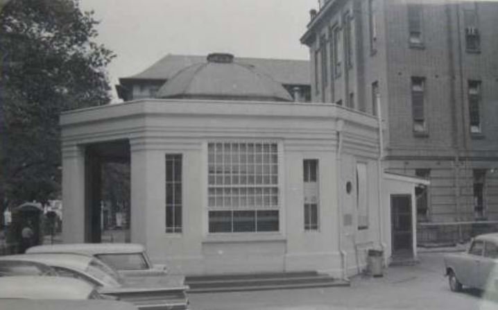
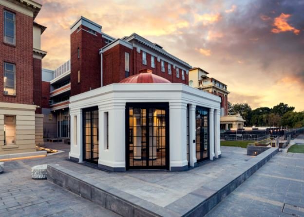
The Sheridan kiosk at the former Royal Adelaide Hospital in 1962 (left) and in 2022 (right)
Back on Mackinnon Pde, if you look further west, on the far side of Provost Street, you can see two blocks of red brick apartments. These two block might not seem unusual but they were relatively important in Adelaide’s 1960s red brick modernism school.
Next to the Sheridan cottage are architect Robert Dickson’s two linked townhouses, which were revolutionary when built in the early 1960s. The two houses were built together in order to get around Council regulations which did not allow subdivision of such a small block, with the owners hoping they could subdivide later. They were the first town houses to be built in North Adelaide.
In the 2010’s these two townhouses were both been substantially altered. Each of the owners wanted to open up the properties to the Park Lands with balconies, rather than having just private outdoor living space, which the houses were designed to maximise. To accommodate the opening up, what was at the time the largest olive tree in South Australia (at the front of #46) was chopped down.

2012 photos: realestate.com.au 2021 photos: Google Street view
Other houses along MacKinnon Parade feature blue plaques which explain some of their history.
There is a pair of Victorian 1880s single-fronted masonry residences with highly decorative cast iron detailing. In recent years they have been linked to form one residence.
Another pair of nearby houses appear to be conventional double-fronted villas, but they are unusual (for their 19th century period) in having the main entrances to the side of the house.
Now, turn around and look back towards Park 9 to see the planter boxes on the edge of the community hub.

6. Residents’ planting activity
In recent years local residents, with the support of the City Council, have tried to develop some orchard and garden activity.
The effort initially consisted of citrus trees in raised beds on the Park side of the road, and a vegetable garden on the verge (although this was left dormant after a while).

The Council continued this initiative by planting fruit trees and herbs near the barbecues in the community hub.

Fruit trees are included in these series of planter tubs placed alongside the Park edge on MacKinnon Pde. Pics: Google StreetView
Now, walk east to the end of MacKinnon Parade.

7. Mann Terrace
This corner of North Adelaide wasn’t always quiet.
Up until the 1970s, MacKinnon Parade and Mann Terrace were through roads and it was possible to drive straight across into Gilberton.
That changed when the O-Bahn busway was built in the 1970s.
Before the road changes, there were tennis courts along the eastern edge of the Park, as you can see in this aerial photo from 1936.

Photo: City of Adelaide archives
In the 1860s and 1870s olive trees were one of the most widely planted trees in the Adelaide Park Lands, because of their fast growth and usefulness.
Although the olives are gone from this Park, you don’t have to look far to see them.
Just across Mann Terrace are Parks 7 and 8 known as ‘The Olive Groves’ or by their Kaurna names Kuntingga and Parngutilla.
These two small Parks retain their original 1860s olive groves.
They are listed as a State Heritage place.

The Olive Groves / Parngutilla (Park 8) across Mann Terrace.
Now, turn to your right, and stop just a few paces along the shared-use bicycle and pedestrian path.

8. Park Lands Trail
Walking south along the eastern edge of Park 9 you are on a shared-use bicycle and pedestrian path.
"Shared use" means all users should keep to the left, and cyclists should use a warning bell when coming from behind pedestrians.
Cycling is a convenient way to explore the Park Lands.
This path is part of the Park Lands Trail that loops around the entire Park Lands.
The Trail connects each part of the Adelaide Park Lands but requires you to cross many roads and railway lines.
A local businessman, Jason Redman has gathered support from a wide cross-section of business, community and sporting organisations for a plan to do away with all these various crossings, constructing tunnels or bridges so that the entire Park Lands Trail can become an unbroken walking cycling or running trail. Mr Redman has called the idea the Adelaide Recreation Circuit.

Jason Redman. Pic: https://www.adelaiderecreationcircuit.com/
In the 2022 State election campaign, the Labor Party promised that in Government, it would investigate the feasibility of the Adelaide Recreation Circuit.
Twice per year the Adelaide Park Lands Association holds a 'Park Lands Loop Collective' walk using the 15 kilometre Park Lands trail to loop around the City.
A longer loop of more than 19 kilometres is possible if you take a route that includes the Park Lands on the northern side of North Adelaide.

With its original broad, flat streets and a growing network of dedicated cycling paths, Adelaide is made to be seen from a bike.
Now, walk further south and stop at the corner of Mann Road and Bundey’s Road.

9. South-east corner
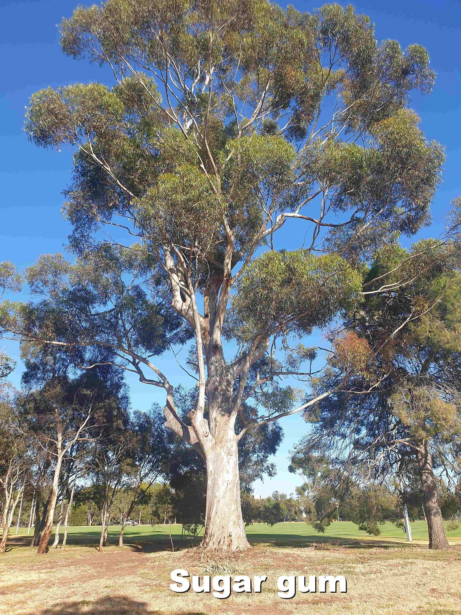
The two largest trees near the corner of Mann Tce and Bundey’s Road are a Himalayan Cypress, and a massive sugar gum.
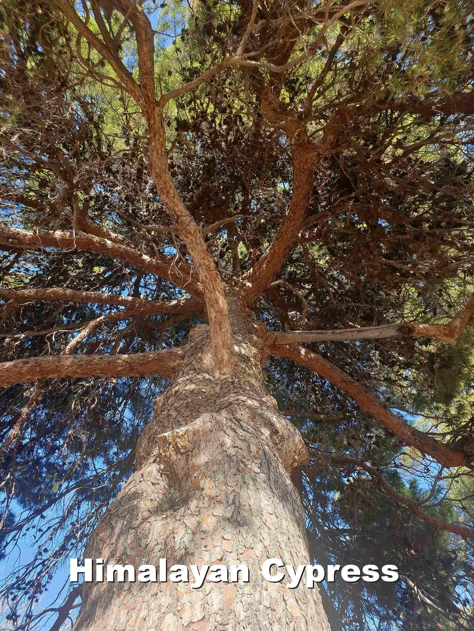

The Himalayan Cypress (Cupressus torulosa). There are not many of this species in the Adelaide Park Lands.
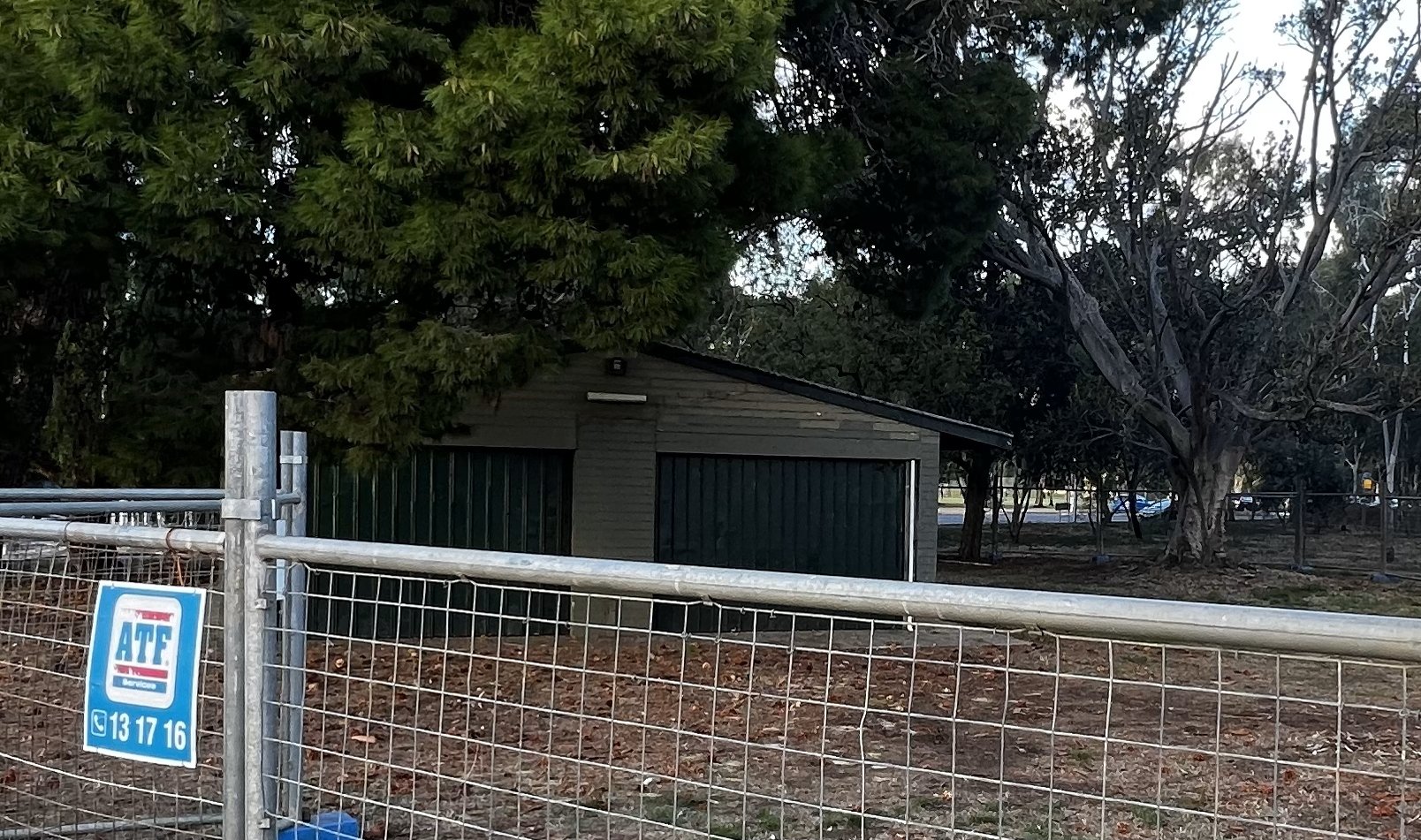
A metal maintenance shed on this corner was used by Prince Alfred College, and its Old Collegians Association.
Originally it housed a tractor but later was used for storage of sporting equipment associated with the College’s use of the Oval.

Metal maintenance shed near Park 9’s SE corner - scheduled for demolition in 2022.
It was scheduled for demolition in 2022 after construction of new sporting facilities, a few hundred metres west in this Park.
From this point, look across Bundey’s Road to the Hackney Road bridge over the River Torrens.

10. Hackney Bridge
The River Torrens is not within Bundey’s Paddock/ Tidlangga (Park 9) but it is, of course, an important part of the Adelaide Park Lands.
During the nineteenth century the river supplied Adelaide with drinking water.
Strangely, to protect the water supply swimming was prohibited but cattle were allowed to drink and muddy the waters.
Despite the swimming ban, many people swam in the River close to this spot.
Just west of the bridge, one swimming spot, known as the Death Hole, was the site of many drownings, mainly of young boys.
This stretch of river was also exploited for its natural resources of sand and limestone.
Early Park Land maps show a ‘Sand Carters Road’ from the river to Bundey’s Road, across the adjacent Park 10..
Sand-carting was so common it was eventually licenced to raise revenue.
Ironically, this revenue was used in the early 1900s to repair the damage done to the riverbank in the first place by the sand carters.

Sand carters working on the banks of the River Torrens, approximately 1912. Pic: State Library of South Australia B 62185
Now walk westwards, into the Park towards the playing fields and stop at the sports building.
11. Sports oval and facilities
.
From the earliest days of European settlement, the Adelaide Park Lands have hosted numerous sports.
By 1920, as many as 250 permits were issued for clubs wanting to play sport in the Park Lands.
A controversial topic for many was the playing of sport on Sundays.
In 1939, under pressure from a deputation from members of Protestant churches, the council banned organised sports from the Park Lands on Sundays.
It took another 28 years, until 1967, for that ban to be reversed.
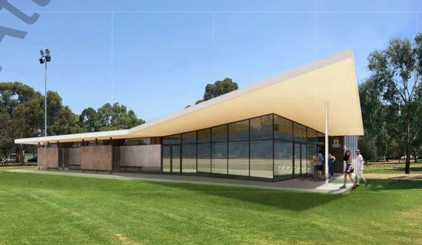
This oval was levelled for use in 1914. This oval is licensed to the Prince Alfred College, and its Old Collegians Association.
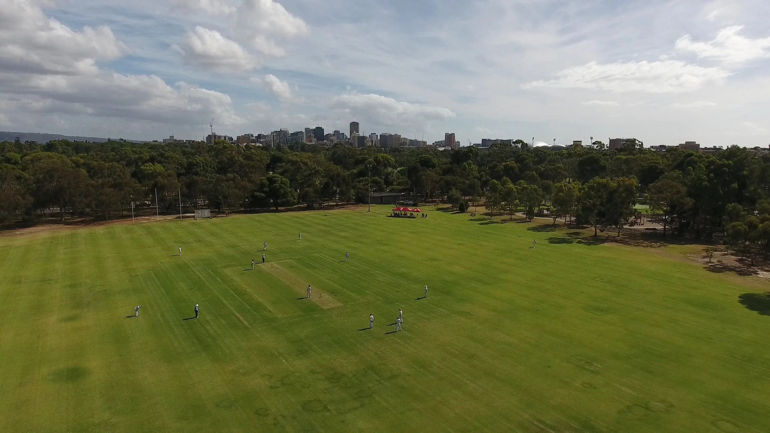
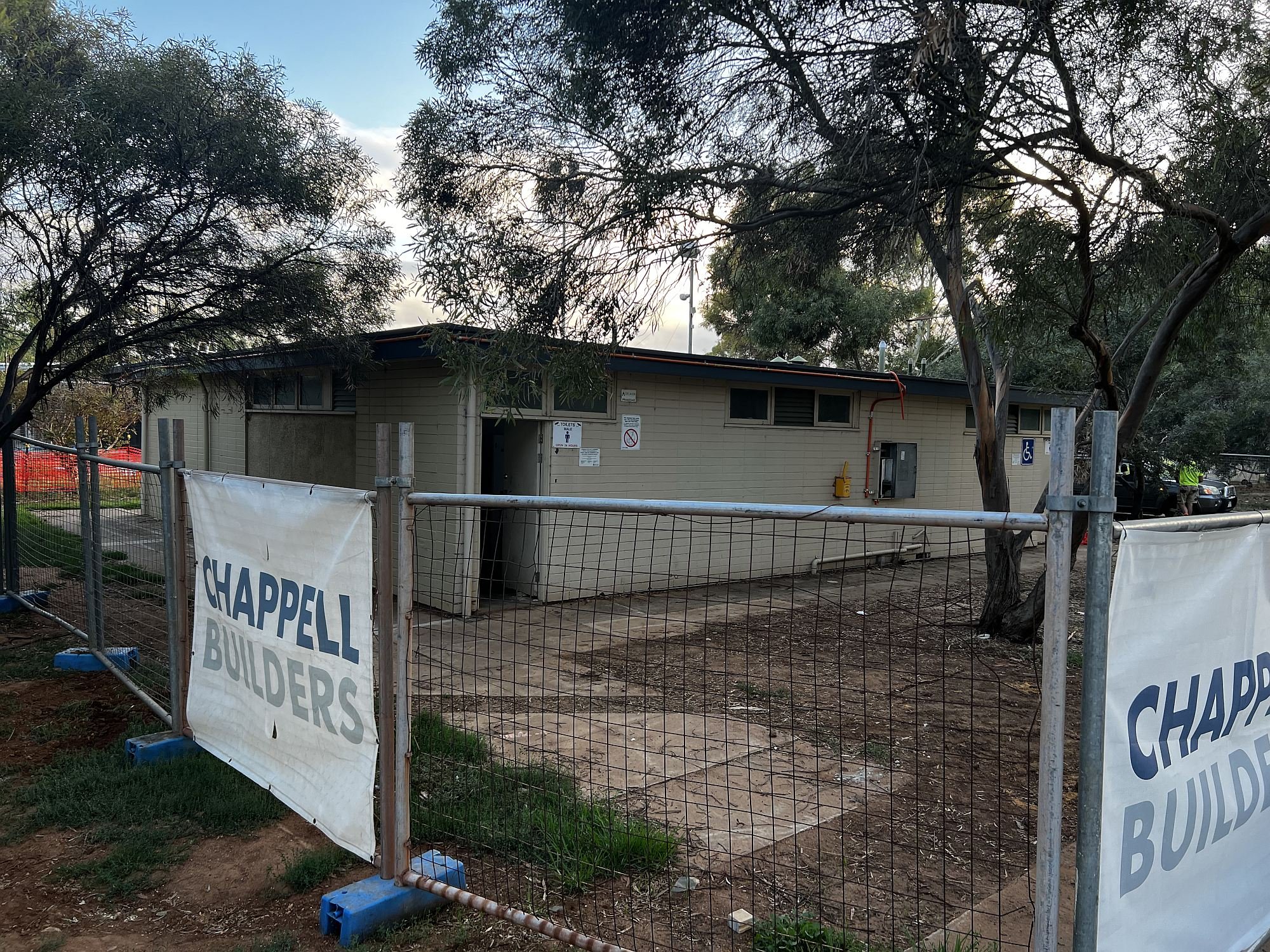
The Park 9 oval, pictured in 2018 before construction of the new clubrooms
This means that PAC and its Old Collegians have the first right of use of the oval. The public can use the area when the licencees aren’t using it.
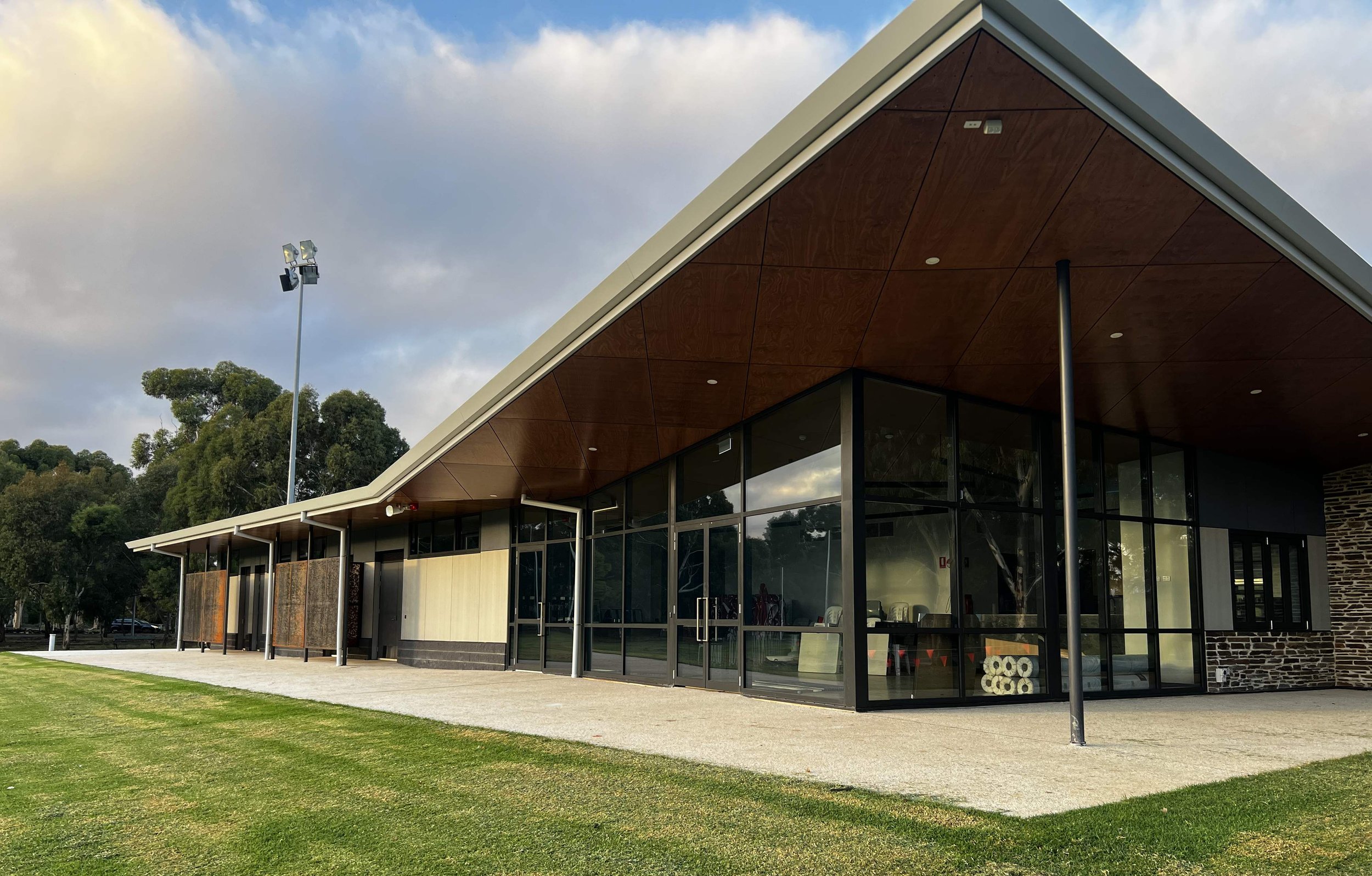
In November 2017, the City Council approved (in principle) the building of a new 375 square metre clubroom facility to replace TWO old facilities.
It approved a new building to replace both a toilet and change room block, and a metal maintenance shed that was on the corner of Mann Rd and Bundey’s Rd.
The new building was required to include “a small community space of 75 sqm and public toilets to service the adjacent community activity hub.”
It took a further three years, until late 2020, for formal plans to be submitted, for a building of 410 square metres, slightly larger than the Council’s in-principle approval.

The building plans also included a bar and viewing deck, along with a new road into the Park, to new building location closer to the centre of the Park. Construction commenced in June 2022, and was completed by March 2023. Demolition of the two older buildings was set to commence immediately afterwards.

The planning of the new building and negotiations over its proposed usage, demonstrates the ever-present tension faced by the City Council in its management of most of the Adelaide Park Lands.
Sporting or recreational clubs and schools often seek to build amenities on Park Lands and their plans must be set against community expectations of Park Lands as open, public and green spaces.
Optional: download and print a tri-fold leaflet, i.e. a double-sided single A4 page, with a brief summary of this Trail Guide: (PDF, 1.5 Mb)
All of our Trail Guides and Guided Walks are on the traditional lands of the Kaurna people. The Adelaide Park Lands Association acknowledges and pays respect to the past, present and future traditional custodians and elders of these lands.

