The City of Adelaide is upgrading the surfaces of a pedestrian pathway, and a road within Red Gum Park /Karrawirra (Park 12).
The Council has erected these signs to alert you to the work:

But do you know where you’d find “Town Clerk’s Walk”?
It turns out, this pathway was first laid through Park 12 way back in the 1860s!
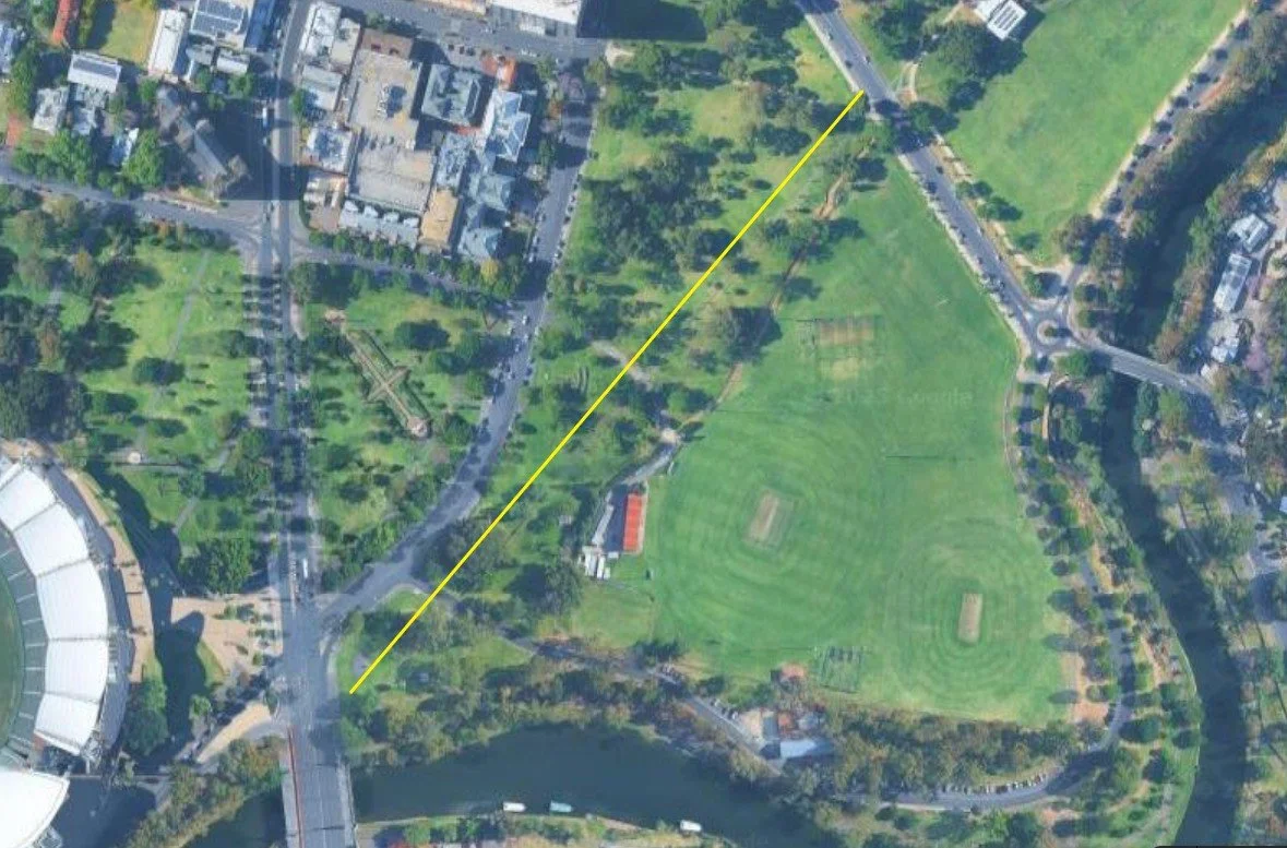
The “Town Clerk’s Walk” on Google maps
The City of Adelaide advises that:
“All existing trees will be protected throughout the works, and measures will be taken to reduce dust.
A small works compound will be in place during construction adjacent the road in the Park. The works are estimated to be completed by the end of February 2026.”

The ‘Town Clerk’s Walk’ is a narrow pathway by modern standards.
Who was the “Town Clerk”?
The “Town Clerk” (what we would call today the Chief Executive) after whom this path was named was Thomas Worsnop (1821-1898). The Australian Dictionary of Biography says Worsnop is particularly remembered for an excellent, detailed History of the City of Adelaide (1878); the original manuscript of which is in the Adelaide City Council Archives.
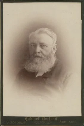
Thomas Worsnop (1821-1898), by S. Solomon. State Library of South Australia, SLSA: B 10803
University Oval Road, which crosses over the Town Clerk’s Walk, has been in disrepair for some time.

University Oval Road, off Sir Edwin Smith Avenue, in Red Gum Park / Karrawirra (Park 12). Pic: Google Streetview

Location of University Oval Road, off Sir Edwin Smith Avenue, in Red Gum Park / Karrawirra (Park 12). Pic: Google Maps.