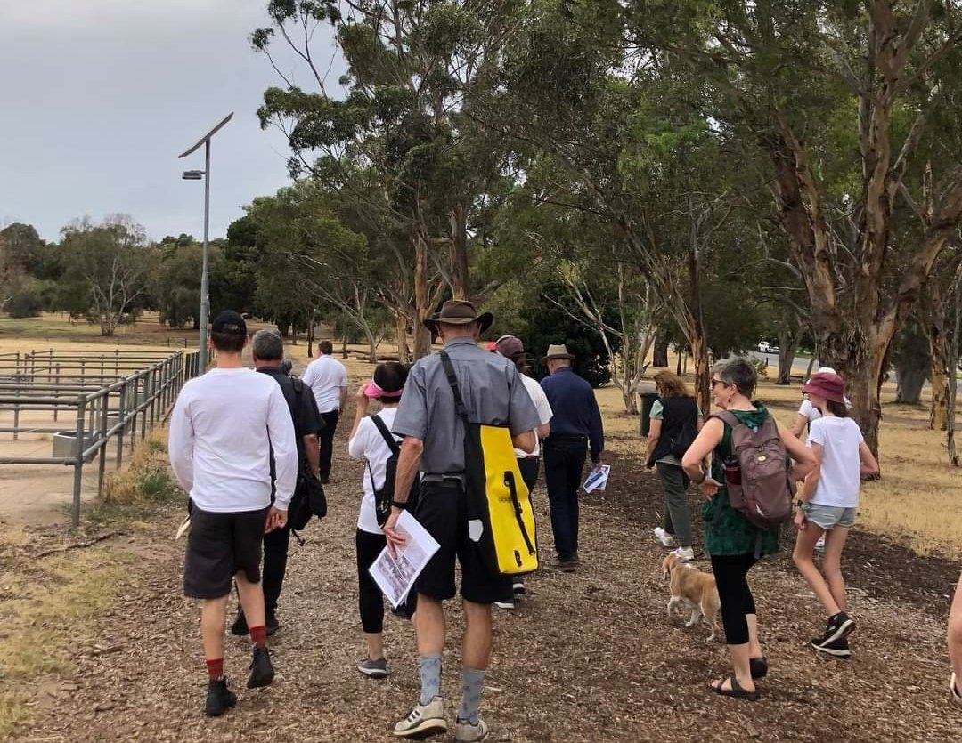
Take the Trail
Start on the southern side of the Glover Playspace on Lefevre Terrace.
This Trail is on the traditional land of the Kaurna people.
Last revised: February 2026.

Optional: download and print a tri-fold leaflet, i.e. a double-sided single A4 page, with a brief summary of this Trail Guide: (PDF, 1.2 Mb)
Start this trail on the southern side of the Glover Playspace off Lefevre Terrace. There are 11 stops on this Trail and it will take about two hours to complete. Walking instructions are designated by bold type at the end of each of the 11 stop descriptions.

1. Introduction and Naming
Start this Trail immediately south of the Glover North playspace on Lefevre Terrace.
You will complete the Trail in about two hours, back here at the playground. The starting point for this Trail is also the starting point for the weekly Nantu Wama “parkrun” which is held every Saturday morning at 8am.
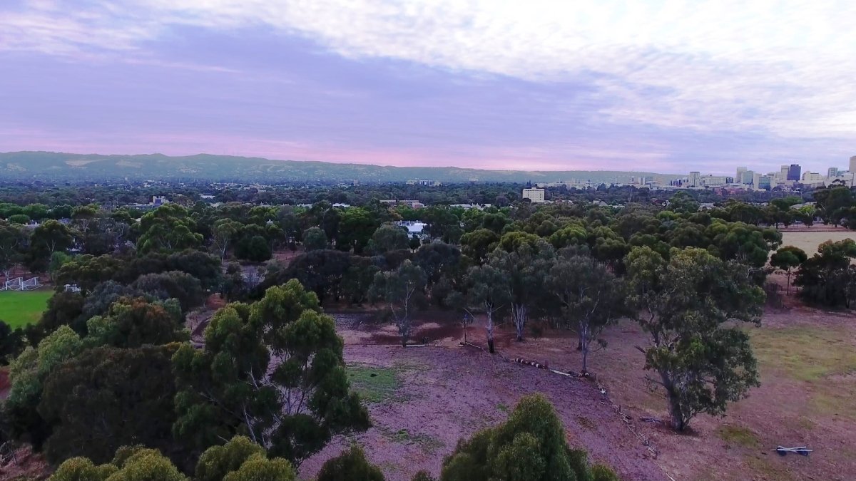
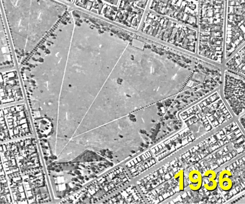
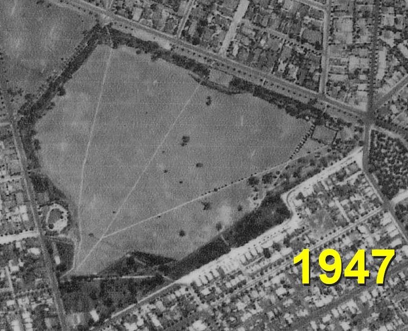
Lefevre Park / Nantu Wama (Park 6) covers 42 hectares of land which is about 6% of the entire Adelaide Park Lands. This area has been known as “Park 6” since at least the 1890s. In recent years it has been given two other names, in English and in the Kaurna language.
The land has been used consistently since the 1870s for the agistment of sheep, cattle and horses but over time the sheep and cattle have been removed and only depastured horses remain. Note the distinction between “agistment” which means the land owner looks after the stock; and “depasturing” which means feeding and caring remains the responsibility of the animal owner, not the land owner.
In the mid to late 1880s Adelaide’s Chief Park Lands Ranger, William Campbell erected wrought iron ornamental fencing along Kingston Terrace and Lefevre Terrace. Some of the original iron and jarrah fencing still exists here – and you should see it on this tour.
After being completely denuded by early European settlers, the native landscape is slowly returning through revegetation efforts of both the City Council, and Bush for Life volunteers.
Park 6 got the name “Lefevre Park” in 2017. It honors Sir John George Shaw Lefevre who died in 1879. He was a British barrister, politician and one of South Australia’s Colonisation Commissioners, when the colony was being founded in the 1830’s. However he did not ever visit South Australia, performing his duties in London.
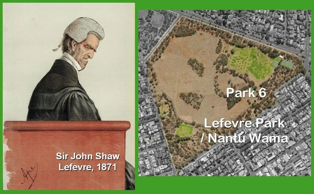
The man and the Park. Sketch of Sir John Lefevre (L) published in Vanity Fair magazine, 1871. Satellite photo (R): Google Maps
Sir John Lefevre’s name is also used for the street that borders the eastern side of the park – i.e. Lefevre Terrace, and Lefevre Rd, as well as Lefevre Peninsula which is where you will find Semaphore, Largs Bay, Osborne and Outer Harbour.
This Park also has a Kaurna name and that will be mentioned below, at the third location on this Trail Guide.
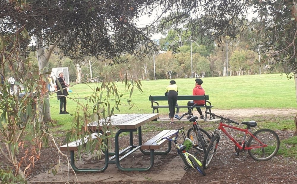
Walk east along the bitumen path. Continue until you reach the pathway intersection and make a right turn to the south. Stop beside the playing field.

2. Orphan southern sports field
.
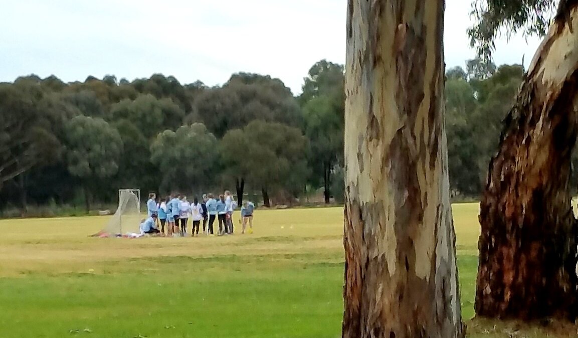
This is what might be called an “orphan” sports ground. It’s on its own, well away from the other larger sports fields, elsewhere in this Park.
There are at least four sporting fields about one kilometre away, in the northern section of the Park and you’ll visit them later on this Trail.
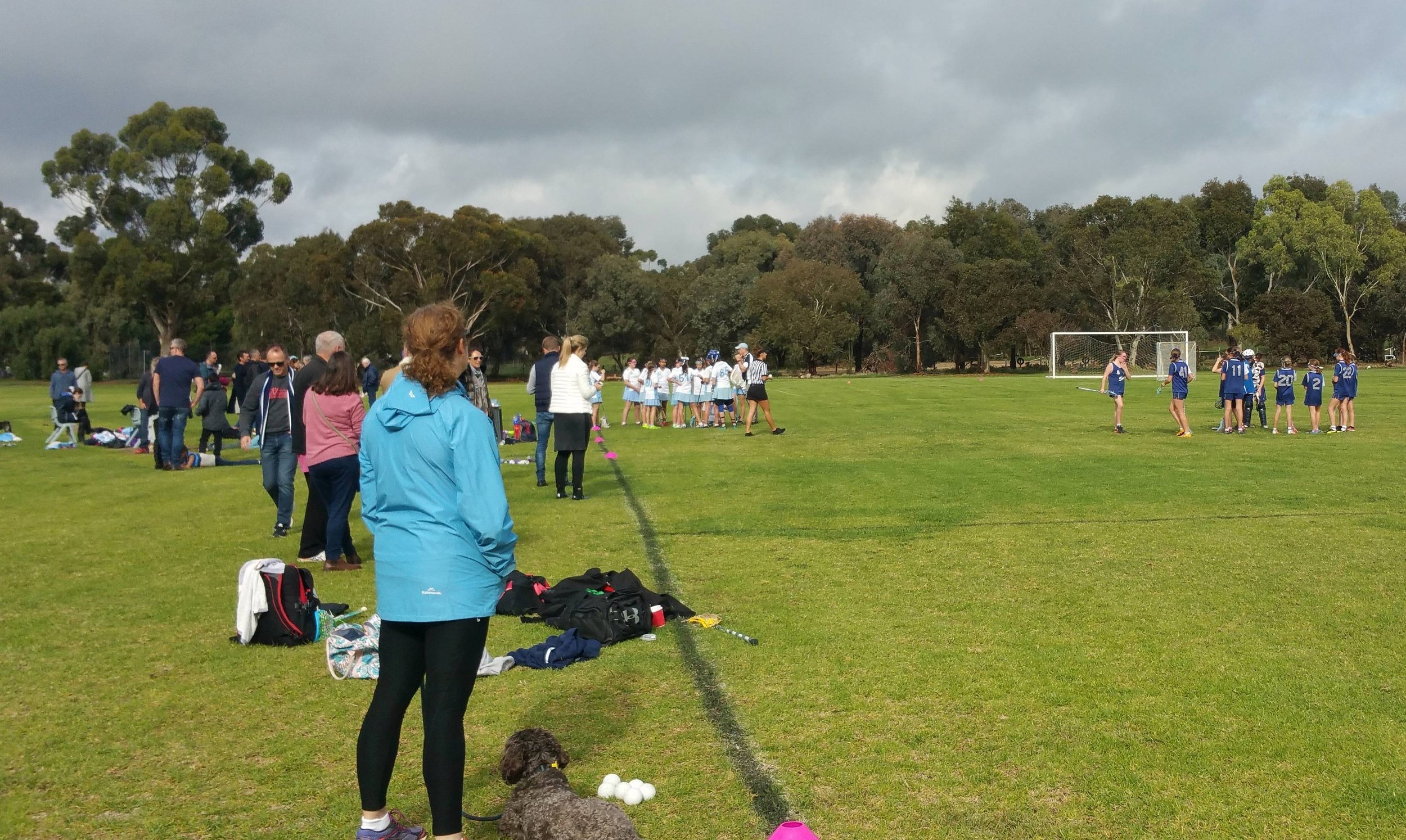
The large sporting fields in the north are licenced to Wilderness School.
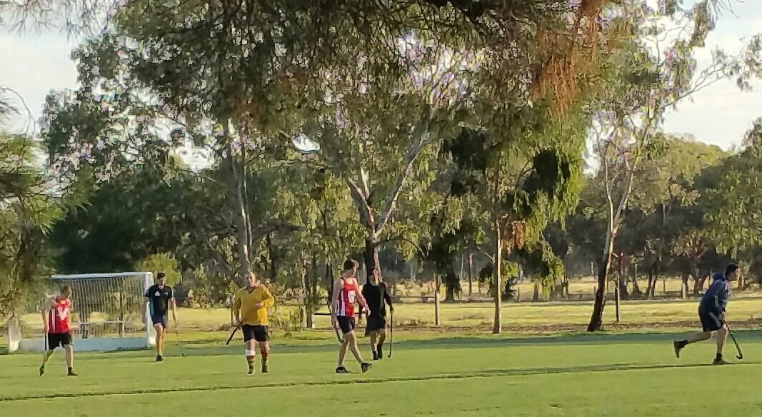
However, this small field, all on its own, is not licenced to any school or sporting club. It is really a community resource. In fine weather you can often see social groups or families playing their own favourite sport here, usually cricket or football. Sometimes there are hockey practice sessions here.
This field was the site of the first blind cricket match in South Australia. In blind cricket, players use a ball that rattles, so they can hear it coming. The first such game was played here in 1928.
There have been many other sports played in this Park, over the years.
For several years, starting in 1892, there was a 9-hole golf course in this park, adjoining LeFevre Tce and even a North Adelaide Ladies Golf Club. The ladies were allowed to play the course only in the mornings, on one afternoon per week. (Mondays!) The “Adelaide Golf Club” moved to Glenelg in 1896, and then to Seaton, but continued using Park 6 for practice rounds until 1911. The rival “North Adelaide Golf Club” was set up in 1905, where its courses are still in use off War Memorial Drive in Possum Park / Pirltawardli (Park 1).
That course in Park 1 has been the site of recent controversy due to legislation allowing for State Government takeover and “re-development” which the Premier has said would require the destruction of 585 trees.
Continue south along the path until you reach the next pathway junction. Turn left there, and walk along the path for about 40 meters where you will find a park bench on the left, northern side of the path. Stop there.

3. Kaurna land
When Colonel William Light arrived to survey South Australia in 1836, he was met by large clan of indigenous people living around a river that we now know as the River Torrens.
These were (and are) the Kaurna people. Their territory reached past Snowtown in the North and all the way to Cape Jervis in the south. As settlement progressed in Adelaide, indigenous people were forced further away from their river, and to what, in the 1840s, was the outskirts of the city, here in Park 6, Nantu Wama.
Today. the condition of the Park includes some similarities to what it would have looked like pre-colonisation, with some areas of woodlands and some areas of grasslands.
As colonisation progressed into the 1840s, the police commissioner at the time requested to have this, Park 6, become a “aboriginal reserve” in an attempt to (in his words) “clean up the streets”.
The idea was that Kaurna people would wear a metal tag, with a number that could identify them as locals, making it easier to differentiate indigenous people travelling from the country and those that lived in or near the city. Anyone found without a tag would be sent back to the country. It was even suggested that if the Kaurna people could be persuaded, they would be tattooed with an identification number.
This Park was the last area of land that Kaurna people were permitted to camp on before they were completely driven out of the city limits. All of the Adelaide plains (including this Park) and other parts of Australia are still as important to Indigenous people as they were when the land was taken from them.
Lefevre Park / Nantu Wama (Park 6). Pics: Shane Sody (L) and Keith Conlon (R)
Earlier we mentioned the English name of Park 6, Lefevre Park. But it also has a Kaurna name. In 1997 the Adelaide City council signed a Reconciliation Statement and from this a Kaurna Naming Project began.
Under the Reconciliation Statement, the City Council formally acknowledged the original occupation of the land, by the Kaurna people. The Statement committed the Council to “where possible, pay respect and honour Kaurna heritage through physical features of the City and by supporting community cultural activities.”
This led the Council to giving Kaurna names to most of the Parks and all of the Squares of the Adelaide Park Lands, as well as the River Torrens / Karrawirra Pari.
The Kaurna name for Park 6 is Nantu Wama, which translates to “Horse Plain”. It was spelt differently (“Nanto Womma”) from 2002 up until 2013 when it changed to its current spelling. However the pronunciation has remained the same.
Head east along the walking path and follow the bridle track westward, until you reach the bend in the bridle track. Stop at the bend.

4. Bridle track
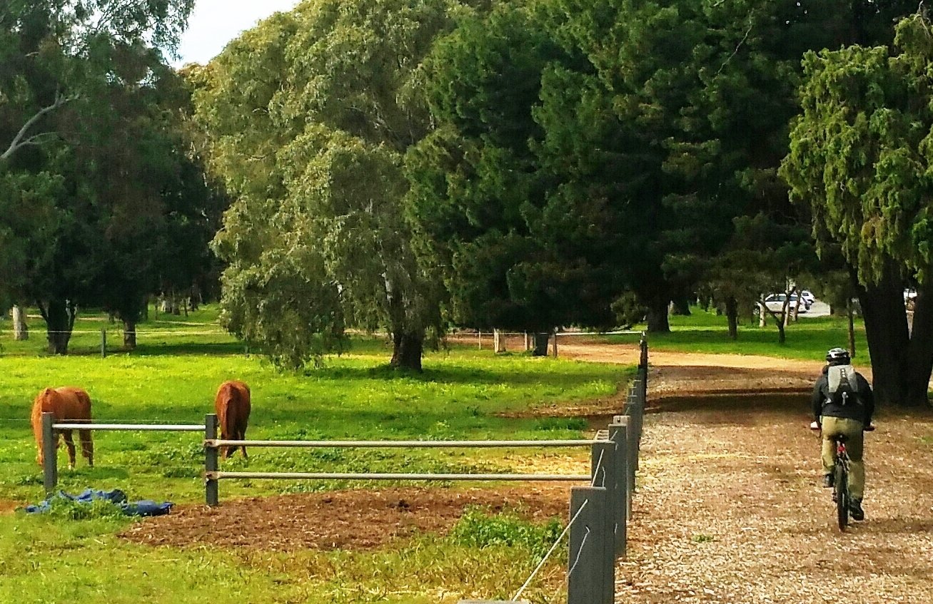
The horse paddock on your left is called “Paddock 3” or the “South Paddock” or “Kingston Terrace Paddock”. There might be horses in this Paddock but it is more likely that horses will be in Paddock 1 (the “North Paddock”) or Paddock 2 (the “Middle Paddock”) which you will reach a bit later on this Trail Guide.
This rough track, strewn with mulch, is intended for exercising horses. It’s called a “bridle track” referring to a horse’s “bridle” the headgear used to control a horse, consisting of buckled straps to which a bit and reins are attached.
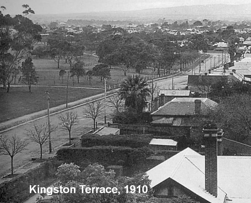
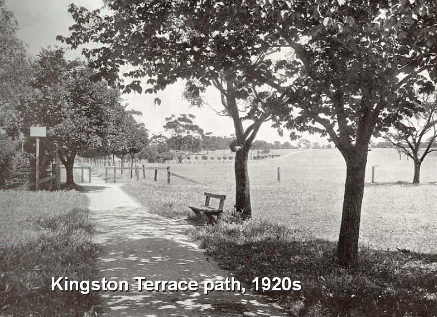
This is what Kingston Terrace looked like before construction of the bridle track, in 1939. The track was modelled on a bridle track in London’s Hyde Park, called “Rotten Row” that still exists.
Much earlier, way back in 1880, there were grand plans for a different bridle track or carriageway through the centre of this Park.
A Scots forestry expert, John Ednie Brown who planned the re-vegetation of your Park Lands, proposed a grand, sweeping horse-drawn carriageway through the centre of the Park from the end of Tynte Street to the north-east corner of the Park.
However his suggestion was never taken up.
You can often see horses being exercised on this bridle track. However, it’s sometimes used for a different purposes, unrelated to horses.
The sport of cyclocross (cross-country cycling) sometimes comes to Park 6.

Cyclocross (CX) racing on the bridle track in Lefevre Park / Nantu Wama (Park 6). Pic: Tim Loft
CX cyclists race on rough ground including the bridle track and sometimes have to carry their bikes across obstacles to complete the course.
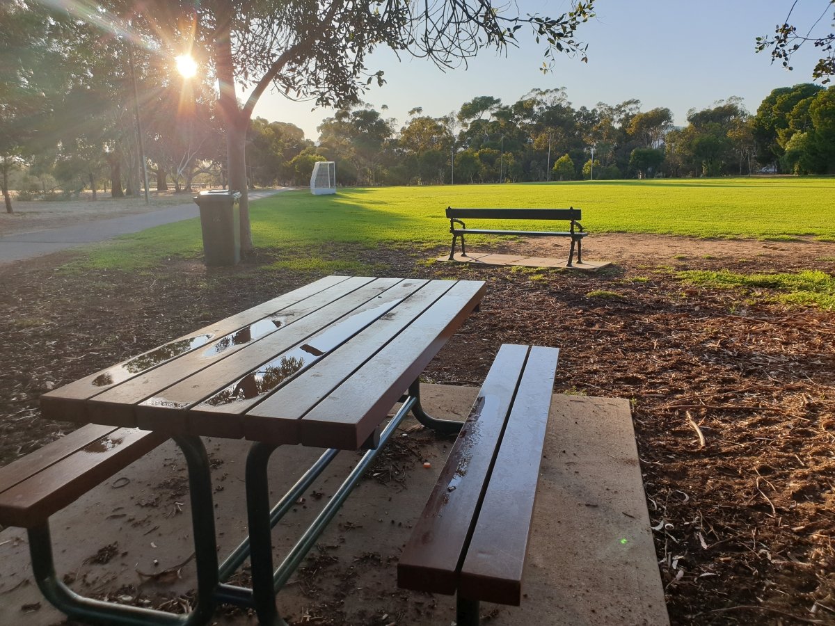
Walk around the tennis court to the corner of the playing field, just after the ‘Bush For Life’ information board. Stand where you can see the tennis courts on the far side of the playing field.

5. Wilderness playing fields
There is a rich history of sporting activity in this Park, dating back to the 1880s.
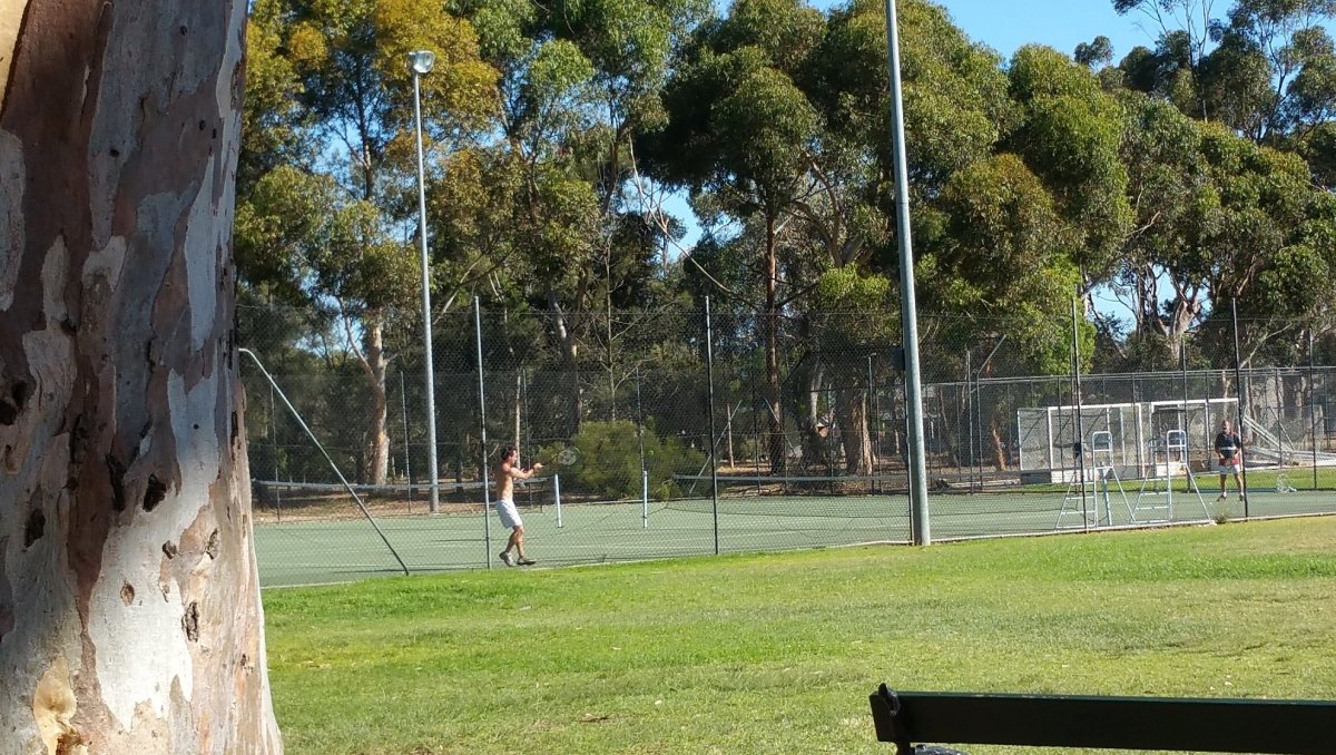
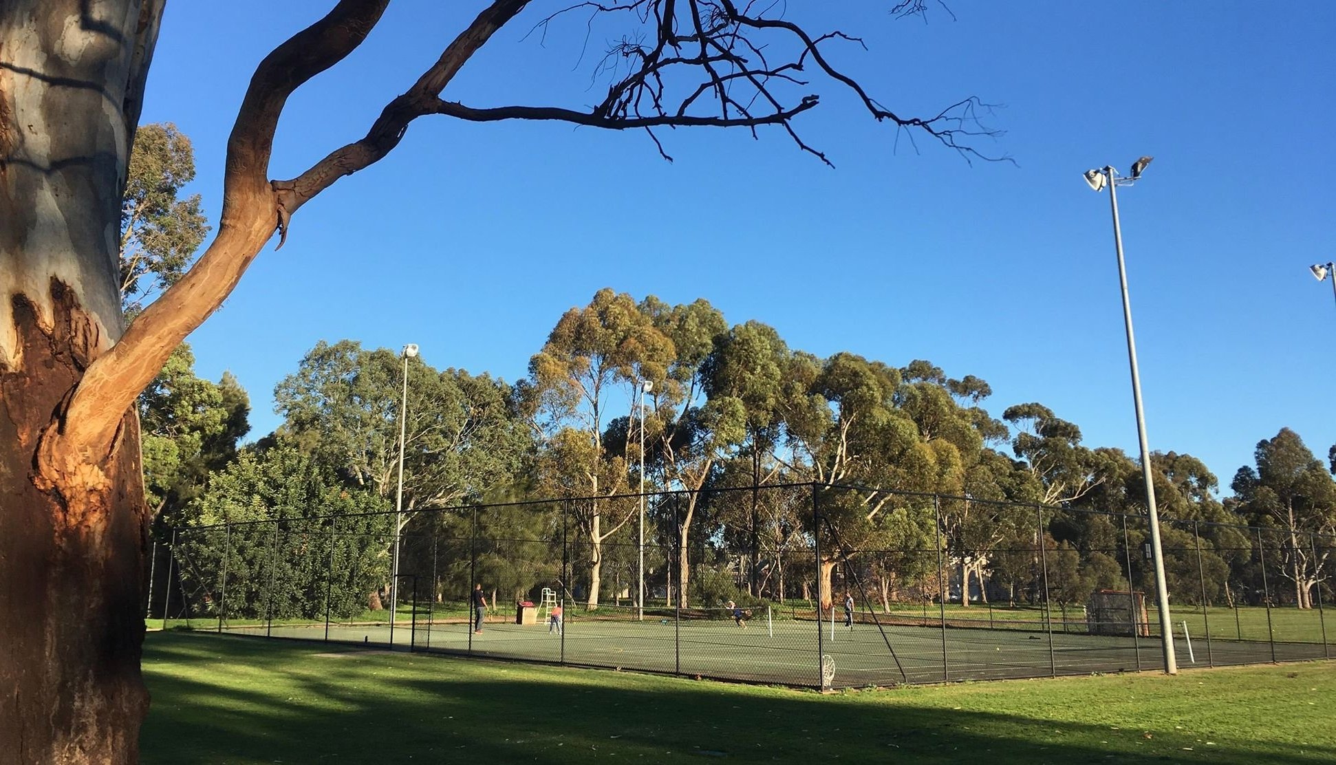
Over time it has been home to a wide range of sports including horse riding, archery, cricket, athletics, baseball, golf, hockey, tennis and cyclocross bike racing.

Horse riding across Park 6 in the 1930s (“Hawker’s Paddock” as it was then known.) Pic: City of Adelaide archives.
These fields also have an historic link to a current Aussie Rules football team in the top state league, the SANFL.
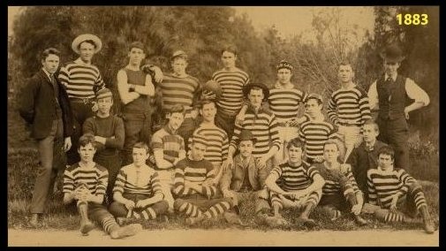
Back in 1881, a group of Prince Alfred College students came to Park 6 to play what was, at the time, the relatively new sport of Australian Rules Football.
At the time, this area was known as Hawker’s Paddock, because it was leased from the City Council by George Hawker – a politician and well-known public figure in Adelaide at the time.
This Prince Alfred College group soon grew into a team, naming themselves the Medindie Football Club. They wore PAC red and white colours and played against other local teams.
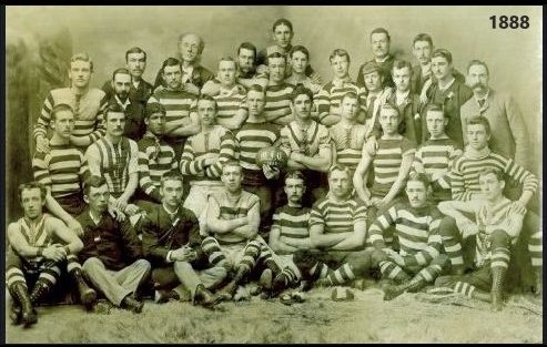
In 1888 the club joined the South Australian Football Association (SAFA), what we now call the SANFL. Soon after that the club changed its name from Medindie to the North Adelaide Football Club which is still around today.
These days, the sporting fields are licenced to Wilderness School, which is located nearby on Hawkers Road, named after the same 19th century politician, Mr Hawker. The school uses the fields for organised sport, sport training, and physical education classes. Across the field behind the tennis courts, you can see a small building that acts as their change rooms and storage for sporting equipment.
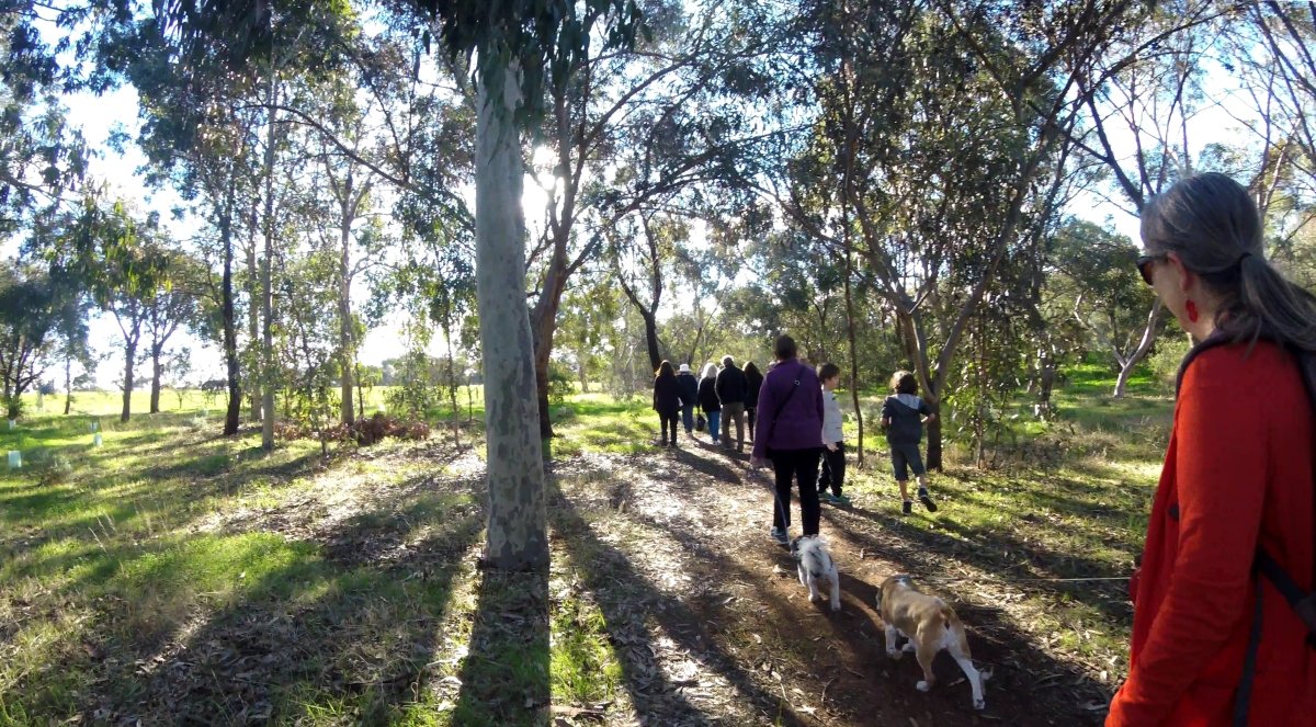
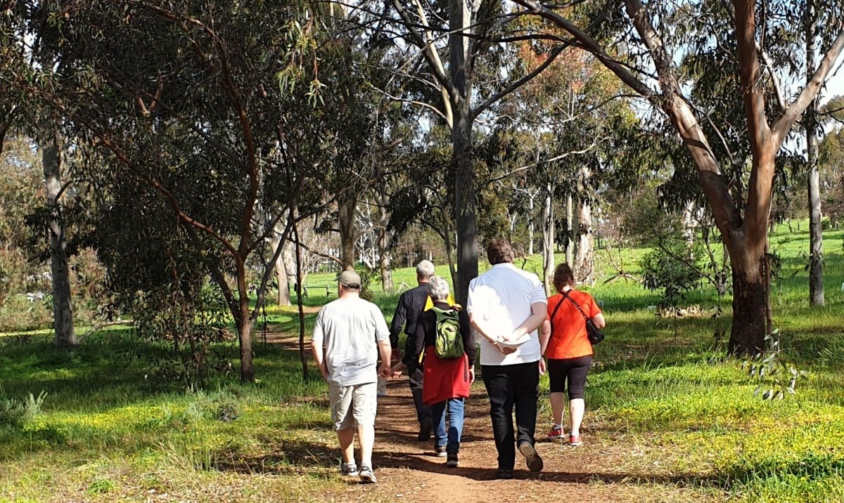
However the fields are free for the public to use when Wilderness students are not using them. Many visitors like to use the park’s fields for recreational purposes including walking dogs. The appeal of open space and paved bike paths and walking track makes the park an accessible and inviting space for neighbouring residents and the general public.
You will notice a large River Red gum a few meters west of the changing rooms. This gum was most liking planted here at the end of the 19th century.
Move over to the Bush for Life information board.

6. Bush for Life
Almost all of the native vegetation of the Adelaide Park Lands had been removed within just the first 20 years after Adelaide was settled. Early European settlers cut down almost all of the trees, from the late 1830s to the late 1850s. In the 1860s and 1870s almost all the Park Lands were bare and windswept.
The original woodland was lost to give the settlers firewood, building materials, and fence posts. Clearing the land in the mid-1800s also created more space for horses and livestock.
Revegetation efforts throughout the Park Lands began in the late 1880s, and in the time leading up to the First World War. In this Park, as in several others, the first re-vegetation efforts (in the 19th century) involved replanting around the perimeter of the Park.
A second major revegetation effort was started almost a hundred years later, in the 1980s – especially in this central area of the Park, with four new revegetation areas in the centre, to divide the horse paddocks, and a fifth re-vegetated area in the northern corner of Park 6.
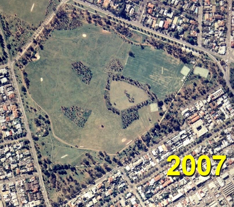
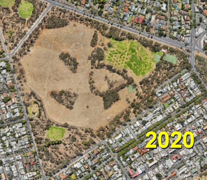
In the 21st century, the revegetation has stepped up again. In recent years it’s been driven not only by the City Council, but also by Bush for Life volunteers.
Walk up the dirt path behind the information board to where new trees have been planted by the horse dressage field.
Bush for Life volunteers have been planting not just trees and shrubs but also native grasses, to replenish the lost biodiversity. New grass plantings are marked with orange ribbon and sometimes also protected by a green sleeve. Please be careful not to tread on them!
The goal of this revegetation is to try to re-create the type of habitat and landscape that would have been here before European settlement. Planting native trees, bushes, shrubs, and grasses invites the return of native fauna. Re‑establishing native plants encourages native insects which encourages native spiders and birds and reptiles. It’s equivalent to a healing process – restoring biodiversity that was lost for more than a hundred years after the mid-1800s.
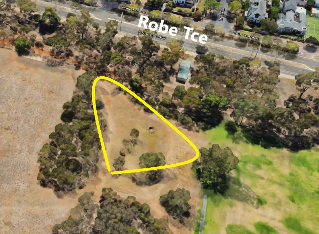
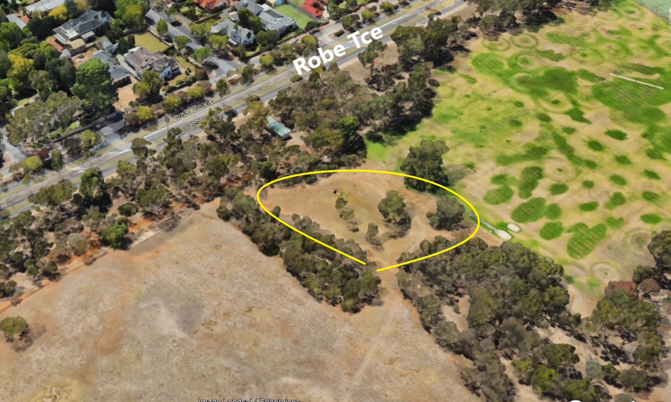
In 2024, a City Council Biodiversity report identified these areas (marked below) as one of the few Key Biodiversity Areas in your Adelaide Park Lands.

The City Council 2024 biodiversity report noted a “high diversity of native grasses” alongside River Red Gums in the area marked PCZ1 next to Kingston Terrace, and a “likely” increased diversity of native plants across all the marked zones, over the previous two decades.
Bush for Life is a South Australian organisation created in 1994 to help people conserve or restore bushland. They practise what they describe as a ‘minimal disturbance’ method.
That means they don’t hover around pulling out every weed as it crops up. Rather, they try to create the right conditions for native plants to thrive, to set seed and regenerate. Over time that will reduce the space for introduced weed plants. This practice takes time to get results, but it’s more sustainable, and less demanding on the Bush for Life volunteers.
Some of the prominent species of tree that can be found in Park 6 are Sugar Gums and River Red Gums. The largest examples are mostly around the boundary of the park – where they’ve been growing for longest. Smaller examples (planted in the 1980s) can be seen here, along the paddock fence lines near the centre of the Park.
Not all the large trees are native species. Another fairly common tree here is the Aleppo Pine, a native of the Mediterranean basin. They make a good wind break and help control soil erosion but they’re actually native to southern Europe, North Africa and Middle East.
Continue walking west along the dirt path, next to the horse dressage area. Stay on the track. Stop when you reach a wide open area, where the land is depressed, a sunken basin.

7. Stormwater detention basin
This sunken area is a stormwater detention basin. Its purpose is to hold stormwater, temporarily, and redirect it to prevent flooding.
This project effectively prevents water from heavy rains, from flooding Robe Terrace.
Once in the basin, water enters the overflow pipe directing it to the northern edge of the park to an already existing system and then connects to a drain on Mann Road (to the east). The water then gets into the River Torrens.
Unless you are a public works engineer, stormwater drainage is not an exciting subject. However good drainage serves multiple purposes. It’s largely about mitigating flood risk, but this basin also indirectly has protected native vegetation in the Park.
The construction of this basin reduced the need to remove surrounding trees. It did not require installation of huge underground pipes. It was a relatively simple and relatively inexpensive way to deal with what are fairly rare large rainfall events.
The stormwater detention basin in Lefevre Park / Nantu Wama (Park 6). Pics: Google Maps / Google Earth
When the basin contains water, it acts as a reservoir that promotes the growth of the trees nearby.
Continue along the path. Turn a slight corner left, and head west, uphill along the path still. Look out for Aleppo Pines along the path here. As you walk along the path you will notice the fence eventually turn left (to the south) taking the fence line further away from Robe Terrace. Stop at the fence corner.

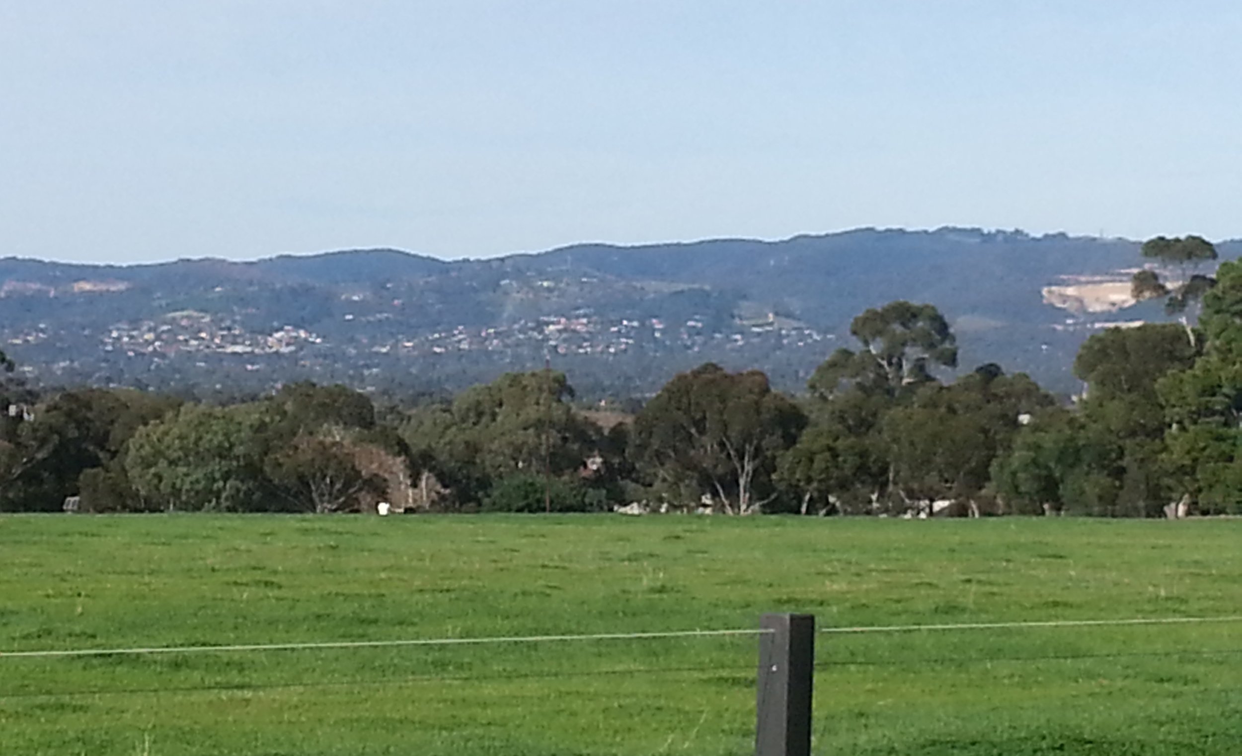
8. Sloping hillside
Here, at this fence corner, not far from the corner of Robe Tce and Medindie Rd, you are at the north-west corner of Park 6.
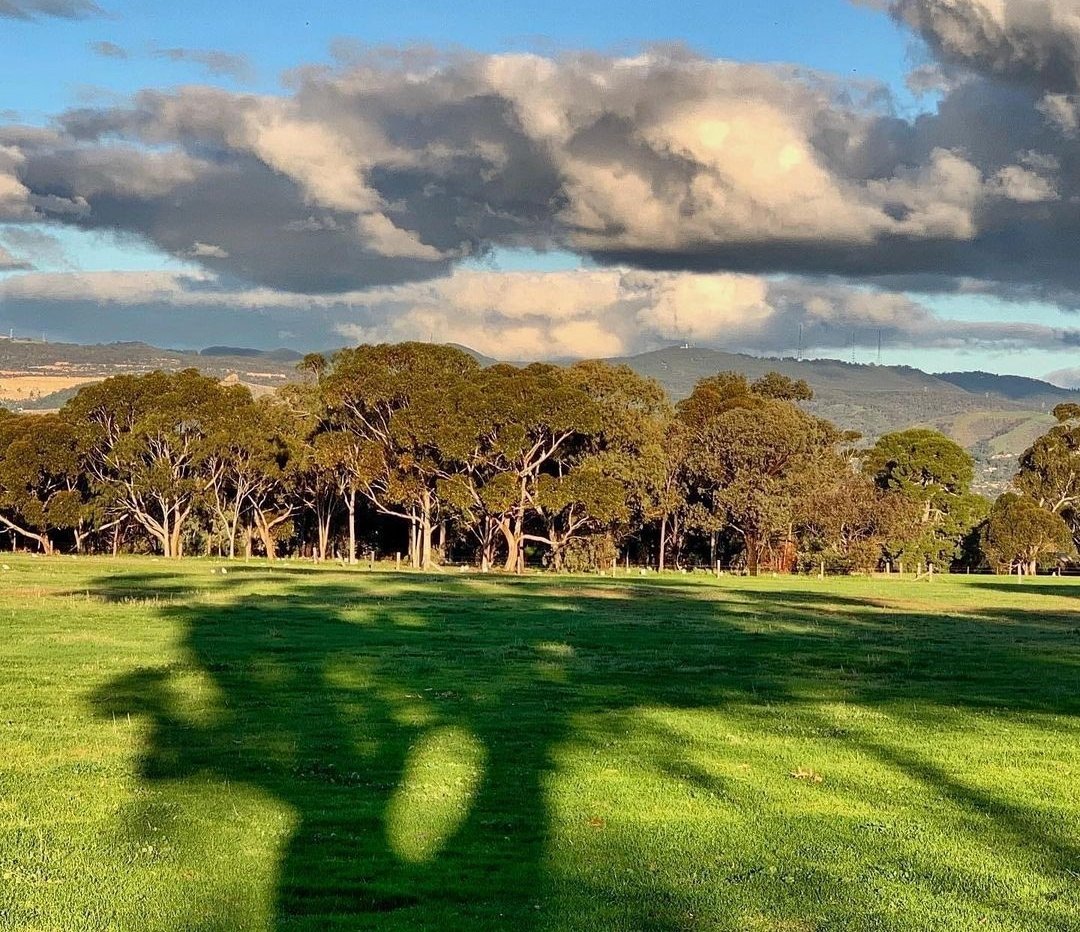
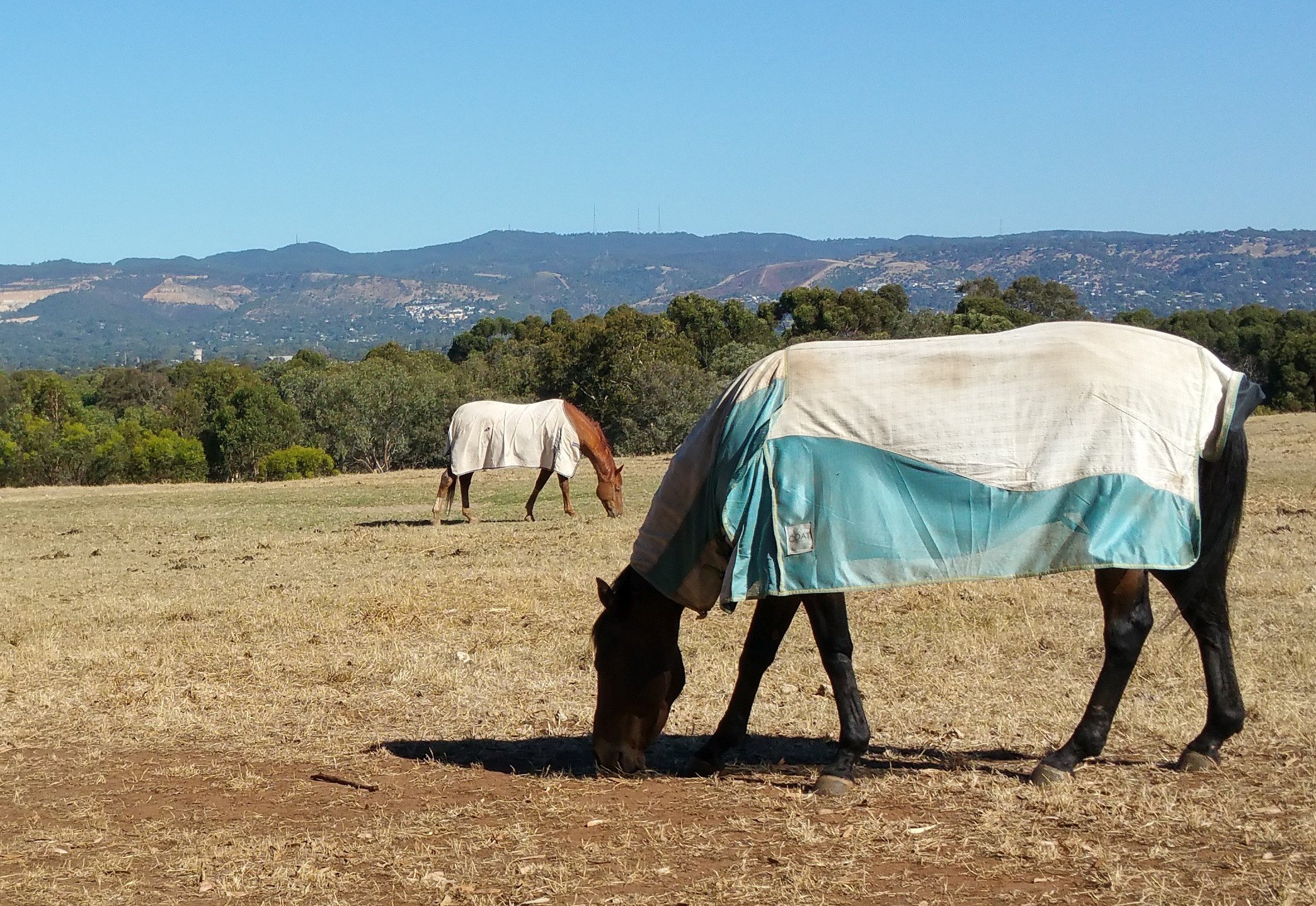
This is the highest point of land in the Park (in fact it’s the highest point in the entire Adelaide Park Lands) and it is therefore, the place where you can obtain the best view of the Adelaide Hills.
One of the features of the Adelaide plains is the topography, with the plains at the foot of a long series of rolling hills to the south and east.
The view from here is very similar to the view that Kaurna people would have had, from this spot, for tens of thousands of years.
This view is one of the reasons that Colonel William Light placed the capital city of South Australia at this location – in between Gulf St Vincent and the hills. It is an optimal location, for views such as this one.
At this location is another revegetation site – with dozens of young eucalypt trees.
Continue to follow the fence line until you reach a pedestrian opening into the paddock and enter into the paddock. This is called “Paddock Number One”, or “North Paddock”.

Map: City of Adelaide
Move directly across Paddock 1 to the fence line ahead of you, which separates Paddock 1 from Paddock 2.
Once you reach this fence, pass through the pedestrian opening and enter “Paddock Number Two” also known as “Middle Paddock” or “Medindie Road/ Lefevfre Terrace Paddock”
If you meet some horses on the way, stop near the horses (but don’t pat them or feed them).
On a rare occasion (once per month, on a Sunday morning) the horses might be changing paddocks, at a gallop! If that’s happening; don’t enter the paddock - walk around the outside of the paddock instead.

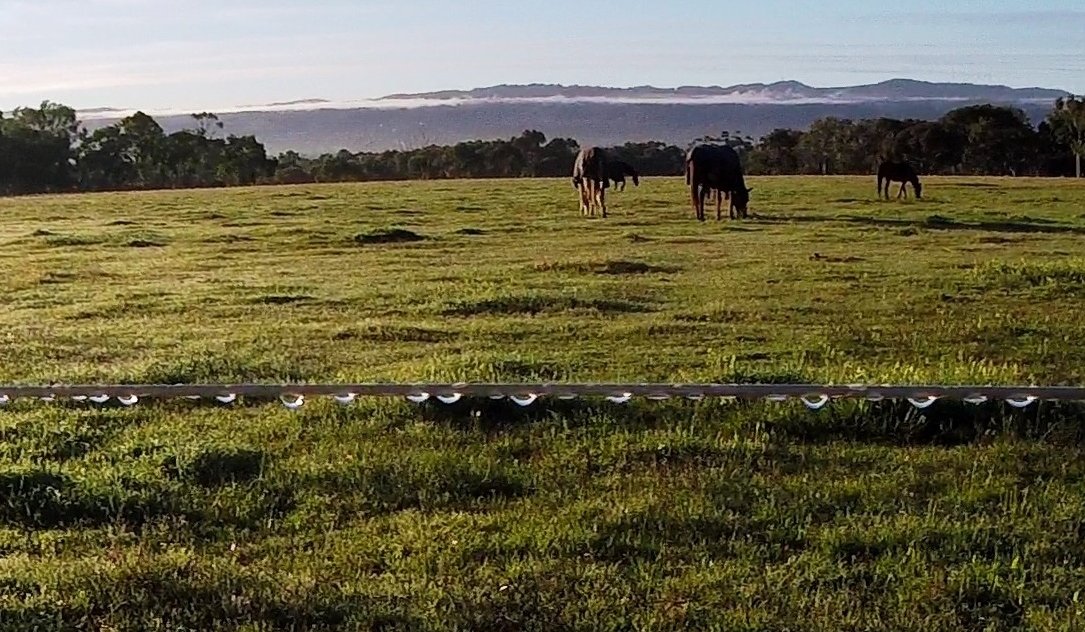
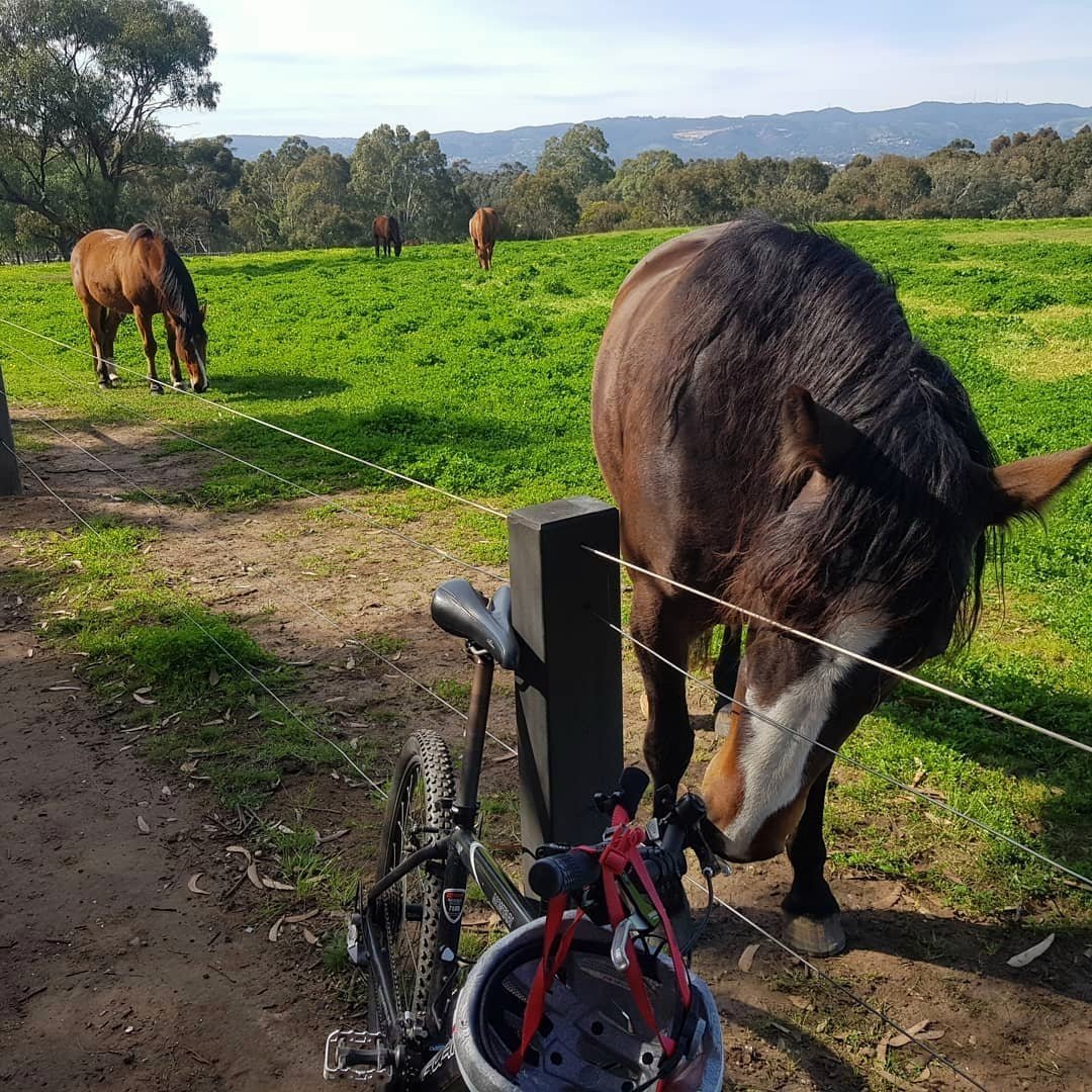
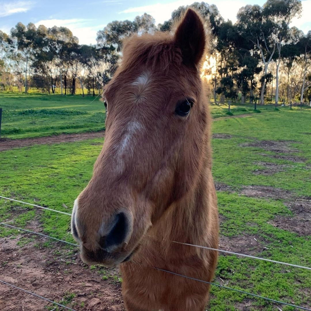
9. Horses
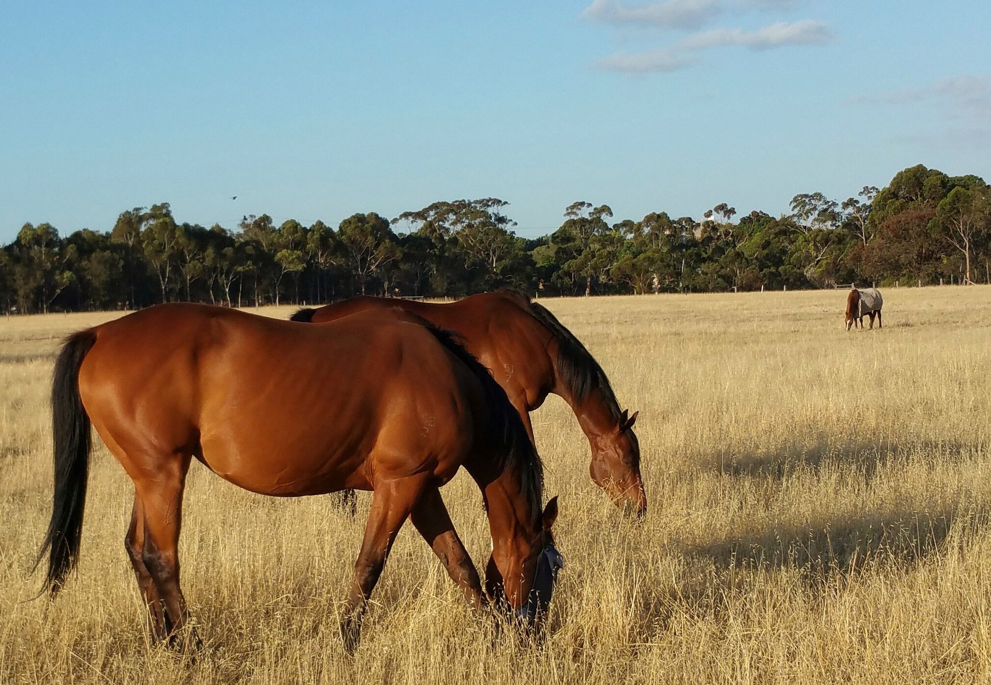
Lefevre Park /Nantu Wama (Park 6) is unique in more ways than one. A large section of the Park is a home for depastured horses which brings many visitors from around the Adelaide area.
The horses here are not agisted. They are depastured meaning they eat what grows here, or what the owners bring them to eat. Although the City Council provides the land, the Council is not responsible for feeding the horses, nor their health. If a horse dies here, the Council will not remove it. The owner has to do so.
Sometimes people complain that horses are taking Park Lands away from people. Some critics wrongly believe that the horse paddocks are fenced to keep people out. Of course the truth is the exact opposite. People can easily walk in, and anyone is allowed to do so. The fences here are designed to keep the horses IN, not to keep people OUT. The Park is Open, Green, Public.
Anyone is welcome to walk through the paddocks but you are strongly advised to avoid feeding the horses to prevent disrupting their feeding routine. Patting them is not advisable either, unless the owner is present and invites you to do so. Most horses here are likely to be tame and sociable but you can’t be sure of that, and you can be bitten or kicked so it’s safer to keep a prudent distance.
Horses have been in this Park since the mid-1800s. But these days, not just any horse can be kept here. The Council has set rules about these horse paddocks.
The owner must be aged over 18, and must live within 2km of the park.
The horse must be at least three years old, and at least 10 hands (100cm) high.
The horse can not be pregnant!
There can be no more than 20 horses living here at a time.
And there are fees. In 2025-26 the fee was $50.80 per horse, per week, or $2,641 per year.
It’s estimated the park collects 100 tonnes of horse manure a year! The horses have a wide area to roam. Their three main paddocks take up most of Park 6. The horses are rotated from one paddock to another to allow the grass to re-grow. There are four separate feeding yards, five horse troughs, and in the centre of the Park there are a couple of sanded areas, used for equestrian and dressage training.
Being around these beautiful animals in this woody environment, it is easy to forget that you are only a 20-minute walk from the city centre. Around the horse paddocks you can see some of the surviving fence structures, three-wire railed fencing and jarrah timber, that was introduced in 1885 by the Park Ranger of the day. As you move around the park, look out for these old fences. Some of the wrought iron pedestrian gates have also survived.
From here in Paddock 2 (or “Middle Paddock”) head north-west (towards Medindie Road) along the fence line to a series of metal feeding bays. There you will find an 1885 wrought-iron gate, and a pedestrian opening in the fence, where you can exit the paddock. Follow the bridle path to the corner of Medindie Road and Lefevre Terrace. Stop there.

10. Lefevre Terrace streetscape
Near the LeFevre Terrace corner you will see three very large and tall Sugar Gums. These were most likely planted at the end of the 1800s or early 1900s.
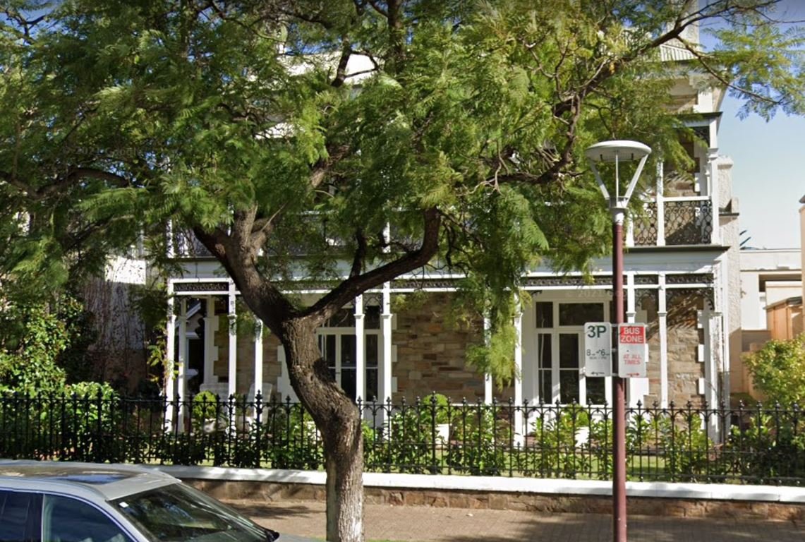
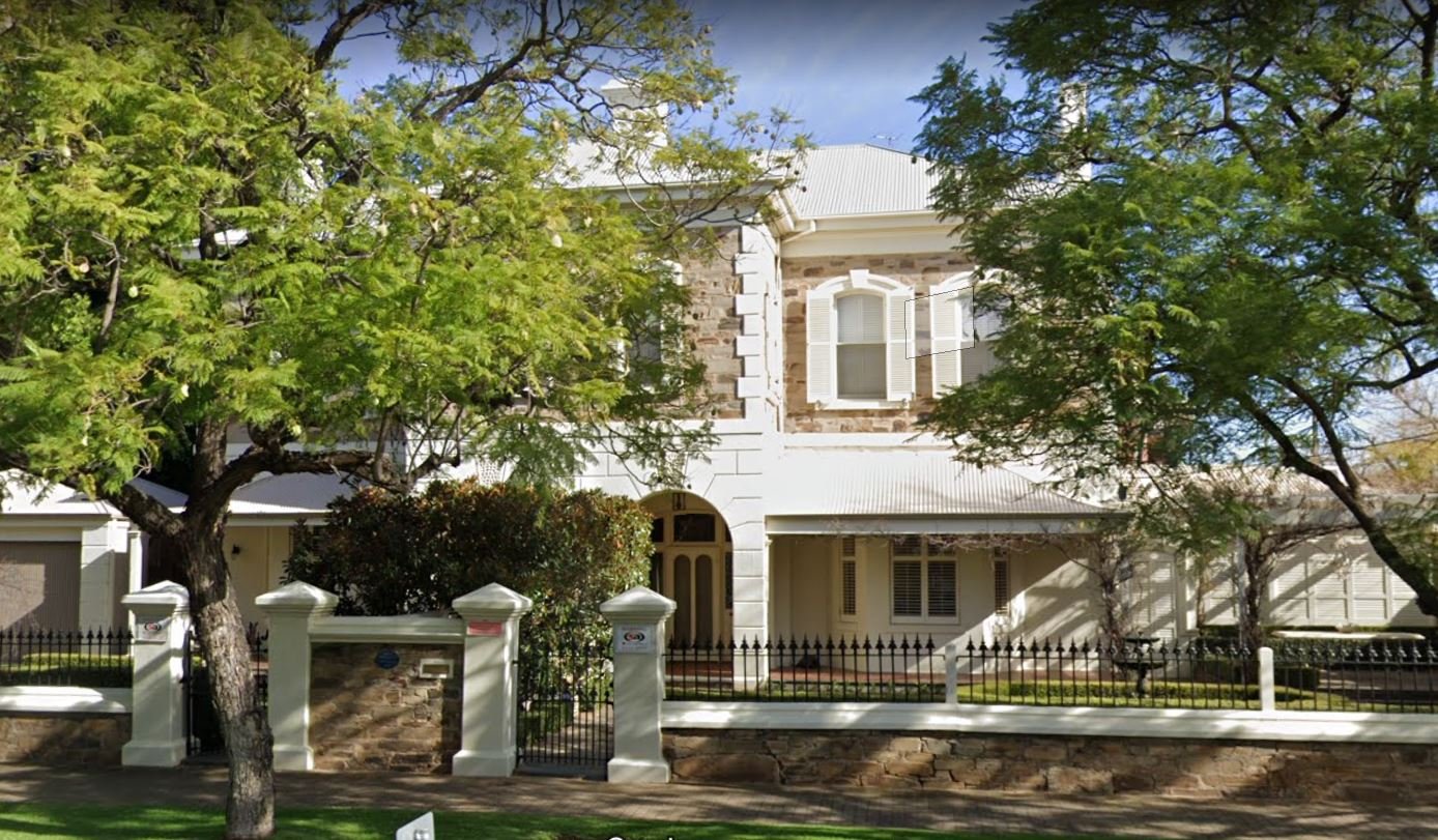
Lefevre Terrace showcases the grand scale of homes that were designed and built for wealthy owners in the mid to late 1800s.
The South Australian State Heritage Register includes 18 sites on LeFevre Terrace. Most of them are houses, but some heritage items are walls, fences, gates, and stables.
These homes were built specifically for the wealthy and prominent figures of the city. Many of them were built by the same developer, Henry Steiner. His name is featured on several of the blue heritage plaques affixed to the front fences.
The real estate near this Park is very expensive. Number 84 Lefevre Terrace, just across the road from here was sold in October 2024 for an undisclosed sum, but was valued soon afterwards at $2.7 million. Houses in nearby streets have sold in recent years for prices exceeding $4 million.
Some of the notable figures who lived on this street were:
Arthur Blyth who was the South Australian premier three times in the late 1800s. He lived in the house on the corner of Barton Terrace (96-100 LeFevre Terrace).
One of Adelaide’s Lord Mayors, Sir Lewis Cohen, lived in that same corner house after Mr Blyth, through the 1880s and 1890s.
71-75 LeFevre Terrace, now known as the ‘Princes Lodge’ motel, was built in 1913, as a residence for Arthur Waterhouse, a prominent businessman of the time. The style of the house is described as “Edwardian free classicism”
On the southern corner of Lefevre Terrace and Tynte Street (#60, one of the Steiner houses) was the residence of two of Adelaide’s most famous scientists, the Nobel Prize-winning father and son team of William Henry Bragg and William Lawrence Bragg.
A few doors further south, (#53, between Tynte Street and Archer Street) is the former home of E S Wigg, an early South Australian printer and bookseller. (The historic E.S. Wigg stationery building is still on Port Road at Thebarton). Number 51-53 LeFevre Terrace, is a two-storey mansion which was built for him.
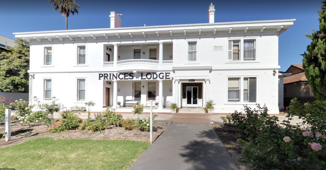
From left: Former E.S. Wigg house, at 51-53 Lefevre Tce; the former Arthur Waterhouse hoouse (Princes Lodge) at 71-75 Lefevre Tce, and the former Arthir Blyth and Lewis Cohen house at 96-100 Lefevre Tce. Pics: Google Streetview
In recent years some of the historic houses of Lefevre Terrace have made way for modern, two storey, narrow-fronted town houses.
However, you don't have to be a millionaire or live on Lefevre Terrace to enjoy this Park. The Adelaide Park Lands are Open, Green and Public. They are not just for the rich, nor solely for those who live nearby.
They are for everyone, including your descendants!
Now, keep walking along the edge of Lefevre Terrace to return to the starting point of this Trail Guide, the Glover North playspace.

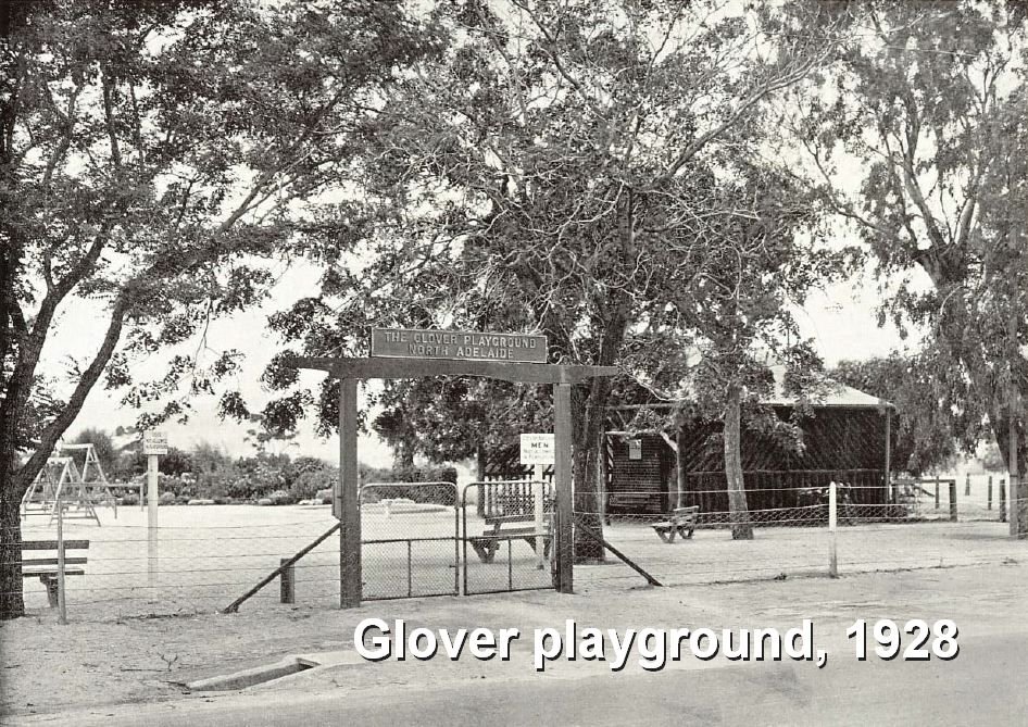
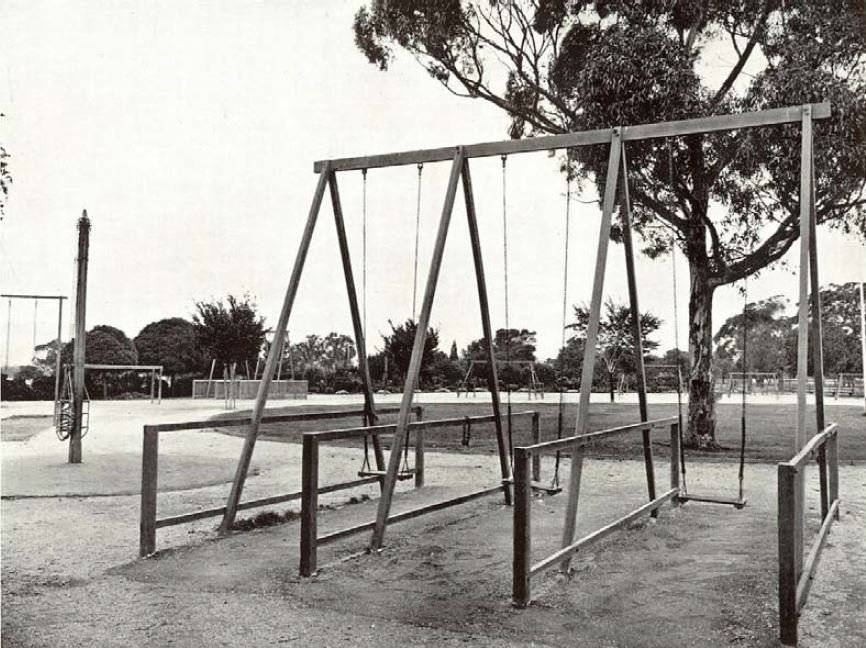
11. Glover North Playspace
.
This is the Glover North playspace, also known as “Helicopter Park”.
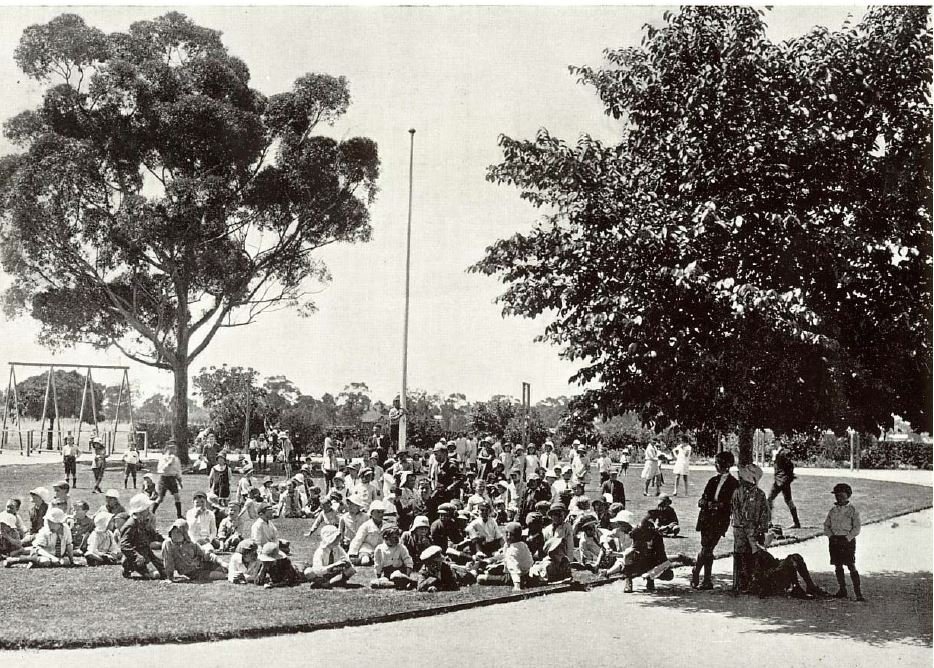
This playground has been around since the 1920s. It’s named after the Lord Mayor of Adelaide at the time, Charles Glover, who helped pay for and establish three playgrounds in the Park Lands. Each one of the three still bears his name. The other two Glover Playgrounds are on South Terrace in Park 20, and on the corner of East Terrace and Wakefield Rd in Park 15.
These playgrounds served to bring some well-being and happiness to the children of Adelaide immediately after the First World War when many children would have lost their fathers, or had a father who was severely injured or disabled by the war.
Pics: City of Adelaide archives
The playground here today looks very different to the way it looked in its early days in the 1920’s. There are some historical photos on display, on a sign near the Lefevre Terrace entrance of the playground. In the late 1920s approximately 150 children were recorded visiting the playground each day. In those days there was a supervisor on site. These days, no-one is keeping count!
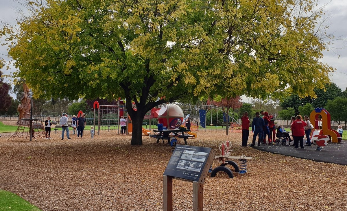
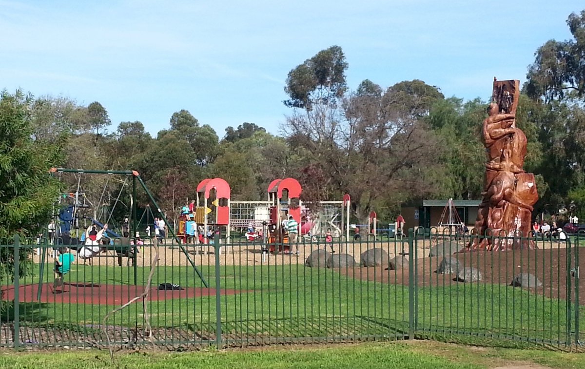
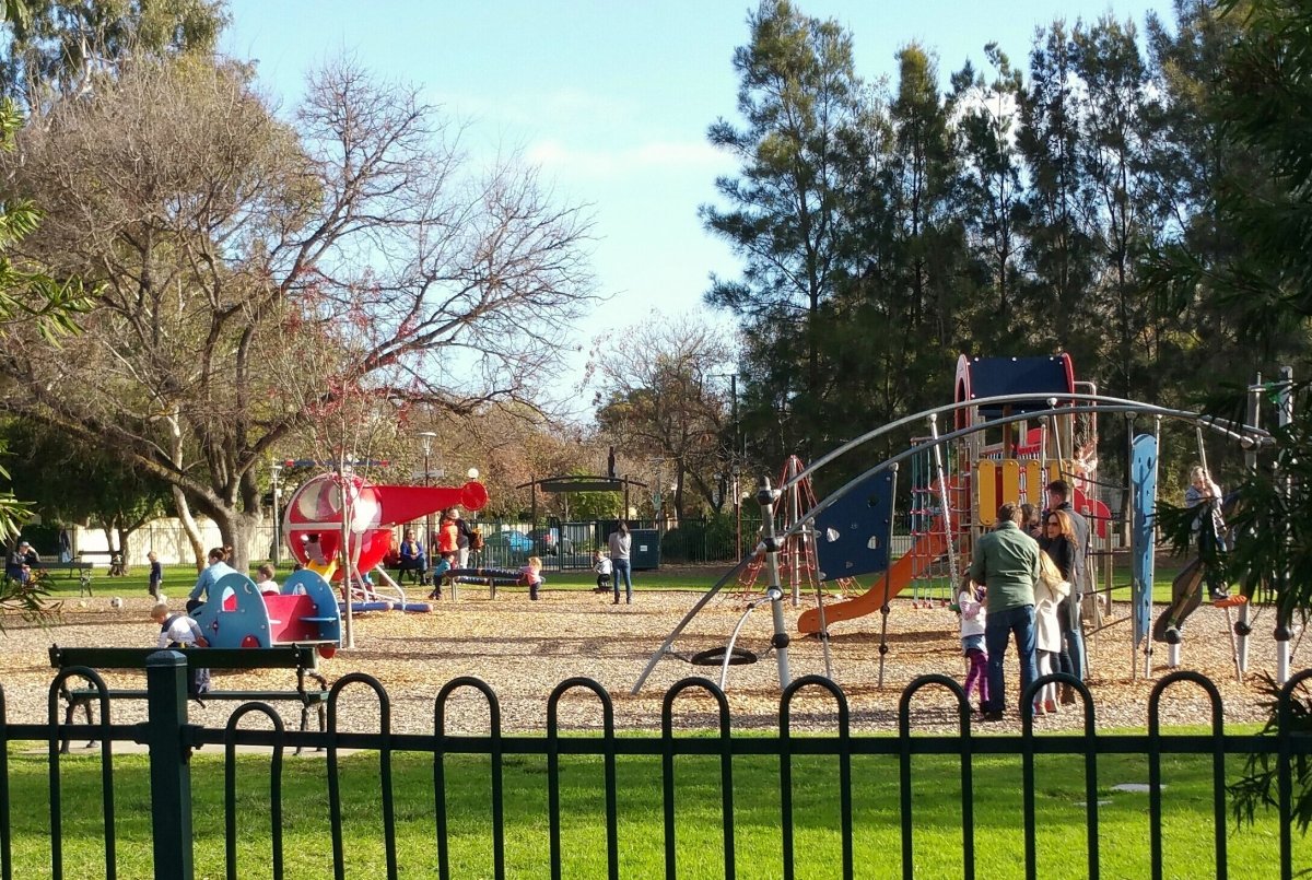
The playground has earned its nickname from its centre-piece play equipment, the helicopter, which remains one of its main attractions.
One of the former features of the playground was a small addition called a “Little Library for little people”. It was built in 2014 by volunteers with the financial help of the Adelaide City Council.
It was located under the shelter of the bathroom block. It was brightly coloured to attracted curious children.
However after six years, in October 2020, the library was destroyed by vandals. In 2026, it was still “checked out” indefinitely.
Optional: download and print a tri-fold leaflet, i.e. a double-sided single A4 page, with a brief summary of this Trail Guide:. (PDF, 1.2 Mb)
All of our Trail Guides and Guided Walks are on the traditional lands of the Kaurna people. The Adelaide Park Lands Association acknowledges and pays respect to the past, present and future traditional custodians and elders of these lands.