

Take the Trail
Begin at the Par 3 golf course shop, off War Memorial Drive near the River Torrens weir.
This Trail is on the traditional land of the Kaurna people. First Nations people are advised that this Trail Guide contains the names of persons who have died.

1. Introduction and Naming
2. War Memorial Drive
3. Golf today
4. Native location
5. Watering
6. First public executions
7. Golf history
8. Trees and wildlife
9. Tennis courts
10. Neidpath; and military history
11. Calvary Hospital
12. Carriageways; and future of golf
13. Torrens Lake and weir (back to start at #1)
Optional: download and print a tri-fold leaflet, i.e. a double-sided single A4 page, with a brief summary of this Trail Guide: (PDF, 4 Mb)

1. Introduction and Naming
We begin this walking trail at the beginning of the Par 3 golf course.
At 76.1 hectares in size, this park contributes almost 10% of the total Adelaide Park Lands area. This makes it one of the largest parks. To the north and east, it is bordered by Jeffcott Road, Barton Terrace West, Mills Terrace, Strangways Terrace, and Montefiore Road. The Park’s western boundary is the Gawler Railway line. The River Torrens acts as a southern border,
Since European settlement, this park has been used for military, recreational, leisurely, political, and cattle grazing purposes. Today, its most common use is for not one, but three golf courses spread across the entire area. We will be looking at the history of golf, and the other uses of this park, in greater detail later in the walk.
Like most of the Parks in the Adelaide Park Lands, this park has three different names. It’s first, and most simple name is Park 1. The name “Park 1” was assigned in the 1960s, after several smaller parks were combined into the larger park that we see today. it was believed that management of the courses and Park Lands would be more efficient if they were named as one park, rather than four.

A 1927 map showing “municipal golf links” on No. 27, and to the north, #28, #29, and #1. All of these have since been re-designated as the large Possum Park / Pirltawardli (Park 1)
The second name of this park is in Kaurna language. In March 2000, “Pitawodli” was adopted as an official name by the Adelaide City Council. In 2013, the spelling was changed to “Pirltawardli”, which we now use today. “Pirltawardli” means “Possum Place”. In 2017 the City Council decided to use the name “Possum Park” as well as “Pirltawardli”.
Here at the start of the walk, opposite the shop, there is a putting green, for golfers to practice their putting before they head out to play a round of golf.

The putting green opposite the golf shop.
From this point, walk through the carpark driveway towards War Memorial Drive.
On your left you will see a bronze statue of a possum, in tribute to this Park’s name. It’s one of two possum sculptures in the Adelaide Park Lands – both by local sculptor Silvio Apponyi. The other one is in G.S. Kingston Park / Wirrarninthi (Park 23).
Cross the road, and stop in the shade of the first cluster of trees after the entrance.

2. War Memorial Drive
.
As World War I came to an end, war memorials became a topic of interest in Adelaide. After four long years and many lives lost, the city wanted to publicly commemorate all soldiers who had died in battle. In March 1919, a War Memorial Drive was suggested by the Lord Mayor, Charles Glover. This suggestion was met with unanimous approval from the Council.

Moreton Bay fig trees on War Memorial Drive, pictured in 1928
Donations were made by the Council, Commonwealth Government, and Mayor Glover. Soldiers who had returned from the War were employed to build the Drive, which was completed in four separate sections. The first section opened in October 1919 and stretched from Frome Road to King William Road.
The second section was from King William Road to Montefiore Road, and opened early 1921. This part of War Memorial Drive (the third and fourth sections) continued to stretch northwest towards Barton Terrace. The project was completed in October 1925.

A sketch by Eugene von Guerard, c 1858. Looking westwards from the vicinity of King William Road it shows how early European settlers cut down most trees in the Adelaide Park Lands.
From here, turn left and walking eastwards, follow the line of trees along the edge of the golf fairway, off War Memorial Drive until you come to two park benches, and two bins. You can rest here on one of the benches. (There are two road signs here: ‘No Standing’ and ‘You are within a 4-hour Parking Area’. )

3. Golf today
Park 1 is most known for its golf courses. With three in total, these golf courses are managed by the City of Adelaide, as they are all part of the Park Lands, and part of Park 1.
You don’t have to be a member of a golf club to play here, as it’s a public course. But you can of course join a club.
There are three golf clubs whose members play here: the “Shell Golf Club”, the “Australia Post-Tel Institute (API) Golf Club” and the North Adelaide Golf Club, which is one of the oldest golf clubs in South Australia. The North Adelaide Golf Club is described as the “resident” golf club.
The largest golf course is the South Course, which measures 5.9 kilometres in length. This course hosts many golf competitions, including the prestigious Lord Mayor’s Golf Trophy each year in April.

Image: City of Adelaide
The North Course is the oldest of the three courses in this park and is shorter, measuring 4.5 kilometres. Like the South Course, the North Course has 18-holes. It often hosts Golf SA Junior events and is considered easier than the South Course. It’s described as "ideal for new golfers or those wanting a quick round.".
The final course in this park is the Par 3 course, which is located between the River Torrens and War Memorial Drive. It is the smallest and easiest course out of the three.
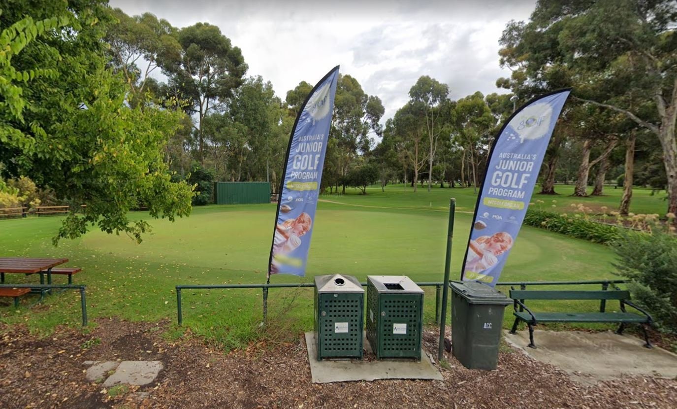
This park also has a driving range for people to practise their swinging hits, two free putting greens for people to practise their technical putting skills, and a free chipping green for people to practise short-range hits.

Teeing off in 2022. Pic: James Elsby
Across all three golf courses in Park 1, players are expected to follow basic golfing rules. There is also an additional list of rules from the North Adelaide Golf Club.
A dress code applies to all people using the golf facilities, or walking through the golf courses. Leather thongs and sandals are allowed in the clubrooms, but not rubber thongs or sandals. Smart denim is okay, but not tracksuits, tank tops, or cargo pants. In the clubrooms, you aren’t allowed to wear any golf shoes, hats, or caps. Shirts with bold advertising or slogans are not allowed.
There are also weather policies for players at North Adelaide Golf Club. For women, if the temperature is forecast to be over 35 degrees, all major competitions will be postponed. For men, this limit is 39 degrees. If the weather gets stormy, it is up to the Club if they close one or all the golf courses.
And, in a world of COVID-19, a rule introduced on 31 January 2022 was that only vaccinated or exempt members were eligible to register for competition play or enter the clubrooms.
During the COVID-19 pandemic, there was a major uptake in playing golf Adelaide. This was true for the three courses in Park 1, with almost 90,000 rounds of golf played during 2021. This was almost double the figure of the previous year, 2020.
From here, continue straight down the line of trees, along the edge of the Golf Course, until you reach a large clearing, next to the Excel-Loo public toilets on War Memorial Drive.

4. “Native location”
If you look across War Memorial Drive at this point, you will see part of the Par 3 golf course, and behind it, a railway bridge over a bend in the River Torrens / Karrawirra Pari.
This is one of the sites where Indigenous Australians tended to gather after European settlement. The settlers took advantage of that fact, by using the area as a place to contain the Kaurna people and prevent them from going into the newly formed town of Adelaide.
In 1838, just over a year after European settlement, over five hectares of Park 1 had been put aside to establish what became known as the “Native Location”.

An 1842 map by surveyor G. S. Kingston, showing the site of the “Native Location” across the River Torrens / Karrawirra Pari from the Adelaide Gaol which had been built only a year earlier.
This “Native Location” is where Kaurna people were forced to live. The area included a store, a Lutheran missionary schoolhouse, a house for an interpreter, and a collection of huts for the Kaurna people to live in. European observers would live alongside the Kaurna people to try and record the Kaurna language and cultural practises. There were also attempts by German missionaries to convert the Kaurna people to the Lutheran church, though they were unsuccessful.
The establishment of a Native Location didn’t last long. Seven years after the Location was established, the European settlers had relocated most of the Kaurna people and torn down many of the buildings. The Kaurna people were moved into a site near Kintore Avenue east of Government House, while Kaurna children were required to attend a new native school nearby. Meanwhile, soldiers involved in construction work, known as Sappers, moved into the remaining buildings at the old Native Location in Park 1.

An image showing the approximate location of the buildings on the ‘Native Location’ including the ‘Sappers Quarters’ on what late rbecane the Par 3 golf course. Reproduced by David Jones (2007) in his Cultural and Landscape Assessment of the Adelaide Park Lands.
From this point, keep following the tree line along the edge of War Memorial Drive, until you come to a bitumen track that heads sharply uphill. Turn right onto the track. Look for a purple plastic cover embedded in the ground.

5. Watering
Purple is the colour used for reticulation of treated waste water.
Because of its massive size, and because it needs to maintain three golf courses, Park 1 requires a lot of water. This water is delivered through the Glenelg to Adelaide Park Lands Recycled Water Project.
Every year since 2010, almost 4 billion litres of recycled water has travelled from Glenelg to Adelaide. The water travels through 50km of underground piping and passes through several stages of treatment plants before reaching the Park Lands. The recycled water is distributed using purple-coloured pipes which are readily identifiable.

Installing the Glenelg-Adelaide pipeline in nearby Park 26, in 2010. Pic: Leed contractors leed.net.au
Despite being safe for irrigation purposes, the water is a little too salty for people to consume (so don’t go running through the sprinklers with your mouth open!).
Because of this initiative, the Park Lands are no longer dependent on the River Murray for water. There has also been a reduction in the amount of wastewater that runs into Gulf St Vincent, since it is being treated and then used in the Park Lands. For these reasons, the Recycled Water Project has made the Adelaide Park Lands easier to manage, and more sustainable for our state.
From here, walk up the bitumen pathway and stop at a golf tee, before you reach the street.

6. First public executions
This is very close to the site of the first public hanging in South Australia.
In the 1800s and 1900s, South Australia, like many other places in the world, used capital punishment as the most extreme form of criminal penalty. In total, 66 people were hanged in the state before capital punishment was abolished in 1976.
In the early days of the colony, from 1839 to 1858, all hangings would take place in a public setting. The executions attracted thousands of spectators. Many of these public hangings took place in this Park, including the first hanging in the State. In fact, you are now overlooking the spot where the first hanging took place!
Michael Magee was hanged on the 2nd of May 1838, after attempting to kill the Sheriff. It was believed that Magee was a runaway convict, which gave more reason for authorities to sentence him to hanging. The site of the execution was at a large gum tree about “100 yards from the Iron Stores in North Adelaide”.
It is said that Magee addressed the crowd before he was hanged, confirming that he was guilty of the crime but denying that he was a convict. Magee struggled a great deal as he was being hanged. This made the crowd of more than 500 onlookers cry out “murder!” but it is not clear if this was aimed at the hangman or Magee.

Sketch of the Magee hanging by J.M. Skipper. Image: State Library of South Australia [B 7797]
At least two other hangings took place in this Park. Both occurred in May 1839 and were the first hangings of Kaurna people. Wang Nucha and Yerr-i-Cha were each convicted of murder (two separate murders). They were both hanged in front of the Iron Stores which was a building down the hill a few metres from Strangways Terrace.
The Register newspaper reported on 1 June 1839 “on passing the native huts immediately after the execution, we found the women and children, and many of the men lamenting, in a most piteous manner.”
By 1858, many people were opposing the public nature of hangings, so the Government passed an Act to make all hangings a private matter. Therefore, after 1858, most hangings took place within the grounds of the old Adelaide Gaol. In the same year, after four Kaurna men murdered a mother and her two children, the Act was changed so that Kaurna people could be hanged at the place of the crime.
Law reform occurred in 1964, when capital punishment was banned for most crimes. However even after that date, it remained legal for Aboriginal Australians to be publicly hanged, until that was abolished eight years later, in1972.
From this point, head north-west and walk towards a line of trees, with very dark trunks, that are separating two golf fairways. These are red ironbark trees (eucalyptus sideroxylon). Walk to the end of the line of red ironbarks, taking care not to stray into the golf fairway.

7. Golf history
North Adelaide golfers in 1923
At this point, you are in-between two golf fairways, running roughly north-south between War Memorial Drive and Mills Terrace.
Golf in South Australia can be traced back to the 1870s after being introduced by Scottish settlers. What is now known as the North Adelaide Golf Club was formed about twenty years later, in the early 1890s. Solicitor William Pope was the club’s founder, along with a small group of professional men who lived in the area.
In 1904, the club was officially named North Adelaide Golf Club and opened to the public. It had 9-holes, and measured around 2.5 kilometres. Within a year, its membership stood at 112 members. Nearly half of these members were women.
Despite its popularity, there was not enough funding to establish a water service to keep the grass in good condition. There was also not enough funding to build strong fences around the courses. Without these fences, golfers would often need to pause a game and wait for grazing cattle to clear off a course.

Sheep grazing on the golf course
By 1921, the Club was taken over by the City Council. The 9-hole golf course was extended to 18-holes, and an official club house was built at a cost of £999. In today’s currency, that is approximately $85,000. Links between different courses were also established across the park. Within the next ten years, stronger fences were built around the golf course to keep cattle off the grass.
A second 18-hole course, today known as the South Course, opened for public use in 1950.

Teeing off in 1959. Pic: City of Adelaide archives
By the next decade, a smaller 9-hole course was built near the River Torrens. This smaller course soon expanded to 18-holes and is today known as the Par 3 course.

The North Adelaide golf courses in the 1960s
From this point, turn right and walk uphill towards Mills Terrace. You will need to cross two golf fairways to reach the street, so look carefully for golfers who might be about to drive along either of the fairways. Continue uphill until you reach the street.

8. Trees and wildlife
Over 30 different tree species can be found in Park 1. These include South Australian native trees like the sugar gum, but also lots of trees from other States and elsewhere in the world. For example, the Lemon-scented Gum tree (Corymbia citriodora) is native to New South Wales and Queensland but has been planted extensively throughout Adelaide and suburbs.
Along the side of Mills Terrace you will see many examples of Aleppo pines (Pinus halepensis), Kurrajong trees (Brachychiton populneus) and Pepper trees (Schinus molle). All three of these are very common within the Adelaide Park Lands although none of them are native to the Adelaide region. The Pepper tree is native to Chile. They are characterised by their drooping leaves and deep pink berries, which is what gives the tree its common name.

A knarled pepper tree off Mills Terrace in Possum Park / Pirltawardli (Park 1)
Within this Park there are also trees from Europe, North Africa, East Africa, the Middle East, and North America. In other words, a tree from almost every continent!
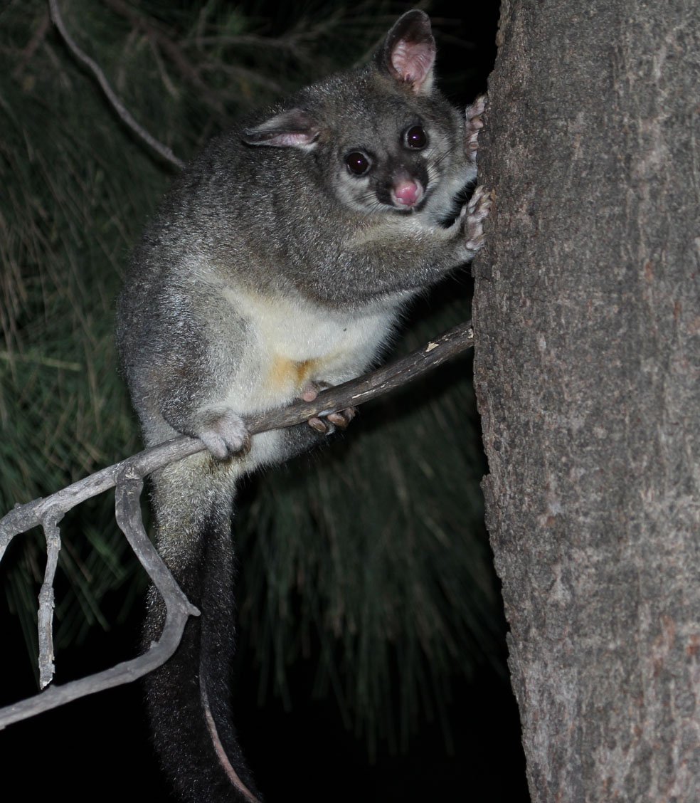
A brush-tailed possum in the Adelaide Park Lands. Pic: naturallysouthaustralia.com
Park 1 is home to many different animal species. When going for a casual walk around the park, it is not uncommon to see a variety of possums, or birds such as parrots and pigeon or dove varieties. This has always been the case. Grey-headed flying foxes established a colony in Botanic Park in around 2010 and they are also sometimes found here in Park 1, eating the Moreton Bay figs and other food before they head back to roost in Botanic Park.

Grey-headed flying foxes in the Adelaide Park Lands. Pic: City of Adelaide
As mentioned above, there used to be grazing cattle throughout the park, much to the annoyance of Adelaide golfers. There were also records of bilbies throughout the park, and other beloved Australian mammals such as platypuses and echidnas. Unfortunately, with land-use change there has been a decline in the number of mammal species in the Park Lands. About two thirds have disappeared. Of these, half have become locally extinct from this area.
From here, walk south along the edge of Mills Terrace until you come to a tennis court that is fenced in timber.

9. Tennis courts
As early as the 1860s, South Australians were playing tennis. Many tennis courts were known as “racket courts” or “racket grounds” at this time, and were always established with lawn rather than the concrete or clay we often see today.
Some of the courts were built in parks, some were built in residential areas along our coast, and there are even records of a court in the Adelaide Lunatic Asylum. This Asylum operated on North Terrace between 1852 and 1902 in what is now part of the Botanic Garden. Many of the patients were encouraged to play tennis as part of their “treatment”.

Lawn tennis court off Mills Terrace
This wooden-fenced grass court was built in in the early 1920s near Mills Terrace.
In the past it was reserved for local residents. Now, it is open to the public, but only in the warmer months between October and May.
There are two other tennis courts nearby; one to the north and the other to the south of the wooden-fenced court. These more recent tennis courts are metal fenced.
There are other tennis courts within Park 1, but they are far from here, south of War Memorial Drive, near the corner of Montefiore Rd, the River Torrens and the Par 3 golf course.

Tennis SA courts off War Memorial Drive in the south-eastern corner of Possum Park / Pirltawardli (Park 1)
Tennis SA has a long-term lease over those courts, making them effectively a privatised part of your Park Lands.
In 2018, they were upgraded to include a pavilion and new clay-surface. The pavilion within the fenced area is named in honour of Dennis Dall, a former President of Tennis SA.
From here, keep walking on the eastern edge of the Park, on the edge of Mills Terrace, turning right, then left and left again. Stop on the edge of the golf course opposite number 125 Strangways Terrace, a mansion with the name “Neidpath”.

10. Neidpath; and military history
This is one of the most well-known historic mansions in North Adelaide.
Designed in 1910 it was built for industrialist James Wigham McGregor, who ran a woollen mill at Hindmarsh.

Neidpath pictured in 1931. Image: State Library of SA B-6015
However for almost 50 years it was the home of a TV station. When TV broadcasting started in Adelaide in 1959, this building was the home of what was known at the time as ADS-7. It swapped call signs to become Channel 10, and stayed in use as a TV station until 2007, when Channel 10 moved to the corner of Hutt Street and Wakefield Street in the city.
Despite being a commercial work site for 48 years, the heritage integrity of the building is largely intact.
Now turn your attention back to the Park side of the road. On the side of Strangways Terrace, on the edge of the golf course, you will see white cedar trees here, along with several very large specimens of Aleppo pines along with a couple of white cedar trees. White cedars are also known as a “chinaberry” or “syringa berrytree” or “bead tree”. There are many of these trees in other parts of your Adelaide Park Lands, especially in Rundle Park/ Kadlitpina (Park 13) where they line both sides of the pedestrian pathways.
Further away to the south you can see a golf driving range.

Opposite Neidpath, large Aleppo pines (Pinus halepensis) and a white cedar tree (Melia azedarach)
However if you were here in the late 1800s or early 1900s you would have seen something very different from golf.
As a large, open, and flat area, Park 1 provided the perfect location for military activities. Training camps were based in the south-eastern region of the park, where the South Australian Military Force would often engage in training exercises. The military presence was from the late 1800s through to World War 1, and was a major reason for the slow pace of Park 1’s development. There was also a military takeover of part of Park 12 – for the Torrens Parade Ground and Drill Hall in Park 12 off King William Rd.
The exact date when the South Australian Military Force stopped using this part of the Park Lands is unknown. However, it was likely to have been either during, or immediately after World War 1 (1914-18). The establishment of the Keswick barracks in 1912 reduced the need to use Park Lands for military training purposes. And of course, immediately after World War 1, there was no longer an urgent need to train soldiers to fight overseas.

An 1885 painting by Edmund Goldsmith “Adelaide looking from Montefiore Hill”
From the 1850s to the 1870s, a lot of limestone was excavated from Park 1. Part of this reason was to create holes in the ground for trees to be planted. Another reason was so that the limestone could be used for building projects.
In the 1880s, there was a dip in how much limestone was taken from Park 1. But in 1894, almost 3,500 cubic metres of limestone was removed in one year and sold for £75. In today’s currency, that amount of money would be almost $18,000!
As Park 1 started to be landscaped and the golf course grew in popularity, the extraction of limestone slowed down. By the 1910s, it had come to an end.
Continue east alongside Strangways Terrace on the edge of the golf course, until you reach the Calvary Hospital.

11. Calvary Hospital
.
There are many heritage-listed buildings along Strangways Terrace. Each one is like a glimpse into Adelaide’s past, showing us how people lived and worked in the late 1800s and early 1900s. One of the most significant examples of a heritage-listed building is the Calvary North Adelaide Hospital, which was given heritage status in 1986.
When the Calvary Hospital was built in the late 1880s, it was known as simply the North Adelaide Hospital. At the time, it was run as a private hospital by Mrs. Isobel Baker. In 1900, it was taken over by the Sisters of the Little Company of Mary. These Sisters were part of the Roman Catholic Church, and had sailed to Australia from England. They first arrived in Sydney in 1884, where they established a small hospital. They then came to Adelaide in 1900, the same year they took over the North Adelaide Hospital.

Calvary North Adelaide Hospital, on Strangways Terrace, overlooking Possum Park / Pirltawardli (Park 1), pictured at the time of its opening in 1880. Pic: State Library of South Australia: B2893
In 1997, the Sisters of the Little Company of Mary established a non-for-profit organisation called the Little Company of Mary Health Care. The Calvary North Adelaide Hospital is one of 14 hospitals, 19 Community Care Service Centres, and 72 Residential Care and Retirement Communities across Australia. The Calvary North Adelaide Hospital is one of the oldest establishments in the Little Company group.
Now, the large, red brick building has around 156 beds, and provides a range of medical services for the Adelaide community. One of its main functions is as a maternity hospital. More than 80-thousand babies have been delivered here since 1902, and some of those babies have grown up to become midwives at the same hospital.
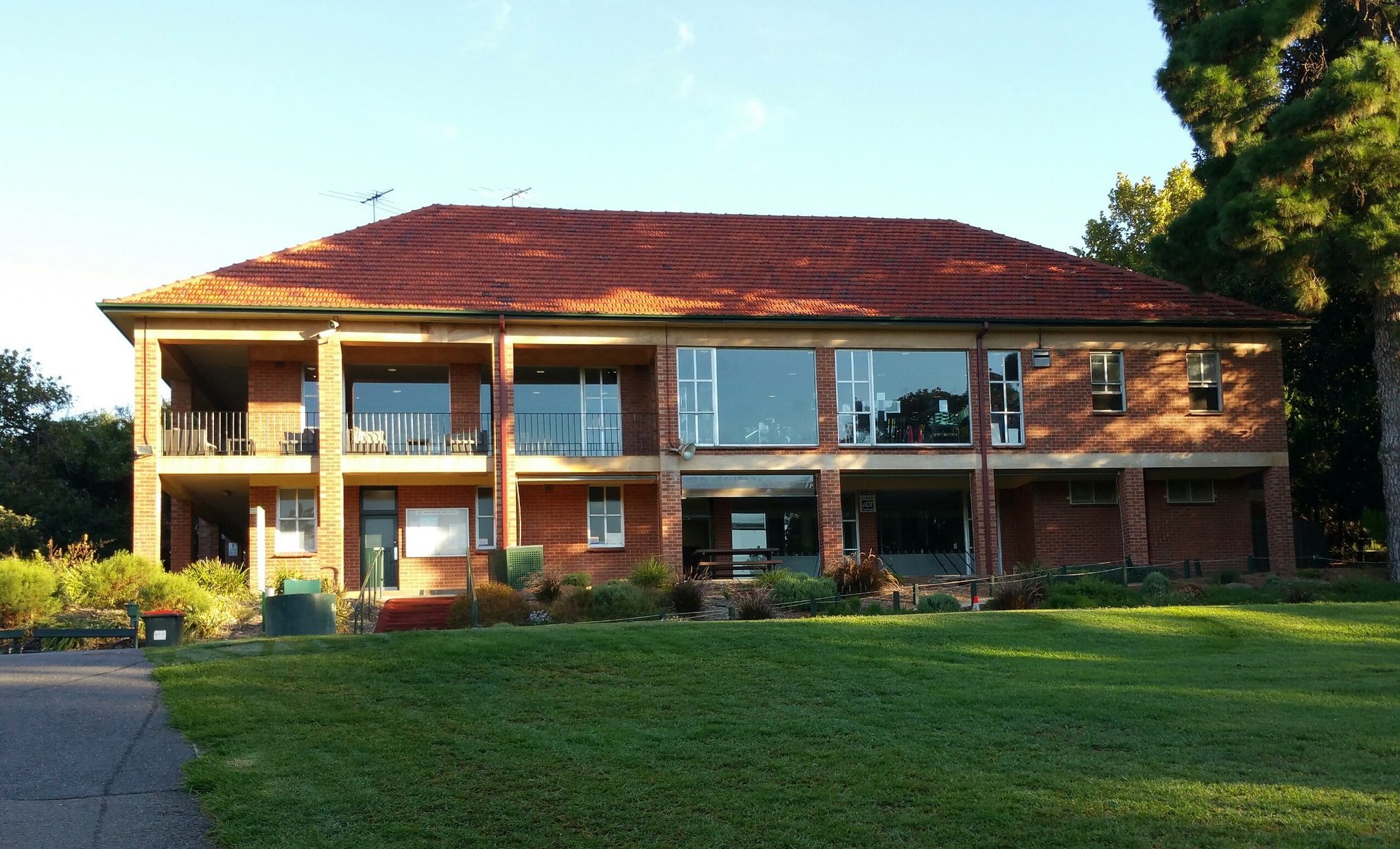
From this point, walk down the pathway towards the North Adelaide Golf Club building, and stop in the shade at the back of the Club Rooms.

12. Carriageways; and future of golf
Though not obvious today, to any casual visitor, carriage drives (broad trails) used to run through this park. Over one hundred years ago, wealthy residents would spend their time riding in horse-drawn carriages through the fields of grass and rows of trees. The man who helped design these carriage drives in the Park Lands was John Ednie Brown.
From 1878 to 1890, Brown served as the South Australian Conservator of Forests. During this time, in 1880, he wrote a report called the “A Practical Treatise on Tree Culture in South Australia.” In his report, Brown came up with landscape designs for each of the individual parks. This included how to best use the space in each park, and what plant species would be most suited to the area.
Brown’s report had a major influence on city gardeners and Mayors when establishing and managing the Park Lands over the following decades. This is especially the case for Park 1.

The northern carriageway as proposed by John Ednie Brown in 1880, was still visible in 1936 but has been subsumed into the golf courses. His proposed southern carriageway later became War Memorial Drive.
The main vision that Brown had for Park 1 was to create wide roads, or trails for horse-drawn carriages. These roads were known as carriage drives, and were designed to be lined with Morton Bay Figs so that people could ride through the parks in shade. The original plan had a northern carriage drive near Strangways Terrace, and a southern carriage drive near what later became War Memorial Drive. It bore some similarities to a proposed road laid suggested by Colonel William Light in his 1837 plan of Adelaide and the Park Lands.
Before the expansion of golf courses in the 1950s, both the northern and southern carriage drives were still in use, as you can see from the 1936 aerial photo above. It is still possible to see where they were. One side of the old carriageway is defined by a row of huge Moreton Bay fig trees (Ficus macrophylla). As you walk southwards from the golf club house, look both left and right to see a line of huge old Moreton Bay fig trees stretching away east and west, on both sides of the pathway.

One of the Moreton Bay fig trees behind the Golf Club building. You can imagine how, a century ago, they defined the edge of the northern carriageway that was proposed in 1880 by John Ednie Brown.
Moreton Bay Fig trees are native to eastern Australia. They have distinctive buttressed trunks, and create massive canopies with their twisting branches and thick foliage. As the name of the tree suggests, you can find figs tucked away in this thick foliage. While they are edible, they aren’t very tasty.
Moreton Bay Figs were first planted in Adelaide as early as the 1860s, and in this Park as early as the 1890s to define both the northern carriageway, and the northern edge of what later became War Memorial Drive. They were used for their impressive size to help create pockets of shade, and because they helped increase the beauty of the park.
While you are here, turn your attention back towards this Golf Club building, and these adjacent storage sheds.
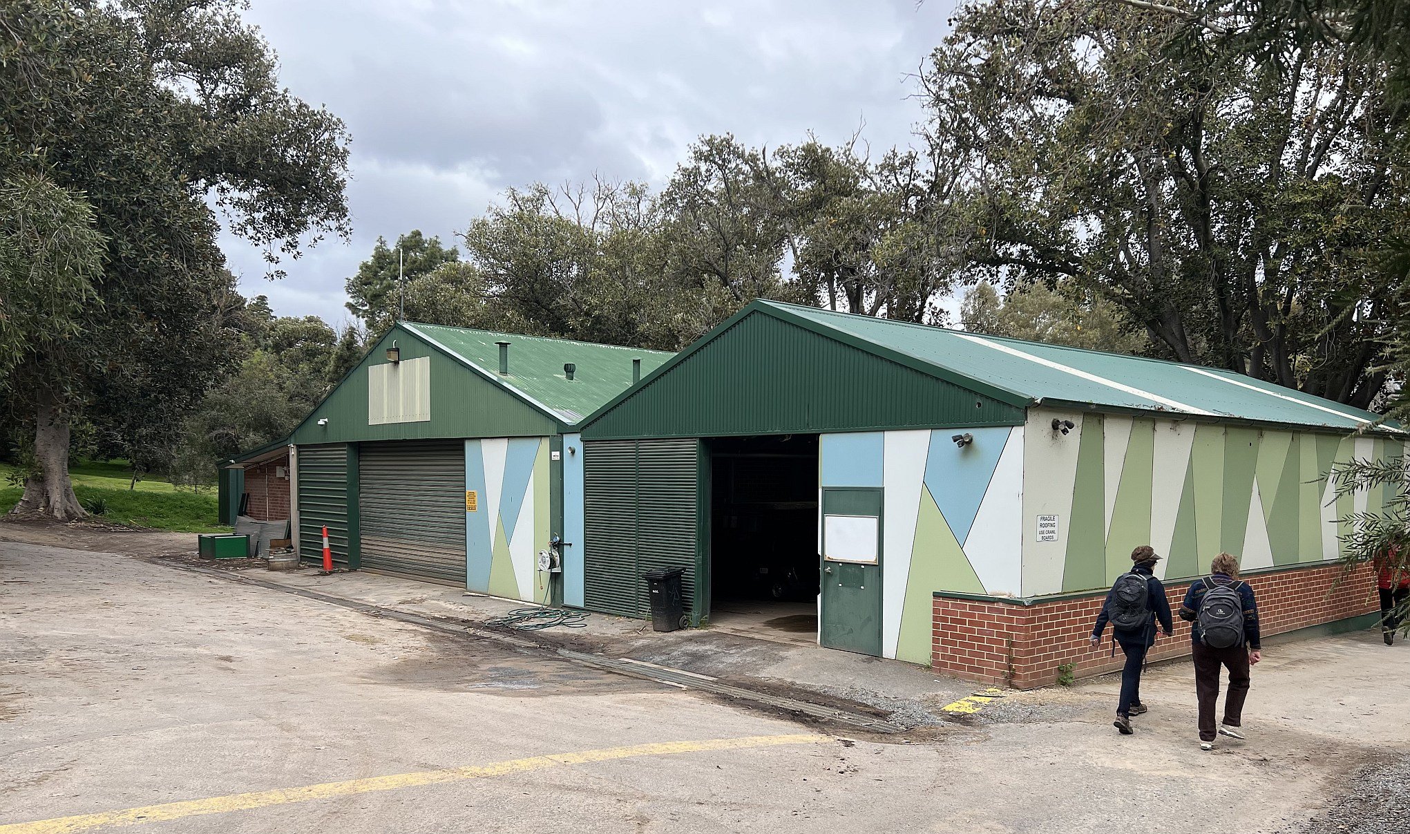
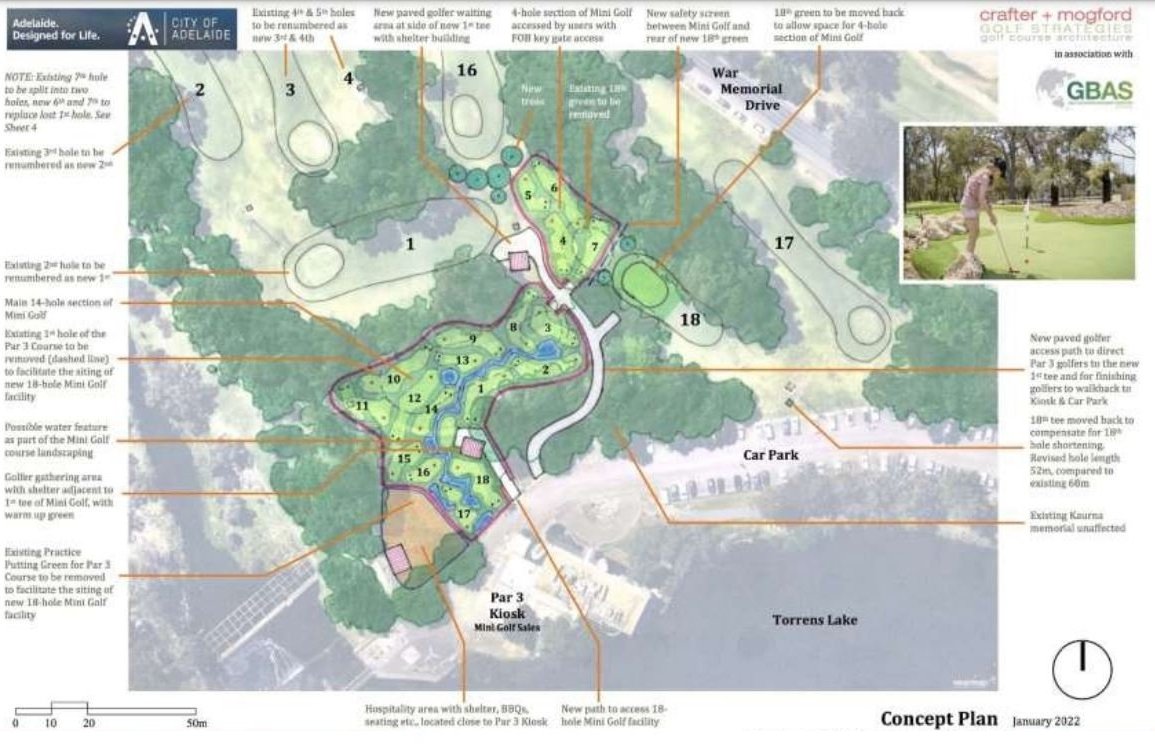
In 2018, the City Council commissioned a consultant’s report on upgrading the North Adelaide Golf Courses. However, the so-called “Draft North Adelaide Golf Course Master Plan for Public Consultation” received in July 2018, was marked “confidential until 2025.” The plan showed proposals for changing the layout of the three golf courses, and a fenced driving range.

An image from the consultant’s report of July 2018 recommending changes to the golf course layouts, and new buildings.
More importantly, the report also canvassed (in a proposed "Stage 2") erecting a new multi-million dollar "Function Centre / Clubhouse, Maintenance Facility" on or near the site of an 1840's Kaurna school - the original "Pirltawardli school".

A plaque near the Par 3 golf course putting green, commemorating the 1840’s “Pirltawardli” Kaurna school, run by Lutheran missionaries in the first few years of European settlement.
In 2018, the City Council "deferred" the matter pending "consultation with the Kaurna community" but it's understood no such consultation was undertaken. Nevertheless, the Council on 11 May 2021 refused to release the whole of the report and most of its detail is blacked out, redacted as still being commercial-in-confidence. You can see the redacted report here. (PDF, 13 pages, 7.8 Mb)
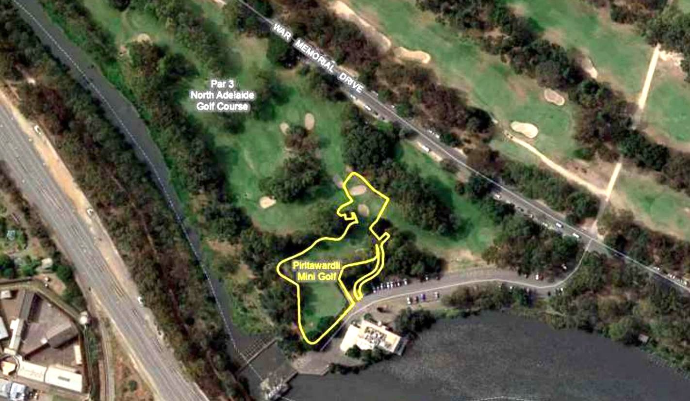
In 2023, new plans emerged for a mini-golf course at the same location. On this occasion, Kaurna elders were consulted.
From here, simply follow the dirt roadway south to War Memorial Drive.
While walking southward, look out for a row of White Poplar trees (Populus alba) and this distinctive large cork oak tree (Quercus suber) on the left-hand side of the dirt road.

A cork oak tree (Quercus suber) on the eastern side of the dirt road.
Cross the road, and then continue on until you reach the Torrens Weir, next to the starting point of this tour.

13. Torrens lake and weir
The River Torrens / Karrawirra Pari is 85km in length - from near Mount Pleasant to the river’s mouth at West Beach. It’s a defining feature of the City of Adelaide, suburbs both east and west of the city, and the Adelaide Hills.
Before European settlement, Kaurna people lived along its length. When the colony of South Australia was established in the 1830s, the colonists started off calling it Yatala River, for a few years. It was then re-named the River Torrens in honour of Robert Torrens, who was on the board of the Colonisation Commissioners for South Australia.
Early European settlers used the river for bathing, washing clothes, disposing of rubbish, drinking water, and as an unofficial sewer. After five children died from water borne diseases in 1839, people were banned from bathing and washing their clothes in the river.
This weir, known as the Torrens Weir, has a long history dating back to the 1860s.
In 1867, a wooden weir was built by prison labour in this very spot. Because of weak materials and poor construction, it lasted only four months, before it was destroyed by flooding. This was a major setback for the City Council and it took another 12 years before they tried again, with a concrete dam, that created the Torrens Lake, immediately upstream from here.
When the dam and lake were officially opened in 1881, a crowd of 50,000 spectators turned out. The new infrastructure created an instant boom in boating activity. Within two months, there were 142 licensed vessels on the lake.

Fish stocks were released into the lake, to encourage licensed anglers, but the fish were quickly devoured by water birds. Only four months after the opening of the lake, licenses were being issued to shooters to kill the birds! The shooting created new dangers to people in boats, and on the shore, so inspectors and water police were hired to enforce conditions on both shooting and boating. The position of “Inspector of Boats and Keeper of Swans” was maintained until the 1970s, with a water police station established off Victoria Drive in Park 12.
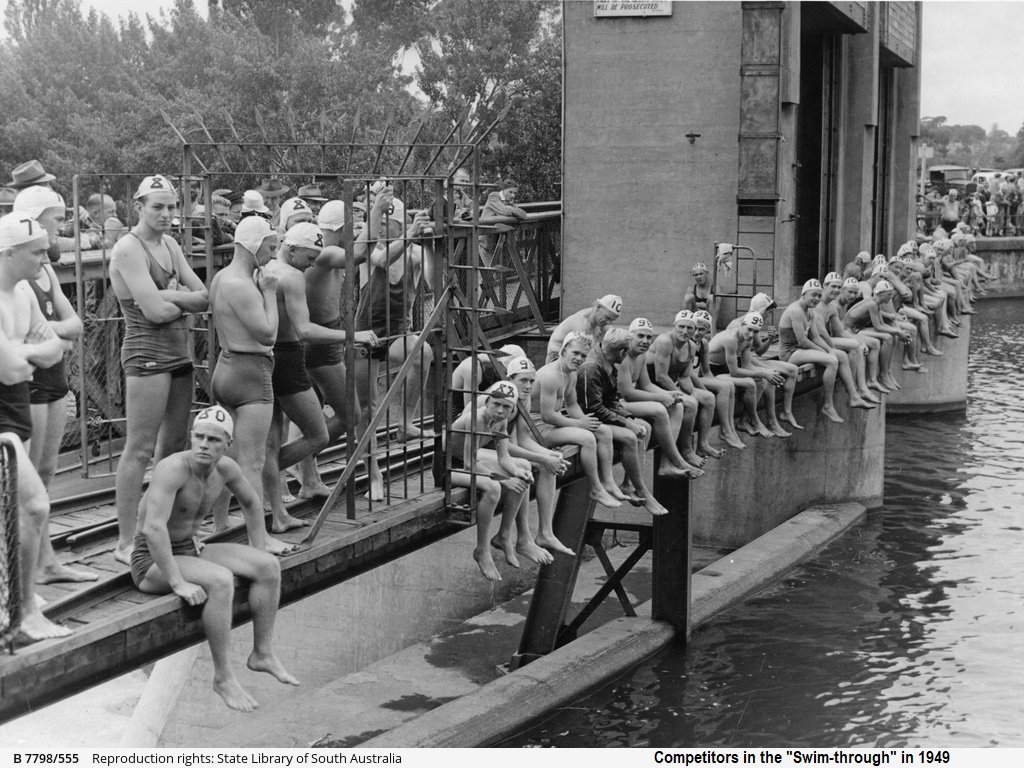
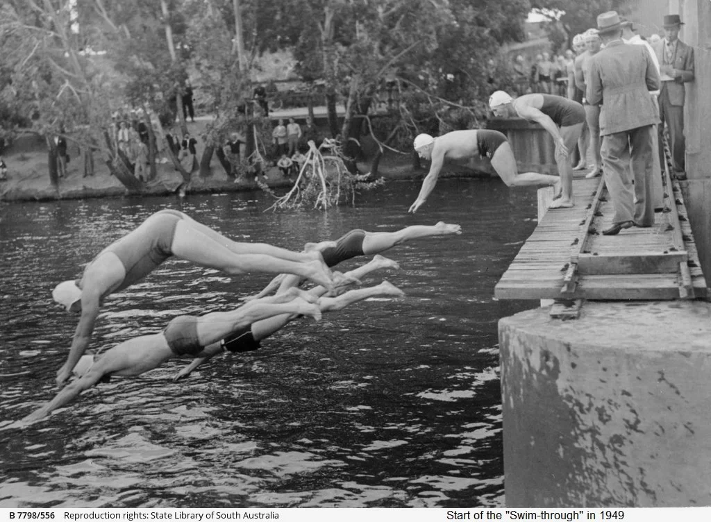
For more than 50 years, starting in 1913, the Torrens Weir was also used for the start of an annual swimming race in the River Torrens. Competitors in the “Adelaide Swim-Through” would dive into the river from here, and swim upstream to the Albert Bridge a distance of more than two kilometres. By the time of the last “Swim-Through” in 1969, the race had been shortened to finish at the University footbridge.
Optional: download and print a tri-fold leaflet, i.e. a double-sided single A4 page, with a brief summary of this Trail Guide: (PDF, 4 Mb)
All of our Trail Guides and Guided Walks are on the traditional lands of the Kaurna people. The Adelaide Park Lands Association acknowledges and pays respect to the past, present and future traditional custodians and elders of these lands.

