
Take the trail
Start at the corner of East Terrace and Halifax Street.
This Trail is on the traditional land of the Kaurna people.

Trail Guide route
Start this trail at the corner of Halifax Street and East Terrace. This Trail is 3.25km in length and will take about two hours to complete. Walking instructions are designated by bold type at the end of each of the stop descriptions.
Optional: download and print a tri-fold leaflet, i.e. a double-sided single A4 page, with a brief summary of this Trail Guide: (PDF, 2.6 Mb)

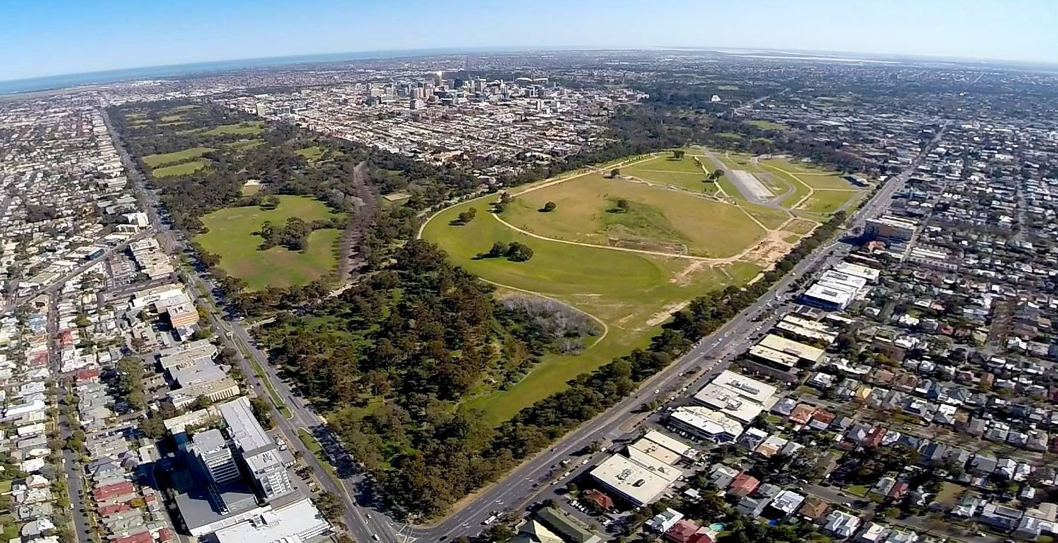
1. Park 16 in context
This Park retains its shape and form as originally laid out by Colonel William Light in 1837.
Covering 72 hectares, it represents about 10% of the entire Adelaide Park Lands, the largest single Park within them.
Victoria Park/Pakapakanthi is bounded by Wakefield Road to the north, Fullarton Road to the east, Greenhill Road to the south, and East Terrace and Beaumont Road to the west.
Its two neighbouring parks are King Rodney Park/Ityamai-Itpina (Park 15) to the north; and Carriageway Park/Tuthangga (Park 17) to the west.
Victoria Park’s history and development is linked to the horse racing and motor racing events which have dominated its use. However, there are also other, less prominent stories here.
The Kaurna name for this park is Pakapakanthi. It means “to trot”, and denotes the history and importance of horse racing to this park’s identity. This name was given in 2003, although the spelling was changed in 2013. The English name, Victoria Park, was assigned in 1897 on Queen Victoria’s Diamond Jubilee.
Prior to European settlement, Victoria Park would have resembled a large flat of blue gums and grey box gums.
Since the demise of horse racing here in 2007, Victoria Park or Pakapakanthi has been gradually restored, from a state of semi-alienation to a people’s park with a range of open, green and public resources. This Park is so large that APA has split it into two separate Trail Guides: this one, covering the south of the Park, and another separate one covering the north half of the Park.
From this point, walk eastwards along the pathway towards the toilet block about half-way across the Park
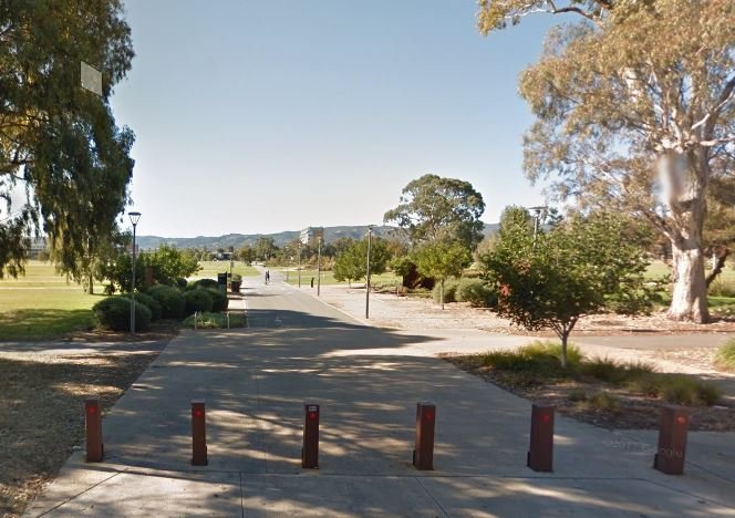
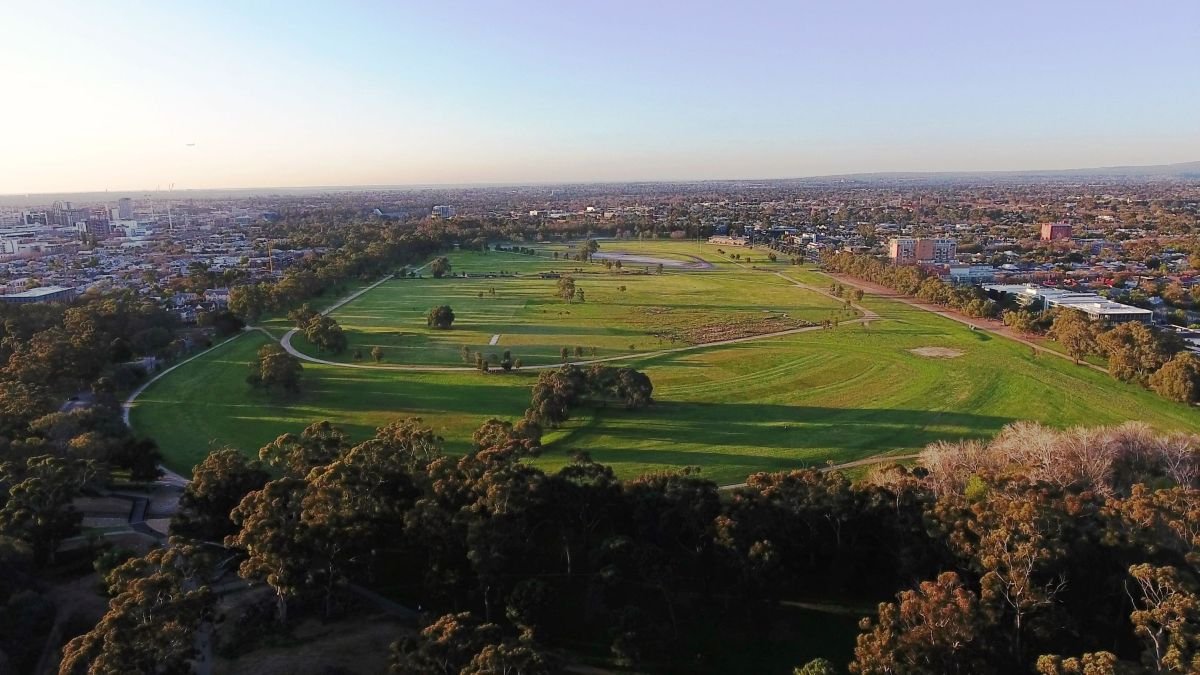
2. Green corridor
This pathway, running east-west across the Park is a very popular walking and cycling commuting corridor.
This so-called “green corridor” for commuters extends from Halifax Street right across the Park to Fullarton Road.
It provides pedestrians and cyclists with an attractive passage between the city and the eastern suburbs.
While this route has long been used by residents, it was enhanced in 2013 with the creation of native garden beds, which also provide a demarcation line between the southern sporting fields and the northern race track area.

The “green corridor” looking east across the centre of Victoria Park /Pakapakanthi (Park 16)
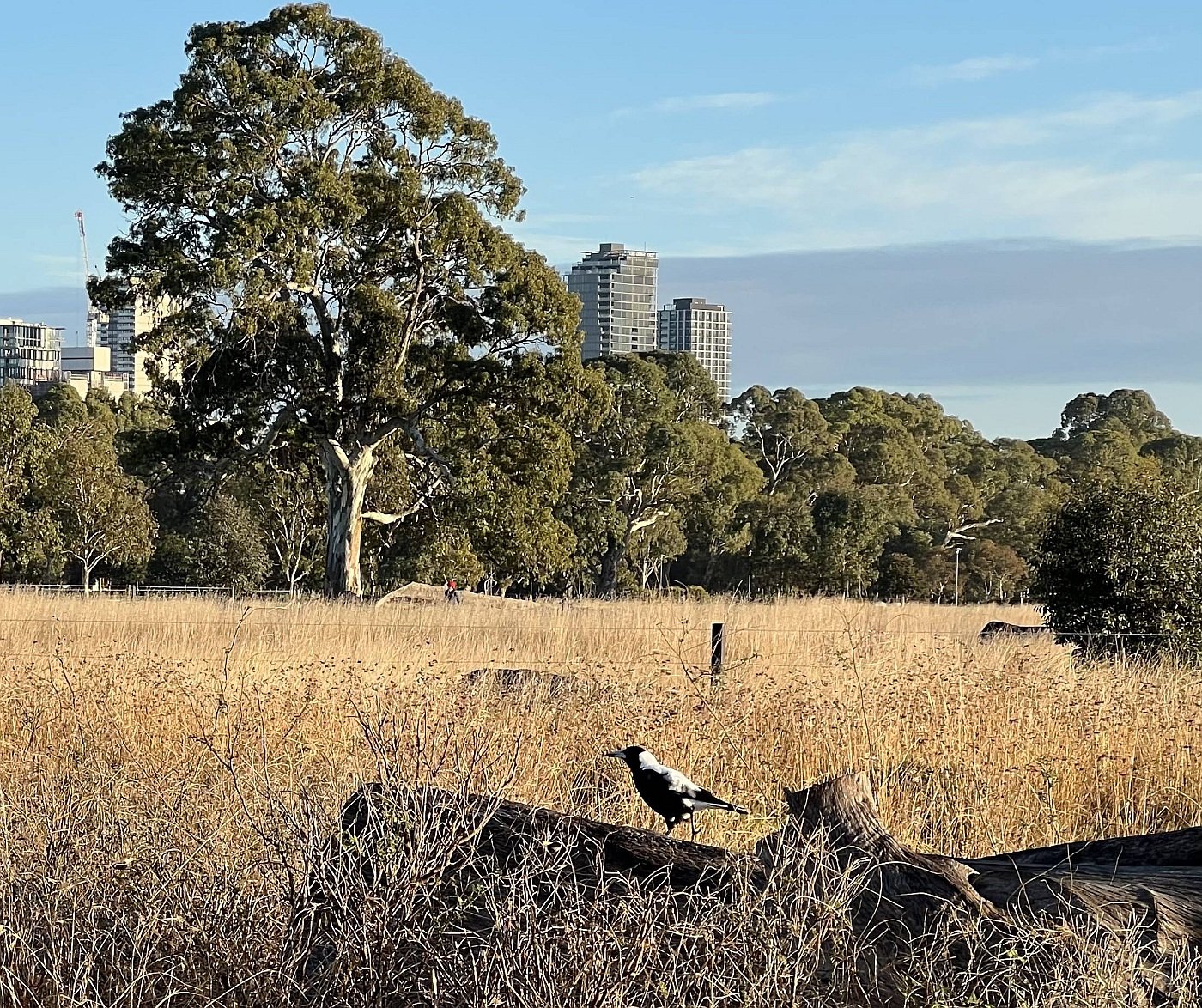
Looking eastwards offers sweeping views of the Adelaide Hills, a significant agricultural, tourism and wineries region.
This uninterrupted vista is also one of the key values which was attached to the Adelaide Park Lands, for their National Heritage listing in 2008.
In April 2023, the City Council was advised that the pathway would be closed for 60 days from October to December 2023, because the State Government’s Motor Sport Board regarded it as being unsafe to remain open during the construction and dismantling of infrastructure for the annual Adelaide 500 motor race, due to be held in late November 2023.

3. Central sports fields
When these sports fields aren’t being used by young cricketers or footballers, the wide open space of this area of the park supports a number of other leisure activities.
Dog off-leash area
The central area of Victoria Park / Pakapakanthi is also a popular off-leash dog walking area. But canine association with Victoria Park has not always been so genteel.
Back in the 1800’s “coursing” matches were held here. Coursing was the practice of having a dog chase a live animal. Sometimes the animal was a rabbit but in 1887 quite a crowd was on hand for a show that was staged as part of a day of horse racing.
A pack of muzzled greyhounds was set upon a tame kangaroo in an enclosure. The crowd on this occasion expressed disgust with the spectacle.
Model Aircraft
The area south of the ‘green corridor’ is one of only two areas in the Adelaide Park Lands where (during daylight hours) the flying of model aircraft and drones for ‘recreational’ purposes is permitted,
If there are any public events or organised sports being held in the central area of the Park, then recreational model aircraft must be restricted further south, past the dirt trail near the wetlands.
In October 2015, something on a much larger scale swooped down on Victoria Park. A light Cessna plane which was carrying skydivers competing in the Adelaide Masters Games, made an emergency landing after experiencing engine troubles.
Two of the skydivers were thrown from the plane but everyone on board survived.
The plane was later found to have run out of fuel.
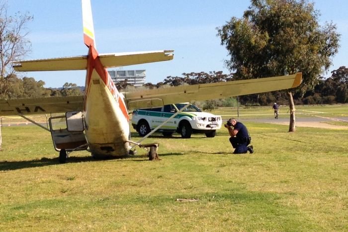
Pic: ABC News, October 2015
From this point, walk south along a dirt road, that curves around to the right, and look for this sign.

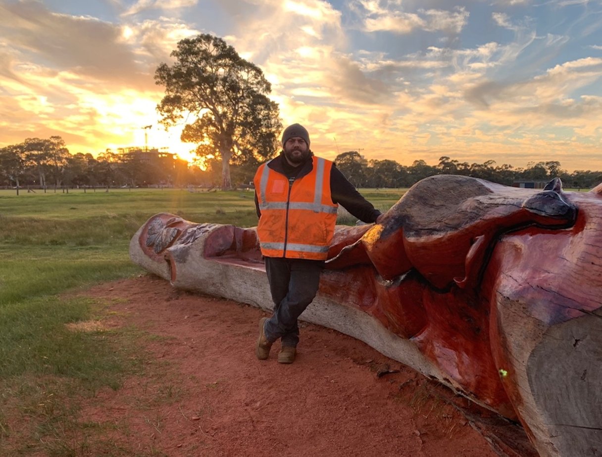
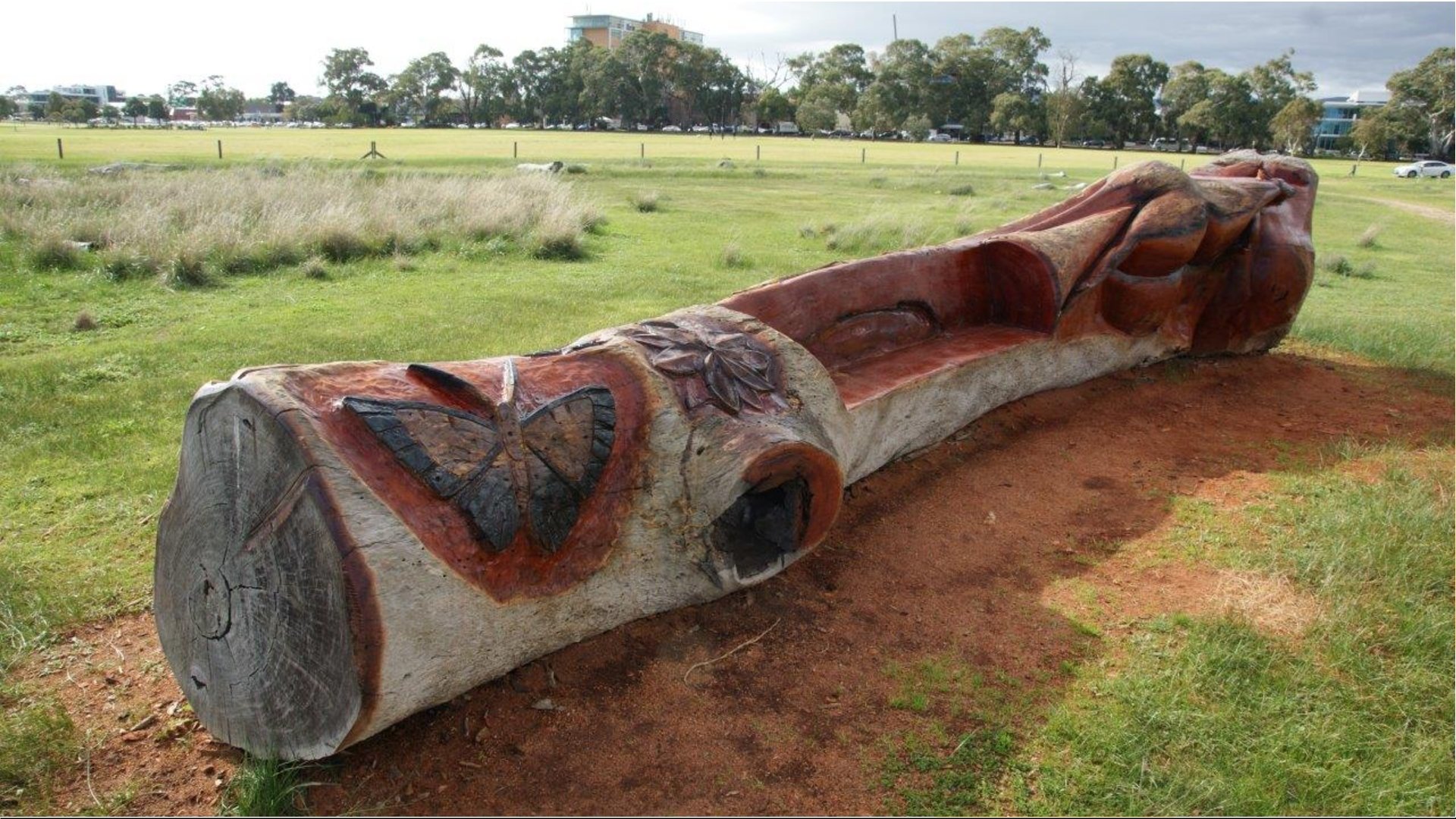
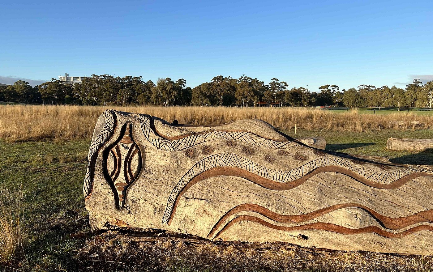
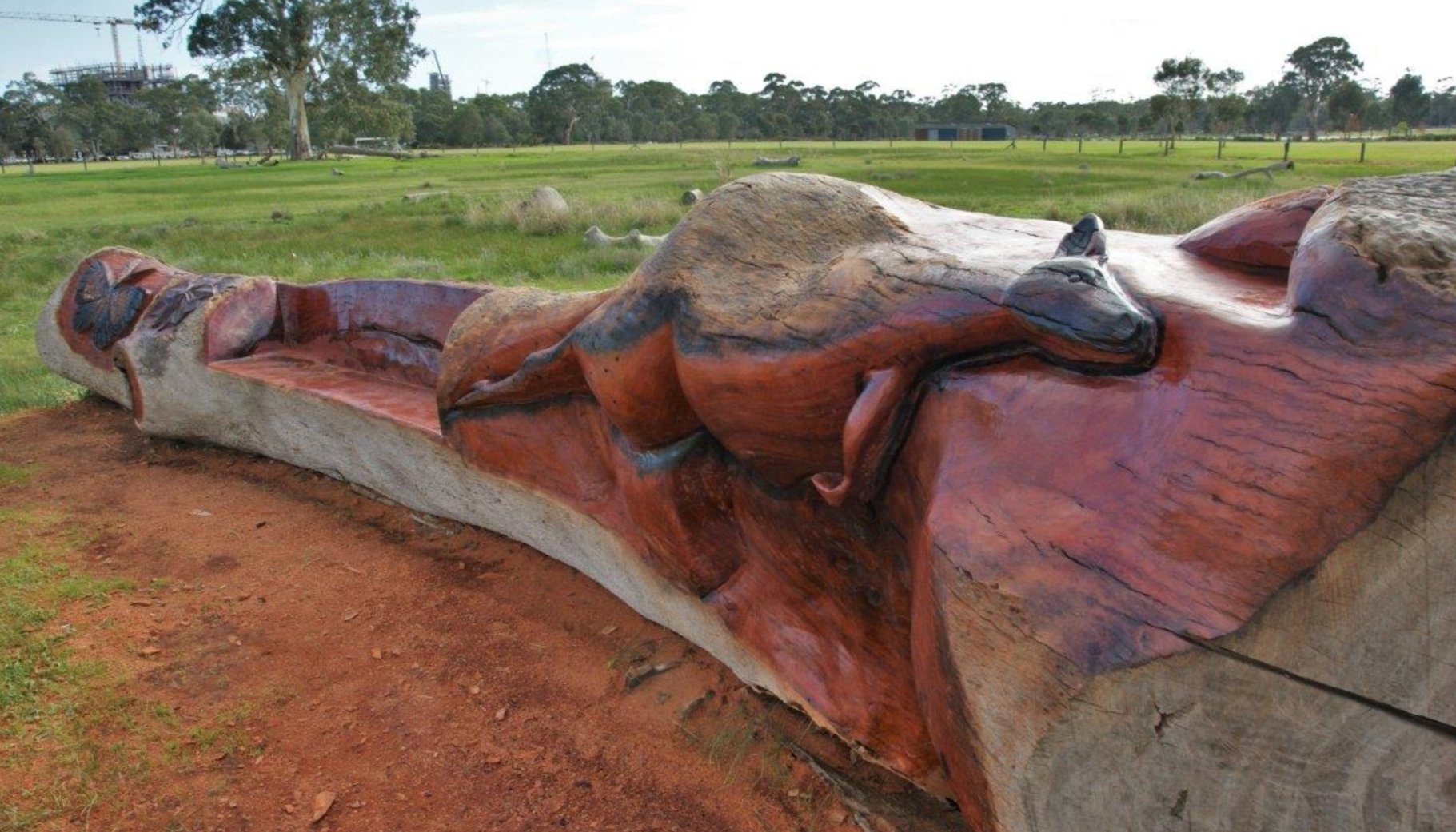
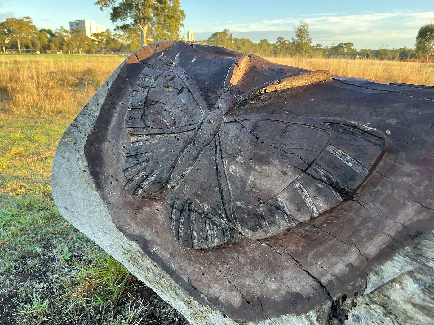
When you see this sign, leave the dirt roadway and follow this narrow dirt path instead. Walk northwards, towards the centre of the Park, and enter a fenced area. Keep walking to a large fallen log or tree trunk adorned with wood carvings.

4. Rare butterfly habitat
The partly fenced area in the centre of Victoria Park / Pakapakanthi contains unusual remnant native grasses, which provide habitat for a rare species of butterfly.
The native grasses here have survived in this small patch, despite more than 187 years of European settlement. They include species such as Spear grass, Early Nancy, Tiny Star, and Garland Lily.
This is one of the very last places on the Adelaide plains where these remnant native grass species have survived.
After the biodiversity significance of these grasses was realised in 2012, the area was fenced, in order to prevent trampling during the annual car racing event.
The City Council has a formal management plan in place with the State Government Environment department to protect these species.
The management plan involves more substantial permanent fencing, protection of butterfly habitat within the park, and a commitment to restore the site to resemble the nationally threatened environment described as ‘Grey Box Grassy Woodlands and Derived Native Grasslands of South Eastern Australia’.

A 2024 City Council report identified this “Butterfly Conservation Zone” as a vital part of one of the few ‘Key Biodiversity Areas’ within your Adelaide Park Lands.
This site is protected habitat for the rare grassland copper butterfly also known as the chequered copper butterfly. It lives in an unusual symbiosis with small common black ants. The ants play a role in feeding the butterfly larva.
Back on the dirt road, this interpretive sign explains what happens.

The only other place within the Adelaide Park Lands where this butterfly has been sighted is in Golden Wattle Park / Mirnu Wirra (Park 21 West) where (in April 2023) the State Government was considering construction of SA Police barracks.
In the centre of the fenced remnant native grassed area is a Kaurna "cultural marker" created from a river red gum trunk by local artist Allan Sumner. “Ngadlu Padninthi Kumangka” is a place to come together, to walk, sit, learn and reflect on Kaurna Culture.
Photos 1, 2 and 4 courtesy of City of Adelaide.
From this point, go back the way you came into the fenced area, until you return to the dirt road. Turn right and follow the road until you reach two shelters on the edge of the wetlands and turn left there - as indicated by the yellow arrows on this diagram.

Image: Keswick Creek and Brownhill Creek Stormwater Management Board

5. Wetlands
The South Park Lands Creek traverses the width of the southern Park Lands, from Victoria Park (Park 16) across the neighbouring Parks to the west: Parks 17, 18, 19, and 20.
The creek is not a natural watercourse but an artificial drainage channel that was built in 1917 to channel water away from the Greenhill Road - Fullarton Road intersection, and through the South Park Lands.
Over the following century, the condition of the Creek gradually but significantly deteriorated.
In 2020 the Adelaide City Council and the Brown Hill Creek & Keswick Creek Stormwater Authority began the biggest Park Lands earthworks since the early 1960s.
A grove of white poplar trees, characterised as “woody weeds” were removed, and a detention basin was excavated. The white poplars had been planted in 1954 to partially reduce winter flooding but were later considered an invasive species.
Clearing the white poplar trees in late 2020. Pics: Brown Hill Creek and Keswick Creek Stormwater Management Authority
In 2021, construction company Bardavcol was given the $13 million contract to build the wetlands. Excess soil was temporarily spread over an area about 150 metres to the north - to be returned later to provide small hills around the wetlands.

The temporary soil dump in 2021.
The project had several aims:
to reduce the risk of flooding downstream in Goodwood, Wayville and Unley
to improve safety and biodiversity along the South Park Lands creek, and
to create a scenic haven to attract visitors to the southern part of Victoria Park.
The wetlands, opened in May 2022, include interpretive and education facilities, boardwalks and a range of nature play and recreation opportunities. Native plants have been restored to a widened creek bed.
In the months after the opening of the wetlands in May 2022, there were concerns that dogs running off-lead were disturbing water birds and damaging newly-planted reed beds. The City Council responded in February 2023 by declaring the wetlands an area where dogs must be kept on a lead.
A dirt path around the wetlands is about one and a half kilometres, but this Trail Guide skirts the eastern edge of the wetlands, near Fullarton Road.
Walk across the boardwalk between the two lakes, then turn left and head back through the wetlands towards Fullarton Road (as indicated by the yellow arrows on the diagram above). Climb the stairs and turn right, to follow the dirt trail and stop under the shade of one of the many ancient trees.

6. River red gums and olives
.
Running along the eastern side of Victoria Park adjacent to Fullarton Road, is an impressive line of thirty or more River Red Gum trees, along with many old olive trees.
Some of the trees in this avenue (both red gums and olives) date from before 1880.

Historic olives on the eastern side of the Park adjacent to Fullarton Road.
From this point, keep following the dirt path south, and cross over the South Park Lands Creek, near the Greenhill Road traffic lights.
Once you have crossed the creek, look for a bitumen path that heads north-west through the urban woodland.

7. Urban woodland
The urban woodland in the south of Victoria Park was originally mapped as a reserve, Park 16A, that was separate to the racecourse precinct of Victoria Park.
Way back in 1889 this urban woodland (in what was then Park 16A) was the site of the inaugural Arbor Day in Australia.
This was a predecessor to the Landcare movement. The first Arbor Day featured a massive communal act of tree planting.
About five thousand schoolchildren marched from Victoria Square to this site in Park 16A. They were accompanied by the Police Band.
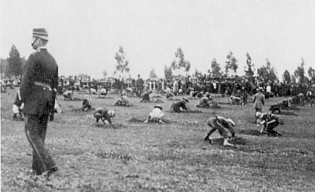
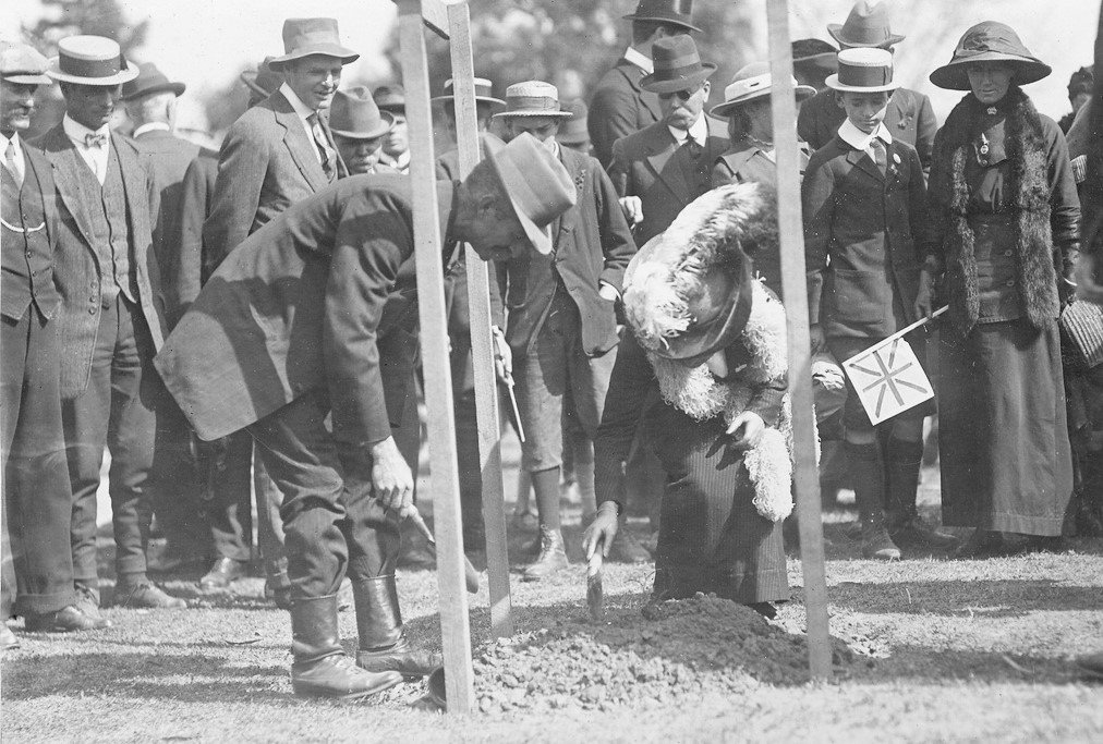
LEFT: Arbor Day, 1889, with Governor Kintore and schoolchildren planting trees. RIGHT: Tree planting on Arbor Day 1914. State Library of SA B 1699/A and PRG 280/1/10/391
Today, this woodland undoubtedly includes some of the trees that were planted by schoolchildren on that day in 1889, as well as many others that were planted later.
The woodland consists mostly of mature river red gums and sugar gums, with some non-natives. The South Park Lands Landcare group has been removing exotic species from the woodland, to return it to a more natural environment.
A 2024 City Council report identified this woodland as part of one of the few ‘Key Biodiversity Areas’ within your Adelaide Park Lands.
Follow this path in a north-westerly direction and, when you reach a T-junction, turn right. Stop on or near the pedestrian bridge over the South Park Lands Creek.

8. Beaumont Road
This is Beaumont Road, which is a no-through road.
To the north of this point it is a car park, with an entrance off South Terrace.
To the south of this point it is also a car park, with an entrance off Greenhill Road.
The bitumen path on which you have just walked, to get here, is a shared-use cycling and pedestrian path.
However the pathway was once a main arterial road; the original course of Beaumont Rd.
It ran on a diagonal line from the corner of Fullarton Rd and Greenhill Rd, up to near the corner of South Terrace and East Terrace where this Trail began.
In 1963 the road was relocated westwards, where it still exists. Fifteen years after the relocation, in 1978, the new alignment of Beaumont Rd was closed to through traffic. It’s now used mostly as a car park.

Extract of a 1927 ‘Plan Showing Improved Pavements’ prepared by the City Engineer depicting ‘Reserve No. 16’ and ‘Reserve No. 16A’ along with what was then the route of Beaumont Road. Source: ACC Archives.
From this point, walk up a gentle slope on the dirt path, so that you are overlooking the wetlands, to your right.

9. “Green Pakapakanthi”
In 2023, the South-East City Residents Association (SECRA) reached agreement with the City Council for re-vegetating some parts of Victoria Park / Pakapakanti (Park 16).
Three separate working bees were planned for 2023, including one here on the western side of the wetlands (due in August 2023) to plant understory vegetation here, to attract small birds and increase biodiversity.
Other projects being jointly sponsored by SECRA and the City Council included:
planting new trees, for shade, around pathways and the central sports fields (due in late July 2023); and
planting trees and shrubs in the central garden, off the “green corridor” where this Trail Guide commenced.
See more details here: https://www.adelaide-parklands.asn.au/blog/2023/4/6/join-green-pakapakanthi
From this point, walk northwards, down the slope towards the corner of Beaumont Road and East Terrace. Keep heading north along East Terrace to get back to the starting point of this Trail Guide on the corner of Halifax Street.
Optional: download and print a tri-fold leaflet, i.e. a double-sided single A4 page, with a brief summary of this Trail Guide: (PDF, 2.6 Mb)
All of our Trail Guides and Guided Walks are on the traditional lands of the Kaurna people. The Adelaide Park Lands Association acknowledges and pays respect to the past, present and future traditional custodians and elders of these lands.

