

Take the Trail
Start at the corner of South Terrace and Sir Lewis Cohen Avenue.
This Trail is on the traditional land of the Kaurna people.

1. Sir Lewis Cohen Avenue
2. Diagonal pathway
3. Purple pipes
4. Wattle Grove
5. Bicentennial Plaque
6. Bush for life
7. Police barracks
8. Lutheran Sports Club
9. Lundie Gardens
10. Princess Elizabeth Playground
The trail starts at the corner of South Terrace and Sir Lewis Cohen Avenue; i.e. #1 on the map. Walking instructions are in bold type at the end of each section.
Optional: download and print a tri-fold leaflet, i.e. a double-sided single A4 page, with a brief summary of this Trail Guide: (PDF, 1.9 Mb)

1. Sir Lewis Cohen Avenue
We start here on the corner of South Terrace and Sir Lewis Cohen Avenue. The tree on this corner is one of the most unusual trees in your Adelaide Park Lands. It is a Brazilian pepper tree (Schinus terebinthifolia). It’s part of the cashew family. As its name suggests, it’s native to South America.

Brazilian pepper tree, at the starting point of this Trail Guide, on the corner of South Terrace and Sir Lewis Cohen Avenue
Historical records suggest that before European settlement, this area would have been used by the Kaurna people as a camp site, as well as for food harvesting, burials and hunting activities.

An 1880 Park Lands plan, showing the large Park 21 between Goodwood Road and Peacock Road, before the 1906 construction of Lewis Cohen Avenue.
This road, Sir Lewis Cohen Avenue, running north-south, connecting Greenhill Road with Morphett Street, was constructed in 1906.
Until that year, Park 21 was a very wide Park - running east-west between Peacock Road and Goodwood Road.
Construction of Lewis Cohen Avenue effectively split Park 21 into two. So since 1906, there has been Park 21 to the east, and this separate, Park 21 West, here. Further to the west, across Goodwood Road, is Park 22 where netball courts are located.

Sir Lewis Cohen Avenue in 1929, planted with elm trees.
Lewis Cohen Avenue was constructed to provide a shorter route between Wayville and the south-western part of the city. For well over 100 years various parts of your Park Lands have been sacrificed to save commuting time. Another recent example is a busway through Rymill Park, constructed in 2016.
Lewis Cohen was born in Liverpool, England, in 1849, where his father had a clothing factory. Lewis Cohen migrated to Australia twice. In 1853 (when Lewis was just four years old) the Cohen family came to Australia for the first time, and settled in Sydney. His father started a clothing business. It was successful, but the Cohen family didn’t stay in Australia. Before young Lewis had turned 13, his father had brought the very large family (his wife and 12 children) back to England.
The teenage Lewis Cohen was sent to a Jewish school near London. Then, at the age of 17, he returned to Sydney with his father. At 19, his father financed young Lewis to set himself up as a general storekeeper in Fiji.
The business prospered, but young Lewis suffered from asthma, and his health caused him to return to Sydney in 1873. Doctors suggested that Adelaide’s climate would be better for him, so, acting on this advice, 26-year-old Lewis Cohen settled in Adelaide with his new wife, in 1876.
He lived for the next 57 years in Adelaide.
Over these decades, he was, for long periods of time, part of the Adelaide Hebrew congregation, the Independent Order of Oddfellows, the Foresters' Friendly Society, the Freemasons, Australian Natives' Association, and the United Ancient Order of Druids, of which he became grand president.
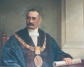
Sir Lewis Cohen
For 10 years, Lewis Cohen represented Adelaide and North Adelaide in the House of Assembly and for almost 30 years he was associated with Adelaide City Council. He was Mayor seven times, and eventually Lord Mayor, becoming Adelaide’s first Jewish Lord Mayor, from 1921 to 1923. He had a reputation as a great defender of the Park Lands.
He was a member of the Municipal Tramways Trust for seven years, and also held the position of Chief Magistrate for seven years. He was knighted in 1924, after which the name of this road was changed from “Lewis Cohen Avenue” to “Sir Lewis Cohen Avenue”.
He died in 1933, at the age of 84, and was buried in the West Terrace cemetery.

A view to the city from the south-west. Golden Wattle Park / Mirnu Wirra (Park 21 West) is in the foreground, at the right. Beyond it, stretching away to the east, are Parks 21, 20, 19, 18, 17 and in the distance on the east side of the City, Victoria Park / Pakapakanthi (Park 16)
From here, walk south-east, for about 100 metres and stop underneath one of the large sugar gum trees that line the pathway.

2. Diagonal pathway
.
This pathway runs diagonally across Park 21 West and splits it neatly in two.
On the left side of the path, the Park is lightly forested with mainly native vegetation.
On the right side of the path, the Park is mainly sporting fields.
The pathway has been a pedestrian and cycling route since 1917.
In 1920, under the direction of City Gardener August Pelzer, the pathway was planted with elm trees alongside it.
However eight years later, in 1928, the trees had been vandalised.
Ten of the elms had been cut down, about 30 cm above the ground.
Shortly afterwards, the City of Adelaide replaced the elms with young sugar gums (Eucalyptus cladocalyx) and they’ve been growing ever since.

1936 aerial photo of Park 21West, showing very young sugar gum trees planted along the diagonal pathway.

The diagonal pathway. Pic: Serafina Tane
Walk a little further along the path until you can see purple water pipes off to your right.

3. Purple pipes
Look to the west of the path and you’ll see a cage housing a pumping station, with purple water pipes. The colour purple indicates that the water being pumped is grey water. It’s waste water that has been treated at the Glenelg North wastewater treatment plant, and has been pumped back from Glenelg North to water your Park Lands.
This was a massive infrastructure program carried out in 2010. In that year, a ten-kilometre pipeline was laid from Glenelg North back to the City, along with a further 30 km of piping around your Adelaide Park Lands.
The availability of this recycled water means your Park Lands have a reliable supply of irrigation water to protect against future drought, while allowing the City of Adelaide to plant and water more trees.

Laying the Glenelg-Adelaide pipeline in 2010. Pic: SA Water
It also means that every time you flush your toilet, you are helping to water the irrigated parts of your Adelaide Park Lands.
Not all of your Park Lands are irrigated.

The blue lines (“GAP”) and the blue patches (“GAP watered”) refer to the Glenelg-Adelaide Pipeline. Source: City of Adelaide
Adelaide City Council's Park Lands management strategy does not envisage every part of your Park Lands being landscaped like an English countryside.
It would be prohibitively expensive to do that, and it would be nonsensical in the driest State in the driest continent to pretend that all vegetation stays verdant during heat waves.
Whether they are lush and green, or dry and yellow (for some parts of the year) your Park Lands are large enough to effectively lower the temperature in the CBD and also reduce electricity consumption in CBD buildings, especially those located close to your Park Lands.
From this point, turn left and walk east back to Sir Lewis Cohen Avenue and look for a stone circle and a short gravel path.

4. Wattle Grove
This Park has two names. In English it’s called “Golden Wattle Park” and in the Kaurna language “Mirnu Wirra” but the two names mean the same thing: the place of golden wattle trees.
There are two reasons for the name. Of course, this park has many golden wattle trees. But the name is also relevant as a reminder of Australian losses in World War One (1914-18) and as a symbol of patriotism in Australia.

Golden wattle (Acacia pycnantha) in Golden Wattle Park / Mirnu Wirra (Park 21W)
During the First World War (1914-18) sprigs of wattle were often sent with letters to soldiers abroad, as a reminder of the things they loved at home. Wattle was sometimes placed with the bodies of fallen Australian soldiers, before burial.

Golden wattle postcards from the period of World War One (1914-18)
In 1915 the Adelaide branch of the Wattle Day League developed a proposal for a Wattle Grove at this place.
The League envisioned a grove of wattle trees to commemorate the landing of Australian troops at Gallipoli. A sculptor, Walter Torode, who was a member of the Wattle Day League, designed what became a “War Memorial Plantation” site.
As part of the memorial, a 12-foot obelisk carrying a stone cross was also positioned in the middle of the memorial plantation.
An inscription on the memorial read: “Australasian soldiers, Dardenelles, April 15th, 1915”.
The memorial lasted 25 years at this site, but has since been moved, twice.
It was shifted within this Park, to Lundie Gardens, off South Terrace, in 1940. Then, in 2018, it was moved again, to the ANZAC Centenary Memorial Walk on Kintore Avenue (in Park 12) where it remains.

LEFT: The Dardenelles Memorial in place off South Terrace, in Lundie Gardens, part of Park 21 West, where it was placed from 1940 to 2018.
RIGHT: The same memorial off Kintore Avenue near the Torrens Parade Ground, where it was moved in 2018.
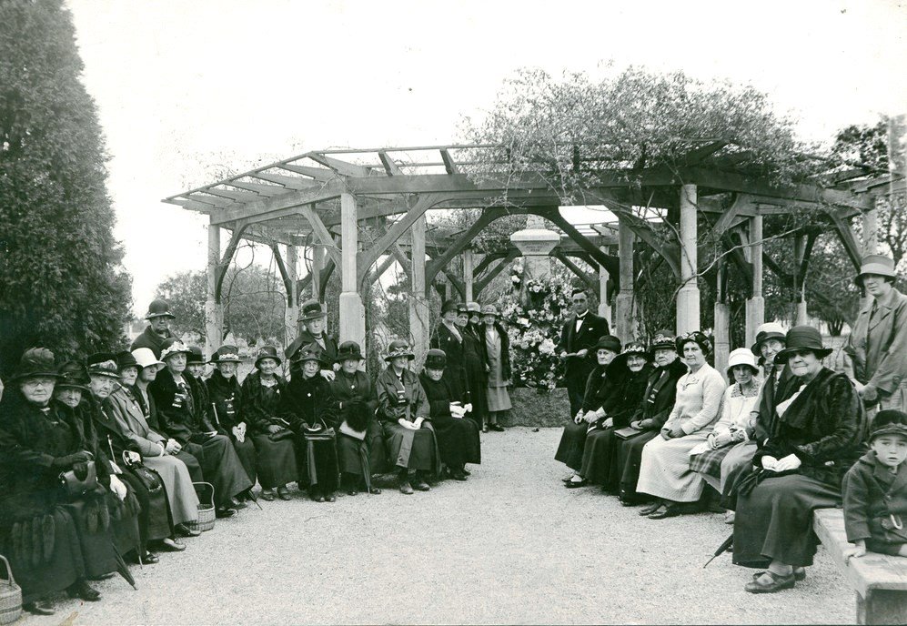
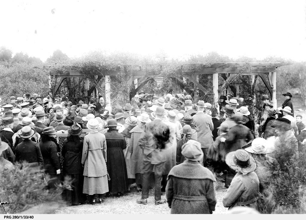
For about 15 years, after 1915, when the memorial was at this “wattle grove” location, a memorial service would be held here, on Wattle Day (the first of September) with hundreds of wattle trees often planted.
But by 1934 the plantation was long forgotten. The golden wattles were neglected. The pergola, built by volunteers at no cost to the public, had become overgrown with creepers, obscuring the sight of the memorial. The decline of the wattle grove in the early 1930s coincided with the retirement of August Pelzer, (the head City Gardener) in 1932.
From here, go out to Sir Lewis Cohen Avenue, and choose a dirt path, heading diagonally south-west into the Park.
Continue until you reach the intersection of two dirt paths. At that point, turn right, and walk about 100 metres until you reach a clearing. There, turn left, and look for a grove of tall Aleppo pine trees. One of the trees will have a plaque, embedded in concrete, at its base.

5. Bicentennial Plaque
This plaque marks the visit of the Adelaide Bicentennial Exhibition in 1988. Described by the Canberra Times as “the greatest road show to ever circle the nation” the exhibition was characterised as “a combination of circus, side-shows, museum and art gallery” celebrating two hundred years since British colonisation of Australia.

The plaque in location underneath an Aleppo Pine. Insets: Images of the exhibition, courtesy of Margaret E Ragless (Feb 1988)
With a blue and yellow big top it had exhibits such as a replica of one of the ships of the First Fleet, prehistoric animals, giant space-age “transformers” and an Aboriginal bark canoe. Exhibits were set up in six separate pavilions, exploring various facets of Australia's past, present and future. The exhibition visited 34 cities and towns throughout Australia during 1988.
From here, turn around and look behind you for a narrow, winding dirt trail that disappears into the bush back towards Sir Lewis Cohen Avenue. Follow this winding trail through the bush until you return to the intersection of two dirt paths.
There, turn right, and head south towards Greenhill Road. Take care not to disturb the native vegetation on either side of the trail. Stop near a stobie pole with a single light.

6. Bush for life
The “Bush for Life” program was developed in 1994 as a way of encouraging people to adopt a practical approach to protecting bushland. As the first of its kind, it remains as one of the largest volunteer programs in Australia.
Bush carers mind over 300 sites across Australia to assist in reviving the health of our bushlands. Bush care involves rehabilitating bushland by minimizing threats and encouraging a natural revival of the ecosystem using a “minimal disturbance” method. This is a slow but effective method to restore and retain biodiversity.
This Bush for Life site officially commenced in 2015 with four regular volunteers who have been working a couple of times every week. Unofficially their volunteer work here began several years earlier.
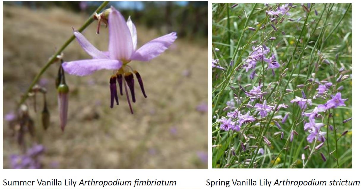
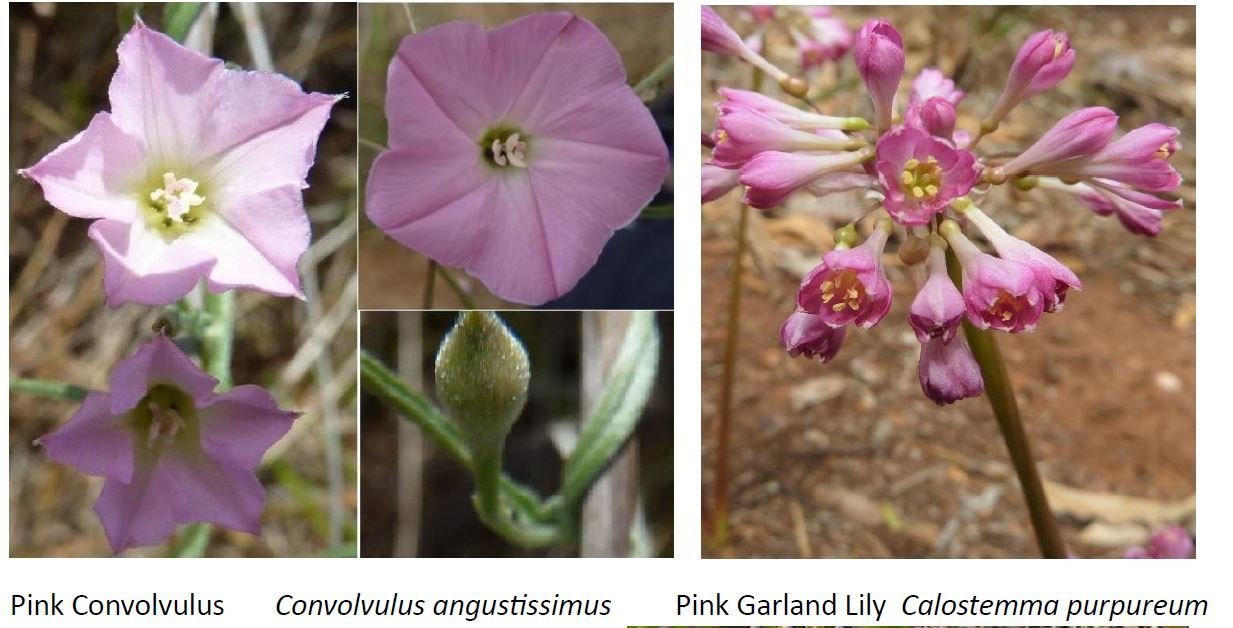
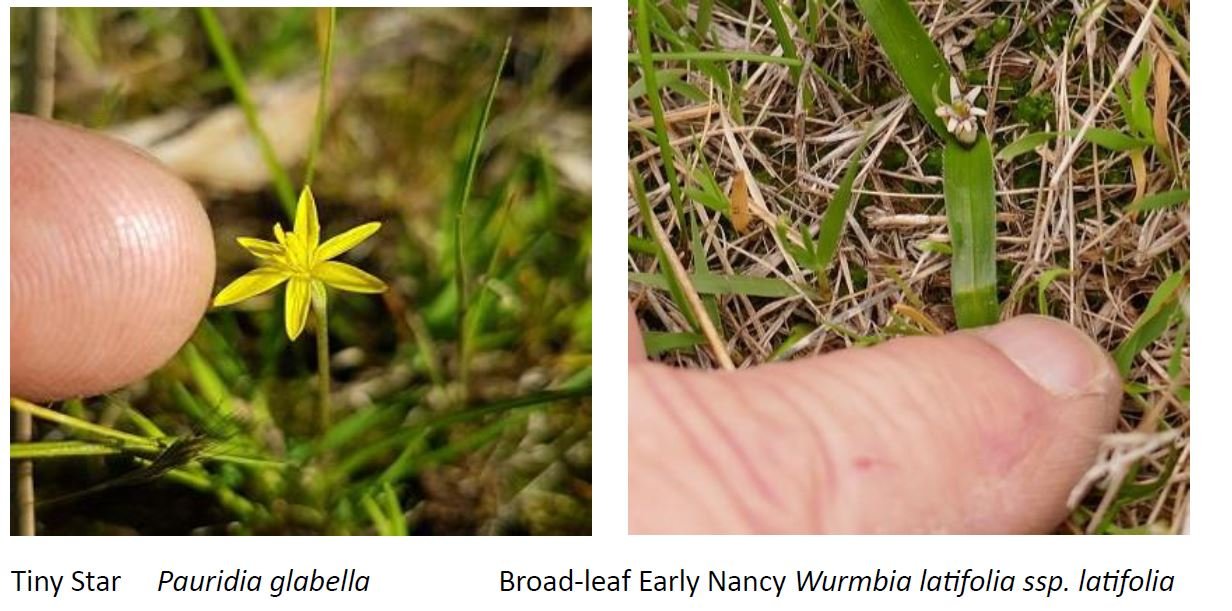
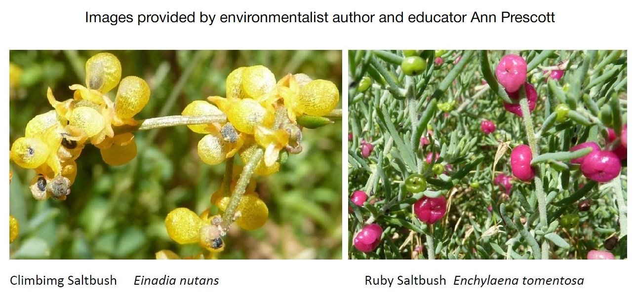
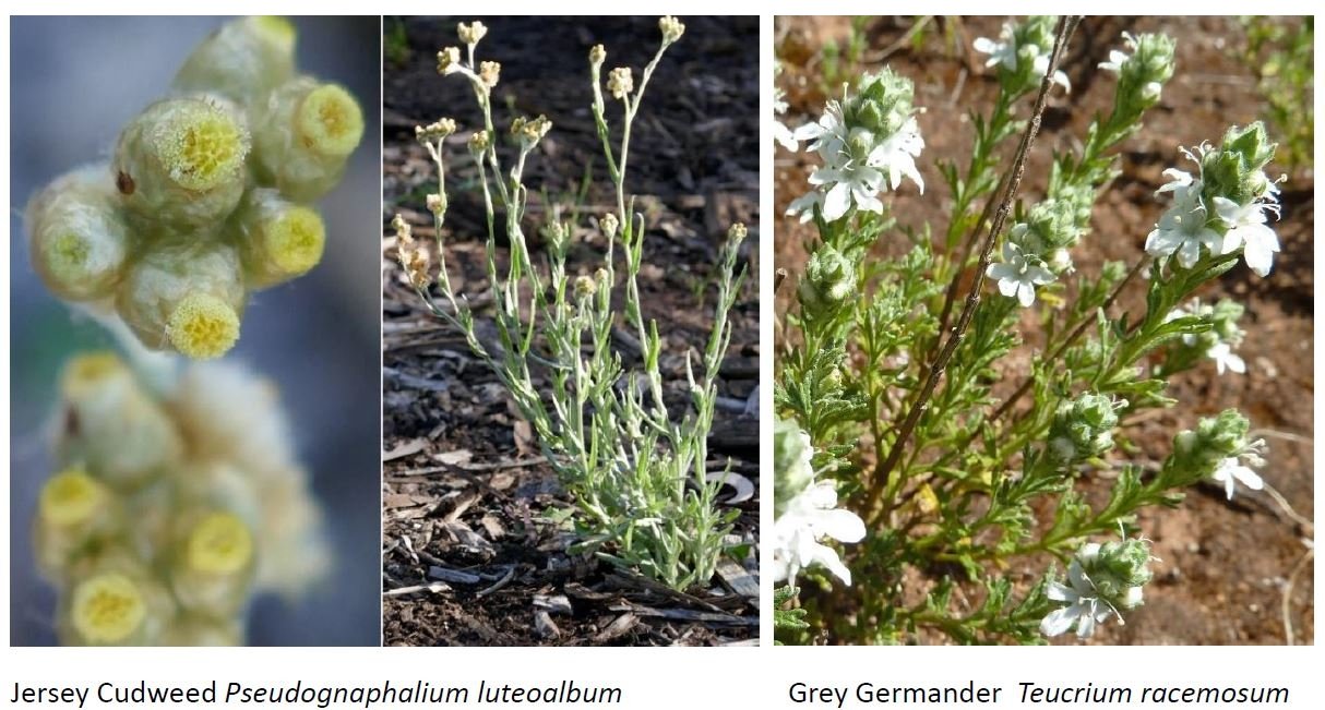
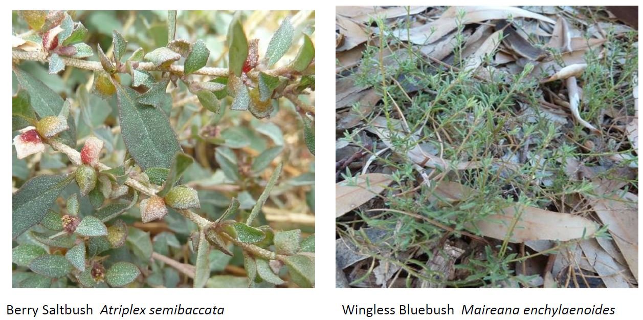
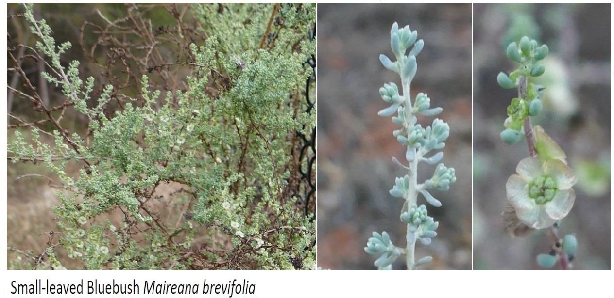
Their work has turned this area into one of the most important biodiversity locations in your Adelaide Park Lands, due to the number and rarity of its native flowers and other species. There are over 70 different types of plants, providing a sanctuary to many varied species of birds, reptiles, insects and other fauna. It is formally recognised by Adelaide City Council as a conservation zone.
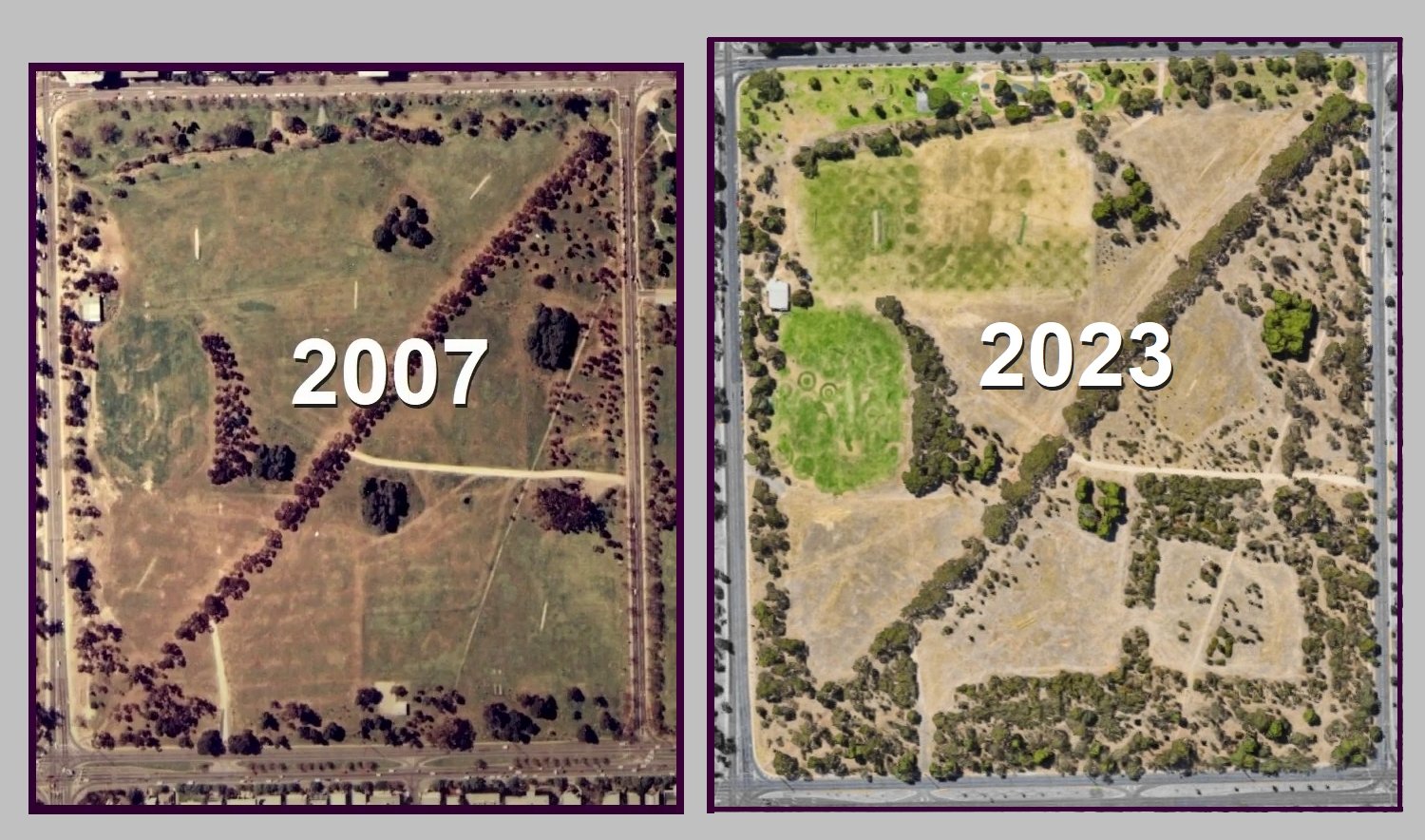
This comparison shows the extent of tree cover, bur does not reveal the extent of improved understorey planrs, including native grasses and wildflowers.
If you look around you might see cracking clay soils. This type of soil is rare in your Park Lands, and is the only type of soil that provides suitable conditions for native grasslands and grassy woodland species.
This is, therefore, one of the few remaining places around Adelaide that resemble the physical features that would have existed at the time of European arrival. Before European settlement, this type of landscape would have been maintained by patchwork burning by people of the Kaurna nation.
There are five known areas in Mirnu Wirra which protect a cluster of rare herbaceous species or are the only known location in the Park Lands for that species.
While wildflowers bloom throughout the year, many of the daisies and lilies only appear in the wetter months; native grasslands naturally appear more ‘dry’ in summer but are essential habitat.
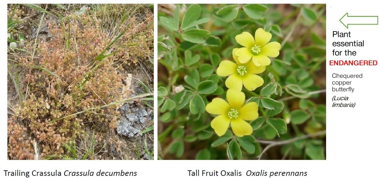
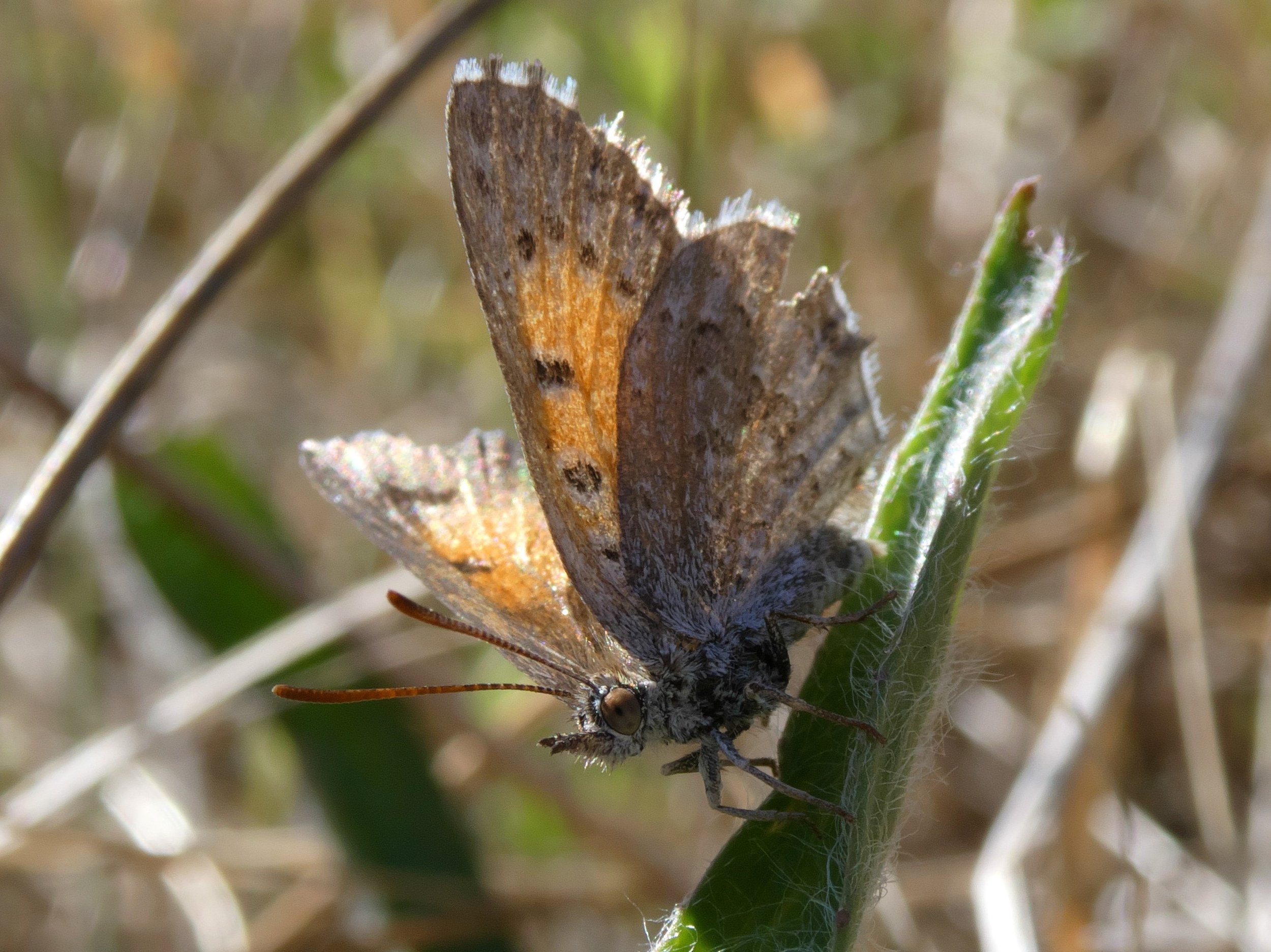
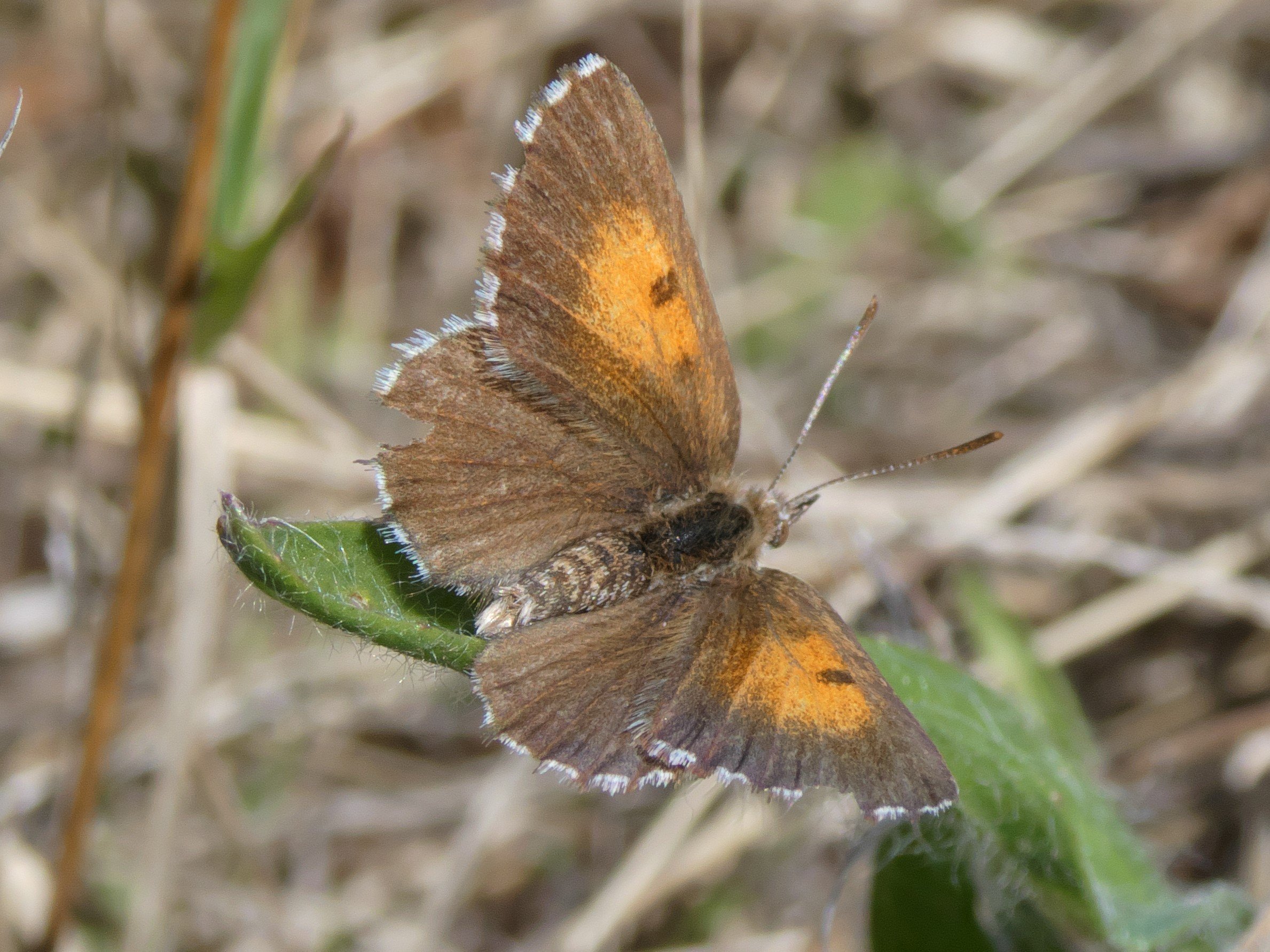
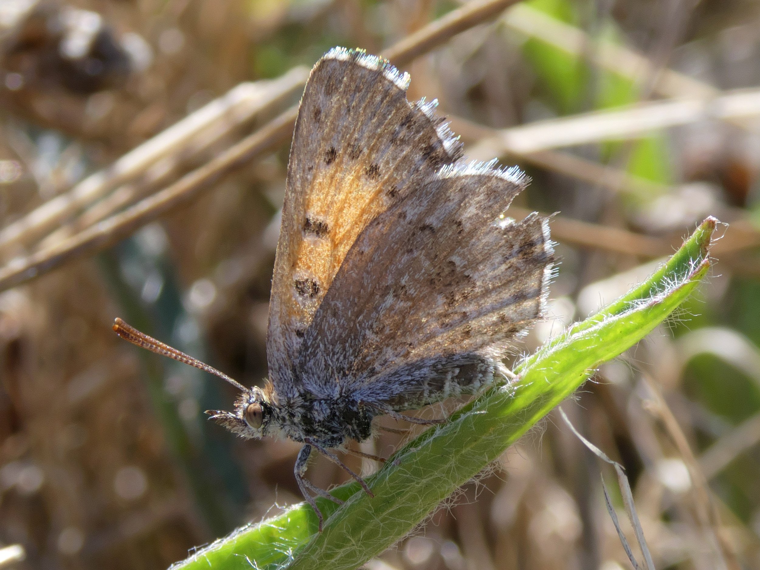
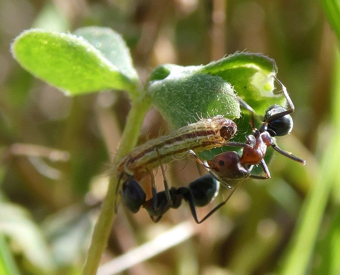
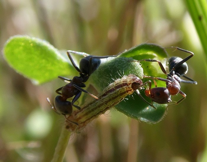
The revegetation in this area has also provided habitat for the rare chequered copper butterfly and the ants that feed its caterpillars.
From here, walk further south towards Greenhill Road. Just before you get to Greenhill Road, turn right and walk west, through the trees, until you reach an old disused bitumen road. Turn right here, and head north until the disused road meets the diagonal pedestrian/cycling pathway.

7. Police barracks
Artist’s impression
In March 2023, the State Government confirmed that the south-eastern quadrant of this Park had been chosen, by the Police Commissioner, as the preferred new location for a new police barracks - to become the home of the Mounted Operations Unit.
Eight hectares were to be required, to build a security-fenced compound; to include stables for 40 horses, offices and meeting rooms for 30 staff, a kitchen, change-rooms, showers, toilets and lockers, horse “tack” rooms, a veterinary suite, fodder stores, a secure gun room, garaging for horse floats, staff car parking and more.

Looking south, across Golden Wattle Park / Mirnu Wirra (Park 21W) with Whitmore Square and South Terrace in the foreground and Greenhill Road and the Wayville Showgrounds in the background. This is an artist’s impression of how the proposed SA Police compound would dominate what is now part of your Open Green Public Adelaide Park Lands.
The land grab was authorised by Section 10 of the New Women’s and Children’s Hospital Act 2022, which allowed the Health Minister to take over one or more of any part or parts of your Park Lands for the SA Police Mounted Operations Unit.
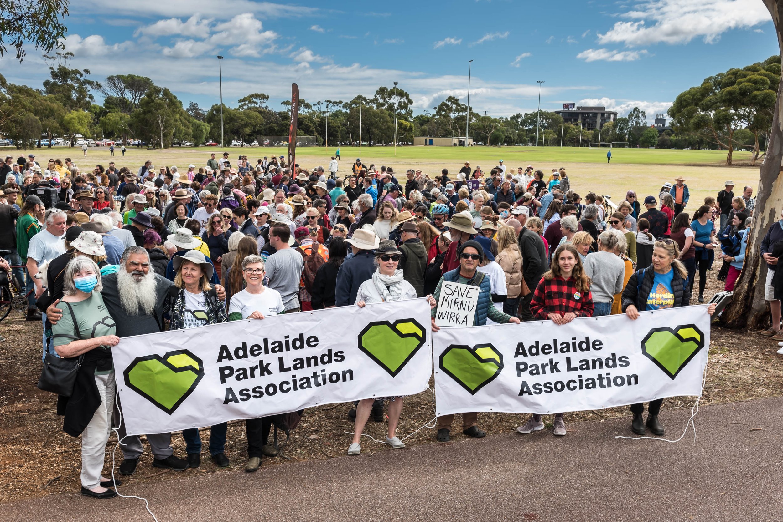
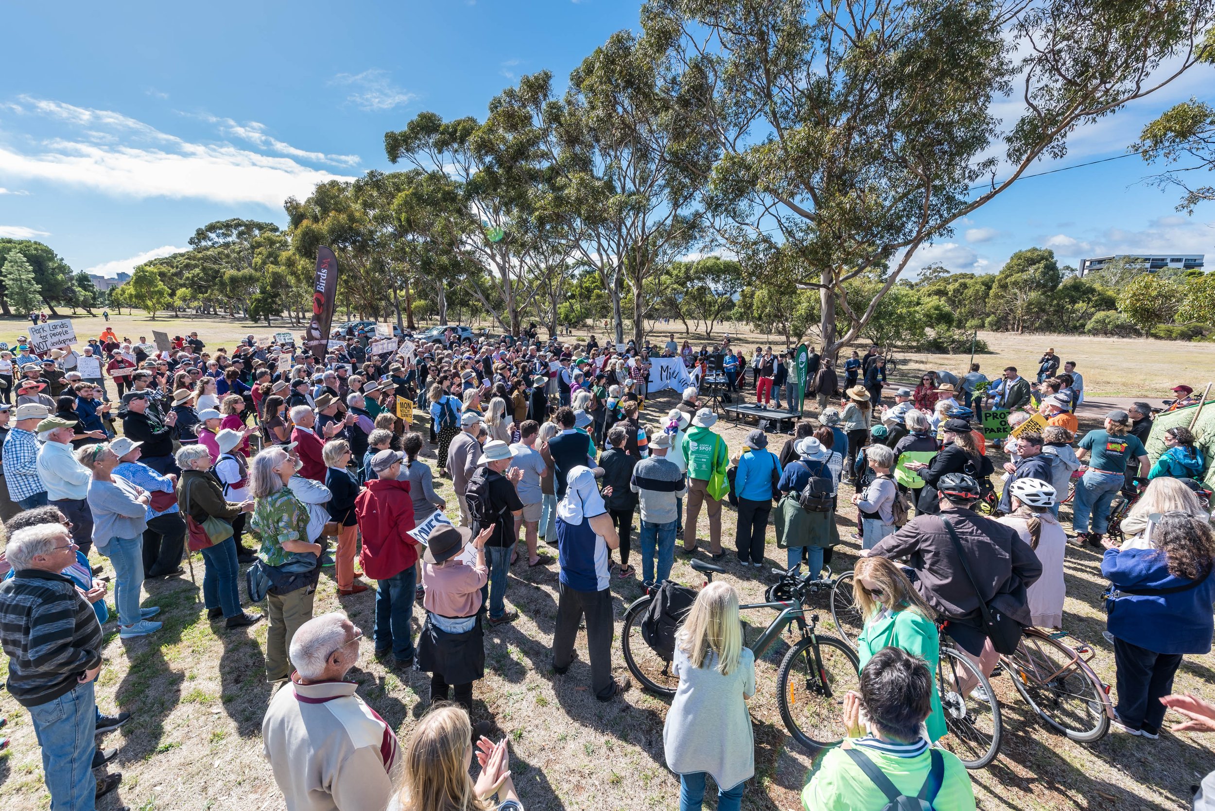
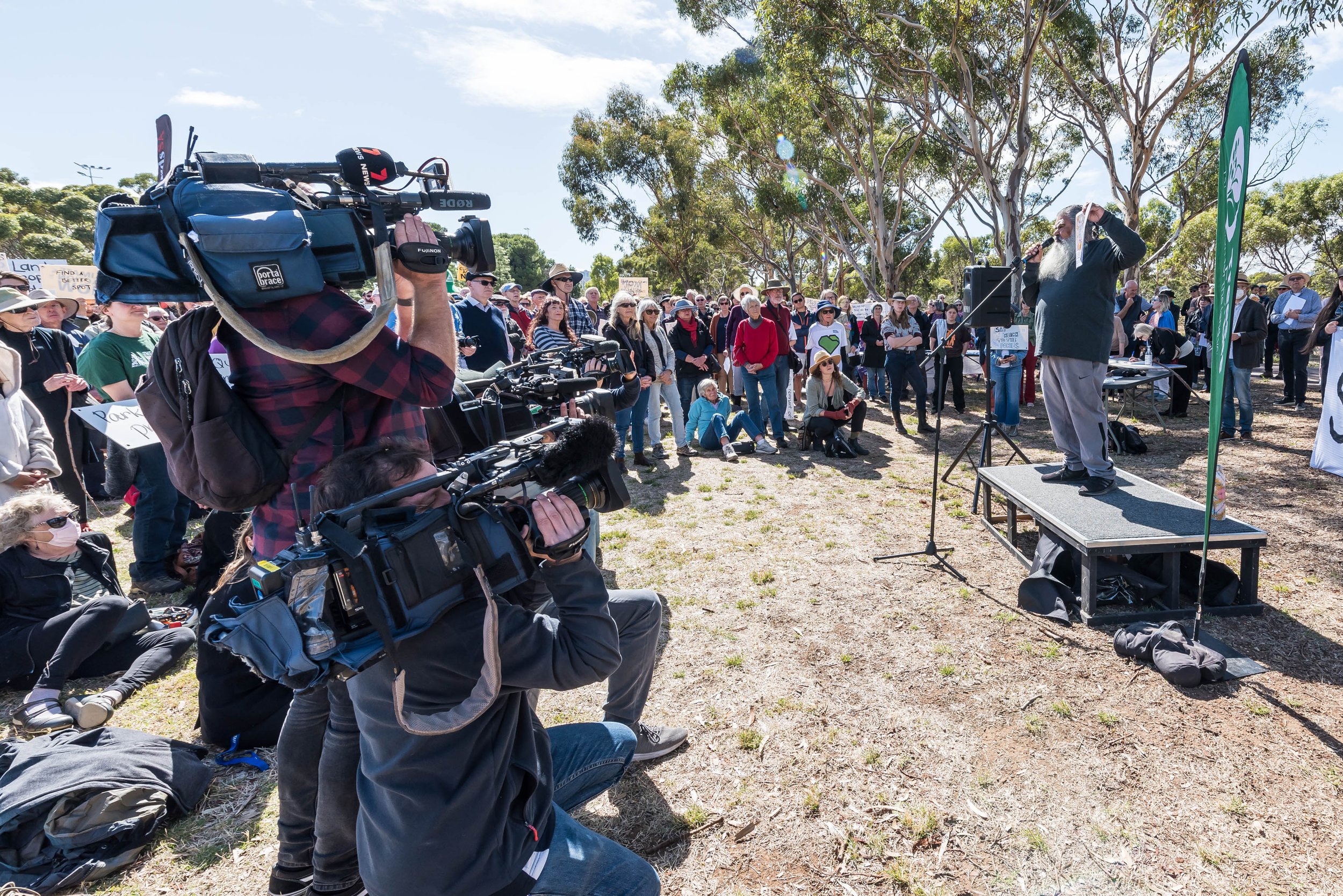
A public rally was held here on 1 April 2023, to protest against the proposal.
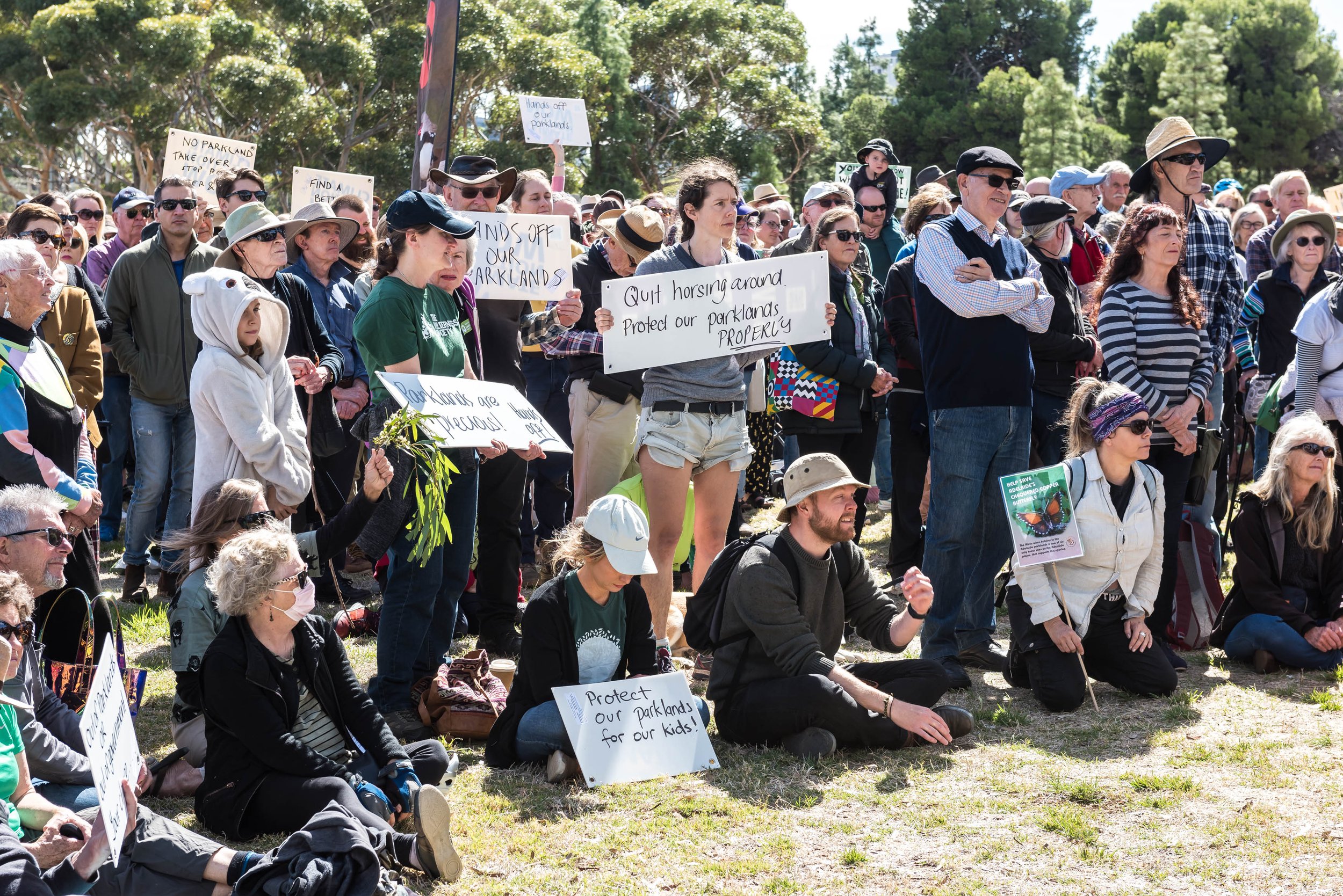
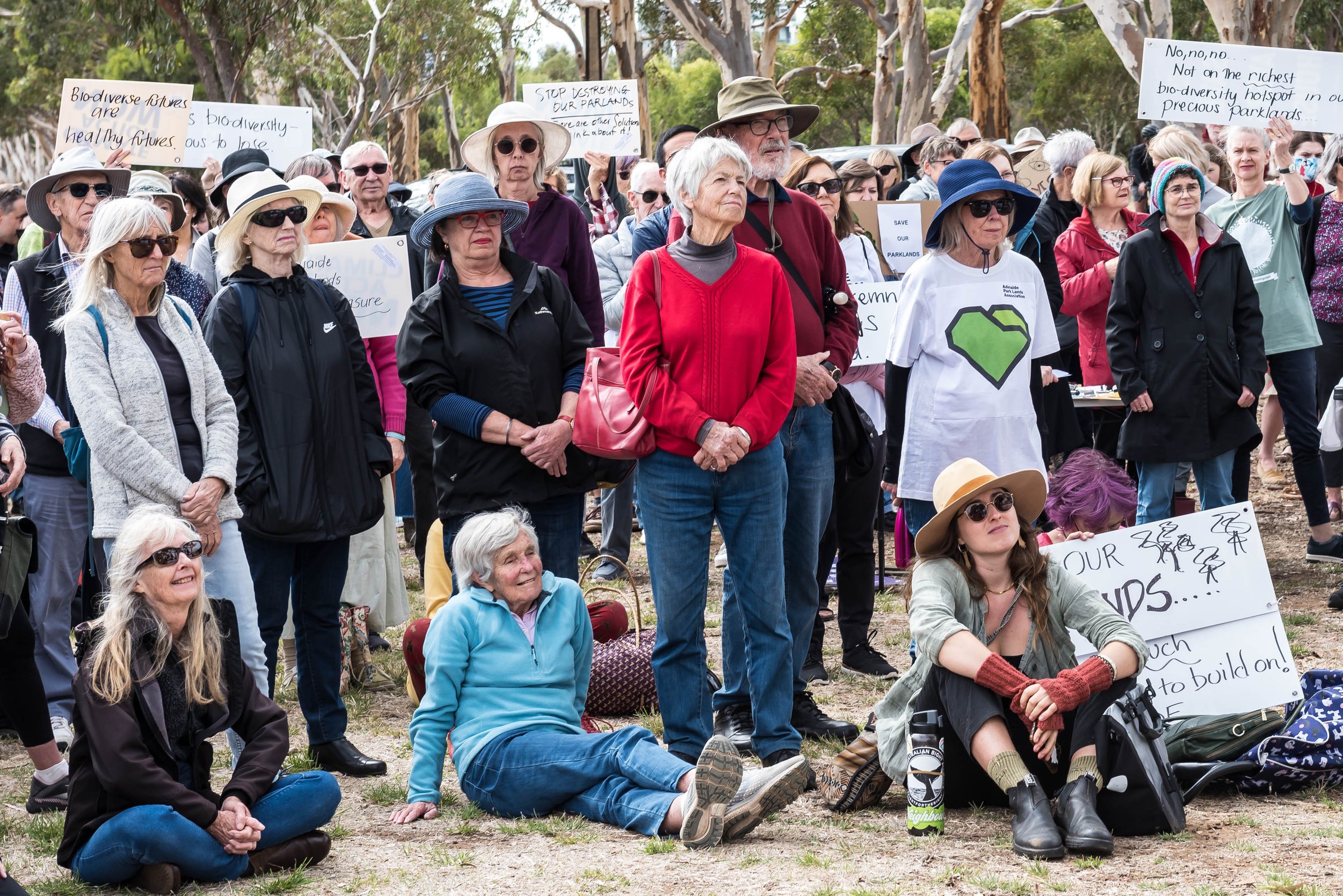
The following month, on 2 May 2023, Premier Peter Malinauskas admitted that the Government was in discussions with SA Police to find a different site.
A second community event held at the site on 4 June 2023, attracted a thousand Park Lands supporters, holding umbrellas to symbolise “providing cover”.
Four days later, on 8 June 2023, the State Government backed down and announced that the police barracks would be constructed instead on a site near Adelaide Airport. This community activism represented a high point in the battle to protect your Park Lands from State Government encroachmen.
From here, walk northwards across the grass to the football goal posts.

8. Lutheran Sports Club
Sport is played regularly on the north-western half of Park 21W. Sports played here include football, cricket, soccer, frisbee and Gaelic football.
The “Adelaide Lutheran Sports and Recreation Association” was formed in 1969. In the 1980’s it shortened its name to the “Adelaide Lutheran Sports Club”.
It began with a single football team in the United Churches League. In its first year, 1969, it had no home ground, and thus no change room facilities for pre or post-game use. After alternating between several home grounds, they settled here, in Park 21 West, in 1983.
In the 1990s these clubrooms were renovated and extended, and the grounds and oval lighting were improved.
Over the years, countless players and supporters have committed a huge amount of time and energy to the Club. The Club’s website says that it has over 400 playing members and 22 different sports teams.
The building, off Goodwood Road is leased from the City Council. The club holds a licence for the two sporting fields. The distinction between a lease and a licence is important. The leased building allows the club to keep it locked. The licence for the sports fields means that the fields are available to the public when they are not in use by regular sport organised by the Lutheran Sports Club.
It’s been estimated that more than 34,000 people, on average, play or watch sport on these ovals each year.
The demand is so great that the Lutheran Sports Club is pursuing plans to upgrade its building, again. Plans have been drawn up for a two-storey building on or near the current site.
In July 2022, Kadaltilla / Park Lands Authority gave tentative approval for the larger building, as part of a new $5 million “concept plan” for Park 21 West.

Concept plan endorsed by Kadaltilla / Park Lands Authority on 28 July 2022.
By early 2023, the Lutheran Sports Club had been assured of $2.55 million in funding, mostly from the State Government, but the City Council was being asked to consider subsidising the cost of construction - with up to $5 million for capital works as part of the Park’s “concept plan”.

2022 artist’s impression of the proposed new Lutheran Sports Club building.
As well as the expected and required toilets and change rooms, the proposed new building would include a “multi-purpose social space” as well as a separate “meeting room” and a kitchen on the first floor, as well as four separate storage rooms on the ground floor.
In May 2023, the City Council was expected to ask the Lutheran Sports Club to downsize its proposed building, after it was described by the Lord Mayor as a “megalith”, placing at least some of that foreshadowed $5 million funding in doubt.
From here, walk north to the gardens just off South Terrace.

9. Lundie Gardens
The patch of Park Lands near the corner of South Terrace and Goodwood Road was laid out as garden around 1917, under the guidance of the City’s head gardener August Pelzer.
At the time it was described simply as “South Terrace Garden”.
It was re-named in 1929 as “Lundie Gardens” in honour of Adelaide City Councillor Frank Lundie who served on Council from 1909 to 1931.
Councillor Lundie was very active in the union movement and the United Labour Party. He was an uncompromising socialist and recognised as a spokesperson for the poor.
After he died in 1933, a crowd of about a thousand people attended his burial in West Terrace cemetery. Thirty years later, in 1963, an ex-prisoners' hostel in Whitmore Square was established and named after him.
There is not much left of the formal garden that used to be here.
There was once a large, semi-rectangular area alongside South Terrace, boasting many pathways and plantings.
There were hedges along the eastern and western borders of Lundie Gardens.
The main plants that remain are a large Stone Pine (dating from about 1890) and a Canary Island Palm.

Interpretive sign in Lundie Gardens

Stone Pine and Canary Island Palm
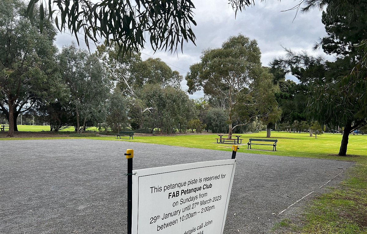
Lundie Gardens retains park benches, a barbecue and a picnic table, as well as a gravel petanque “piste” which is popular on weekends.
As noted earlier, this garden area formerly hosted the Dardanelles War Memorial from 1940 until 2018.
Dozens of the soldiers who died at Gallipoli in 1915 had come from this south-west corner of Adelaide.
Many of the mothers and wives of soldiers from the First and Tenth battalion were the ones who had contributed for the Dardenelles memorial.
Because of this, the memorial held a historical and emotional significance to this location, and to the descendants of those who sacrificed their lives in the war.
Various proposals have been suggested for this site such as a monument to the World War One Armistice on 11 November 1918, or a memorial for women who have died at the hands of their partners as a result of domestic violence.

The Dardenelles Memorial in place off South Terrace, in Lundie Gardens, part of Park 21 West, where it was placed from 1940 to 2018.
It’s hoped that for any such suggestions, proper consultation will occur involving all the stakeholders including historians and the communities of the South West City, Unley and Wayville.
From here, walk a little further east, to the playground.

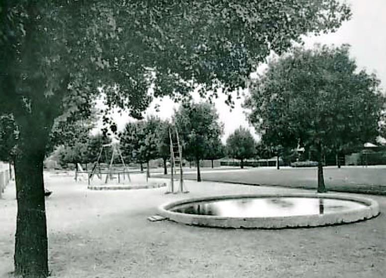
10. Princess Elizabeth Playground
.
The Princess Elizabeth playground was developed in the 1920s and named after someone who was at the time, only a toddler. Of course Elizabeth grew up to become Queen from 1954 to 2022.
The playground was opened in September 1929 by Lady Bonython, wife of the Lord Mayor, Sir John Bonython. The Lady Mayoress was also a renowned Adelaide socialite; named ‘Hostess of the Year’ in the same year she opened the Playground.
In those days, playgrounds used to be separated into one for girls and one for boys, with a supervisor employed on site.

In 1930 a cluster of trees was planted to both stand in as a windbreak and present as an attractive backdrop for Princess Elizabeth Playground, as viewed from South Terrace. The surroundings included a number of shade trees, including four desert ash trees.
Over the years, safer and more contemporary play equipment was installed gradually throughout the 1960s and 1980s and again in the 2010’s.
In April 2014, Princess Elizabeth Playground closed for a makeover, opening again in late August the same year. The new version of the playground unites sensory, active and nature play opportunities. Its features offer children the opportunity to explore and challenge themselves. The City Council estimates that each weekend the trampolines get more than 900,000 bounces!
The wider area between the playground and Lundie Gardens is now described as an “activity hub” open to a wider range of people, (not just families with small children) and encouraging more social interaction.

Princess Elizabeth Playground in Park 21W.
The playground has retained its original 1920’s shelter shed. In mid-2023, new shade structures were being constructed.
From here, it is a short walk east back to the starting point of this Trail Guide on the corner of South Terrace and Sir Lewis Cohen Avenue.
Optional: download and print a tri-fold leaflet, i.e. a double-sided single A4 page, with a brief summary of this Trail Guide: (PDF, 1.9 Mb)
All of our Trail Guides and Guided Walks are on the traditional lands of the Kaurna people. The Adelaide Park Lands Association acknowledges and pays respect to the past, present and future traditional custodians and elders of these lands.

