

Take the Trail
Begin at the car park off Park Terrace, opposite North Adelaide Railway Station.
This Trail is on the traditional land of the Kaurna people.

This Trail Guide starts at the car park off of Park Terrace, opposite Jarmer’s Kitchen. (Stop #1 on the map above).
1. Mary Lee Park - naming
2. Park Terrace Community Garden
3. North Adelaide railway station
4. Trees and Cows
5. Park Lands Trail
6. John Ednie Brown Park
7. Torrens Rail Junction Project
8. Model Aircraft, CX bikes
9. Horses
10. The Bunyip Trail
11. Kaurna History & language
12. Irrigation
13. Trees and wildlife
14. Deceased Workers Memorial Forest
15. West Adelaide Soccer Club
16. Community hub
This trail begins at the car park off of Park Terrace, opposite Jarmer’s Kitchen. (Stop #1 on the map above). The Trail will cover a distance of about three kilometres and will take about 90 minutes to walk. There is some rough ground to cover, and some stairs.
It starts here in Mary Lee Park (Park 27B) before crossing into John E. Brown Park (Park 27A) then returning to the starting location here in Park 27B.
Walking instructions are designated by bold type at the end of each of the stop descriptions.
Optional: download and print a tri-fold leaflet, i.e. a double-sided single A4 page, with a brief summary of this Trail Guide: (PDF, 4 Mb).

1. Mary Lee
The naming of this Park honours a woman who played an historic role in the South Australian suffragette movement by securing South Australian women the right to vote.
Mary was born in Ireland in 1821, before she emigrated to Adelaide in 1879, to care for her son who was ill. Mary Lee was first introduced into activism when she joined the Social Purity Society, which campaigned for law reform in the areas of child labour, employment for young women, and raising the age of consent.
By 1890, she was the founding Secretary of the Working Women’s Trade Union League. Mary was also an active member of the Trades and Labour Council and the Committee of the Adelaide Sick Poor Fund.
In 1888, Mary Lee helped form the Women’s Suffrage League of South Australia, where she held the role of Secretary, and worked closely with the President, Augusta Zadow. Together, they travelled across South Australia with a petition to secure the right for women to vote and to stand for election to Parliament.
Her petition was presented to the South Australian Parliament with 11,600 signatures on a singular scroll that was 122 metres long!
The petition helped pass the Adult Suffrage Bill in 1894 allowing women both the right to vote and the right to stand as candidates in South Australian elections.
The work done by Mary Lee and the Women’s Suffrage League of South Australia was of global significance, and led to South Australia becoming the first electorate in the world to give equal political rights to both men and women.
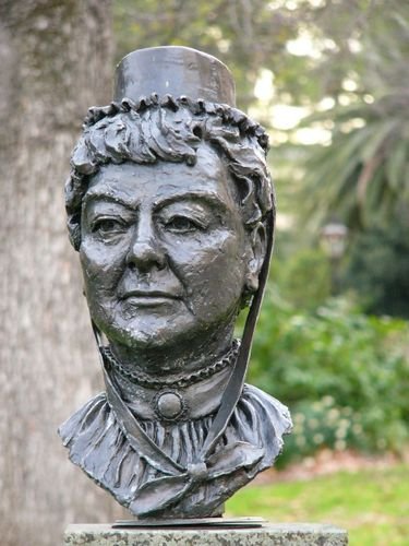
As well as having this Park named after her, Mary Lee is also honoured with this bust on North Terrace.
The Adult Suffrage Bill also allowed First Nations women the right to vote. However, seven years later, at Federation in 1901, that righr was removed by the Commonwealth Government and was not restored until the Commonwealth Electoral Act was amended in 1962.
Mary Lee died in 1909, at age 88, in North Adelaide. Her daughter and a son in England survived her.

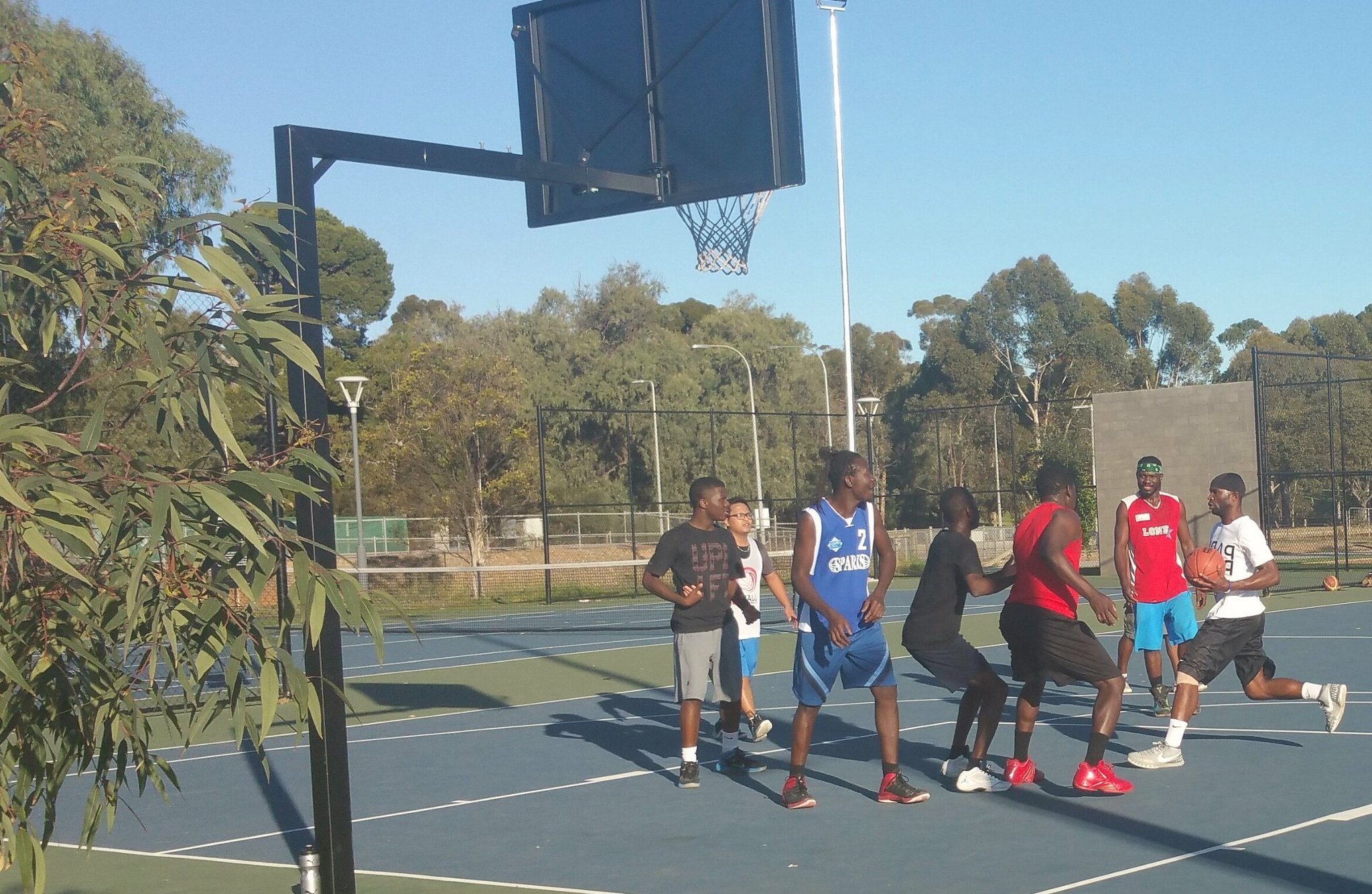
Alongside the car park, and opposite the basketball this small courtyard features 11 Kurrajong (bottle) trees, and an understorey of cardboard cycad bushes.
At the end of the car park, at the closest point to the railway line, turn left and walk around the Park Terrace Community Garden.

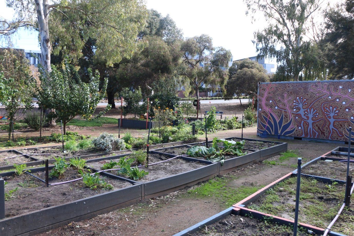
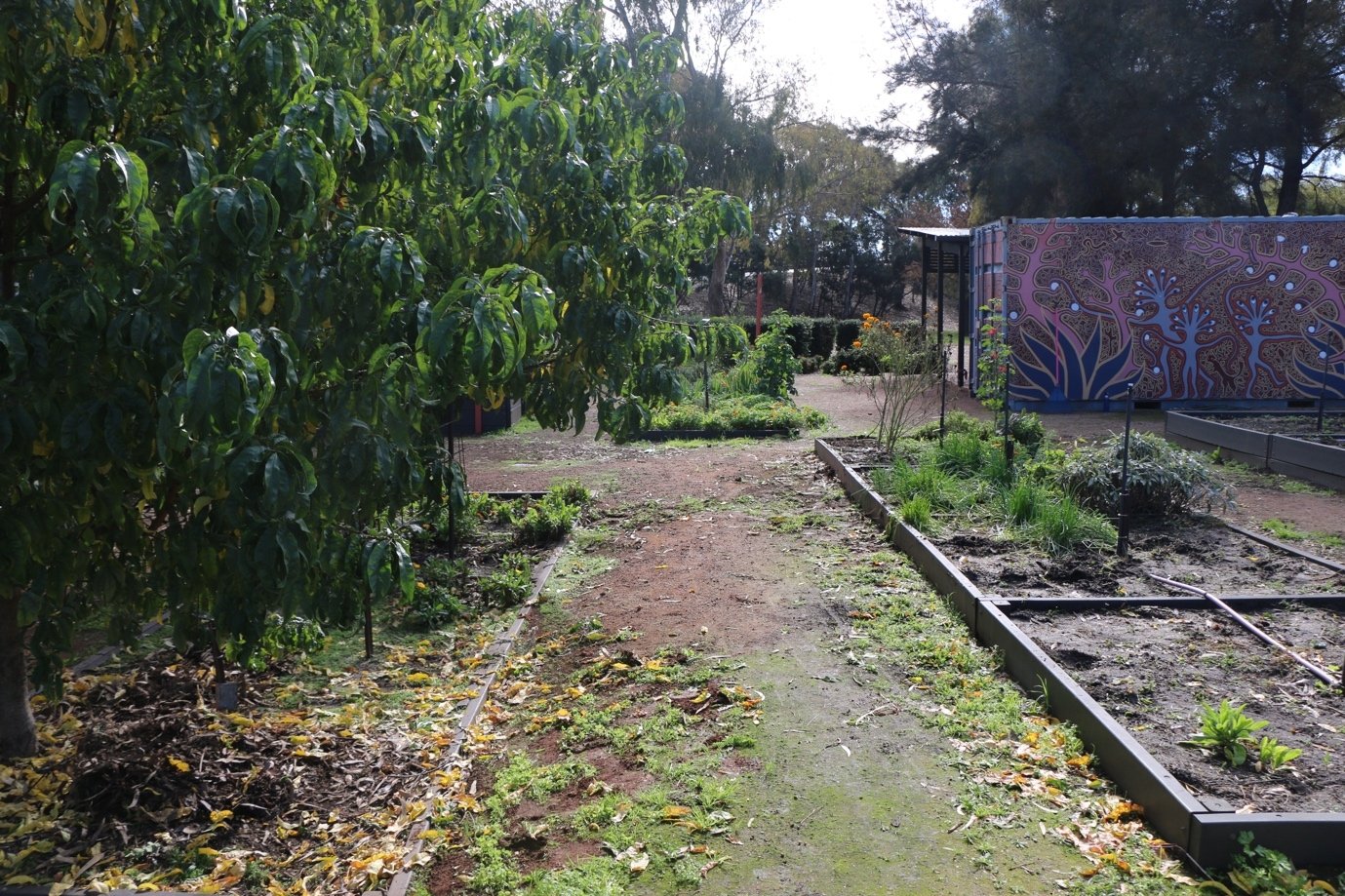
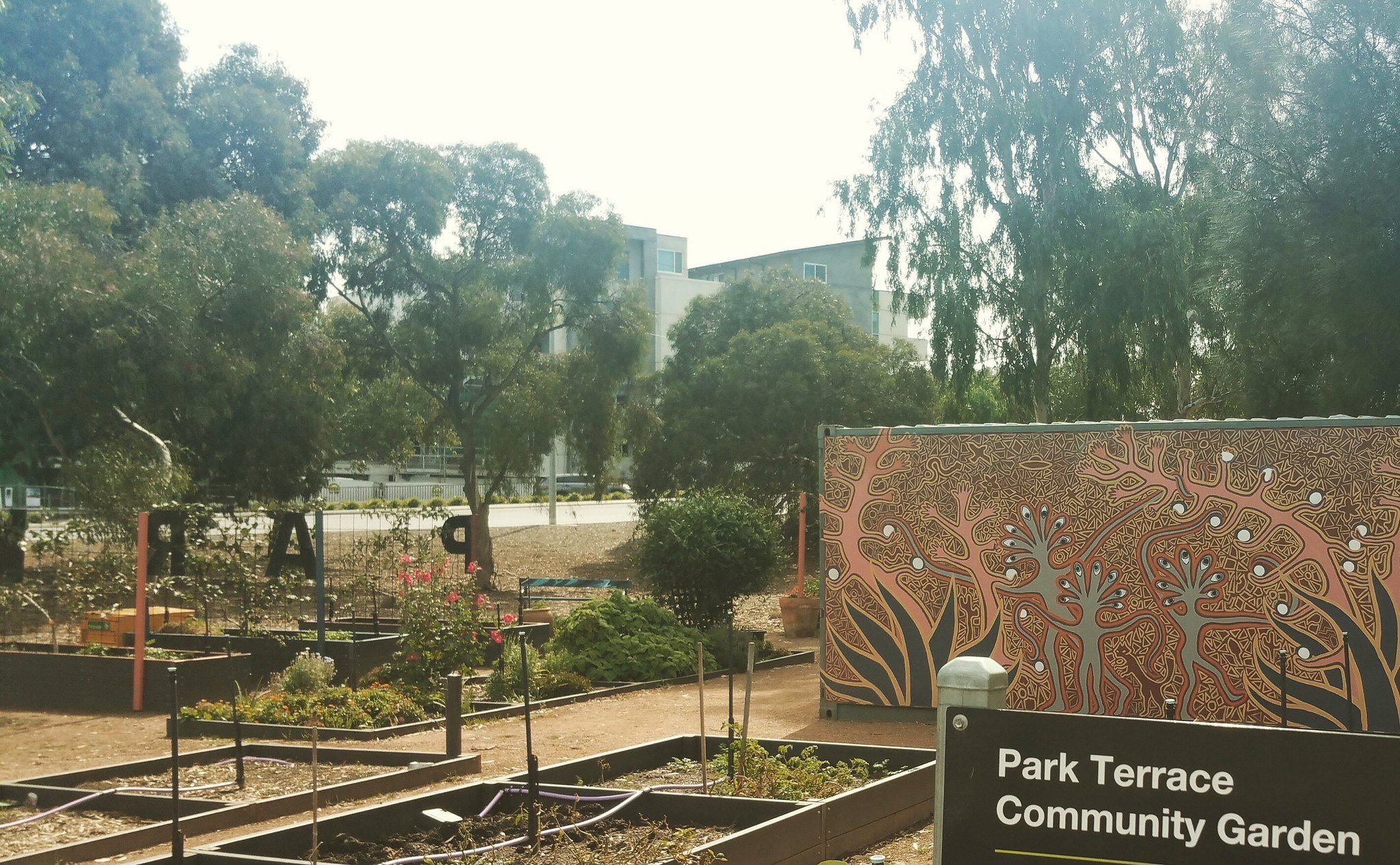
2. Park Terrace Community Garden
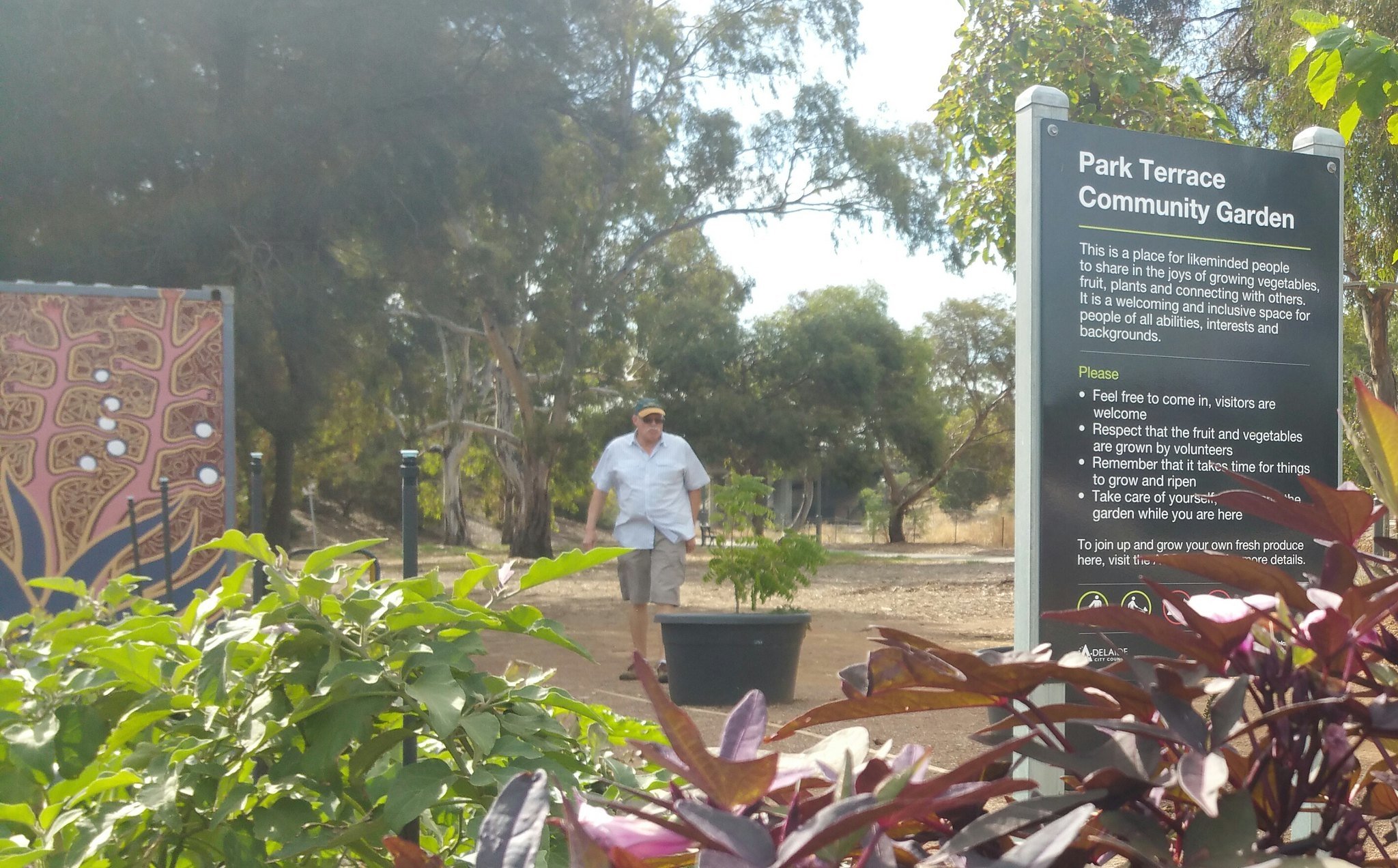
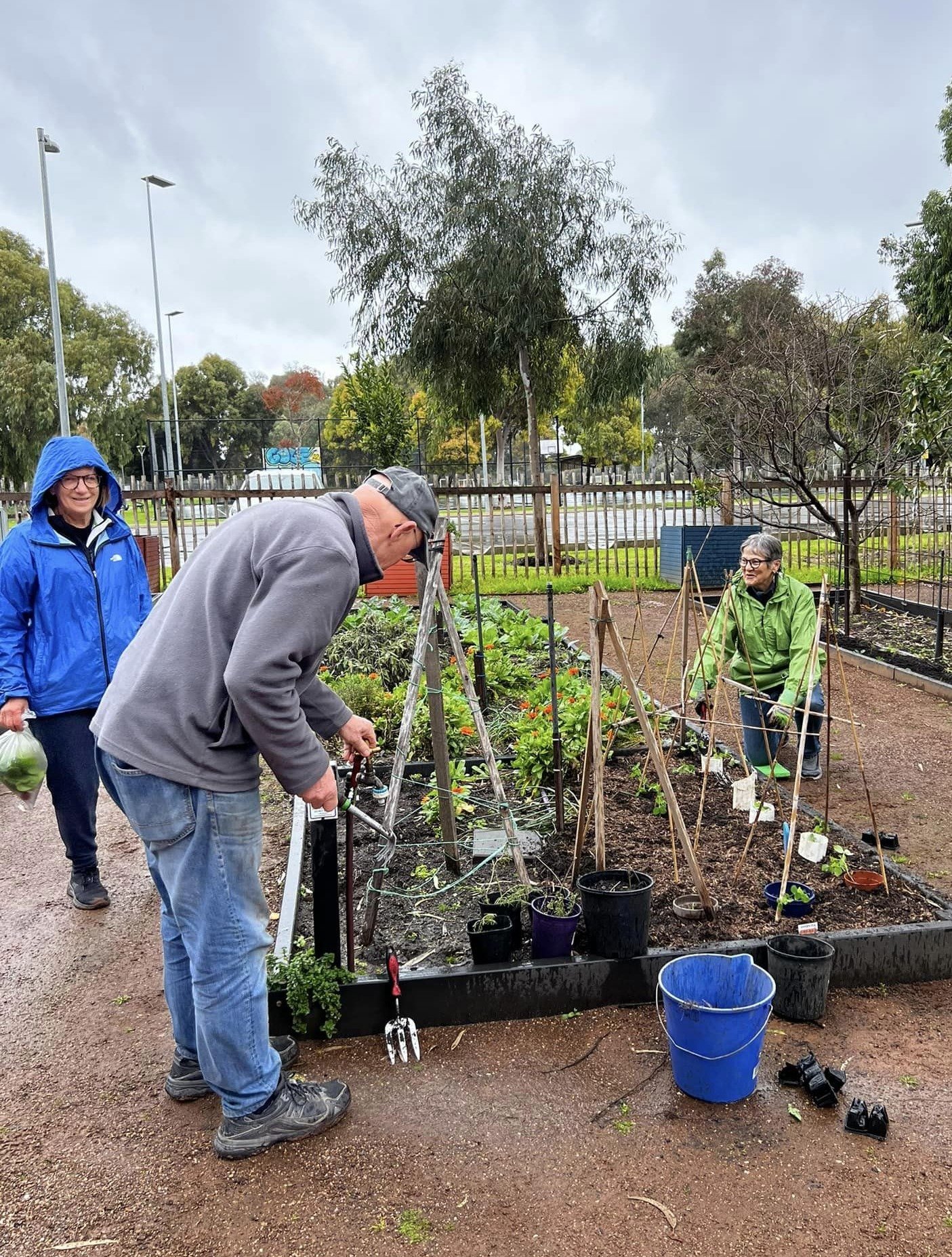
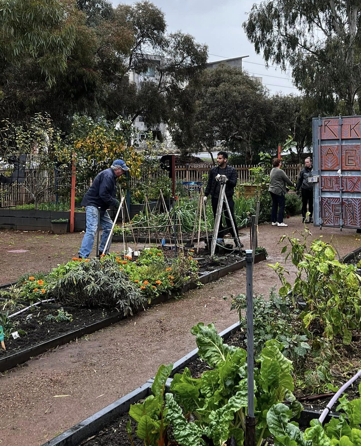
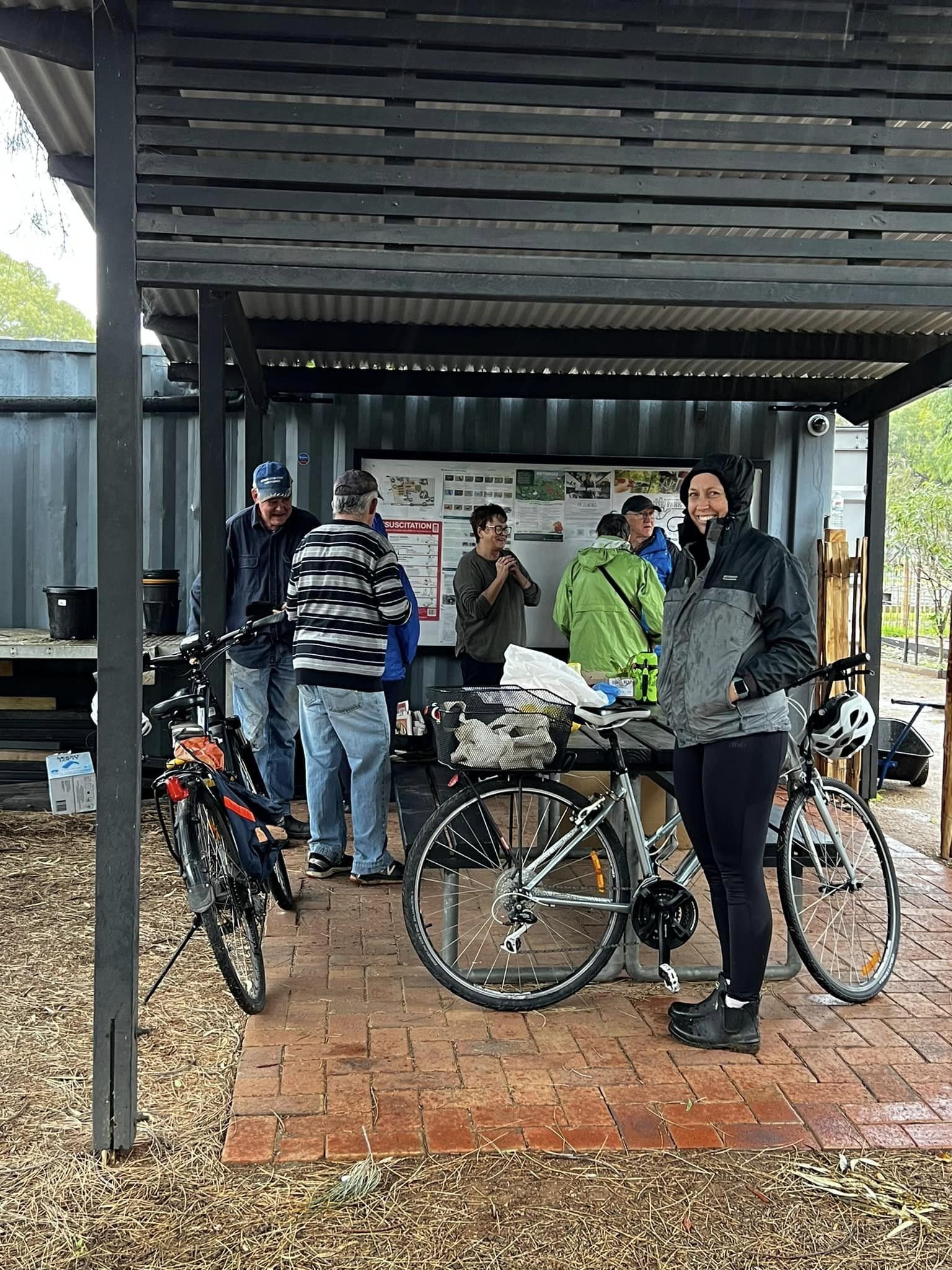
The Park Terrace Community Garden was built in 2016 by Renewal SA. The Garden has been operated by a small community group: the Park Terrace Community Garden, Inc. with members who live in nearby suburbs. The group licences the land from the City Council and has well-established vegetables and flowers blooming.
All plots are available for members to participate in planting and harvesting. On its website, the PTCG says its aim is “to create a place for like minded people to share in the joys of growing fresh produce which can be enjoyed by all garden members.” The regular garden drop in time is most Saturdays.
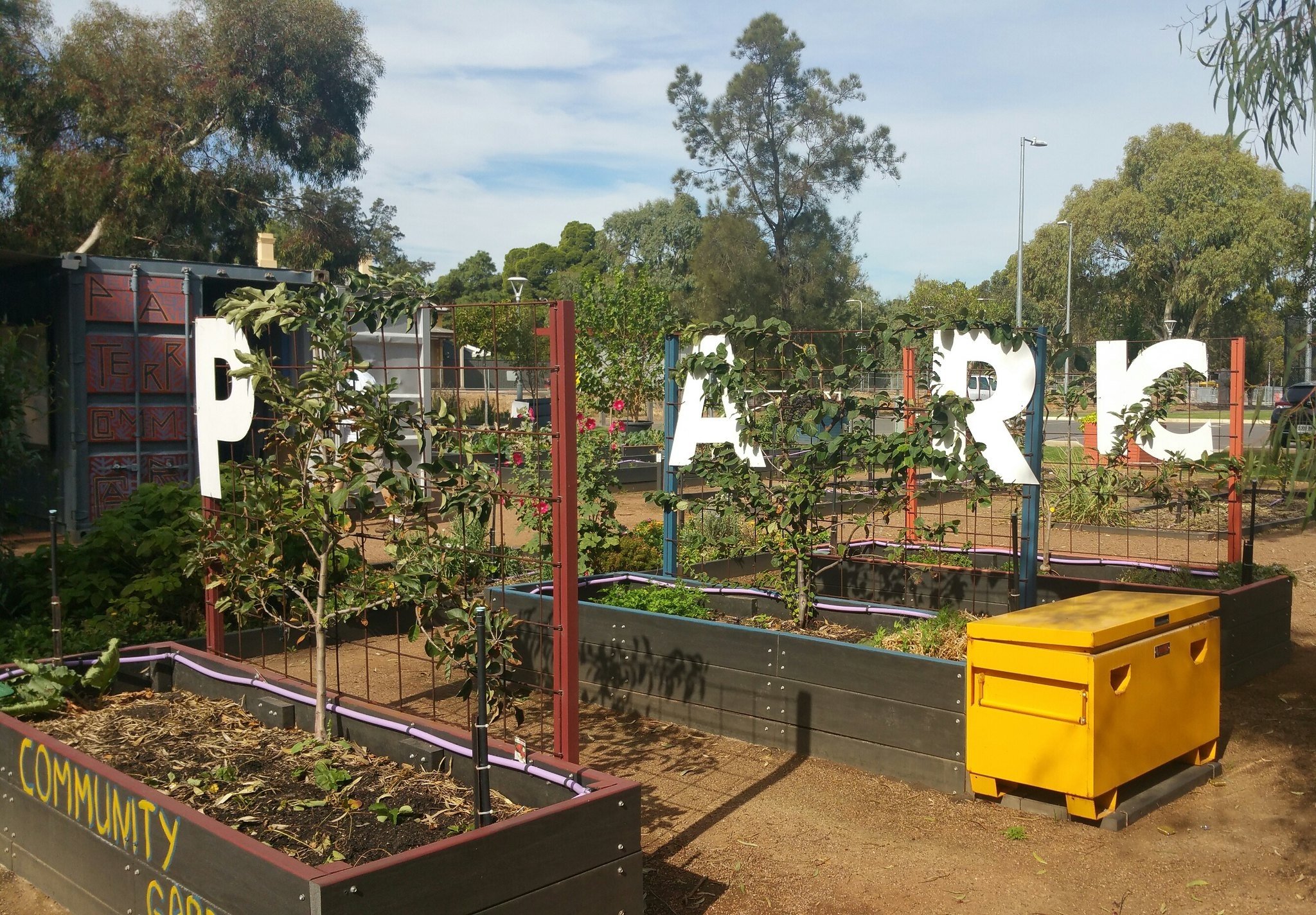
In 2020 and 2021, a series of crimes affected the Community Garden, destroying much of the hard work of the community group; with damage, theft, and issues of personal safety impacting operation. The Community Garden Committee then sought approval from the City Council to have the Garden fenced and for individual plots to be available for hire.
Both the City Council and the State Government’s “Green Adelaide” agency have made funding grants to the Park Terrace Community Garden, and it’s been revived since August 2022, with the help of many willing volunteers.
Photos: Park Terrace Community Garden Facebook page.
There is another community garden in your Park Lands - in Veale Park / Walyu Yarta (Park 21)
Now, walk back to the end of the car park where you started, to face the historic Railway Station building.

3. North Adelaide Railway Station
.
The North Adelaide railway station is a State Heritage building that opened in 1857. It is the third oldest remaining railway station in South Australia, after the Bowden and Alberton Stations.
It is serviced by the Gawler train line. These days, most trains on the Gawler line are express through here. Only limited services stop here.
This line opened in 1851, four years after the first Australian law, enabling the construction of railway lines, was passed in 1847.

North Adelaide Railway Station, c1880. Pic: State Library of SA
When the station opened in 1857, it had a waiting room, a separate ladies waiting room, and a ticket office. It also had an attached four-room residence with exotic gardens.
It was a very popular station in the late 1800s and early 1900s. By 1969, all trains except the express trains stopped here at least once every day. However, its condition gradually deteriorated, until it was closed for a short period of time in the 1990s after the north-bound platform burnt down. It was subsequently rebuilt, which is what we see today.
Until the early 2000s motorists were allowed to drive across the railway lines from Park Terrace to War Memorial Drive, passing over the Gawler railway line.
Since the mid-1990s, the North Adelaide railway station building has had various tenants who’ve leased the premises from the City of Adelaide. Between 1996 and 2004, it was the home of Bicycle SA. Later, it was utilised as a café until 2019.
The station building was again up for lease in 2022, with the City Council seeking expressions of interest.
From here, walk south past the toilets and tennis courts. Leave the bitumen path and turn left, onto the grass. Keep to the left of the soccer field, and the right of the trees. Follow the trees and the edge of the soccer fields until you reach the end, the southern limit of the playing fields.

4. Trees and cows
As you walked along the edge of the playing fields, you would have seen a corridor of native vegetation on your left, providing a screen between the playing fields and the railway line. Some of the most prominent of the trees in this corridor are Quorn malleee trees (Eucalytus porosa).

A Quorn malleee tree (Eucalytus porosa) in blossom in November in Mary Lee Park (Park 27B).
In the first decades of European settlement, after 1836, most of the trees in your Adelaide Park Lands were cleared for firewood, construction and fencing posts. This Park, like all other parts of the Park Lands, suffered from this clearing.
In neighbouring parks, such as Bonython Park/ Tulya Wardli (Park 27), native vegetation was entirely cleared!
Mary Lee Park was more fortunate, with a small area of remnant and and re-planted vegetation remaining. This meant that Kaurna people could host activities here as one of the few remaining areas near Adelaide with vegetation which provided shelter and firewood.
Some of the native Australian species that remain are the Drooping Sheoak (Allocasuarina vercilata), Southern Cattail (Typha domingensis), Hedge Bindweed (Calystegia sepium), and Slender Knotweed (Persicaria decipiens). Significant replanting has occurred, which has slowly restored the native tree species.
Cows!
This was the last place in your Park Lands where cows were allowed to graze.
Livestock had been present in the Park Lands since European settlement in 1837, but this was the very last place they remained. Throughout the 1960s, this Park 27B was home to more than one thousand cows. They were not removed until 1972.
After World War II, many working families living in the southern and western parts of the City owned a family cow.
The Park Lands gave them the space to keep their cow, and also saved the Council the cost of mowing the grass!

During this time, most of your Park Lands were fenced, to prevent livestock escaping. The fencing meant that pedestrians would have to pass through a gate or climb over a wire fence. Some people today may still remember the abundance of signs with the phrase ‘Cows Only’.
It took nearly forty years to fence the entire Park Lands. There were about 130 kilometres of fencing in total: not just here, but throughout your Park Lands. The fencing was removed, only twenty years after the job had been fully completed.
The cows that lived here definitely thought that the grass was greener on the other side as they damaged many fences trying to find a better grazing spot.
One cow in the southern Park Lands became a minor celebrity in the 1950s. After becoming unwell, the cow was sheltered in a tent and covered in blankets by its owners, who tended to it day and night. Eventually the cow wasn’t able to move, and after gaining significant press coverage, a good Samaritan paid for a crane to winch the cow out of the Park Lands and into a better shelter.
In 1972, the last two dozen cows were evicted from this Park.
Now walk directly across the playing fields until you come to a bitumen path, that leads to a pedestrian bridge over the railway line.

5. Park Lands trail
The Park Lands Trail is a 19.5km trail that loops around the entire Park Lands. It forms a figure-8 double loop of the city of Adelaide and North Adelaide. It passes through nearly every Park within the Park Lands, including both John E Brown and Mary Lee Parks.
The Trail is a generally flat walk on mostly sealed bitumen, meaning it can be walked in around four hours or cycled in around one and a half hours.
The Trail can also be split into one or more shorter walks, to allow more time to sightsee. The northern loop of the Park Lands Trail is only 9 kilometres. It passes through Park 27A and Park 27B and follows the northern side of the River Torrens.
The Trail is marked by a big blue circle on the bitumen, so you won’t get lost!
Now, cross the railway bridge, to enter John E Brown Park (Park 27A).

6. John Ednie Brown Park
On this (south-western) side of the railway bridge, you have left Park 27B behind, and you are now in Park 27A.
While it may not be visible to the passers-by driving down Port Road, John E Brown Park is a lively green space bordering Karrawirra Pari (River Torrens) and home to bush walks, a billabong, cyclocross racing events, magnificent wildlife and a fascinating history.
The man after whom this Park is named, John Ednie Brown, was a Scottish sylviculturist (forest expert), who held the role of Conservator of Forests in South Australia from 1878 to 1890.
In this time, he literally wrote the book on trees in the Adelaide Park Lands. A Practical Treatise on Tree Culture in South Australia and The Forest Flora of South Australia are considered important founding documents of your Adelaide Park Lands.
Both of these works were highly praised and led to him being regarded as “the most competent man in dealing with forestry in all the Australian colonies.”
The plans drafted by John Ednie Brown in his 1880 report are reflected throughout much of the Park Lands today. He had a fondness for diagonal pathways, inviting pedestrians to experience the beauty of the Park Lands for themselves.
After 10 years in the service of South Australia, the New South Wales Government offered him the post of Director General of Forests in New South Wales, at an increased salary. However, this position was abolished during the Great Depression.
He then was appointed Conservator of the newly created Department of Woods and Forests of Western Australia. During his time here, the value of Western Australia's timber exports increased fivefold.
The City Council decided to name this Park after John E Brown only as recently as 2017!
However this Park has been identified as number 27A since September 1882.

John Ednie Brown literally wrote the book (1880) on how to re-vegetate the Adelaide Park Lands to repair the damage caused by the first few decades of European settlement.
From here turn left and walk down the wide dirt path along the rail line fence. Stop at a fenced-off (disused) railway pedestrian crossing.

7. Torrens Rail Junction Project
The Torrens Rail Junction Project was commissioned by the Federal Government in 2016 and was carried out between 2017 and 2018. The entire cost of the Goodwood-Torrens Junctions Project was over $350 million. This particular section through the northern Park Lands, cost $238 million.
Prior to the completion of this Project, freight trains were required to give way to passenger trains coming from Adelaide’s Outer Harbour, causing a delay in rail freight network services and increasing the presence of heavy vehicles on Adelaide’s road networks.
The Torrens Rail Junction Project built the rail underpass that goes underneath Park Terrace at Bowden. The project also separated the freight rail line from the passenger rail line, which allowed trains to increase their length.
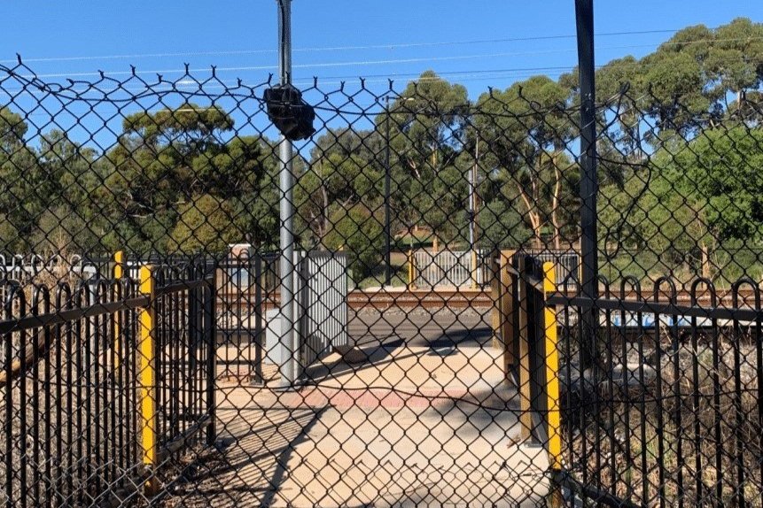
The fence which prevented pedestrian and cycle crossing for almost seven years, from March 2017 to December 2023.
In the construction of the Torrens Rail Junction Project, the pedestrian crossing that linked John E Brown Park, Mary Lee Park, and Tulya Wardli (Bonython Park) with North Adelaide was closed in March 2017.
At the time, the plans for the upgrade included a new automated pedestrian and cyclist crossing. However, after completing this pedestrian crossing to provide a direct connection between this Park 27A, and North Adelaide in 2018, engineers formed the view that it was not sufficiently flat, or level. The slight camber of the railway, on this curve supposedly made it unsafe for users of mobility aids and devices, such as wheelchairs.
The Department of Transport and Infrastructure advised that it could not justify the ‘increased cost’ associated with fixing these issues. The crossing remained closed for almost seven years, cutting off what had been previously a commuter route for cyclists and pedestrians between Thebarton and North Adelaide.
However, in December 2023, the crossing was quietly re-opened without any Government announcement.

Re-opened in December 2023 - the pedestrian and cyclist crossing from John E. Brown Park to War Memorial Drive and the North Adelaide Golf Course in Possum Park / Pirltawardli (Park 1)
From here, turn right onto the bitumen path, lined with young eucalyptus trees. Stop half-way along the path, which is about the centre of a large open grassed area.

8. Model Aircraft, CX bikes
After World War II, this area was used by model aircraft enthusiasts.
The South Australian Associated Aeromodellers Club didn’t start off their operations here. Their first site was in Ellis Park / Tampawardli (Park 24) starting in 1952. However three years later, in September 1955, they moved here to Park 27A, where they flew their model planes, alongside another group, the Air Training Corps on Saturday afternoons.
In recent years there’s been a declining interest in model fixed-wing aircraft. However, the modern counterpart, the drone or model quad-copter has been gaining immense popularity. The generic name for all types of small flying things is UAV: “Unmanned Aerial Vehicles”.
The City Council of Adelaide now regulates the areas that UAVs can be used in your Adelaide Park Lands. The two approved areas are the southern part of Veale Park / Walyu Yarta (Park 21) and the southern part of Victoria Park / Pakapakanthi (Park 16).
John E Brown Park is also home to the occasional cyclocross race. Cyclocross, or CX, is a form of bicycle racing described as ‘a cross between road racing and cross-country running’. It tests the aerobic endurance of cyclists as they manoeuvre between natural obstacles that may require dismounting from the bike and carrying it (instead of riding) across difficult terrain.

A cyclocross event in John E Brown Park (Park 27A).
Cyclocross is a sport that uses bitumen roads, dirt roads or tracks and also cross-country fields or paddocks.
Cyclists participating in CX races aim to avoid any degradation of the Adelaide Park Lands and reduce their impact by switching the course where they will race. This allows the natural environment to regenerate after any event.
CX is generally regarded as a more enjoyable form of cycling to watch, due to the slower speeds and shorter tracks with difficult terrain.
Continue crossing the John E Brown oval until you get to the bitumen John E Brown Road and a disused shed.

9. Horses
.
This old brick building, with an iron roof, was once known as the ‘John Vaughan Equestrian Park Pavilion’. The building is no longer in use and is likely to be demolished.

The former “John Vaughan Equestrian Park Pavilion” as it appeared in 2020 and (inset) in 2007, while it was still in use for equestrian activities.
John E Brown Park was formerly used for activities hosted by the Equestrian Federation of Australia.
Horses have not been present in John E Brown Park since the mid 2010s. There are other locations in the Park Lands where horses can still be seen, such as Lefevre Park/Nantu Wama (Park 6).
However this part of Park 27A hit news headlines in August 2023, when the Police Association revealed that this Park would be its preferred new location for the SA Police Mounted Unit, that was soon to be evicted from the Thebarton Police barracks.
However the State Government quickly shut down the suggestion. Treasurer Stephen Mullighan confirmed that there would be no new police barracks on this site, nor anywhere else on your Park Lands.
From here, turn left and keep walking along the bitumen path until you come to a bollard in the middle of the path, and a park bench on the right of the path.

At this location, look for a dirt path heading off to the right.
Turn right onto a dirt pathway which leads to these stairs, down to the river.

The stairs leading down from John E. Brown Road to the River Torrens / Karrawirra Pari.
At the bottom of the stairs you’ll see a footbridge over the River Torrens / Karrawirra Pari. This marks the start of the Bunyip Trail.

10. The Bunyip Trail
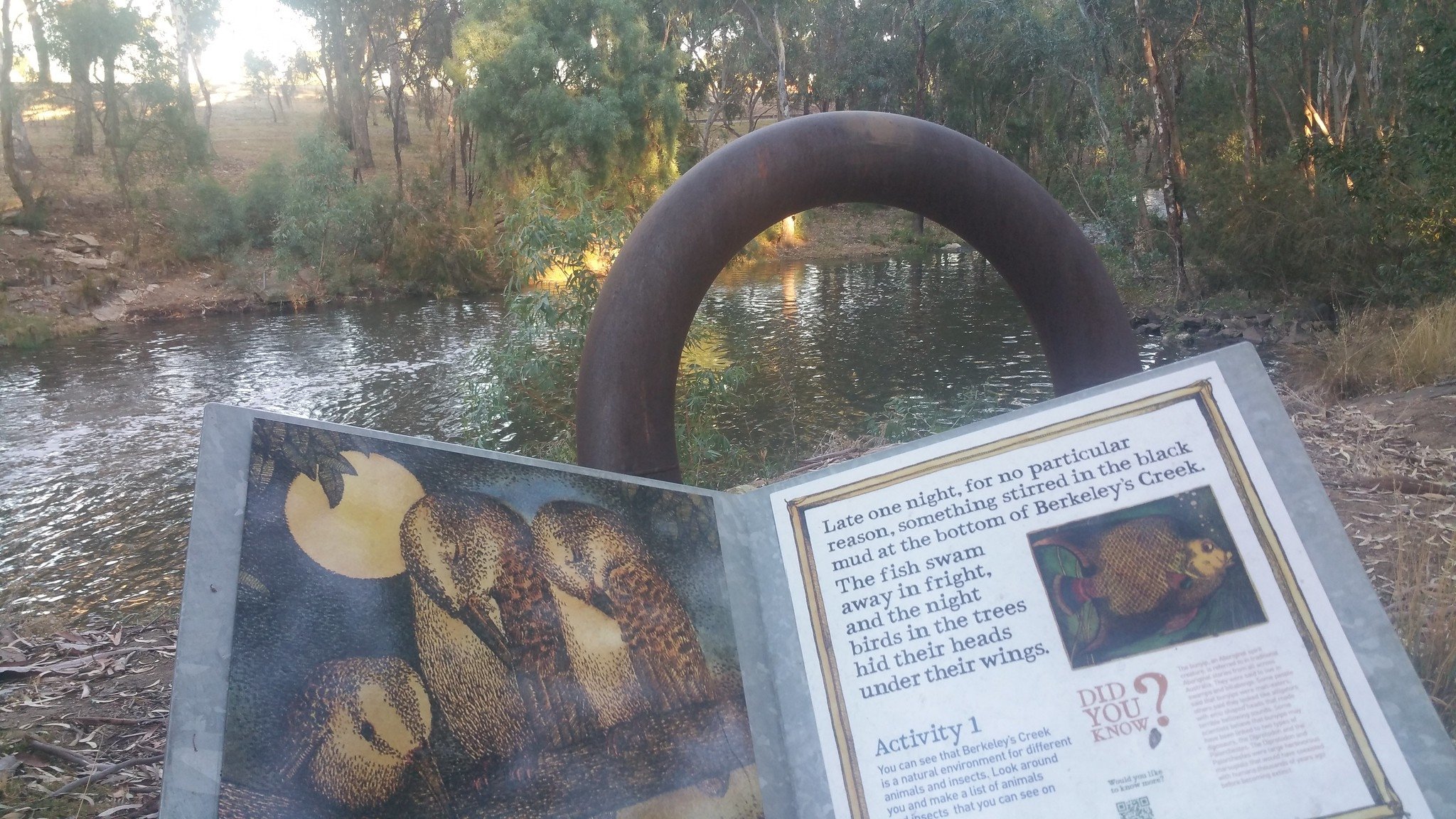
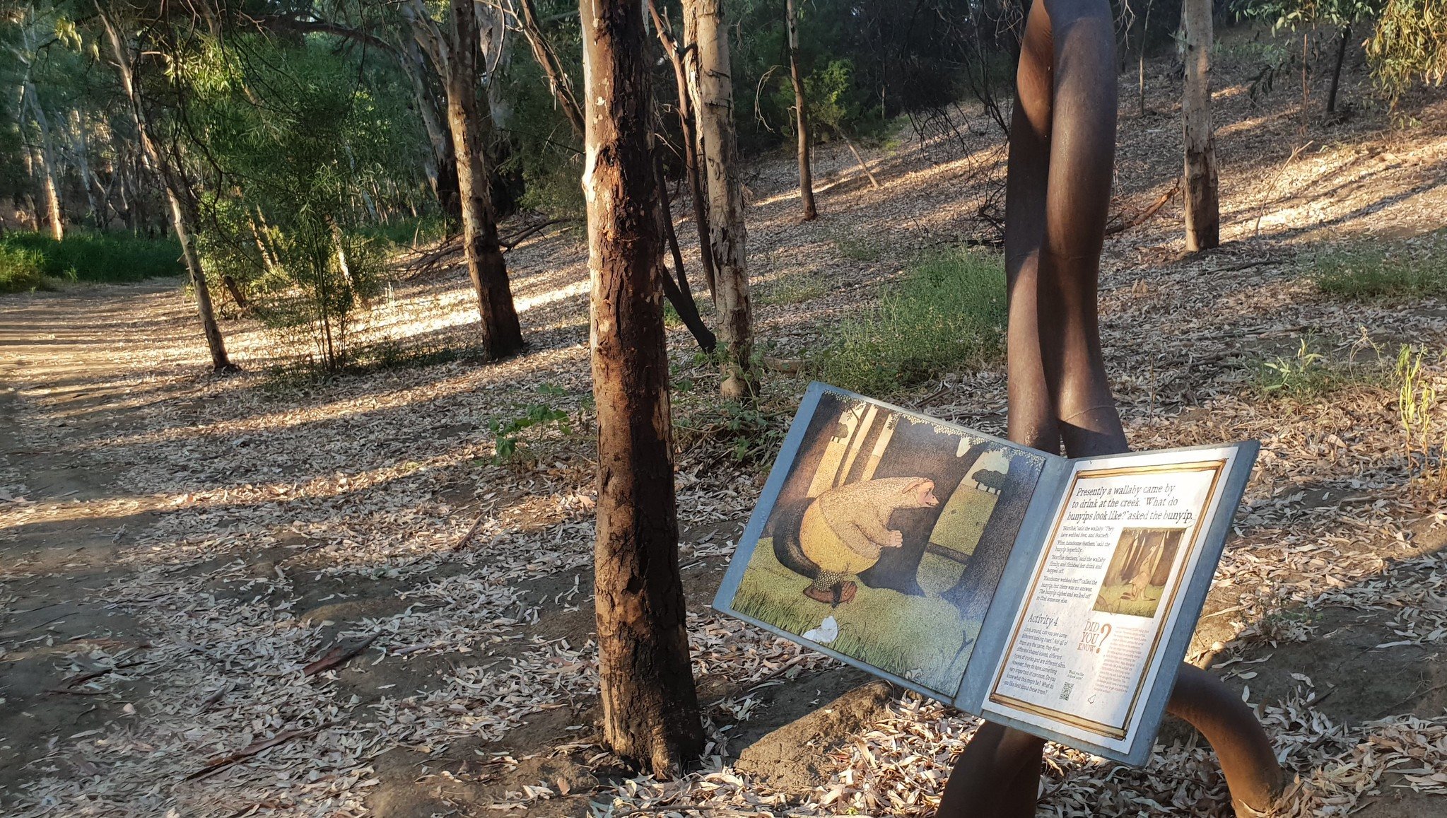
The Bunyip Trail is a native bush walk along Karrawirra Pari (River Torrens) which is designed for both children and adults alike. It is based on a children’s storybook called The Bunyip of Berkeley Creek by Jenny Wagner and it follows the journey of ‘something very large and muddy’ who doesn’t know who he is or what he looks like.
On the way, he encounters many other animals who tell him that he is a Bunyip. It’s not until he reaches a Billabong where he is able to see his own reflection in the water that he realises that he is indeed a Bunyip, and learns what he looks like!
If you follow this walk until the end, you will also reach a Billabong to mirror the conclusion of the story.
On this walk, you will find nine story boards and activities scattered along a 520-metre riverside trail. There is also an interactive booklet for young kids walking the Bunyip Trail which can be found in the link below.
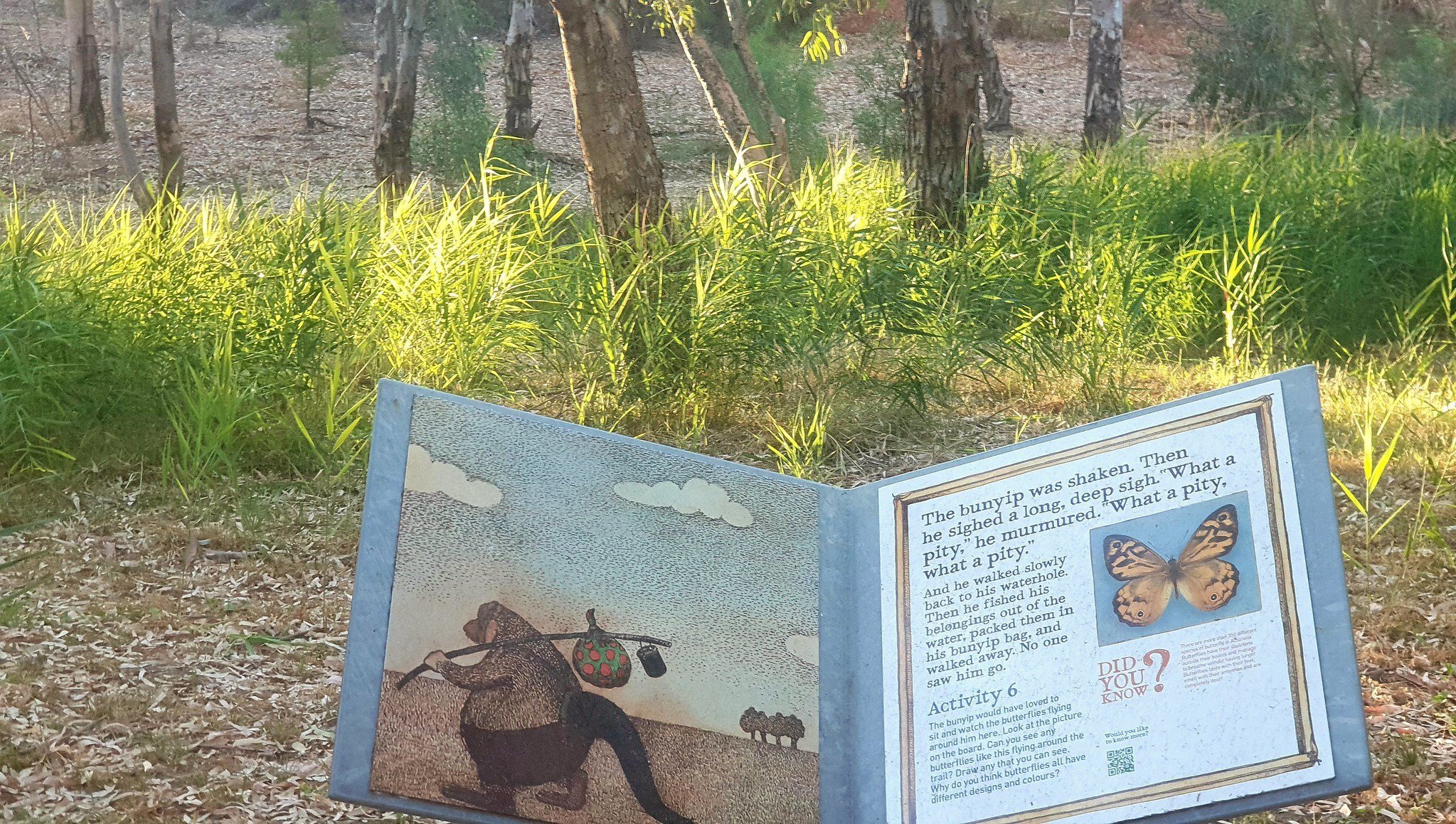
The Bunyip Trail was damaged by severe storms in 2016. Many of the native plants you see today are the result of re-planting organised by local communities to restore the Bunyip’s home. The trail is closed each winter (from May to August) due to the risk of localised flooding in the area, and should not be used on days of heavy rain.
Walking SA has made available three downloads for finding and exploring the Bunyip Trail: https://www.walkingsa.org.au/walk/find-a-place-to-walk/bunyip-trail-childrens-trail-bonython-park-tulya-wardli/#downloads
Walk the Bunyip Trail. Stop at the end, at the billabong, and pause to appreciate the serenity!

11. Kaurna History and Language
Not much is known about the importance of John E Brown Park to Kaurna people prior to European colonisation.
The layout of your Adelaide Park Lands does not reflect traditional usages of the Adelaide plains by First Nations people. On the other side of the train tracks is Possum Park / Pirltawardli (Park 1). While these areas are now divided by War Memorial Drive and the railway line, the entire area was regarded by the Kaurna people as the House of the Possum, and was a regular camping site.
It was in this general area, alongside Karrawirra Pari, that the first Christian mission was established in 1839 by two German missionaries: Schürmann and Teichelmann. Unlike most other missions, lessons to Kaurna children were taught in the Kaurna language. This was the reason that it was ultimately closed by Governor Gawler in 1845, who insisted that classes for Kaurna people had to be taught in English. Prior to this mission, the Kaurna language was entirely oral.
The missionaries, relying on three prominent Kaurna Elders, Murlawirrapurka (‘King John’), Kadlitpinna (‘Captain Jack’) and Ityamai-itpinna (‘King Rodney’), documented over 3,000 words of vocabulary, creating a written language for the first time.
The work of the German missionaries allowed the Kaurna language to be revived in the early 1990s by Adelaide University’s Professor Rob Amery, after the last known Kaurna native speaker, Iparrityi, died in 1929.
The Adelaide City Council first launched the Kaurna Naming Project in 1997, creating the dual Kaurna place name of each of park and square within the Adelaide Park Lands.
Since March 2012, the City of Adelaide has considered the Kaurna naming project to be complete.
However, both John E Brown and Mary Lee Park received their English names in 2017.
They were previously known only as Park 27A and 27B, subdivisions of the larger Park 27.
When they were assigned their English names in 2017, no Kaurna name was added. The City Council of Adelaide has advised that they are in the process of revising the Kaurna naming project and will likely ask Kaurna people to suggest names for both John E Brown and Mary Lee Park.
The Council also plans to reverse the order of English and Kaurna names of all Parks, with the Kaurna name then becoming the primary name.
Now, retrace your steps. Walk back along the Bunyip Trail and climb the stairs. Stop at the top stair (where the dirt pathway begins) and look to your right, down towards the river where you can see a shed on the river’s edge.

12. Irrigation
This shed houses a water pump. The pump siphons the water out of the River Torrens / Karrawirra Pari for irrigating the nearby North Adelaide golf courses in Possum Park / Pirltawardli (Park1), and some parts of this Park 27A.
John E Brown Park is irrigated partly by mains water and partly by water pumped from here, out of the River. There are some areas of the Park Lands that are not irrigated at all.
Most of the irrigation within the Park Lands is provided through the Glenelg to Adelaide Park Lands Recycled Water Project which delivers a sustainable supply of 3.8 billion litres each year.
An underground pipeline transfers wastewater processed at the Glenelg North wastewater treatment facility to the Adelaide Park Lands. It’s known as the “GAP”: the Glenelg-Adelaide Pipeline.

How and where your Park Lands are irrigated, or not.
There is a patchwork approach to irrigating the Park Lands. For example, sporting fields are irrigated but areas of native bush or open woodland are not.
Above the pump shed there are two large Holm Oak trees (Quercus ilex) that would be more than 100 years old.
From here, walk back up the path (retracing your steps) until you reach John E Brown Road again. There you will see some of the electrical infrastructure that serves the irrigation pump house.

The pumping infrastructure off John E Brown Road in Park 27A.
From here, head north-west along the bitumen John E Brown Road until the road is joined, on your right, by the second of two bitumen pedestrian pathways.

13. Trees and wildlife
In this Park, as in many other parts of your Adelaide Park Lands, most of the trees native to Australia were replaced by exotic species.
A biological survey conducted in 2003 found that John E Brown Park was dominated by planted exotic species. This was largely done at the request of John E Brown himself! He recommended that the area be used for the planting of the Aleppo Pine (Pinus halepensis), Corsican Pine (Pinus nigra), as well as Moreton Bay Fig (Ficus macrophylla), and Himalayan Cypress (Cupressus torulosa).
However in this Park some of the tree species native to South Australia include Native Cherry (Exocarpus cupressiformis) and River Red Gums (Eucalyptus camaldulensis).
John E Brown Park is home to an abundance of wildlife!
For the birdwatchers, it’s a lovely place to observe water birds right in the heart of the city. Numerous water birds frequent Karrawirra Pari (River Torrens), including a variety of Cormorants (such as the Great, Little Black and Little Pied), White-Faced Heron, and Australian White Ibis. Terrestrial bird sightings include the Adelaide and Eastern Rosella, Rainbow Lorikeets, Crested Pigeons, Galahs, Little Corellas, Kookaburras, New Holland Honeyeaters and the common Noisy Miners.
More permanent visitors include the Black Swan, Black Ducks, Wood Ducks, Magpies, Coots and Dusky Moorhens. If you are very lucky, you might even see Nankeen Night Herons, Australasian Grebes, or Great Egrets! The surrounding eucalypt trees may also have an occasional koala visitor.
For those who feel like a night walk, the trees also host Brushtail and Ringtail Possums.

A pied cormorant on the River Torrens / Karrawirra Pari in John E. Brown Park (Park 27A).
In Karrawirra Pari itself, alongside the Bunyip Trail, you might see a fresh-water turtle or two basking on a rock in the sun or swimming.
Rakali, water rats, are also fond of this area, as well as Eastern Water Skinks. Unfortunately, the platypus has been considered as extinct in South Australian mainland since the 1970s, despite being regarded as ‘common’ during the late 1800s.
From here, keep walking north-west along the bitumen John E. Brown Road, towards Park Terrace, until you see a wooden shelter, and what look like several different-coloured balloons on sticks.

14. Deceased Workers Memorial Forest
The plantings here are due to the work of a single individual, Rosemary McKenzie-Ferguson, who sought a safe place to honour those who died in the workplace from injury or illness due to work, transport deaths, and work-related suicide.
The forest survived the threat of removal by local developers for 13 years before becoming an official memorial after a visit by the then Lord Mayor of Adelaide, Martin Haese, in 2016.

It is now protected by the National Trust, and is the only memorial in the world where plantings are used to formally recognise deaths resulting from the workplace.
Rosemary McKenzie-Ferguson suffered a workplace injury herself in 1994, which left her with lifelong spinal cord injuries.
Her recovery was hampered by the lack of social support available for injuries of this kind. It was not until 2003, when a young man she had a chance-encounter with took his own life as a result of their workplace accident, that John E Brown Park became the home of the Deceased Workers Memorial Forest.
For twelve years, from 2003-2015, a tree planting ceremoney was held each year on the 28th of April, the International Day of Mourning. In total over those 12 years, 280 Blue Gums (Eucalyptus leucoxylon) were planted here.
Each Blue Gum represents a worker whose death was the result of a workplace injury. From 2016 onwards, there was considered to be no more room for any additional blue gums to be planted. Since 2016, pavers around the memorial have been laid and engraved to represent the workers who lost their lives in each year.
The balloon sculptures were a further addition in 2016 with each balloon symbolising a type of loss resulting from workplace incidents.
The black balloon represents those in fatal incidents in the workplace.
The white balloon represents death due to industrial disease or illness.
The blue balloon represents death resulting from transport or the transportation industry.
The red balloon represents death due to suicide as a result of workplace bullying or workplace injury.
The monument represents the former practice of releasing of balloons on the International Day of Mourning. It’s no longer regarded as good environmental practice to deliberately release balloons.
From here, walk back across the railway line into Mary Lee Park again, and follow the pathway to Park Terrace. Stop at a red brick sports building.

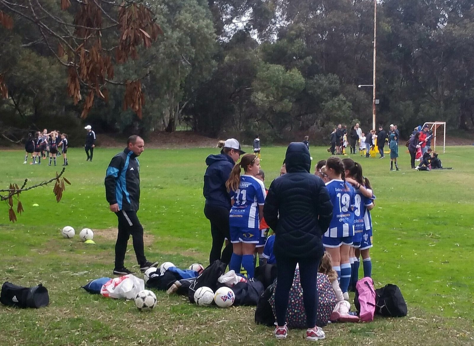
15. West Adelaide Soccer Club
The soccer pitches here are licenced to the West Adelaide Soccer Club. “Licencing” means that they can be used by the public whenever the licencee (the club) is not using them.
The West Adelaide Soccer Club has long been associated with Adelaide’s Greek community.
It was founded in1936 by a handful of Greek migrants, with the name Hellenic Soccer Club. For a time they played their home games at Adelaide High School. It was not until 1976, when they found this home here in Park 27B. The next year, 1977, West Adelaide Hellas became a founding member of the National Soccer League.
Since then, it’s been regarded as one of South Australia’s most successful soccer clubs. After one year in Mary Lee Park, in April 1977, John Kosmina scored the first ever goal in the National Soccer League, the predecessor of the current A-League.
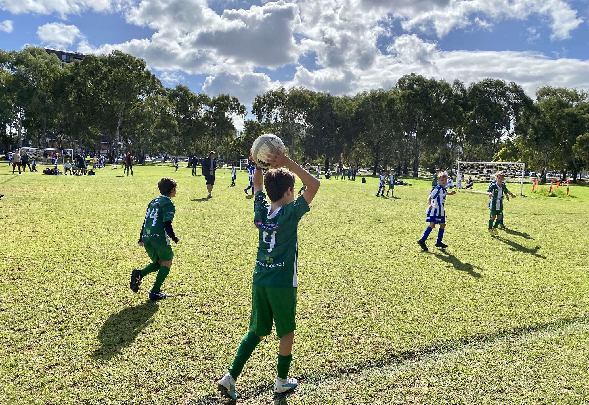
In 1978, West Adelaide won the National Soccer League championship at its home ground against Adelaide City with an 85th-minute goal in front of 16,251 fans.
After a short rough patch, it returned to the top-tier league of South Aussie soccer in 2014 which attracted one the highest match attendances in SA in the 21st century. It then went on to win the 2015 South Australian Premiership and Championship.
In 2023, the club was seeking funding to erect lights, extend and improve this building.
Continue walking the Park Lands Trail until you reach the paved courts and playground.

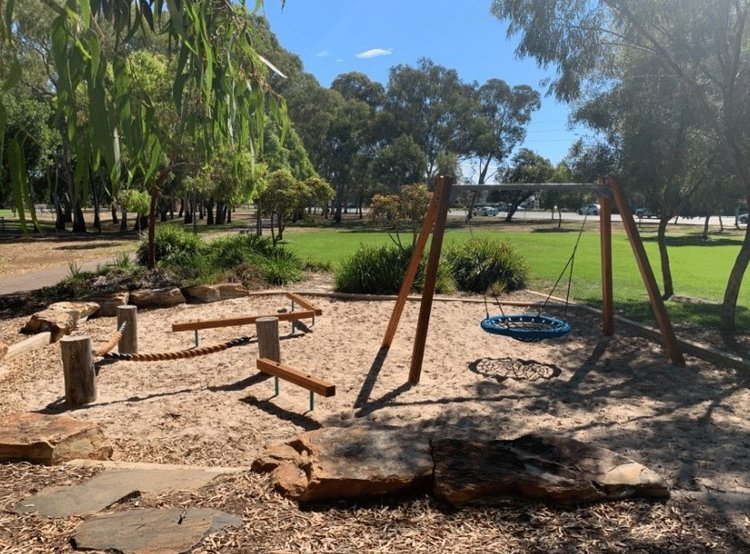
16. Community Hub
In 2013, Renewal SA under the State Government funded an upgrade of this Park in conjunction with the Adelaide City Council and Kadaltilla (Adelaide Park Lands Authority)
The upgrade included the Park Lands trail, a skate park, a nature play area, barbeque facilities, picnic shelters, a petanque piste for playing petanque (or bocce), basketball courts, tennis courts, an enlarged car park, and the Park Terrace Community Garden. The entire upgrade cost around $10 million. It was completed in 2016.
From here, return to your starting point at the car park.
Optional: download and print a tri-fold leaflet, i.e. a double-sided single A4 page, with a brief summary of this Trail Guide: (PDF, 4 Mb).
All of our Trail Guides and Guided Walks are on the traditional lands of the Kaurna people. The Adelaide Park Lands Association acknowledges and pays respect to the past, present and future traditional custodians and elders of these lands.

