

Take the Trail
Start at the corner of Peacock Road and South Terrace, opposite the tram stop.
This Trail is on the traditional land of the Kaurna people.

1. History and naming
2. Pulteney Grammar School
3. Sporting grounds
4. Glover Playground South
5. BMX bike tracks
6. Mature trees
7. Petanque piste
8. Tree Climb aerial adventure
9. South Park Lands Creek
10. Pathways
11. Tennis and hockey
12. Electric light cricket
The trail starts at the corner of Peacock Road and South Terrace. Walking instructions are in bold type at the end of each section.
Optional: download and print a tri-fold leaflet, i.e. a double-sided single A4 page, with a brief summary of this Trail Guide:. (PDF, 875 Kb)

1. History and naming
This Tour or Trail starts at the corner of Peacock Road and South Terrace. It’s about 1.8 kilometres and should take you between 60 and 90 minutes to walk.
Blue Gum Park / Kurangga (Park 20) is rectangular in shape – bounded by the four roads around it: South Terrace, Peacock Road, Greenhill Road and Unley Road.
It is one of the most picturesque and well used parts of the Adelaide Park Lands.
This Park has been known as Park 20 since the year 1882.
Its two names (an English name and a Kaurna name) are much more recent. In 2002, the City Council named it Kurangga which means “Blue Gum Place”. The English name “Blue Gum Park” was assigned more recently – in 2017.
While there are no specific references to Kaurna sites within this Park, oral evidence suggests that the South Park Lands were regularly used for Kaurna camping, food harvesting, burial and hunting in the time before European settlement.
This ended in the 1860s, when the Kaurna were driven out by the colonists, and their camps burnt.
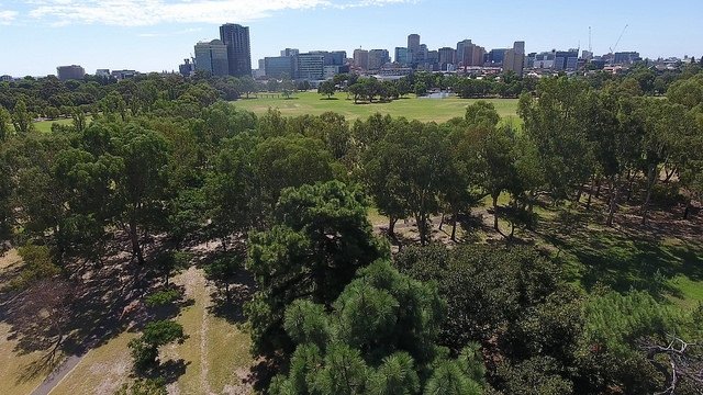
A view to the city from the southern end of Blue Gum Park / Kurangga (Park 20)
From the 1850s to the late 1870s Park 20 was used for grazing, firewood collection and agistment.
It was fenced in white-painted timber posts and wire in the late 1860s, and by this time most of the original indigenous vegetation had been effectively removed from the park.
This Park retains its original shape and form as devised by Colonel William Light.
On this trail you will see that the Park has been laid out, with two main pathways through the middle, and mass plantings of particular species along pathway alignments.
That design is from the year 1880. It reflects the recommendations and philosophies of a Scots forestry expert, John Ednie Brown who was brought to Adelaide for that purpose.
Sporting facilities were introduced a few decades later in the very early 20th century, but they have altered the configuration of the Park very little.
Walk east on the pathway alongside South Terrace, and stop at the footbridge overpass that crosses South Terrace from Pulteney Grammar School.

2. Pulteney Grammar School
.
This reinforced concrete footbridge over South Terrace was erected in the 1970s.
If you walk to the top, the footbridge offers views southwards over Blue Gum Park / Kurangga (Park 20) to the Adelaide Hills escarpment.
Why is the school called Pulteney Grammar when it is located on South Terrace? It was established in Pulteney Street in 1848. It moved to this site on South Terrace in 1919.
Pulteney Grammar School was the second private school in the colony after St Peters College. It began as a school which would be attractive to the poorest families in the area.
The School was involved in a Park Lands controversy in 2018.
In that year, Pulteney Grammar School was telling its community that it was planning to expand its campus “on both sides of South Terrace.”
Concept plans were lodged with the Adelaide Park Lands Authority. The agenda papers for the Authority’s meeting, at which the School’s proposal was recommended, described “class rooms” on the second storey of a massive proposed new building here.

Image from a promotional video published by Pulteney Grammar School in 2018
The school was planning to include several features of a private nature: a “multi-purpose” space (though Pulteney’s principal denied this space was to have been used as classrooms) an office, a gym, and extended storage.
However, after hearing a deputation from APA at its meeting in June 2018, the Authority agreed that the School’s plans could NOT be accepted.
The Authority instead urged Pulteney Grammar School to scale back plans to a more modest size, to minimise the extent of any new building’s impact on the Park Lands.
Almost three years later, in May 2022, no new plans had yet been lodged.
Now walk another few metres east, on the grass, and stop at the basketball courts.

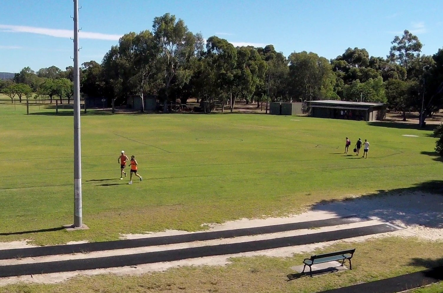
3. Sporting grounds
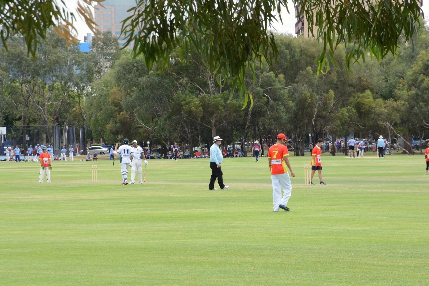
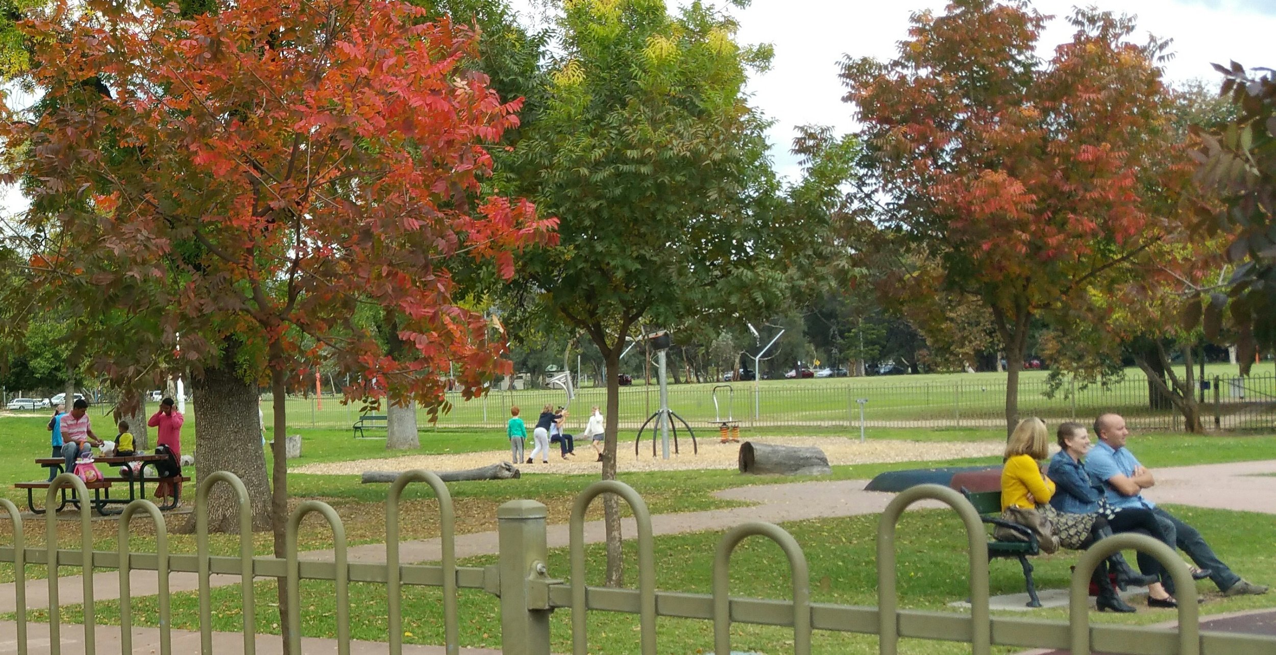
Blue Gum Park/Kurangga, is probably best known for the amount of sport played and watched right throughout the year.
There are seven sporting fields or courts, and 13 different sports or recreation played regularly in this Park. The list includes soccer, cricket, Aussie Rules football, netball, basketball, athletics, hockey, tennis, petanque, and orienteering.
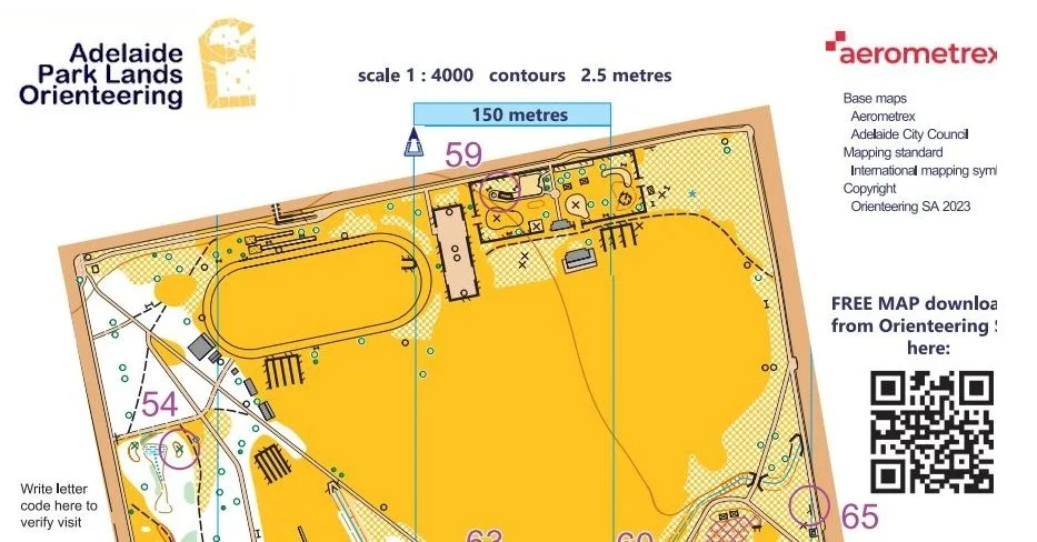
Part of Orienteering SA’s map of Blue Gum Park / Kurangga (Park 20). The course is a permanent one, with 16 orienteering control points fixed in place. See the full map here.
Many of the sporting facilities in this Park are used by Pulteney Grammar School, and the Adelaide Harriers Athletics Club, which is the oldest athletics club in South Australia.
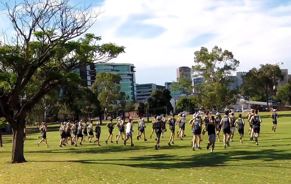
The “Harriers” held races in the North Park Lands and Victoria Park in 1913 and 1914 before moving to this site in 1921. The original track was of couch grass and in 1932 the track was enclosed with iron fencing.
In 1950, the grass track with replaced with a cinder track. The track was laid with cinders for 60 years – from 1950 to 2010. After 2010, faced with an inability to source cinders, the track was returned to grass. There is also an Adelaide Harriers Little Athletics Club and young children use these facilities over the summer months.
In 2017, the Adelaide City Council renewed the licenses of several sporting fields to Pulteney Grammar and Adelaide Harriers.
The renewed licence conditions are expected to lead to the removal of old and unsightly storage buildings dotted around the northern part of this Park, a consolidation of facilities in a new shared building, and encourage more use by other sporting groups and the general community.
In 2018, Pulteney Grammar School was invited to submit new designs for a new shared building.
Now walk past the basketball court, to the children’s playground.
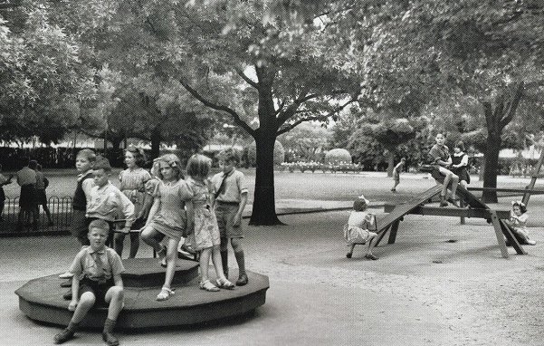
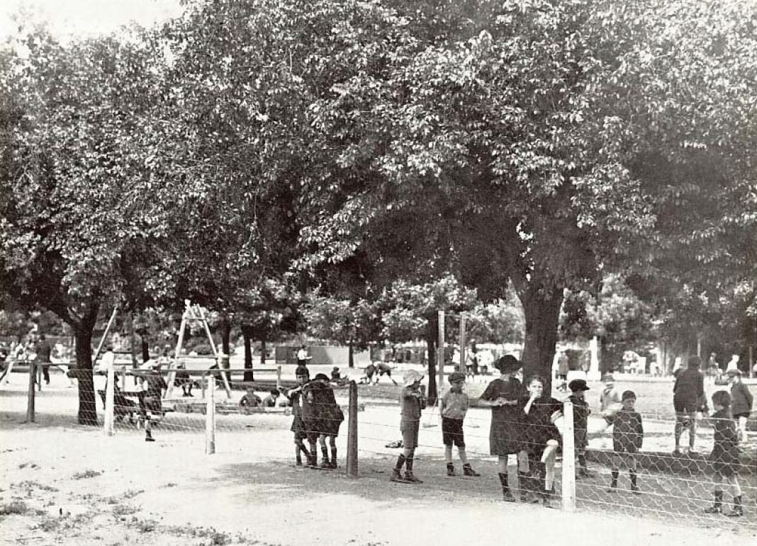
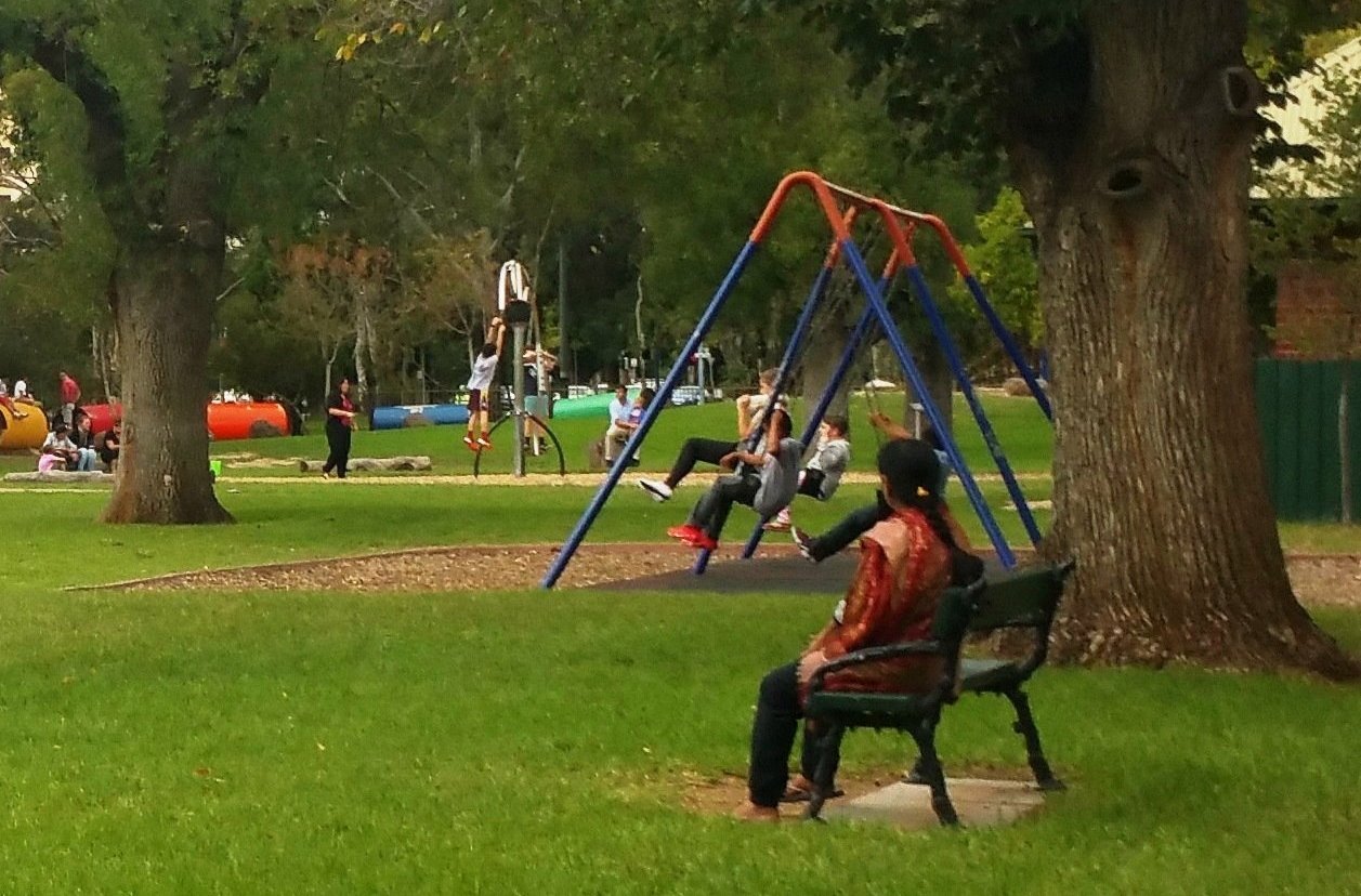
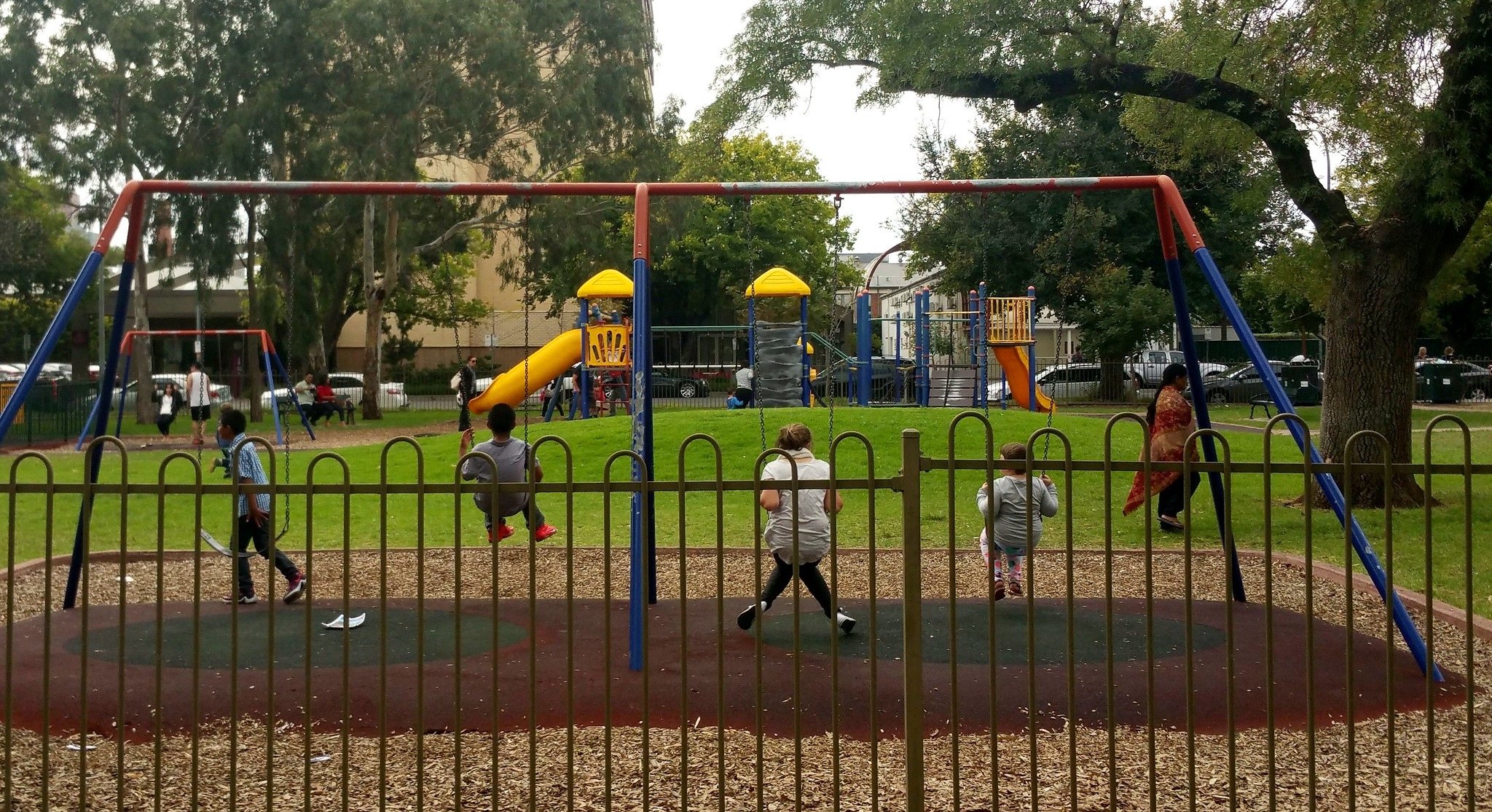
4. Glover Playground South
This is the oldest children’s playground in Adelaide. It was opened in December 1918.

The Adelaide Mayor of the time, Charles Glover, believed playgrounds were important to “promote the happiness and well-being of the children of the City”.
Mayor Glover donated 863 pounds towards construction of the playground. The Council set aside the land of 8,000 square metres.
When it opened in 1918, there were two grassy areas: one area for girls, and one for boys, as well as shade trees, garden plots, sand piles, wading pools, seating and equipment such as swings and see-saws.
Over the course of the first12 months of operation, the supervisor of the playground recorded over 6,000 attendances per month, equivalent to 200 per day.
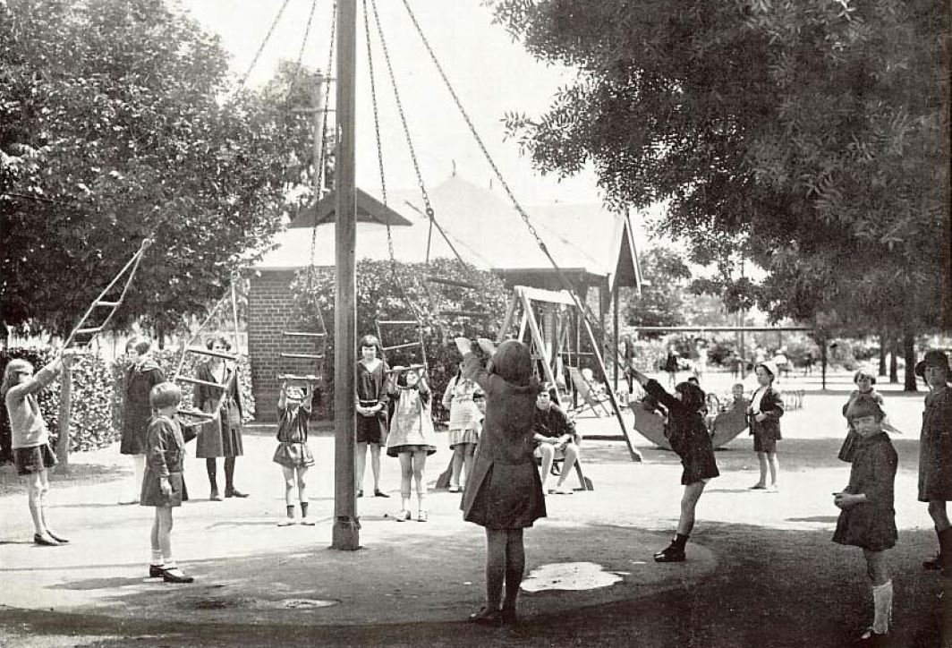
The two separate playground areas in 1928. For boys (left) and girls (right). Pics: City of Adelaide archives.
There are no recent comparable attendance figures because playgrounds these days don’t have “supervisors” on site.
There are now 10 children’s playgrounds in the Adelaide Park Lands, including another two only a short distance away, so children have much more choice of places to play.
But this Glover South playground is still very popular, especially in fine weather and on weekends.
The fully fenced area contains equipment intended mostly for children 7 years and older. There’s a flying fox, climbing net, brightly coloured caterpillar tunnels and a large swinging hoist.
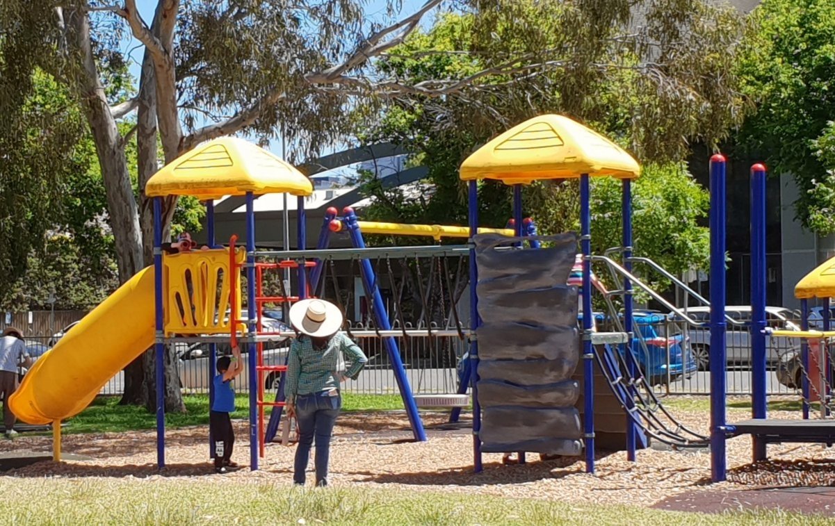
There’s also a brick shelter, with a brass plaque mounted on the wall recording the opening of the playground in 1918 by the State Governor.
This building has what is recognised as “Edwardian” architectural traits.
Although it has a relatively modern Colourbond roof, the shelter retains its original form, original brickwork, and basic configuration, including public toilets on either side.
The playground features a pair of mature English elm trees and a group planting of eight golden ash trees dating from 1927.
From here, walk south-east diagonally across the playing field to meet the side of Unley Road and stop where you can see dirt mounds, just past a creek crossing.

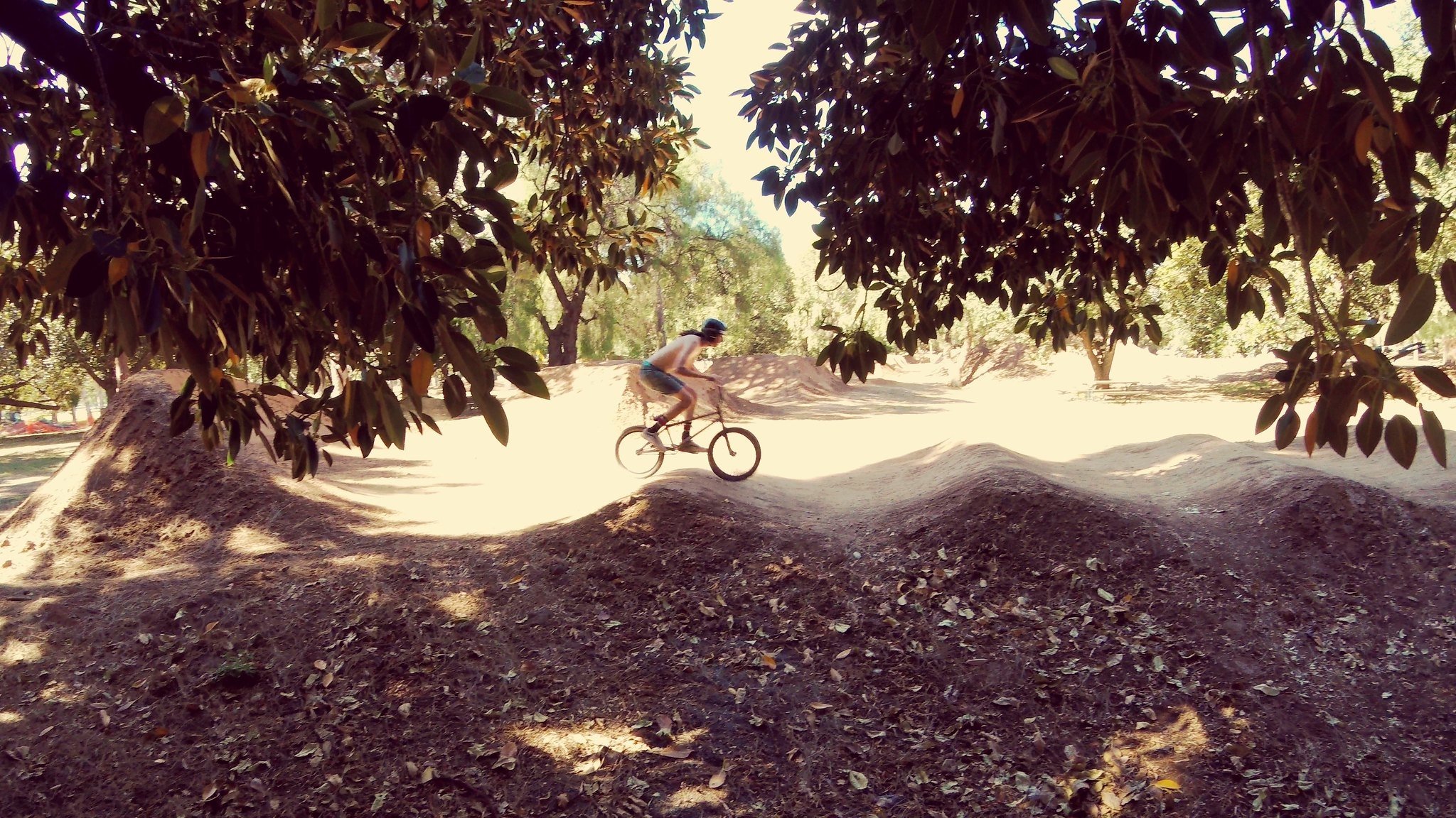
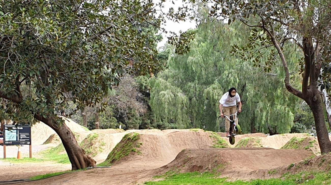
5. BMX bike tracks
You can see a number of dirt mounds rising in amongst the trees. This is the Kurangga BMX Track, also known as Adelaide City Dirt Trails.
Here, bike riders of all ages and abilities can enjoy a variety of different bike tracks.
When first constructed there were only two tracks, for beginners and for “advanced” riders.
However, an upgrade in 2018 expanded options for riders, so that now there is a beginner track; an intermediate track; and an advanced track, which sometimes draws large crowds for competitions.
There’s also a fourth option - a pump track (for all skill levels); a course of banked turns and features designed to be ridden completely by riders “pumping” – creating momentum by up and down body movements.
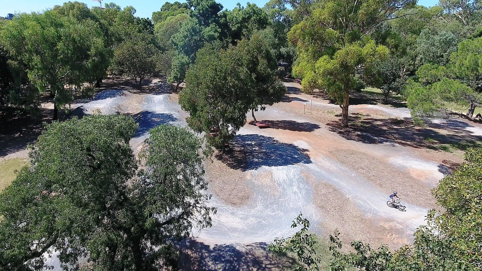
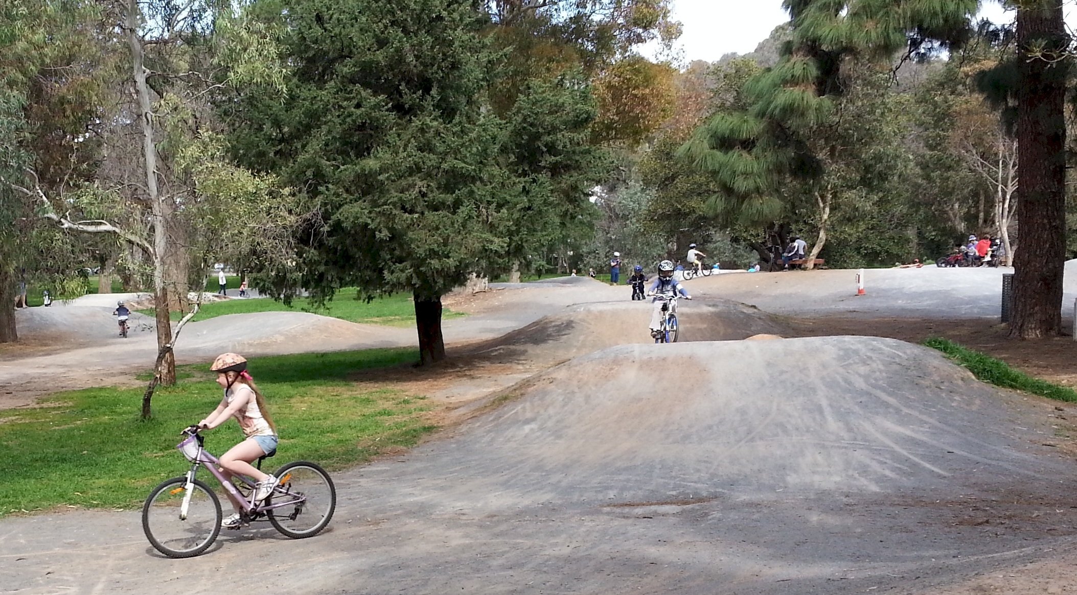
In 2024, the City Council was considering a major upgrade of the entire site, set to cost several million dollars.
According to the City of Adelaide, there are more than 1,000 stacks (or crashes) on these tracks each year - so if you fall off, you won’t be the only one!
This area is also designed for picnics; with barbecue facilities, tables and benches, plenty of shade and a toilet.
Just beware, when crossing any of the BMX tracks!
Now, walk south, past the BMX tracks and stop near (but not underneath) a very tall, symmetrical dome-shaped tree.

6. Mature trees
The BMX track is surrounded, on all sides, by a number of tall trees – some of them more than a century old.
They come from a wide variety of species, including the popular Moreton Bay figs, and Canary Island Pines, along with European Olives, Hoop Pines and Himalayan Cypress.
There are also two species that are relatively unusual in the Adelaide Park Lands and NOT native to the Adelaide plains.
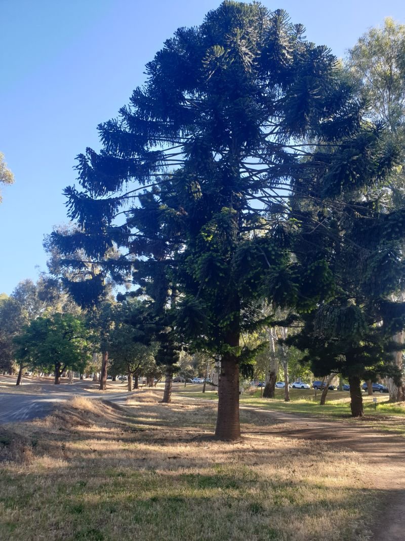
Bunya Bunya (or Bunya pine) trees are easily recognisable because of their symmetrical dome shape. There is one of them on the southern edge of the BMX track that would have been planted around 1910. Bunya pines are ancient, delicious and deadly.
They’re ancient because most similar type of trees are long extinct. Bunya trees are related to the Wollemi Pine which is 200 million years old.
They are deadly because of the size of their pine cones. A single cone can weigh up to 10kg, so you wouldn’t want to be standing underneath when it fell. Each tree can have up to 100 nuts.
Bunya pines are native to Queensland – in particular around the Bunya mountains.
Bunyas also produce highly valued timber, which is used for musical instruments. The seed in the Bunya pine cone is a delicious and nutritious food, a famous and celebrated example of Australian bush tucker.
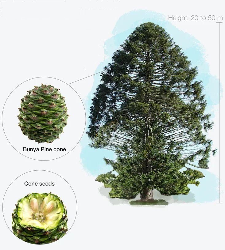
Indigenous people used to travel for hundreds of kilometres to the Bunya forests in Queensland to feast on these cones when they were in season.
Alongside the Bunya pine is a carob tree, native of the eastern Mediterranean area. The pods of the carob tree can be crushed to powder to make a naturally sweet paste as a chocolate substitute.
Carob seeds were brought back to Australia by returned soldiers after World War One. Therefore, carob trees in the Park Lands may be regarded as informal war mementos. Carob seeds are also used in rosaries.
There are also olive trees in this vicinity. As long ago as 1882 an Italian olive expert brought to Adelaide recorded some 134 olive trees, in various locations along “both sides of Unley Road”.
Today the few remaining olive trees in Park 20 have been incorporated within the surroundings of the BMX bike tracks.
There are more substantial 19th century olive plantations in other parts of the Park Lands.
Now, walk along the dirt path next to the Bunya pine. Head towards the “Tree Climb” building, but turn left and cross over a bridge. Then go to a brick shed next to a flat clear gravel area.

7. Petanque piste
This flat gravel area is described as a “petanque piste” – an area for playing the game of petanque, or “boules”.
Some sports have been played in the Adelaide Park Lands for more than 150 years. In contrast, the game of petanque is a comparative newcomer.
Petanque has been played in Adelaide only since 1973. The writer and film producer Wylton Dickson is credited with introducing it to Adelaide as ‘the poor man’s bowls’.
The first club dedicated to the game, Club De Petanque d’Adelaide, was set up by the French Australian Association in 1977. It’s Australia’s oldest petanque club.
Five years after the club was founded, in 1982, it moved to the South Park Lands, and to this site shortly afterwards.

Home of the Club d’Adelaide de Petanque in Blue Gum Park / Kurangga (Park 20)
This building is leased from the City Council. Regular competitions are held here.
Although there are 12 different sports or recreations in this Park, one sport that is NOT catered for here, is horse riding. However that was not always the case.

Horse and rider at the “Dressage Club Grounds” in the Adelaide Park Lands. Painting by Miss Cathleen Edkins
There used to be organised horse riding in this Park for several decades.
In 1951 the Horse Riding Clubs Association of SA was granted the use of grounds around this south-eastern corner of Park 20.
This building was originally the home of the Horse Riding Clubs Association. However, by the 1980s most of its horse activities at this site had been phased out.
The Petanque club took over the lease of the building shortly afterwards, in the 1980’s.
Horse racing at nearby Victoria Park ended in 2007. The SA Police “greys” were removed from Kate Cocks Park, part of Park 27, in 2024.
Now, the only place in your Park Lands where you can see horses regularly are in North Adelaide, in Lefevre Park / Nantu Wama (Park 6).
This area, near the corner of Unley Road and Greenhill Road, was also known as a place to play the illegal ‘two-up’ gambling game in the early 1900s.
In other States, two-up was associated with pubs, but in Adelaide in the early 1900’s people (always men and boys) tended to play it mostly in quiet alleyways, yards, sand dunes, the back of tea rooms, shops, beaches and on the Park Lands, including in football club sheds that were dotted around the Park Lands.
This area was just one of many used for that purpose before the First World War.
Now go back to the bitumen path, and walk north-west along the bitumen path to the “Tree Climb” aerial adventure building.
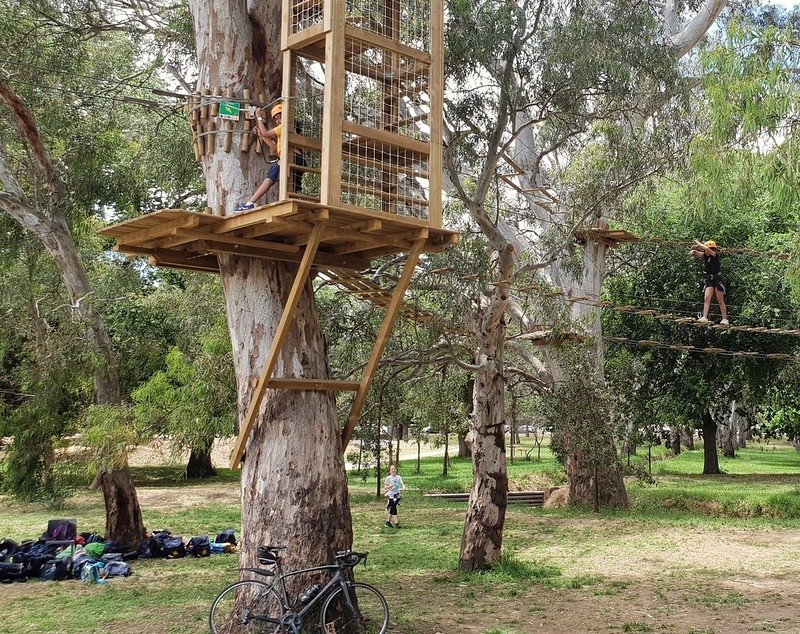
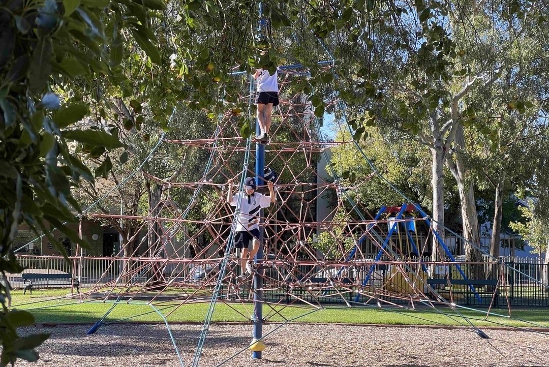
8. Tree Climb
In January 2018, the City of Adelaide approved an eight-year lease – not of the ground – but of the tree tops.
The courses and obstacles you can see here were built over an area of 16,000 square metres, using the existing mature trees, including large River Red Gums and Blue Gums.
The operation was opened in late 2018. It’s been successful in encouraging young people to visit the Park Lands to take part in more physical activity.
Families can make a day in this Park by also bringing bikes and using the BMX track as well as visiting the Tree Climb.
Unlike other private enterprises within the Park Lands, the ground below the course is maintained as open public green space.
There are eight graded courses and 70 obstacles. The courses incorporate a range of suspension lines, flying foxes and climbing obstacles set amongst the existing trees and the South Park Lands Creek.
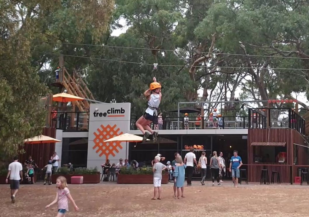
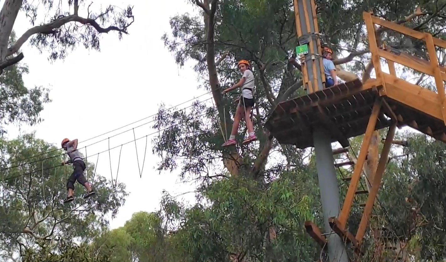
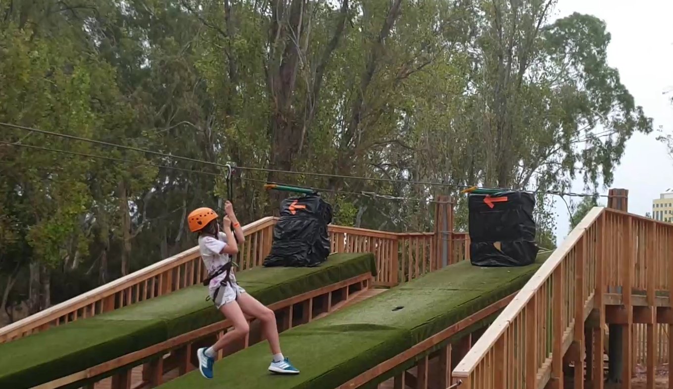
Customers can choose the level of difficulty they prefer. You must undergo safety training before setting out on a course.
The Council has been assured that the Tree Climb aerial adventure park does not damage the trees. If the lease is not renewed in 2026, then these facilities, including the transportable building here can be easily removed.
Now, walk on the bitumen path, past the Tree Climb building, and head north-west to a crossing over the South Park Lands Creek.

9. South Park Lands Creek
The South Park Lands Creek traverses the southern Park Lands, from Victoria Park in the east across the neighbouring Parks 17, 18, 19 to this spot in Park 20, where it disappears under Greenhill Road and flows through Unley, Wayville and Goodwood.

The South Park Lands creek area near Tree Climb before the project began in 2021
For most of its length within the Park Lands, the Creek is not a natural watercourse but an artificial drainage channel.
It was built in 1917 to channel water away from what was a boggy area near the corner of Greenhill Road and Fullarton Road.
Here, in Park 20, it did look like more of a natural water course.
In the past, people casually walking through Blue Gum Park / Kurangga might not have even noticed the creek, because it was partly obscured amongst the trees – including many old growth river gums.
Between 2017 and 2022, major earthworks were carried out to rehabilitate the entire length of the South Park Lands Creek with signage, education facilities, boardwalks and a range of nature play and recreation opportunities.
The overall plan included:
a large wetland, or stormwater detention basins in Victoria Park/ Pakapakanthi (Park 16);
broadening the creek bed throughout the south Park Lands for better stormwater flows and improved public safety;
the removal of poplar trees, characterised as “woody weeds”, in both Victoria Park and here in Blue Gum Park; and
the introduction of native vegetation in and around the broader creek bed.
The rehabilitation project began in 2017. The first few stages were carried out to the east of here, in Parks 16 through to 19. This Park was left until last, with work scheduled for completion in late 2022.
There were previously two separate creek-beds within Park 20. These have been consolidated into one, which required re-aligning one of the footpaths.

The plan of works on the South Park Lands Creek, carried out in 2021-22. Note the realignment of two creek beds into one. Image: Brown Hill Keswick Creek Stormwater Project
The work has served five different purposes:
◦ FIRST, to protect both the Park Lands and nearby land in Unley and Wayville from flooding;
◦ SECOND, to increase safety for Park users, by getting rid of steep and dangerous eroded creek banks
◦ THIRD, to increase biodiversity along the length of the South Park Lands Creek;
◦ FOURTH, to replace woody weeds with native trees; and
◦ FIFTH, to create a seasonal wetlands environment to attract wildlife
The project was controversial because as part of the creek widening, a small number of kurrajong trees and significant eucalypts perched on the steep creek banks were removed.
The ground underneath those trees had to be dug away to widen the creek bed. However, backfilling of the old creek alignment was intended to support the health of the remaining large eucalypts, most of which have been retained.
Bringing the two former creek flows together, to a common point behind the mound (northern side) has enabled controlled flows to be discharged under Greenhill Road, reducing the risk of flooding downstream. For more information about the project see: https://bhkcstormwater.com.au/stormwater-management-in-the-south-park-lands/
From this point, keep walking north-west along the path until you reach a path T-junction.

10. Pathways
The path networks throughout Park 20 have heritage significance - and are very popular with pedestrians, runners and cyclists.
This pathway, near the Tree Climb, is not one of the major paths through Park 20. It’s a secondary path aligned east-west that connects the other two, mainly north-south pathways.
The ideas behind the pathways in the Adelaide Park Lands go back to the very early days of the British colony of South Australia in the mid 1800s.
The intention of Park Lands planners was that paths through the Park Lands would be an opportunity for people of different social status to interact.
People of lower social rank would be encouraged to dress well, while “promenading” in the Park Lands, and emulate those of higher social status, to promote greater civilisation.
The main diagonal pathway through this Park is just north of here.
It runs from north-west to south-east, from the corner of South Terrace/Peacock Road to the corner of Unley and Greenhill Roads, in accordance with a plan laid out by forestry expert, John Ednie Brown in 1880.

1917 map of the pathways in Blue Gum Park / Kurangga (Park 20) and the course of several drainage channels, including the South Park Lands Creek (bottom right). Note the absence of any east-west pathway.
That diagonal pathway was named Sellar Avenue after a City Councillor of the late 1800s (James Sellar).
It’s lined with (mostly) white cedar trees that are native to southern Queensland and northern New South Wales. The cedars are drought resistant. They were planted just before the First World War (from 1910 to 1912).

Sellar Avenue in the late 1800’s
The growth of these trees inspired the planting of a similar diagonal avenue in the adjacent park to the east, Park 19. There’s also a diagonal path across Park 21W to the west of here.
Some hackberry trees have been planted at the south-eastern end of Sellar Avenue to replace dead white cedar trees
Councillor James Sellar was a tea merchant. He was also President of the Adelaide Democratic Club and served as a Labour Member of State Parliament for the electorate of Adelaide.
The other main pathway on the eastern side of Park 20 is called “Kurrajong Avenue”. It’s a bitumen-covered path, running almost directly north-south from South Terrace to Greenhill Road. As its name suggests, it’s lined with mature Kurrajong trees that are native to the east coast of Australia.
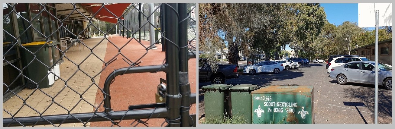
From here, walk westwards on this bitumen path, until you come to another path T-junction. Turn left onto this Kurrajong Avenue path and walk a short distance south, to look through the fence into the enclosed tennis and hockey courts.

11. Tennis and hockey
.
This fenced area is used for both tennis and hockey. It’s leased to the Adelaide Hockey Club and Tennis Seniors SA.
The grounds are covered in synthetic grass. They are marked out for both tennis and hockey, in three separate fenced areas.
The largest enclosure, on the northern side, is laid out as either 12 tennis courts or one full-size hockey pitch.
A smaller enclosure, on the south-east, is laid out as either four tennis courts, or a small, junior hockey pitch.
The third and smallest enclosure has just two tennis courts.
The courts are all floodlit for playing at night.
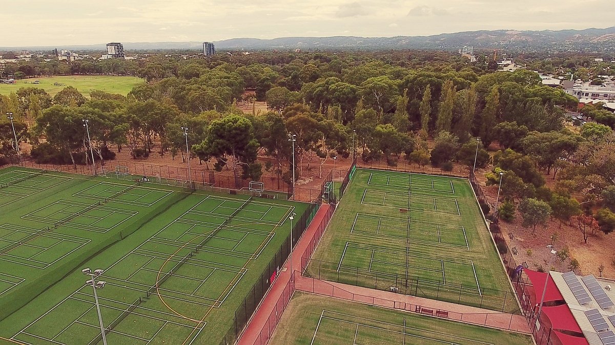
The fenced tennis and hockey courts in Blue Gum Park / Kurangga (Park 20)
The Adelaide Hockey Club is one of the largest in South Australia with over four hundred members playing both the Junior and senior competitions.
The club has plans for new facilities and clubrooms on another Park Lands site to the west of here, on Park 22, alongside netball courts.
Tennis Seniors SA clubhouse and car park in Blue Gum Park / Kurangga (Park 20)
Tennis Seniors SA caters for players age 35 or over. There are about 600 members who play here.
However, for most of Adelaide’s history this site was not reserved for tennis nor hockey – rather for lawn bowls, albeit with a few tennis courts placed alongside the bowling greens.

The former South Park Bowling Club (circa 1920’s) on the site of what later become tennis and hockey courts.
Lawn bowls developed into a major sport in the Parklands from 1897, when the newly-founded Adelaide Bowling Club secured a site on part of Park 12 - off Kintore Avenue near Government House.
The second bowling club on the Park Lands was here, when the South Park Bowling Club leased from the Council, a one-acre site here, in 1908.
The club expanded its leased site over the years, as it became extremely popular – and not just for playing bowls. It also hosted large private functions, here, for bowlers and their guests.
At one such function, in 1934, the “SA Bowler Magazine” reported more than 3,000 people attended and supper was served to 2,000 people within an hour.
The South Park Bowling Club moved out in the early 2000’s, which allowed the City Council to re-allocate the site for both hockey and tennis.
At that time one of the most prominent former features of this Park was moved away from here.
The feature was a memorial commemorating the members of South Park Bowling Club who served in World War One.
It was a white painted concrete obelisk topped by an urn with four lions, standing about head-high.
For many years, while the South Park Bowling Club existed on this site, the soldier’s memorial was fittingly placed here at the club.
It was originally unveiled at the site of the Club in 1917 while the First World War still raged on.
At this location the memorial had the lions spouting water, surrounded by a pebble covered circular pond.
In 2009 the memorial was re-installed at its new home, just one and a half kilometres south from here at the Soldiers’ Memorial Gardens on the corner of Unley Road and Thomas Street, at Unley.
The water features were not included at its new Unley location.

The Soldiers Memorial in its newer location in Unley after being removed from Park 20.
Now re-trace your steps back to the bitumen path T-junction at the northern end of the hockey compound. Even though there is no trail, turn left, and walk west, right through the bush for about 25 metres and look for a stobie pole, supporting a high electric cable.
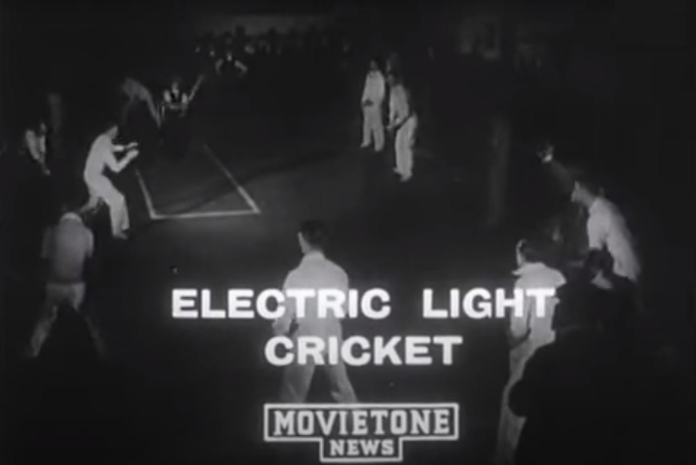
12. Electric light cricket
This stobie pole carrying an electric cable, near Peacock Road here, is all that remains of a uniquely Adelaide institution – an invention that was way ahead of its time.
Day-night cricket is very popular with the Big Bash League and one-day internationals played under lights.
But most people don’t realise that an earlier form of night cricket was invented here in Adelaide and played by hundreds of people on evenings right here in Park 20.
The game of “electric light cricket” was invented by Alf Stone, a tram dispatcher, in his backyard in Cowandilla in 1930.

At first, it was a recreation only for World War One returned soldiers.
However, the game became immensely popular over the following years. The first “official” game was in 1933.
It was played under electric lights by two teams of 18 with a cricket bat and a tennis ball.
During the 1960s and 1970s, up to 50 teams a week during would play on six separate fenced grounds here.
There were over 200 players per night, with separate mens and womens competitions.
Strangely, the game was not taken up in any other state of Australia. Although an exhibition was staged in Melbourne It was only ever played as a regular sport, here in Adelaide.
No special clothes and equipment were needed. It was very sociable.
Batsmen did not run between the wickets. If you hit the ball you scored 2, 4 or 6 depending on where it landed.
Huge scores of up to 1,000 were possible. Teams often scored 700 runs a night. A long game could last 3 hours.
The last game of Electric Light Cricket was played here in 2006. Indoor cricket and the popularity of day-night cricket probably killed it off.
But if anyone asks you where cricket under lights was first played – tell them it was here, in Adelaide, in Park 20.
From this point, walk back onto the paved Kurrajong Avenue, and head north, back to the starting point of this trail near the corner of Peacock Road and South Terrace.
Optional: download and print a tri-fold leaflet, i.e. a double-sided single A4 page, with a brief summary of this Trail Guide:. (PDF, 875 Kb)
All of our Trail Guides and Guided Walks are on the traditional lands of the Kaurna people. The Adelaide Park Lands Association acknowledges and pays respect to the past, present and future traditional custodians and elders of these lands.

