

Take the Trail
Start on West Terrace, opposite Hindley Street.
This Trail is on the traditional land of the Kaurna people. First Nations people are advised that this Trail Guide contains the name and an image of a person who has died.

Optional: download and print a tri-fold leaflet, i.e. a double-sided single A4 page, with a brief summary of this Trail Guide: (PDF, 3.1 Mb)

1. Context
This is Park 25 of the Adelaide Park Lands. On this trail, you’ll learn about this Park’s two names: one in English and one in the Kaurna language.
The park is on the north-western edge of the Adelaide CBD. It’s bounded by Port Road on the north, West Terrace on the East, Glover Avenue on its South, and James Congdon Drive on its western side.
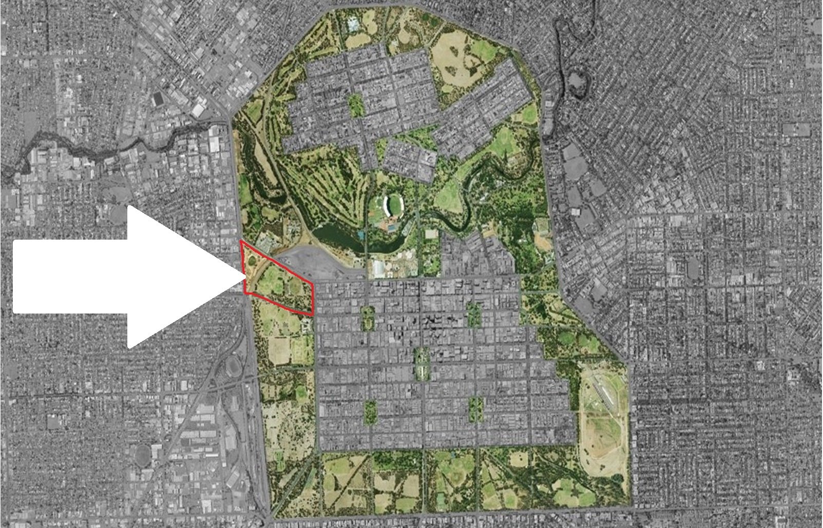
Gladys Elphick Park /Narnungga (Park 25) in the context of the entire Adelaide Park Lands.
This Park is split in two by a railway line. The Adelaide to Melbourne railway corridor runs roughly north-east to south-west through this Park so the Park has two parts; east and west of the railway line. This Trail visits both sides.
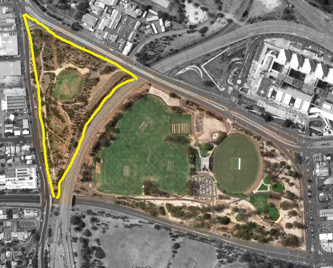
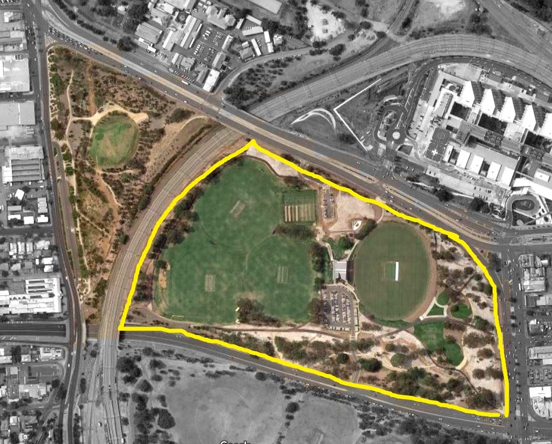
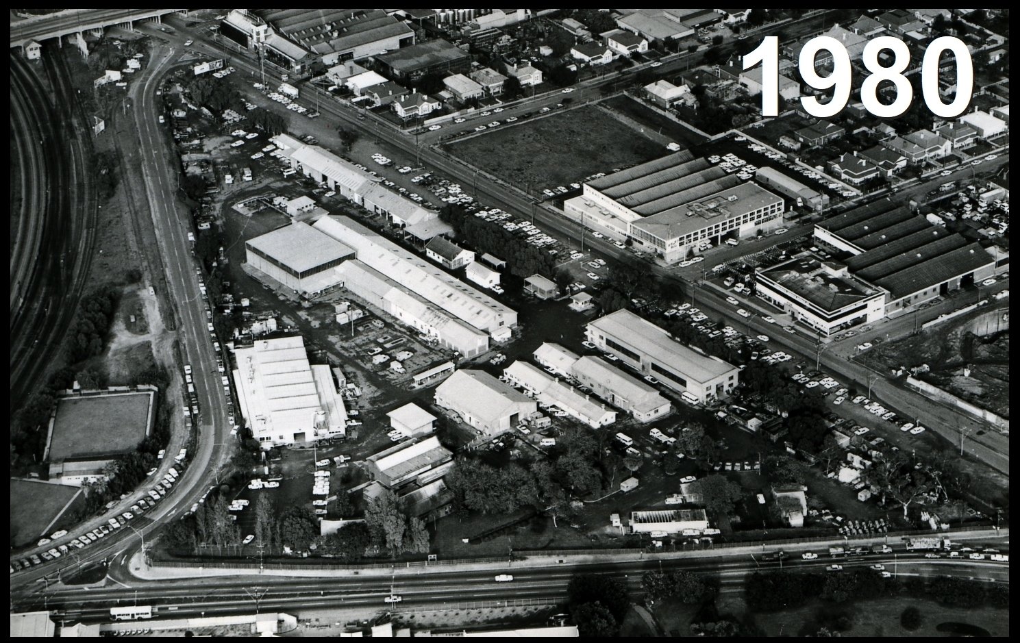
The larger part of the Park, about 18 hectares, on the eastern side of the railway, over the past century or more has been reserved for sports; mainly cricket and football. The western side is smaller (only 6 hectares). It was home to a former water works depot for 132 years; being converted into a urban forest only since 2012.
A network of bike paths and walking trails run throughout both sides of the park. The paths link the western suburbs to the city centre.
Now walk towards Glover Avenue and into the skate park.
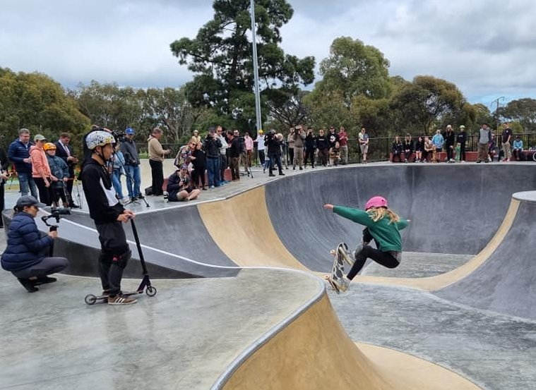
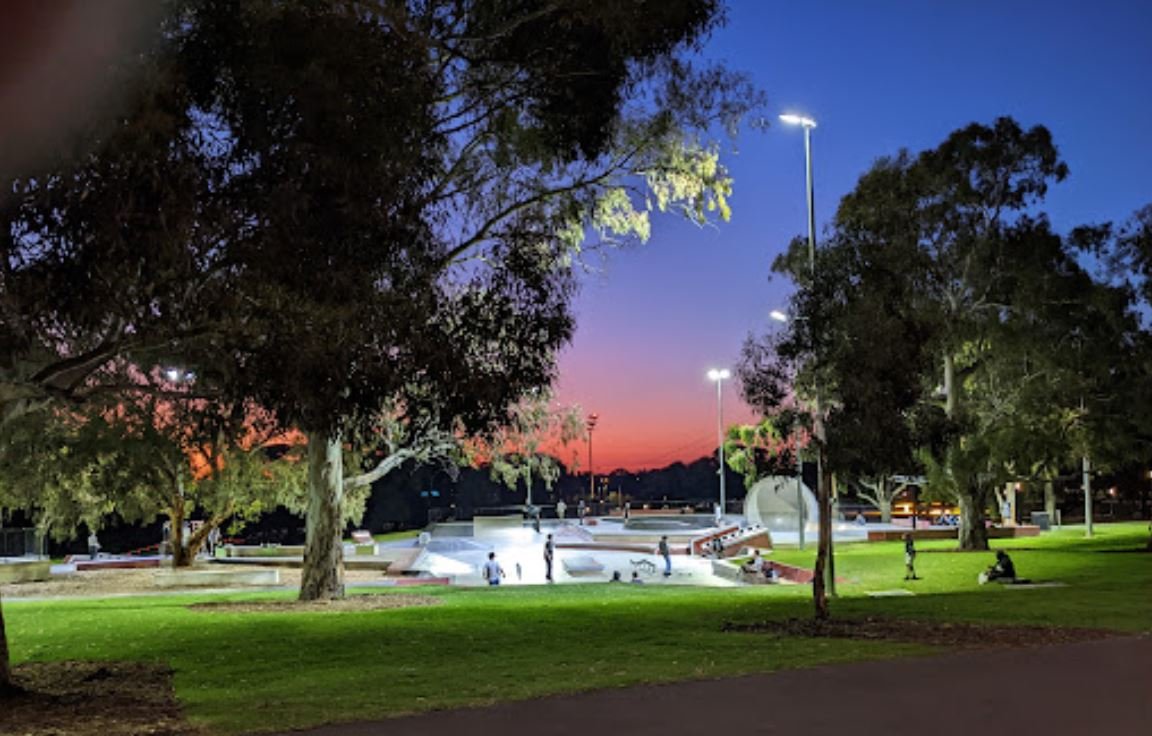
2. Skate park
.
This is the newest addition to Park 25. You might remember that there was a previous city skate park on North Terrace near the Morphett Street / Montefiore Road overpass.

The former skate park, off North Terrace, that was removed in 2015, to make way for a new University building.
That former skate park was demolished in 2015 to make way for a new University building.
Later in 2015, the State Governmen, and Adelaide City Council collaborated with the local skating community to erect a temporary skate park off Wakefield Road in Park 15.
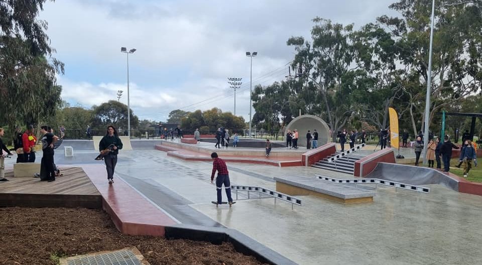
In response to demand from skaters and BMX cycle enthusiasts, the State Government eventually provided $3 million funding for this skate park.

Skate park designer, Angus Thomas
It was designed by professional designer (and skateboarder) Angus Thomas, from the Melbourne firm “Convic” with input from the skateboarding community, during consultations in late 2019.
The design was revealed in October 2020, and construction began in February 2021.
The park also caters for those riding BMXs, scooters, and more.
Construction took longer than expected as the impacts of COVID-19 put pressure on the construction industry but the skate park was finally finished and opened to the public in September 2022.
The delay was good for the standard of the Park because during the delay, the Federal Government made a funding contribution, which meant that the original design could be enlarged, with a mini skate bowl added for beginner skateboarders immediately to the south of the main footprint.
Although the features of the skate park have replaced what were formerly grassed areas, the design has retained all of the existing mature trees from this area of the Park.
Images: Left: Feargal Ryan, Google Maps; and Right: Keiran Snape.
Skateboarding made its debut at the Olympic games at Tokyo in 2020. This skate park is said to be of Olympic standard, including floodlights so it can be used at night.
According to Angus Thomas, some of the standout components are the concrete cradle within the advanced skateboarders bowl area, and the overall paving and material palette, which reflects the former Adelaide Festival Plaza.
From here, walk west to the car park off Glover Avenue.

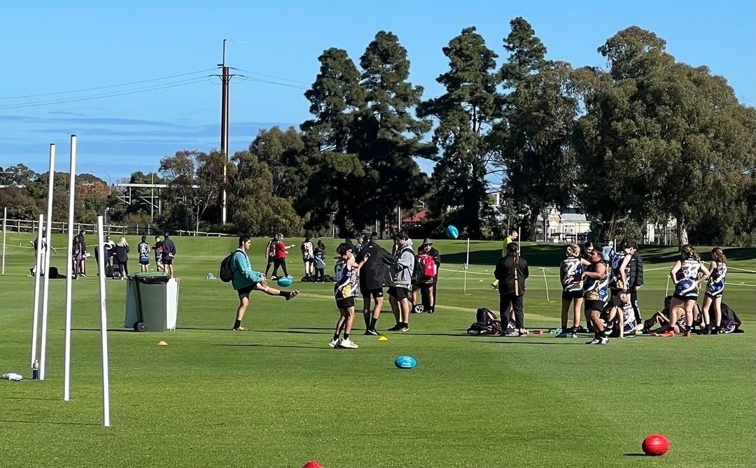
3. Sports fields & car park
There are four sporting fields on the eastern side of this Park.
The best-known of these five fields is called “Karen Rolton Oval” which is overlooked by the three-storey clubrooms, built by the SA Cricket Association. Karen Rolton is a former cricketer; former captain of the Australian national women's team. This trail will return to Karen Rolton Oval, on the way back to the starting point of the trail.
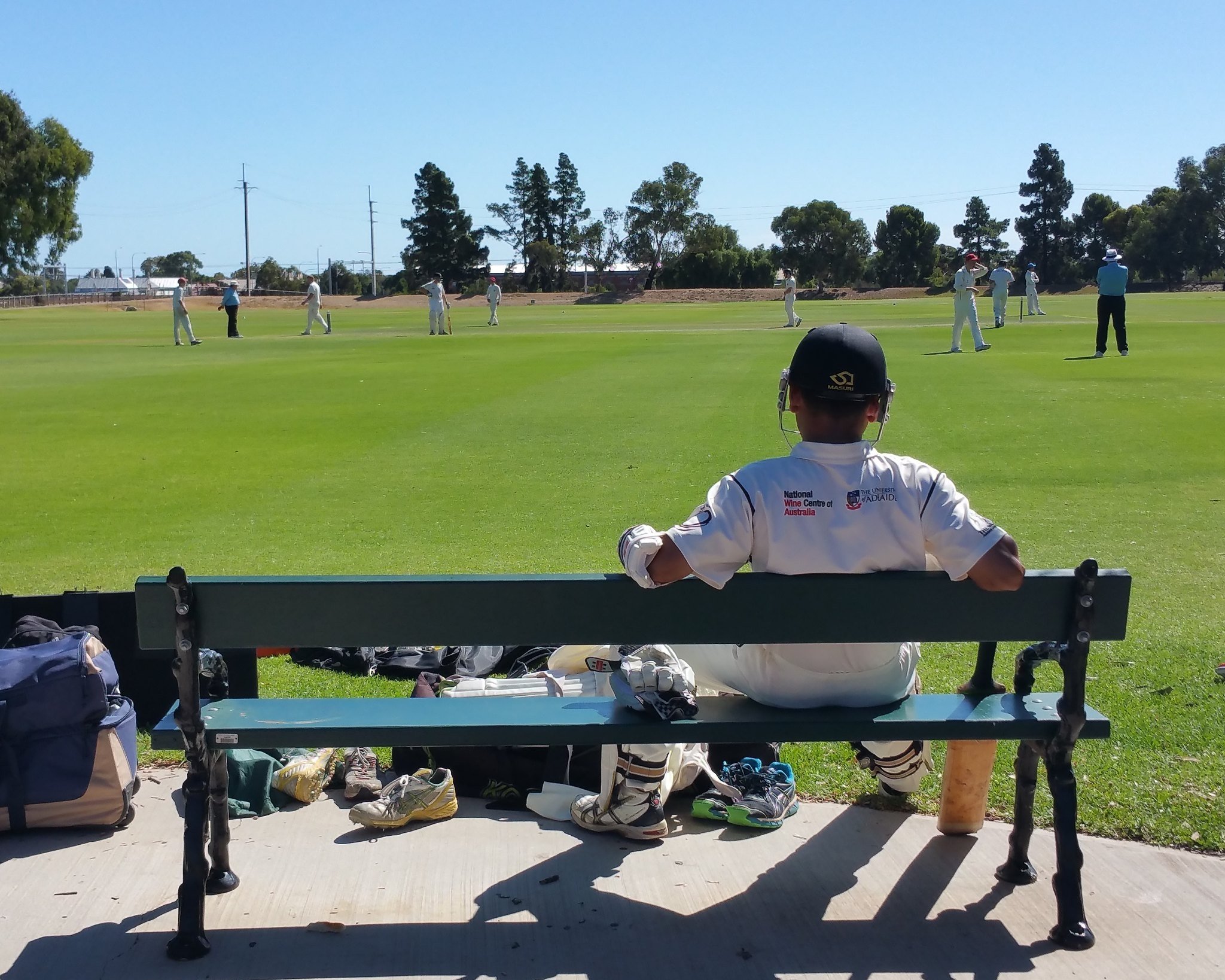
Behind the main building are three other ovals, called Ovals number 1, number 2 and number 3. These ovals host cricket games in summer and Aussie Rules football games during the winter months.
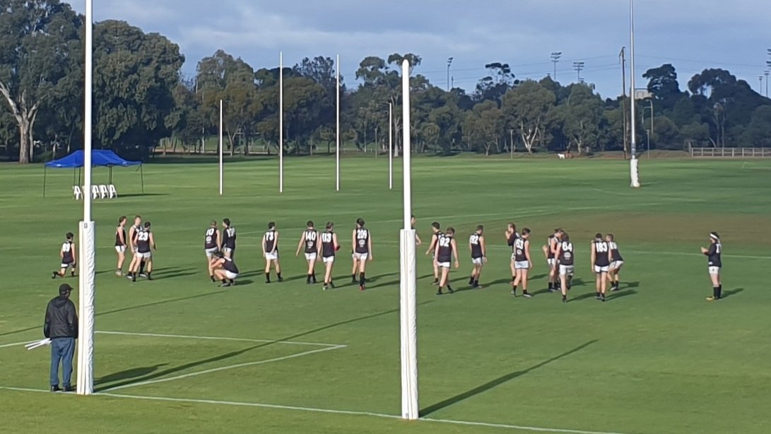
Left: Football training on Oval #1, and Right: Cricket on Oval #2
One of the annual fixtures on these three ovals is the Power Cup; an initiative of the Port Adelaide Football Club. It’s a football carnival held here in late May and involves hundreds of aboriginal youth from across South Australia. It’s jointly sponsored by SA Police.
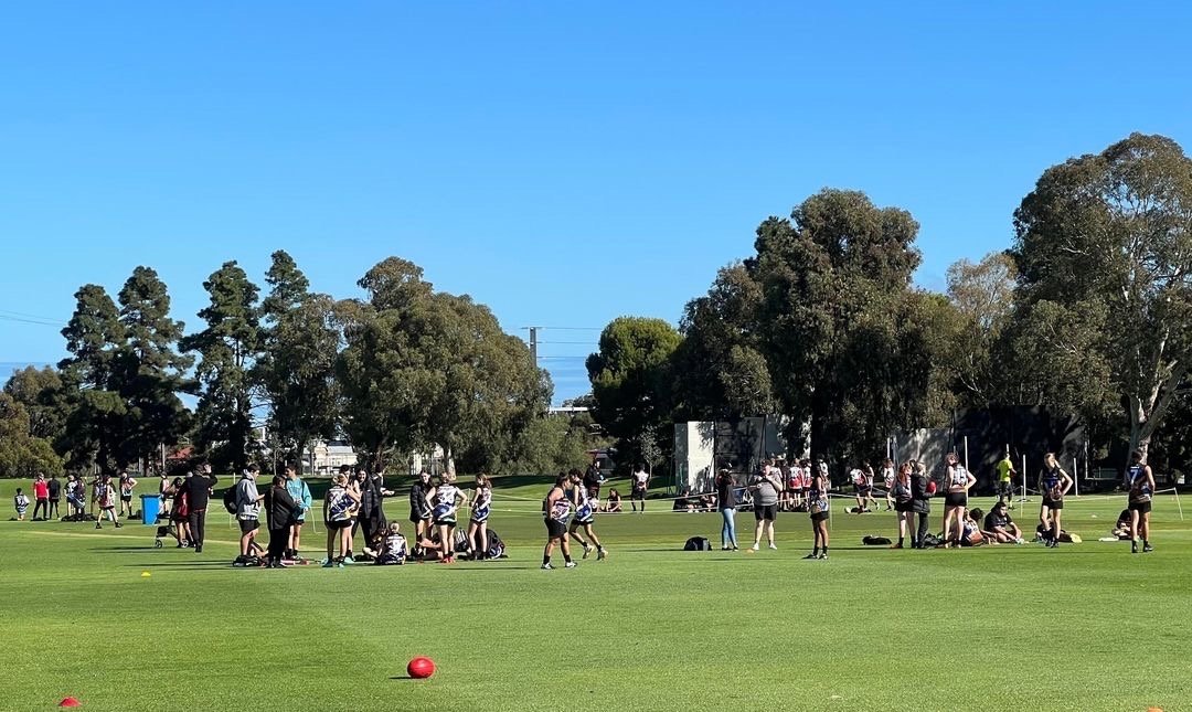
Participants in the Power Cup carnival, May 2022
The car park here is one of two very large car parking spaces within the Park and has been somewhat controversial.
As part of the SA Cricket Association's $8 million re-development here, in 2017 the City Council permitted an expansion of car parking within the Park.
Car parking spaces within the Park were increased from 105 to 158. These car parks were not intended to be available for city workers, nor for patients and staff at the Royal Adelaide Hospital. The hospital itself has 2,300 car parking spaces, but that's another story.
Commercial parking in the west end of Adelaide is expensive. In 2022 the commercial car park nearest to the Royal Adelaide Hospital (in Newmarket Street) was charging $5 for half an hour, or $18.00 for ten hours. But if you don't want to pay those rates, and you can get into one of the 158 car parking spaces here in Park 25, then you will be able to park for up to three hours - no charge.
Not all of those 158 spaces are available to the public, however. At its meeting on 28 November 2017, the City Council decided that:
"Thirty (30) ‘Permit At All Times’ spaces will be provided in the Southern car park for SACA/St Ignatians’ players/officials and ground staff."
The holders of these permits therefore are allowed to park their cars within this Park, at any or all hours, as long as they retain the permit. The permits are not restricted to any sporting event at the Park. They are effectively "golden tickets" for free parking on Park Lands.
Judging by the commercial rate for long-term parking in Newmarket Street, each one of these permits would be conservatively valued at $5,000 per year, or $210,000 over the length of the 42-year Park Lands lease.
The combined value of all 30 permits, therefore, exceeds $150,000 per year, or $6.3 million over the 42-year lease.
This 2017 decision by the Council seemed to fly in the face of the Adelaide Park Lands Management Strategy which, at the time, relevantly promised that the Council would:
“Provide car parking on and adjacent to the Park Lands only where need has been demonstrated and no reasonable alternative exists."

Between the car park and Glover Avenue, look out for this majestic Stone Pine (Pinus pinea)
From here, keeping walking west along the path and stop underneath the largest tree.

4. Former Mile End Rd & tram line
In the 1800’s, this path was not just a footpath – it was a road, called Mile End Road. The road connected Hindley Street with Henley Beach Road, and ran in a precisely east-west direction.
In the first decade of the 20th century, tram lines were being constructed throughout Adelaide.
In 1908 a tram line was installed along Mile End Road. It connected the city to Henley Beach. However the tram line didn’t stay there for long.
In 1925, Mile End Road was closed, and a new roadway, Glover Avenue, was constructed a short distance to the south. This road connected Henley Beach Road with Currie Street, instead of Hindley Street. Shortly afterwards, in the late 1920’s, the tram line was relocated onto the western side of the railway line, where it connected Henley Beach Road to Port Road and North Terrace.

These changes in the 1920s made this Park 25 a little bit larger than it was before. The area between this pathway and Glover Avenue was added to Park 25. Before 1925, that strip of land had been part of the neighbouring Park 24 instead.
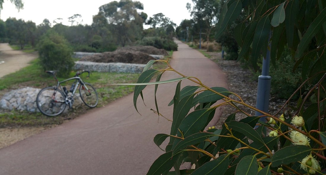
From here, walk westwards and stop at a pathway junction.

5. Around the back
There's nothing like a good walk to get to know a place intimately. And fortunately, Adelaide has an abundance of walking and/or cycling trails at varying difficulty levels that would suit anyone.
You can choose from short, medium or long walks to take in and learn more about our cityscape, or opt to 'forest bathe' and ramble in the Adelaide Park Lands - exploring its winding paths and trails.
The Adelaide Park Lands Trail is a shared cycling and walking track. To help you follow the Park Lands Trail as it winds its way throughout the Adelaide Park Lands its bitumen surface has been coloured with a dull reddish tinge.
The Park Lands Trail is not a single route; because there are shorter and longer versions of the Trail depending on whether you want to circle only the CBD, or take a longer route further north around North Adelaide as well.
It’s a “shared use” path, which means walkers and cyclists and scooter riders are all sharing it. Everyone is supposed to keep to the left of the path. Cyclists are supposed to ring a bell to let you know they’re approaching, but that doesn’t always happen, so you need to be alert.
You will notice at this pathway junction that the path with the reddish tinge (the Park Lands Trail) curves away to the left and goes over a bridge, across Glover Avenue; crossing into the neighbouring Park 24.
However to keep within Park 25, and follow this Trail Guide, please take a right-hand bend instead. This Trail Guide curves around the playing fields on your right, keeping the railway line on your left.
At this path intersection, you can see several tall Canary Island pine trees. Further along the path, the western side of the path features both Aleppo pines, and more Canary Island pines.

“Kidical Mass” cyclists on the pathway alongside the railway line in Gladys Elphick Park /Narnungga (Park 25) in September 2022
From here, walk north-east on the pathway, and stop at a grove of four Moreton Bay fig trees.

6. Naming
Pic: Native Pine (Callitris gracilis)
Like most of the Parks within the Adelaide Park Lands, this Park (#25) has been given two names: one in English, and the other in the Kaurna language.
“Narnungga” means “place of native pine.” The native pine occurs naturally in most states of Australia. In South Australia it is widespread mainly in the lower rainfall areas and is either called southern cypress pine, native pine or Murray pine. In Western Australia it is commonly referred to as Rottnest Island pine. Its Botanic name is Callitrus gracilis. There are only one or two in the eastern section of the Park but many more have been planted in the western section; the Narnungga Urban Forest.
This Park’s English name commemorates local Kaurna elder Gladys Elphick.
“Aunty Glad” was the founding president of the Council of Aboriginal Women of South Australia in the 1960’s, which later became the Aboriginal Council of South Australia.
Gladys Elphick died in 1988 at the age of 84. Her life’s work helped to improve the social status of Indigenous people living in South Australia, providing more equitable social services and rights.
You can read more about the life of Gladys Elphick in the Australian Dictionary of Biography.

Gladys Elphick 1904-1988
From here, walk around the sporting field and up onto Port Road, following the pathway as pictured immediately below.

The pathway continues northwards towards Port Road.
At Port Road, turn left and use the footpath to cross over the railway lines. Once you have crossed the railway lines, immediately turn left and climb up the small grass hillock to a collection of metal poles.

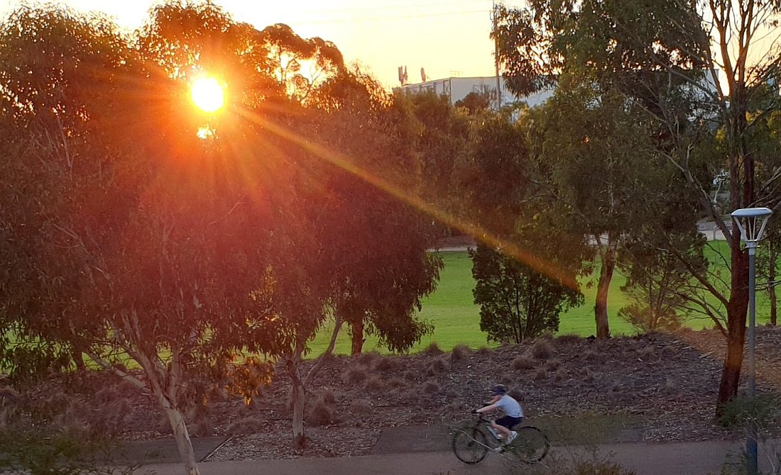
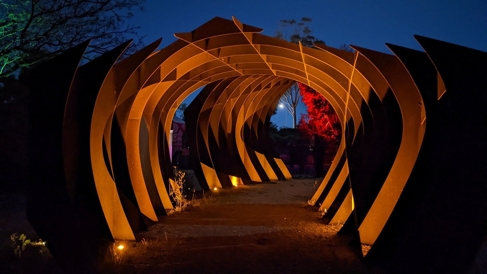
7. “Eucalyptus Alive”
This sculpture was created in 2012 by Marijana Tadic to become a part of the refurbishment of this western portion of Park 25.
It’s made of corten steel or “weathering steel” which is a product developed to deliberately eliminate the need for painting. It forms a stable rust-like appearance after several years' exposure to weather. However, these poles have been painted so they no longer have the weathered appearance!
The artwork consists of vertical columns with a “cracked bark”-like surface. Laser-cut patterns are intended to evoke the concept of a self‐sustaining ecosystem, through the interaction of the natural cycles of water, fire, growth and regrowth.

“Eucalyptus Alive” overlooking the trail line through Gladys Elphick Park / Narnungga (Park 25)
It’s illuminated after dark. Flickering lights inside the poles gradually come on as the sky darkens, and so the poles appear to come alive. Motorists can notice it here, in the dark, while commuting along Port Road.
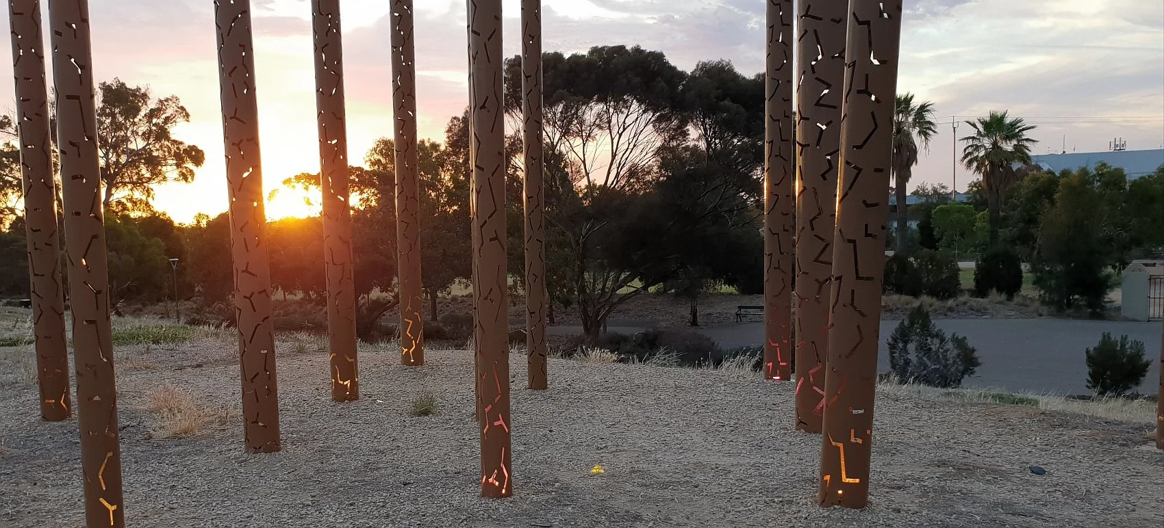
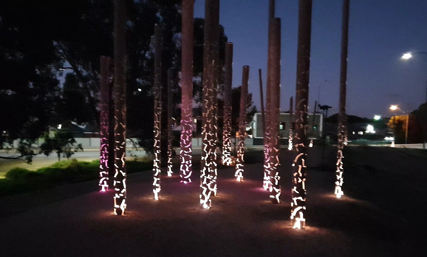
“Eucalyptus Alive” (left) starting to illuminate itself at sunset; and (right) after dark, looking back towards Port Road.
From here, drop back down the grassy slope, onto the bitumen pathway below, and walk south-west, past the open green sports oval, to a junction with a dirt pathway.

8. Narnungga Urban Forest
Ever since the Adelaide Park Lands were established in 1837, sections of Park Lands have been chipped away, with new buildings constantly being erected on land that used to be ‘Open Green, and Public’. That process is still continuing and shows no signs of slowing.
However this area is one of very few spots within the Adelaide Park Lands that has bucked the trend; where the opposite has happened.
This western side of Park 25 is almost 6 hectares. It was leased by the City Council to the State Government in 1879, for water and sewerage purposes.
The depot was established in 1881. It was an important milestone in the development of Adelaide.
It was the base of operations for the construction and maintenance of Australia’s first deep drainage sewer system.
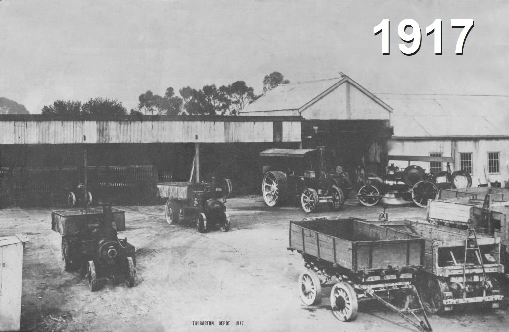
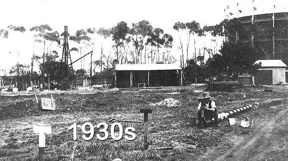
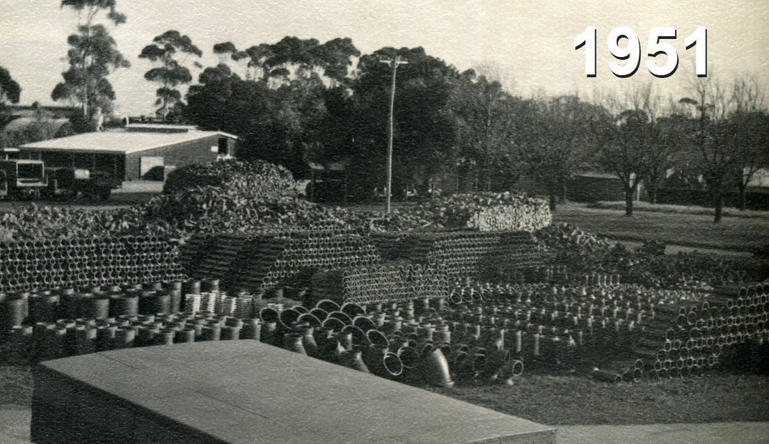
The lease over this Park Lands site was, originally, only for a term of 21 years, from 1879 to 1900.
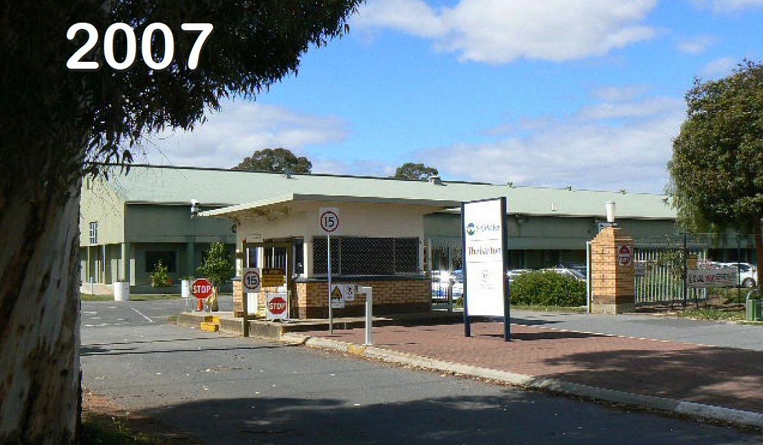
However, the Depot stayed on for more than 130 years. SA Water finally vacated the site in 2011 allowing the City Council to undertake landscaping and open the Narnungga Urban Forest in 2012.
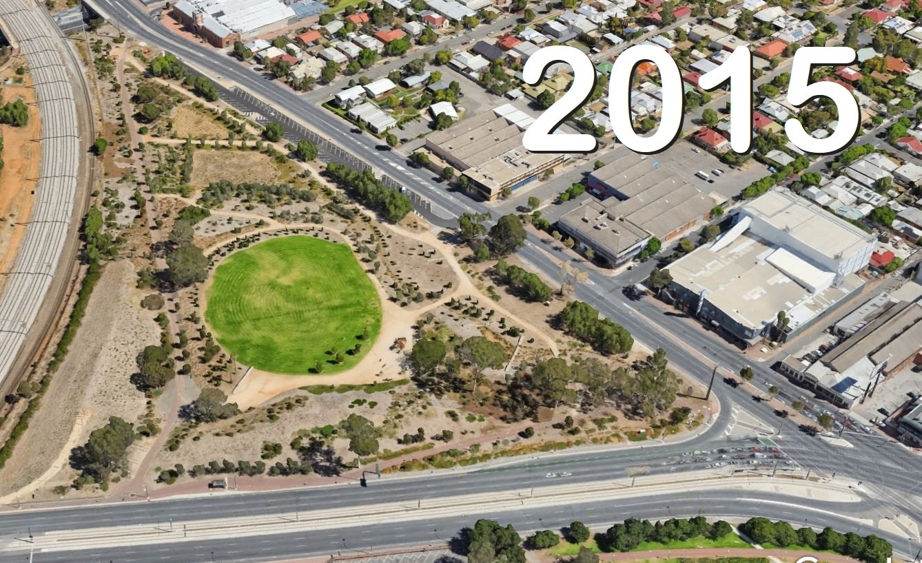
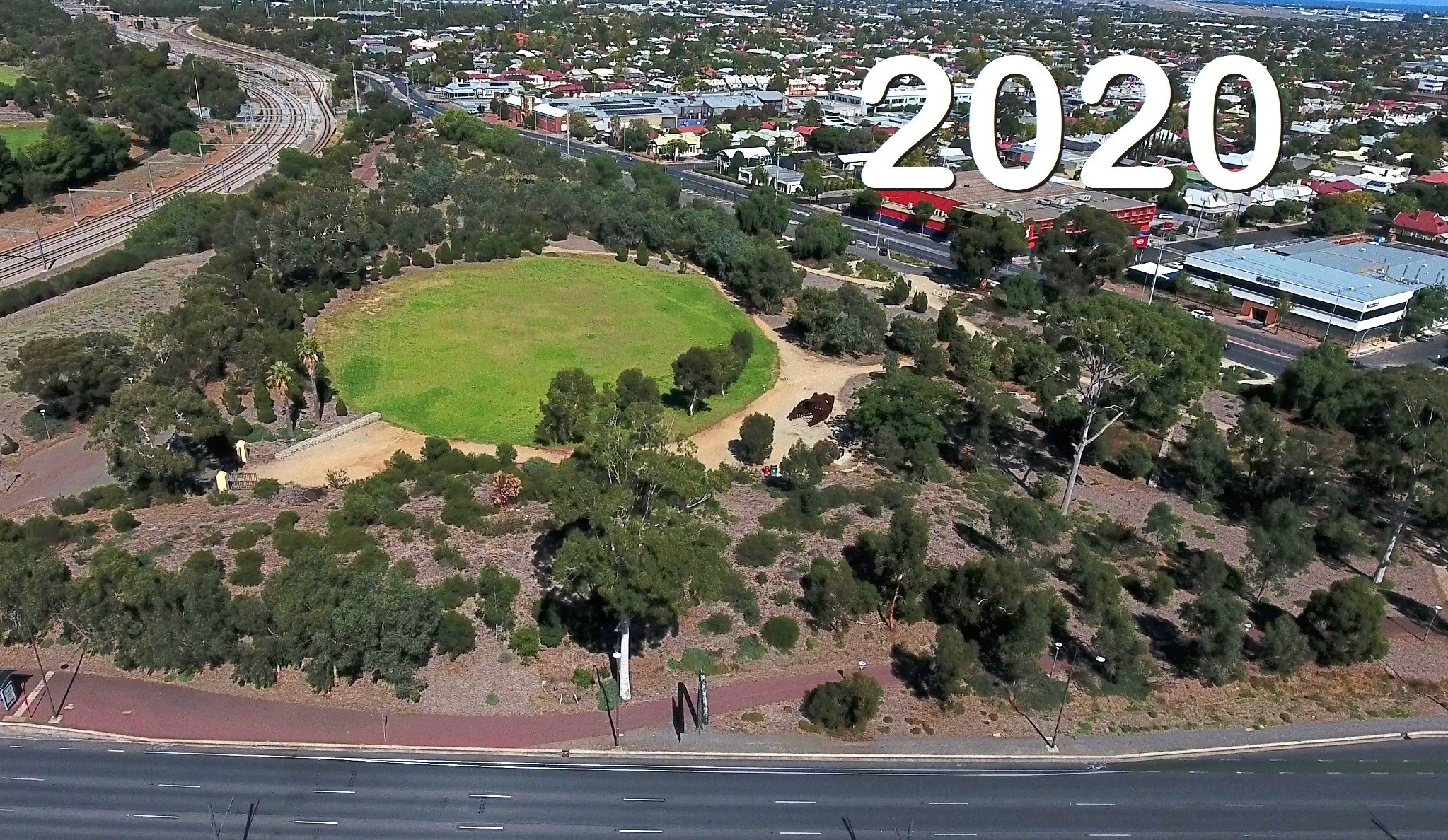
The forest has been growing ever since. It's criss-crossed with trails. and is now a trove of biodiversity right next to the City.

One of the dirt trails through the Narnungga Urban Forest.
This bike path through the forest follows the route of the former “Deviation Road” which also had a tram line running alongside for decades between the late 1920’s and the mid-1950s.
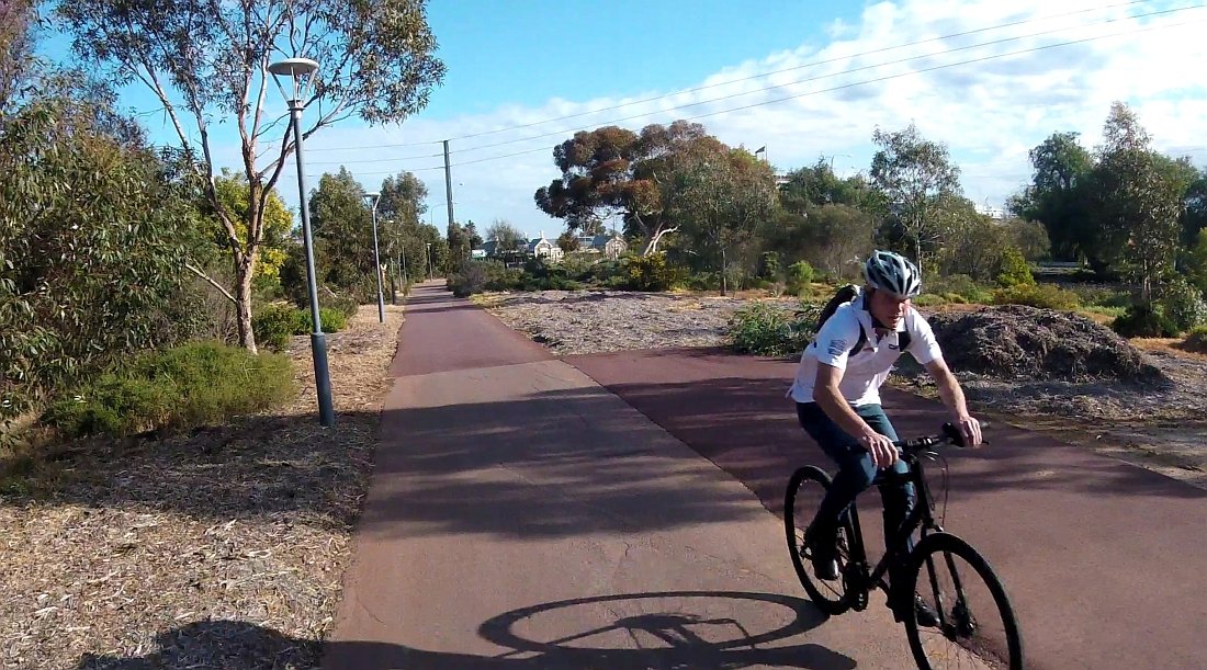
This, Deviation Road was closed to traffic while the tram line used the route. After the tram line was ripped up in the 1950’s it went back to being a normal road, and was closed only in 2012 when it was converted into a pedestrian and bicycle path alongside the Narnungga Urban Forest.
There is a Facebook group “Friends of Narnungga Urban Forest”. They are doing what they can to look after this area, amid fears that it might one day be subject to privatisation or commercialisation.
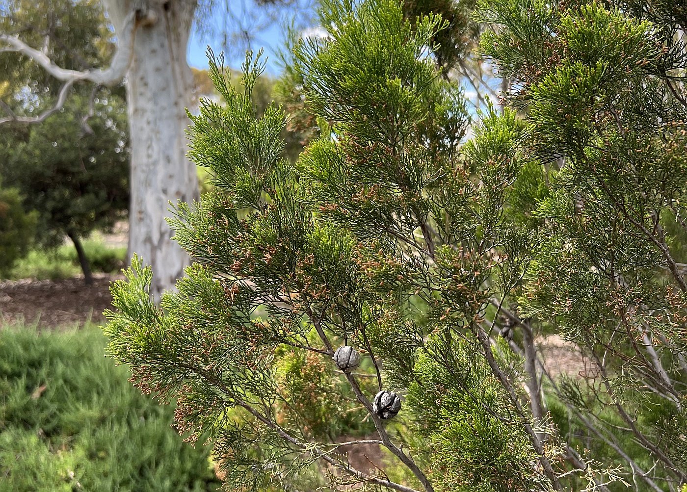
Some of the native pines (Callistris gracilis) within the Narnungga Urban Forest that give “Narnungga” its name, meaning Native pine place.
This is one of the areas that the AFL team, the Adelaide Crows were looking at, during 2020-21, for their new corporate headquarters, until the City Council in March 2021 rejected any Park Lands location.
From here, walk west across the Urban Forest on the dirt pathway, near to the edge of James Congdon Drive. Turn right and follow the dirt pathway to the northern side of the sporting field. Stop where you can see a barbecue and picnic area, and what looks like a metal whale skeleton.

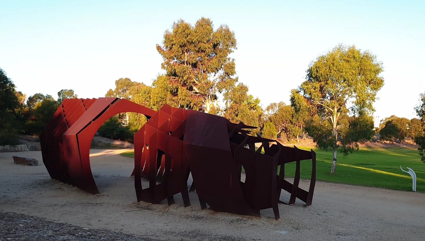
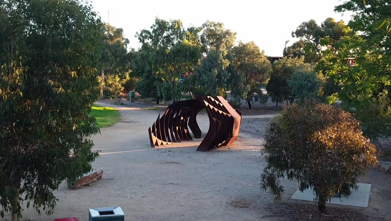
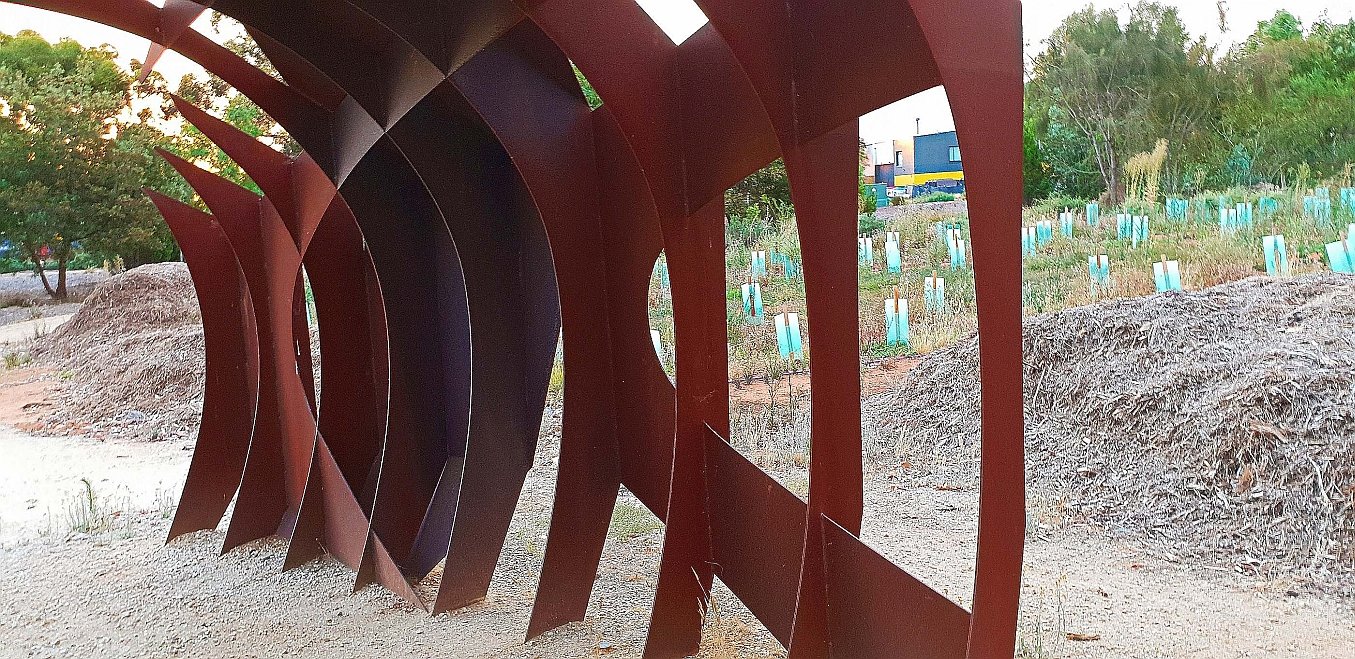
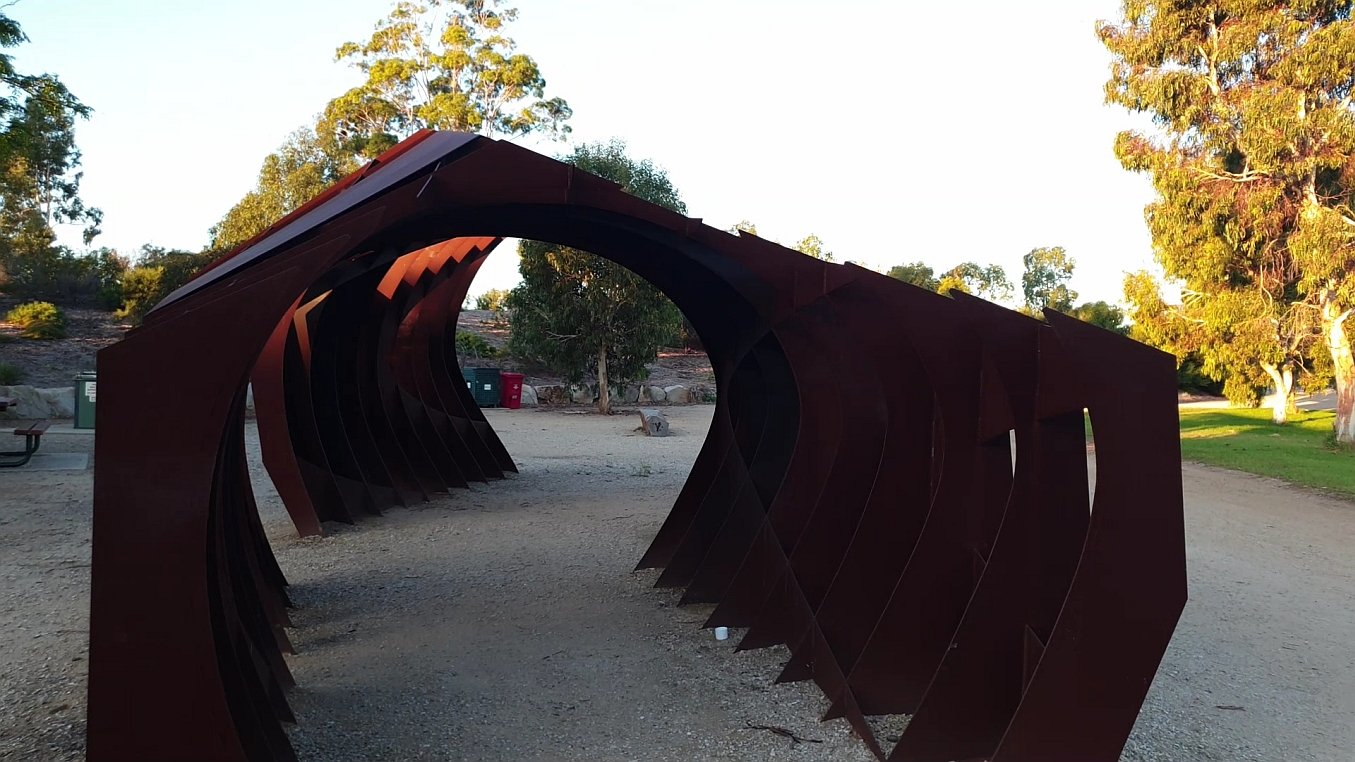
9. Picnic area: “Flock Shelter”
This is another example of the public art that was installed in this Park in 2012, coinciding with the creation of the Narnungga Urban Forest.
It’s called “Flock Shelter” and was created by James Martin and Steve Hooper, who describe their work as “a junction between architecture and art.”
Reviewer Hugh Michelmore, writing about this work, said:
“Using their skills in digital parametric modelling, James and Steve worked with metal fabricators and their own mental fantasies to produce an unnatural sculpture that sit’s in perfect harmony with the natural surroundings of the park. The “Flock Shelter” is austere and harsh, with a multitude of sharp facets and sweeping cuts, yet sits with a sense of place within the native forest that surrounds it.”
The artists say that the inspiration for this artwork was a swarm of native bees! Like the ‘Eucalyptus Alive’ artwork, it’s also made of weathering steel.
Read more about the artists and this artwork here: https://thelocalproject.com.au/articles/talents-in-tandem/
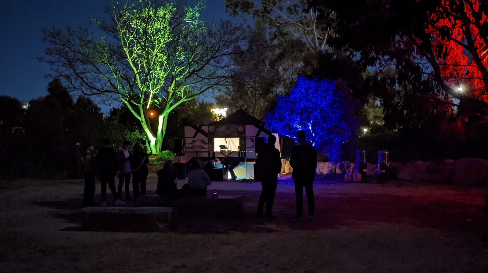
“Flock Shelter” has been used as the location for house music parties, after dark. Pics: Michael Genrich
To the east, you can see two large cotton palm trees (Washingtonia filifera) and a formal gateway. The gate and the palms are the only items remaining from the 130-year history of this area as a water works depot.
The gates that were formerly the entrance to the SA Water Depot.
From here, walk through the gates, and turn left. Go back to the shared-use pedestrian and bicycle pathway along Port Road. Retrace your steps back over the railway line, and then drop down into the car park next to the main sports field, the Karen Rolton Oval.

10. Sporting leases & licences
Since 1926, this area has been devoted mostly to sport. Originally it was the SA Railways Institute based here, with sport for union members. However, since the 1980s the South Australian Cricket Association has been the main user of this Park.
In 2015, approval was granted for this three-storey pavilion. In November 2016, following community consultation, Council approved a 42-year Park Lands lease agreement with the SA Cricket Association.

Cricket at Karen Rolton Oval in Gladys Elphick Park / Narnungga (Park 25)
Signing of the lease allowed the SACA to go ahead with construction of this building, which it calls a “pavilion”.
The “pavilion” includes six changerooms, a private function room and tiered seating. The crowd capacity here is estimated at 5,000 and so Karen Rolton Oval tends to be used by SACA for events for which it is not practical to use the much-larger Adelaide Oval.
It is used in the cricket season for Women’s matches in the Big Bash League, Australian women's international matches, and some Sheffield Shield matches. During the summer of 2020, it also hosted warm-up matches for the T20 World Cup.
Approval to construct this building required SACA to demolish these former old brick sheds:

Former sheds that were removed after construction, in 2017, of the SACA “pavilion”

By 2022, the tree that had been behind the brick shed had also disappeared.
The City Council advised in 2016 that construction of the new “pavilion” and demolition of the two sheds would result in a smaller overall building footprint. That footprint calculation did not include the footprint of the expanded car parking.
Since signing the lease, the SA Cricket Association has also obtained approval for installation of floodlights to allow games to be played at night. There was also subsequent approval in 2022 for construction of tiered concrete seating and shade structures on the western side of the Karen Rolton Oval.
In the winter, outside cricket season, the SACA sub-licences the playing fields to the Old Ignatians Football Club.
All of the ovals within this Park are licensed, rather than leased. That means that the licensees (SACA and Old Ignatians) have the first right to use the playing fields, but each field is available to the public when not being used by the licensees. Nevertheless, most people would see the fence around Karen Rolton Oval and assume (incorrectly) that there was no public access permitted.

SACA has also installed fenced cricket practice nets within the Park.
The developments in 2017 resulted in the loss of two tennis courts which were previously in the centre of this Park.

The site of former public tennis courts, removed in 2017.
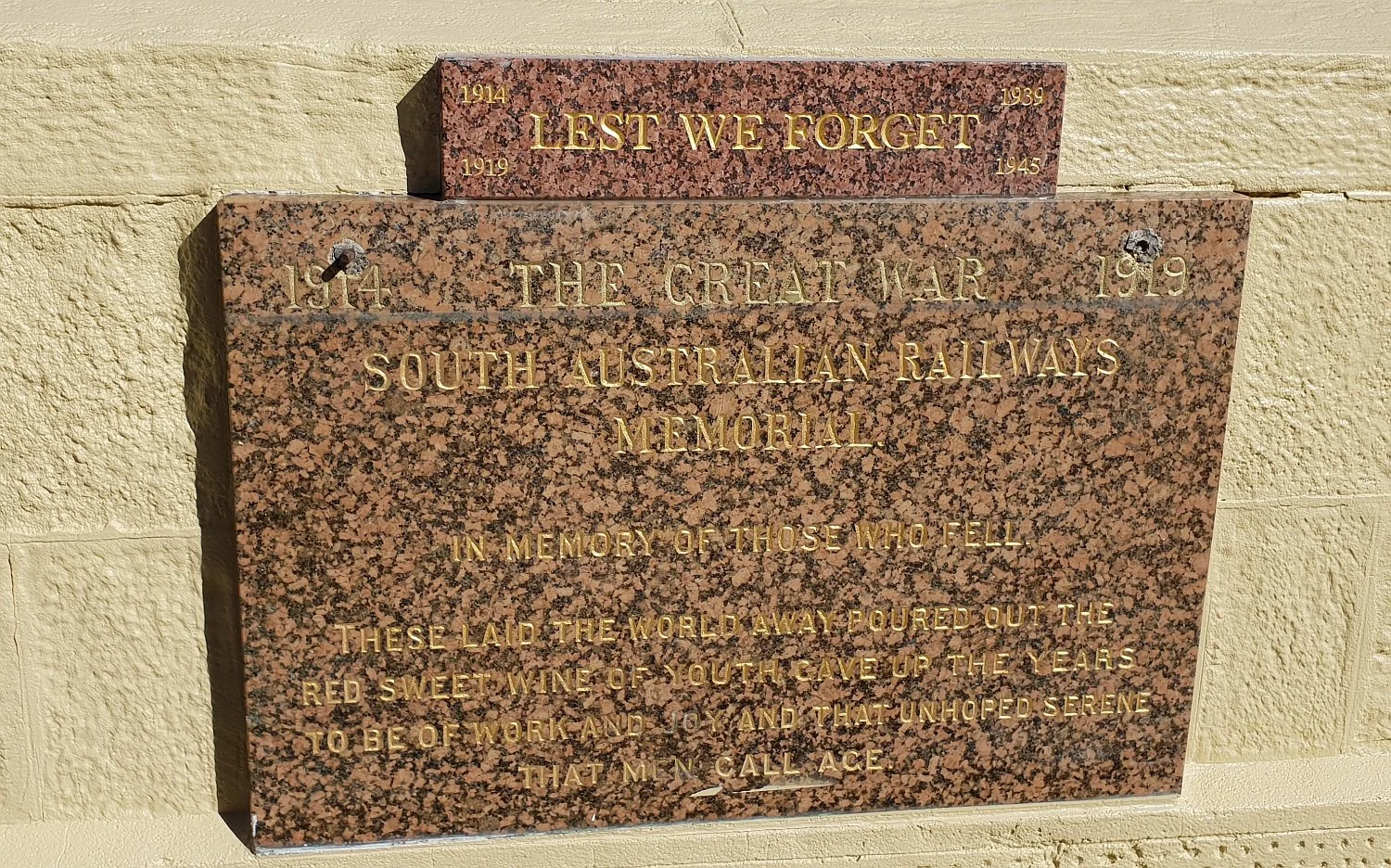
There is a war memorial here next to the car park, which acknowledges the use of this Park by members of the Railways Institute. Many Railways Institute members were killed in the first world war.
From here, walk around the northern side of the oval back to the starting point off West Terrace, opposite Hindley Street.
Optional: download and print a tri-fold leaflet, i.e. a double-sided single A4 page, with a brief summary of this Trail Guide: (PDF, 3.1 Mb).
All of our Trail Guides and Guided Walks are on the traditional lands of the Kaurna people. The Adelaide Park Lands Association acknowledges and pays respect to the past, present and future traditional custodians and elders of these lands.

