

Take the trail
Start at the corner of East Terrace and Halifax Street.
This Trail is on the traditional land of the Kaurna people. First Nations people are advised that this Trail Guide contains images of persons who have died.
About 2 kilometres. Allow one and a half hours.
Trail Guide route
Start this trail at the corner of Halifax Street and East Terrace. The Trail is about 2km in length. There are 11 stops on this Trail and it will take up to 90 minutes to complete. There are three public toilets on the route. Walking instructions are designated by bold type at the end of each of the 11 stop descriptions.
Optional: download and print a tri-fold leaflet, i.e. a double-sided single A4 page, with a brief summary of this Trail Guide: (PDF, 2.8 Mb)

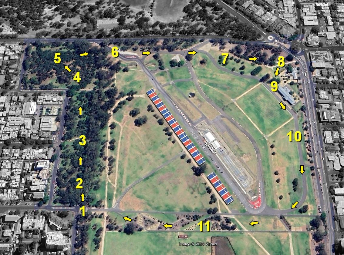
1. Park 16 in context
This Park retains its shape and form as originally laid out by Colonel William Light in 1837.
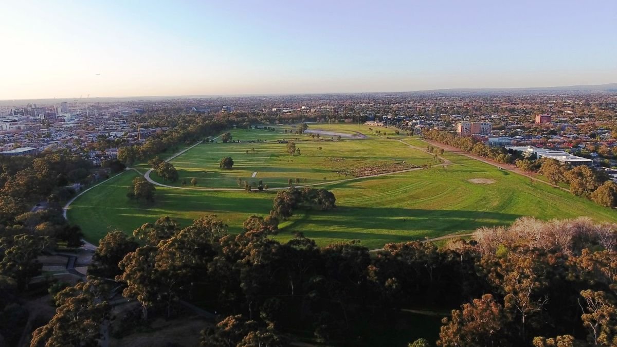
Covering 72 hectares, it represents about 10% of the entire Adelaide Park Lands, the largest single Park within them.
Victoria Park/Pakapakanthi is bounded by Wakefield Road to the north, Fullarton Road to the east, Greenhill Road to the south, and East Terrace and Beaumont Road to the west.
Its two neighbouring parks are King Rodney Park/Ityamai-Itpina (Park 15) to the north; and Carriageway Park/Tuthangga (Park 17) to the west.
Victoria Park’s history and development is linked to the horse racing and motor racing events which have dominated its use. However, there are also other, less prominent stories here.
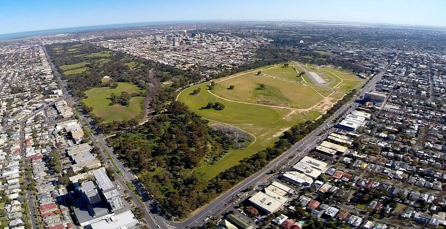
Since the demise of horse racing here in 2007, Victoria Park or Pakapakanthi has been gradually restored, from a state of semi-alienation to a people’s park with a range of open, green and public resources.
From this point, walk northwards along the pathway and stop where you can see a rectangular patch of gravel.

2. Petanque piste
This rectangular gravel area is a “petanque piste”.
Other parts of Victoria Park are well used for a wide variety of intensive sports and recreation - from running and cycling, to equestrian activities.
However not all of the sporting activities here require physical strength or fitness.
This flat shaded gravel area is for playing the leisurely game of “petanque” similar to bocce or boules.

Playing petanque on the piste
There are barbecue facilities, tables and benches alongside. The shade offered here makes it an attractive option for summer gatherings.
This is not the only petanque piste in the Adelaide Park Lands. There are similar areas marked out in Park 9 (off MacKinnon Parade) in Park 13 (off Rundle Road); in Park 20 (near the corner of Unley Road and Greenhill Road) and in Park 21W off South Terrace.
Now walk a few metres further north - to the first of the activities on the so-called “Sweat Track”.
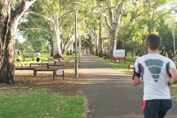
3. Sweat Track / Botanic Creek
This 600 metre long “sweat track” was installed in the early 1970s.

Opening of the “sweat course” in 1971. Pic: City of Adelaide archives 3554/33
The “sweat track” course includes opportunities for running, step-ups, bar dips (for triceps) a sit-up station, pull-ups (i.e. chin-ups) for biceps, log-lifts, and hurdles.

There are also other, more recently installed exercise stations which create a fitness loop around the park, mostly to the south of the playing fields.
Victoria Park /Pakapakanthi (Park 16) is also one of three locations within your Adelaide Park Lands for the 5-kilometre “parkrun” held every Saturday at 8am. The other locations for “parkrun” within your Park Lands are at the Torrens Weir in Park 1, and in Lefevre Park / Nantu Wama (Park 6)
Alongside the path to your left you can see a creek or watercourse. This creek was built in the early 1900s as flood mitigation channel, lined with bluestone. See the images below.

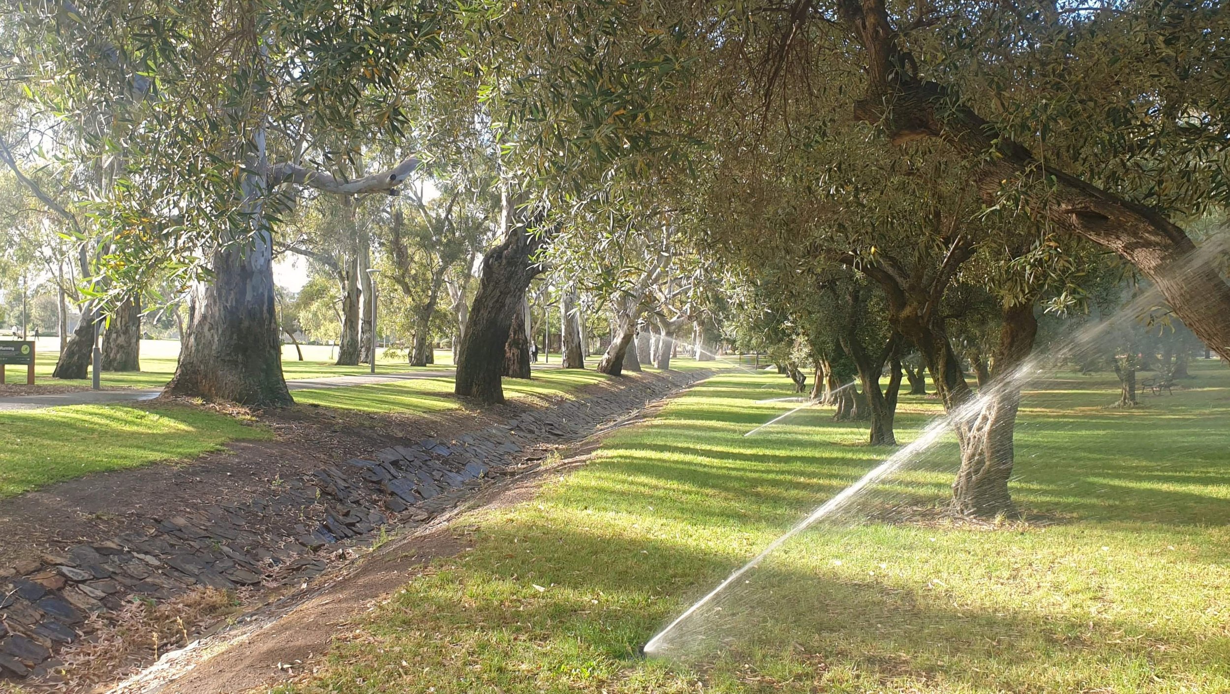
This waterway doesn’t flow all year, but after rain it channels water through the eastern Park Lands and eventually drains into the Botanic Gardens lake about a kilometre north.
It is unclear from City Council records exactly when the channel was constructed but a date in the 1920’s is considered the most likely.
Before European settlement, this would have been a major camping area for the Kaurna people, with the watercourse providing a wealth of natural resources.
In late 2023, the City Council commenced what was described as a three-year project to convert this ephemeral waterway into what is described as a “Creek of Cultural Connection” …weaving together “the physical features of water sensitive urban design, watercourse rehabilitation, biodiversity restoration and Kaurna land and waterway management.”
The first stage of this project was completed in January 2024. You will see the changes at the next location on this Trail.
In January 2024, a giant river red gum fell alongside the sweat track. Fortunately no-one was injured.
Walk further north to where the creek disappears under a bitumen roadway and look where the creek emerges from underground, on the northern side of the roadway.

4. Ancient olive grove
Where the Botanic Creek emerges from under the roadway you can see the first stage of construction of “The Creek of Cultural Connection” where Botanic Creek is channeled into curved lines through the old olive trees.


These are among many surviving olive groves around your Adelaide Park Lands. Olive trees were a Victorian-era solution to the degradation of the land, after the first three decades of European settlement in the colony.
By the 1860s, due to the effects of grazing and clearing for firewood, most of the Park Lands had become bare dust-bowls in summer and quagmires in winter.
Concern over the aesthetic degradation led to an increased public demand during the 1860’s, for something to be done.
At that time, olives were seen as an optimal solution, because they were both fast growing and considered to be potentially lucrative. This sheltered grove was planted in 1872 by city gardener William Pengilly.
By 1884, about 1,500 olive trees bordered Victoria Park.
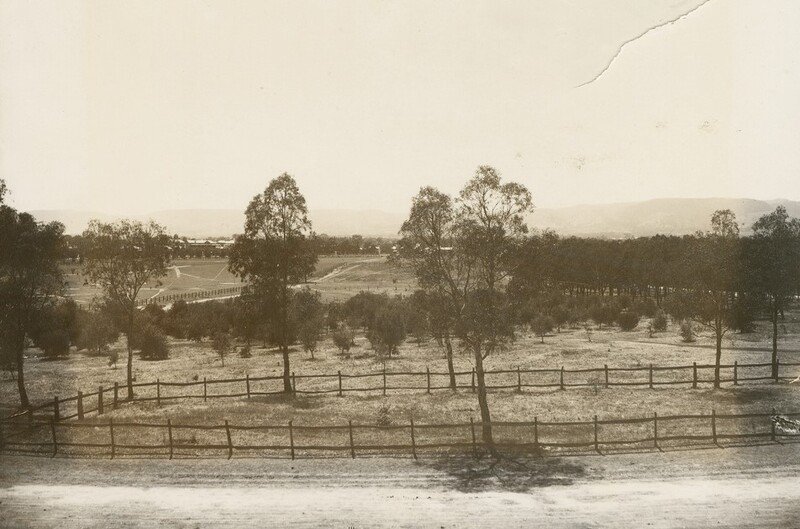
Re-vegetation in Victoria Park, circa 1920s
Although attempts were made by contractors to create an industry by processing the oil, they had limited financial success.
By the 1880s, the olive trees in the Park Lands had fallen out of favour - and more ornamental plantings were being used.
However this grove, and another one, across Wakefield Road in neighbouring King Rodney Park (Park 15) both remain much as they were set out in the 1870’s.
You can register to pick olives from groves in the Park Lands. Provided that you obtain a free permit you can pick enough for your domestic use.

Picking olives in Victoria Park / Pakapakanthi (Park 16). Pic: Shane Sody
Walk through the olive trees on the left-hand (western) side of Botanic Creek and stop about half-way to Wakefield Road, where you can see tracks curving around and between the olive trees.

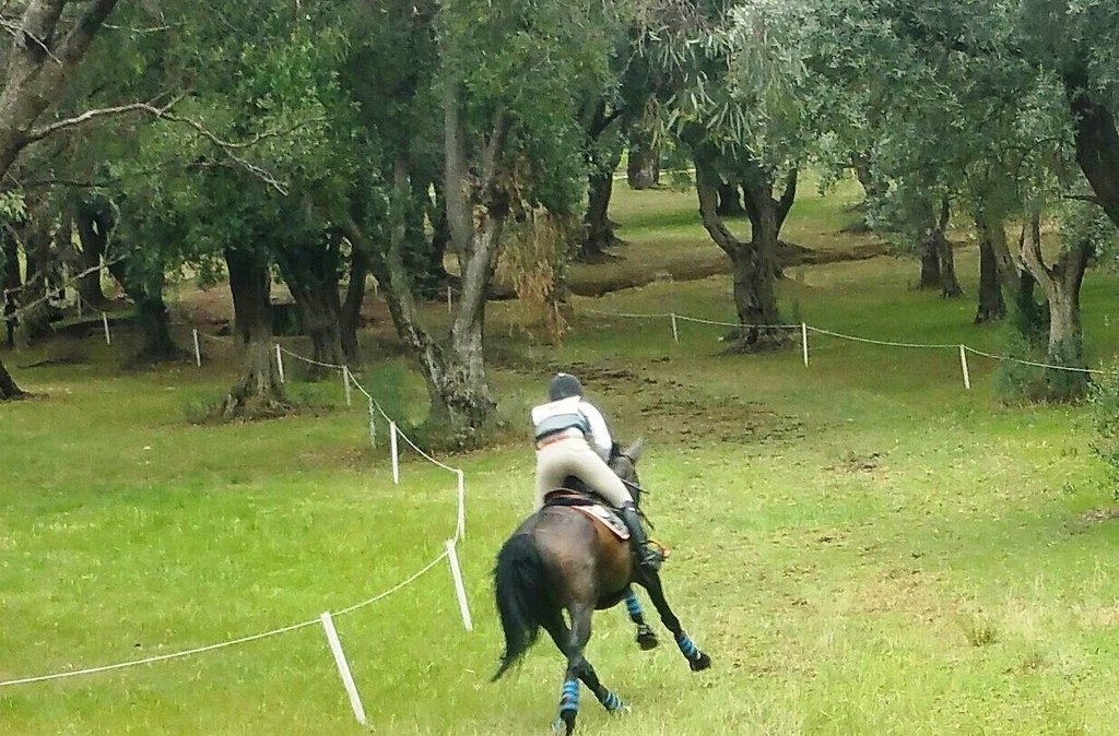
5. Equestrian course
The northern part of Victoria Park, including the olive groves near Wakefield Road is used once each year as part of a cross country course, for highly-trained horses and their riders.
Horse racing left Victoria Park after 2007. However the Kaurna name of the Park - Pakapakanthi - is still relevant during Australia’s premier equestrian event which is held here once per year.
The Australian International Three Day Event was held in the Adelaide Park Lands every year from 1997 to 2019.
It was cancelled in 2020 and in 2021 due to the COVID-19 pandemic.
However it returned in April 2023 and 2024, (re-named as the “Adelaide Equestrian Festival”) and is scheduled again for early May 2025.
The Adelaide Equestrian Festival is one of only five equivalent such events anywhere in the world.
It is not confined to Victoria Park. The cross-country part of the event extends to include the two Parks immediately to the north, King Rodney Park (Park 15) and Rymill Park (Park 14).
When the event is held, many horse hurdles and temporary course markings are moved into the eastern Park Lands.
From this point, keep walking northward towards Wakefield Road. Turn right, and go across Botanic Creek on a wooden bridge. Stop on a wide bitumen road into the Park. This is part of a motor racing circuit.

6. Motor racing
Motor racing in Victoria Park has been perhaps the most controversial activity in any part of the Adelaide Park Lands.
Motor racing came to Victoria Park in 1985 and annual events were held in most years up until 2019.
Despite the popularity of motor sport at Victoria Park, there were also many people who questioned the disruption and alienation caused by these events, and the legitimacy of their use of the Park Lands.
The idea to attract a round of the international Formula One Grand Prix to Adelaide was first conceived in 1983.
Early designs of a proposed street circuit did not include the Park Lands, but Victoria Park was added to the proposal in order to better ‘sell’ Adelaide to the television cameras.
Despite concerns raised over disruption to residents and the environment, engine noise, traffic disruption and the ever-lingering possibility of additional permanent buildings in the Park Lands, State Parliament passed the SA Motor Sports Act in 1984, allowing construction of a permanent track.

The Australian Formula One Grand Prix in the 1980s
The Adelaide Grand Prix was a very popular event, three times winning the Formula One Race Promoters’ Trophy as the best run Formula One Grand Prix of the season.
As it was the last race of the annual Formula One season, Adelaide twice saw the Formula One World Drivers Championship decided on its circuit.
In 1996, the Australian Formula One Grand Prix moved to Melbourne.
Then, for 21 years, from 1999 to 2019, the Adelaide street circuit hosted one annual round of the Australian V8 Supercars championship, each March.
While the championship race and related events were restricted to four days, construction and deconstruction of temporary buildings including grandstands, pit lane, and corporate boxes took about five months: from December to May.

The Adelaide 500 motor racing festival (aka “Clipsal” after its major sponsor) in the year 2000.
After the event was cancelled in 2020 due to COVID-19, with the event’s popularity waning, and an alternative track established at Tailem Bend, the then Liberal State Government decided not to renew sponsorship of motor racing in Victoria Park.
In 2020 the former motor racing track was transformed by marquees into a testing station for COVID-19, which operated for the following two years.
The Labor State Government, elected in March 2022, returned motor racing to this Park and entered a five-year contract, to hold the “Adelaide 500” event each year until 2026. In addition, another “Festival of Motor Sport” was scheduled to recur annually each March. The requirements for staging both of these motor sport events means that motor racing infrastructure remains in this Park for more than seven months each year.

COVID-19 testing station in Victoria Park / Pakapakanthi (Park 16) in 2020. Pic: ABC-TV news
From this point, walk eastwards towards the old stone grandstand and stop at a large, white-painted planter bowl.

7. Horse racing
Victoria Park’s association with horse racing is nearly as old as the park itself.
The white concrete planter bowl you can see here was previously the centrepiece of a rectangular garden, which was itself at the centre of the former stables area.

If you look around you at the arrangement of ash, cedar, elm, plane, and Norfolk pine trees you might observe the remnants of the yard that was surrounded by horse stalls.
One map from 1839 already includes a racing track here, and by the 1840s races were held regularly.

A watercolour on paper representation by John Michael Skipper (1815-83) entitled “Racecourse, Adelaide (1840)” providing a vivid scene of a race meeting on the site of the Victoria Park Racecourse looking from East Terrace towards the Mount Lofty Ranges escarpment. Source: Lock-Weir 2004, pp. 94, 97.
Horse racing was seen as an important cultural and social event – a very desirable and significant way to verify the British identity of this colonial outpost.
Not everybody approved, however. One Reverend of a nearby church wrote to the governor complaining of the dust raised by the horse’s hooves.
Horse racing was officially sanctioned in Victoria Park in 1855. The City Council believed at the time, that it had no power to permit permanent structures within the Park Lands. However, that did not stop the Racing Club from constructing its unapproved grandstand anyway.

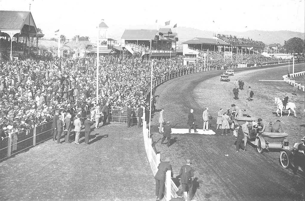
A race day scene about 1900
A lease which enabled the construction of permanent buildings was issued in 1867, and a grandstand was erected, with approval, in time for the Queen’s Birthday that year. The grandstand you can see today, however, came 15 years later in 1882. At that time, there were two grandstands alongside each other.
Further built additions to the park over the years included fences, stables, a betting ring, secretary’s office, and maintenance and amenities buildings – most of them since removed.
In 1975 the Adelaide Racing Club and the South Australian Jockey Club amalgamated.
Racing’s popularity began to decline in the decades following that merger.
Horse racing was eventually consolidated at the suburban Morphetville racecourse, but not before one final controversy at Victoria Park.
The SAJC lease expired in 2004, but the Jockey Club temporarily continued its occupation in a holding-over period.
The SAJC met with overwhelming public opposition over an ultimately unsuccessful proposal to upgrade its facilities and build a permanent, 200m long, three storey building.
In December 2007 Victoria Park hosted its last race, and the lease was terminated the following year.
From this point, walk across a short distance to the west, to look at a blue-painted weatherboard building nearby.

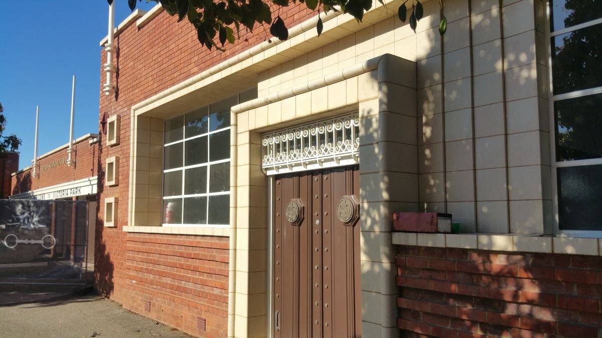
8. Cafe and exotic trees
Close to Wakefield Road, this is an unassuming, timber-framed, weatherboard building. It looks relatively modern but somewhat surprisingly, dates from the 1880s.
During the days of horse racing, it provided beer and other refreshments to race goers. In 2017 it was converted to a kiosk, known as Cafe 16 (recognising this Park’s number), then was renamed in 2024 as “Kiosk Lola”.
Walk a bit closer to the grandstand, and look for an unusual tree with a dome canopy, i.e. shaped like the top half of a sphere, completely bare of leaves.
This is (or was) a Dragon Blood tree, planted in 1903. It grew and survived for 123 years before unexpectedly dying in 2024, less than a third of the way through what is usually a 400-year lifespan for this species.


The Dragon Blood tree is a sub-tropical species, native to the Canary Islands, Cape Verde, Madeira, and Morocco. A related species (Dracaena cinnabari), is found on the island of Socotra off the horn of Africa in the Arabian sea, where it is endangered.
The tree is called “Dragon Blood” due to the red sap that the trees produce.
Its cause of death in 2024 was not immediately apparent. There was little if any evidence of infestation by borers or other pests. At the time, the City Council’s head of horticulture opined that it might simply have been due to the effects of old age, and an environment with a lot of nearby activities (“construction and events”) that might have rendered the tree more susceptible.
Other exotic trees nearby include two very tall Auracarias, a Cheesewood tree, and clusters of Yucca trees.


Now, go behind the grandstand to look at the red-brick buildings that border Fullarton Road.
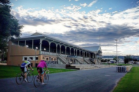
9. Grandstand & other heritage buildings
The red brick buildings bordering Fullarton Road are some of the rare built remnants of Victoria Park’s horse racing history.
From left to right (looking from inside the park), they are the the former offices of the Adelaide Racing Club (built 1954) the turnstile building (built 1926) and the Grandstand Entrance Gates (built 1954).
On the edge of Fullarton Road, outside the old entrance gates, there is a line of Queensland bottle trees (Brachichyton rupestris) running parallel to the buildings. These trees were likely planted in the early 1930s. This is the largest plantation of Queensland bottle trees in Adelaide.
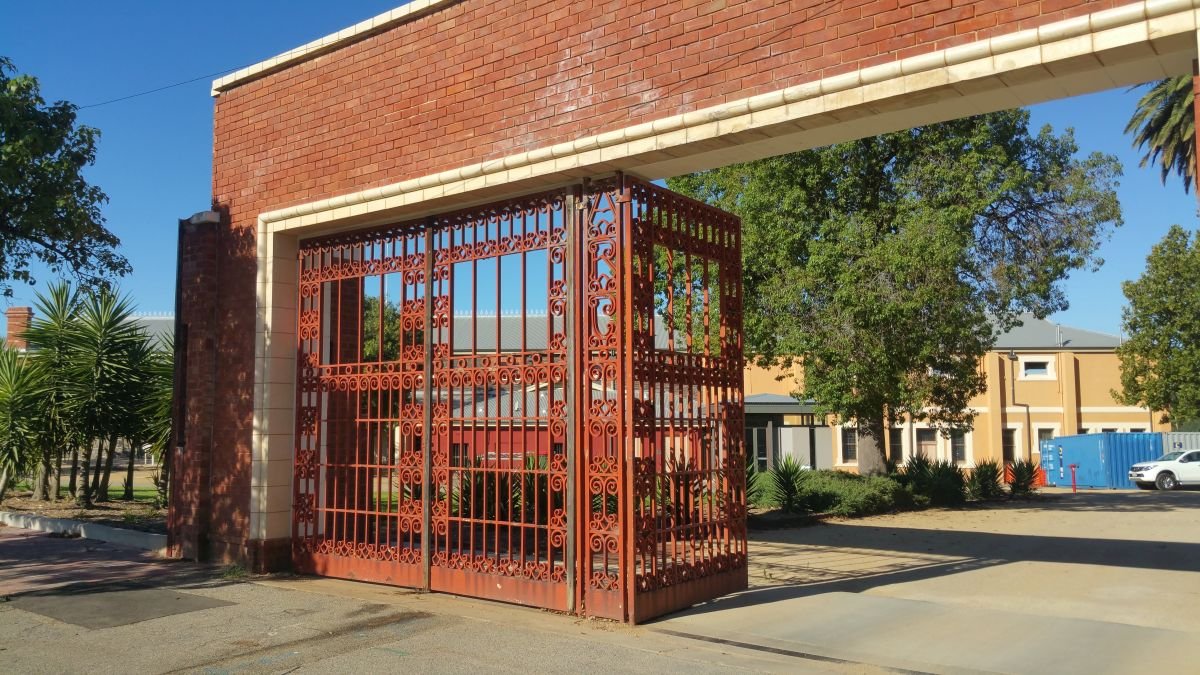
The turnstile building, erected in 1926, was designed by prominent Adelaide architect Kenneth Milne.
In 2017, it was re-purposed for use as a café.
Before it was repurposed, it contained ten original cast-iron turnstiles – an indication of the size of the crowds that used to come here in those days for horse racing.
The Grandstand Entrance and the Racing Club offices were added on either side in 1954.
Notice the decorative design character of both, indicative of the post-war period, including timber flagpoles, glazed terracotta, and wrought iron work.

The grandstand in the 1890s
From this point, walk back inside the Park, to the front of the heritage grandstand.
Erected in 1882, this grandstand is the oldest surviving building in Victoria Park.
It is constructed of bluestone with red-brick dressings, timber-framed openings (including some stained-glass windows), corrugated-galvanised-iron roof, and timber and cast-iron detailing in typical Victorian era style. This building was State heritage-listed in 1986.
Since 2017, the grandstand has incorporated a café, established at that time by former Australian champion cyclist Stuart O’Grady.
Cycling has become a popular pastime in this area of the park, with a 1.3km criterium race track passing in front of the grandstand and using part of the former car racing circuit.
Your next stop is the central area of Victoria Park, including the sports fields.
Walk south for about 400 metres (about five minutes). Stop at the giant River red gum tree, at the traffic lights on the corner of Fullarton Road and Grant Avenue.

10. Kaurna History and naming
The Kaurna name for this park is Pakapakanthi. It means “to trot”, and denotes the history and importance of horse racing to this park’s identity. This name was given in 2003, although the spelling was changed in 2013.
Prior to European settlement, Victoria Park would have resembled a large flat of blue gums and grey box gums.
Oral history of surviving Kaurna elders indicates that this area was used for corroborees, burials and camping.
In 1980, indigenous Pitjantjatjara and Yankunytjatjara people, along with other indigenous groups from the desert lands in the north-west of South Australia arrived in Adelaide to confront the State Government over land rights.
They established a camp here at Victoria Park in a symbolic action to commandeer an important symbol of white culture. Numerous meetings were held at the campground.
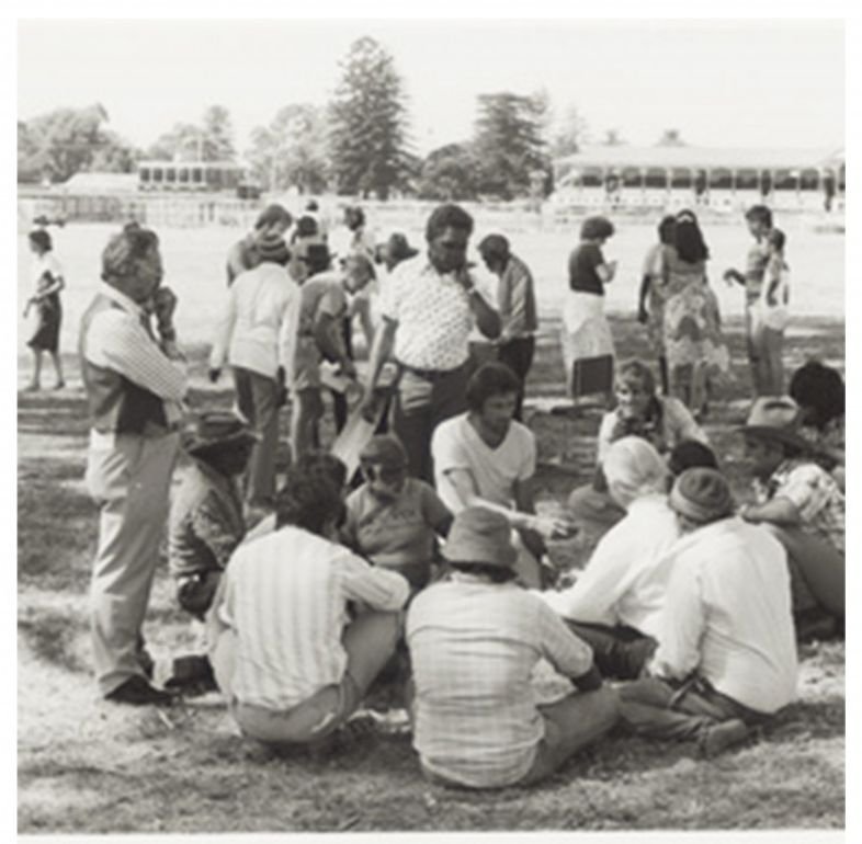
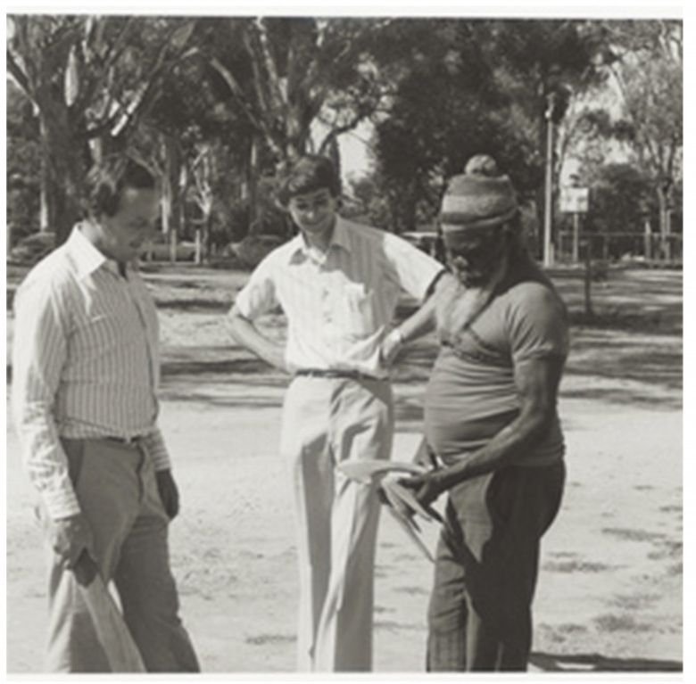
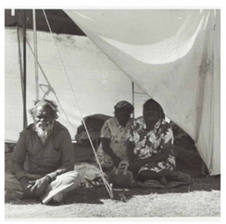
Pitjantjatjara tent encampment at Victoria Park in 1980. Pics: State Library of SA
The protesters received support from community groups and businesses in the form of media coverage, firewood, and food. Local Kaurna and Ngarrindjeri aboriginal people, themselves experiencing their own issues of land rights, also joined the protesters at the camp to talk and listen to the songs and speeches.
This stand was an important moment that came before the passing, the following year (1981) of a Land Rights Act that covered the Pitjantjatjara and nearby lands.
The was the first recognition in South Australian law, of Aboriginal community freehold land title.
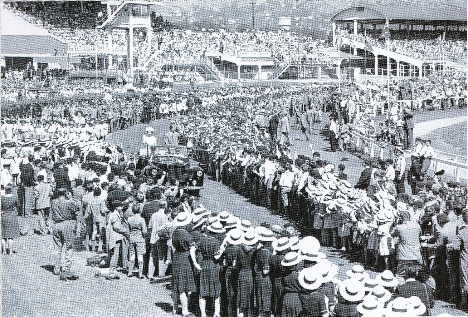
The English name, Victoria Park, was assigned in 1897 on Queen Victoria’s Diamond Jubilee. True to its name, Victoria Park has hosted several royal visits.
Images: Prince of Wales arrives at Victoria Park, 1920. Source: State Library of South Australia PRG 280/1/23/318
The Queen arrives at Victoria Park, 1963. Source: City of Adelaide archives
Pope John Paul II conducted a 'Mass for all South Australians' here in 1986. It was attended by more than 180,000 people. The service involved nine languages, including Pitjantjatjara, Polish and Vietnamese.

Pope John Paul II celebrating mass at Victoria Park / Pakapakanthi on 30 November 1986
From this point, walk eastwards, across the bitumen track and stop about halfway; near a toilet block.

11. Green corridor
This so-called “green corridor” for commuters extends from Fullarton Road, right across the Park to Halifax Street, where this Trail Guide began.
It provides pedestrians and cyclists with an attractive passage between the city and the eastern suburbs.
While this route has long been used by residents, it was enhanced in 2013 with the creation of native garden beds, which also provide a demarcation line between the southern sporting fields and the northern race track area.
Looking eastwards offers sweeping views of the Adelaide Hills, a significant agricultural, tourism and wineries region.
This uninterrupted vista is also one of the key values which was attached to the Adelaide Park Lands, for their National Heritage listing in 2008.

The “green corridor” looking east across the centre of Victoria Park /Pakapakanthi (Park 16)
Green Pakapakanthi
The garden beds alongside this pathway are being improved, over time, in an arrangement involving the City Council and the South-East City Residents Association (SECRA) - an initiative called “Green Pakapakanthi”.
Working bees are scheduled in this Park on a regular basis, including (but not only) here in the central garden of this “green corridor”.
See more details here: https://secra.asn.au/green-pakapakanthi/
From this point, keep walking east until you return to your starting point on East Terrace.
Optional: download and print a tri-fold leaflet, i.e. a double-sided single A4 page, with a brief summary of this Trail Guide: (PDF, 2.8 Mb)
All of our Trail Guides and Guided Walks are on the traditional lands of the Kaurna people. The Adelaide Park Lands Association acknowledges and pays respect to the past, present and future traditional custodians and elders of these lands.

