

Take the Trail
Start at the corner of War Memorial Drive and King William Road, near the East Gate of Adelaide Oval stadium.
This trail is on the traditional land of the Kaurna people.
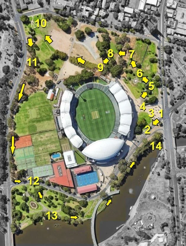
Start this Trail Guide at #1
1. Introduction
2. Sir Ross Smith and War Memorial Oak Tree
3. Creswell Garden
4. Adelaide Oval and Hotel
5. Pennington Gardens West
6. North-east pathway
7. Hedged gardens and plaques
8. Moreton Bay Fig Walk
9. Magarey Grove
10. Montefiore Hill/Light’s Vision
11. Oval No. 2
12. Tennis SA
13. Pinky Flat
14. Adelaide Bridge and mural
This tour or trail starts at the corner of War Memorial Drive and King William Road, near the East Gate of Adelaide Oval stadium, next to a statue of cricketer Sir Donald Bradman (site #1 on the map).
Walking instructions are in bold type at the end of each section.
Optional: download and print a tri-fold leaflet, i.e. a double-sided single A4 page, with a brief summary of this Trail Guide: (PDF, 4.6 Mb)

1. Introduction
This tour or trail starts at the corner of War Memorial Drive and King William Road, near the East Gate of Adelaide Oval stadium, next to a statue of cricketer Sir Donald Bradman.
The trail is about 3.9 kilometres and should take you between 70 and 100 minutes to walk.
“Tarntanya” is the Kaurna name for Adelaide and means male red kangaroo rock. “Wama” translates as “plain”.
In some places you might see “Tarntanya Wama” translated as “Adelaide Oval” but “Wama” does not mean “Oval”. It means “plain”. The Kaurna word “Wama” is also used as one of the names for Park 6: “Nantu Wama” which means horse plain.
Kaurna names for Adelaide’s Park Lands were assigned in 2002, consistent with Adelaide City Council’s 1997 Reconciliation Statement which aimed to acknowledge the prior occupation of this land by the Kaurna people and seek opportunities to recognise Kaurna heritage through physical features of the city, and by supporting community cultural activities.
There is no English name for the whole of Tarntanya Wama.
It is 54.1 hectares made up of several sections that each have different English names. The entire Park, Tarntanya Wama (Park 26), includes both sides of the River Torrens / Karrawirra Pari. That is to say, Park 26 includes everywhere between North Terrace, King William Road, Pennington Terrace and Montefiore Road. It includes the Torrens Lake and War Memorial Drive.
However, this Trail Guide covers only the north side of the River. We have a separate Trail Guide for Elder Park, and the Riverbank precinct on the south side of the River.

Detail from Alexander Schramm: Adelaide, a tribe of natives on the banks of the River Torrens (created 1850)
Before settlement in 1836, this whole area was an important place for the Kaurna people, for hunting, ceremonies and burials. This part of the park where we are now was particularly important for traditional men’s initiation and ceremonies called palti. They continued to perform these ceremonies for early settlers and were sometimes paid in flour and sugar.
The Park was also a venue for recruitment of Kaurna men for World War One.
This walk will take us past numerous landmarks, statues and species of trees—all of which are on your heritage listed Park Lands.
As you would expect, given the imposing presence of Adelaide Oval, there are many tributes to famous sportspeople in this part of the Park.
This statue is of one of the most famous sportsmen of the 20th century: famed at least in those parts of the world where cricket is played.

Sir Donald Bradman statue outside Adelaide Oval. Pic: Geoff, Google Maps Local Guide.
Only the very best Test cricketers have batting averages better than 50. This man, Sir Donald Bradman had a Test batting average of 99.94, way better than anyone else who has ever played cricket at Test level. His career Test batting average is regarded as the greatest achievement of any sportsman in any major sport.
Don Bradman was born in Cootamundra, NSW. There is a well-known story that young Don practised his craft by using a thin cricket stump to hit a small golf ball, against a wall - much harder than hitting a cricket ball with a cricket bat.
During the 1930s Depression years, and later, he was like a sporting rock star. In his later years he was reclusive, but his opinion and endorsements were highly valued by others.
In 1997, then-Prime Minister John Howard called him the greatest living Australian. Bradman died in 2001 at the age of 92. After his death, the State Government re-named Burbridge Road, as Sir Donald Bradman Drive.
The statue was crafted by Rob Hannaford and was installed in 2002 at a cost of $115,000.
Walk a short distance south west to a statue of pioneer aviator, Sir Ross Smith.

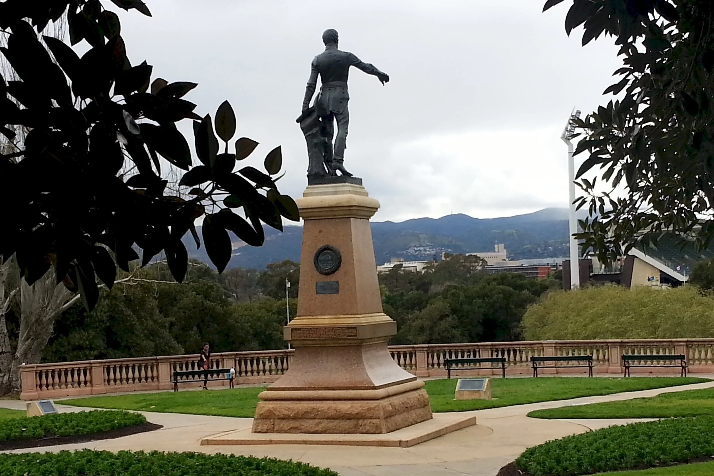
2. Sir Ross Smith & War Memorial Oak
.
The Memorial to Sir Ross Smith was unveiled on 10th December 1927. The statue shows Sir Ross in his flying gear with one foot in Europe and the other in Australia to symbolise his famous flight. The two female angels are made from bronze. One is holding an aeroplane to represent flight and the other wears a winged helmet to represent fearlessness.
In 1919, Prime Minister Billy Hughes launched a competition for the first Australian aviators to fly from England to Australia within thirty days. The prize was 10,000 pounds. Ross and Keith were South Australian brothers who, with engineers Walter Shiers (SA) and James Bennett (Vic) were the first successful crew and completed the flight in 28 days.
The statue was made by Frederick Brook Hitch in 1927. Ross Smith and Bennett were killed when a plane they were testing (a Vickers Viking amphibian aircraft) crashed in England in 1922. Smith was 29. He was given a state funeral and buried at North Road Cemetery, Nailsworth.
Immediately behind the Sir Ross Smith Memorial, is an even older, but living memorial:

War Memorial Oak
Planted to honour the fallen in World War One, this English Oak, Quercus robur, is known as the ‘War Memorial Oak’.
It was planted on 29 August, 1914, a mere 25 days after Britain declared war on Germany. This oak was an initiative of the Wattle Day League which had been founded to establish wattle blossom as the national emblem of Australia.
The oak was planted by the Governor of South Australia, His Excellency Sir Henry Galway, in the company of Lady Galway and many other dignitaries. This oak tree is considered to be of national importance because it was the first tree to be planted to commemorate World War One by any of the countries involved in that conflict.
Although it’s more than a century old, this is still a relatively young oak tree, because some oaks can live for 1,800 years,
Botanists say that oak trees can grow to a height of 12 metres. However this tree has already exceeded that height. It’s more than 14 metres tall. Its canopy stretches more than 27 metres east to west.
Both the statue of Sir Ross Smith and the War Memorial oak tree are listed on the State Heritage register.
Now follow the road north a short distance to the Creswell Garden Arch.
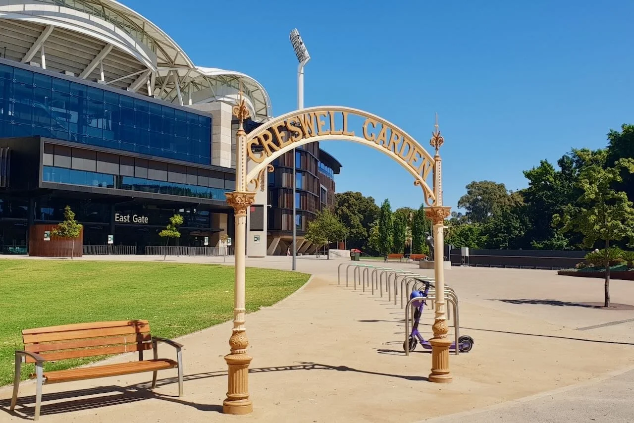
3. Creswell Garden
Creswell Garden was named after John (‘Jack’) Creswell (1858-1909) who was born in Woodville and went to St Peter’s College. He was an Adelaide businessman with a strong passion for cricket and other sports. He is remembered for his major contribution to cricket and Australian rules football.
He was said to be a ‘man of cheerful disposition capable of infecting others with similar enthusiasm and confidence in a successful outcome’. He was one of the founders of the SA Football Association, played for South Park Football Club in his youth and served as Secretary of the Adelaide Oval Bowling Club.
This arch was erected in 1910, shortly after John Creswell’s death. The arch consists of two cast iron columns with a domed arch fabricated by AC Harley in 1910.
It was restored in 2001 and was placed in its current location after the Adelaide Oval redevelopment in 2014.
Now walk north a small distance to a statue of a footballer outside the Oval’s East Gate.

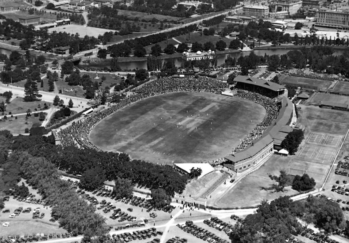
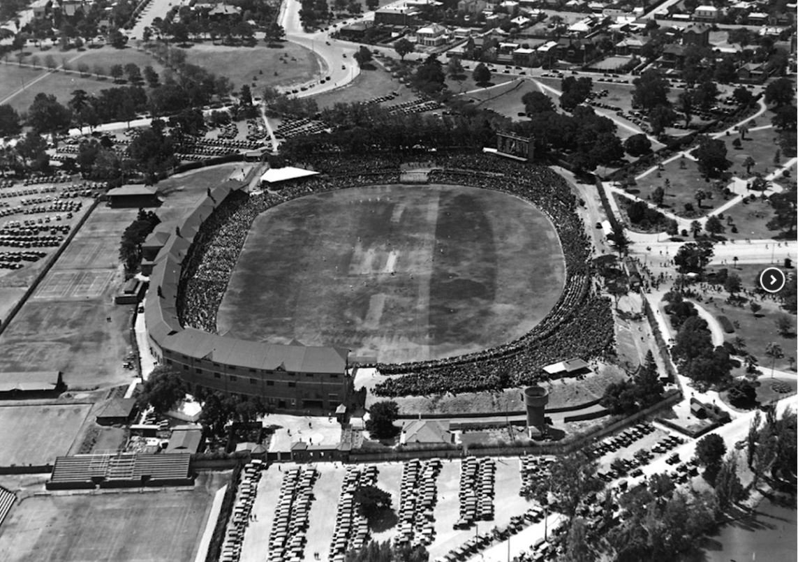
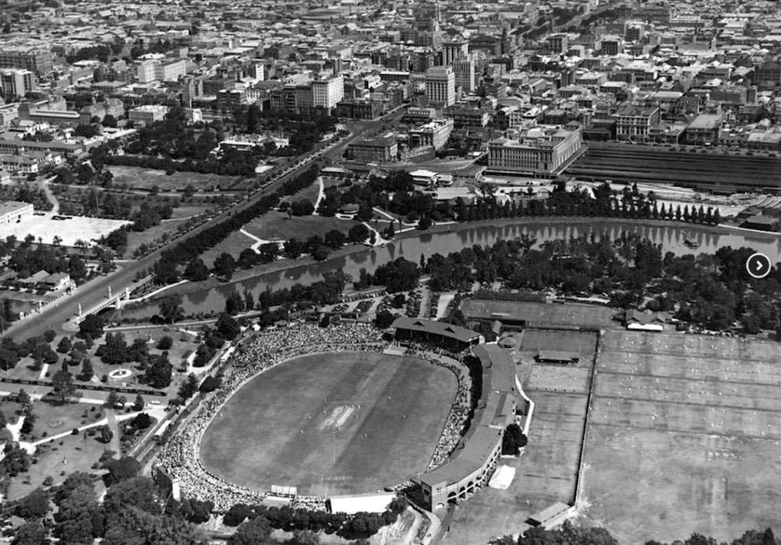
4. Adelaide Oval and Hotel
This Trail Guide does not include all of the sporting statues that are scattered around the perimeter of the Adelaide Oval. Near the South Gate, off War Memorial Drive, there are statues of former Aussie Rules football stars Malcolm Blight and Barrie Robran as well as cricketer Clem Smith.
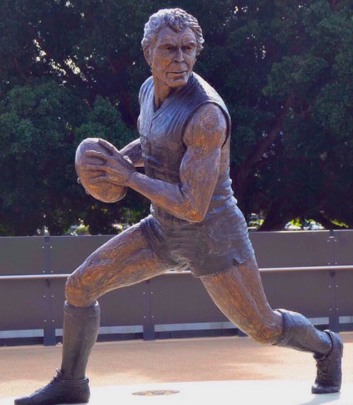
This statue, outside the Oval’s East Gate, honours Russel Ebert, considered to have been one of the greatest players of Australian rules football in SA.
He played for Port Adelaide - regarded as that club’s greatest ever player.
He was the only player to have won four Magarey Medals which are awarded annually to the best and fairest player in the SANFL.
Football historian John Devaney described Ebert as coming as close as any player in history to exhibiting complete mastery over all essential skills of the game.
He died in 2021 at the age of 72.
Historically, Adelaide Oval has been a focal point for major sporting and cultural events since it was first established and the site was used as a sporting venue as early as the 1840s. In 1869, SA Cricket leased 6 acres from the government to lay a cricket pitch. The land was fenced and a pitch planted.
In 1872, the Adelaide Oval Act was enacted and enabled the development of the Adelaide Oval which was improved by SACA to stage its first formal match between English and Colonial Members of SACA in 1873.
The first test match played against England, which England won, was played in 1884.
The first Australian Rules football game was played in 1877 between Adelaide and St Kilda, which St Kilda won (5 goals to 2).
The Oval is part of the Adelaide Park Lands but the Adelaide City Council has no control over how it is managed. The Oval is run by the Stadium Management Authority, an eight-member board comprising four members appointed by the SANFL and four members appointed by the SA Cricket Association.
The State Government has leased the Adelaide Oval to the Stadium Management Authority on a very long term—at least 75 years. When the Adelaide City Council opposed construction of the Adelaide Oval Hotel in 2019, they had no power to block its construction.
Adelaide Oval has also been host to major concerts such as those by Paul McCartney and Elton John, and was the first venue in the southern hemisphere where David Bowie performed on 11 November 1978.

Ed Sheeran concert at Adelaide Oval
The Oval has a long tradition, including a huge redevelopment in 2014. It now has a seating capacity of 53,000 with 2100 metres of grass and 900 square metres of viewing platforms.
In 2020, a Hotel was controversially added to the eastern side of the Oval, despite the objections of the City Council.
If you are interested in learning more, specifically about the Oval or Hotel, you can see behind the scenes on guided walking tours conducted most days, by the Oval’s volunteers. Roof walking tours are also available.
Now follow the path north to the Hercules statue, in Pennington Gardens West.

5. Pennington Gardens West
If you look across to the other side of King William Road you will see Pennington Gardens East. Those gardens are part of Red Gum Park / Karrawirra. Therefore, they are included in a different Trail Guide, to Park 12.
Both Pennington Gardens East, and these Pennington Gardens West (along with the nearby Pennington Terrace that goes up the hill) are named after James Pennington who was a writer and economist. Mr Pennington was one of the founding South Australian Commissioners in 1835.
These gardens were landscaped from 1899 by head City Gardener August Pelzer.
Pelzer was born in Bremen, Germany, in 1862 and trained in horticulture and landscape gardening. He came to Adelaide in 1886 and was Adelaide City Council’s city gardener from 1899 to 1932. He is responsible for the design of many of Adelaide’s gardens. The Pennington West Gardens feature Pelzer’s formal style with garden beds, straight paths and statues.
Hercules statue
This statue of “Hercules” was a gift to Adelaide City Council in 1892 by William Horn who was associated with the mining company BHP. He wanted to bring “refinement to both the streets and citizens of Adelaide.”
It is a copy of a famous statue that dates from the 3rd century AD, and is on display in Naples in Italy. Even that 3rd century statue was a copy of an even older “Hercules” statue.
The donation of this statue to the City of Adelaide was on the condition that it would be placed where it would not be damaged by “larrikins”. In 1892, when it arrived, it was placed in Victoria Square / Tarntanyagga. However, it was moved to its current location in 1930 when Victoria Square was remodelled. The statue is listed on the State Heritage register.
Turn right here, and follow the path to the fountain.

6. North-east pathway
The pathway leading north-east from the statue of Hercules, towards the spires of St Peters Cathedral, is lined with lights, designed to appear similar to early 20th century Paragon lights.
The Cathedral itself is one of Adelaide’s best-known landmarks. It was completed in 1869. If you are in the gardens at the right time (8:00 am and 10:30 am) on a Sunday, you can hear the bells calling parishioners to services.
Along the pathway; there are several notable features:

1887 fountain
This fountain was brought to Adelaide in 1886 after being cast in London by Andrews Handyside and Company.
Its arrival was timed for the Adelaide International Jubilee Exhibition, which was held in 1887, on North Terrace in an imposing “Jubilee Exhibition Building.”
The Jubilee Exhibition commemorated Queen Victoria’s 50 years and also 50 years since the establishment of the South Australian colony.
The Exhibition Building was demolished in the 1960s to make way for Adelaide University’s “Napier” building.
Long before its demolition, this fountain was brought to Pennington Gardens West in 1909. A second fountain from the Exhibition Building was relocated to Rundle Mall outside Adelaide Arcade.
In 2014, a sapling from the War Memorial Oak tree was planted 150 metres away from the War Memorial Oak. 100 school children planted a seedling grown from an acorn of the original oak to commemorate 100 years of the planting.

Jack Reedman drinking fountain
This is the Jack Reedman drinking fountain, which was installed in 1929. The plaque that goes with it was positioned in 2001.
Jack Reedman (1865-1924) was a sportsman who captained both the North Adelaide football club and then the South Adelaide football club as well as playing for South Australia.
In total, Reedman played what was, at the time, a record number of 319 senior matches.
He was also a renowned cricketer who captained the South Australian cricket team and was also a well-known long distance swimmer.
He worked as a letter sorter in Adelaide and coached the cricket and football teams at Prince Alfred College for many years.
Now, travel west across the lawns to find the hedged gardens and plaques.

7. Hedged gardens and plaques
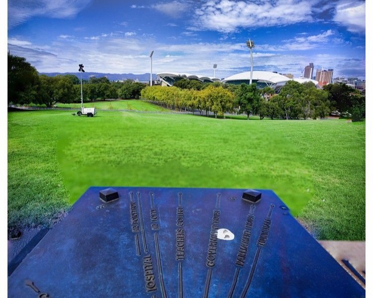
This sundial is known as the “Light’s Vision” sundial because it was previously located at Light’s Vision / Montefiore Hill, before it was relocated here in 1936.
As well as the sundial, there are also three plaques in this garden. See if you can find them:
“Bereaved through Suicide Support Group”, installed in 2002 and dedicated to the group formed in 1986.
“Compassionate Friends Memorial” bronze plaque on Carey Gully sandstone.
“Homicide Victims of SA” memorial on granite boulder, 1997.
Walk west, across the lawn to the Moreton Bay Fig Walk.

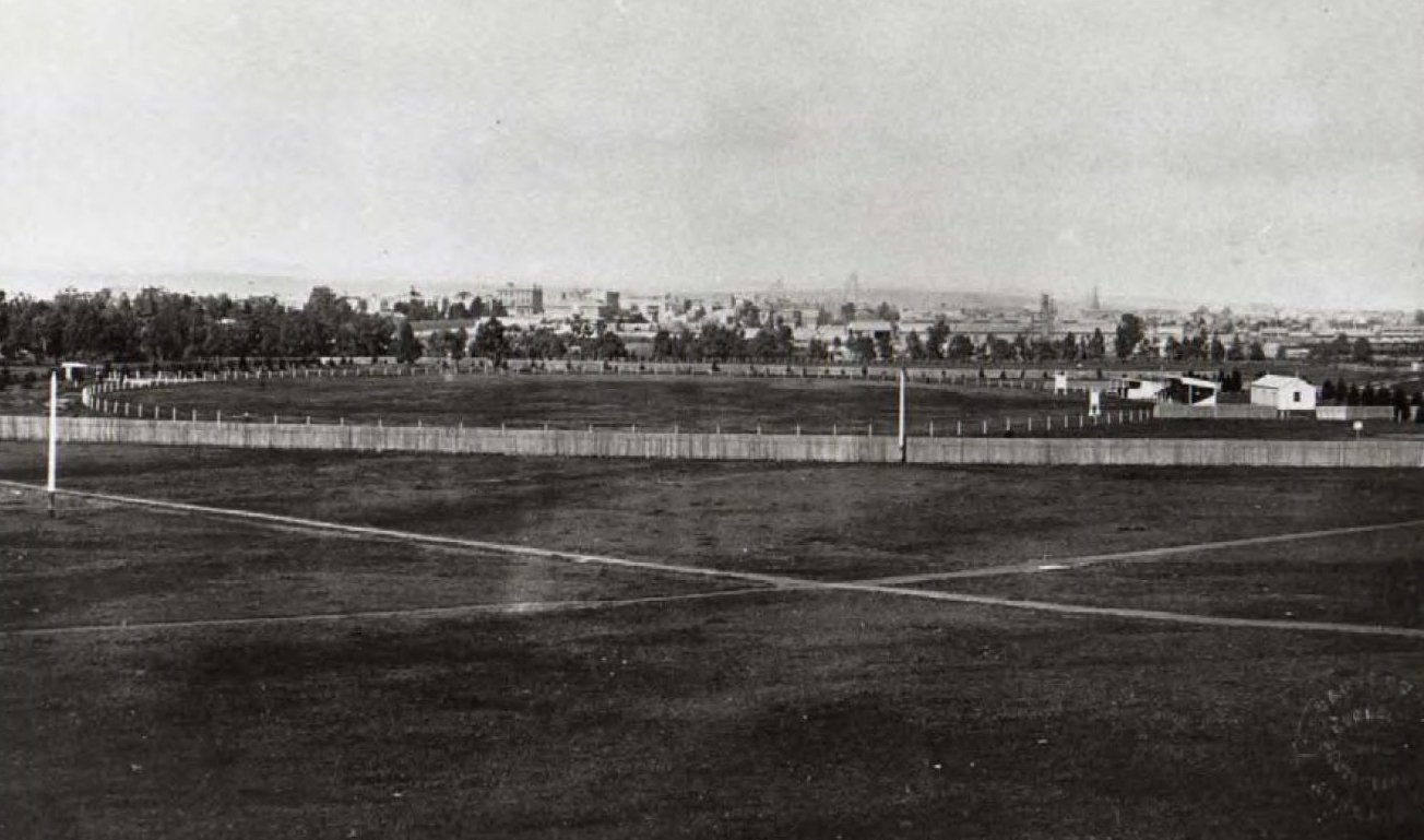
8. Moreton Bay Fig Walk
It’s not clear when this avenue of Moreton Bay fig trees (Ficus macrophylla) was planted. However it’s likely to have been around 1890.
As well as the trees here, alongside the paved pathway, there are several other Moreton Bay fig trees of the same age inside the Oval stadium compound, on the famous northern “hill” of Adelaide Oval.
Young trees are clearly visible in the 1887 photograph below. However these trees were likely removed and replaced with others when the northern mounds were raised in the late 1880s.
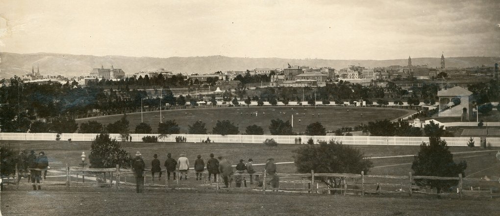
Adelaide Oval, looking south from the hill at the northern end, 1887. Pic: State Library of SA B8083
This paved, Moreton Bay Fig walk, separates Pennington West Gardens from Stella Bowen Park.

Stella Bowen Park (to your left, extending up to Montefiore Hill) is named after one of South Australia’s most famous artists, Esther Gwendolyn (Stella) Bowen.
Stella Bowen was born in North Adelaide in 1893 and studied at the SA School of Arts and Crafts. In 1914, at the age of 21, using an allowance from her parents’ estate, she went to England and was enrolled in the London Westminster School of Art. She became part of artistic circles including T.S. Eliot, Ezra Pound, Gertrude Stein and Pablo Picasso.
In 1944, she became only the second woman to be appointed as an official war artist by the Australian Government. The firsr was Norah Heysen, daughter of Sir Hans Heysen. Stella Bowen died in 1947.

The Moreton Bay Fig Walk. Note the cars parked on Stella Bowen Park, on an AFL game day.
The Adelaide Oval Stadium Management Authority has a “licence” to use Stella Bowen Park for car parking and other purposes associated with major events at Adelaide Oval.
However when the Authority is not using the area, the City Council will permit weddings and small community and cultural events with attendance of up to 1,500 people, only during daylight hours.
Now, walk south, across the lawn to the Phillip Walsh memorial tree, near the start of an avenue of Plane trees.

9. Magarey Grove
Phillip Walsh was an Aussie Rules footballer and coach. Walsh played for Collingwood, Richmond and the Brisbane Bears between 1983 and 1990.
After his playing career, Walsh held assistant coaching roles at Geelong, West Coast and Port Adelaide before being appointed as the senior coach of the Adelaide Football Club for a three-season contract beginning in 2015.
On 3 July 2015, Walsh was found dead at the age of 55 in his Somerton Park home with multiple stab wounds.
His son Cy was charged with his murder. Cy Walsh was later found not guilty due to mental incompetence.
This tree was planted in his memory, after consultation with his family.
Now, walk west on the pathway lined with plane trees.

The Phil Walsh memorial tree
Magarey Grove is an avenue of Oriental Plane trees, lined with plaques commemorating all the winners of the Magarey medal; the annual award for the best and fairest footballer in the SANFL.
This avenue was established here in 2017. There was an earlier Magarey Grove set up in 1988 at West Lakes Boulevard in a partnership between the SANFL and Charles Sturt Council.
The grove was moved from West Lakes to Adelaide Oval in 2017. At that time, the plaques from West Lakes Boulevard were returned to the families and new ones struck.

Magarey Grove
The Grove (and the Magarey medal) honours William Magarey (1868-1929) who was the first chairman of the SAFA. In 1898, he established a medal for the best and fairest player in the minor round each season. He personally presented it until his death in 1929.
Now, walk north west to Light’s Vision at the top of the hill. You can get there by going up the grassed slope or via the stairs leading out of Magarey Grove. If you find the stairs or the grassy slope too hard, use Pennington Terrace instead.
10. Montefiore Hill / Light’s vision
This lookout and the statue are listed on the State Heritage register.
The lookout was named after Jacob Barrow Montefiore who was one of the founding British Commissioners of South Australia in the 1830s.
Montefiore was a friend of Colonel Light and in 1859 donated a silver bowl to Adelaide City Council to toast his memory, a tradition which continues each year on Light’s birthday, on 27 April.
Colonel William Light (1786-1839) was the first Surveyor-General of the new British Province of South Australia. He is best known for choosing the site of Adelaide and for designing the layout of streets, six city squares, gardens and the figure-eight Adelaide Park Lands in a plan sometimes referred to as Light’s Vision.
Legend has it that he stood on the rise and looked over the site for his planned city but there is no proof of this, particularly as many of his journals were later burnt when his house at Hindmarsh was destroyed in January 1839, in what was thought to be an arson attack.
Light may have been brilliant but he was not universally popular. Many, like Governor Hindmarsh, did not agree with his site for Adelaide. Added to this, Colonel Light came from England with his common-law wife and housekeeper Maria Gandy. The couple were not accepted into Adelaide society.

Light’s Vision, 1940s
EXTRACT FROM COLONEL LIGHT’S JOURNAL, 1839:
“The reasons that led me to fix Adelaide where it is I do not expect to be generally understood or calmly judged of at present. My enemies, however, by disputing their validity in every particular, have done me the good service of fixing the whole of the responsibility upon me. I am perfectly willing to bear it; and I leave it to posterity, and not to them, to decide whether I am entitled to praise or to blame”
The idea of a statue, to honour Light, was raised in 1902. The commission for the statue, 2.7 metres high, was awarded to Scottish sculptor W. Birrie Hind of Edinburgh for a tender of 1000 pounds. Architects, Garlick, Sibley and Woolbridge made the pedestal at a cost of 510 pounds. The inscription on the pedestal reads, “Colonel William Light, first surveyor general fixed the site and laid out the city of Adelaide in 1836.”
It was unveiled by Governor Le Hunte on 27 November 1906 at the intersection of Flinders and Franklin Streets. It was moved to this location in 1938, soon after the centenary of the founding of the colony.
View from Light’s Vision. Pic: Trentino Priori
To mark SA’s centenary in 1936, Montefiore Hill was developed as a central piece for the statue which by this time was causing congestion in Victoria Square.
A viewing platform was created at Montefiore Hill overlooking the city to mark SA’s centenary in 1936.
In 1938, Light’s statue was moved to this location.
Also of historical interest is the orientation plaque with directional lines installed on the Italianesque balustrade (designed under the influence of Walter Bagot) as part of the state’s centenary in 1936. There is an interpretive board which explains the history of the Hill.

Statue of Colonel Light
From Light’s Vision, walk downhill, along the unsealed path past Oval 2. Stop where the unsealed path, curves back to Montefiore Road, and you get a good view of Adelaide Oval No. 2, below.

11. Oval No. 2
The area between the Adelaide Oval stadium and Montefiore Road has long been used for lower-key cricket matches (not regarded as “first-class fixtures”). However it’s only been in the 21st century that it’s been formally identified as “Adelaide Oval No. 2”.

The legal arrangements of the Adelaide Oval Precinct make a distinction between the Core leased area (outlined in pink) and the Licenced Area (outlined in yellow). In the licenced area, the City Council still has authority to set conditions on what the Stadium Management Authority can do.
The Adelaide Oval Redevelopment and Management Act 2011 says that “the Minister should, in managing any part of the Adelaide Oval Licence Area, seek to protect and enhance the area as park lands for the use and enjoyment of members of the public”.
The City Council has responsibility for managing the licenced areas. It has a “Community Land Management Plan” for the Adelaide Oval precinct. However the Council’s plans must be consistent with State legislation and the long-term leases and licences that the State Government has granted to the Stadium Management Authority.
For example, the Council cannot prohibit car parking on grassed areas in association with events at Adelaide Oval nor at Adelaide Oval No 2.
The Council’s Community Land Management Plan permits Oval #2 to be used for up to six single-day community, cultural or music events per calendar year. Each event must be restricted to no more than 15,000 people in attendance; and (in a concession to the objections of North Adelaide residents) sound equipment must face southwards, towards the city.
From here, walk downhill and turn left onto War Memorial Drive. Stop where you see a car park behind a fence on your left.

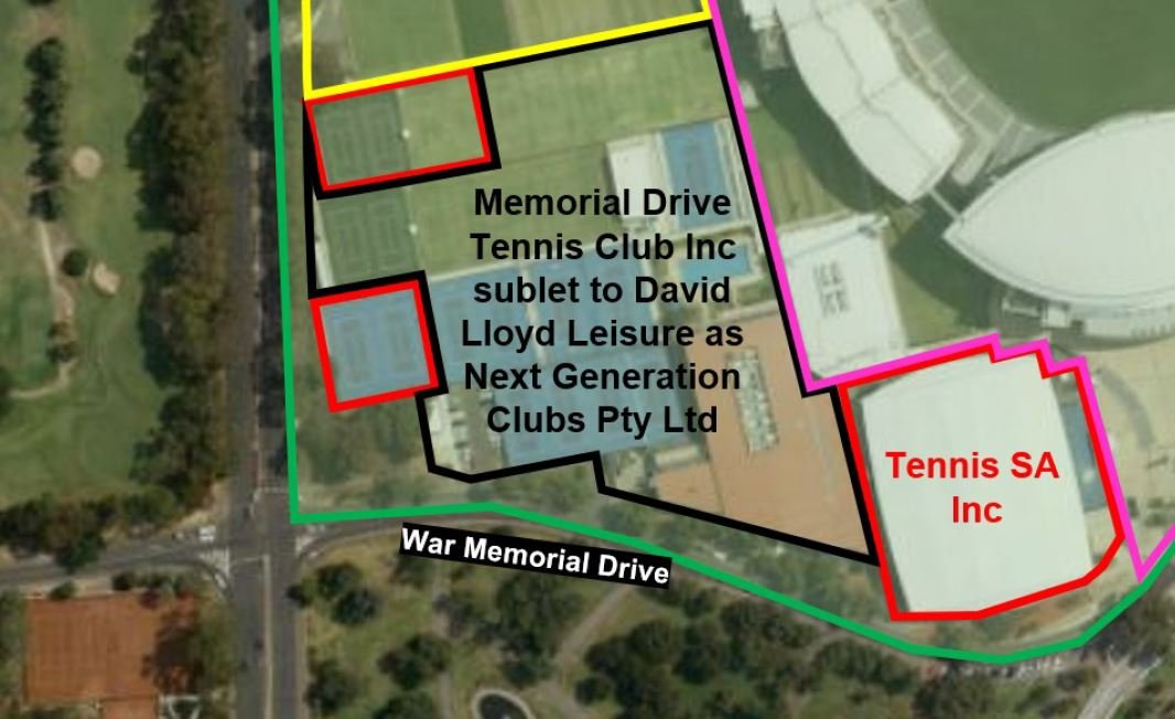
12. Tennis
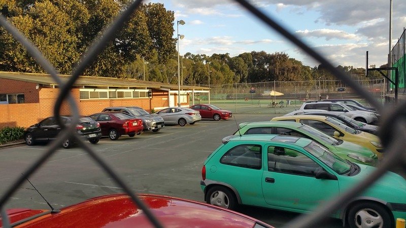
Although these tennis courts are part of your Adelaide Park Lands, they have been fenced, to keep out the public, for more than 100 years. In 1919, the Lawn Tennis Association of SA obtained a 25-year lease over 1.3 hectares of this Park.
Before the lease was granted, the City Council held a poll of ratepayers. 67% were in favour of the lease. That’s not how the Council handles leases of your Park Lands these days! The area leased by Tennis SA and the Memorial Drive Tennis Club today is a about three times larger than the original lease area. It’s grown to 3.8 hectares, which is one of the largest privatised areas of your Park Lands.
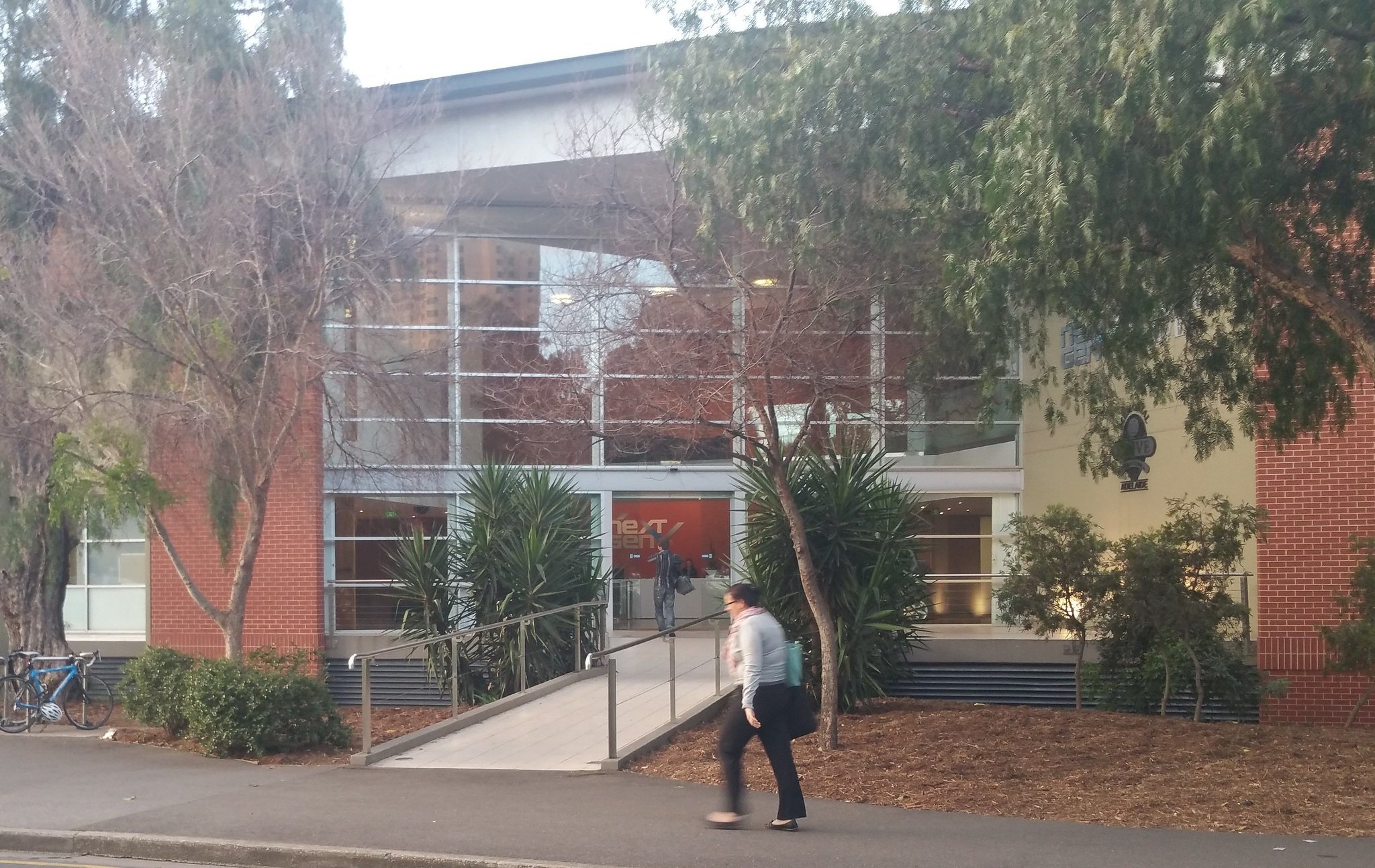
The current lease to Tennis SA is for a term of 42 years, and doesn’t expire until 2057. It allows not just for the playing of Tennis, bur also for Tennis SA to have its administrative office here on your Park Lands.
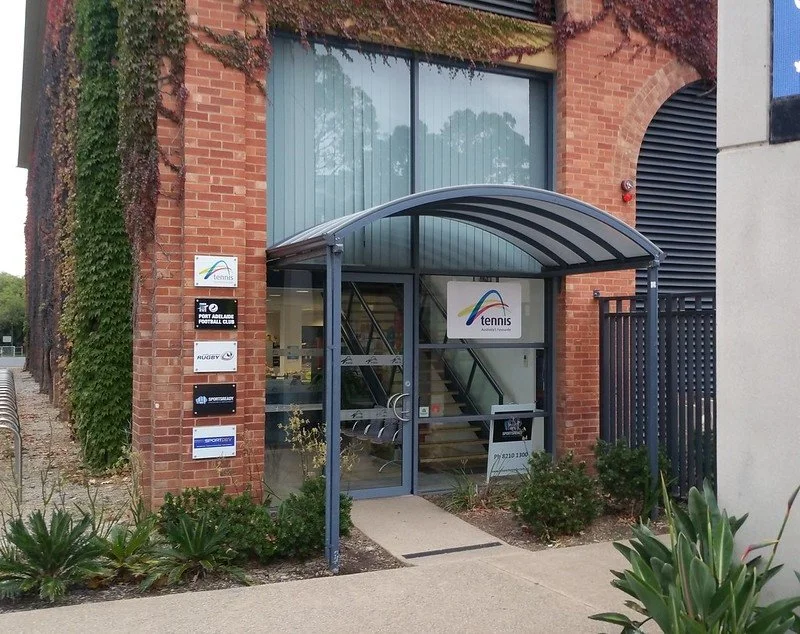
Tennis SA and other sporting offices off War Memorial Drive in your Park 26.
The Memorial Drive Tennis Centre completed a redevelopment in 2019. This included:
a new woven fibreglass membrane fabric roof over the existing stands and centre courts
LED lighting to tournament standard on all match and practice courts
refurbishment of the international standard court platform.

Permanent car parking is permitted in the areas outlined in yellow.
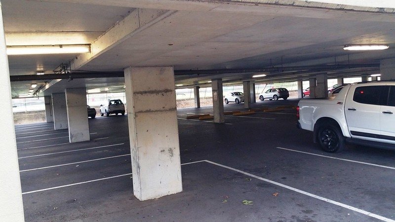
Part of the leased area is sub-leased for the purposes of a private gym (“NextGen”) and its members. These are 50-year leases that continue until the end of the year 2048.
From here, cross over War Memorial Drive and walk down to the pathway on the river’s edge.

13. Pinky Flat
Please be careful walking on these paths as they are shared with cyclists and might be busy. Keep to the left!
This area, known as Pinky Flat has also been known in the past as Montefiore Flat.
For centuries before European settlement, this was an important Kaurna camp site and a place for ceremonies (palti).
However a State law, passed by the SA Parliament in 1911, authorised the arrest and imprisonmenr of Kaurna people, who dared to camp here, on their own land.
During the 1930s Depression, Pinky Flat was also a camping place for non-Kaurna people.
Pinky Flat is thought to take its name from pingko or bilby which was a traditional food and also eaten by early settlers when there was a food shortage. It was immediately adjacent to the first bridge over the River Torrens / Karrawirra Pari.
In recent years, Pinky Flat has been used for many events, such as the Lantern Festival.

Ornamenral pond at Pinky Flat
Features of Pinky Flat include:
An embankment wall holding up the soil on the side of Montefiore Road;
An ornamental pond and fountain, in surrounding gardens;
Several species of trees - most notably large Moreton Bay figs;
Bird life, including magpies, pelicans, swans, coots, dusky moorhens, swamp hens, and wood ducks;
Launching site for kayak tours, and BBQ Buoys.
Now walk east along the riverbank pathway. You will pass the 2014 Riverbank footbridge. Read about the footbridge here.
Then, walk further east, to the Adelaide Bridge.

14. Adelaide Bridge
The first bridge over the River Torrens / Karrawirra Pari on this site was erected in 1839. It lasted until it was replaced in 1877.

The original City Bridge, which lasted from 1839 to 1877. Photo: Duryea (1866)
It was replaced in 1877 with this bridge:

The second Adelaide bridge, which lasted from 1877 to 1931.
However, the 1877 bridge became out of date by 1920, because of congestion, especially from trams.
The current bridge, built in 1931, is 40 metres wide, to match the width of King William Road. This was considered enormous for its time. The engineer used a three hinge reinforced concrete arch over the river together with two bow-string arches over sub-portal footways.
Now go under the bridge on the northern side of the river, to see the tiled mural.
Tiled mural under the bridge
This is a fitting place to finish. Underneath the bridge is a tiled mural - you are standing on Kaurna country.

Photo: Camilo Medina Google Maps Local Guide
The ceramic tile mural depicts (among other things) European fish, such as carp, which have replaced the now vanished endemic fish species.
Also depicted are animals and creatures that once lived around this part of the Torrens before it was dammed by the weir in 1880.
The gudegeon fish were a staple of the Kaurna people but no longer exist in the river.
This concludes the tour. We hope you have enjoyed your walk.
Optional: download and print a tri-fold leaflet, i.e. a double-sided single A4 page, with a brief summary of this Trail Guide: (PDF, 4.6 Mb)
All of our Trail Guides and Guided Walks are on the traditional lands of the Kaurna people. The Adelaide Park Lands Association acknowledges and pays respect to the past, present and future traditional custodians and elders of these lands

