
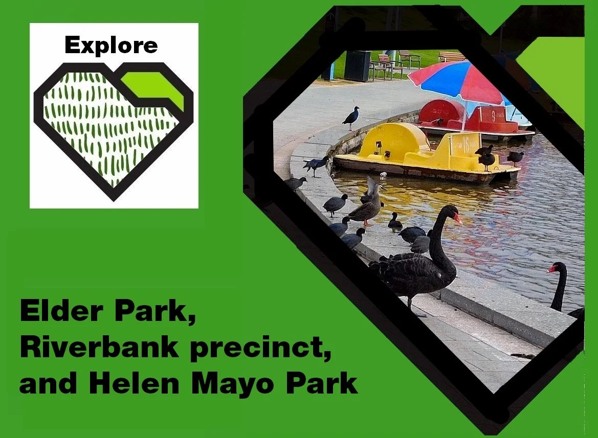
Take the Trail
Start at the rotunda in Elder Park
This Trail is on the traditional land of the Kaurna people.

Begin this Trail at the Elder Park rotunda, place #1 on the map above. There are 19 stops on this Trail and it will take about 90 minutes to complete.
Most of this Trail is in the southern portion of the broader Tarntanya Wama (Park 26) (i.e. Elder Park and the Riverbank precinct). The four locations west of the Montefiore Road bridge (locations 11-14) are in Helen Mayo Park, which is part of the neighbouring Park 27.
Walking instructions are designated by bold type at the end of each of the 19 stop descriptions.
Optional: download and print a tri-fold leaflet, i.e. a double-sided single A4 page, with a brief summary of this Trail Guide: (PDF, 2.0 Mb)

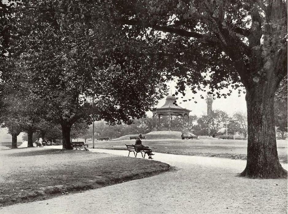
1. Elder Park
Begin this Trail at the Elder Park rotunda, place #1 on the map above.
Very soon after the start of European settlement in Adelaide, this area of the Park Lands was described as a “Government Garden”. This was before the establishment of King William Road.

G.S. Kingston’s map of Adelaide, 1842. Note that, at the time, King William Street did not extend northwards past North Terrace.
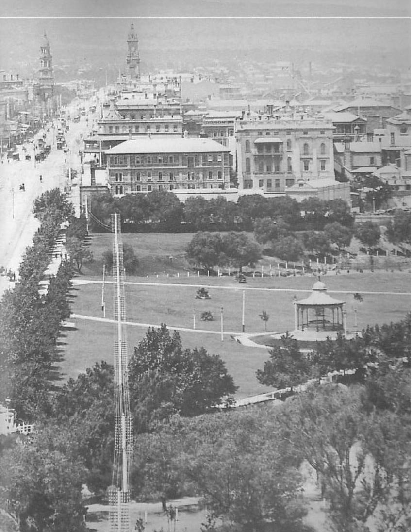
Later this site became a horse agistment paddock for Government House. It was not until 1886 that the area was planted with couch grass. In that year a firework display celebrated Queen Victoria’s birthday.
From the 1880’s right up until about 1960, Elder Park was the only part of the Adelaide Park Lands that had been landscaped, grassed and watered to encourage people to visit. In the early 1960’s other parts of the Park Lands were developed as ‘event spaces’ but for decades Elder Park alone filled that role, and it was immensely popular for that purpose. It was often crowded with visitors on the weekend, as early as the late 1880s.
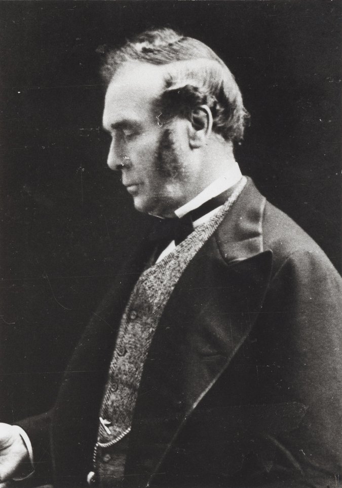
Elder Park was named after Sir Thomas Elder, a Scottish-Australian pastoralist and highly successful business man and philanthropist. Among other things, he is notable for introducing camels to Australia.
Elder Park has hosted the development of the City Baths, Railway Station, Old Parliament House, Parliament House and Festival Theatre. All these buildings are on the original parklands planned by Colonel Light.
Elder Park hosts numerous events including the annual Dumpling Festival and Carols by Candlelight.

A music festival, “FOMO” in January 2019
In recent years, a Kaurna “smoking ceremony” has been held here, on 26 January.
From this point, walk around the rotunda, and stop again on its steps.
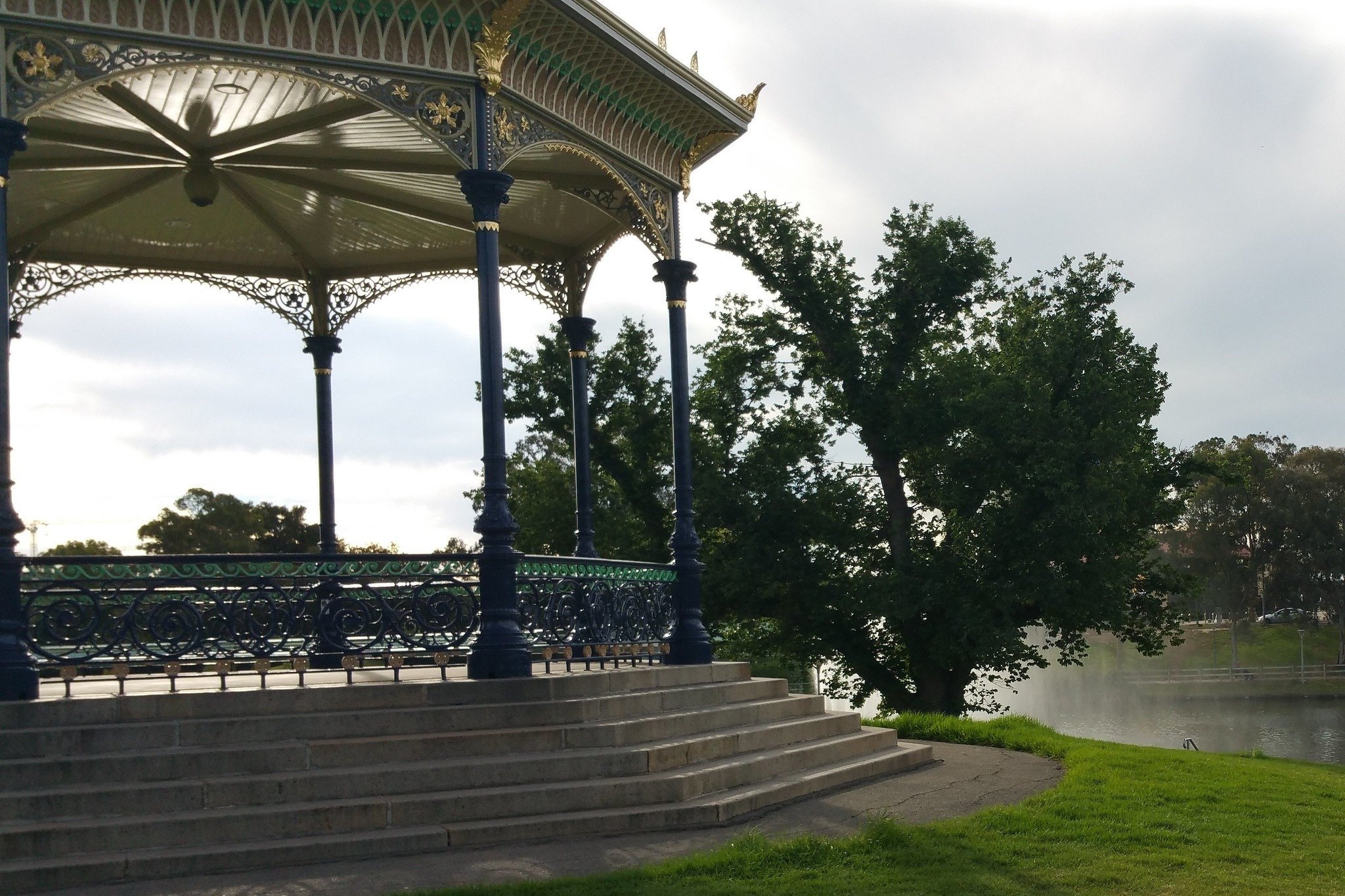
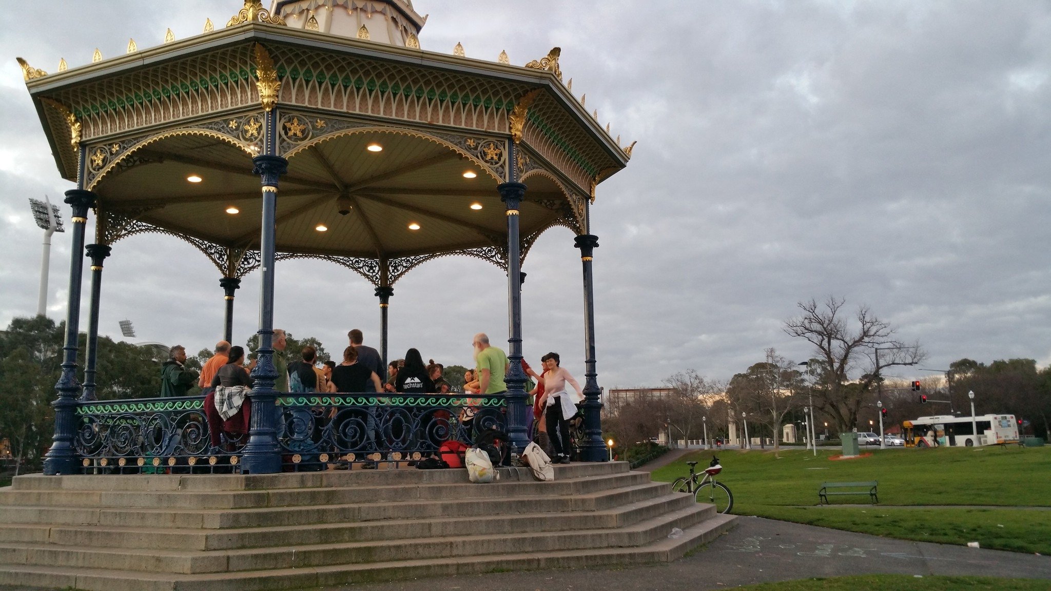
2. Rotunda
.
The iconic rotunda in the centre of Elder Park was made in Glasgow and sent to SA by Sir Thomas Elder in 1882.
The City Council had been unable to raise sufficient funds for a rotunda so Sir Thomas donated it to the City.
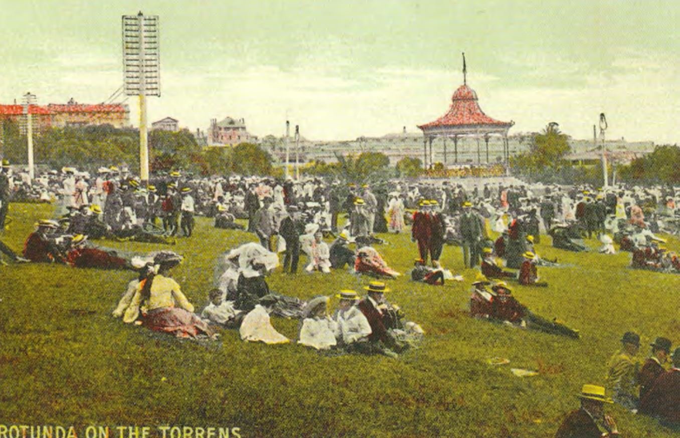
Its opening, in November 1882, came one year after the weir and Torrens Lake were completed.
At least 3000 people attended the official opening on a fine Adelaide spring evening.
A ‘Rotunda March’, dedicated to Sir Thomas Elder, was composed for the occasion by band leader Mr W Worlsey and played by the Military Band. A traditional German male choir, performed, with lanterns on a procession of boats on the lake.
Supper for invited guests was provided afterwards at a boat shed, across the river.
In his speech to launch the rotunda, retiring Mayor Edwin Smith announced that it would be the venue for regular music performances for the enjoyment of the community.
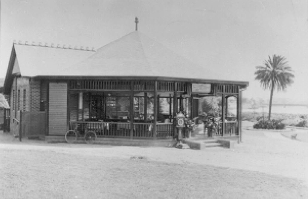
A short distance south from the rotunda, was a “refreshment kiosk” that stood for 60 years: 1910 to 1970. The Kiosk was demolished to make way for the Festival Centre.
From here, walk across to the footpath alongside King William Road and look for a covered drinking fountain (as pictured below).
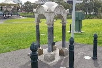
3. Fireman Gardner’s Memorial
John Gardner was one of two firemen, killed by a fire in a drapery store, in Rundle Street, on Christmas eve, 1886.
Shop assistants and customers were herded out of the back door as window displays exploded into flames
Adelaide had only a rudimentary fire brigade at that time. Three firemen responded but the roof collapsed on them. John Gardner was crushed and died on the scene. One of his colleagues, Albert Clark was taken to hospital where he died later.
A public appeal raised 100 pounds, enough to fund a tombstone and this drinking fountain.
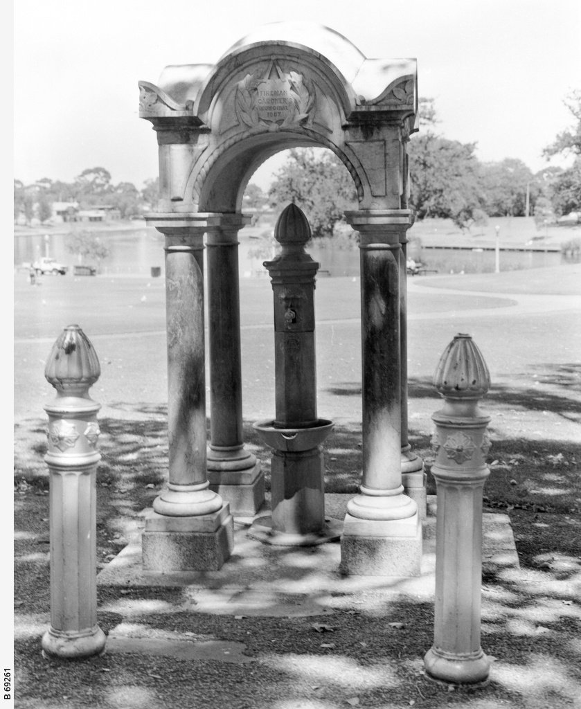
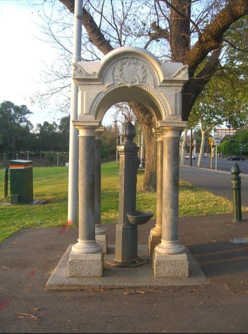
The fountain is of Gothic design, made of Kapunda marble, on a granite base. The canopy alone weighs three tonnes, and was carved from a single block of white marble, by a Mr F Herring of West Terrace.
Read more here: https://monumentaustralia.org.au/themes/people/tragedy/display/50083-john-a.-h.-gardner
From here, turn around and look at the Adelaide Festival Centre.

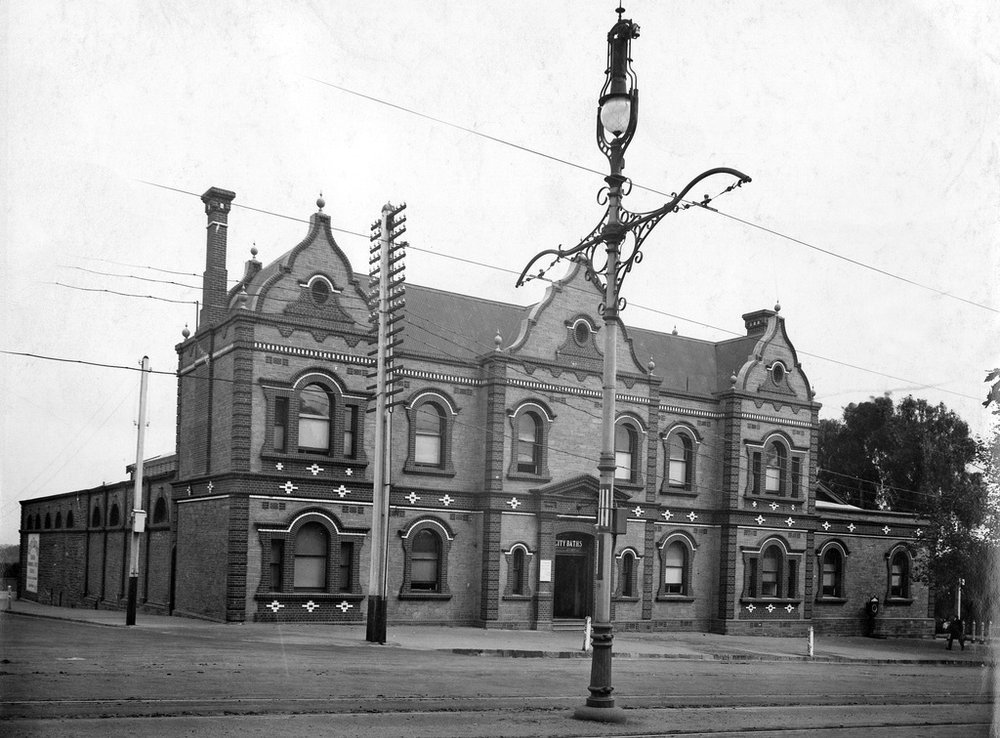
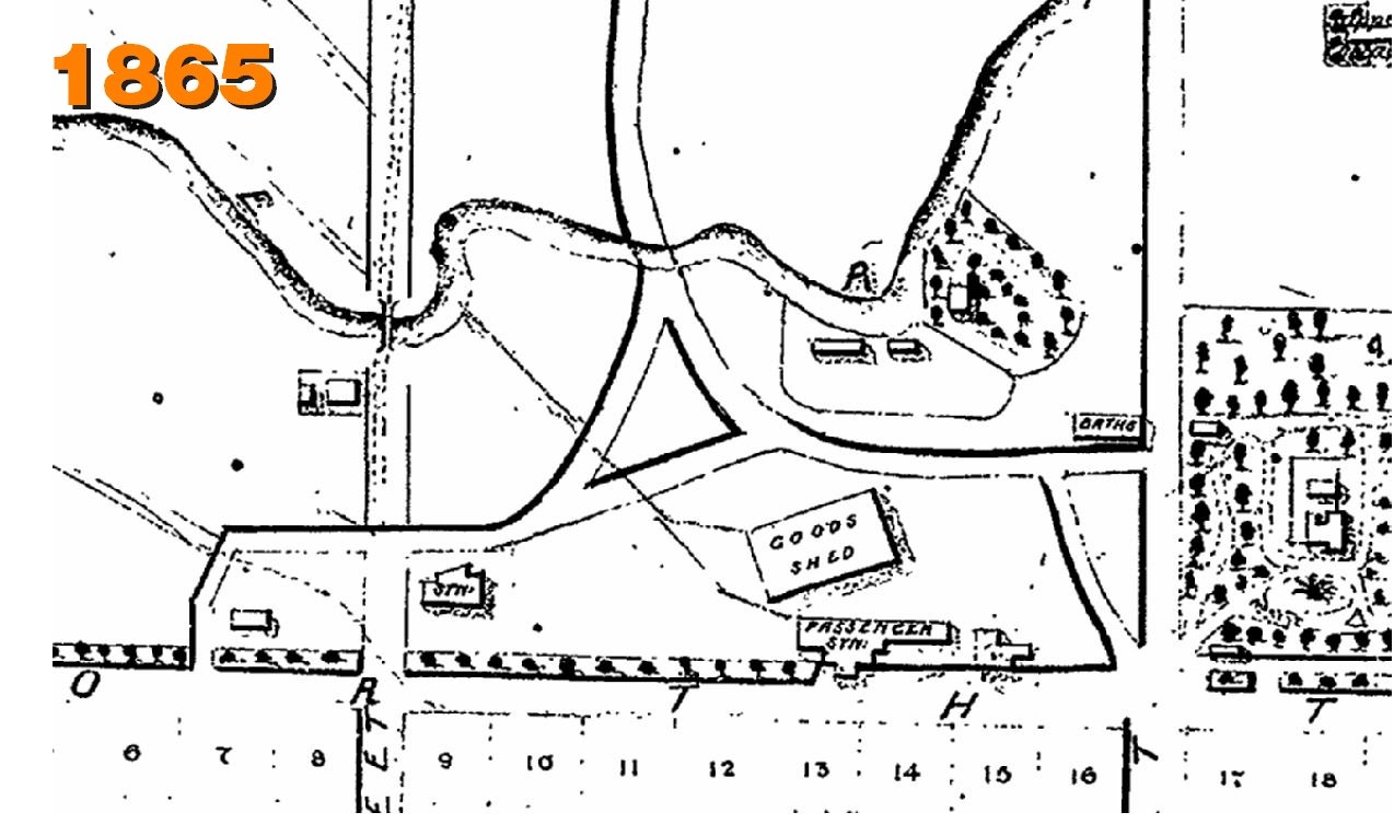
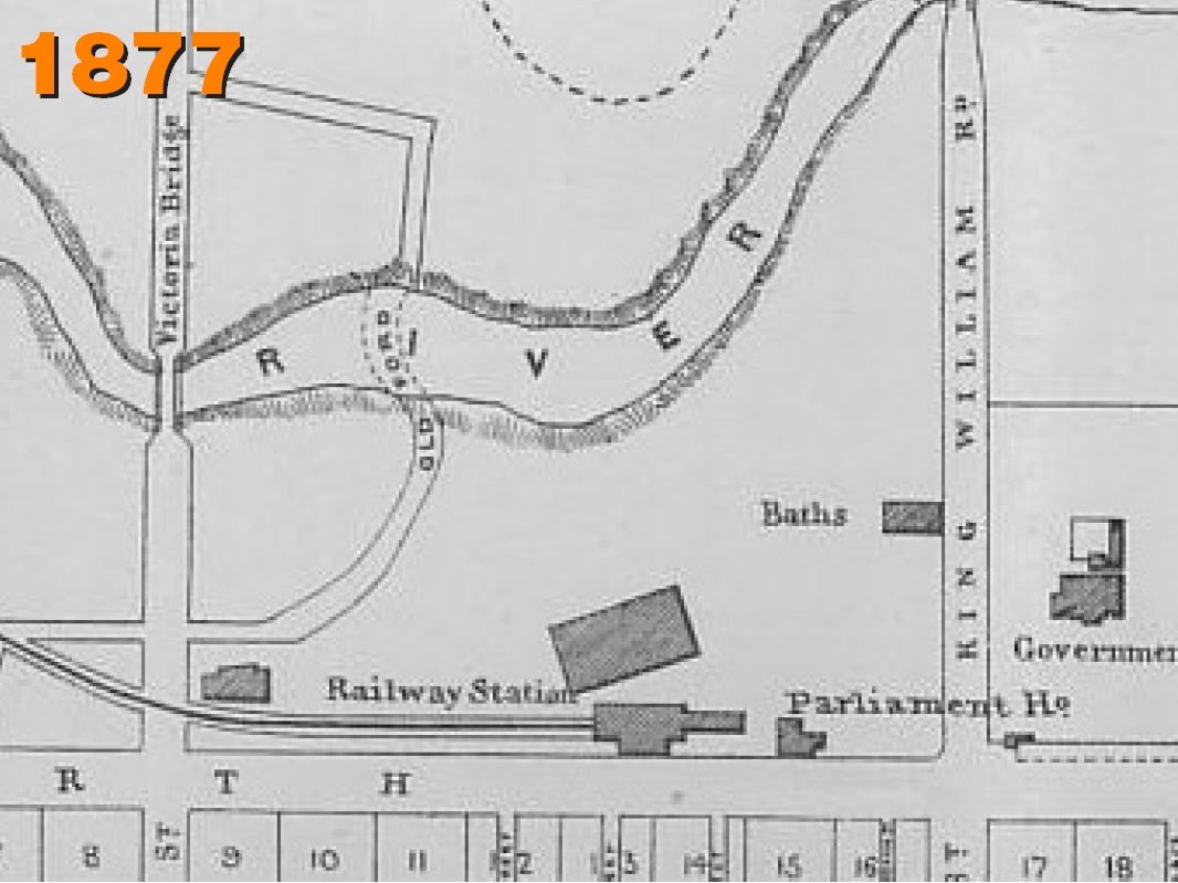
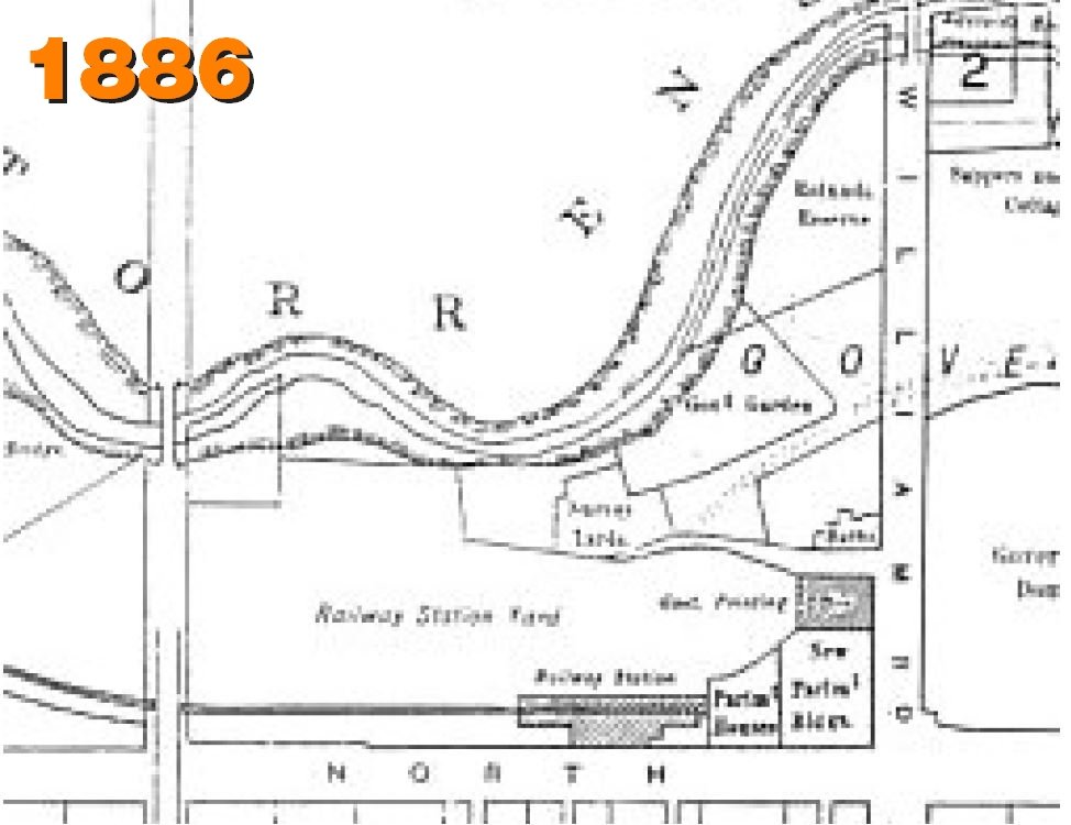
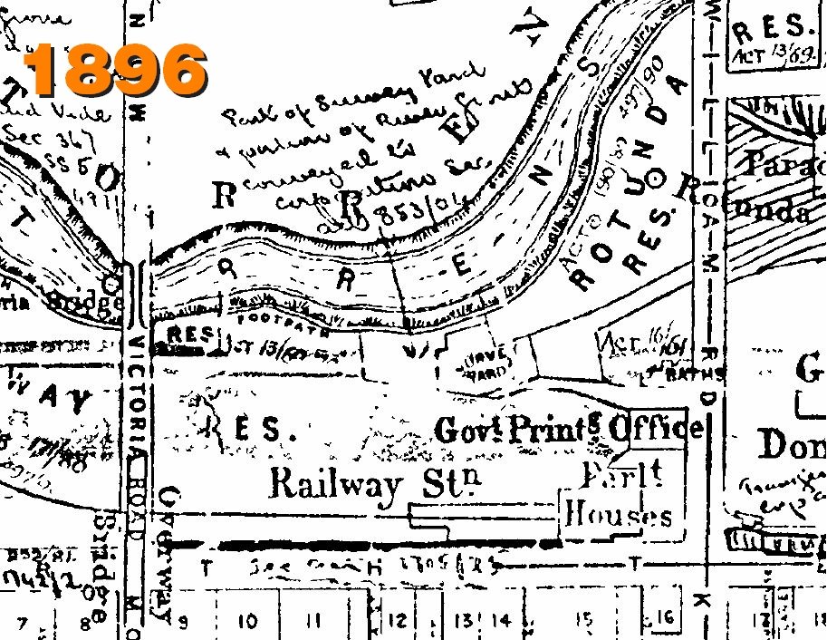
4. City Baths, Festival centre
The Festival Centre was constructed here, in Elder Park, starting in 1970. It was officially opened in 1973.
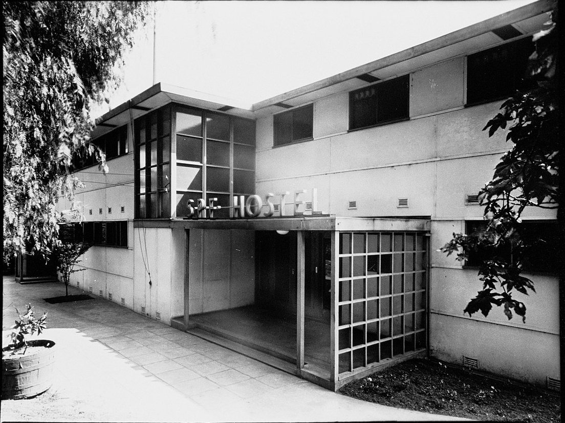
Prior to that date, the site had been used by a collection of unrelated buildings: most notably the City Baths. Other buildings nearby included a migrant hostel, the Government Printing Office, some shabby railway buildings, and the Elder Refreshment Kiosk.
The first City Baths opened here in 1861. For 78 years the baths were operated by a family dynasty, leased for the first two decades by a man called Thomas Bastard, and then from 1883 to 1939 by his son Charles.
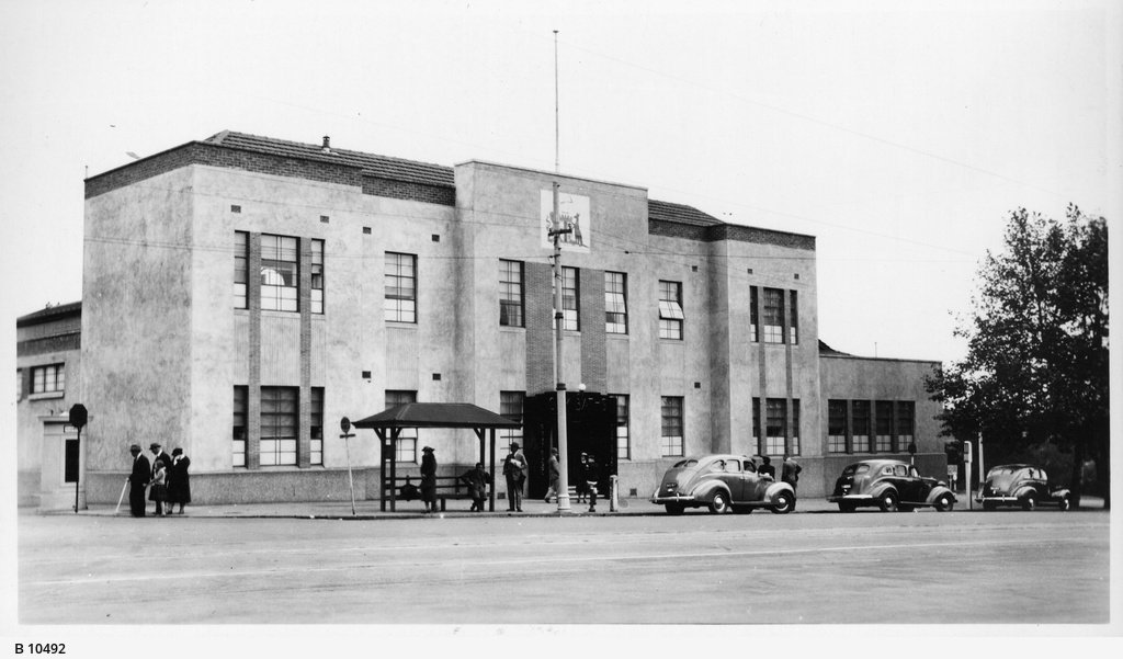
A refurbishment in 1940 saw the baths taken over by the City Council. At that time they were fitted with an Olympic-sized pool and a high diving platform, while given a bland Modernist façade.
The City Baths were an important social institution for over a century, particularly when the inner city supported a large residential population. They were demolished in 1969.
The Adelaide Festival Centre took over the site, while the City Council built a new Aquatic Centre in what is now called Denise Norton Park / Pardipardinyilla (Park 2).
This was not the first site selected for the Festival Centre. In 1964, State Parliament passed a law: the Festival Hall Act, which gave powers to the City Council to construct a ‘Festival Hall’ at the historic Carclew mansion in North Adelaide.
However there were some misgivings. In the late 1960s, Liberal Premier Steele Hall, and his successor, Labor’s Don Dunstan were both keen to see not just a single theatre venue, but a multi-purpose complex established on a more central site to support the Adelaide Festival of Arts.
The Adelaide Festival Centre is not just one theatre or venue. The complex includes three separate performance spaces: the Festival Theatre, the Dunstan Playhouse and small Space Theatre.
The Festival Centre was designed by architect John Morphett, and was officially opened in 1973 by the then-Prime Minister, Gough Whitlam.

Festival Centre under construction, c1970
From here, walk onto the forecourt of the Festival Centre, to look at a large round sculpture in the centre of the paved area.

5. Kaurna Reconciliation sculptures
The Kaurna Reconciliation Sculptures have been situated in the forecourt of the Adelaide Festival Centre since 2002.
These sculptures are dedicated to the Kaurna People, as a reconciliation gift, recognising their traditional ownership and custodianship of the Adelaide Plains.
They represent some of the Kaurna story, giving insight to the Kaurna history and continuous living culture.
The sculptures are installed at a traditional meeting place that remains a significant Kaurna site and is one of many included in the Kaurna Walking Trail along the Karrawirra Pari (River Torrens) and in Adelaide city area.
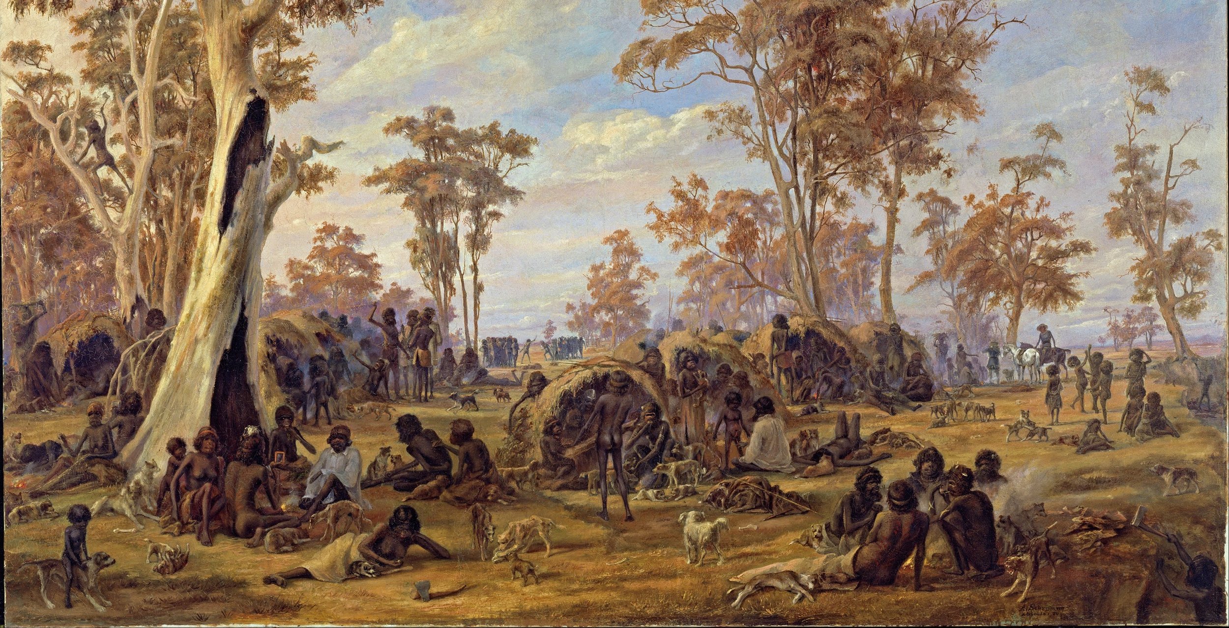
Alexander Schramm - “Adelaide, a tribe of natives on the banks of the river Torrens” (1850)
This film was commissioned to record the sculpture for viewing until its relocation and includes interviews by Uncle Lewis Yerloburka O’Brien and Eileen Karpany.
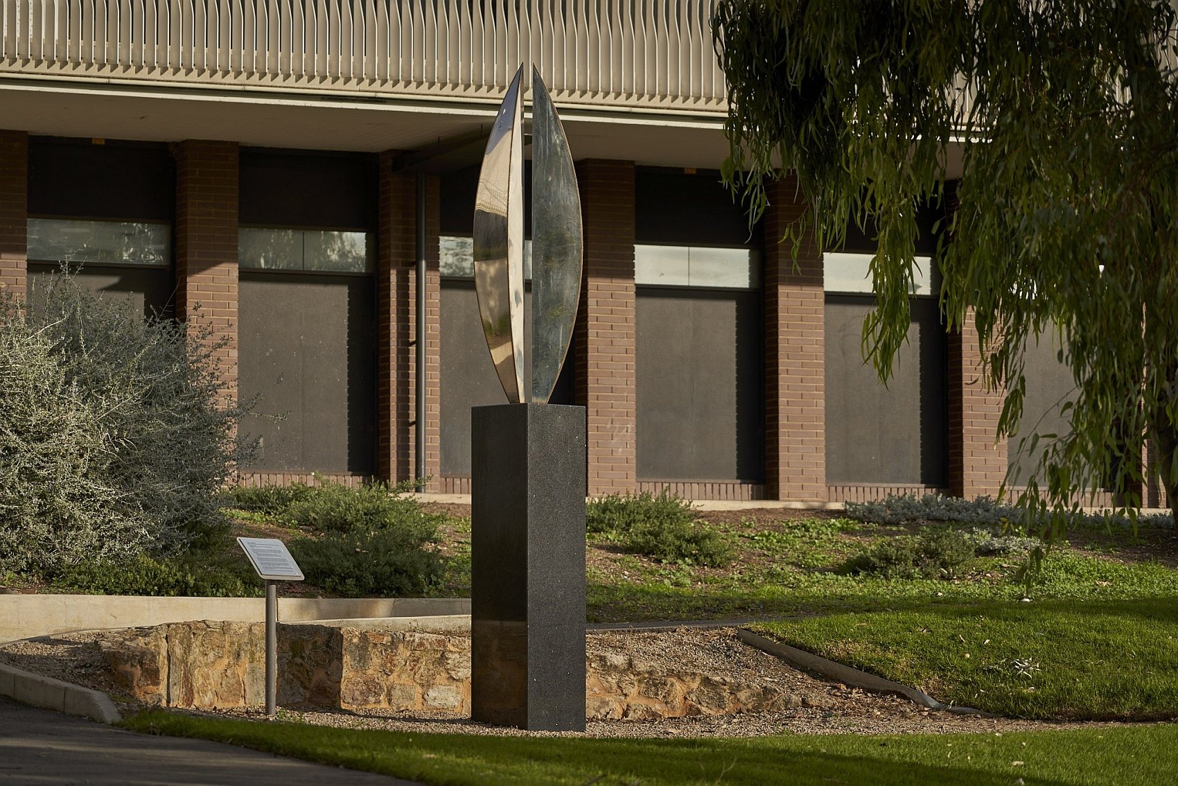
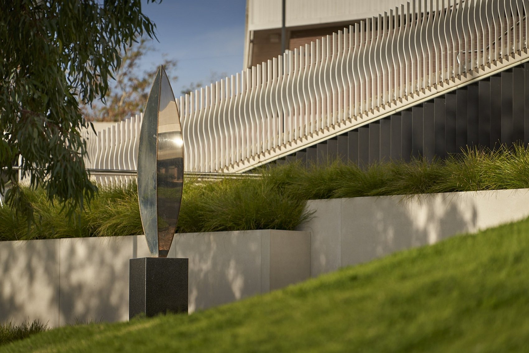
Right beside the Kaurna reconciliation sculpture is another public art work which has adorned the Festival Centre forecourt since 1974. It’s by Bert Flugelman (1923-2013) who is celebrated for his large-scale stainless steel artworks, in particular “Spheres” (1977) better known as Rundle Mall’s Balls.
This one is called “Sculpture No. 2: Vertical Variations”. It was installed near a similar, but larger, horizontal work: “Sculpture No. 1 Tetrahedra” on the Festival Plaza. “Tetrahedra” was removed in 2016 (shortly after Flugelman’s death) to make way for the redevelopment of Festival Plaza. Since then, it has been re-installed at a different, nearby location.

1970s Bert Flugelman public art. Left: “Vertical Variations”; and right: the former site of “Tetrahedra” on the adjacent Festival Plaza.
From here, walk south onto a higher, paved plaza area: what remains of the former Festival Plaza.
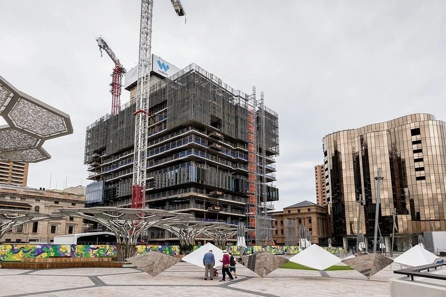
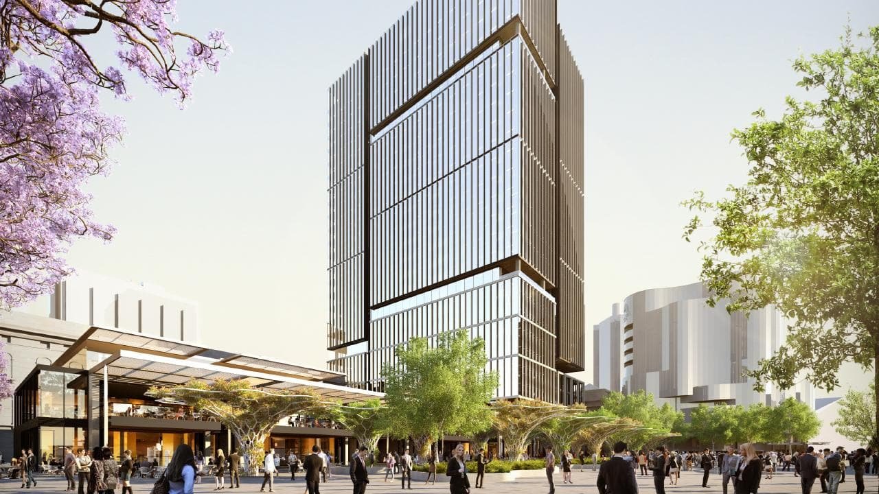
6. Festival Plaza
Few people realise that the Festival Plaza is part of the Adelaide Park Lands. Yet in 2012, it was given away to a billionaire for a 27-storey office tower, shops and a car park. Demolition started in 2018, then paused as the property developer (Lang Walker) haggled to get more money out of South Australian taxpayers, to increase his profits.
Here’s the 2015 story about how it unfolded:
Both sides of State politics share blame for this. The initial deal was done by the former Labor Government of Jay Weatherfill. The Liberal Government of Steven Marshall could have walked away from the deal in 2018, but allowed it to proceed.
In 2020 the then-Liberal Government even increased the size of the giveaway to the Walker Corporation, increasing taxpayer commitment to more than $250 million and agreed to reduce the number of trees in the Walker Corporation plans. (Subscriber-only link to News Ltd story 21 April 2020)
In September 2022, Walker Corporation began a renewed push to get a second skyscraper approved. .
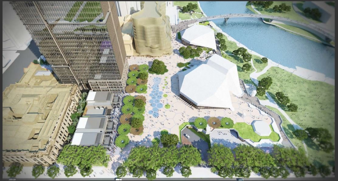
The Plaza could have been easily and cheaply returned to Park Lands.
A design competition for this purpose was run in 2015, by the then-leader of the Greens Party in SA, the Hon. Mark Parnell:

Design by Arnie Blanden - just one of the several winning designs in the competition hosted by former Greens MLC Mark Parnell.
The former State Government ignored this Park Land-friendly, low-cost design. The Walker Corporation tower was due for completion in 2023.
From here, walk westwards, to the Railway station and Adelaide Casino hotel.

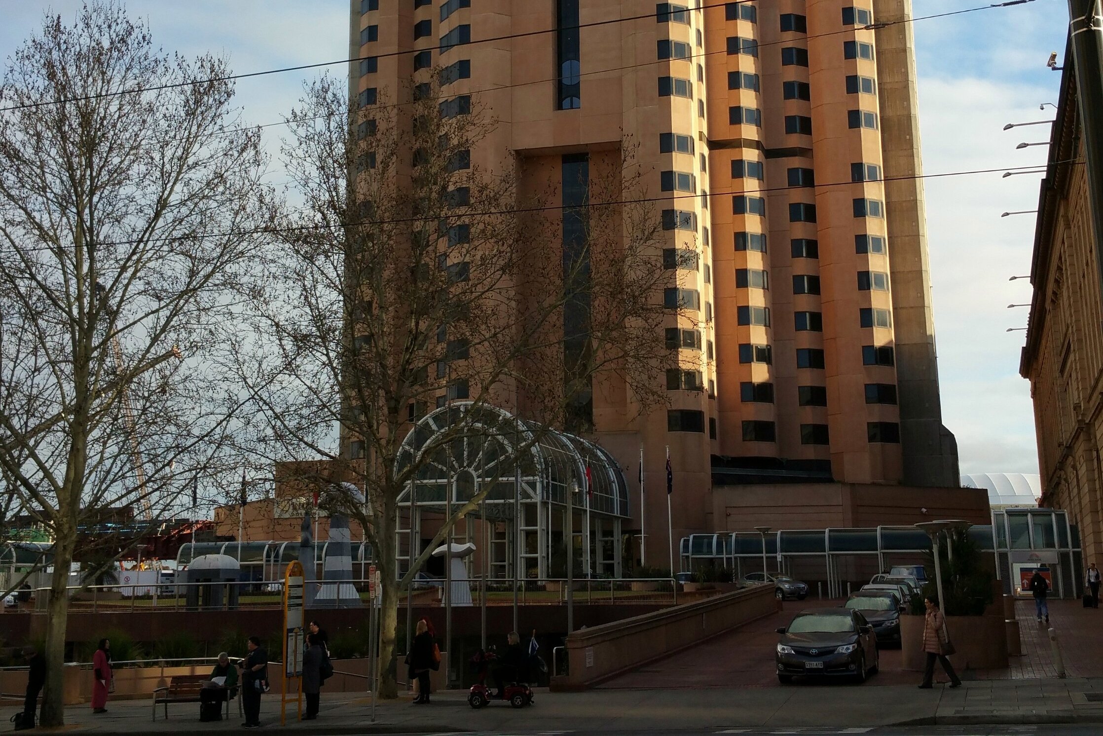
7. Railway station & casino
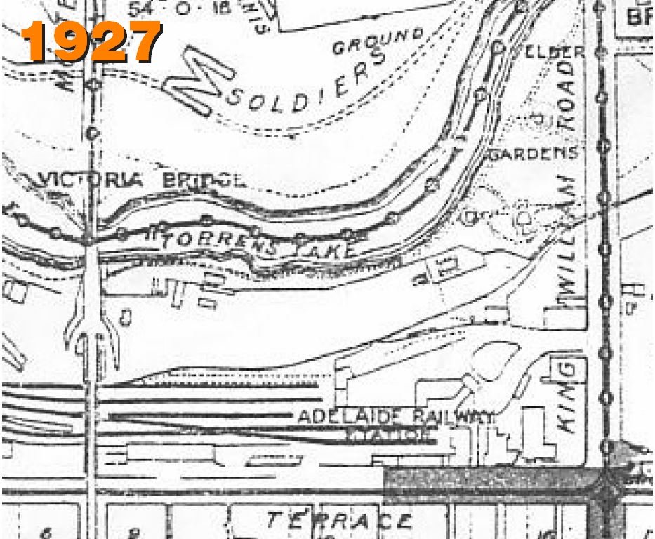
One of the few mistakes made by Colonel William Light, in his 1837 design of Adelaide, was to make no provision for the inevitable development of railways. In the UK, inter-city railway travel was well established by 1830.
It took until 1850 before Park Land was set aside for what was, at first, a railway line only to Port Adelaide. The initial site chosen was a quarry, located immediately north of Government House, where the Pioneer Women’s Memorial Garden was established much later.
After much debate, the railway terminus was founded on this site on North Terrace. The first railway line, to Port Adelaide, opened in 1856. Over following decades, railway yards and lines spread further over both the northern and western Park Lands.
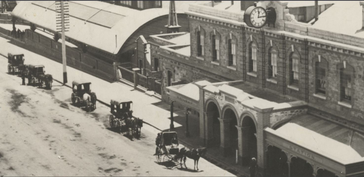
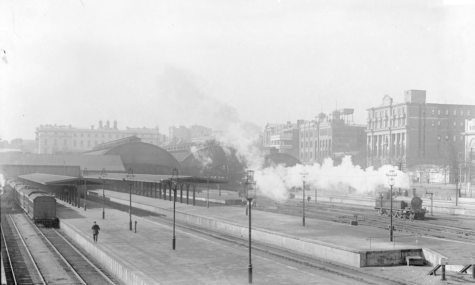
The current Adelaide Railway Station opened in 1928. At the time, it was touted as “the most magnificent and contemporary railway station in the Commonwealth.” It is heritage listed.
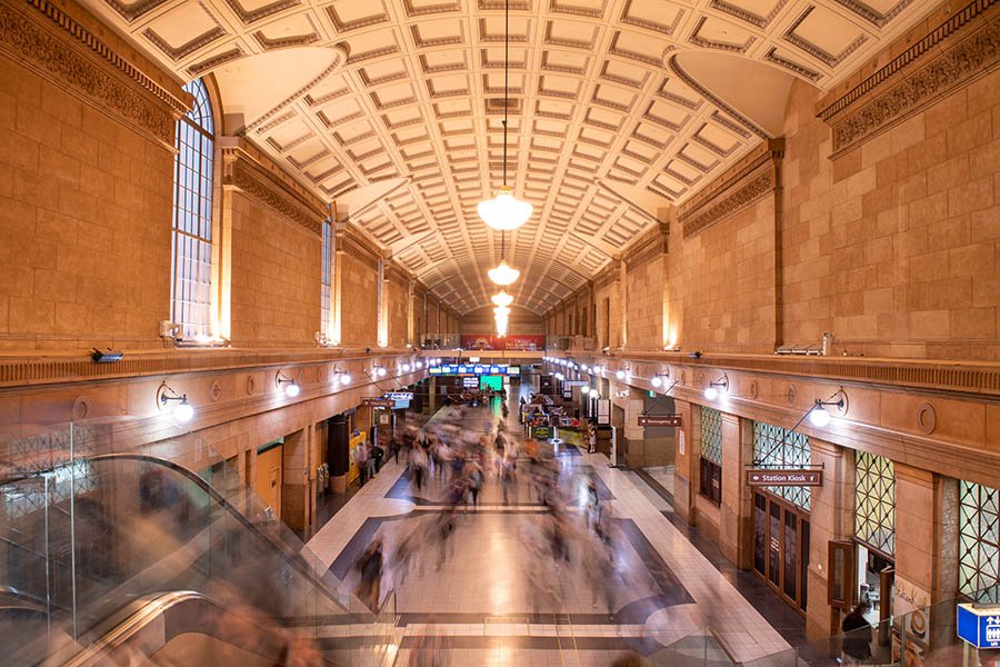
In 1985 most of the building was handed over to private operators to become Adelaide’s first casino. This was part of the Adelaide Station and Environs Redevelopment (ASER) project of the late 1980s, promoted by the Labor Government of Premier John Bannon.
In 2020, the casino extended its operations northwards into the Festival Plaza and Tarntanya Wama (Park 26) with a $330 million hotel, pictured above.
From here, walk past the casino hotel and stop at the entrance to a wide footbridge over the River Torrens / Karrawirra Pari.

8. Riverbank footbridge

Pic: Alex Frayne
Completed in 2014, this footbridge is 255 metres long and very wide (8 metres) to accommodate huge crowds going to and from Adelaide Oval before and after major events.
The bridge includes interactive elements, with the flexibility to program lighting in various colours and patterns.
The south landing includes stainless steel artwork. During the day you can see subtle traces of animals etched onto the surface of the steel. At night, you can see star constellations on the steel.
It’s clad in white glass to reflect the water and greenery.
The architects were TCL, Aurecon and Tonkin Zulaikha Greer, and the construction company was McConnell Dowell.
You can watch a timelapse video of the bridge’s construction here: https://www.youtube.com/watch?v=uoRx4C7kqyo
From here, walk further westwards and stop underneath one of the huge buildings on your left.

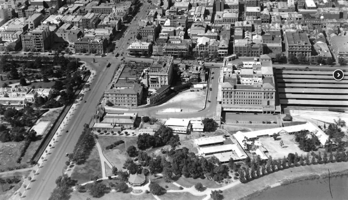
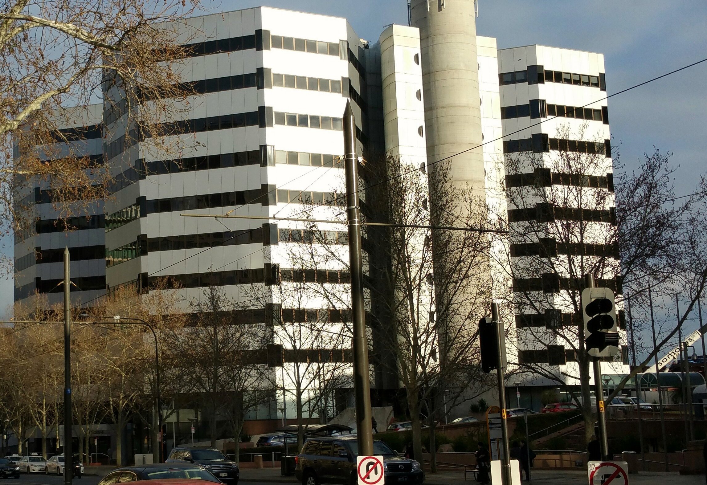
9. Commercial, entertainment zone
Most of the former Park Land between North Terrace and the River Torrens / Karrawirra Pari has been taken over by enormous commercial buildings, including:
the three buildings of the Adelaide Convention Centre,
an Exhibition Hall; built over the top of a two-storey car park;
The InterContinental Hotel (formerly the Hyatt Regency); and the
Riverside office building
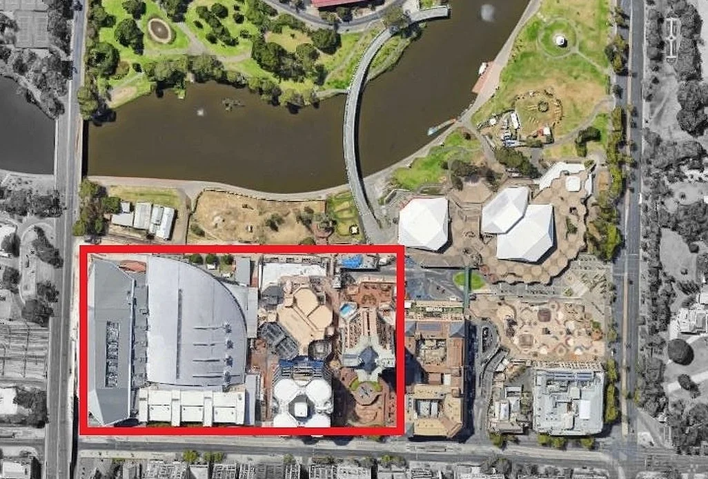
The Adelaide Convention Centre is a series of three inter-connected buildings that include 20,000 square metres of multi-purpose space, all on Tarntanya Wama (Park 26) of your Park Lands.
The first part of the Convention Centre - the central section with a curved roof, was built in 1987, at which time it was the first purpose-built convention centre in Australia. It was part of the Adelaide Station and Environs Redevelopment (ASER) project of the late 1980s, by the Labor Government of Premier John Bannon.
The ASER project was, at the time, the biggest single loss of Park Lands in history. The Park losses from the ASER project became one of the sparks that led to the formation (in 1987) of a grassroots community organisation now known as the Adelaide Park Lands Association.
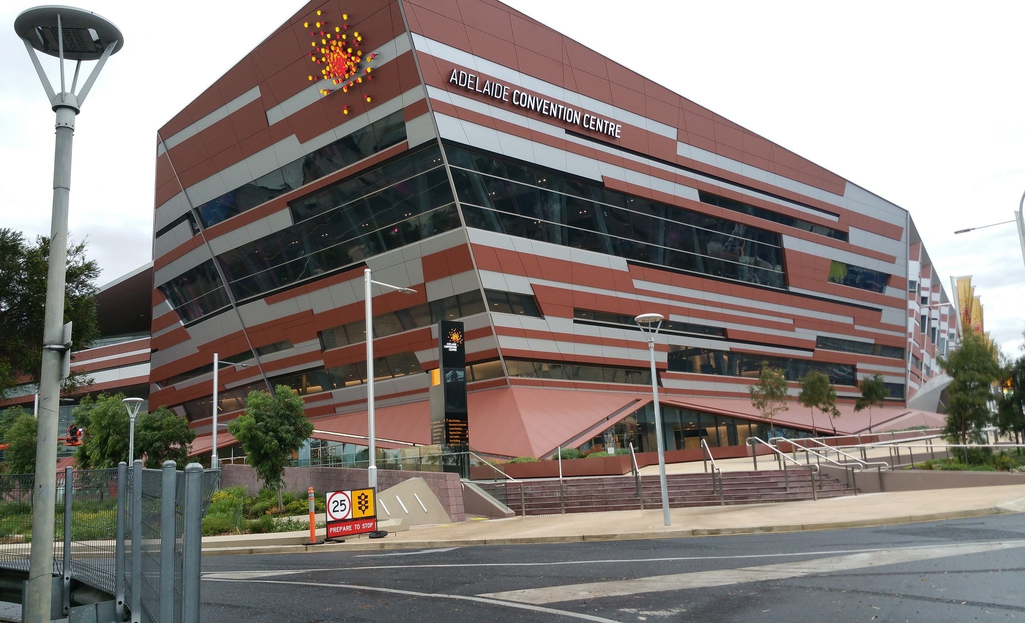
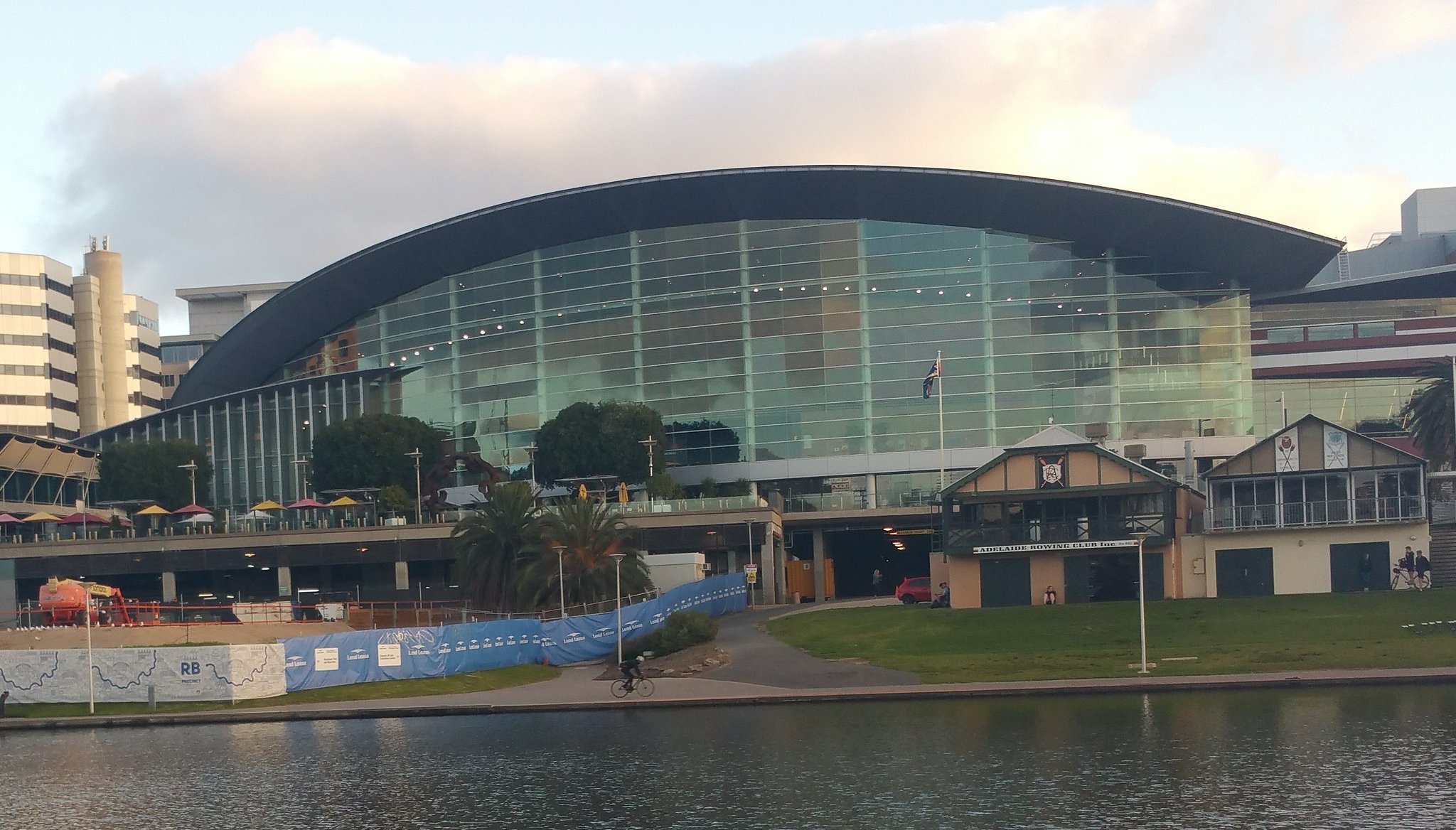
The second part of the Convention Centre, on the eastern side, was built over railway yards, and opened in 2001.
The western side of the Convention Centre, next to the Morphett Street bridge, was opened in 2014, after which the original building was extended, being completed in 2016.

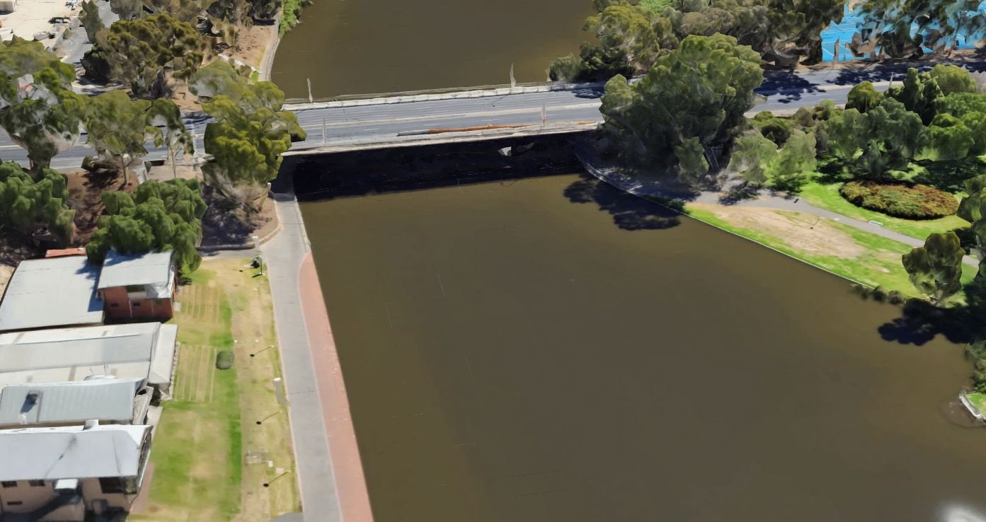
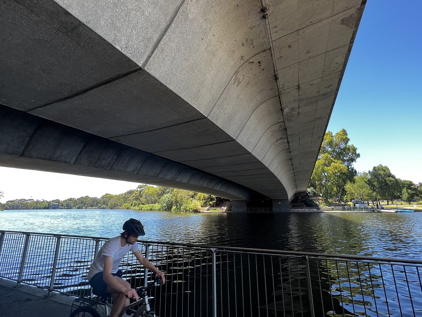
10. Victoria Bridge
This “Victoria Bridge” over the River Torrens / Karrawirra Pari was erected in the 1960s. It replaced an earlier “Victoria Bridge” that dated from 1870. (See the image directly above.)
From here, carefully cross over Montefiore Road, and enter an un-named roadway that borders a fenced car park.

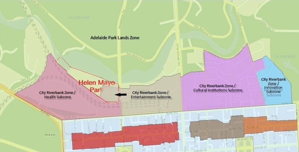
11. Helen Mayo Deserves Better
.
The area on the western side of Montefiore Road is known as Helen Mayo Park.
South Australia's first female doctor would be turning in her grave if she knew how poorly the City Council and the State Government were managing the Park named in her honour.
Helen Mayo, who grew up in the late 1800s, wanted to be a doctor even though she had never even heard of the possibility of female doctors.
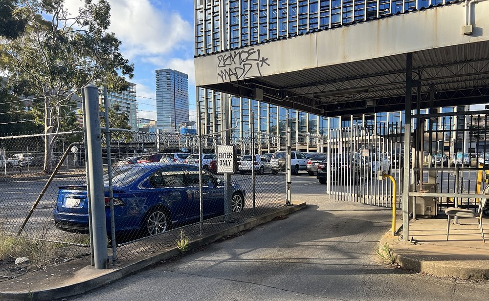
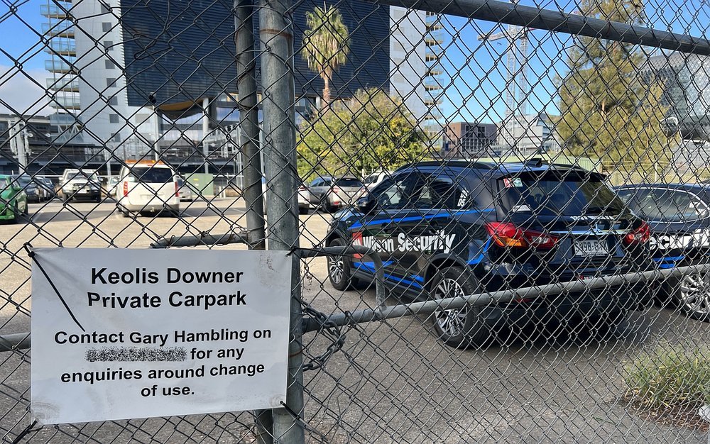
Part of Helen Mayo Park has been fenced off for a State Government car park:

Helen Mary Mayo OBE (1878-1967) Doctor and medical educator.
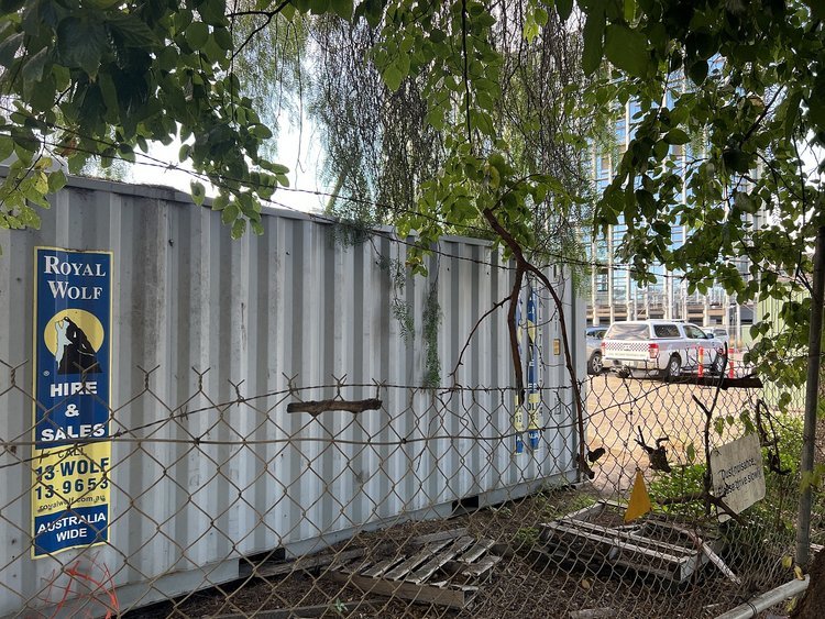
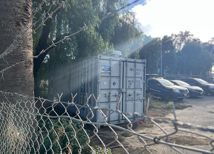
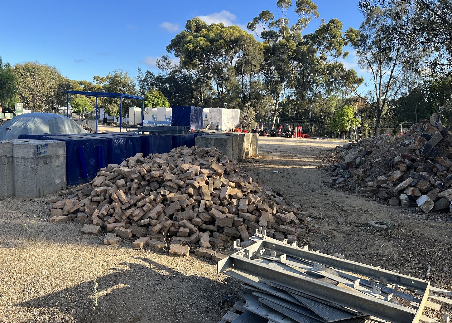
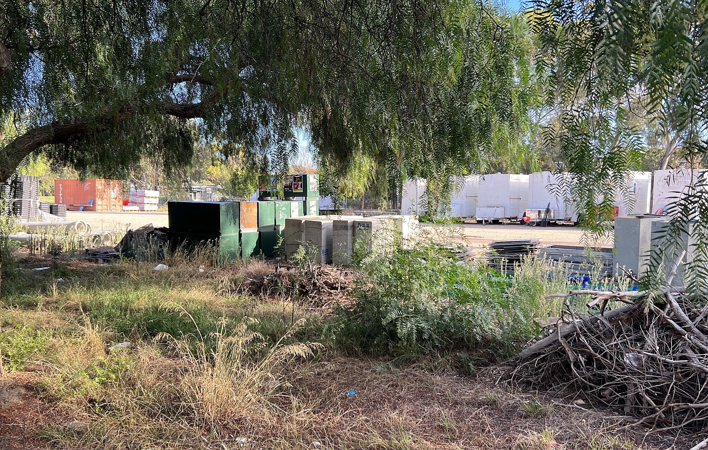
An adjacent area of Helen Mayo Park has been fenced off for a City Council works depot:
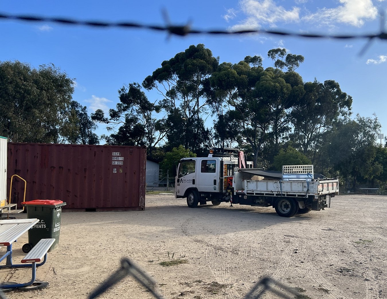
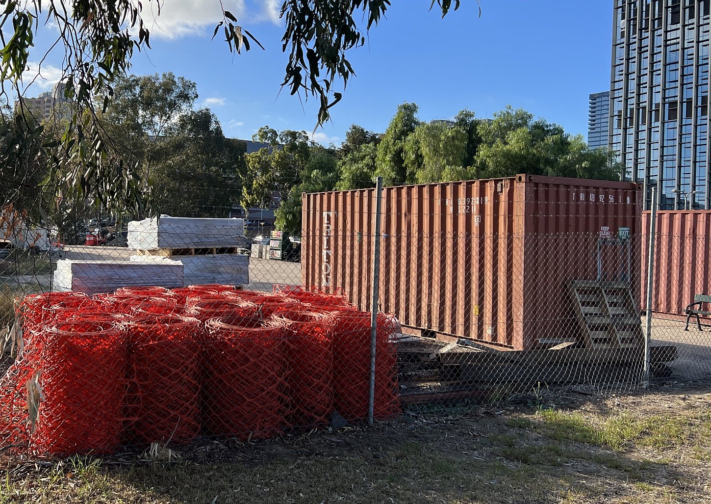
Walk further west, past both of these fenced areas, until you come to a wide open space with little or no vegetation.

12. Development proposals
This site has not been landscaped because it contains contaminated soil, dredged from the River Torrens/ Karrawirra Pari.
Partly because of its “degraded” state, it has been targeted for a succession of proposed developments, dating back at least to the early 2010s.
In the Park Lands Management Strategy 2015-25, this area was nominated as a likely site for a city skate park. Then, in December 2017, the former State Government led by Labor Premier Jay Weatherill proposed putting a 27-storey hotel on this site.
In 2018, the City Council entered commercial-in-confidence negotiations with an entrepreneur who wanted to build and operate a commercial helipad here.
Then in 2021, the former State Government led by Liberal Premier Steven Marshall proposed a $662 million ‘Riverbank Area’ to seat 15,000 patrons on this site.
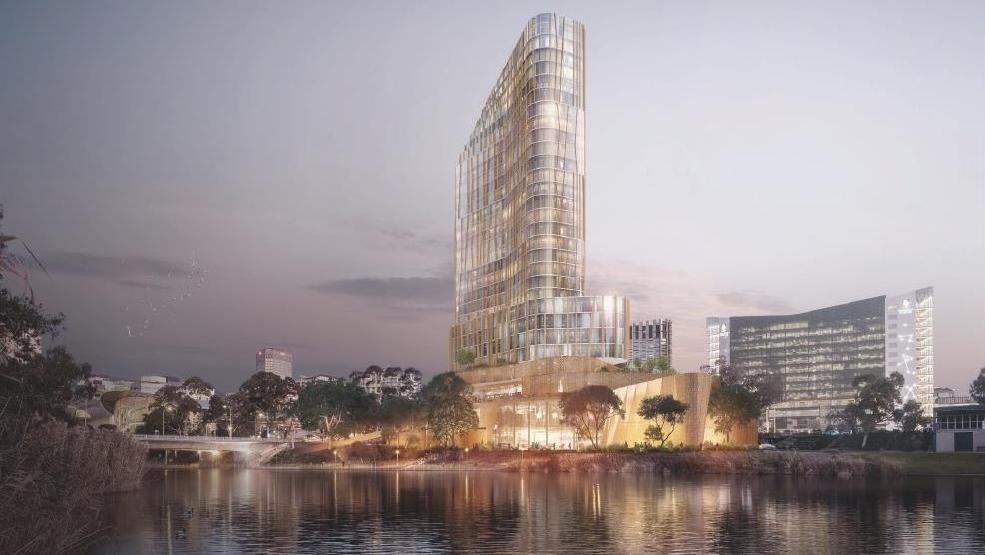
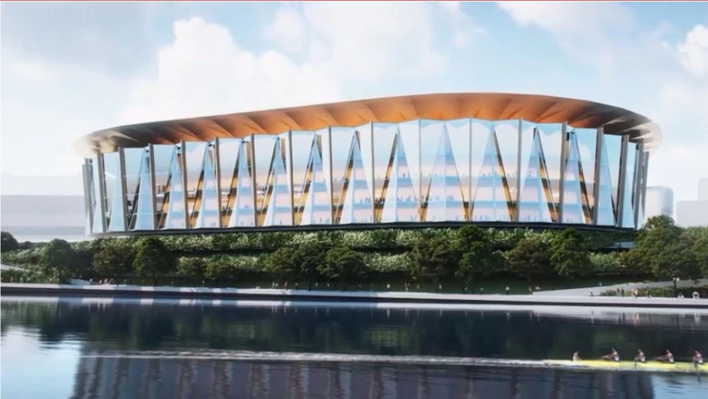
After a rally to ‘Save Helen Mayo Park’ here in October 2021, the stadium proposal became a State election issue.
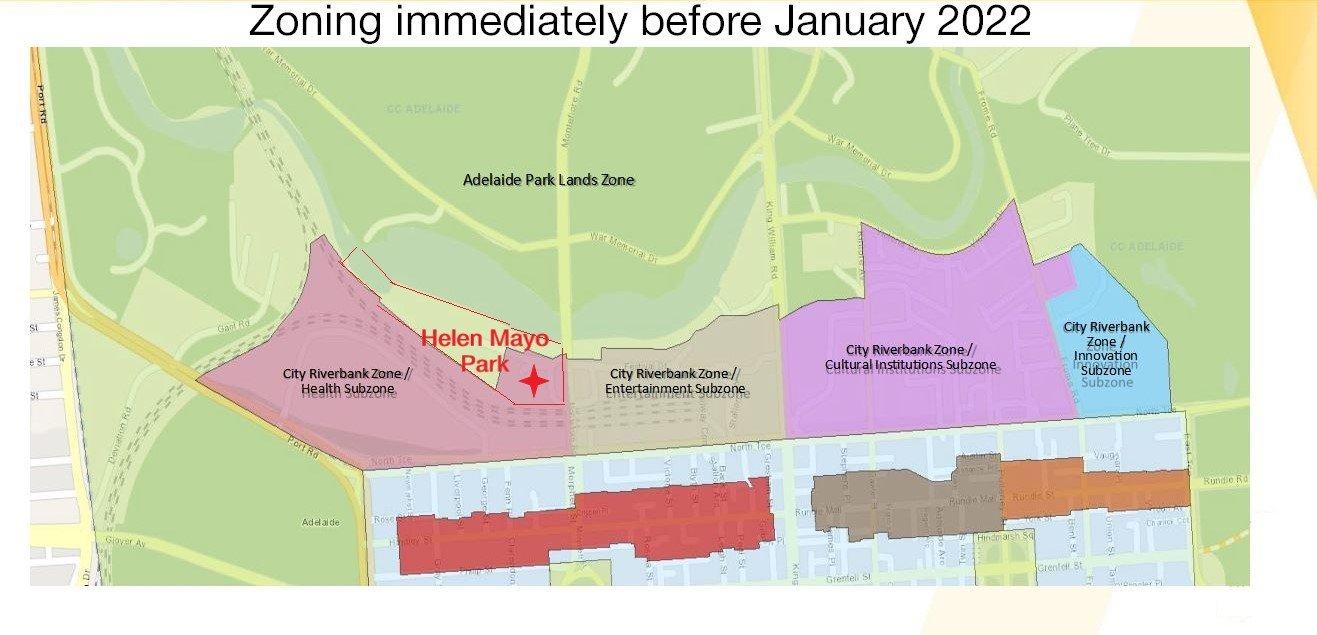
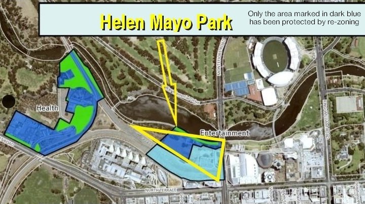
In December 2021, the former Liberal State Government re-zoned Helen Mayo Park as an “entertainment” sub-zone, allowing future buildings of up to 20 storeys. During the election campaign the Labor Party promised that it would not build the stadium. In campaigning for election in March 2022, then-Opposition leader Peter Malinauskas promised that a Labor Government would, in his words: "restore full protection to Helen Mayo Park."
In December 2022, the State Government restored Park Lands zoning, but only to about two-thirds of Helen Mayo Park. The eastern one-third was left as an “entertainment sub-zone” meaning that in future it could still be used for buildings of up to 20 storeys including a new hotel, cinema complex or similar.
Now walk across to the bitumen road and stop in the car park, between the two rowing club buildings.

13. Rowing clubs
There are two rowing club that have been long-established on the banks of the River Torrens / Karrawirra Pari here in Helen Mayo Park.
On the western side, the Riverside Rowing Club (pictured above) caters mainly for older rowers (aged 27 or more.)
It advertises its building as having “a function room and bar for hire.” The club also has gym equipment for use by members.
To the east, a similar-sized building is home to the Pulteney Grammar School Rowing Club.

Pulteney Grammar School Rowing Club building in Helen Mayo Park.
From here, walk down the steps next to the Riverside Rowing Club, and onto the pathway next to the river.

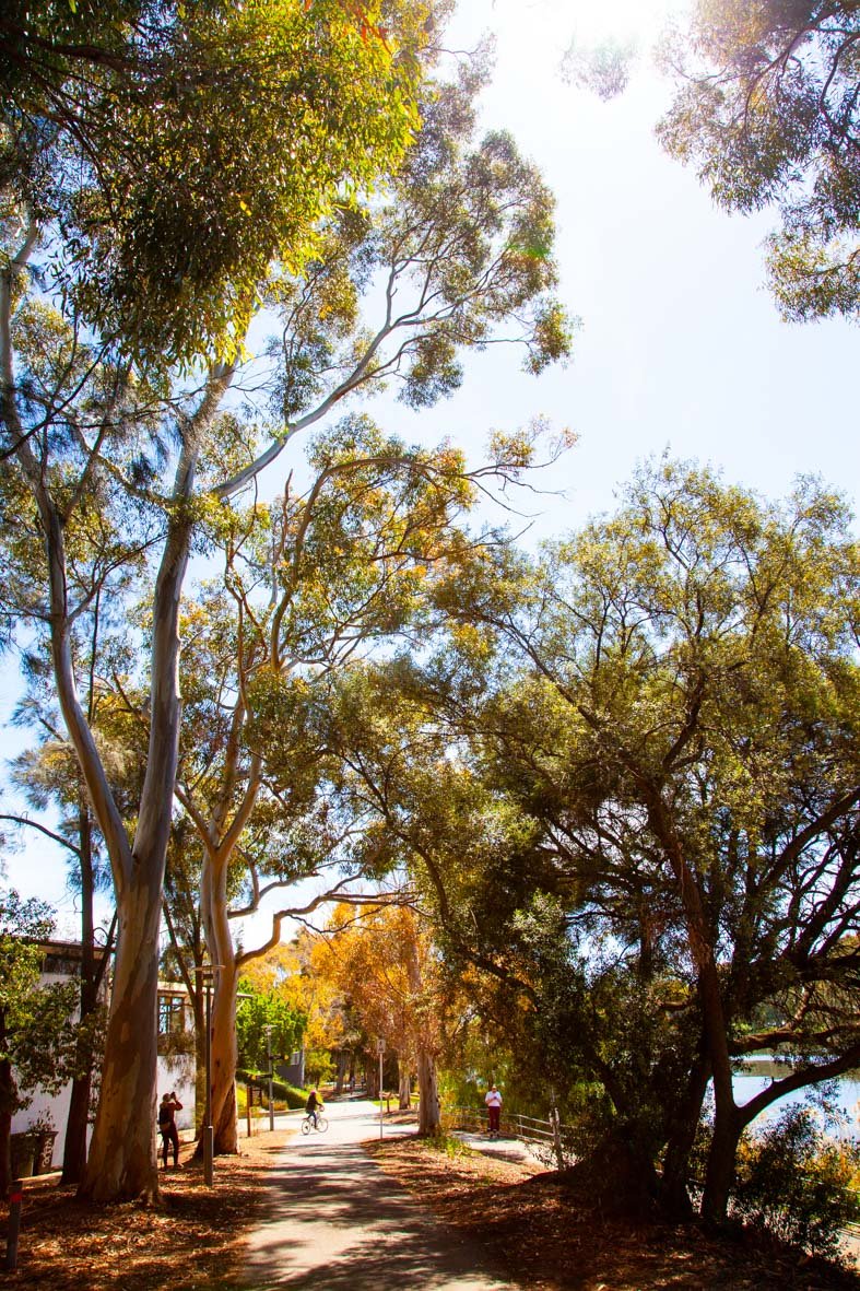
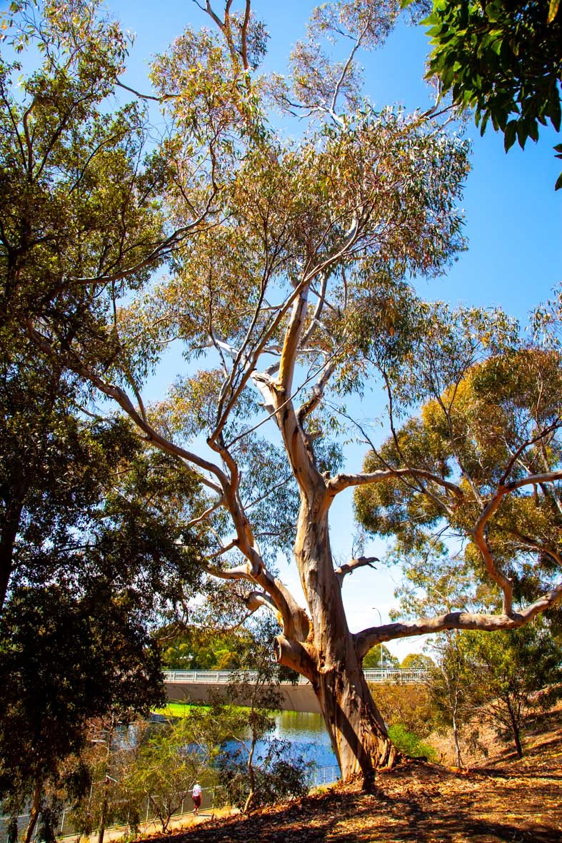
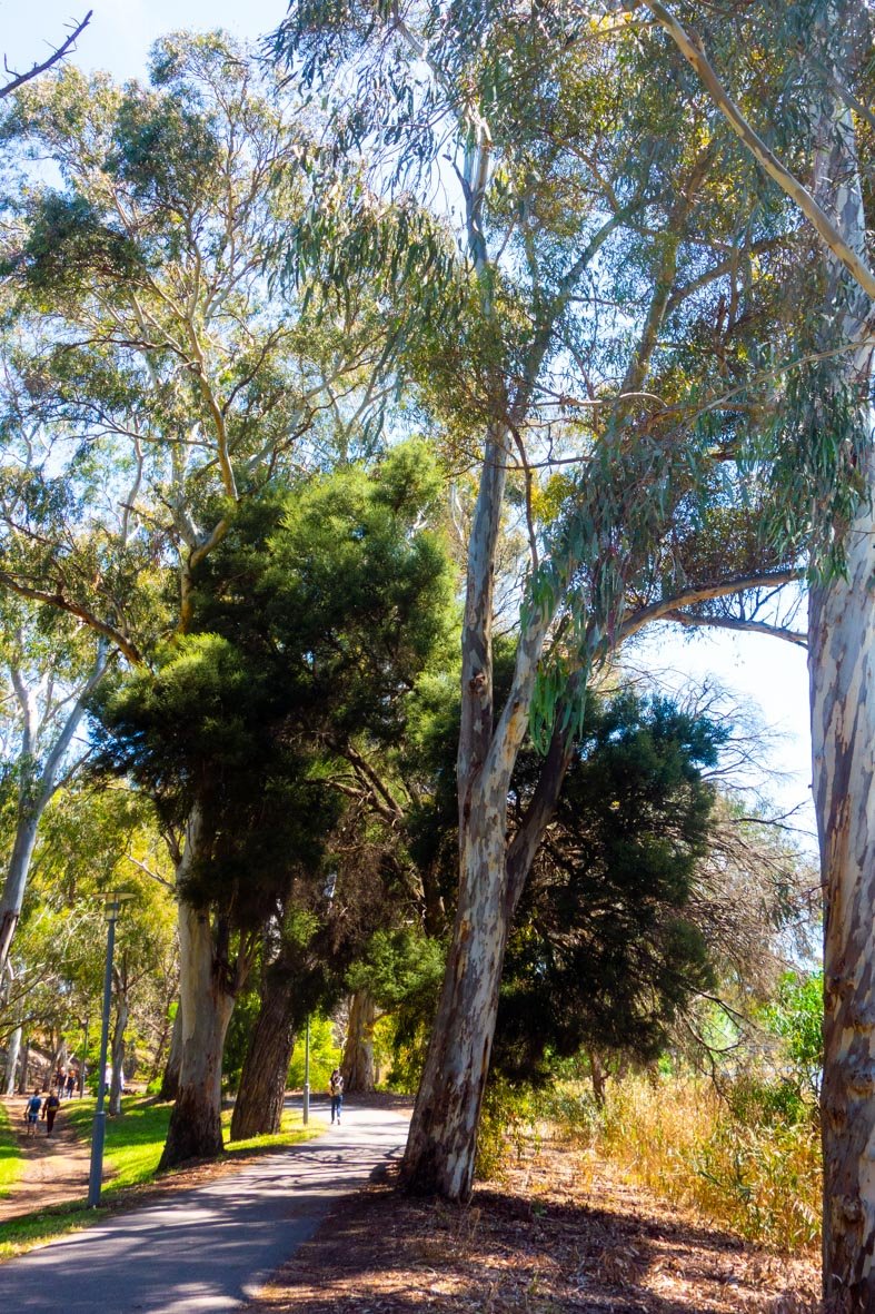
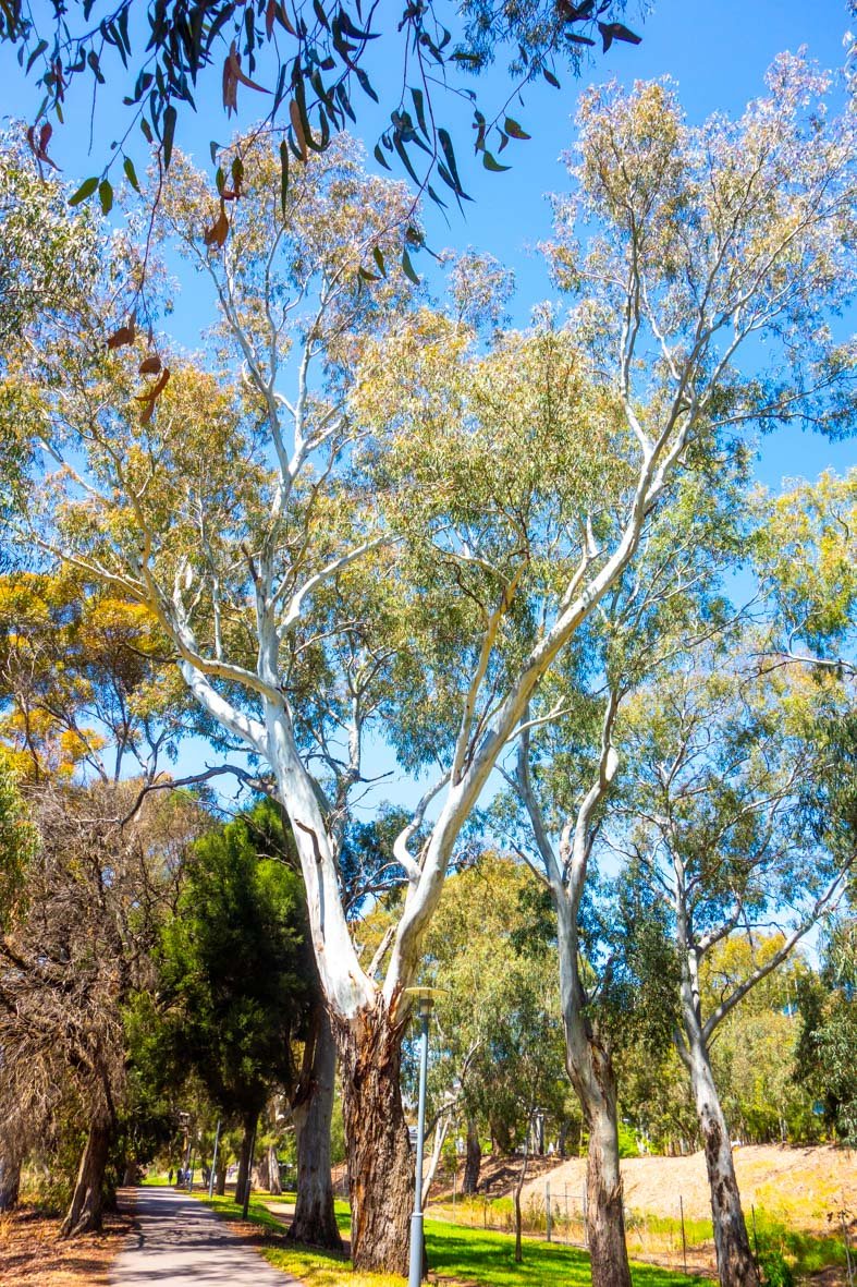
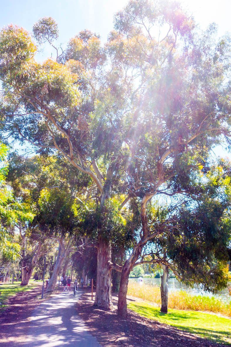
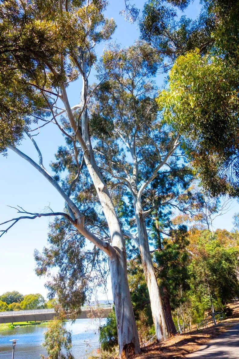
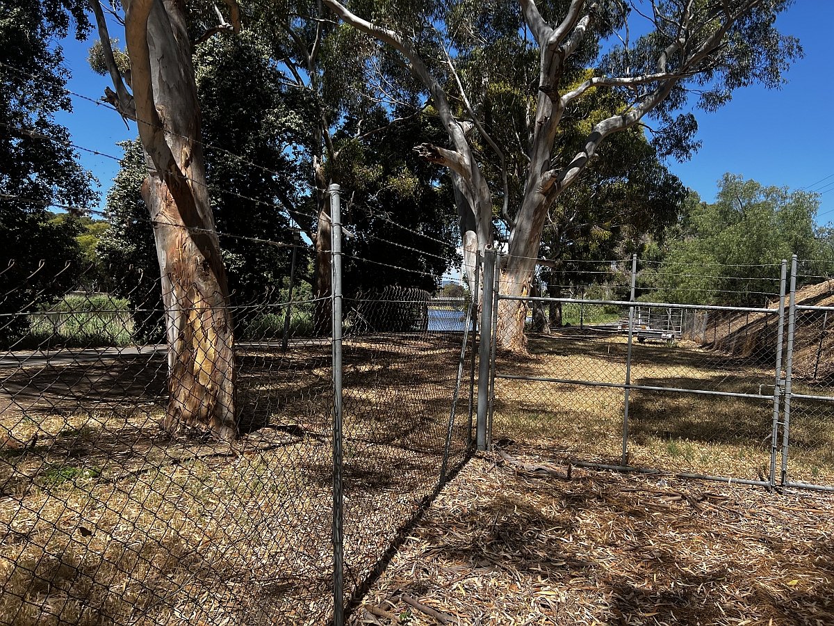
14. Trees of Helen Mayo Park
The City Council has advised that there are 257 trees in Helen Mayo Park. They include blue gums, red-flowering ironbark, Mexican fan palms, wattles and many others. But the main feature is more than 100 river red gums, alongside this shared path used by thousands of pedestrians and cyclists every day.
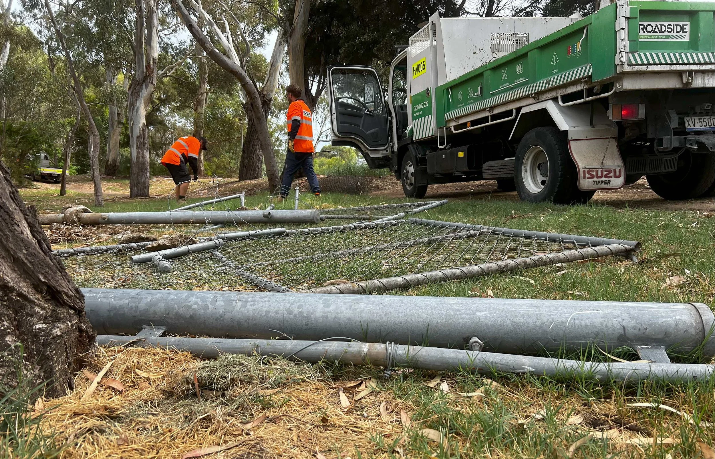
Prior to 2024, for at least thirty years, there was a 300-metre long cyclone-wire fence extending westwards from the Riverside Rowing club.
The fence prevented pedestrians climbing up or down the embankment between the riverside bitumen pathway, and the upper level of Helen Mayo Park.
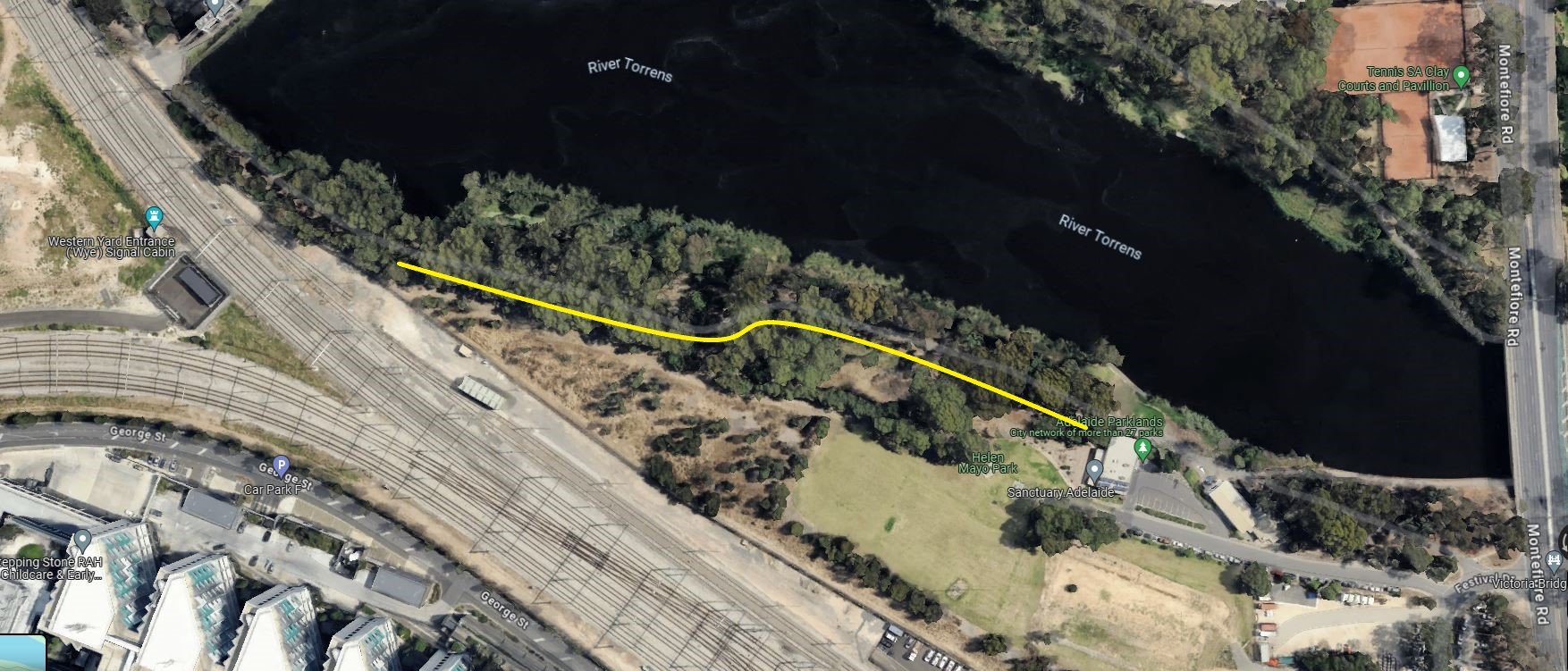
Highlighted in yellow; the line of the former 300-metre fence, now removed.
From here, walk along the pathway, eastwards and under the Victoria Bridge, and stop at the next two rowing club buildings.

15. Barr Smith Walk
This pathway between the Victoria Bridge and Elder Park has been known as the “Barr Smith Walk” since the first decade of the 20th century.
Robert Barr Smith donated funds to this part of the riverbank development.
Mr Barr Smith was a business partner to Thomas Elder. Together they established the agri-business Elder Smith & Co. in 1863.
He was also Thomas Elder’s brother-in-law, marrying Joanna Elder in 1856.
Despite his generosity, including donations to what became the Barr Smith library at the University of Adelaide library, Robert Barr Smith was a modest man and unlike Elder refused a knighthood.
++++ ++++ ++++ ++++
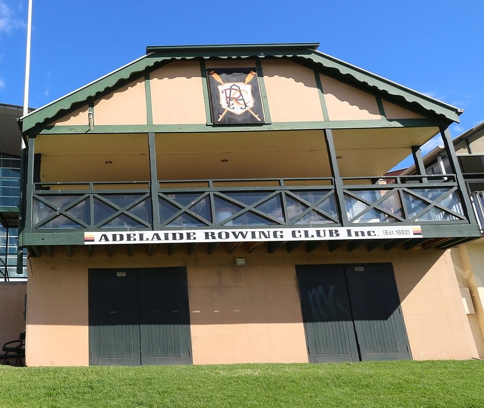
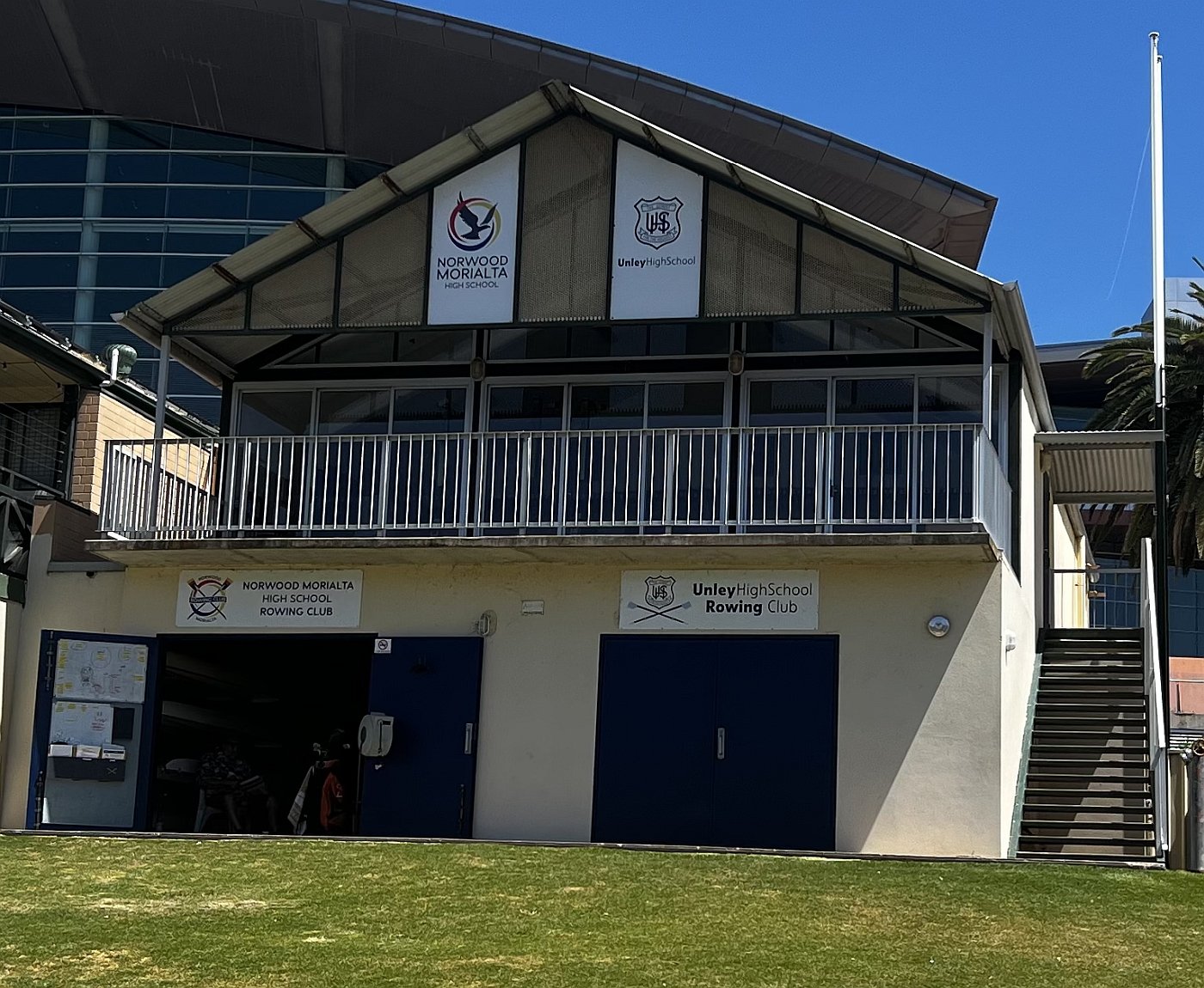
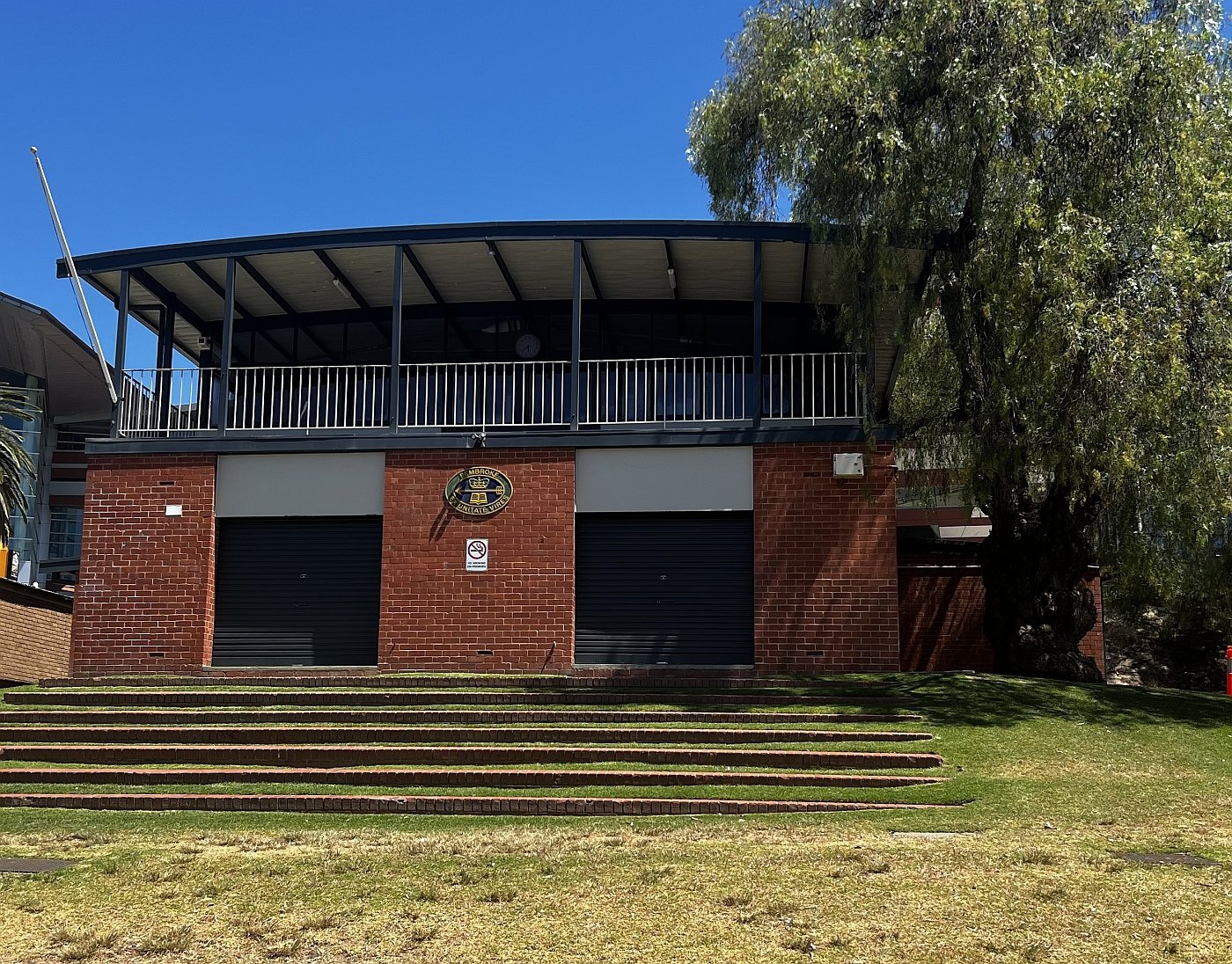
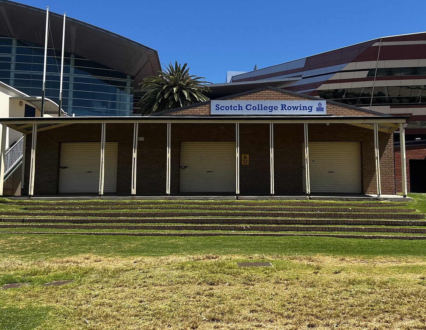
There are four rowing club buildings on this side of the bridge. Two are operated by private schools, Scotch College and Pembroke.
A third rowing club shed is shared between two public high schools: Norwood-Morialta and Unley High.

Robert Barr Smith. Photo: State Library of SA B-59765
The fourth building, a double-storey boat shed and function centre is operated by the Adelaide Rowing Club which has been in this prime position since 1882. Its location gives its operators repeated commercial opportunities to profit from a stream of visitors before or after major sporting events across the river at Adelaide Oval. It is licensed for 190 people (standing) or 120 (seated).
When first established, the Barr Smith Walk featured a line of poplar trees (Populus nigra ‘Italica’ or Populus simonii) along the water’s edge.
In recent decades, poplar trees have been characterised as woody weeds and are gradually being removed throughout the Park Lands.

Barr Smith Walk in winter, 1915, with the bare deciduous poplar trees
Immediately to the east of the Adelaide Rowing Club, there is a plaque embedded in the paving on the river’s edge. The plaque honours rower Kate Slatter, a former World Champion and Olympic gold medallist, who trained here on the River Torrens.

Plaque marking the ‘Kate Slatter Regatta Course’ and (inset) Kate Slatter.

16. First bridge site
Before European settlement, the banks of the River were covered in dense vegetation and supported prolific wildlife. The watercourse itself provided abundant aquatic food.
The river was critical in Colonel William Light’s plan for the new city. The site for Adelaide was chosen because, in Light’s words, the city: “was on a beautiful and gently rising ground, and formed altogether a better connection with the river than any other place.”
The very first temporary bridge here was erected in 1837 and was probably no more than a series of planks. It was washed away in the winter rains of 1837. A second temporary bridge was built later in 1837. It too was washed away after less than two years.
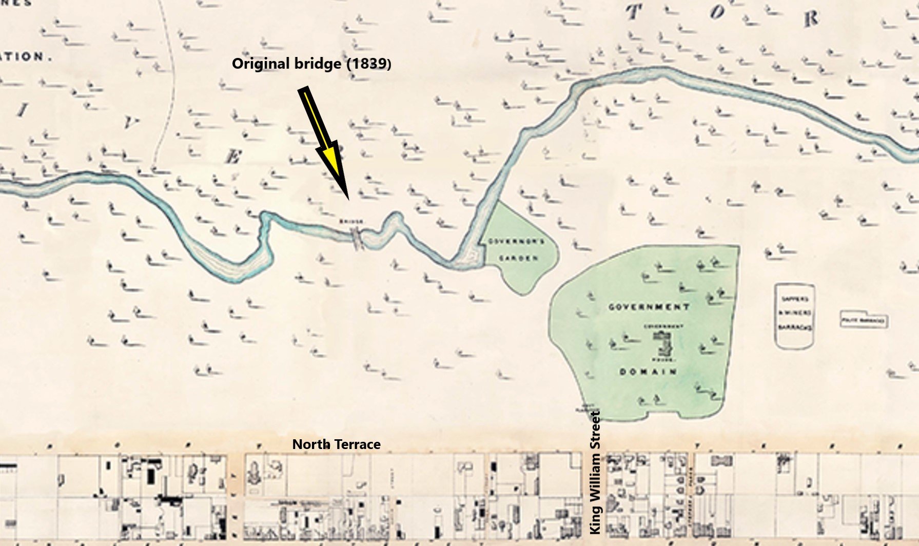
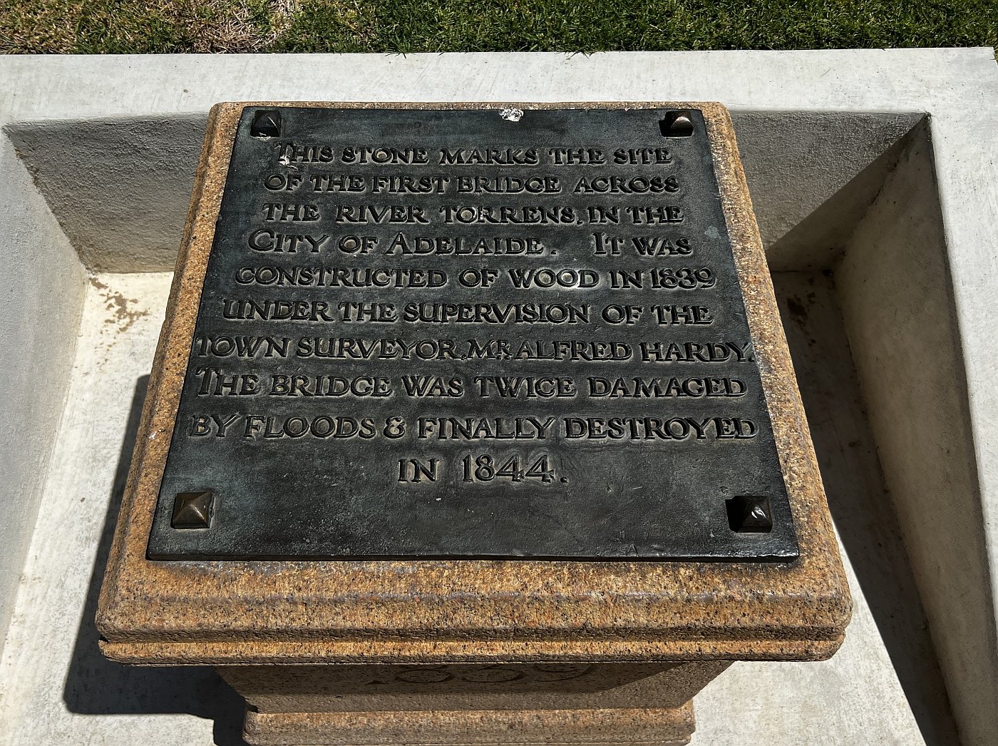

The marker here featuring the date “1839” commemorates the date of the first bridge intended to be of a more permanent nature with piers and hardrails, built by Town Surveyor Alfred Hardy. It was made of wood, like its predecessors, but lasted longer: about five years until 1844. After it was washed away, the town had to wait another 12 years, until 1856, before the City Bridge was built, upstream, to carry King William Road over the River.
From here, walk further along the river bank until you see the mosaic artwork pictured below.

17. Mosaic and sculpture
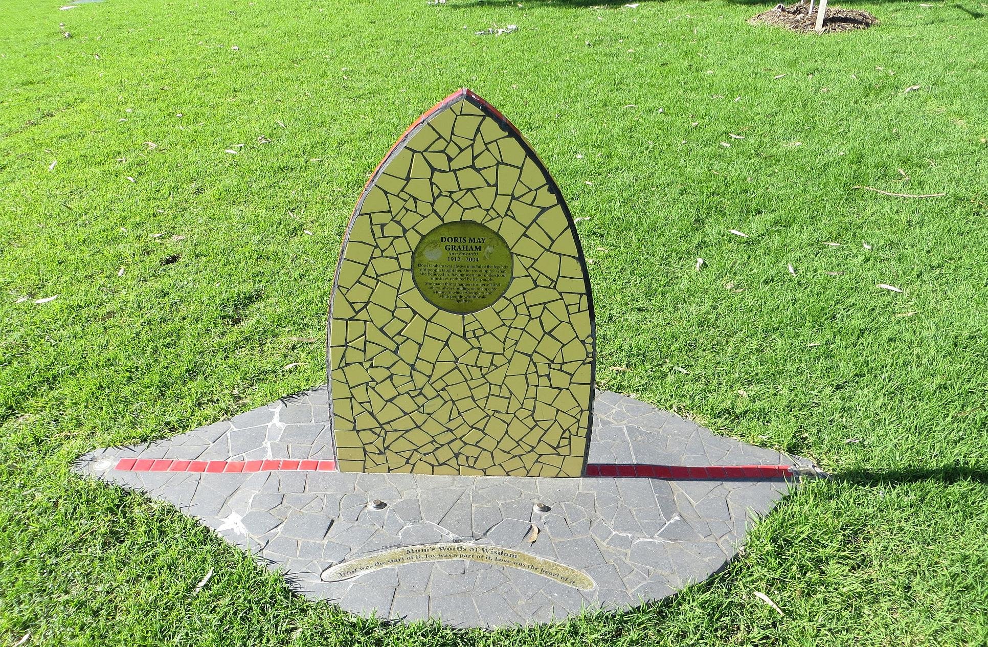
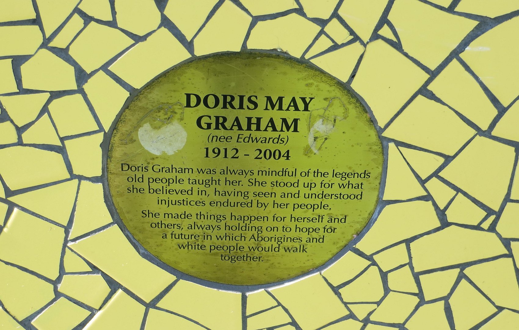
This mosaic headstone was installed to acknowledge Kaurna elder Doris May Graham (1912-2004) who worked tirelessly for reconciliation. On the mosaic are Doris’ words ‘Trust was the start of it. Joy was part of it. Love is the heart of it.’
Nearby, another stainless steel sculpture by Bert Flugelman is called “Tribute”. It is a tribute to Richard Llewellyn AM 1936-2004 who was a polio survivor and disability rights activist. As mentioned earlier, two other sculptures by Bert Flugelman are located outside the Festival Centre.
From here, walk a little further east along the river bank, to the boat landing.

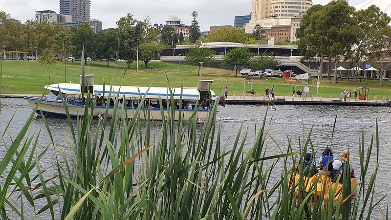
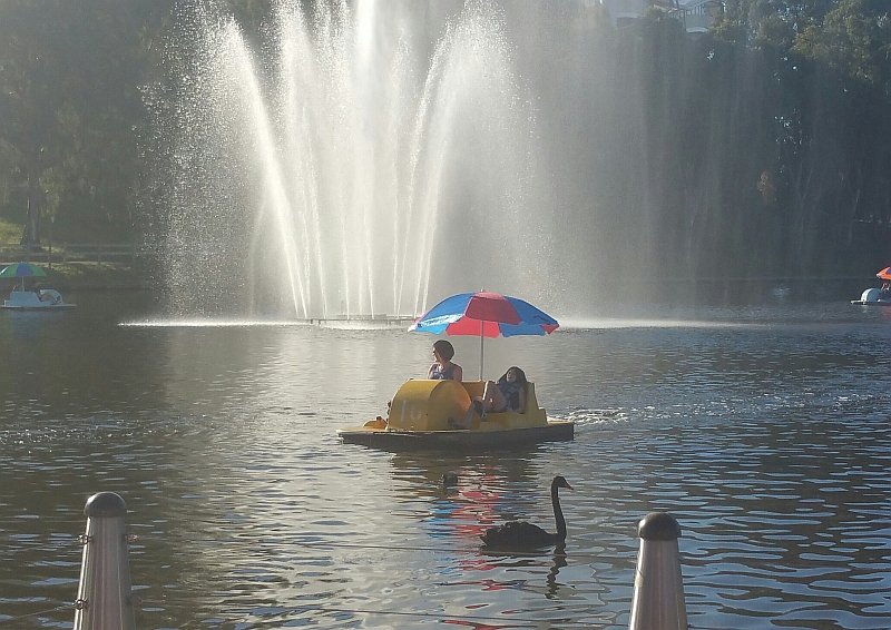
18. Popeye, paddle boats
Popeye boats have been plying the River Torrens / Karrawirra Parri since 1935, when Captain Gordon Watt launched his first Popeye.

The original “Popeye” in the 1930s
The boat was constructed on the banks of the river from jarrah wood. It was built by Harold Launder, who owned Launder’s boat shed - now a cafe a few hundred metres up-river.
The first Popeye was 7.6 metres long and could accommodate 20 people. The boat was named after the popular spinach-eating cartoon character of the same name.
A second boat was commissioned in 1948.
The owners of the business, Tony and Lidija Shuman, got involved in 1991 when they purchased the River Torrens Paddle Boats. After 20 years of managing the paddle boats, they expanded to take over the Popeye boats as well.
In 2022, Tony was still operating at the helm of Popeye as the captain. However, he transferred management of the business to his daughter, Bianca Shuman in 2018.
The Popeye business varies between 12-15 employees throughout the year, some staff staying for 20+ years and others staying for a summer.
In 1977, Popeye V was converted into a Royal Barge for the Queen’s visit in March that year. Popeye IV sailed closely behind with a singing choir to entertain the royals as they cruised the river.
Five years later in 1982, three new fibreglass Popeyes—each able to carry 80 passengers—replaced the existing fleet of five boats, with Prime Minister Malcolm Fraser officially unveiling the new craft.
Pedal powered paddle boats have been used as a source of fun for children, families, and tourists coming to see our beautiful city of Adelaide since as far back as 1881.
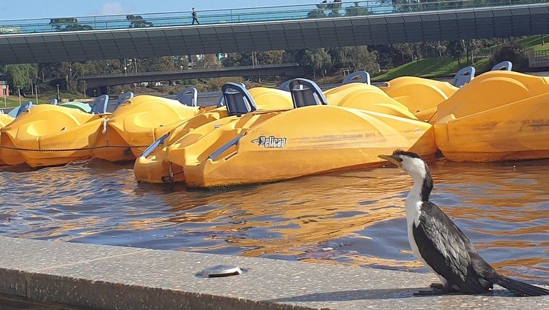
In 2022, the cost to hire one of Captain Jolley’s paddle boats for 30 minutes was $25.
From here, walk a little further along the river’s edge to see what looks like paper boats in the river.

19. Talking Our Way Home
This public art work “Talking our way home” by Adelaide artist Shaun Kirby, is an installation of five glass and steel boats on the River Torrens. The origami-like boats appear translucent and fragile. The installation suggests movement and transport, and the idea of a journey. It’s said to be an historical and personal reflection on migration, dispossession and the role that language plays in creating a sense of identity and belonging.
The artist, Shaun Kirby was born in London in 1958. In the mid-1960s, he and his family migrated to South Australia by ship.
Many Britons moved to Australia after the Second World War on the Australian Government’s “Ten-Pound Pom” assisted migration scheme. It was meant to boost the population, under Immigration Minister Arthur Calwell’s mantra “populate or perish”.
After arriving in Adelaide, Kirby lived temporarily with his family, at the Elder Park Migrant Hostel, on the site of the present Adelaide Festival Centre. His installation is intentionally nearby.

The inscribed glass and steel ‘floating paper boats’, draw on the handwritten letters of 19th and 20th century immigrants, and Kirby’s own experiences.
The artwork was installed in 2005. In addition to the ‘floating’ glass forms, the work features a shore-based element containing a text developed in collaboration with a Kaurna Indigenous language working group. The Kaurna words on the shore translate as “The sky and the outer world are connected in the waters and the two become one.”
“Talking Our Way Home” has been featured in our series of articles: “Know Your Park Lands Art”. Read the full article here.
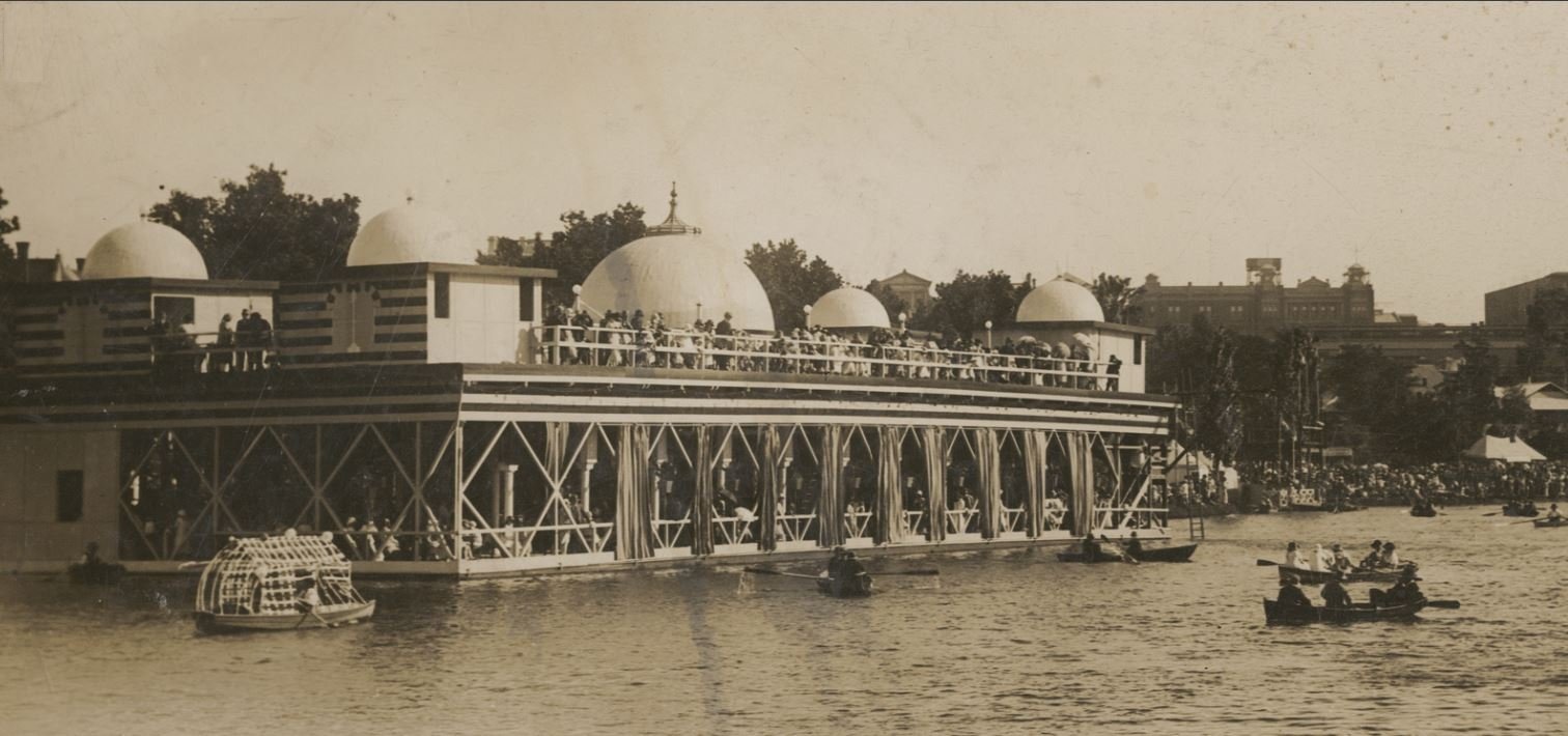
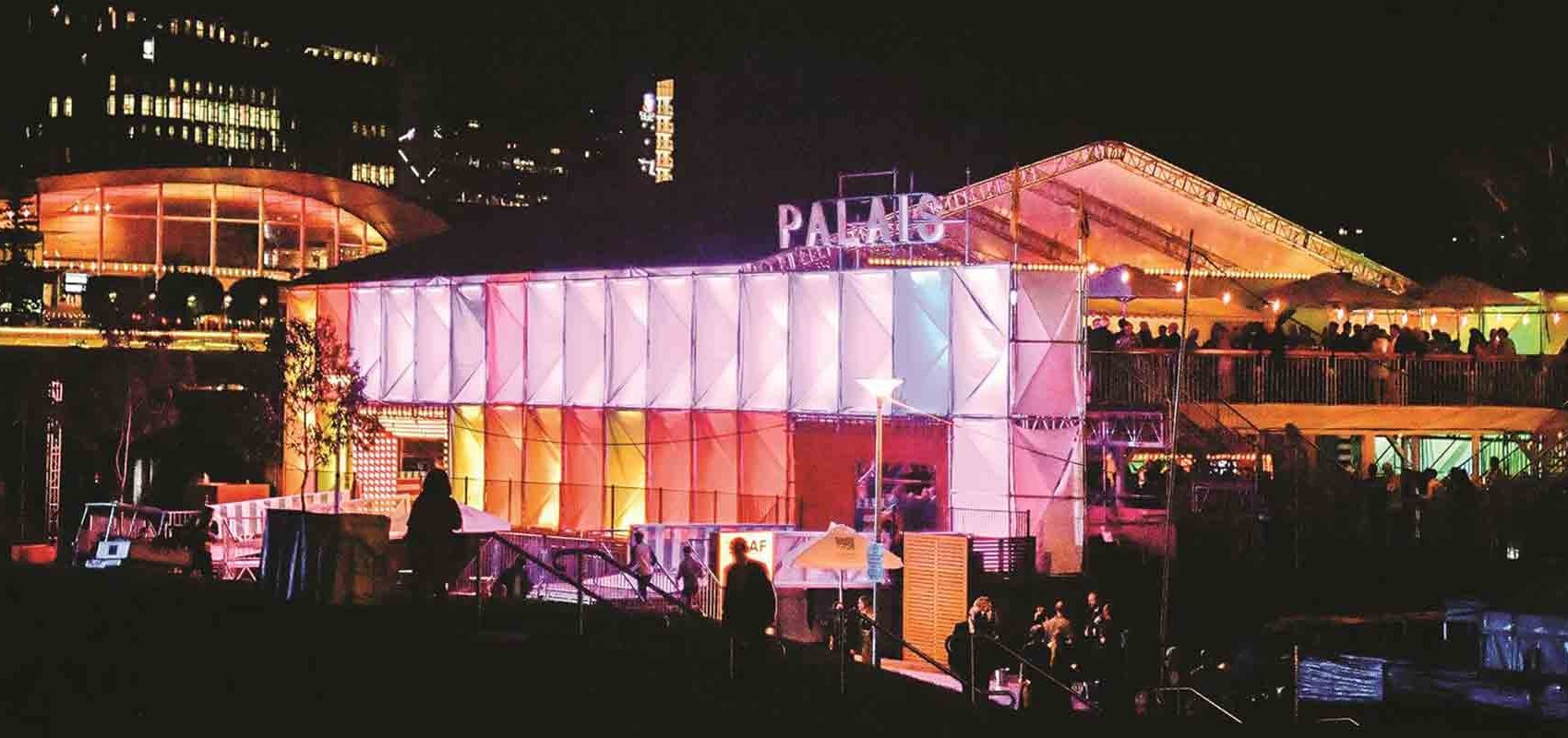
A short-lived experiment on the river’s edge, near here, was a floating dance pontoon. The so-called Palais De Danse was tried twice, 90 years apart: in the 1920s and then again as part of the Adelaide Festival from 2017 to 2019.
From here it is a short walk back across Elder Park to the starting point of this Trail Guide at the rotunda.
Optional: download and print a tri-fold leaflet, i.e. a double-sided single A4 page, with a brief summary of this Trail Guide: (PDF, 2.0 Mb)
All of our Trail Guides and Guided Walks are on the traditional lands of the Kaurna people. The Adelaide Park Lands Association acknowledges and pays respect to the past, present and future traditional custodians and elders of these lands.

